

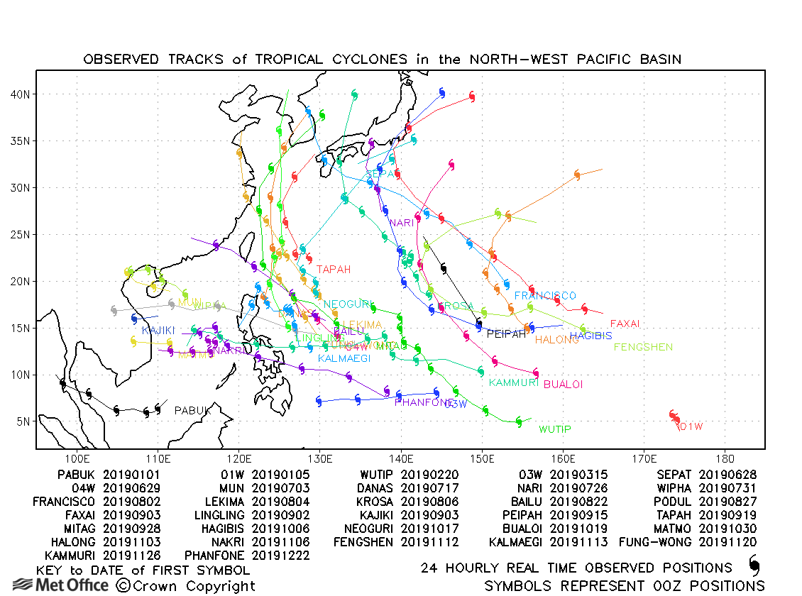
Observed and forecast tracks: northern hemisphere 2019
All tropical cyclones in the northern hemisphere season in 2019 are listed below including details of their start and end dates, lowest central pressure and maximum sustained wind (MSW).
Click on the name of the tropical cyclone to see a chart of the observed track and forecast tracks from the Met Office global model. Verification statistics on each tropical cyclone are available upon request from [email protected]. At the end of the season a verification report on the performance of the Met Office global model will be published.
| Name & ID | Start & end dates | Central pressure, 1-/10-minute MSW | Comments on Met Office global model forecasts |
|---|---|---|---|
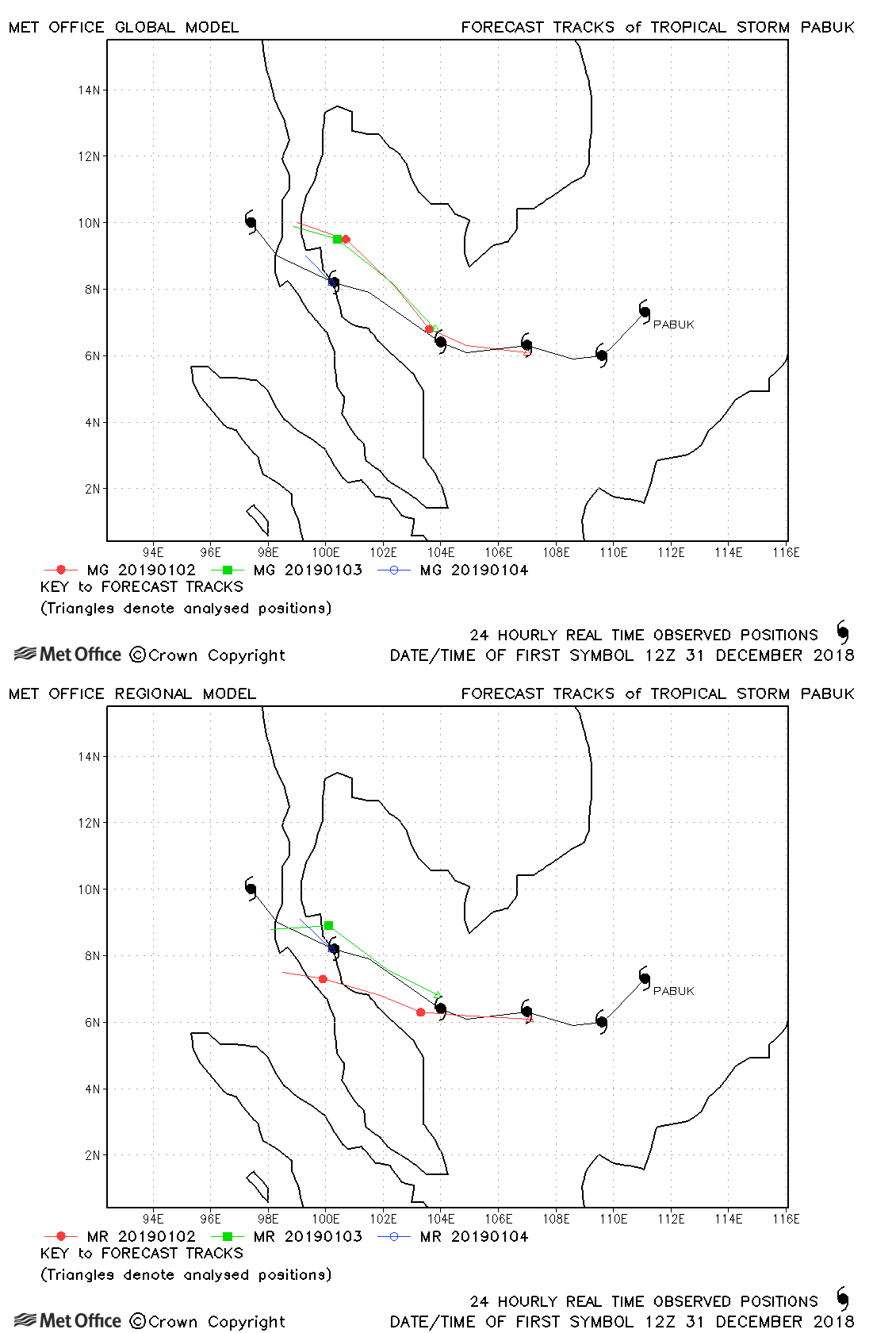
| 31 December-06 January | 994 mb, 50/45 knots |
Track forecast errors were a little above last season's average due to a right-of-track bias close to landfall. |
|
|
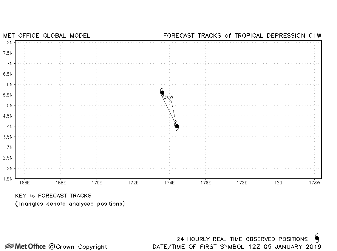
04-06 January |
1003 mb, 25/- knots |
No forecasts were verified for this depression. |
|
| 19-28 February | 915 mb, 140/105 knots |
Despite a few early forecasts having a large northwards bias, track errors were below last season's average at most lead times from 72 hours onwards. |
|
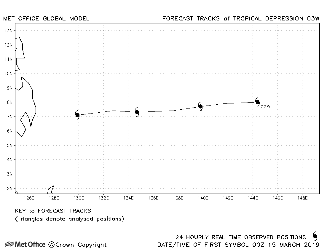
| 03W | 15-18 March | 1001 mb, 25/- knots |
No forecasts were verified for this depression. |
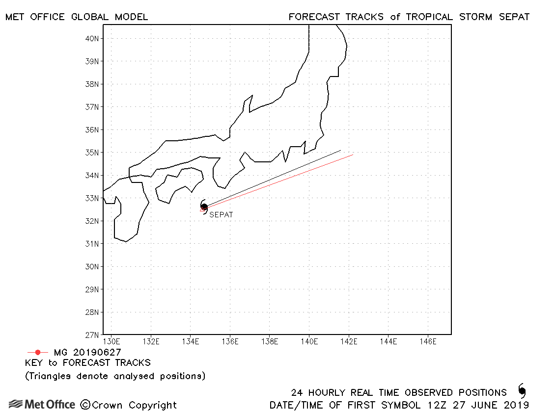
| 27-28 June | 994 mb, -/40 knots |
Sepat was only briefly a tropical storm and few forecasts were verified. |
|
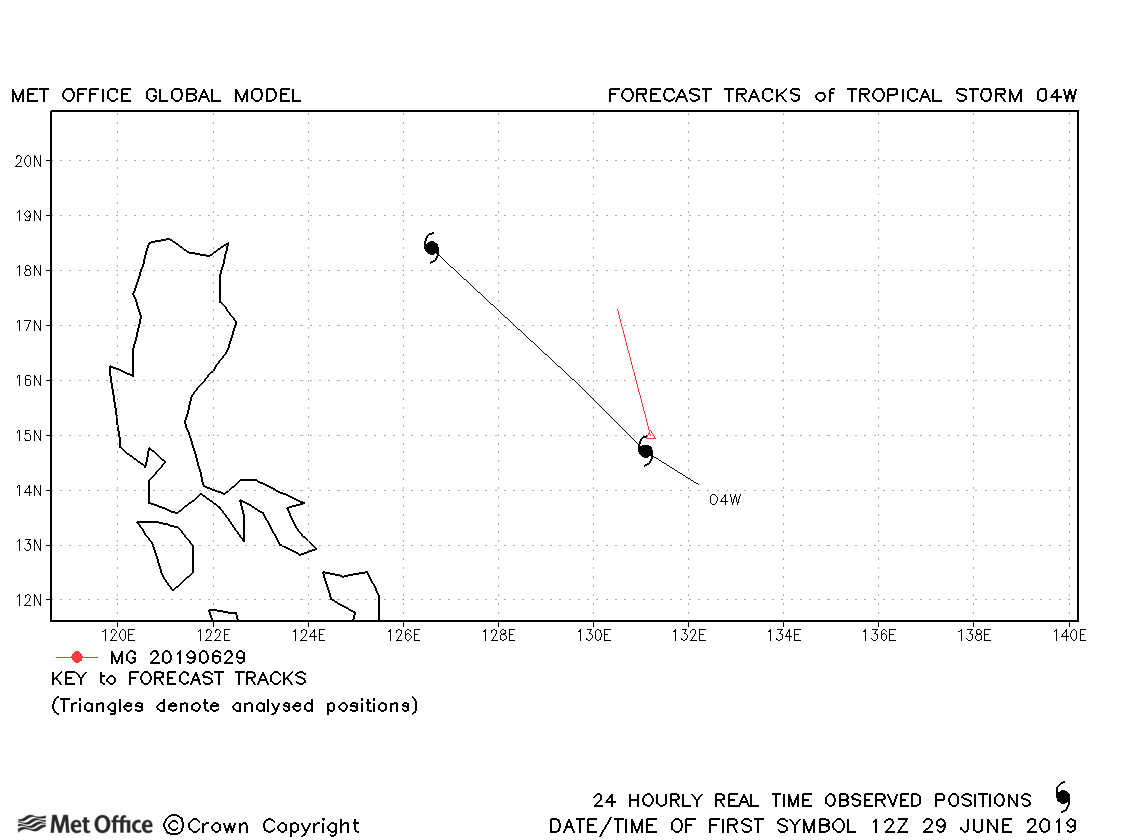
| 28-30 June | 1001 mb, 40/30 knots |
04W only briefly attained tropical storm status as defined by JTWC, but not JMA. |
|
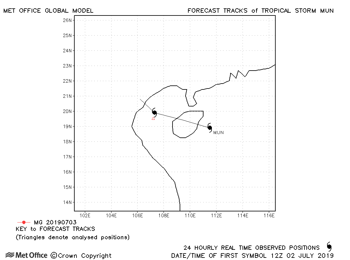
| 02-04 July | 992 mb, 35/35 knots |
Mun only briefly attained tropical storm status and no forecasts were verified. |
|
| 16-21 July | 985 mb, 45/45 knots |
There was a slow bias in forecasts for Danas resulting in track forecast errors above last season's average. |
|
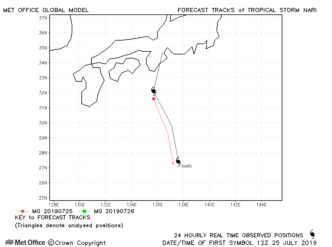
| 25-27 July | 998 mb,35/35 knots |
Nari was fairly short-lived as a tropical storm with track errors near to last season's average. |
|
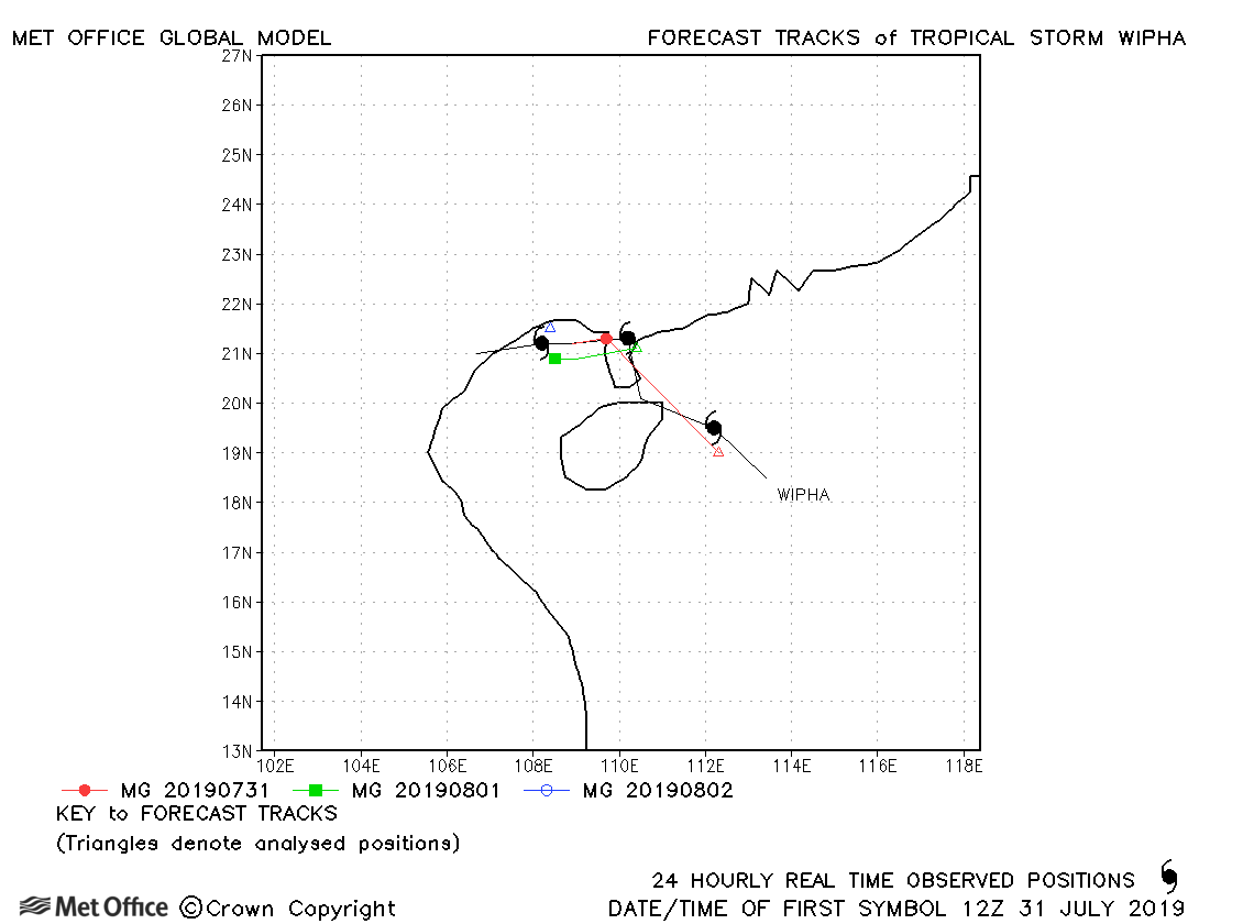
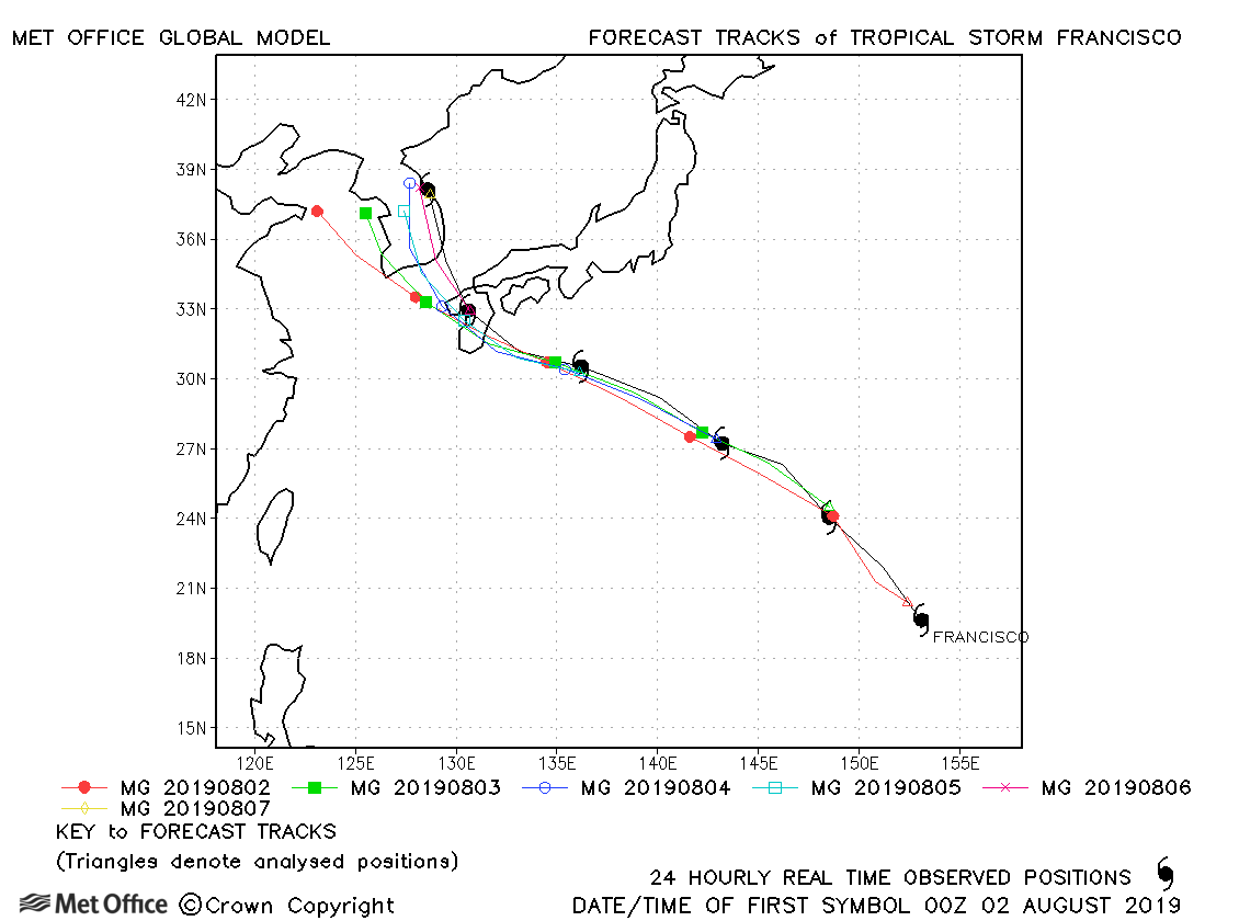
| 30 July-03 August | 985 mb, 40/45 knots |
Track forecast errors were below last season's average. |
|
| 01-07 August | 970 mb, 75/70 knots |
There was a slight left-of-track bias at longer lead times with errors generally near to or slightly above last season's average. |
|
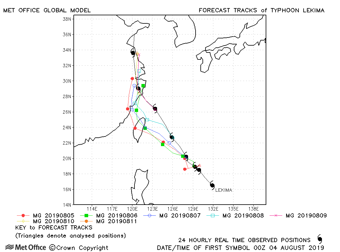
| 04-12 August | 920 mb, 130/95 knots |
There was a left-of-track bias resulting in track forecast errors at some lead times being above last season's avalues. |
|
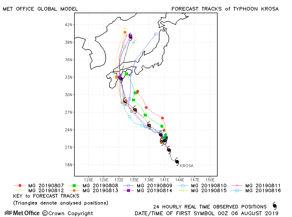
| 05-16 August | 950 mb, 100/85 knots |
Track forecast errors were mostly below last season's average, although there was a right-of-track bias at longer lead times. |
|
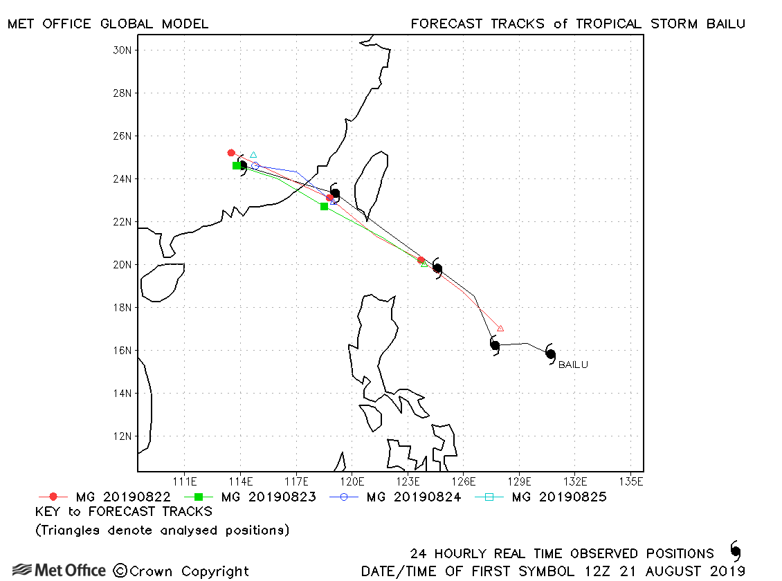
| 21-25 August | 985 mb, 55/50 knots |
Track forecast errors were low and skill scores high for this storm. |
|
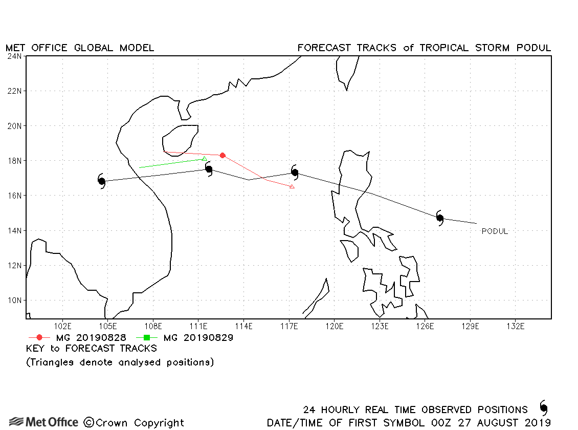
| 26-30 August | 993 mb, 35/45 knots |
Track forecast errors were above last season's average. |
|
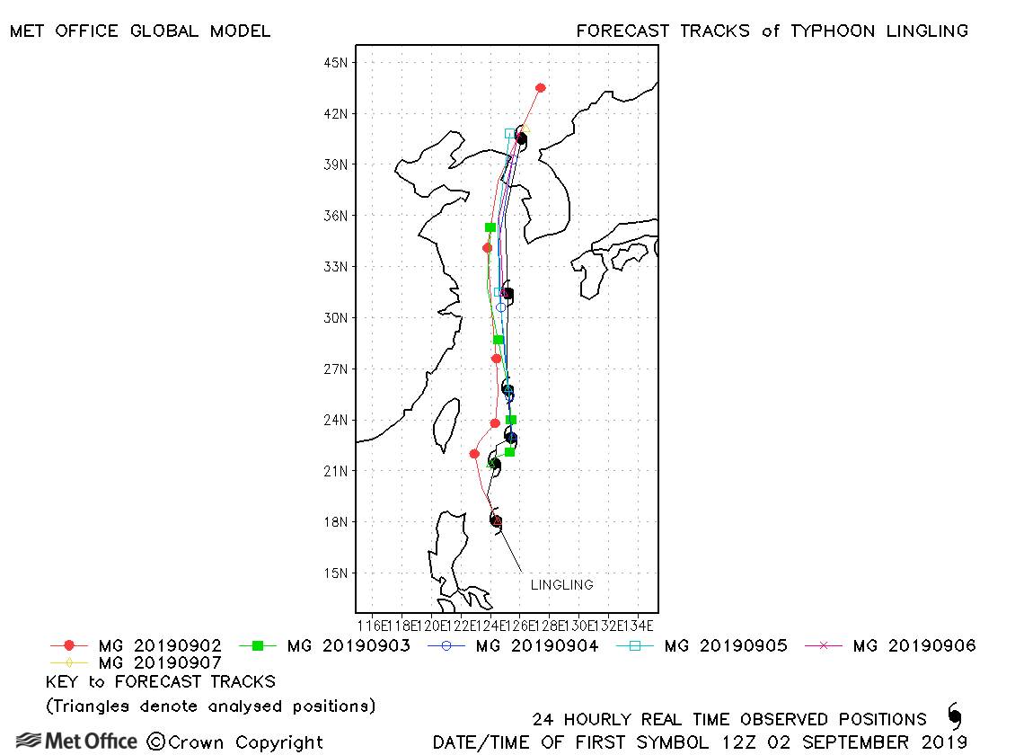
| 01-10 September | 955 mb, 115/85 knots |
Track forecast errors were mixed, but there was a slight fast bias in forecasts. |
|
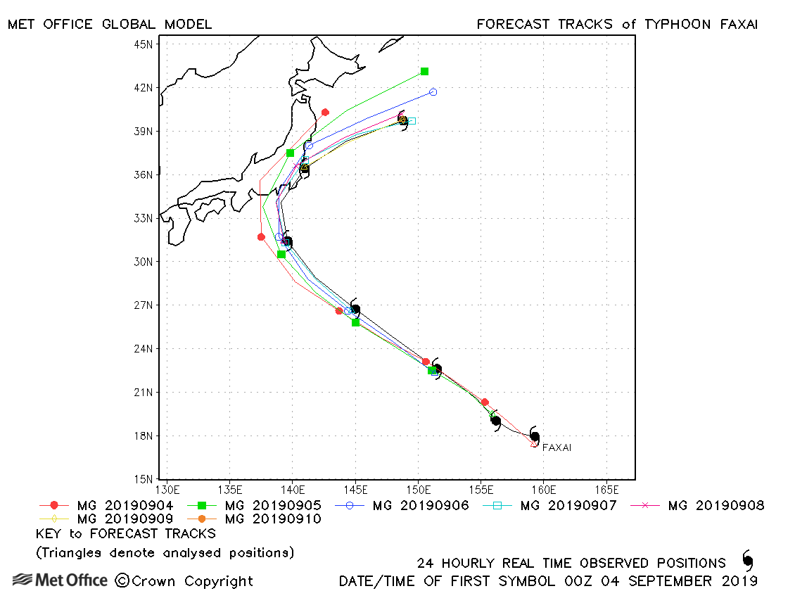
| 02-07 September | 940 mb, 120/90 knots |
Track forecast errors compared to previous seasons were mixed for this typhoon. |
|
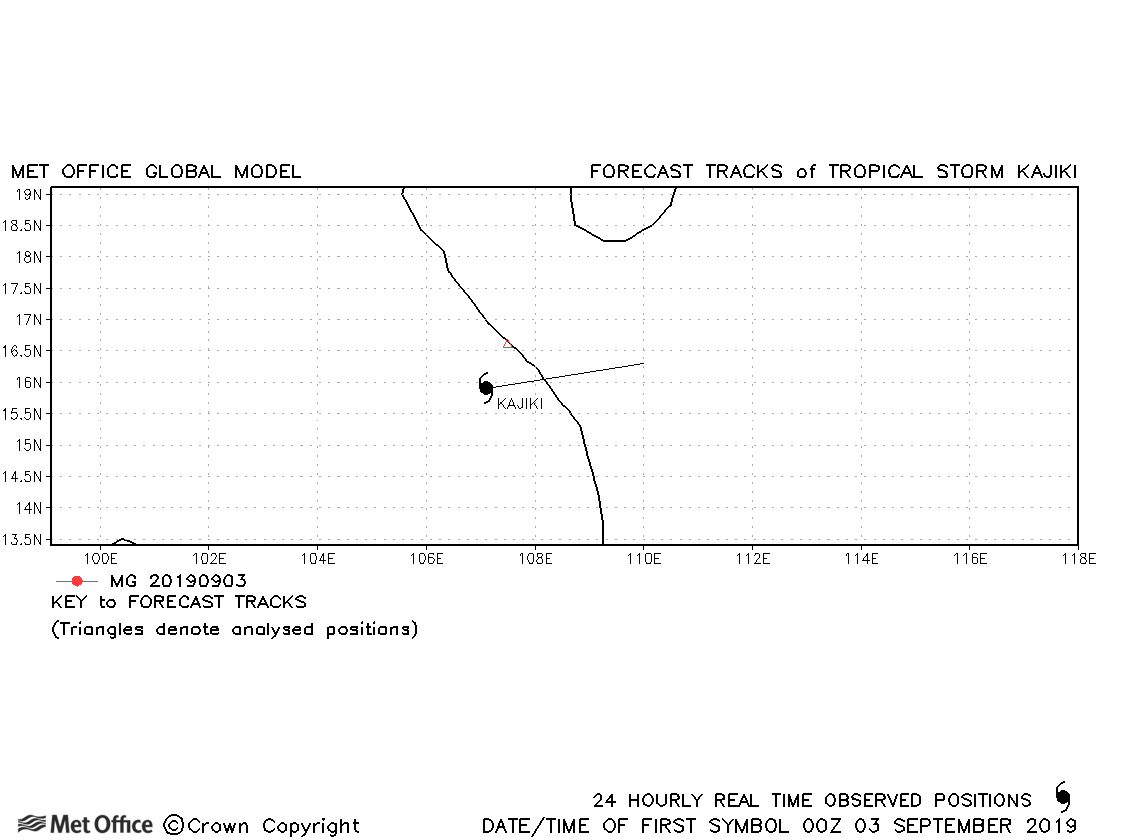
| 02-03 September | 996 mb, 30/35 knots |
Kajiki only briefly reached tropical storm strength. |
|
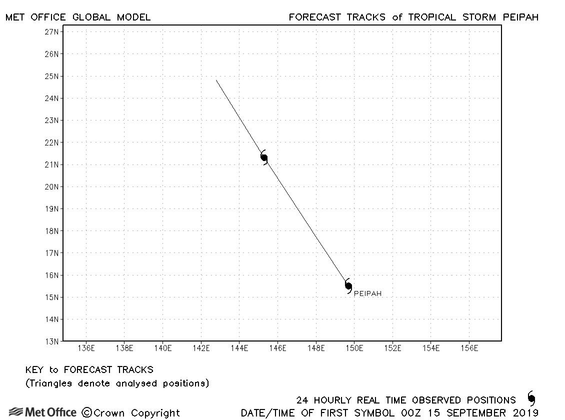
| 14-16 September | 999 mb, 35/35 knots |
Peipah only briefly reached tropical storm strength. |
|
| 18-22 September | 970 mb, 60/65 knots |
Track forecast errors were near last season's average. |
|
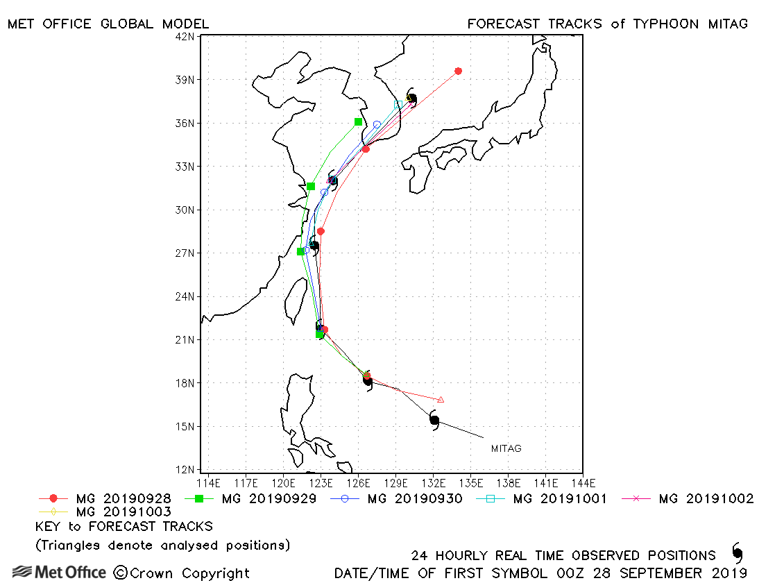
| 27 September-03 October | 965 mb, 90/75 knots |
Track forecast errors were mixed, with a slight fast bias at long lead times. Skill scores against CLIPER were high. |
|
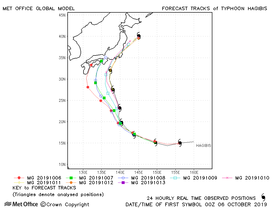
| 05-13 October | 915 mb, 140/105 knots |
There was a slow and left-of-track bias resulting in track forecast errors above last seasons average. However, the landfall location was well predicted up to 84 hours before it occurred. |
|
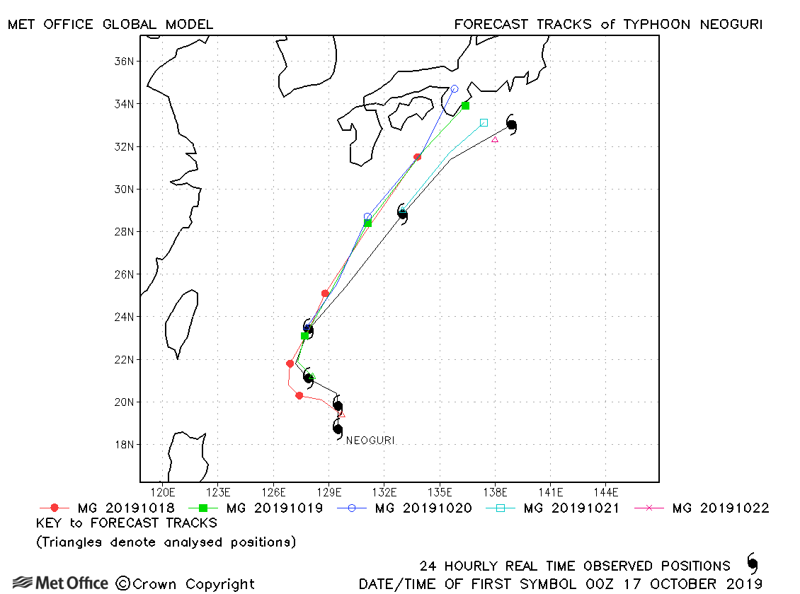
| 16-22 October | 970 mb, 95/70 knots |
There was a slow bias in early forecasts resulting in large track forecast errors at longer lead times. |
|
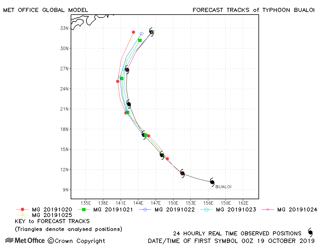
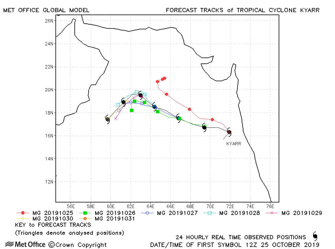
| 19-25 October | 935 mb, 125/100 knots |
Track forecast errors were near to average with a slight slow bias. |
|
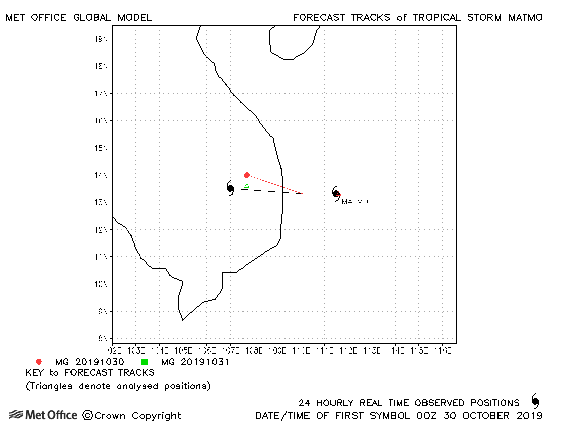
| 29-31 October | 992 mb, 50/50 knots |
Matmo was shoert-lived with few forecasts verified. The cyclogenesis of the storm was well predicted. |
|
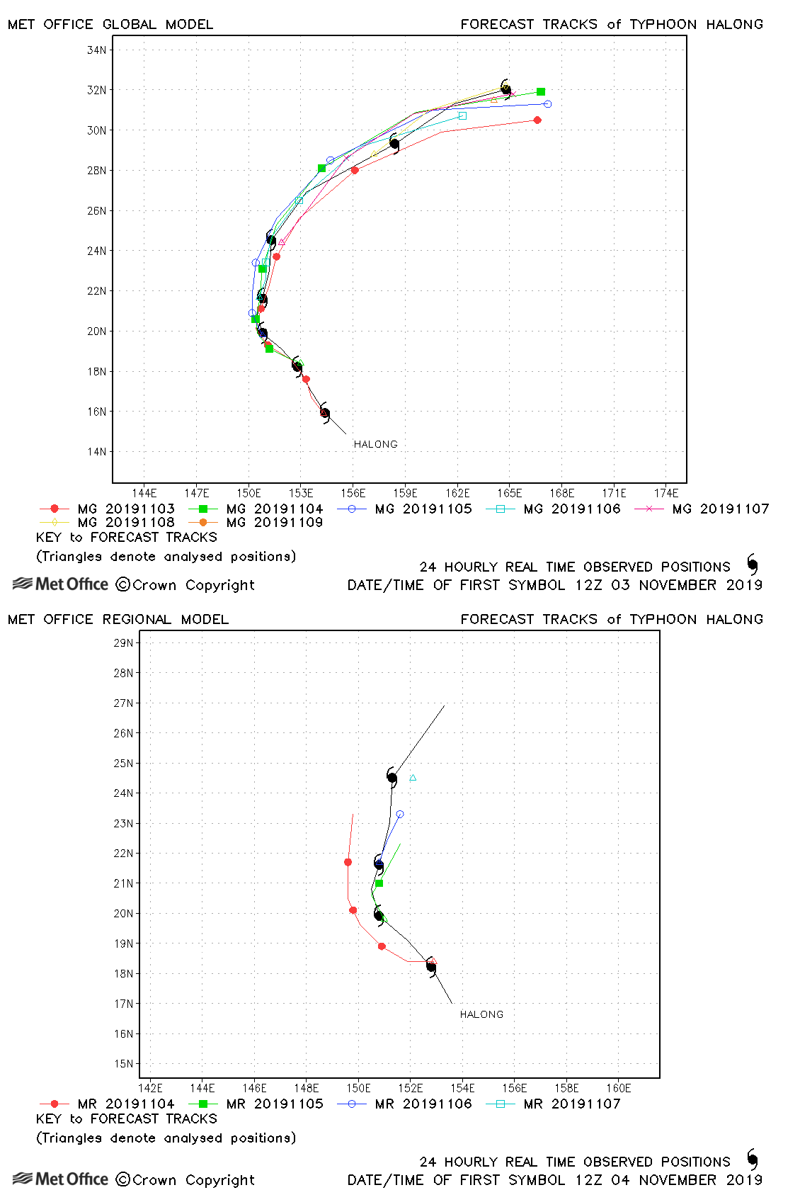
| 02-09 November | 905 mb, 155/115 knots |
Track forecast errors were above last season's average at short lead times, but lower than the average at longer lead times. There was a slow bias in forecasts. |
|
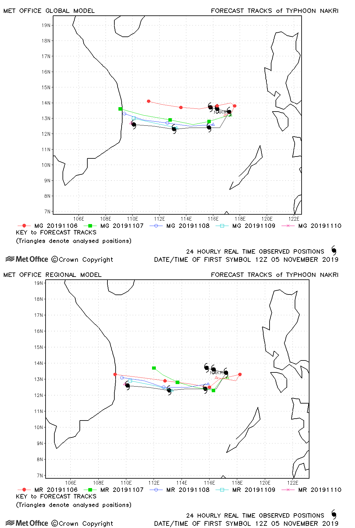
| 05-10 November | 975 mb, 65/65 knots |
Track forecast errors were near last season's average. |
|
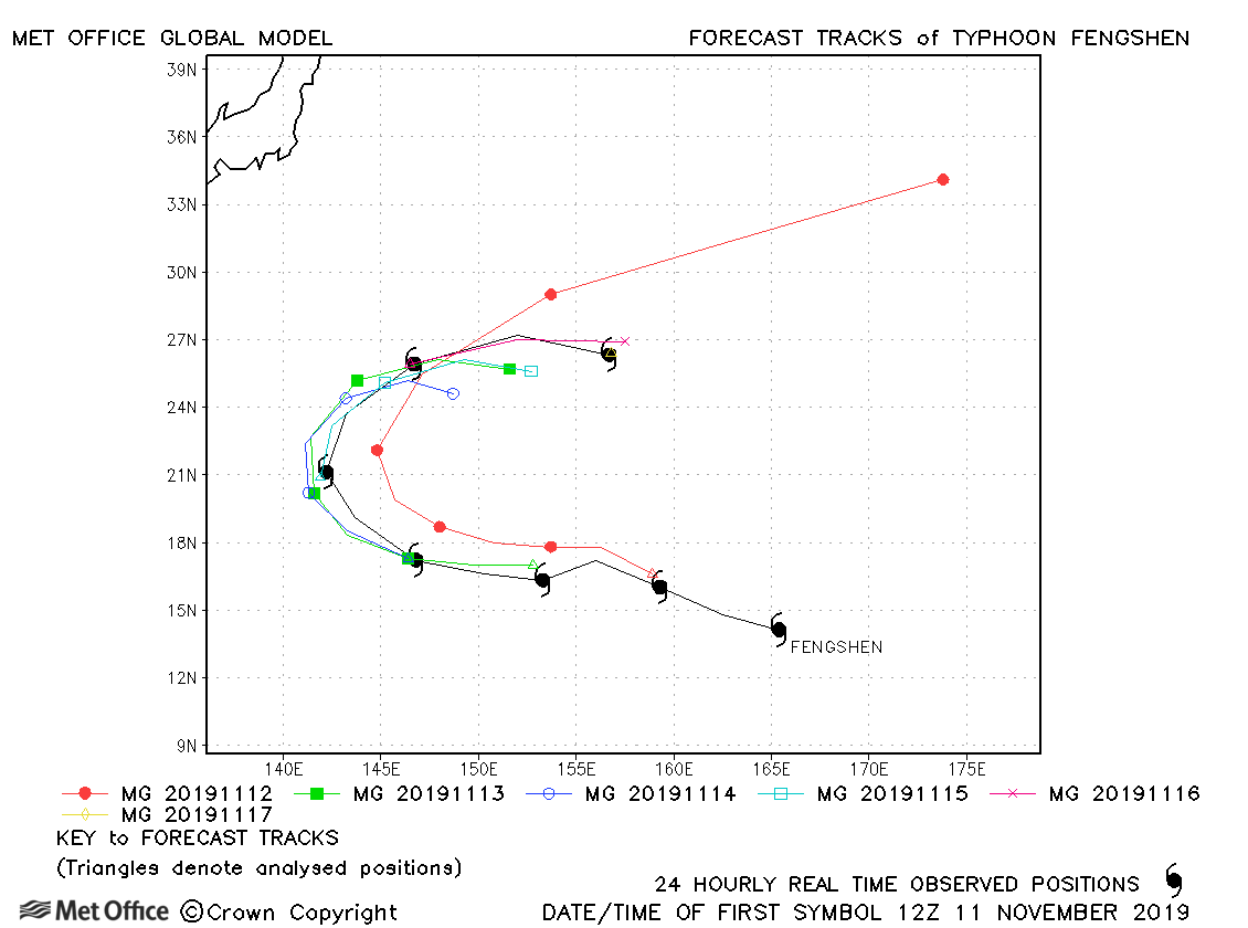
| 11-17 November | 965 mb, 110/85 knots |
Track forecast errors were high for Fengshen. There was mostly a slow bias, except for a few long lead time forecasts which were too quick accelerating the storm into the subtropics. |
|
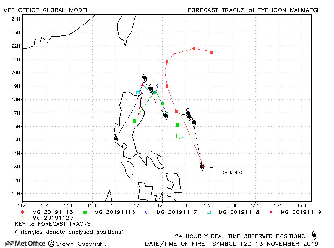
| 12-20 November | 980 mb, 80/65 knots |
Track forecast errors were mixed. Initial forecasts moved Kalmaegi northwards too quickly. However, most forecasts handled the erratic movement of the storm well. |
|
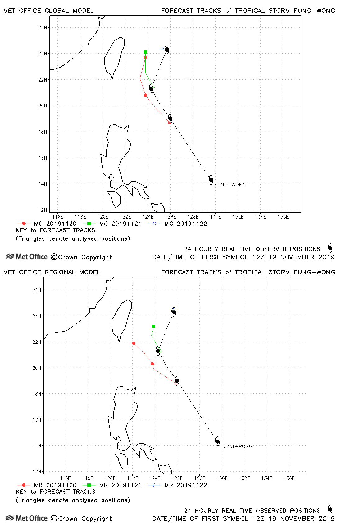
| 19-22 November | 990 mb, 60/55 knots |
Fung-wong was short-lived with track forecast errors higher than last season's average. |
|
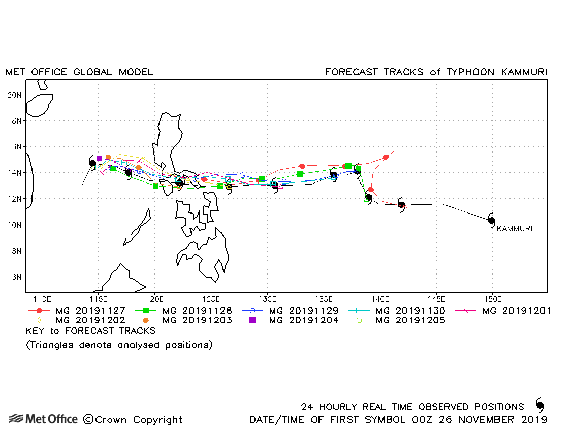
| 25 November-05 December | 950 mb, 115/85 knots |
Track forecast errors were higher than the recent running mean due to a slow bias. |
|
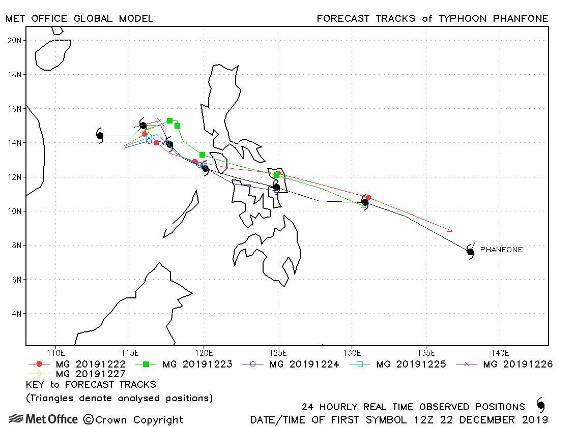
| 21-28 December | 970 mb, 95/80 knots |
Track forecast errors were lowe than the recent running mean, particularly for longer lead time forecasts. |
North-west observed tracks in 2019
| Name & ID | Start & end dates | Central pressure, 1-minute MSW | Comments on Met Office global model forecasts |
|---|---|---|---|
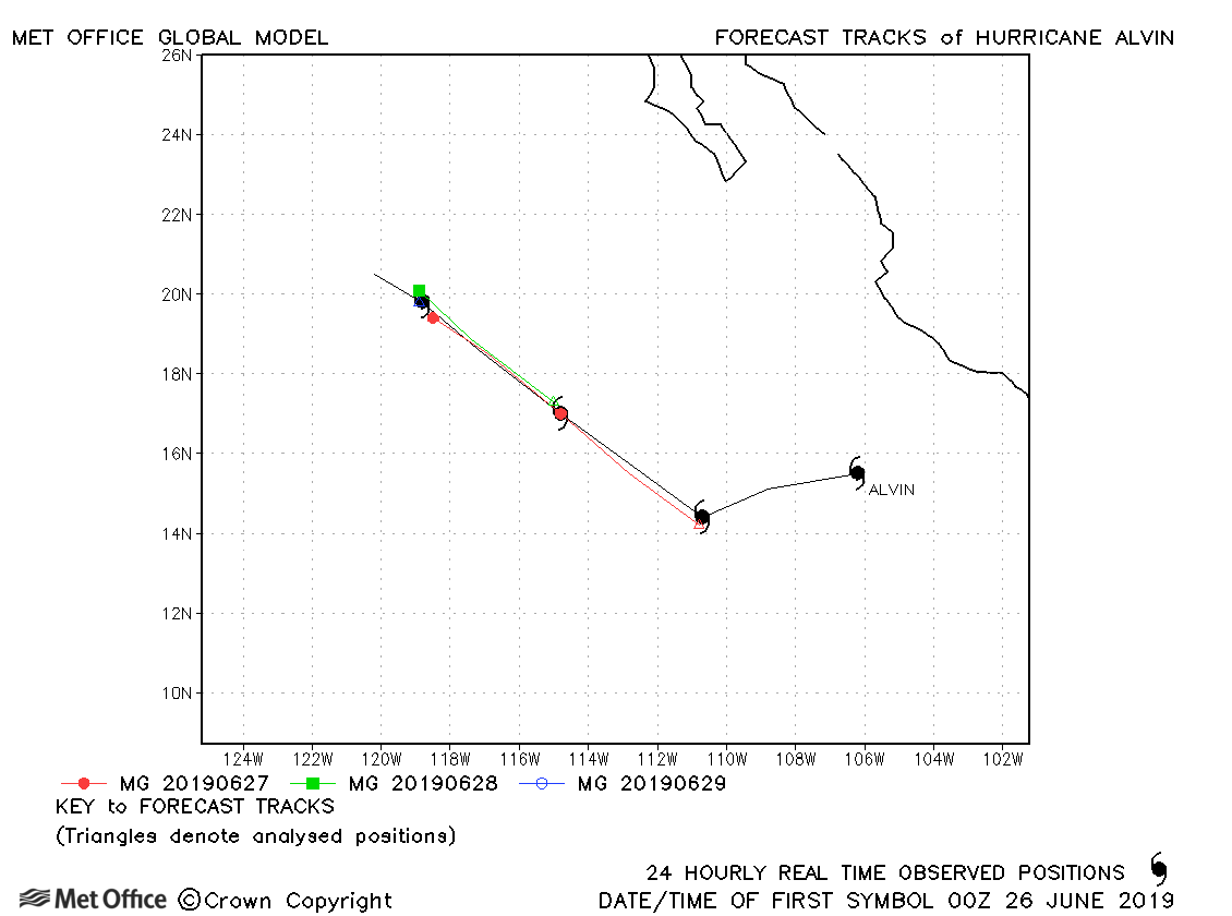
| 25-29 June | 992 mb, 65 knots |
The first forecast for Alvin had larger than average track forecast errors, but subsequent forecasts were very good. |
|
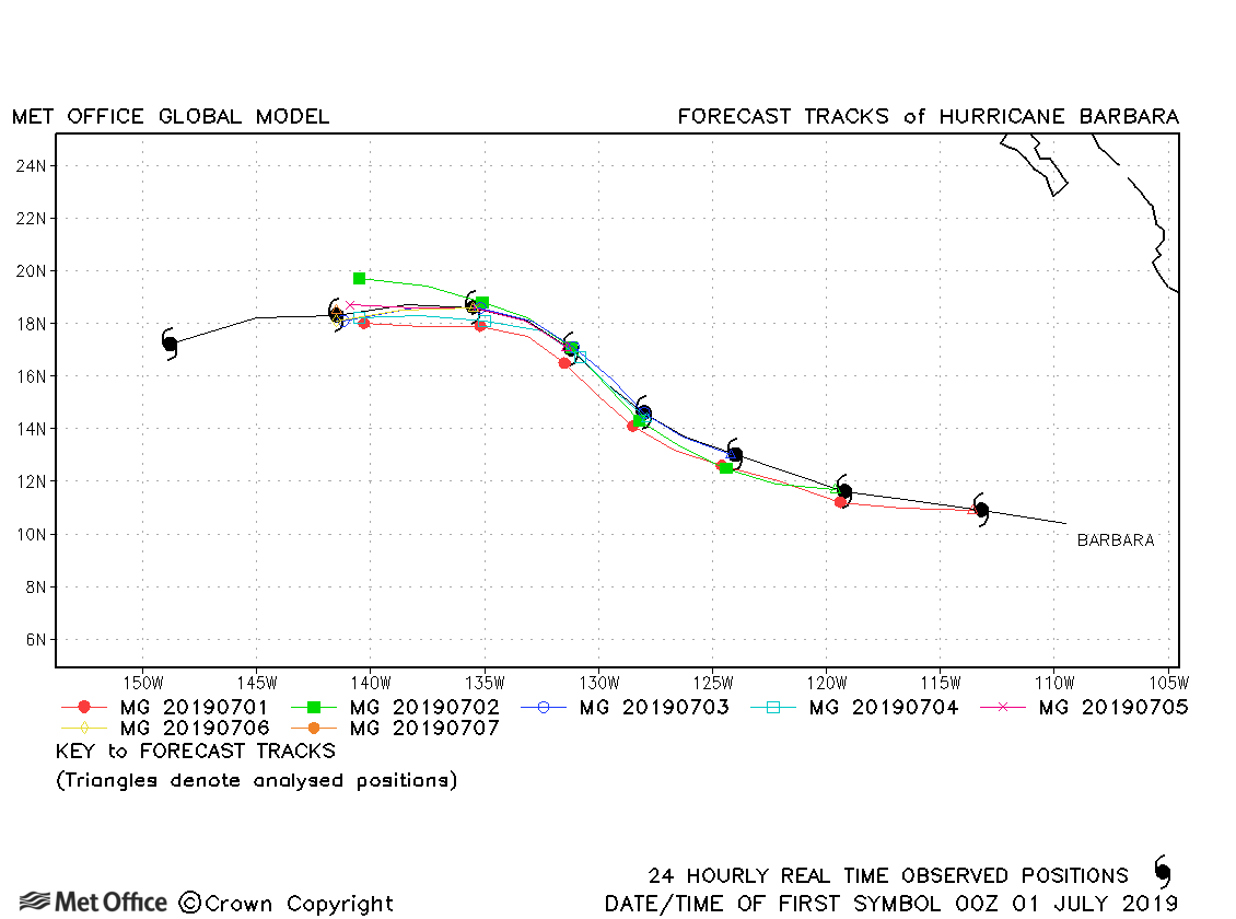
| 30 June-08 July | 933 mb, 135 knots |
Forecasts for Hurricane barbara were very good with track forecast errors very low and skill scores high. |
|
| 06-08 July | 1001 mb, 45 knots |
Cosme was briefly a tropical storm and few forecasts were verified. |
|
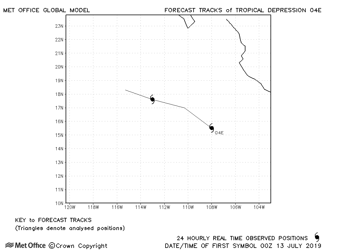
| 12-14 July | 1006 mb, 30 knots |
04E was a tropical depression and no forecasts were verified. |
|
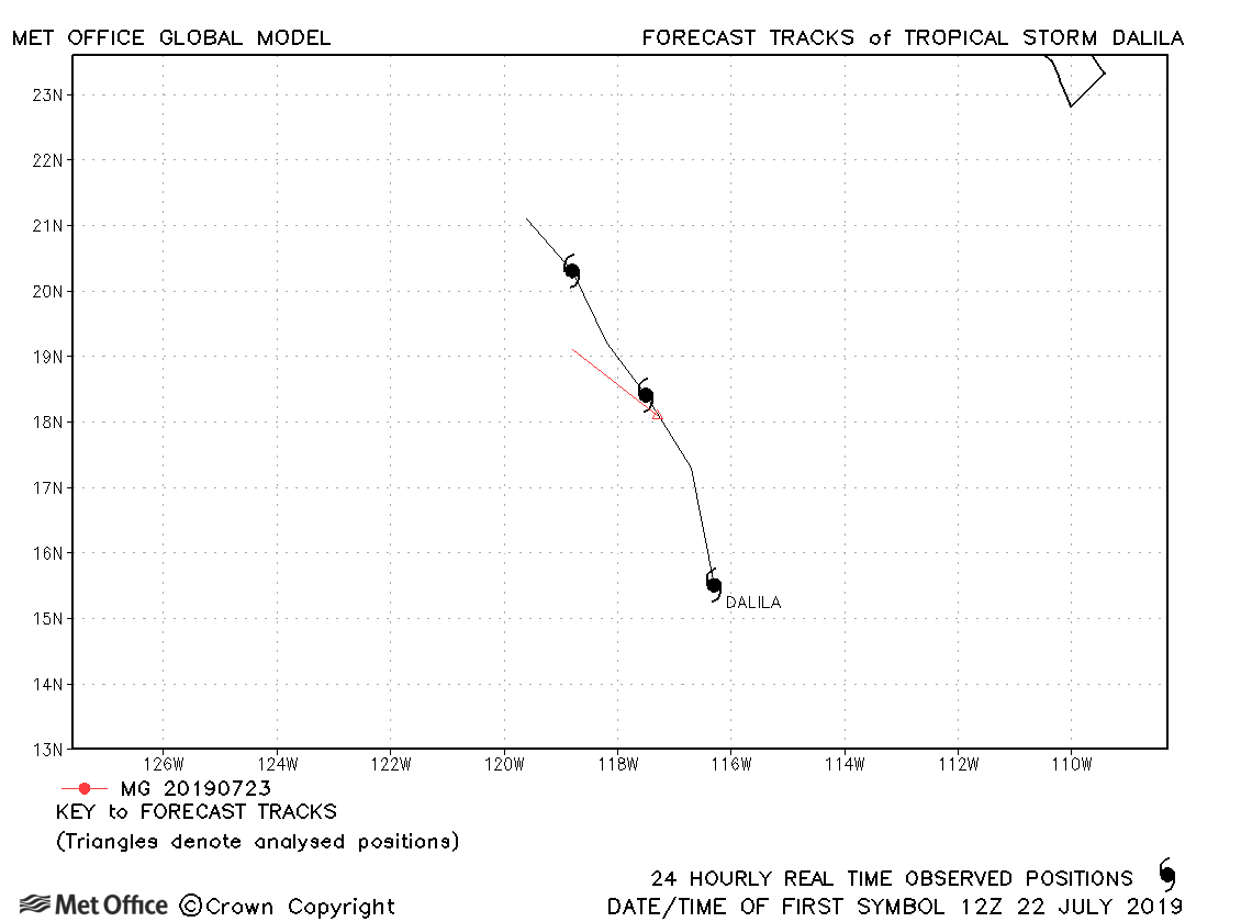
| 22-25 July | 1006 mb, 35 knots |
Dalila was briefly a tropical storm and only one forecast was verified. |
|
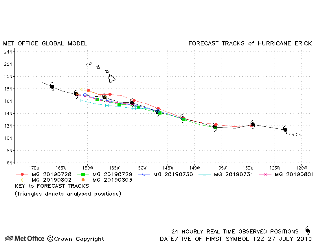
| 27 July-05 August | 952 mb, 115 knots |
Track forecast errors were low for this hurricane |
|
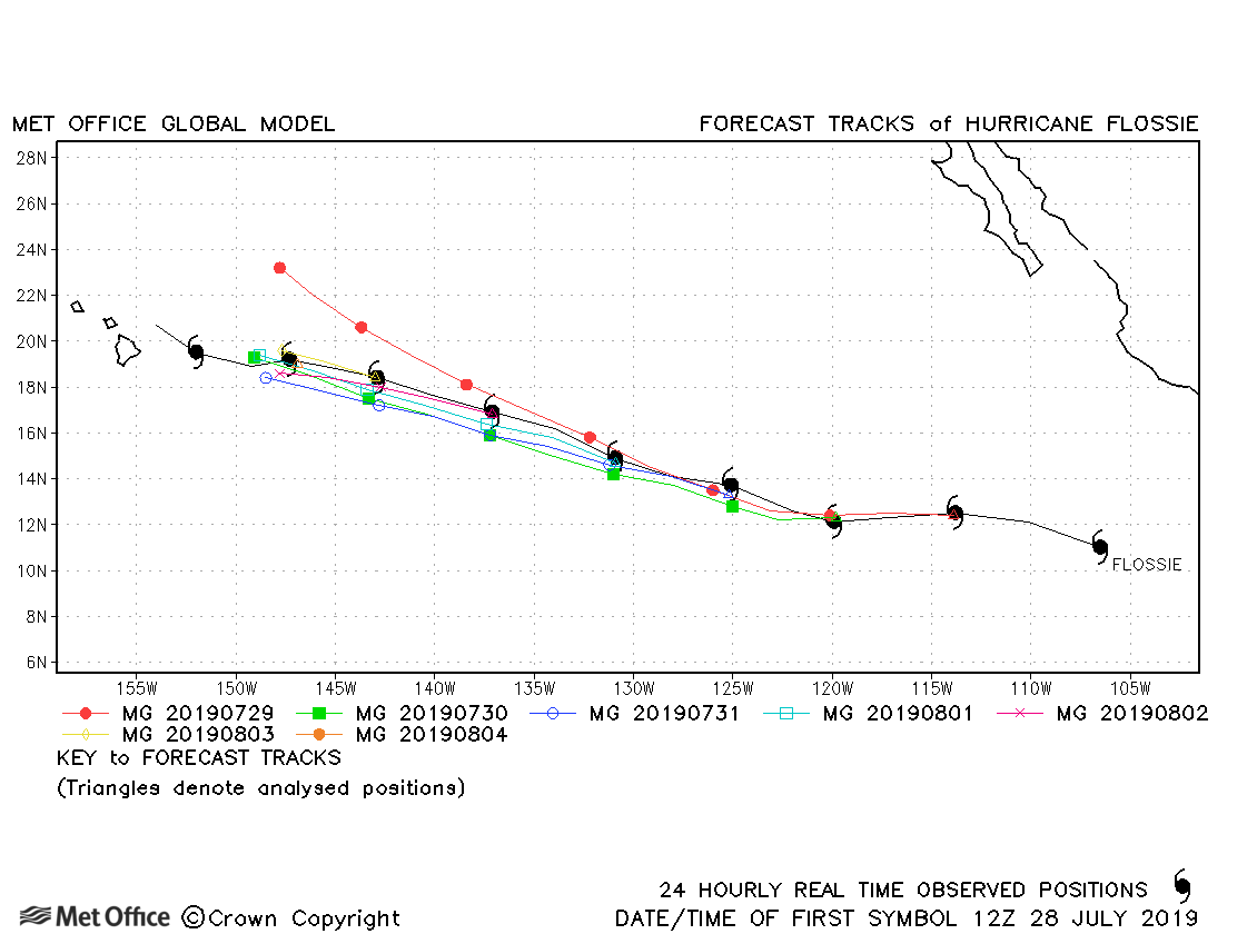
| 28 July-06 August | 990 mb, 70 knots |
Track forecast errors were mostly lower than last season's average. |
|
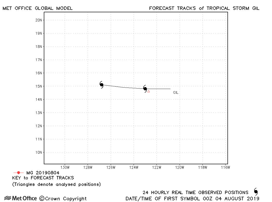
| 03-05 August | 1006 mb, 35 knots |
Gil only briefly attained tropical storm status. |
|
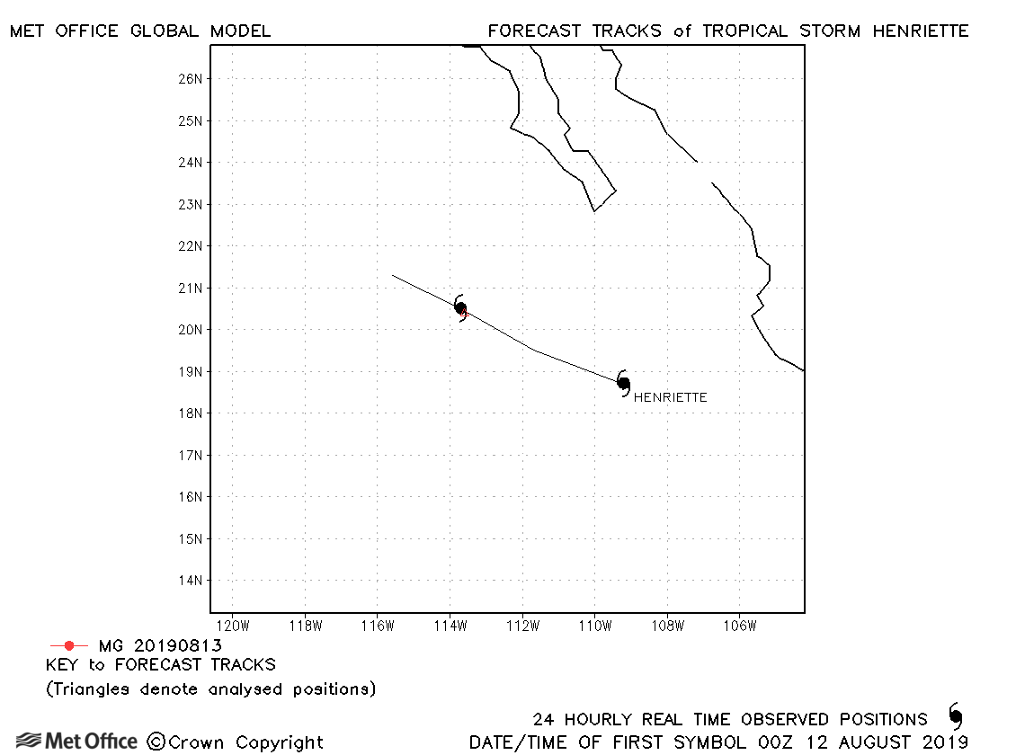
| 12-13 August | 1005 mb, 35 knots |
Henriette only briefly attained tropical storm status. |
|
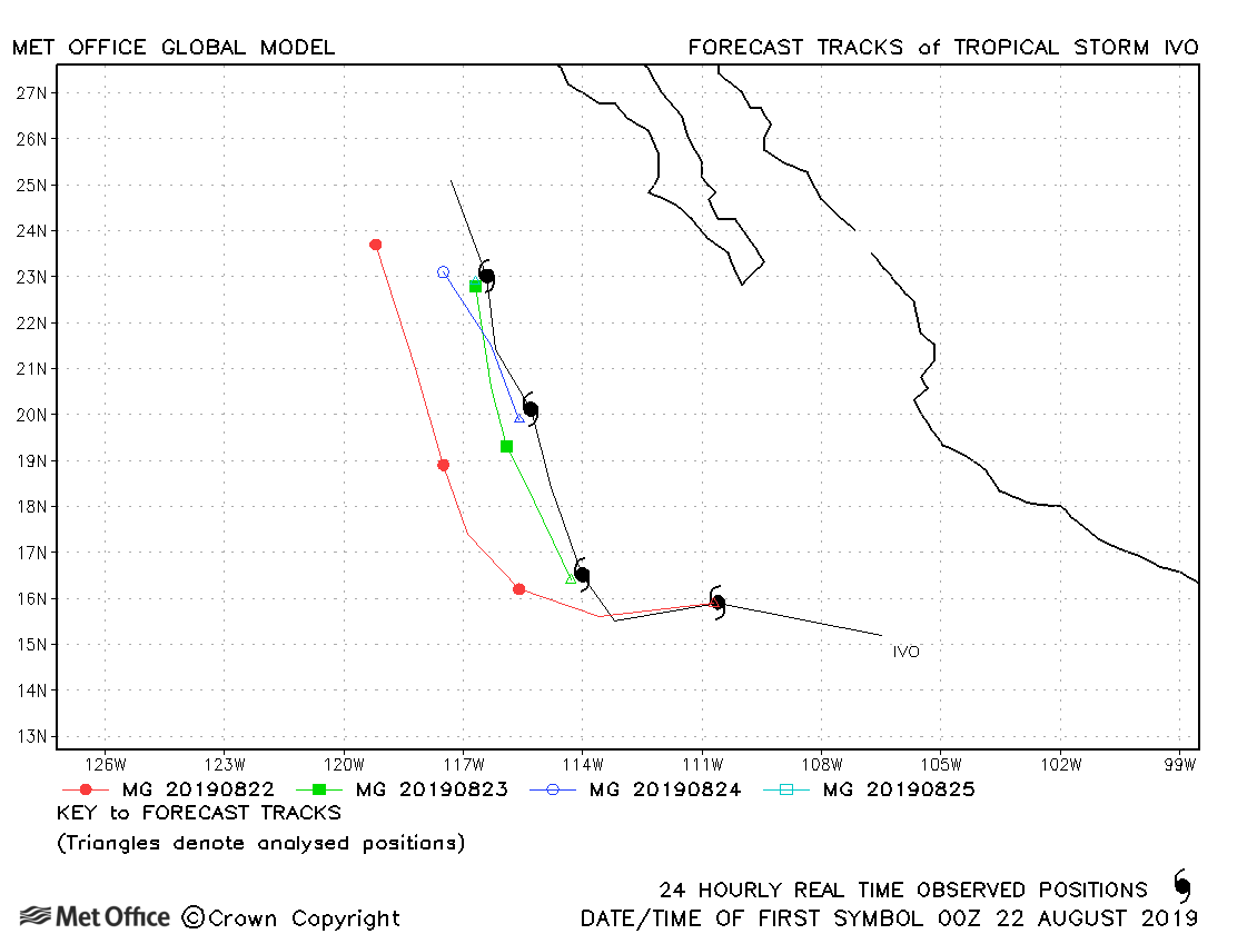
| 21-25 August | 993 mb, 55 knots |
Track forecast errors were higher than last season's average. |
|
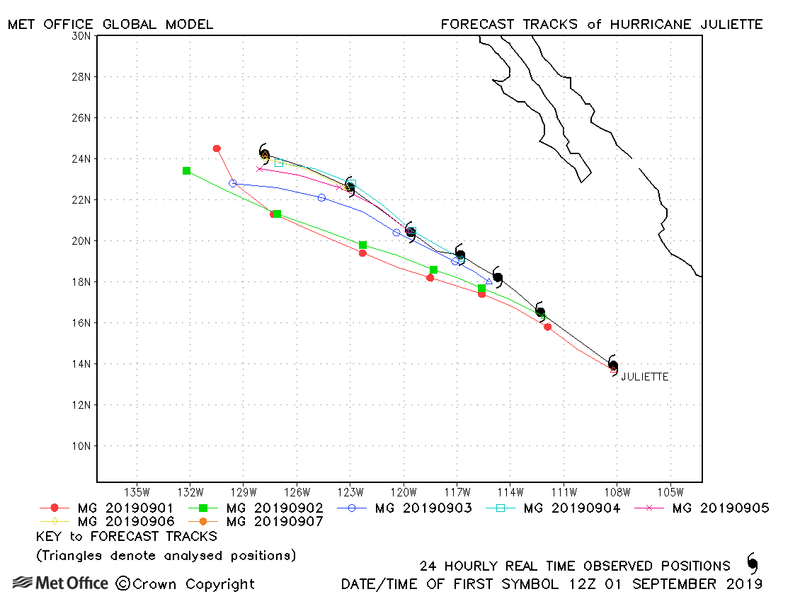
| 01-07 September | 950 mb, 110 knots |
Track forecast errors were mostly a little above last season's average with a fast bias. |
|
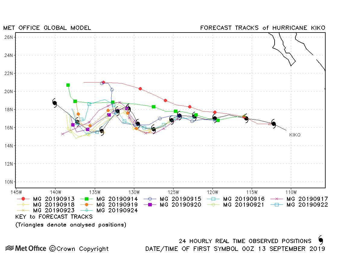
| 12-25 September | 950 mb, 115 knots |
Despite the unusual track of Kiko track forecast errors were mostly below last season's average. |
|
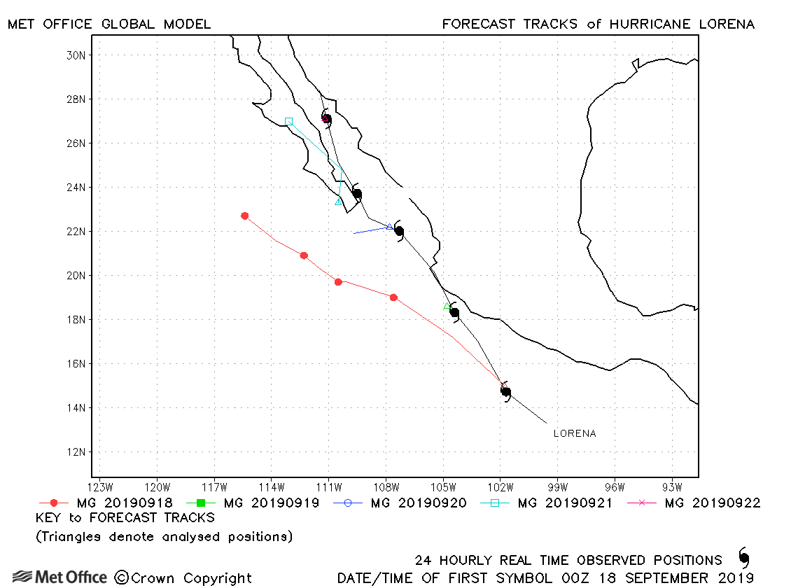
| 17-22 September | 985 mb, 70 knots |
Difficulties in predicting the interaction between Lorena and Mario resulted in some large track forecast errors. Also Lorena was not initialised or forecast as a very strong circulation resulting in premature dissipation in many forecasts. |
|
| 17-23 September | 992 mb, 55 knots |
Difficulties in predicting the interaction between Mario and Lorena resulted in some large track forecast errors. |
|
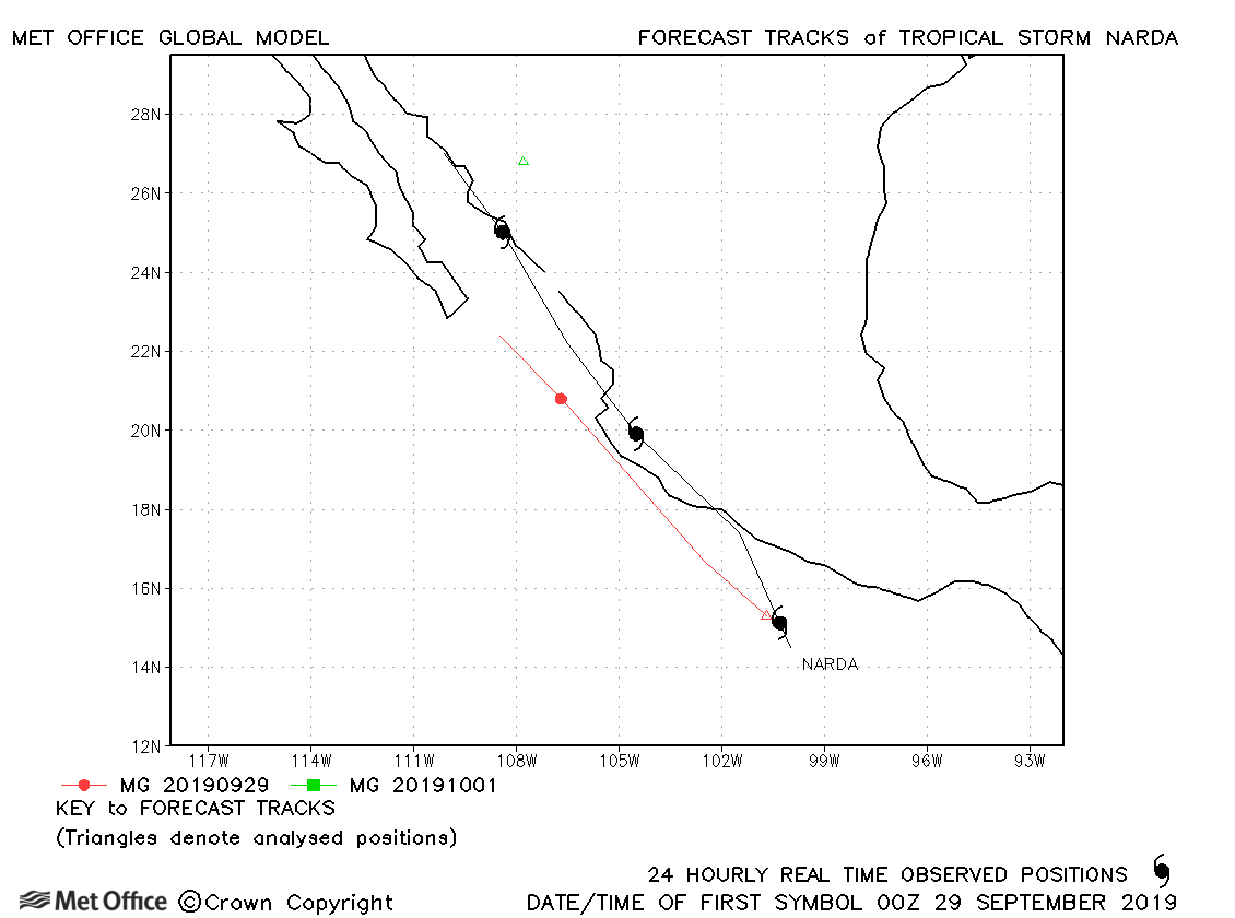
| 28 September-01 October | 998 mb, 45 knots |
Track forecast errors were above last season's average. |
|
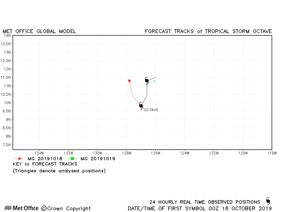
| 17-19 October | 1005 mb, 40 knots |
Octave was a short-lived storm. |
|
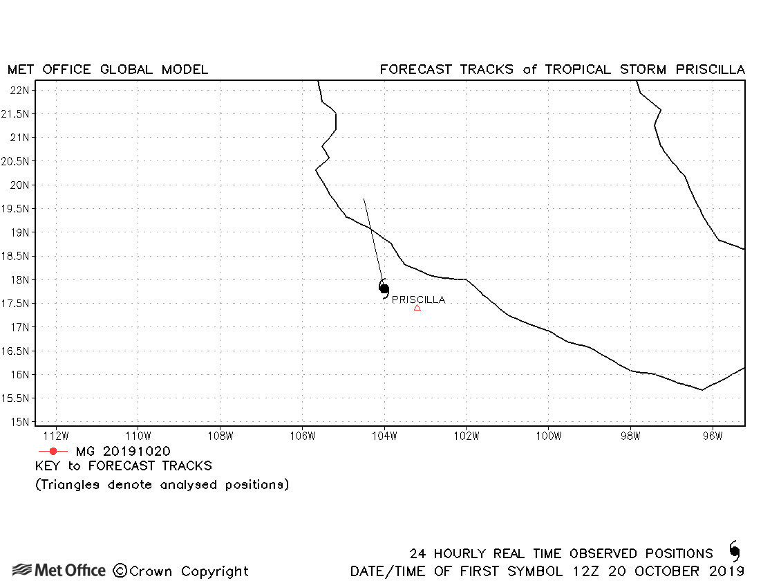
| 20-21 October | 1005 mb, 35 knots |
Priscilla was very short-lived. No forecasts were verified. |
|
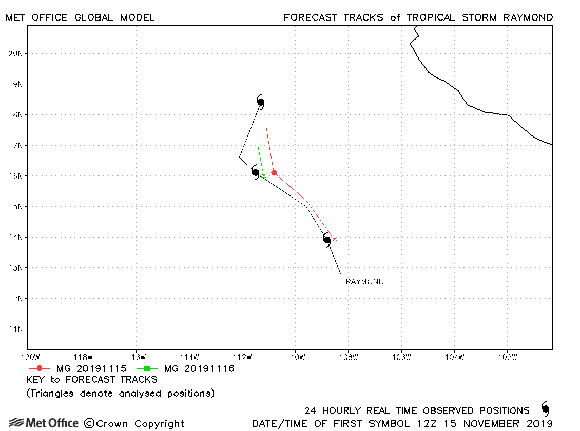
| 15-17 November | 1002 mb, 45 knots |
Raymond was short-lived. Track forecast errors were above last season's average. |
|
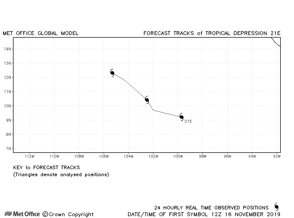
| 16-18 November | 1006 mb, 30 knots |
21E did not achieve tropical storm status. |
| Name & ID | Start & end dates | Central Pressure, 1-minute MSW | Comments on Met Office global model forecasts |
|---|---|---|---|
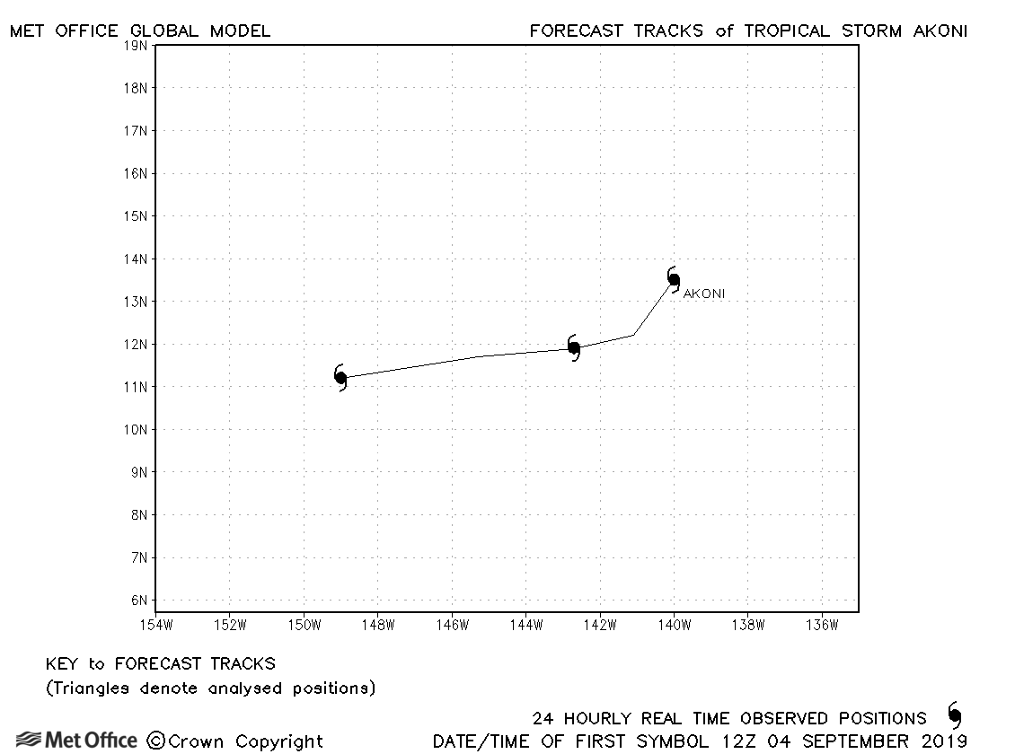
| 04-06 September | 1003 mb, 40 knots |
Akoni only briefly reached tropical storm status. Despite forming as a depression in the North-East Pacific, it was named in the Central North Pacific. |
|
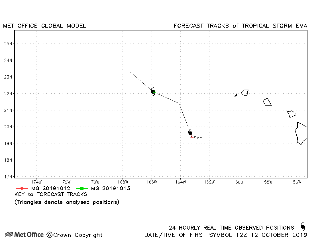
| 12-14 October | 1003 mb, 45 knots |
Ema was short-lived and not well initialised. No forecasts were verified. |
North-east and Central North Pacific observed tracks in 2019
Tropical cyclone names (North-east Pacific)
Tropical cyclone names (Central North Pacific)
| Name & ID | Start & end dates | Central pressure, 1-minute MSW | Comments on Met Office global model forecasts |
|---|---|---|---|
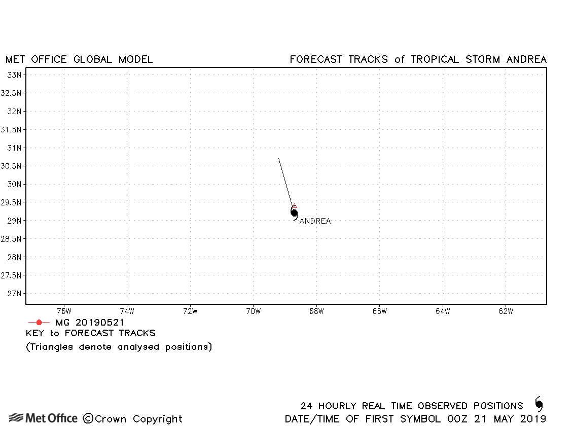
| 20-21 May | 1006 mb, 35 knots |
Andrea was short-lived and no forecasts were verified. |
|
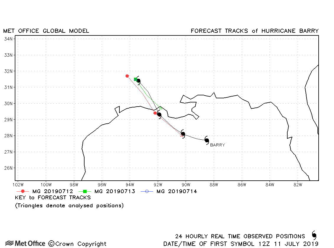
| 11-14 July | 993 mb, 65 knots |
Track forecast errors for barry were below last season's average. |
|
| 22-23 July | 1013 mb, 30 knots |
03L did not reach tropical storm status. |
|
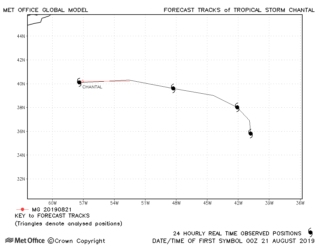
| 21-24 August | 1009 mb, 35 knots |
Chantal only briefly reached tropical storm status. |
|
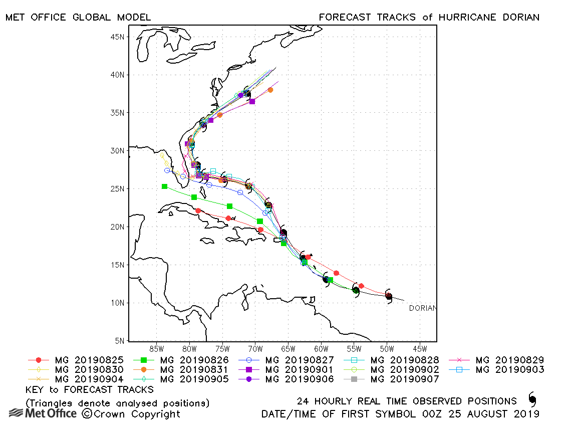
| 24 August-07 September | 910 mb, 160 knots |
Early forecasts predicted a track too far to the west, but later forecasts were very good. This resulted in overall track forecast errors well below last season's average and skill scores very high. The rapid deepening prior to landfall over the Bahamas was not captured and the model tended to deepen Dorian for too long after it moved away from the Bahamas. |
|
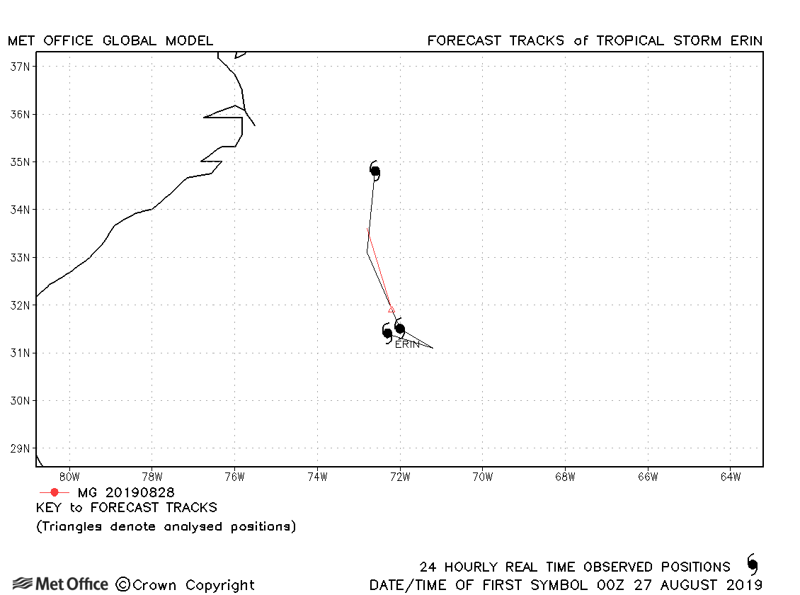
| 26-29 August | 1005 mb, 35 knots |
Erin only briefly reached tropical storm status. |
|
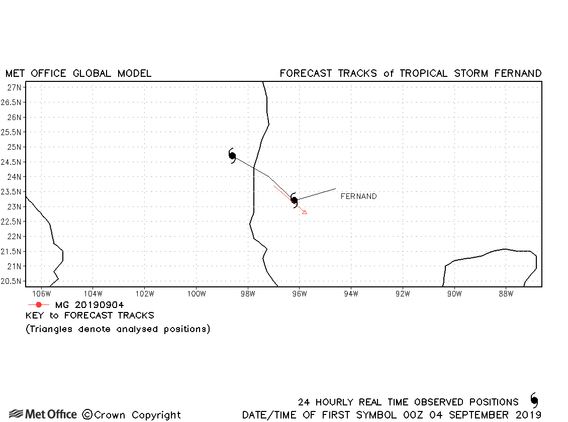
| 03-05 September | 1000 mb, 45 knots |
Fernand was only briefly a tropical storm. |
|
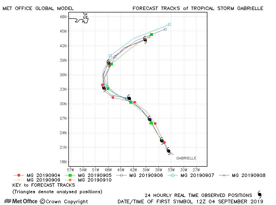
| 03-10 September | 995 mb, 55 knots |
Track errors were mixed for this storm, but gave a good indication of the recurvature. |
|
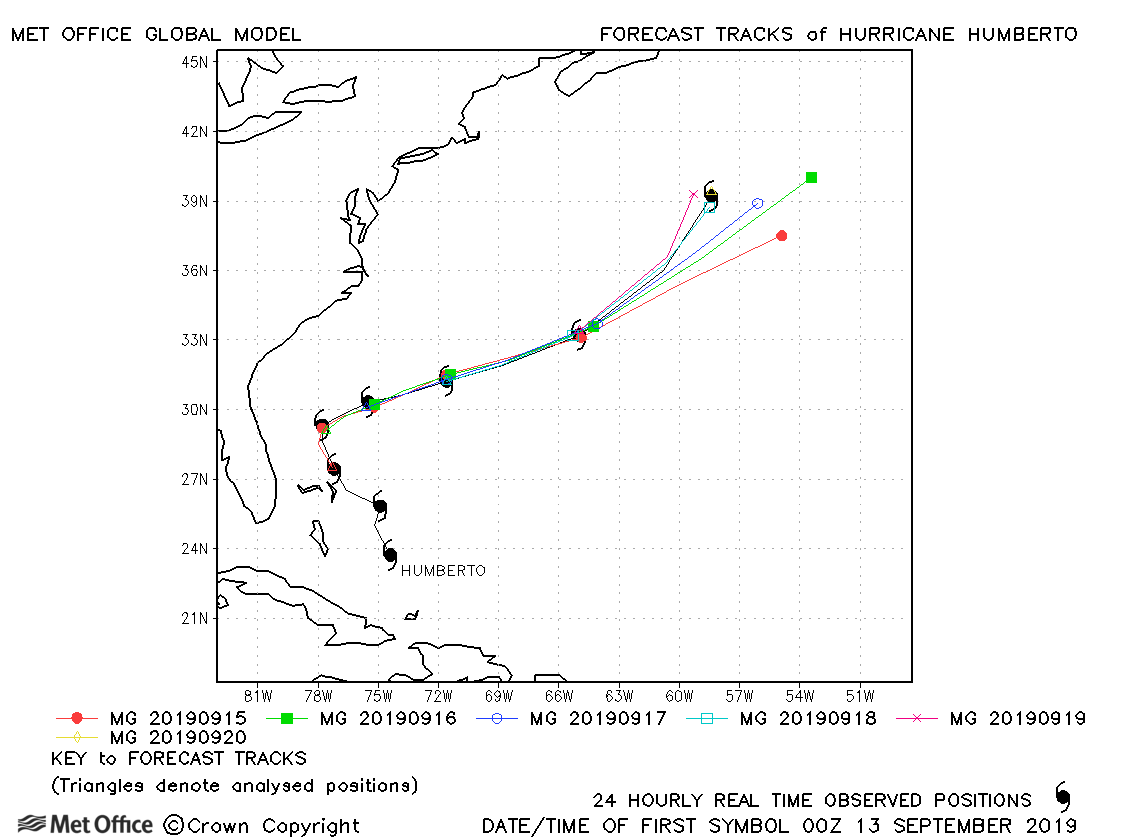
| 13-20 September | 951 mb, 105 knots |
Track forecasts were very good for this hurricane. Errors were below last season's average for all but the longest lead times. |
|
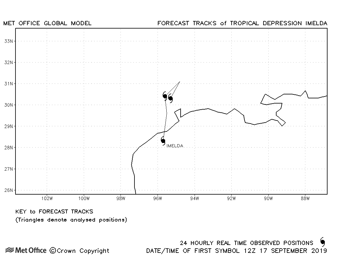
| 17-19 September | 1005 mb, 35 knots |
Despite causing considerable impacts, Imelda was only briefly a tropical storm and no forecasts were verified. |
|
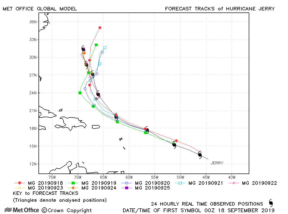
| 17-25 September | 976 mb, 90 knots |
Track forecast errors were below last season's average at all lead times. |
|
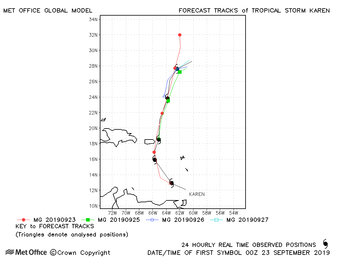
| 22-27 September | 1003 mb, 40 knots |
Track forecast errors were below last season's average at short lead times, but above average at long lead times. |
|
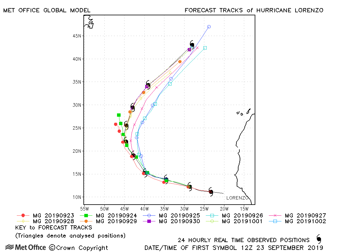
| 23 September-02 October | 925 mb, 140 knots |
There was a left-of-track bias in some forecasts. Track errors at shorter lead times were above last season's average, but below average at longer lead times. |
|
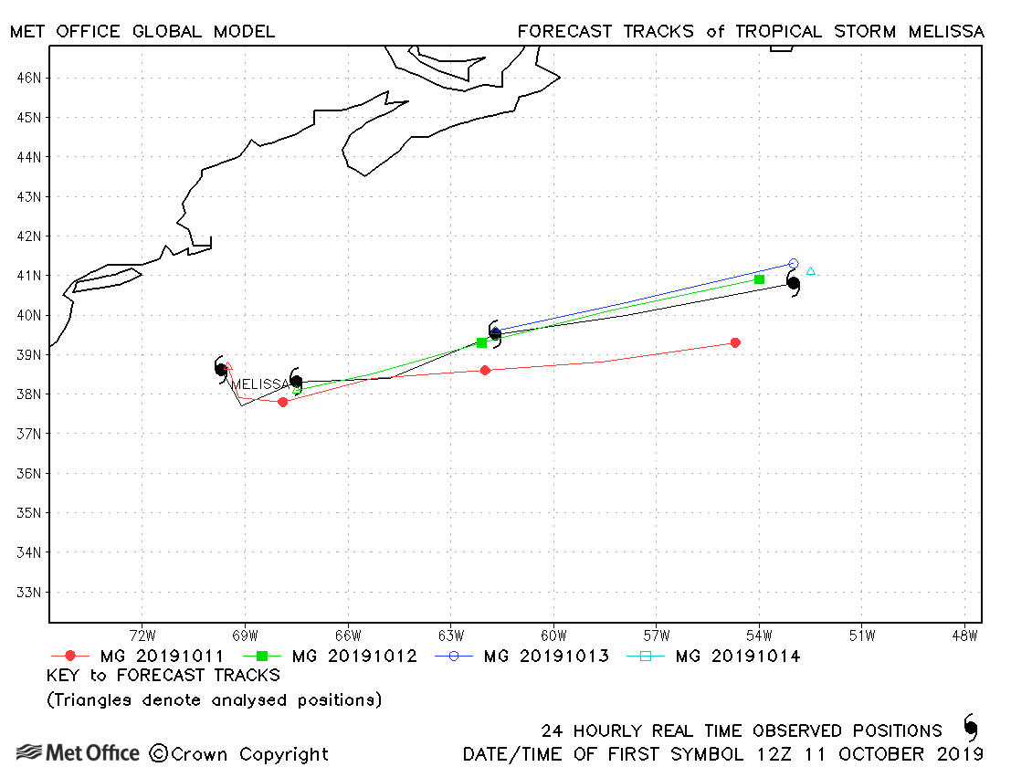
| 11-14 October | 995 mb, 55 knots |
Track forecast errors were near to or below last season's average for Melissa. |
|
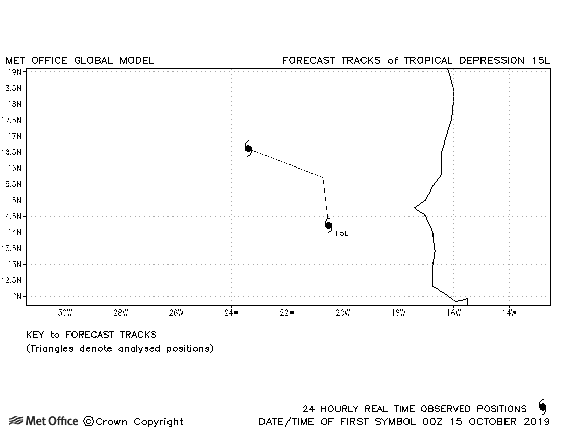
| 14-16 October | 1006 mb, 30 knots |
15L did not reach tropical storm status. |
|
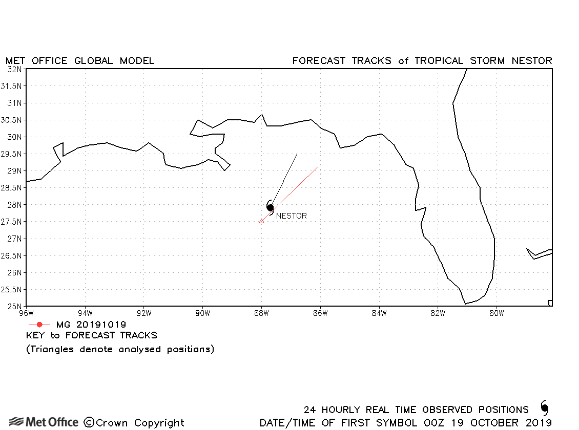
| 18-19 October | 996 mb, 55 knots |
Nestor was short-lived and only one forecast verified. |
|
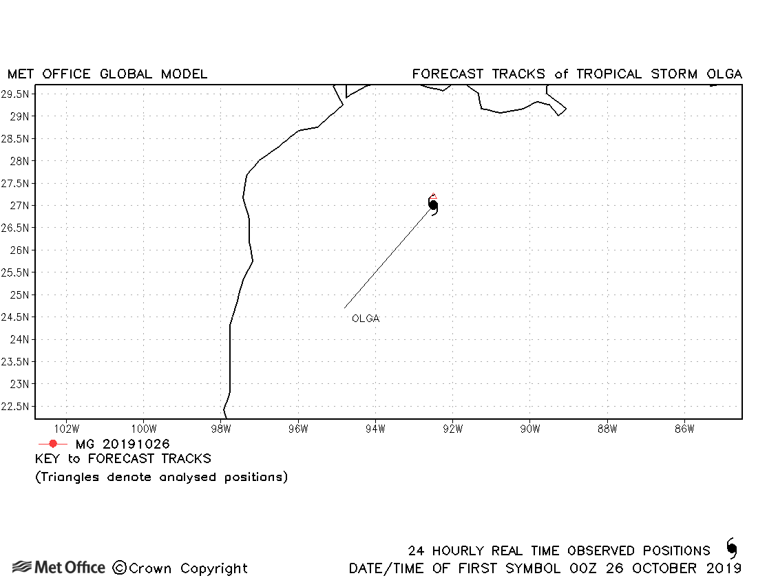
| 25-26 October | 999 mb, 45 knots |
Olga was very short-lived as a tropical storm. |
|
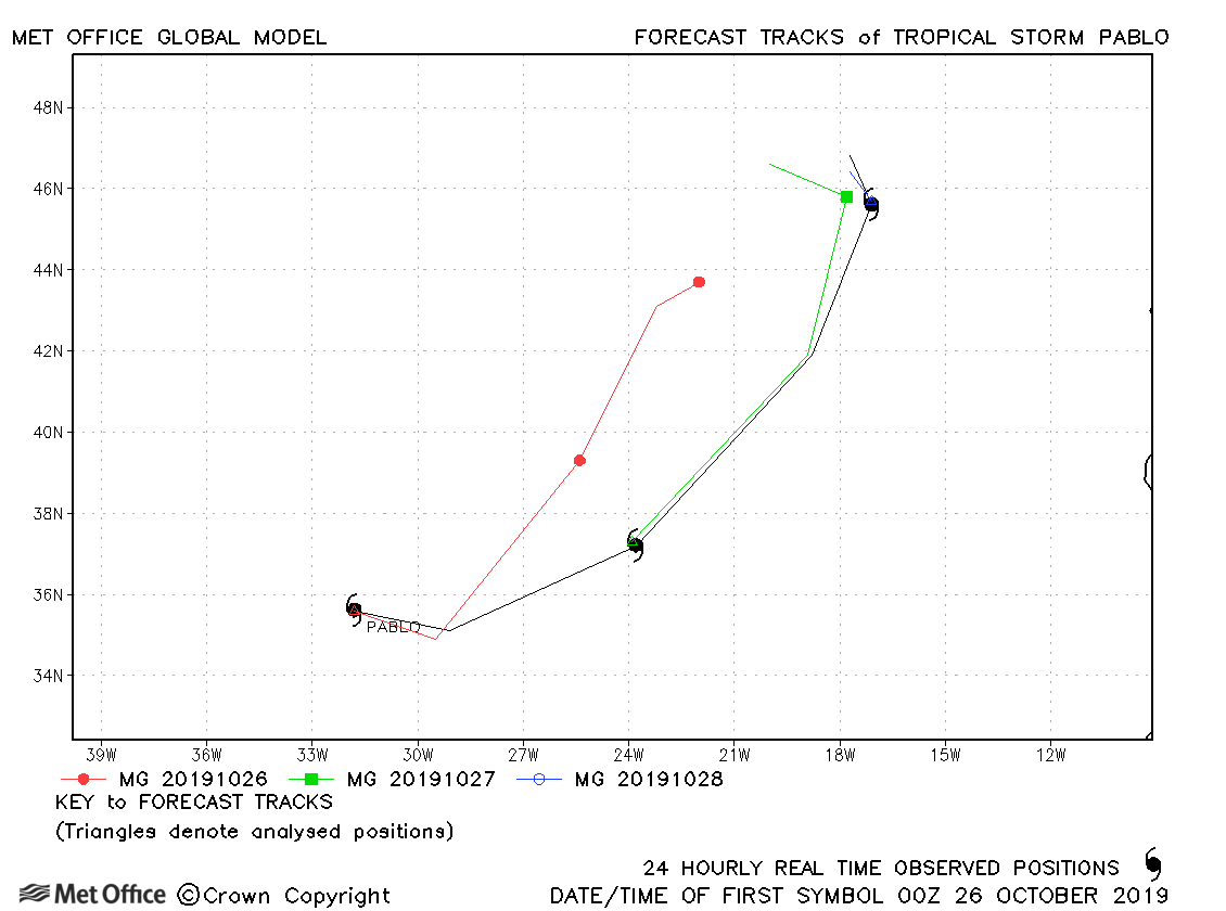
| 25-28 October | 977 mb, 70 knots |
Track forecast errors were above last season's average for Pablo. |
|
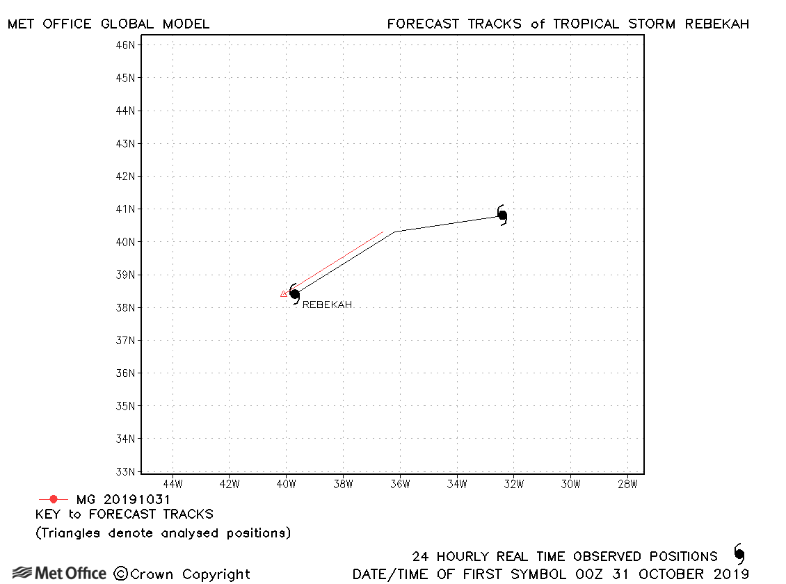
| 30 October-01 November | 987 mb, 40 knots |
As with many other storms in October Rebekah was short-lived. |
|
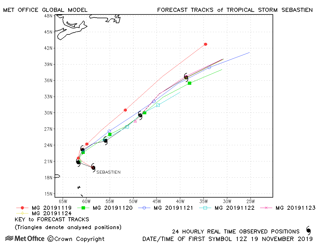
| 18-25 November | 993 mb, 55 knots |
Track forecast errors were larger than last season's average. The direction of motion was well predicted, but the speed of motion erratic (both fast and slow) resulting in the large errors. |
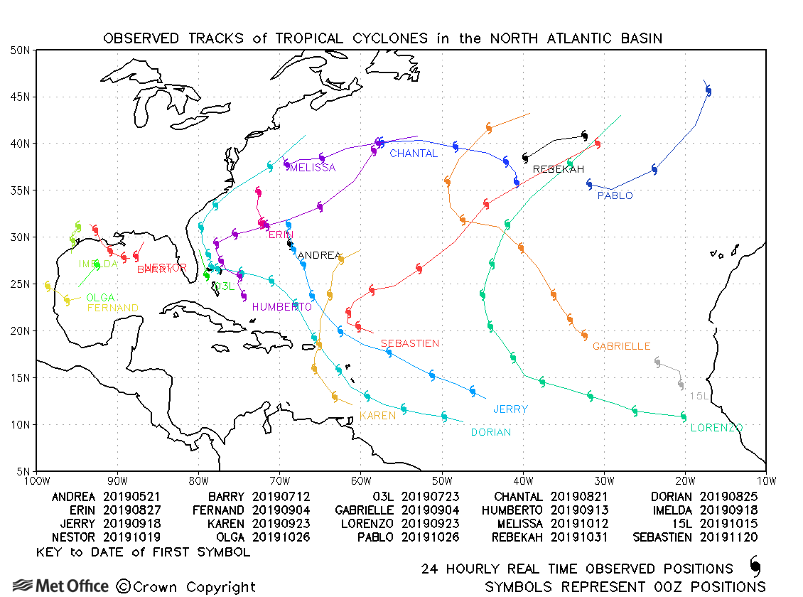
North Atlantic observed tracks in 2019
| Name & ID | Start & end dates | Central pressure, 1-/10-minute MSW | Comments on Met Office global model forecasts |
|---|---|---|---|
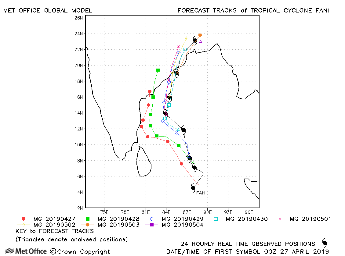
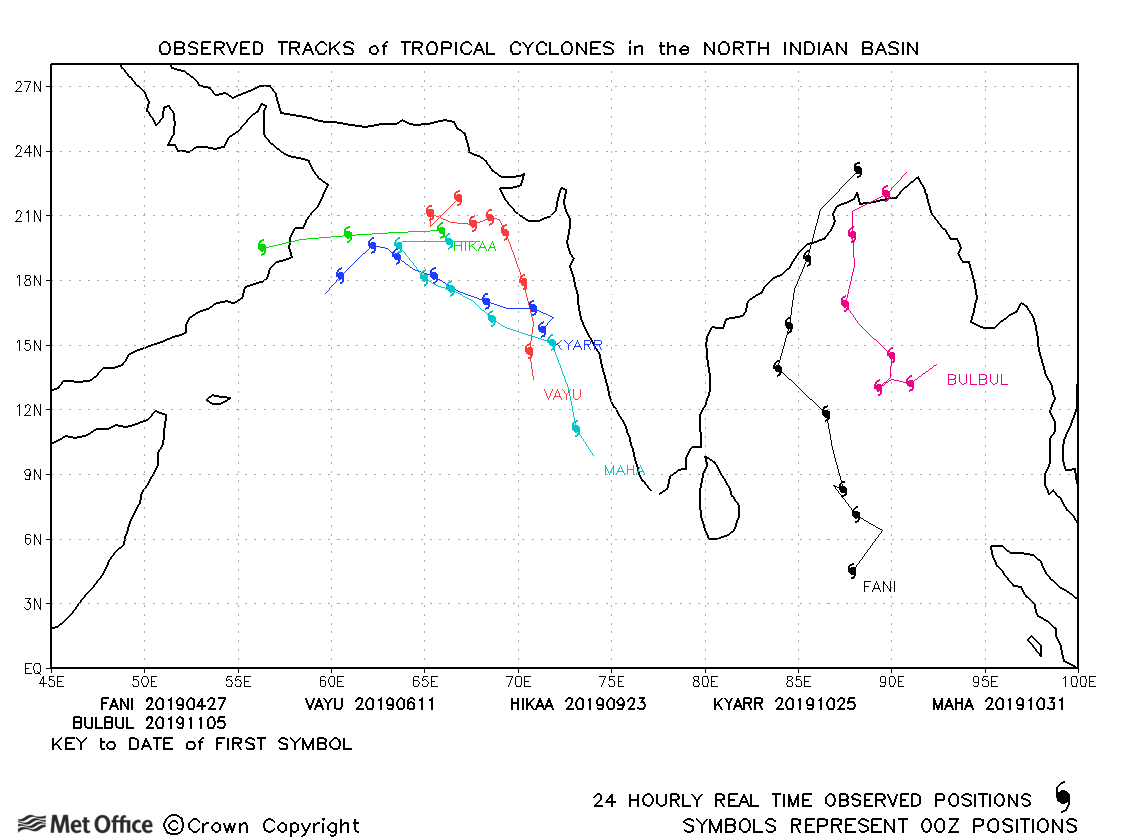
| 27 April-04 May | 917 mb, 135/110 knots |
Early forecasts for Cyclone Fani had a left-of-track and slow bias resulting in large forecast errors. However, from four days ahead of landfall track forecast errors were much lower and the location of landfall well predicted. |
|
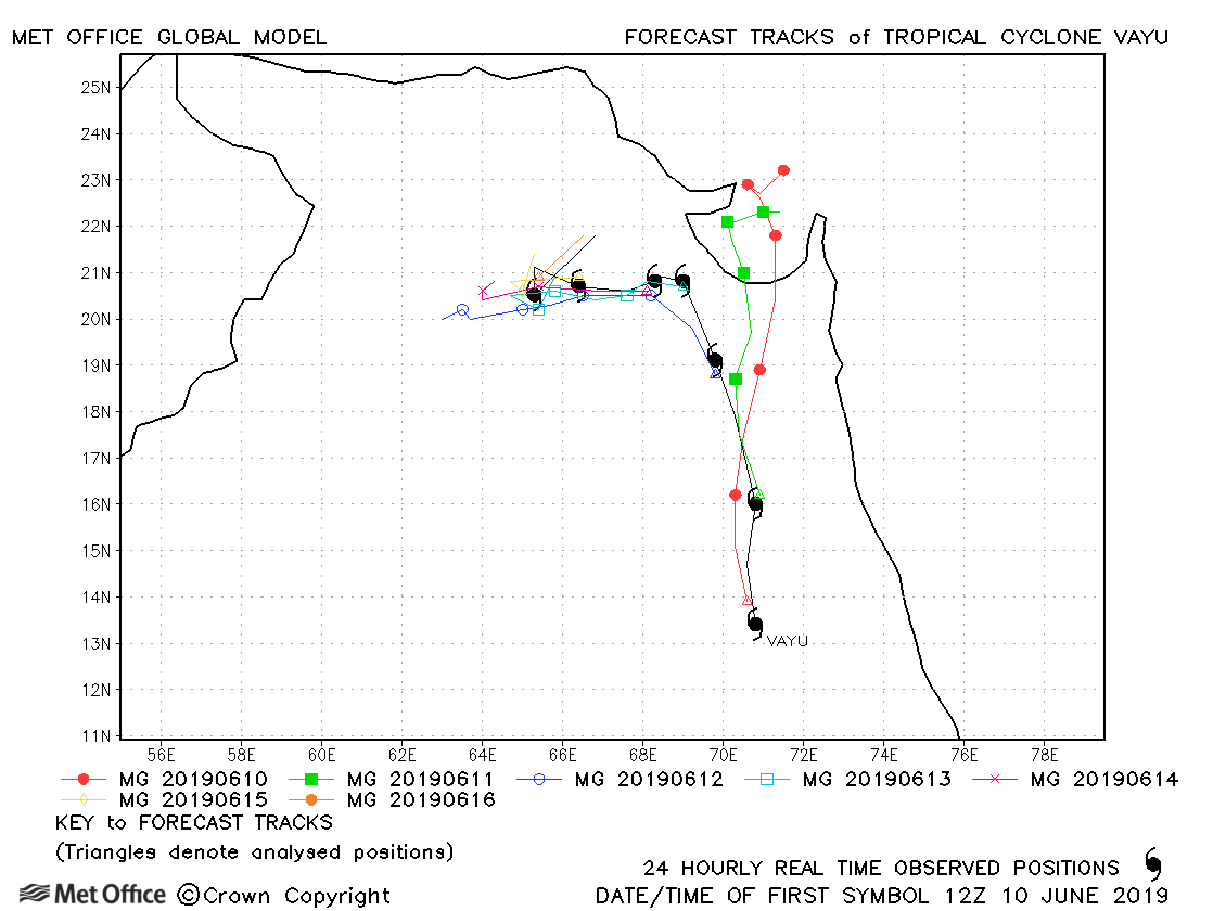
| 10-17 June | 950 mb, 95/80 knots |
The first few forecasts called for landfall over Gujarat which did not occur. Therefore longer lead time errors were large. However, later forecasts predicted the turn westwards well and track forecast errors were low. |
|
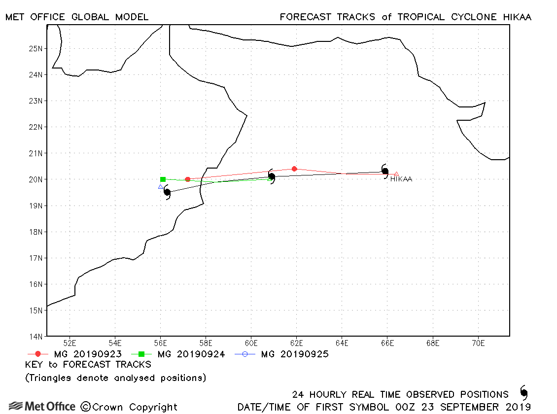
| 22-25 September | 972 mb, 85/75 knots |
Track forecast errors were well below last season's average for this storm. |
|
| 24-31 October | 920 mb, 135/125 knots |
Long lead time errors were high due to a failure to turn southwestwards. However, shorter lead time errors were low since this turn was well predicted. |
|
| 30 October-06 November | 956 mb, 105/90 knots |
Track forecast errors were below average for Maha. Although forecasts moved the cyclone too far west, they all correctly predicted the sharp turn back towards the east. |
|
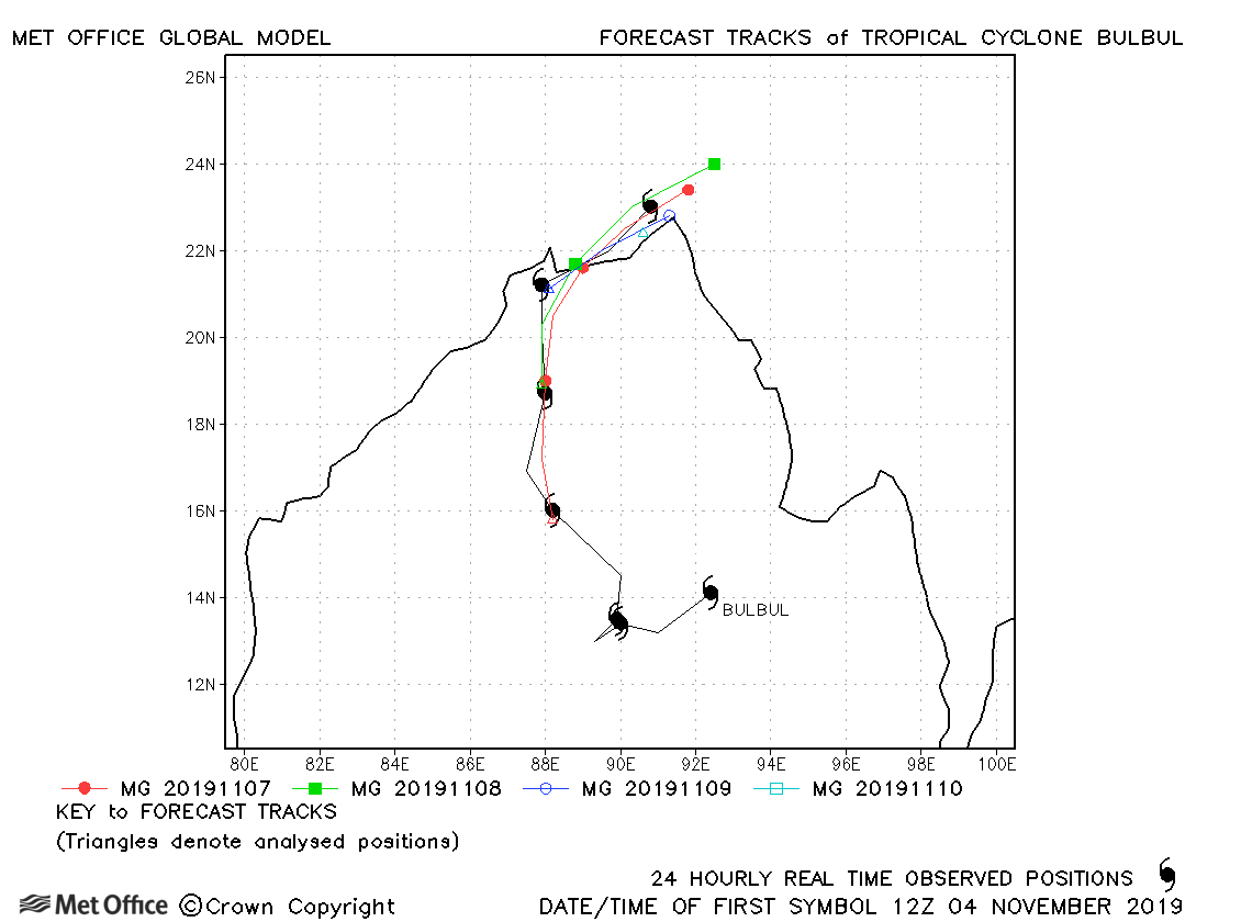
| 04-10 November | 971 mb, 85/80 knots |
Bulbul was a regeneration of Tropical Storm Matmo which made landfall over Vietnam. Track forecast errors were low and landfall well predicted. |
|
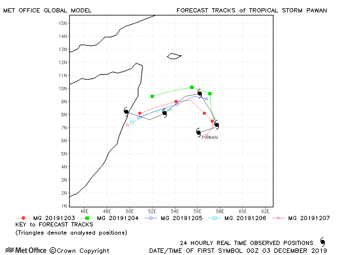
| 03-07 December | 998 mb, 40/35 knots |
Track forecast errors were mixed. There was a slow bias. |
|
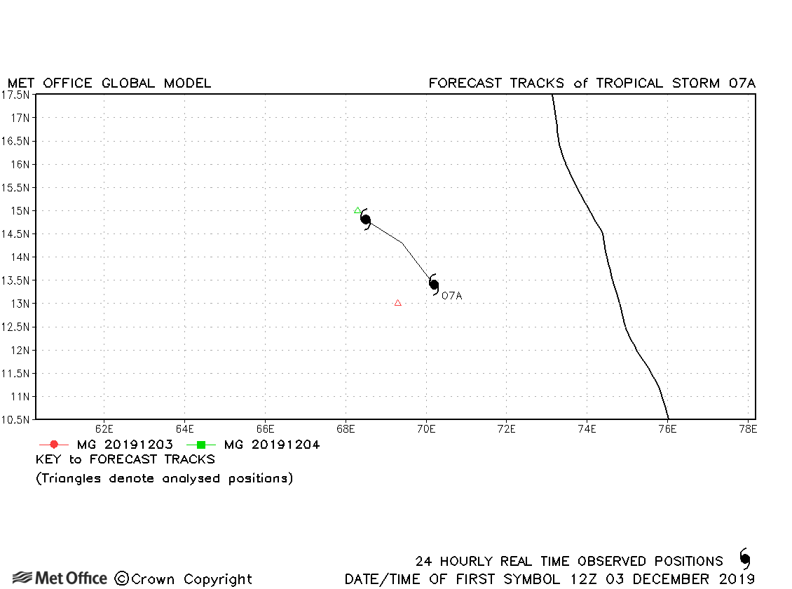
| 03-04 December | 999 mb, 45/30 knots |
Only one forecast was verified for this storm. |
North Indian observed tracks in 2019
Note on estimated wind speeds
1-minute MSW: Maximum sustained wind (knots) averaged over 1 minute (JTWC Hawaii, NHC Miami, CPHC Hawaii)
10-minute MSW: Maximum sustained wind (knots) averaged over 10 minutes (JMA Japan, IMD New Delhi)
Note: Although 1-minute average winds should be stronger than 10-minute average, this may not be the case here since estimates are obtained from different warning centres.

