

Observed and forecast tracks: northern hemisphere 2022
A summary of tropical cyclone activity in the Northern Hemisphere for the 2022 season together with an assessment of the performance of the Met Office global model in predicting the track and intensity of these tropical cyclones.
Click on the name of the tropical cyclone to see a chart of the observed track and forecast tracks from the Met Office global model. Verification statistics on each tropical cyclone are available upon request from [email protected]. At the end of the season a verification report on the performance of the Met Office global model will be published.
| Name & ID | Start & end dates | Central pressure, 1-/10-minute MSW | Comments on Met Office global model forecasts |
|---|---|---|---|
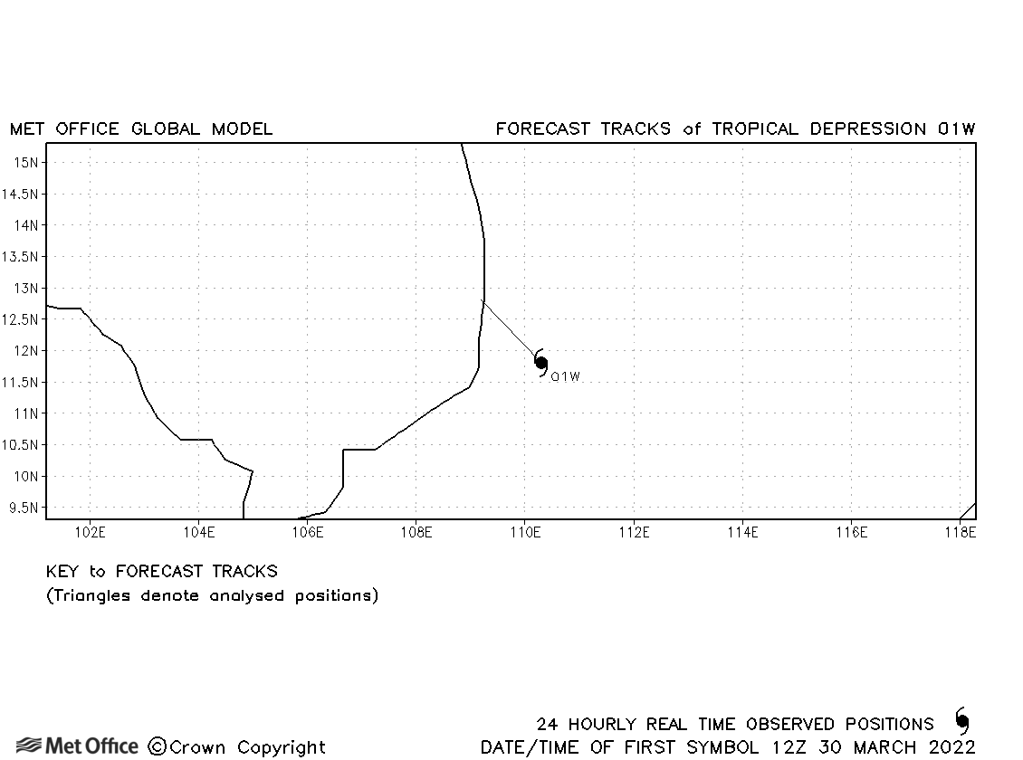
| 30-31 March | 1005 mb, 30/- knots | 01W was short-lived tropical depression. | |
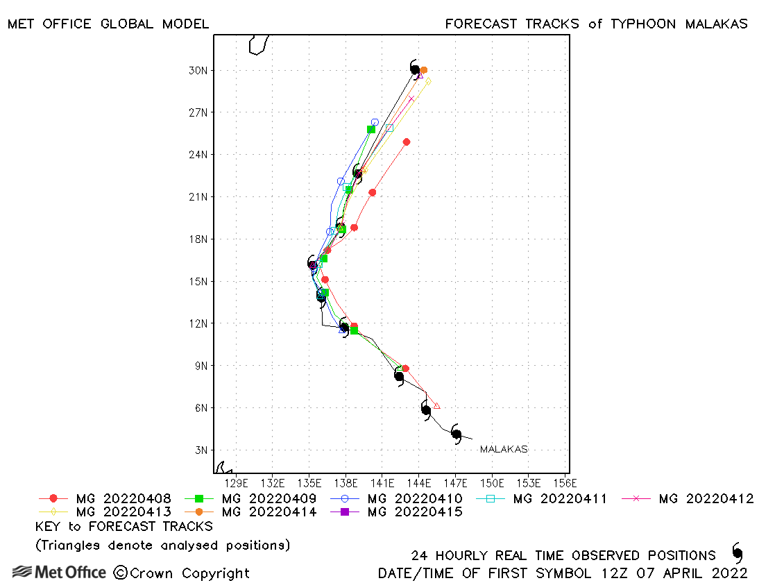
| Malakas (02W) | 07-15 April | 950 mb, 115/85 knots | Track forecast errors were lower than the recent mean for this storm. There was a slight slow bias for longer lead times. |
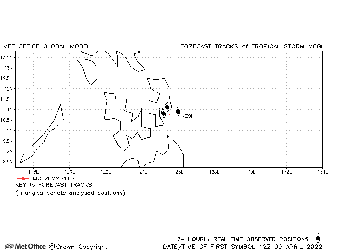
| Megi (03W) | 09-12 April | 998 mb, 40/35 knots | Megi was short-lived as a tropical storm. |
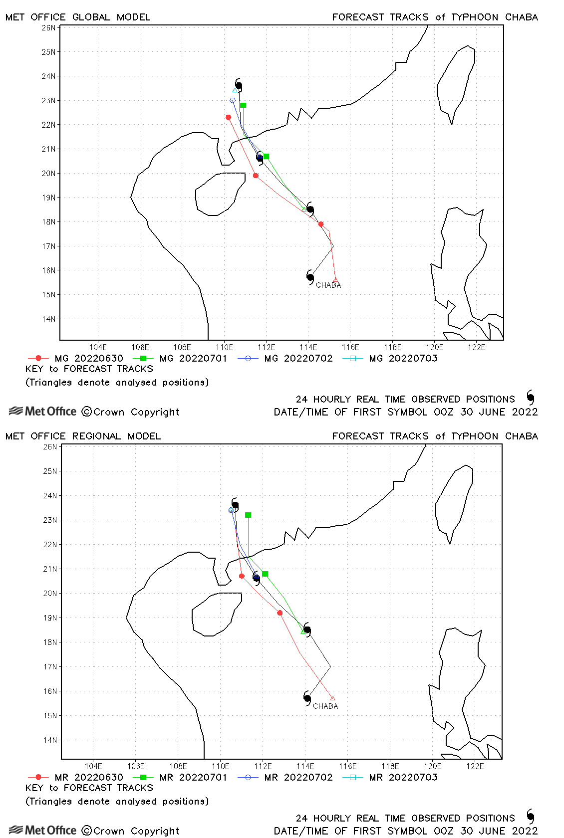
| Chaba (04W) | 29 June-03 July | 965 mb, 75/70 knots | Track forecast errors were low for this storm. |
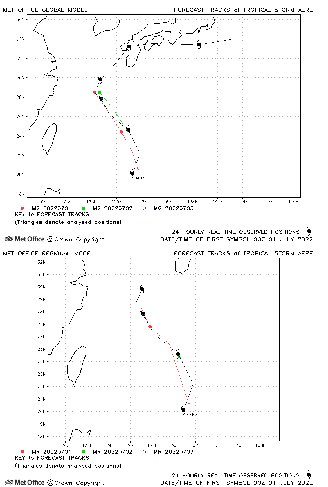
| Aere (05W) | 30 June-06 July | 994 mb, 45/45 knots | Track forecast errors were mostly a little higher than the recent mean. |
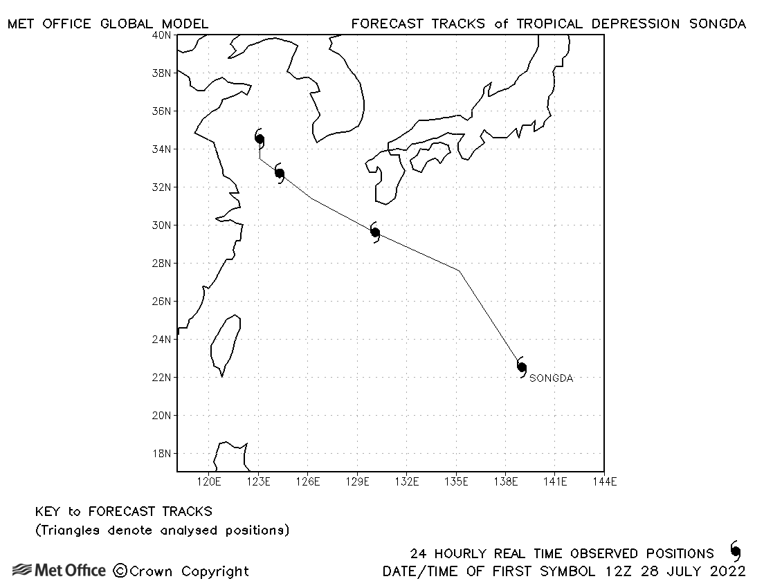
| Songda (06W) | 28 July-01 August | 996 mb, 30/35 knots | No forecasts were verified as 1-minute sustained winds did not reach tropical storm status. |
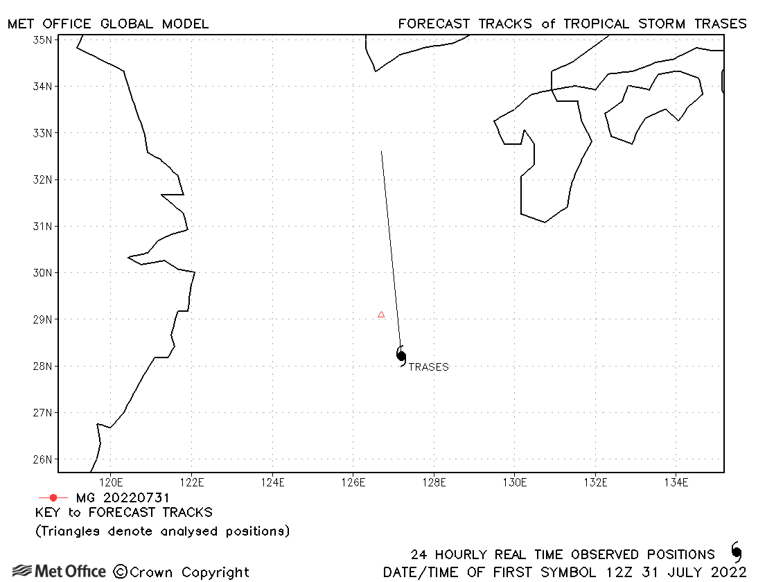
| Trases (07W) | 31 July-01 August | 998 mb, 35/35 knots | Trases was a short-lived storm. |
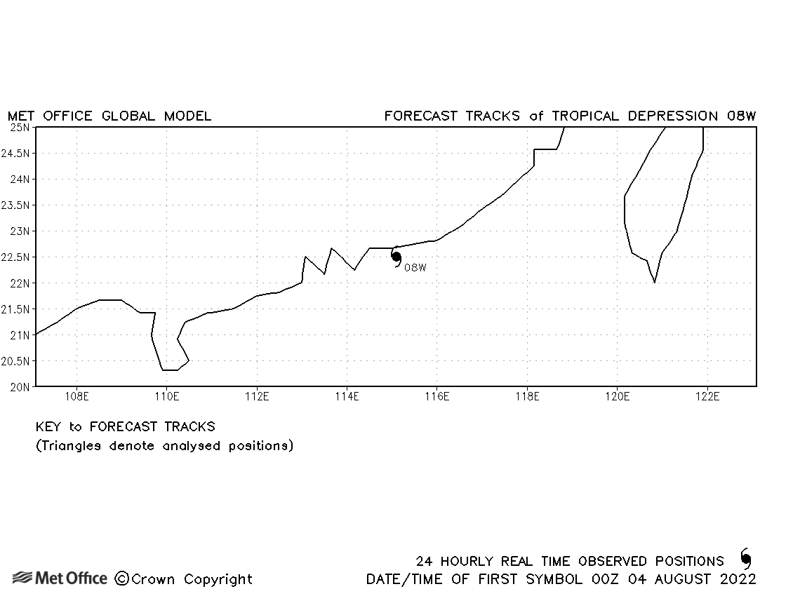
| 08W | 04 August | 1002 mb, 25/- knots | 08W was a brief tropical depression and no forecasts were verified. |
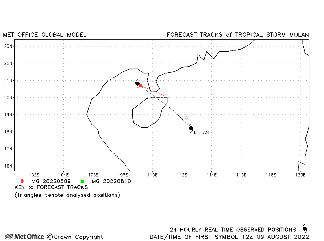
| Mulan (97W) | 09-10 August | 996 mb, 35/35 knots | Track forecast errors were low for this brief tropical storm. |
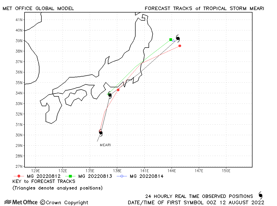
| Meari (09W) | 11-14 August | 996 mb, 35/40 knots | Forecast tracks for the storm's passage across southeastern Japan were good. |
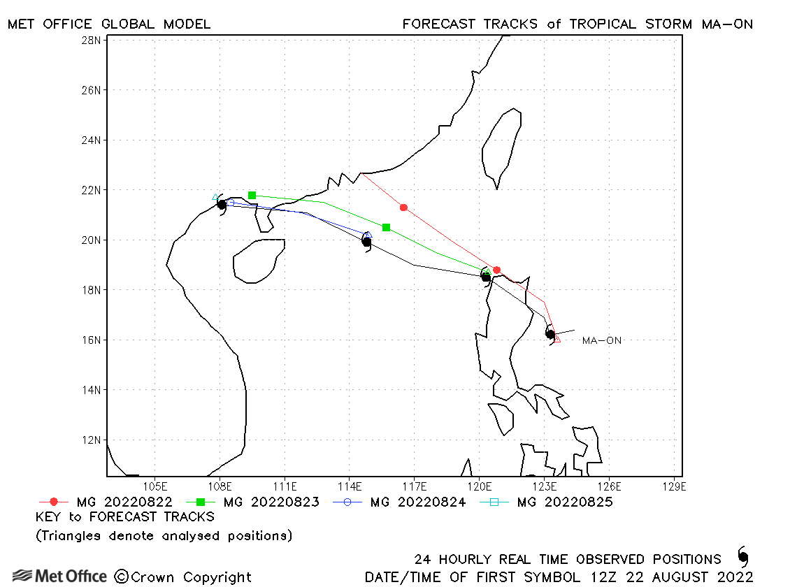
| Ma-on (10W) | 21-25 August | 980 mb, 60/60 knots | There was a right-of-track bias in forecasts resulting in errors above the recent mean value. |
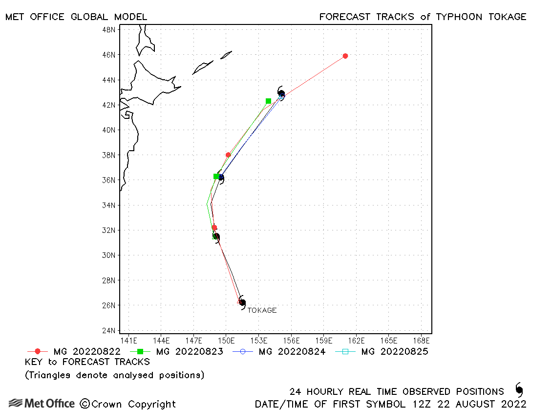
| Tokage (11W) | 22-25 August | 970 mb, 95/75 knots | The direction of motion forecasts were good, but the speed was too fast resulting in longer lead time errors above the recent mean values. |
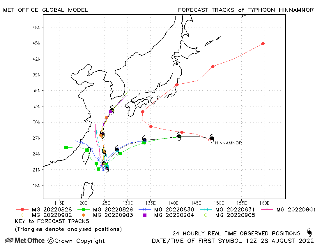
| Hinnamnor (12W) | 28 August-06 September | 920 mb, 140/105 knots | Beyond 48 hours track forecast errors were large mostly due to a westwards bias in tracks across Taiwan. |
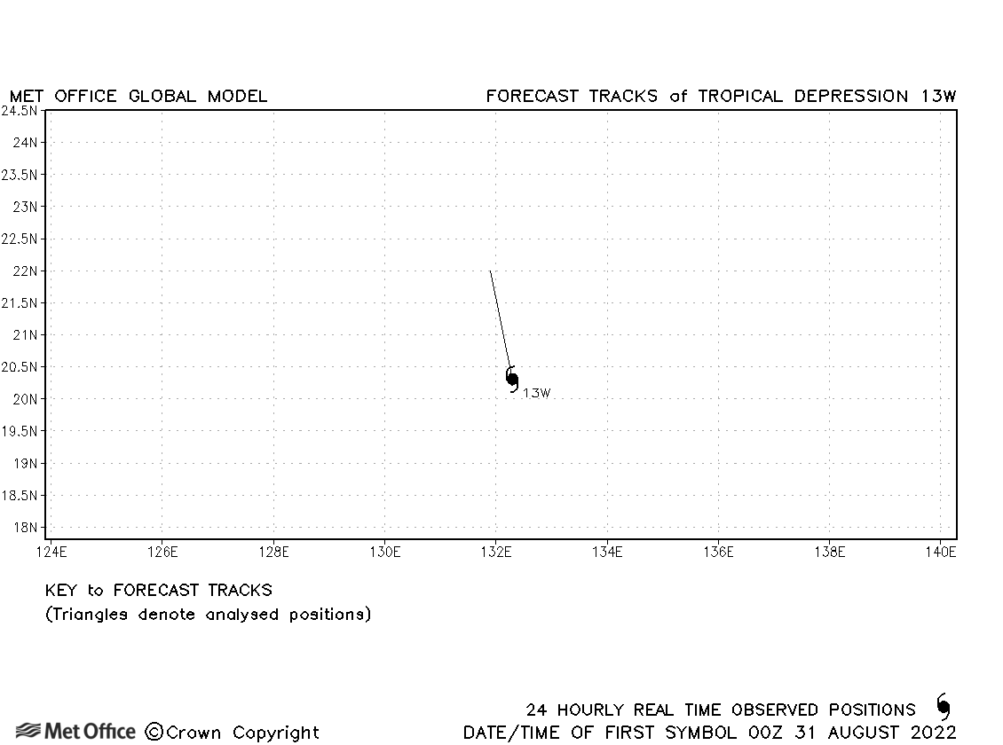
| 13W | 30 August-01 September | 1000 mb, 30/30 knots | No forecasts were verified for this tropical depression. |
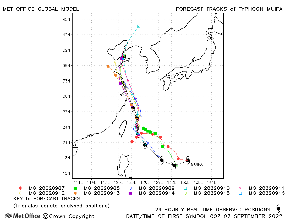
| Muifa (14W) | 06-16 September | 950 mb, 115/85 knots | Track forecast errors were mostly near to or below the recent mean values. |
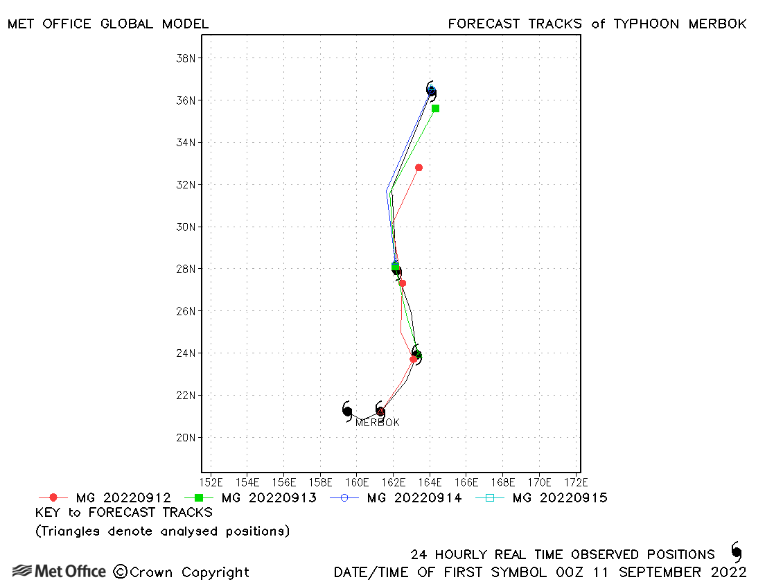
| Merbok (15W) | 10-15 September | 970 mb, 70/70 knots | There was a slow bias in longer lead time forecasts, but short lead times track forecast errors were low. |
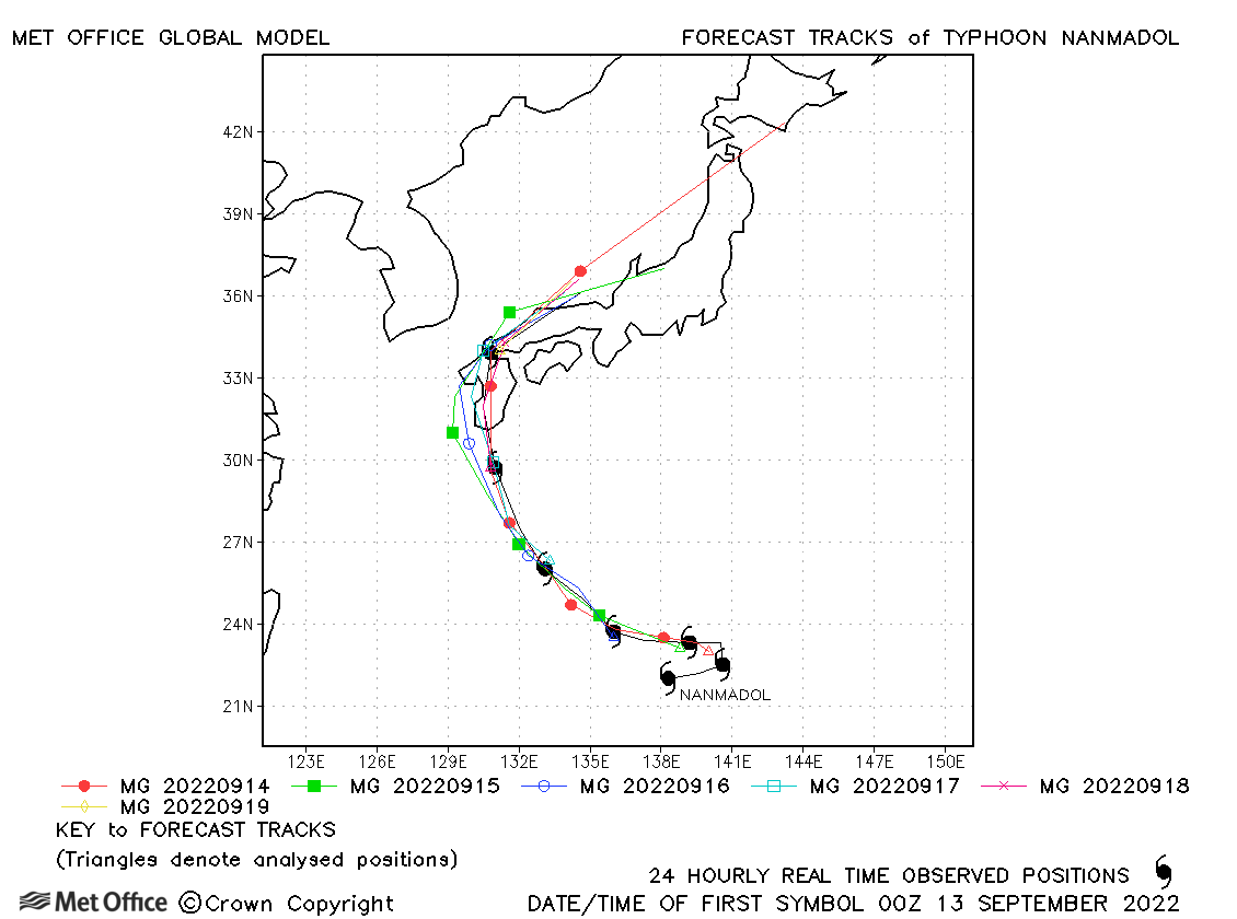
| Nanmadol (16W) | 12-19 September | 910 mb, 135/105 knots | Track forecasts were near to the recent mean values for this typhoon. |
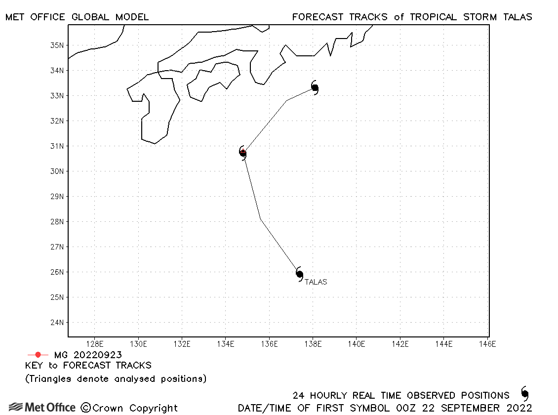
| Talas (17W) | 21-24 September | 1000 mb, 35/35 knots | Talas was only briefly a tropical storm and no forecasts were verified. |
| Noru (18W) | 22-28 September | 940 mb, 140/95 knots | Early forecasts of the Philippines landfall were poor, but errors reduced for later forecasts. |
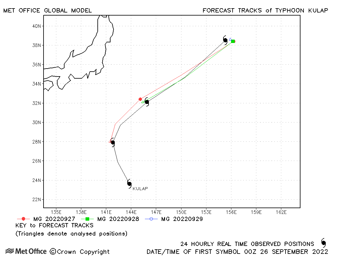
| Kulap (19W) | 25-29 September | 970 mb, 65/60 knots | Track forecast errors were near to or below the recent mean values. |
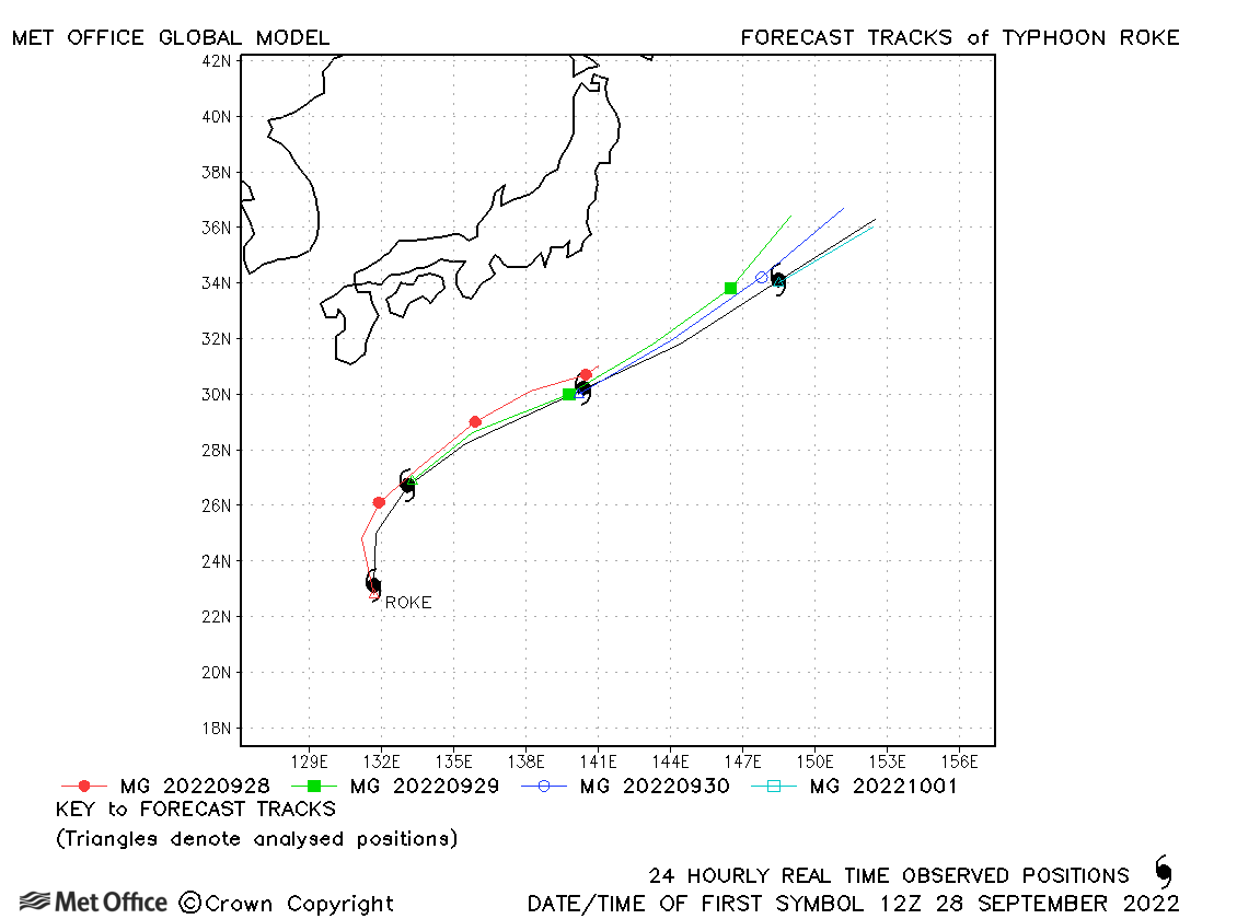
| Roke (20W) | 28 September-02 October | 975 mb, 85/70 knots | The direction of motion was well predicted but the predicted forward speed was too slow. |
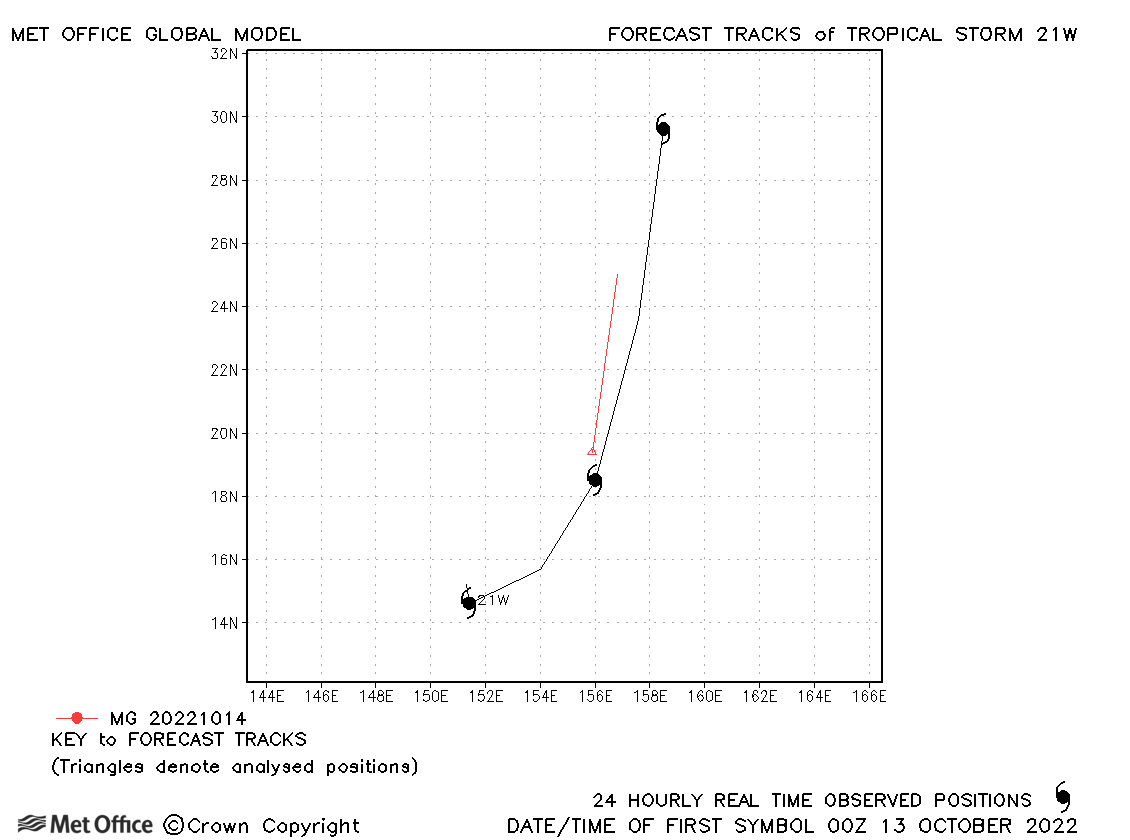
| 21W | 12-15 October | 999 mb, 40/30 knots | 21W was short-lived and few forecasts were verified. |
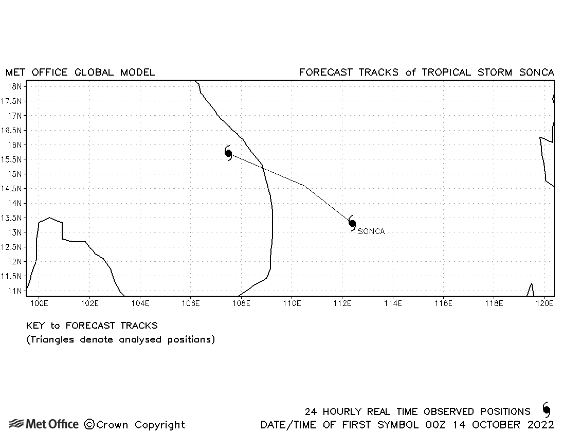
| Sonca (22W) | 14-15 October | 998 mb, 35/35 knots | Sonca was a short-lived storm. |
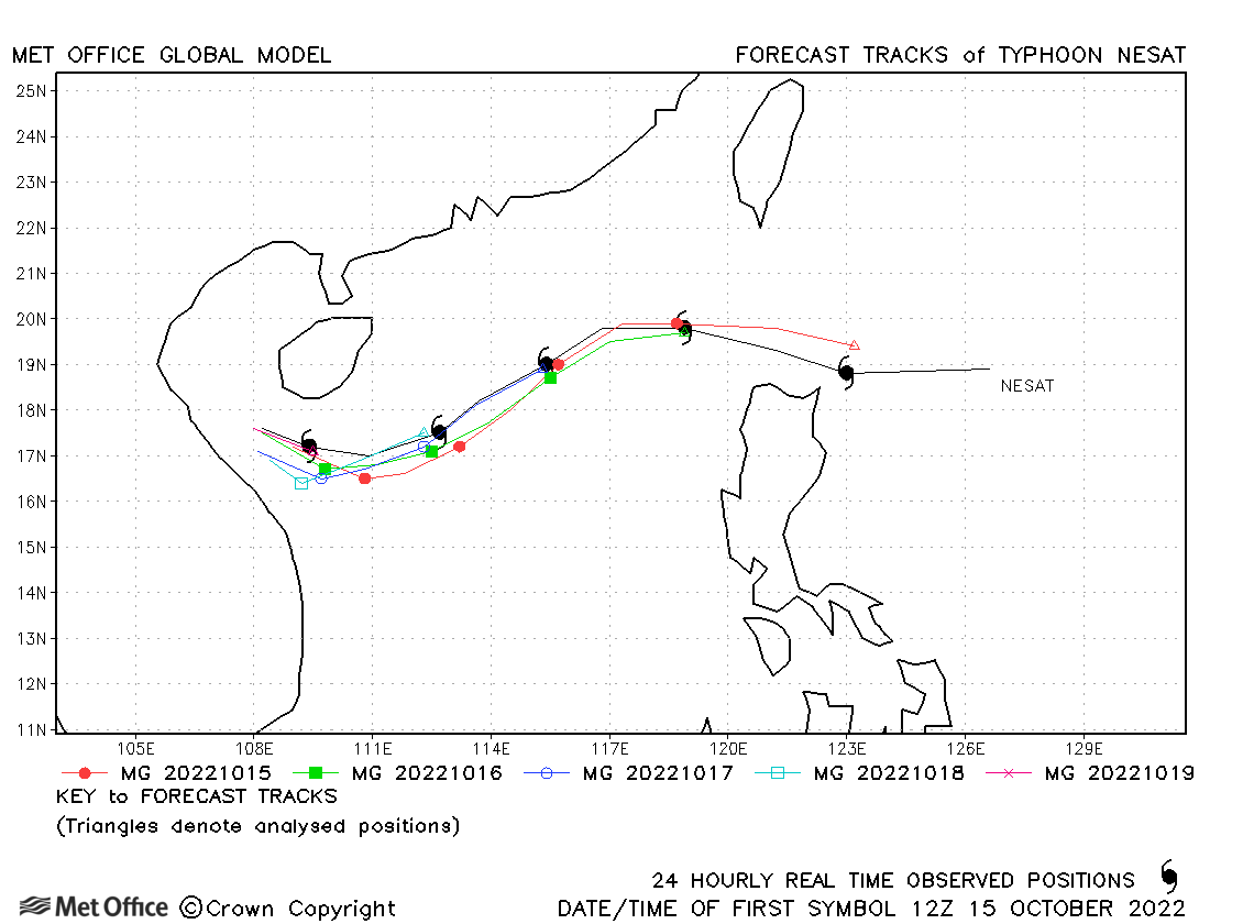
| Nesat (23W) | 14-20 October | 964 mb, 90/75 knots | Track forecast errors were low and skill scores high for this typhoon. |
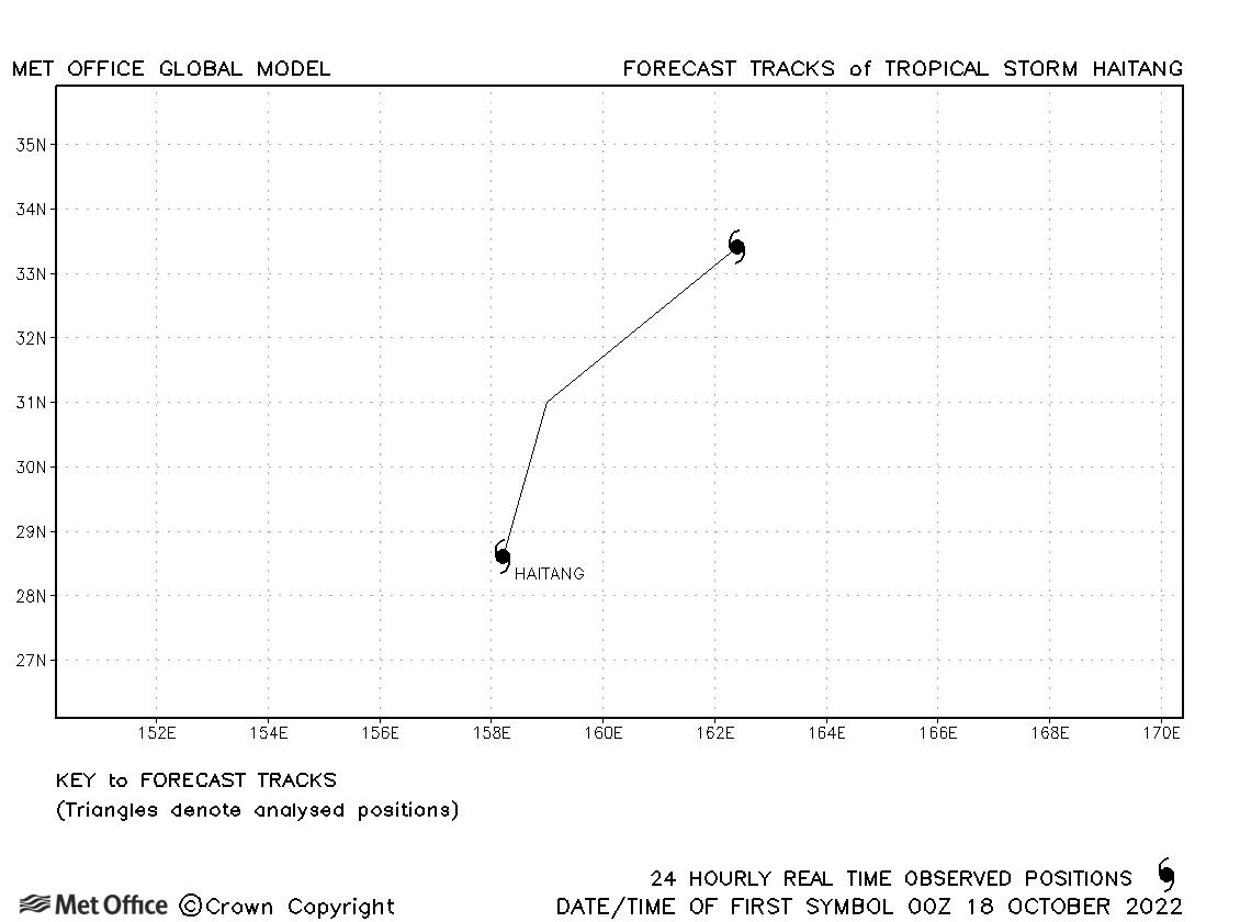
| Haitang (24W) | 18-19 October | 1004 mb, 35/35 knots | Haitang was a short-lived storm. |
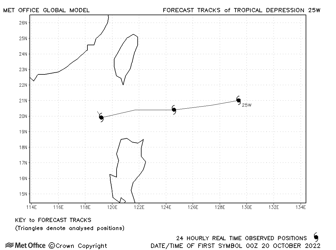
| 25W | 19-22 October | 1004 mb, 30/30 knots | 25W did not attain tropical storm status. |
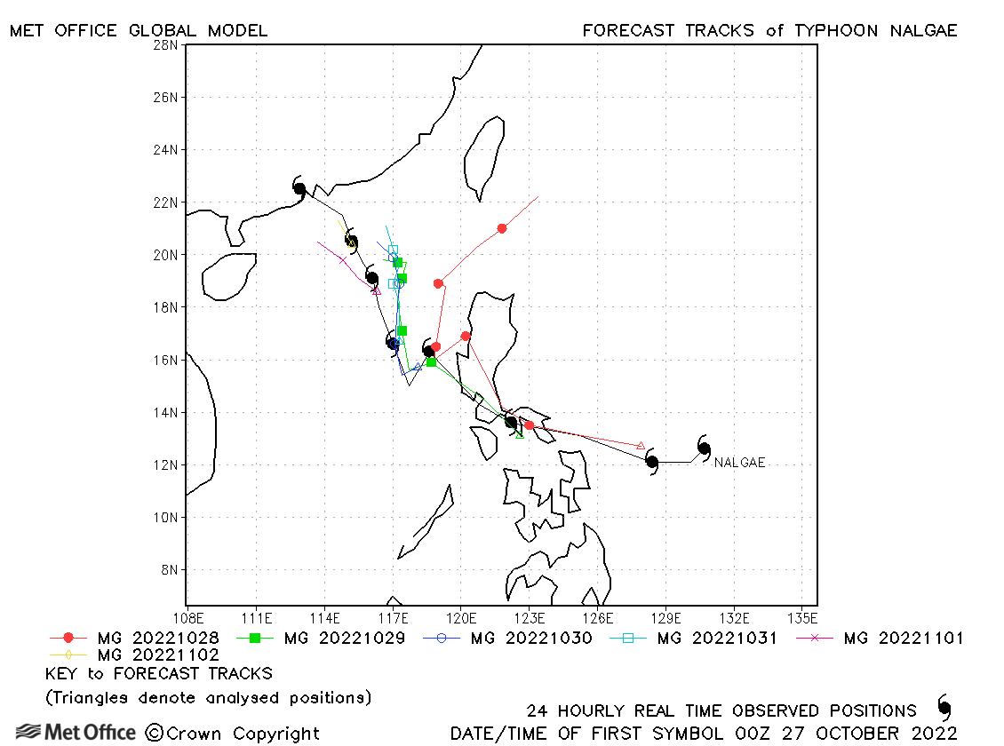
| Nalgae (26W) | 27 October - 03 November | 979 mb, 70/60 knots | Track forecast errors were close to the recent mean except at long lead times which had larger errors. |
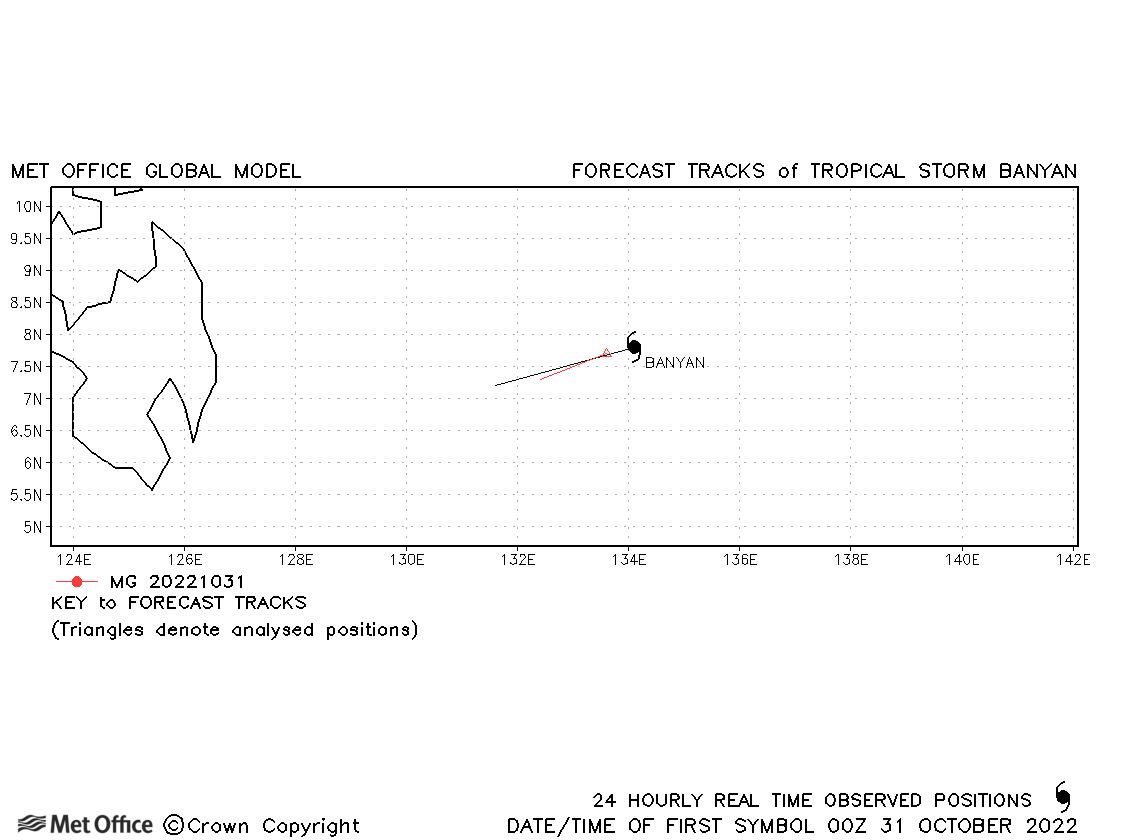
| Banyan (27W) | 30-31 October | 1000 mb, 35/35 knots | Banyan only briefly reached tropical storm status. |
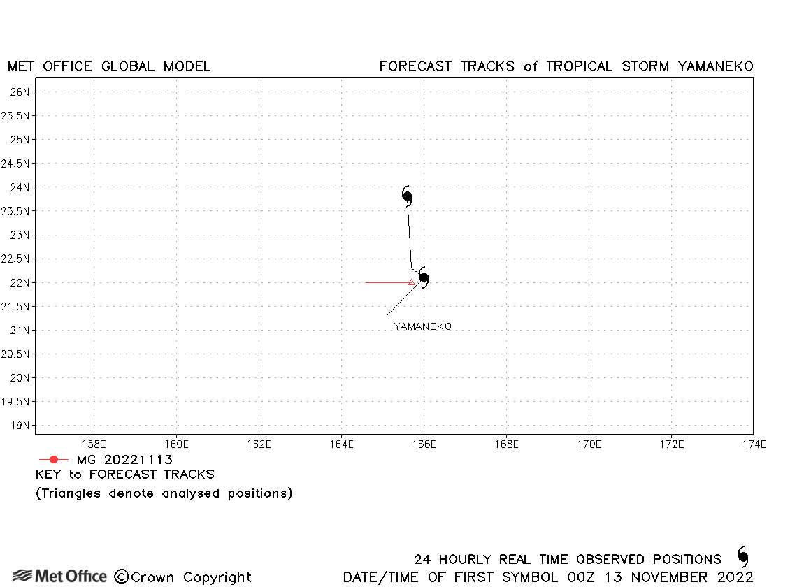
| Yamaneko (28W) | 12-14 November | 1000 mb, 35/35 knots | This was a short-lived storm with few forecasts verified. |
| Pakhar (29W) | 10-12 December | 992 mb, 50/40 knots | Pakhar was short-lived with few forecasts verified. |
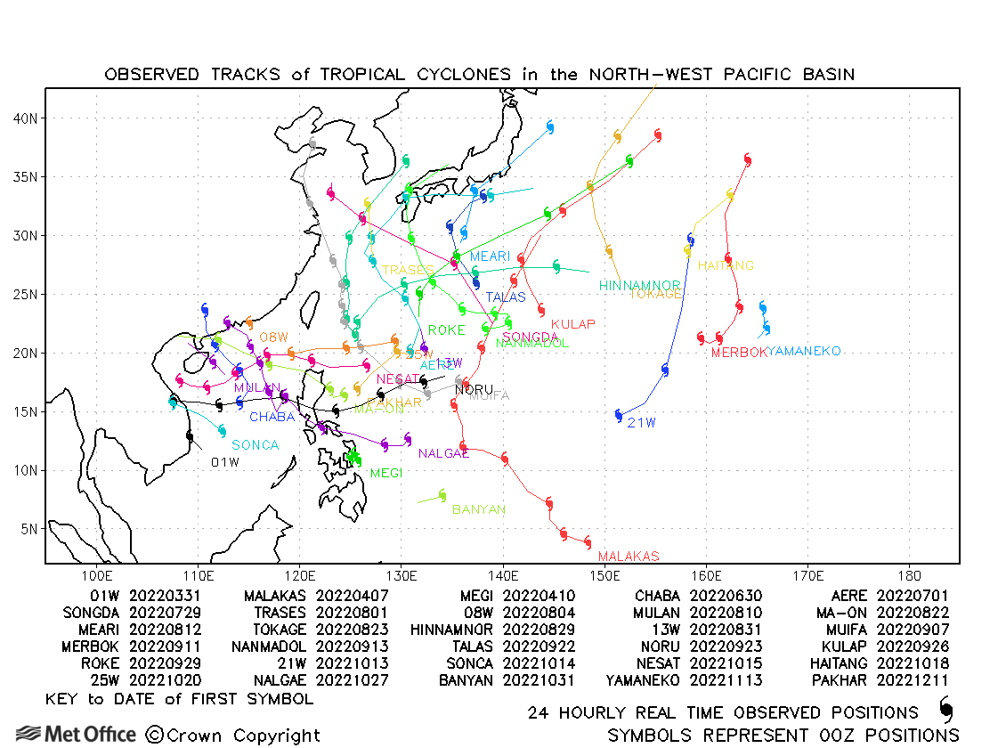
North-west observed tracks in 2022
| Name & ID | Start & end dates | Central pressure, 1-minute MSW | Comments on Met Office global model forecasts |
|---|---|---|---|
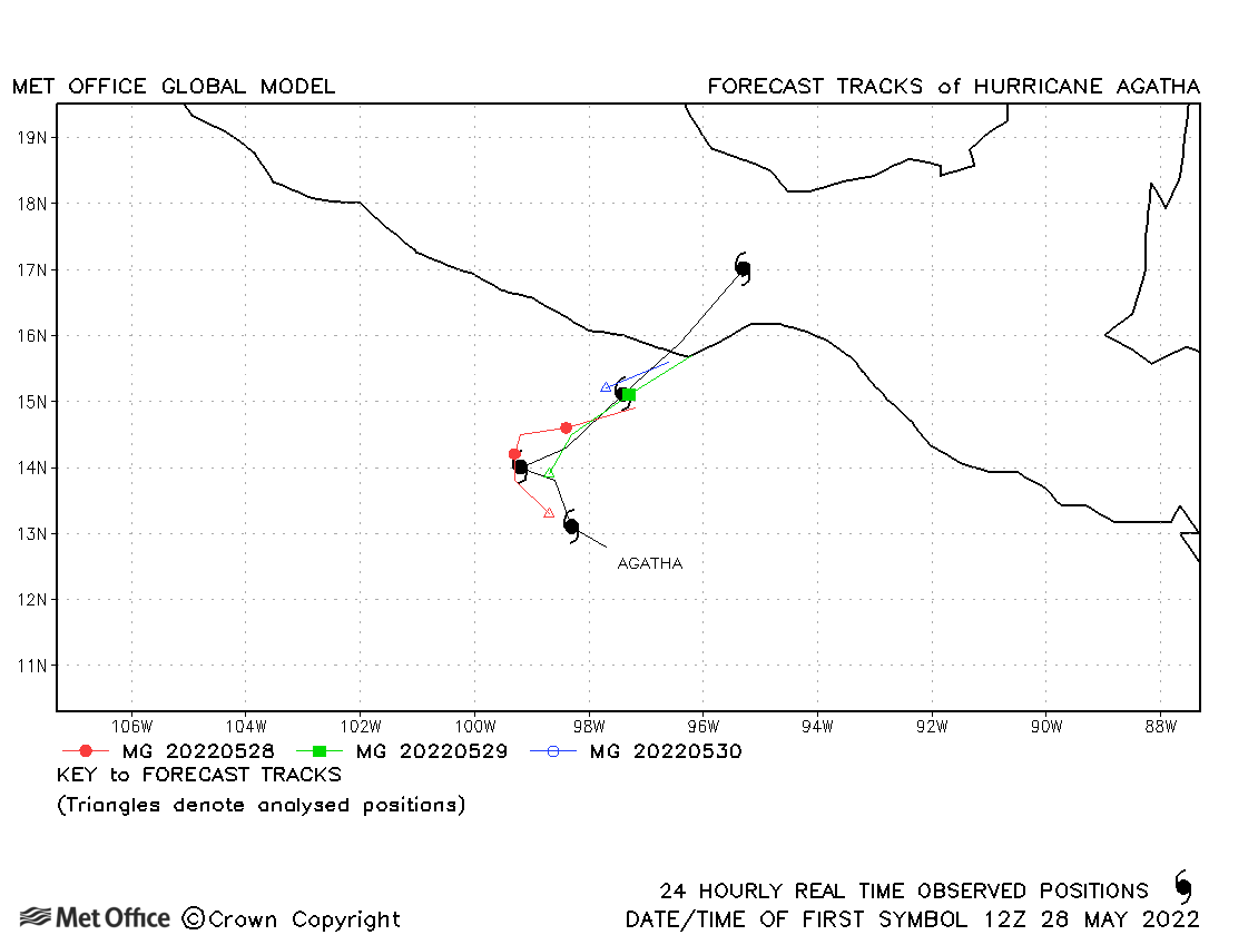
| 28-31 May | 964 mb, 95 knots | Track forecast errors were near to the recent mean values. | |
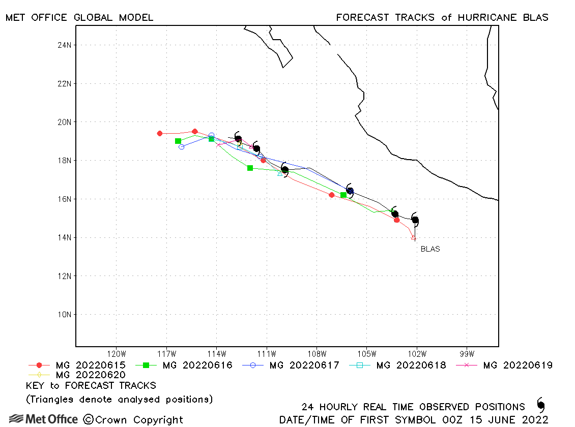
| Blas (02E) | 14-20 June | 980 mb, 75 knots | Track errors were higher than the recent mean values due to a fast and left-of-track bias. |
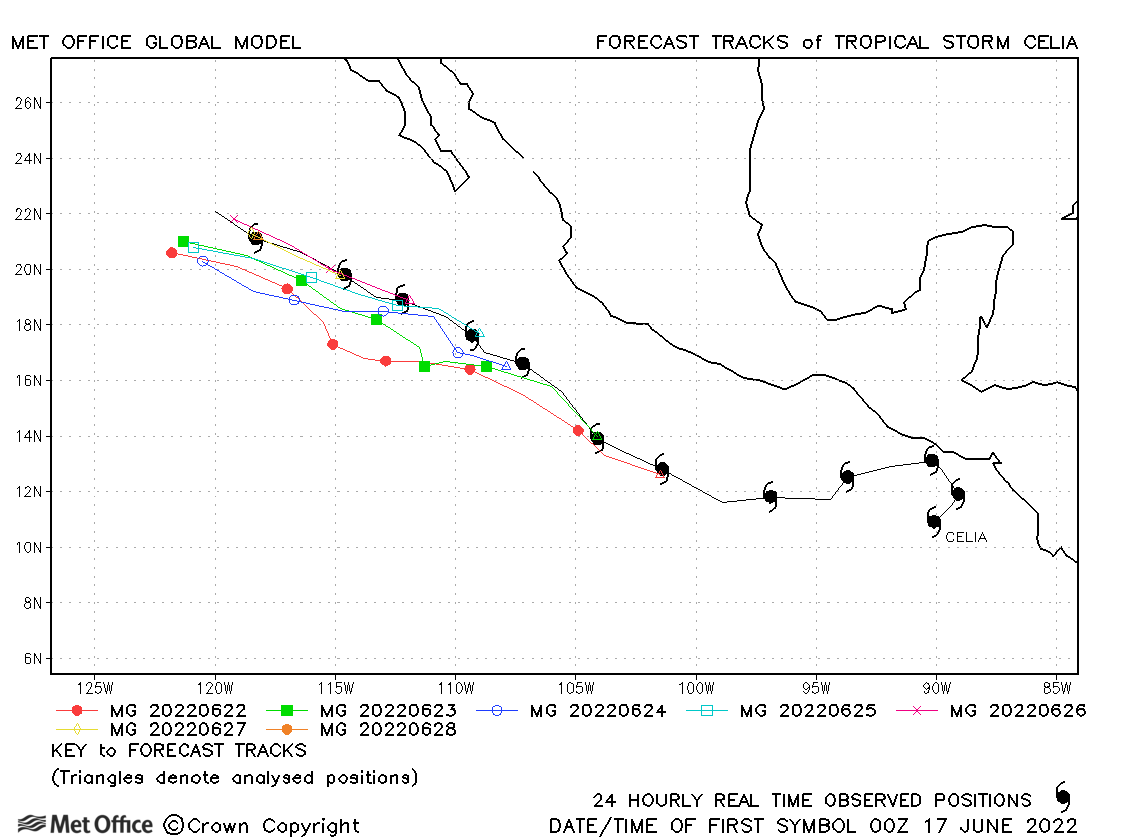
| Celia (03E) | 16-28 June | 992 mb, 60 knots | Track forecast errors were above the recent mean for short period forecasts. |
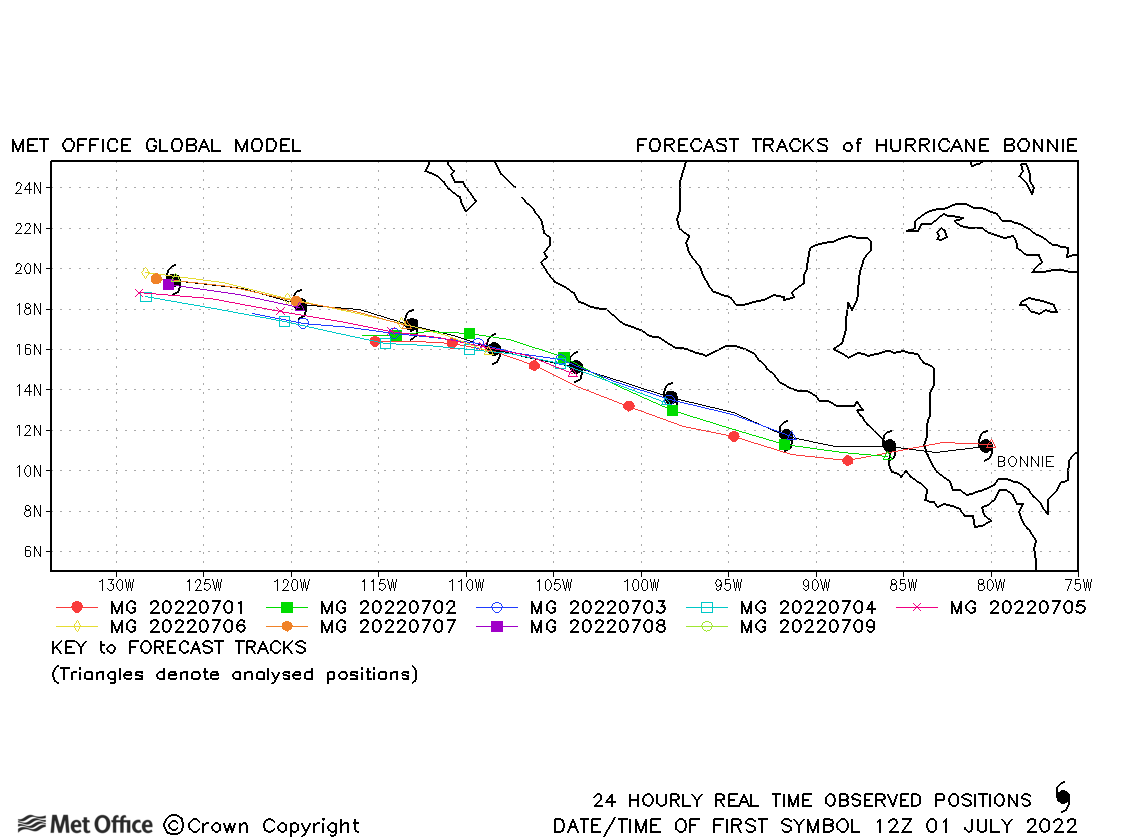
| Bonnie (02L/04E) | 01-09 July | 964 mb, 100 knots | Bonnie formed in the Atlantic basin, but spent most of its life in the NE Pacific basin. Track forecast errors were low and skill scores high. |
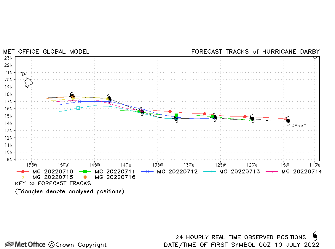
| Darby (05E) | 09-16 July | 954 mb, 120 knots | Track forecast errors were low and skill scores high for this hurricane. |
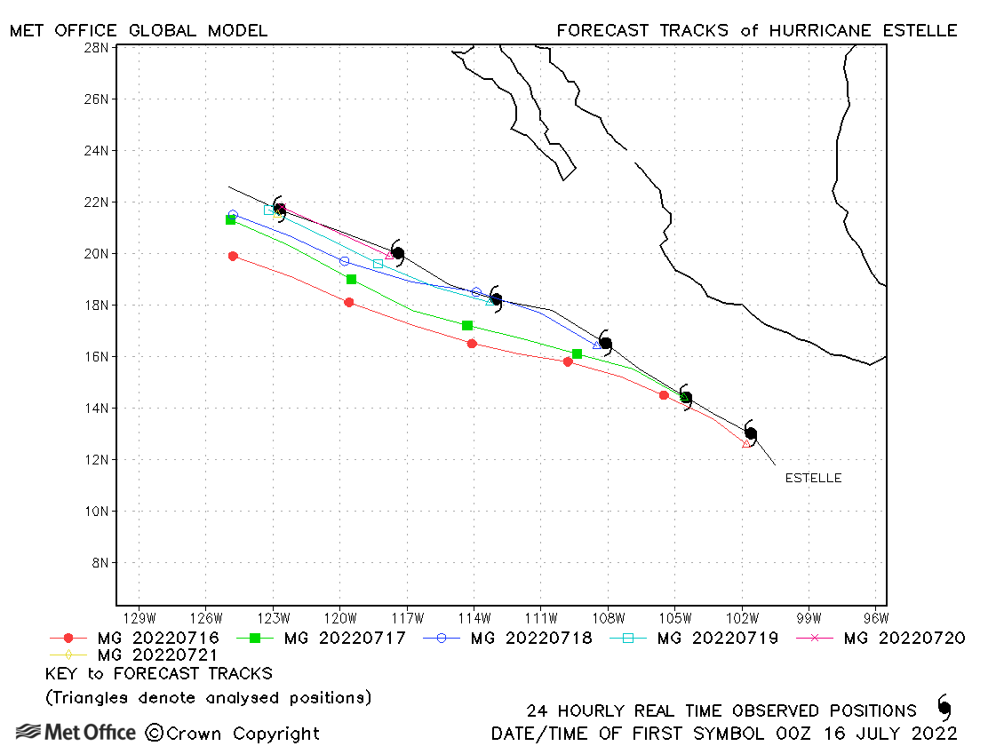
| Estelle (06E) | 15-21 July | 984 mb, 75 knots | Due to a left-of-track bias, track forecast errors were a little above the recent mean values. |
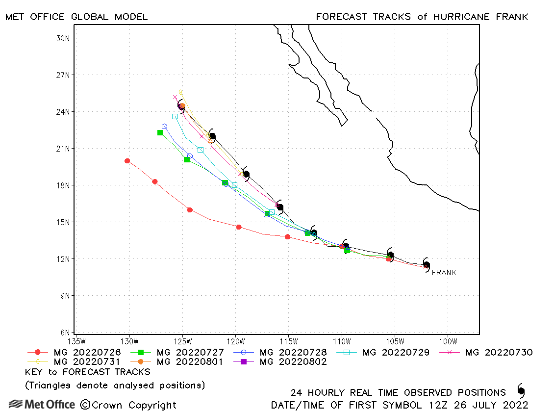
| Frank (07E) | 26 July-02 August | 975 mb, 80 knots | Track forecast errors were near to or slightly above the recent mean values. There was a left-of-track bias in many forecasts. |
| Georgette (08E) | 27 July-03 August | 997 mb, 50 knots | Track forecast errors were mostly above the recent mean values. |
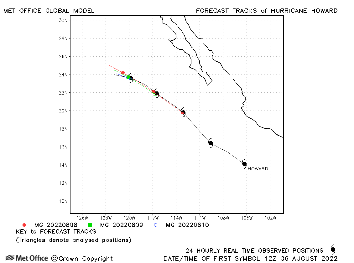
| Howard (09E) | 06-11 August | 983 mb, 75 knots | Track forecast errors were low for this hurricane. |
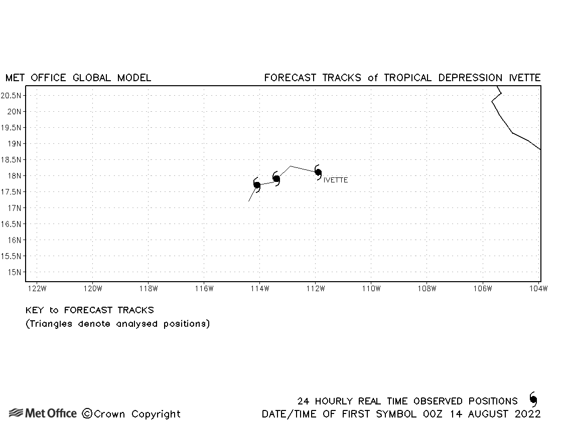
| Ivette (10E) | 13-16 August | 1005 mb, 35 knots | Ivette was only briefly a tropical storm and no forecasts were verified. |
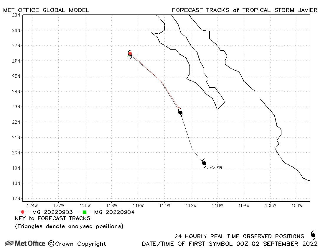
| Javier (11E) | 01-04 September | 999 mb, 45 knots | Track forecast errors were low. |
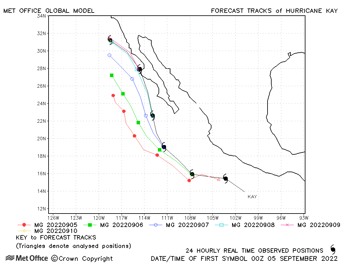
| Kay (12E) | 04-10 September | 967 mb, 90 knots | Track forecast errors were larger than average due to a left-of-track bias. |
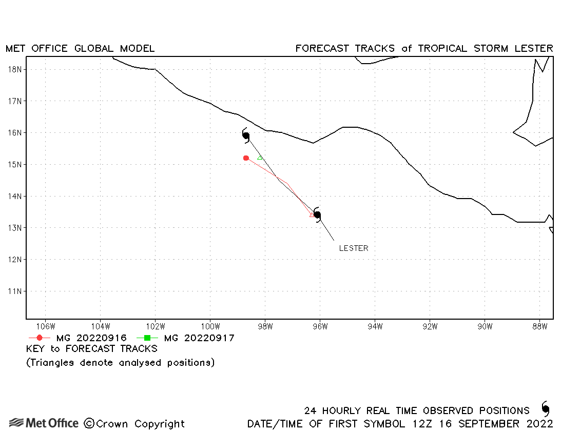
| Lester (13E) | 15-17 September | 1002 mb, 40 knots | Lester was short-lived with few forecasts verified. |
| Madeline (14E) | 17-20 September | 992 mb, 55 knots | Track forecast errors were near the recent mean values. |
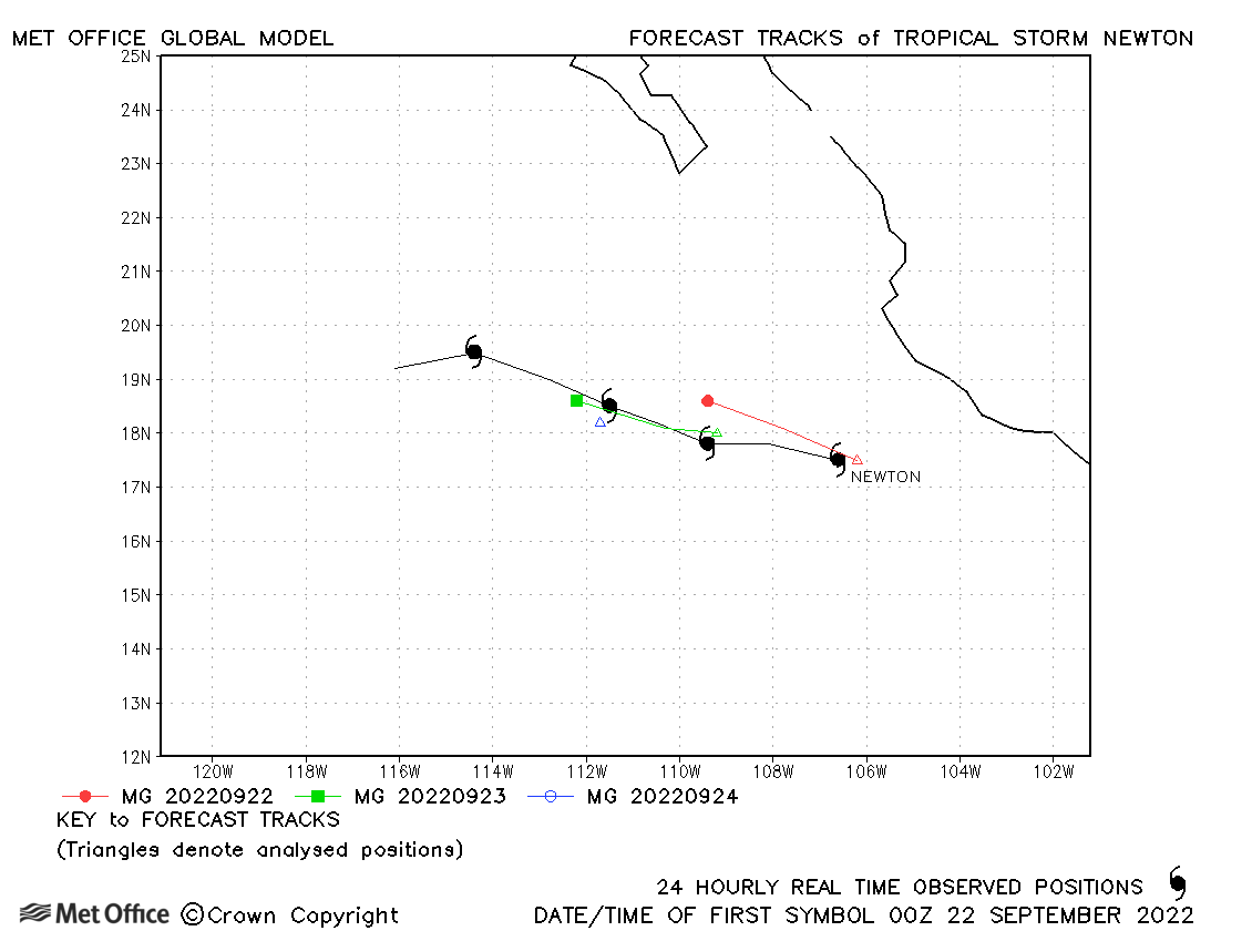
| Newton (15E) | 21-25 September | 996 mb, 55 knots | Track forecast errors were near the recent mean values. The storm was weakened too quickly. |
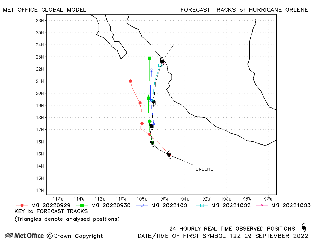
| Orlene (16E) | 29 September-04 October | 949 mb, 115 knots | Track forecast errors were mostly below the recent mean, but early forecasts had a left-of-track bias. |
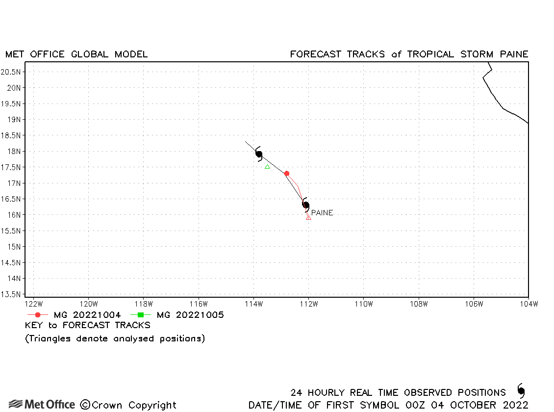
| Paine (17E) | 03-05 October | 1004 mb, 40 knots | Track forecast errors were slightly above the recent mean values. |
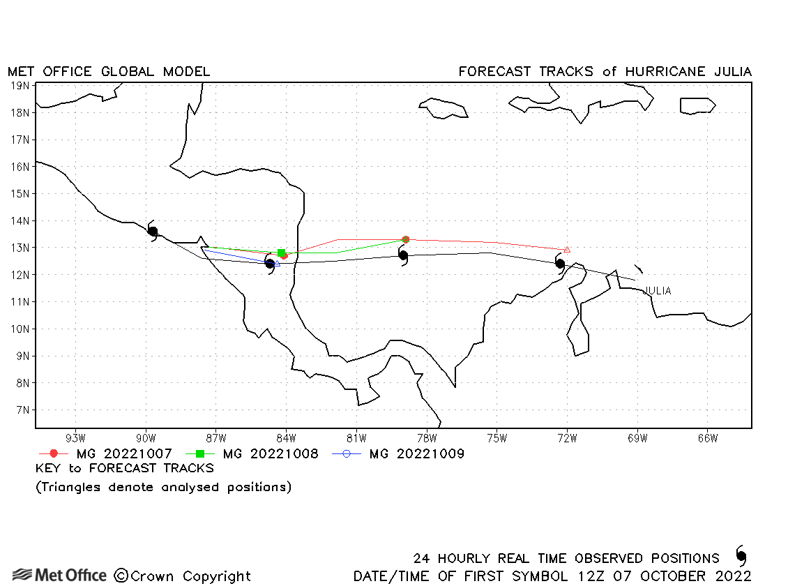
| Julia (18E/13L) | 07-10 October | 982 mb, 75 knots | Julia formed in the Atlantic basin and only briefly moved into the NE Pacific basin. Track forecast errors were low for Julia. |
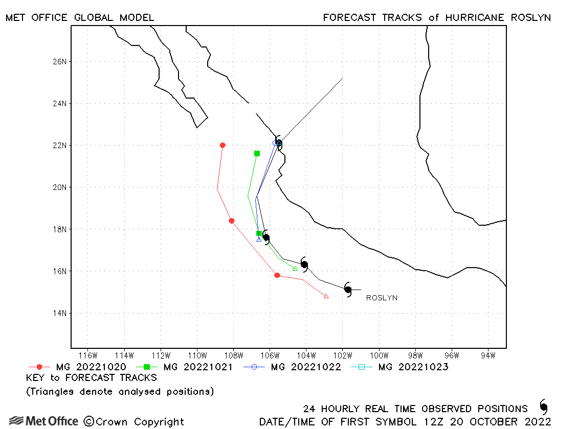
| Roslyn (19E) | 20-24 October | 950 mb, 115 knots | Track forecast errors were a little above the recent mean values due to a left-of-track bias. |
| Name & ID | Start & end dates | Central Pressure, 1-minute MSW | Comments on Met Office global model forecasts |
|---|---|---|---|
|
|
|
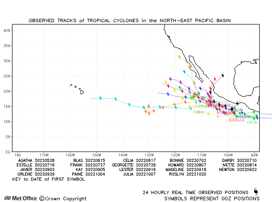
North-east and Central North Pacific observed tracks in 2022
Tropical cyclone names (North-east Pacific)
Tropical cyclone names (Central North Pacific)
| Name & ID | Start & end dates | Central pressure, 1-minute MSW | Comments on Met Office global model forecasts |
|---|---|---|---|
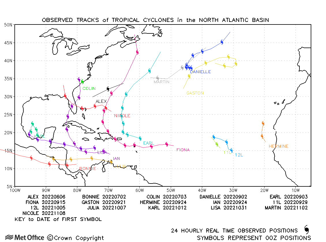
| 05-06 June | 986 mb, 60 knots | Alex was a short-lived storm which was well forecast. | |
| Bonnie (02L/04E) | 01-09 July | 964 mb, 100 knots | Bonnie formed in the Atlantic basin, but spent most of its life in the NE Pacific basin. Track forecast errors were low and skill scores high. |
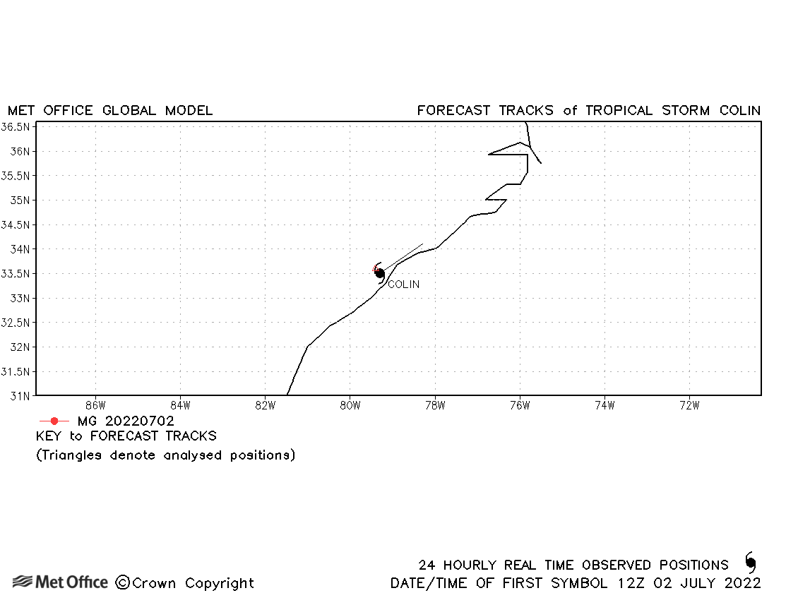
| Colin (03L) | 02-03 July | 1011 mb, 35 knots | Colin only briefly reached tropical storm status. |
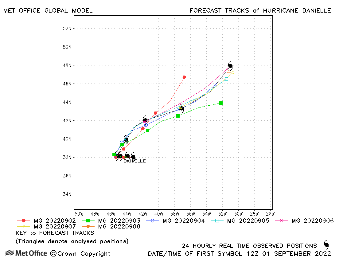
| Danielle (05L) | 01-08 September | 972 mb, 80 knots | Track forecast errors were mostly below the recent mean values and skill scores high. |
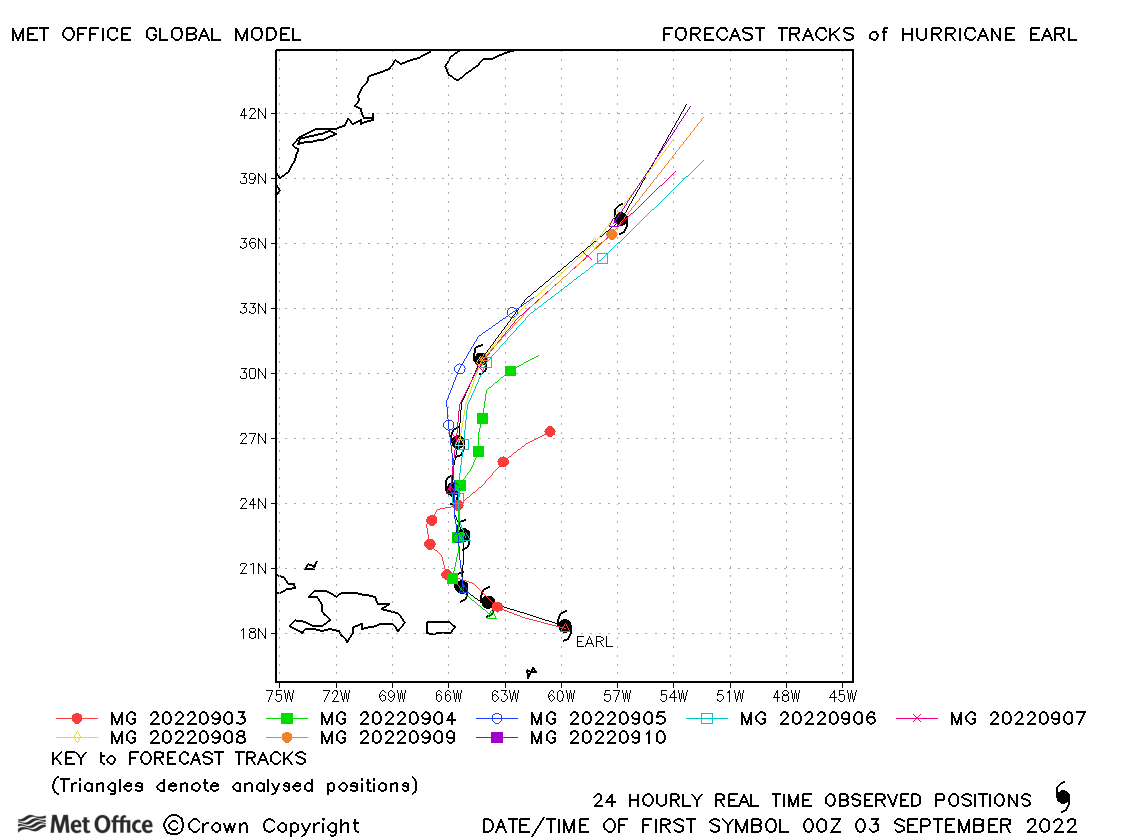
| Earl (06L) | 03-10 September | 954 mb, 90 knots | Shorter lead times track errors were low, but longer lead times errors high due to a slow bias. |
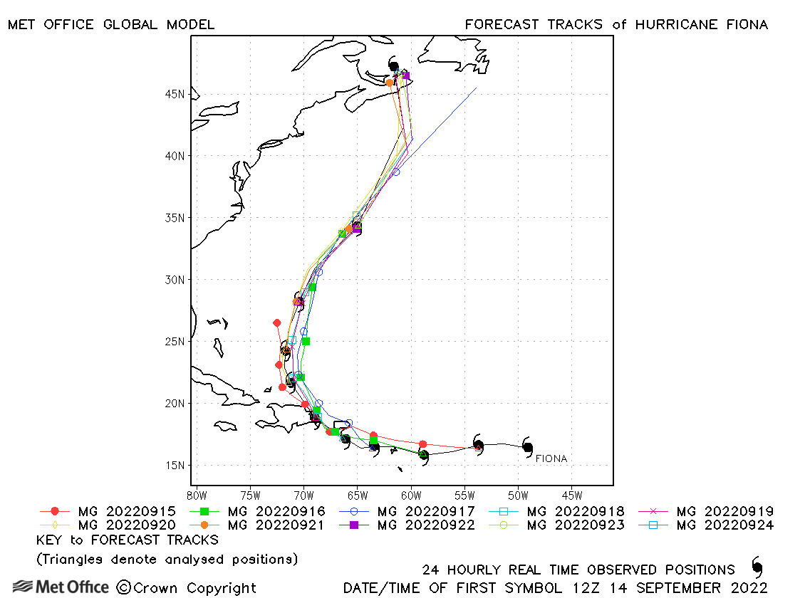
| Fiona (07L) | 14-24 September | 931 mb, 115 knots | Track forecast errors were below the 5-year running mean at all lead times and skill scores were high. |
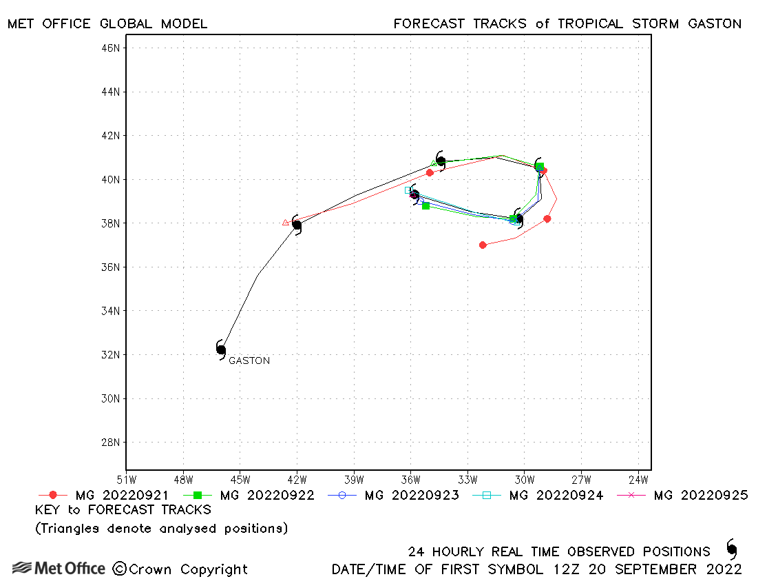
| Gaston (08L) | 20-25 September | 997 mb, 55 knots | Track forecast errors were low at most lead times. |
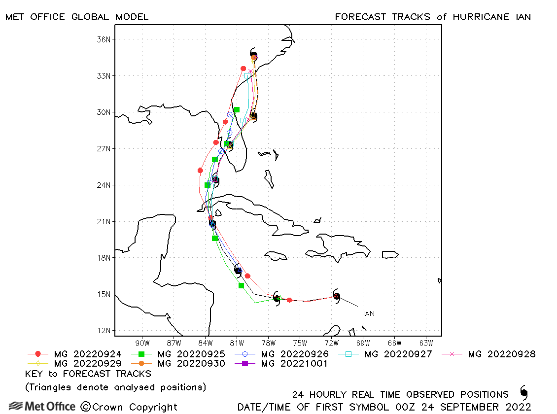
| Ian (09L) | 23 September-01 October | 937 mb, 135 knots | Short lead times track forecast errors were low, but at longer lead times there was a slow and left-of-track bias. However, Florida landfall predictions were more consistent than some other models. |
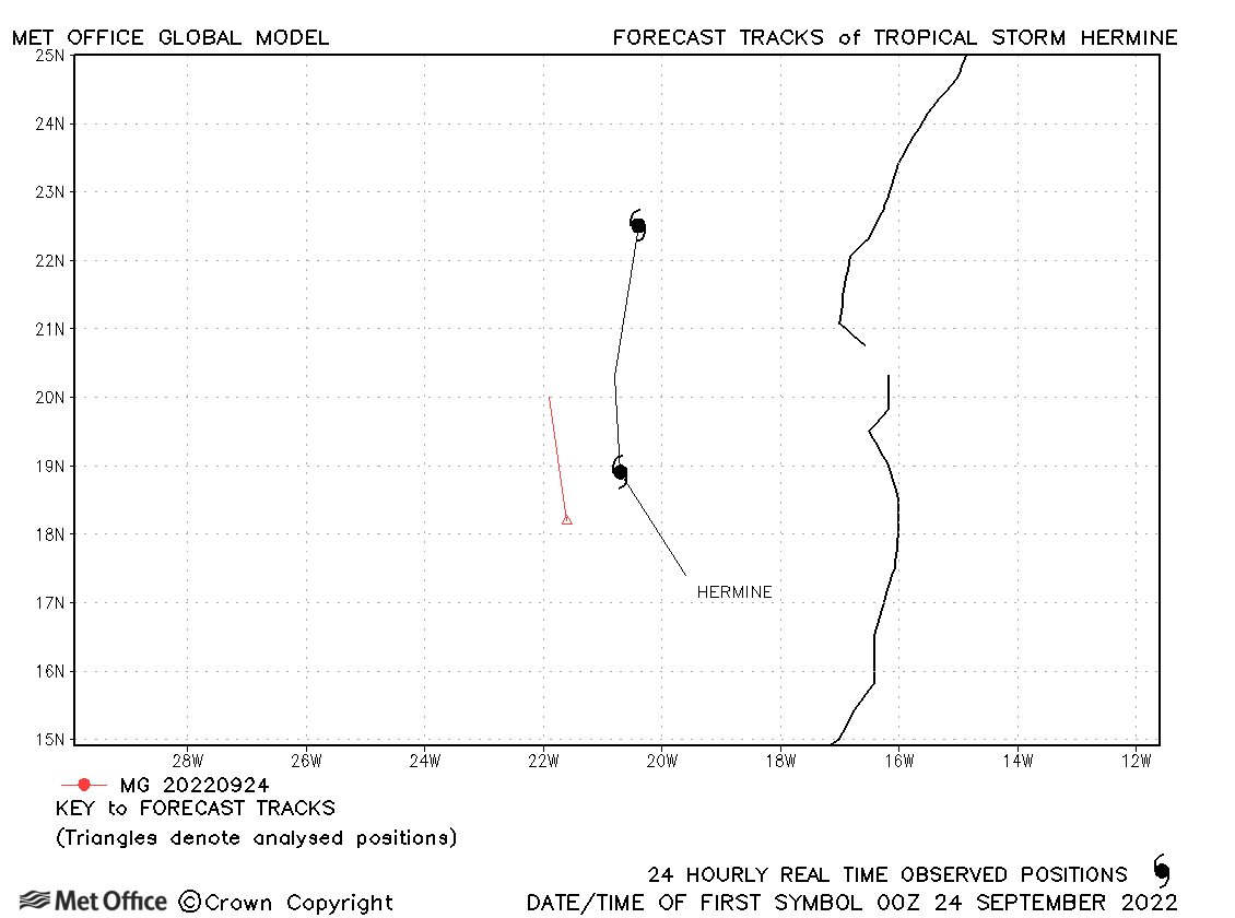
| Hermine (10L) | 23-25 September | 1002 mb, 35 knots | Hermine was short-lived and only one forecast was verified. |
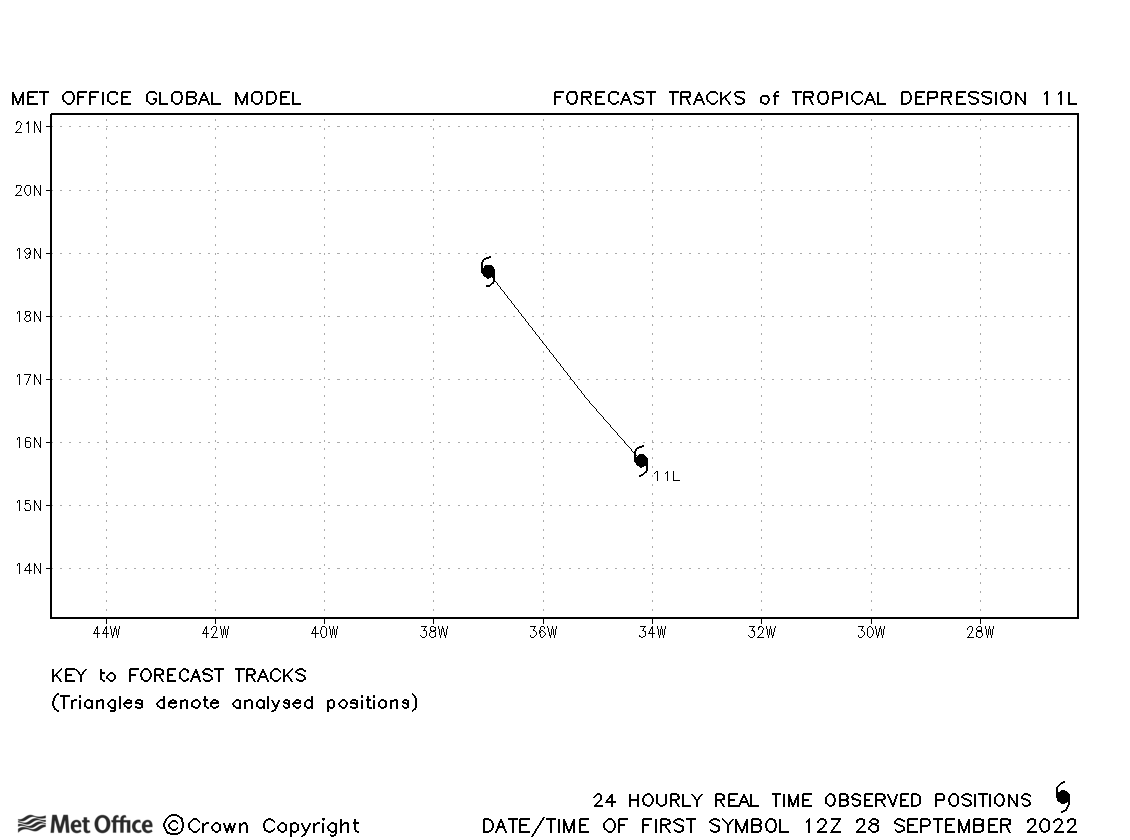
| 11L | 28-29 September | 1008 mb, 30 knots | No forecasts were verified for this depression. |
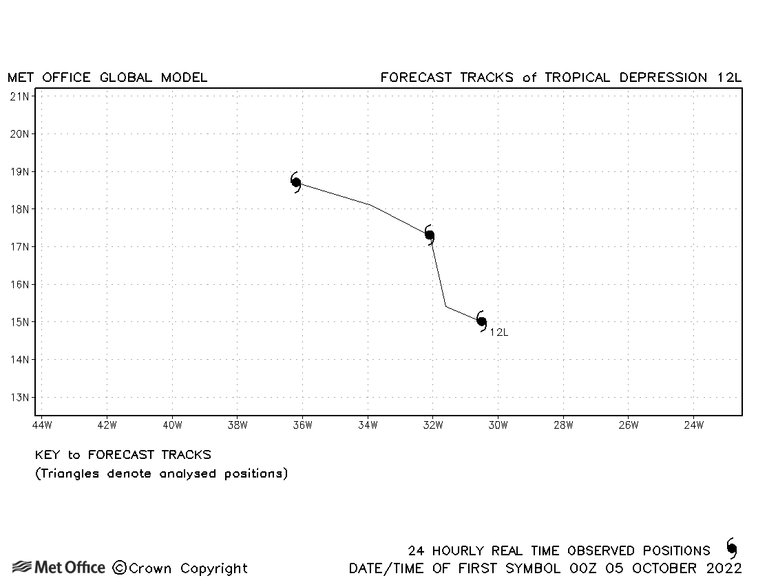
| 12L | 04-07 October | 1006 mb, 30 knots | 12L did not become a tropical storm. |
| Julia (13L/18E) | 07-10 October | 982 mb, 75 knots | Julia formed in the Atlantic basin and only briefly moved into the NE Pacific basin. Track forecast errors were low for Julia. |
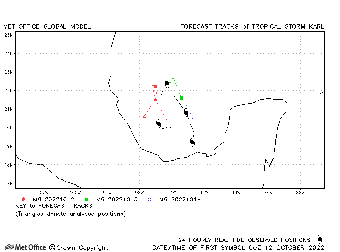
| Karl (14L) | 11-15 October | 998 mb, 50 knots | Track forecast errors were close to or above the recent mean values. |
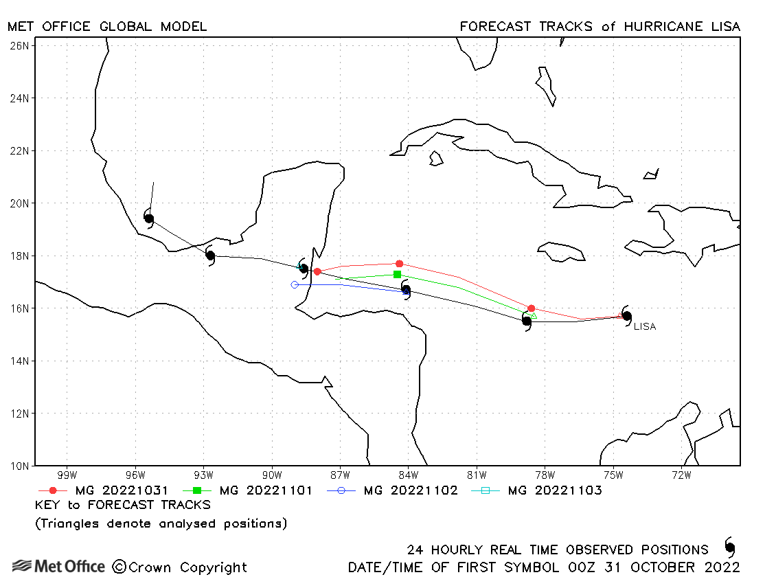
| Lisa (15L) | 30 October - 05 November | 988 mb, 75 knots | Track forecast errors were low for this storm. |
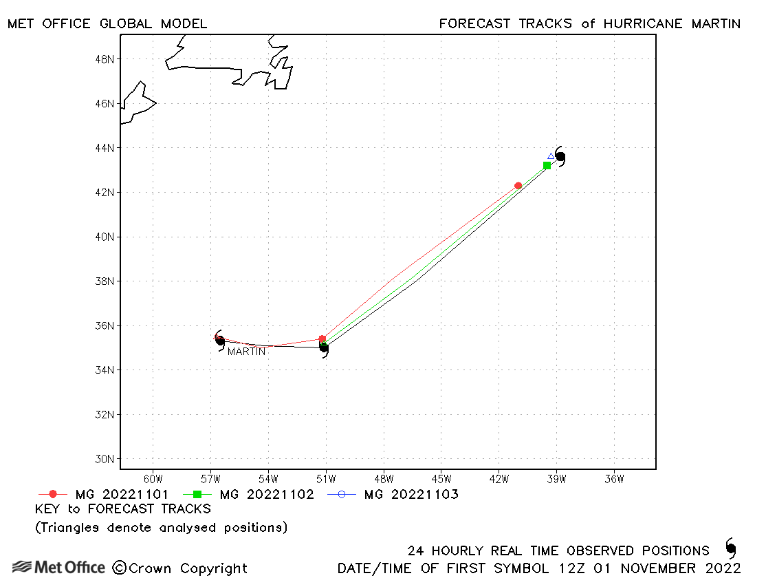
| Martin (16L) | 01-03 November | 960 mb, 75 knots | Track forecasts were mostly good. |
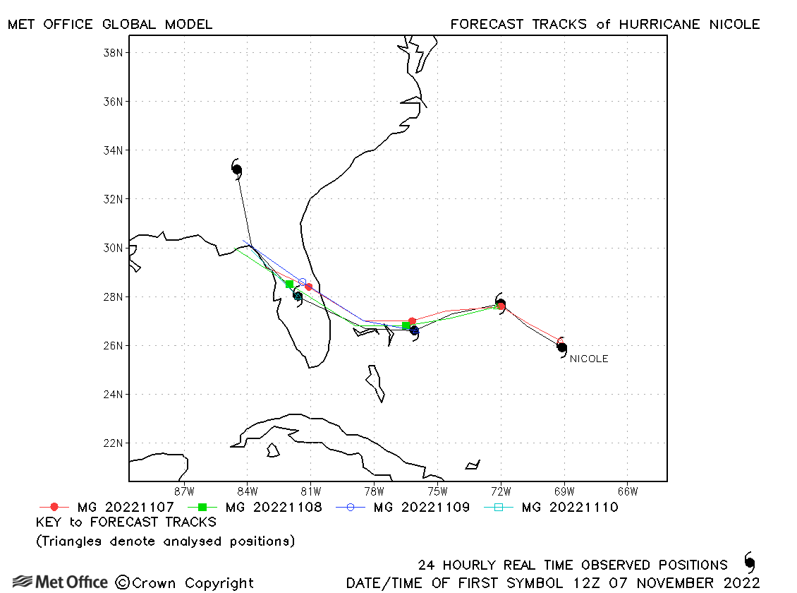
| Nicole (17L) | 07-11 November | 980 mb, 65 knots | Track forecasts were very good for Nicole with low errors. |
Note 04L was a 'potential tropical cyclone' which never attained tropical cyclone status.
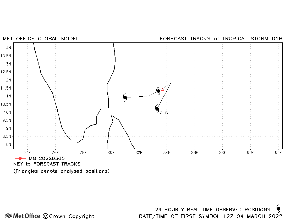
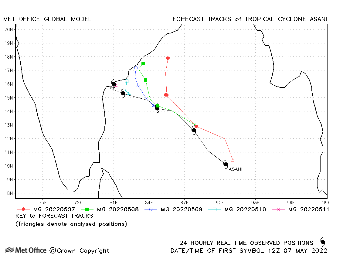
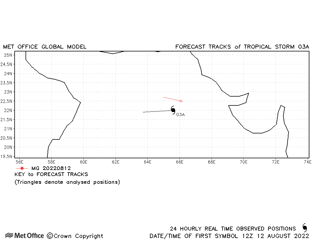
North Atlantic observed tracks in 2022
| Name & ID | Start & end dates | Central pressure, 1-/3-minute MSW | Comments on Met Office global model forecasts |
|---|---|---|---|
| 04-06 March | 996 mb, 35/30 knots | 01B briefly attained 35 knot 1-minute sustained winds according to JTWC. | |
| Asani (02B) | 07-11 May | 976 mb, 65/60 knots | Forecasts persistently predicted a northwards turn which did not happen, resulting in track forecast errors above the recent mean. |
| 03A | 12-13 August | 989 mb, 35/30 knots | 03A only briefly reached tropical storm status based on 1-minute average winds. |
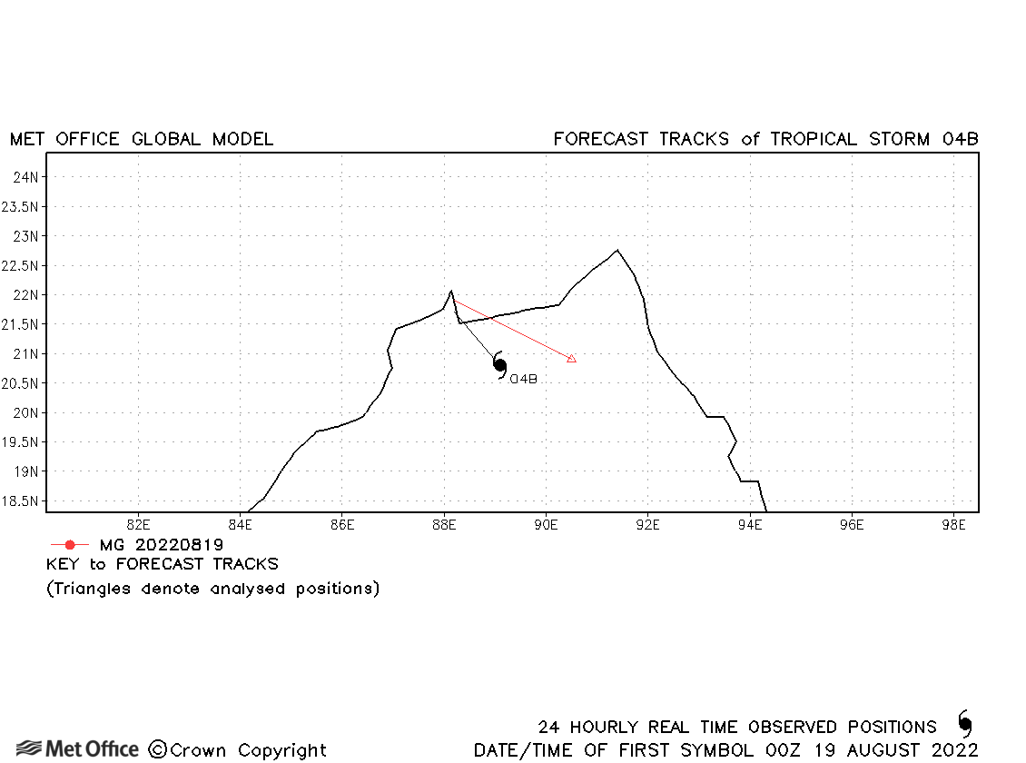
| 04B | 18-19 August | 995 mb, 45/30 knots | 04B only briefly reached tropical storm status based on 1-minute average winds. |
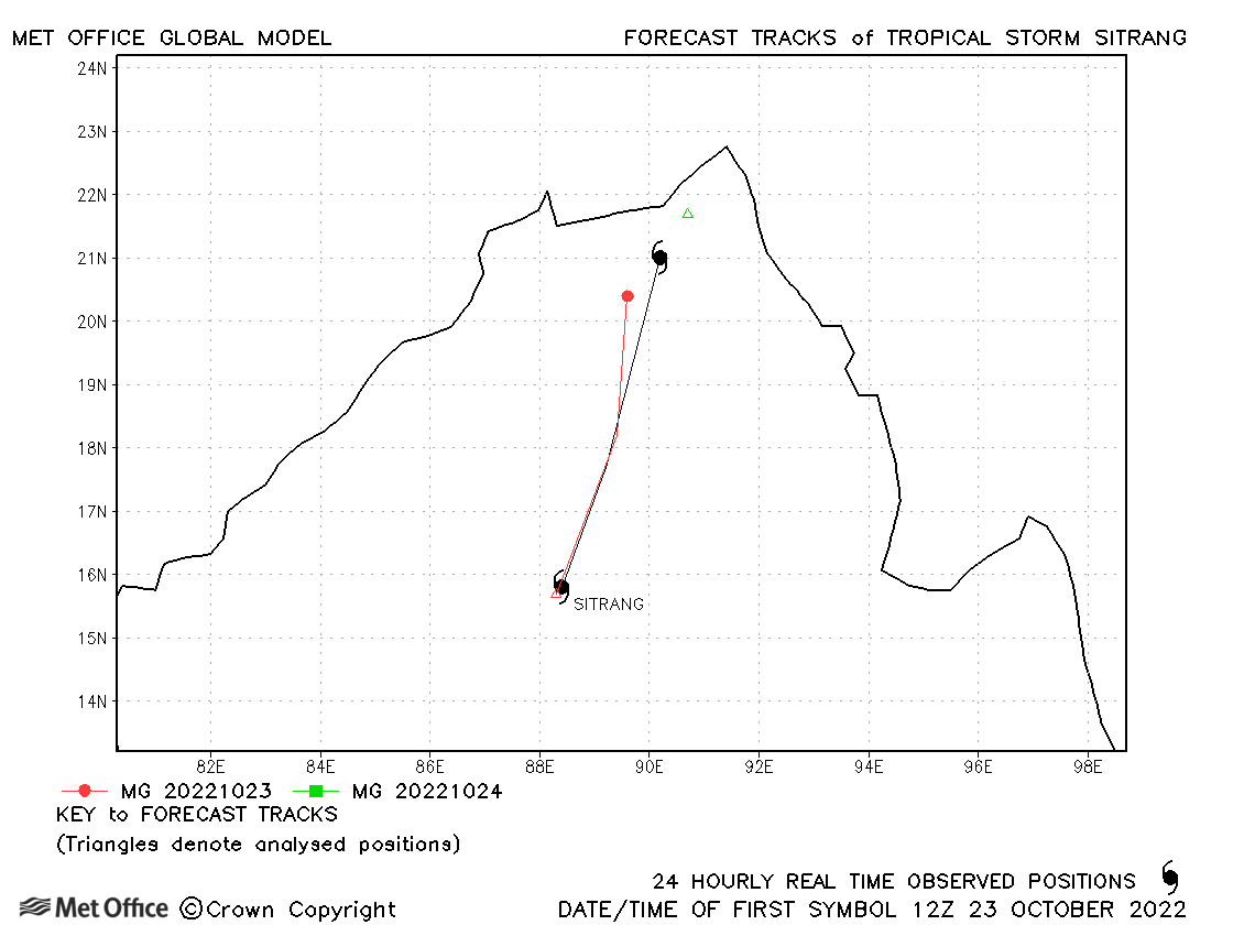
| Sitrang (05B) | 23-24 October | 994 mb, 45/40 knots | Sitrang track forecasts were good, but the storm was short-lived. |
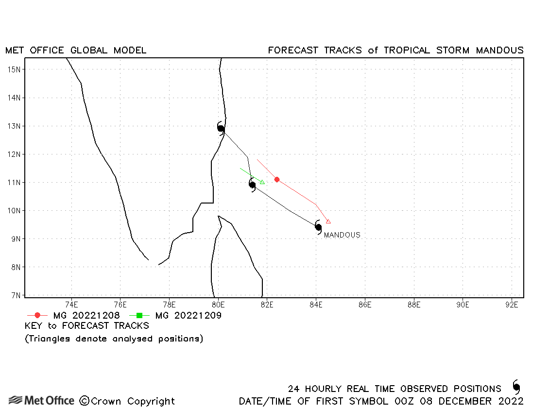
| Mandous (06B) | 07-10 December | 990 mb, 55/50 knots | There was a right-of-track bias in forecasts. |
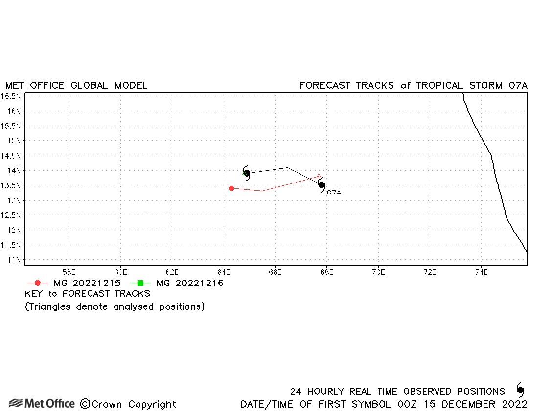
| 07A | 14-16 December | 999 mb, 45/30 knots | This storm was a short-lived regeneration of Tropical Storm Mandous. |
North Indian observed tracks in 2022
| Name & ID | Start & end dates | Central pressure, 1-/10-minute MSW | Comments on Met Office global model forecasts |
|---|---|---|---|
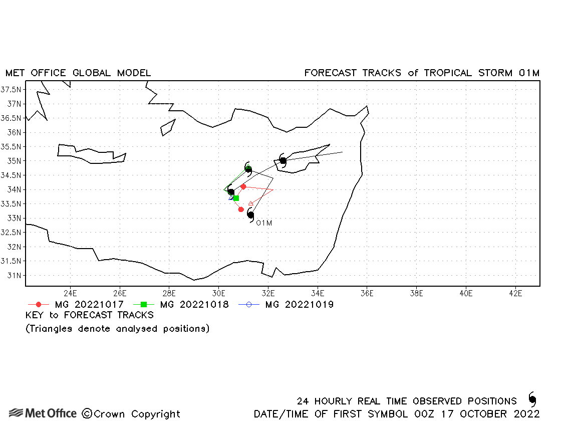
| 01M | 17-20 October | 1008 mb, 40 knots | This low pressure system exhibited subtropical characteristics. Track forecast errors were low. |
Note, there is no official warning agency for Mediterranean tropical or subtropical cyclones, so identifiers are assigned by the Met Office to facilitate tracking and forecast verification.
Mediterranean observed tracks in 2022
Note on estimated wind speeds
1-minute MSW: Maximum sustained wind (knots) averaged over 1 minute (JTWC Hawaii, NHC Miami, CPHC Hawaii)
3-minute MSW: Maximum sustained wind (knots) averaged over 3 minutes (IMD New Delhi)
10-minute MSW: Maximum sustained wind (knots) averaged over 10 minutes (JMA Japan)
Note: Although 1-minute average winds should be stronger than 3-/10-minute averages, this may not be the case here since estimates are obtained from different warning centres using different analysis techniques.

