

Observed and forecast tracks: southern hemisphere 2020-21
All tropical cyclones in the southern hemisphere season in 2020-21 are listed below including details of their start and end dates, lowest central pressure and maximum sustained wind (MSW).
Click on the name of the tropical cyclone to see a chart of the observed track and forecast tracks from the Met Office global model. Verification statistics on each tropical cyclone are available upon request from [email protected]. At the end of the season a verification report on the performance of the Met Office global model will be published.
| Name & ID | Start & end dates | Central pressure, 1-/10-minute MSW | Comments on Met Office global model forecasts |
|---|---|---|---|
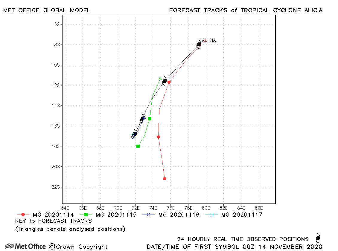
| Alicia (01S) | 13-17 November | 975 mb, 65/70 knots | Early tracks forecasts were too fast, but later forecasts had low errors. |
| Bongoyo (02S) | 07-11 December | 988 mb, 55/55 knots | Track forecast errors were mostly a little above the recent mean values. |
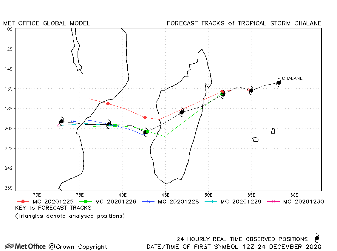
| Chalane (07S) | 24-30 December | 983 mb, 60/60 knots | Track forecast errors were a little above the recent mean, although the reformation in the Mozambique Channel and subsequent landfall were well predicted. |
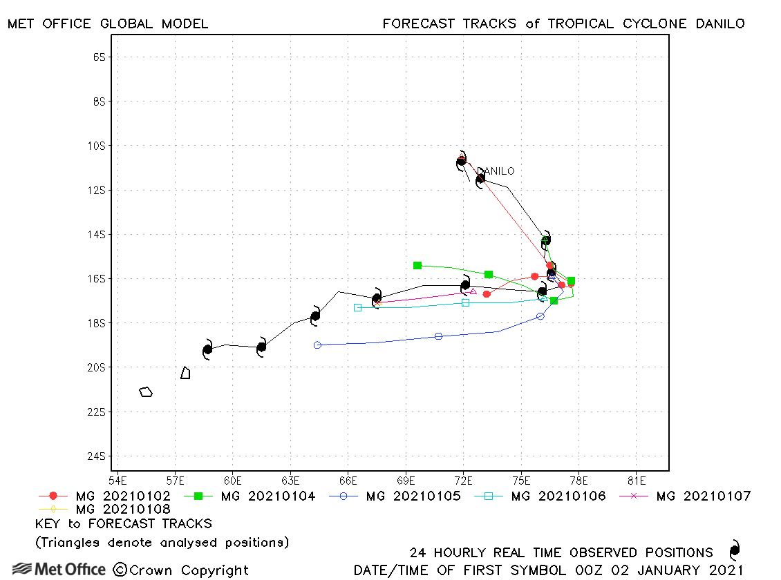
| Danilo (08S) | 01-11 January | 981 mb, 70/55 knots | Track forecast errors were close to the recent mean values at all apart from the longest lead times. Skill scores against CLIPER were high. |
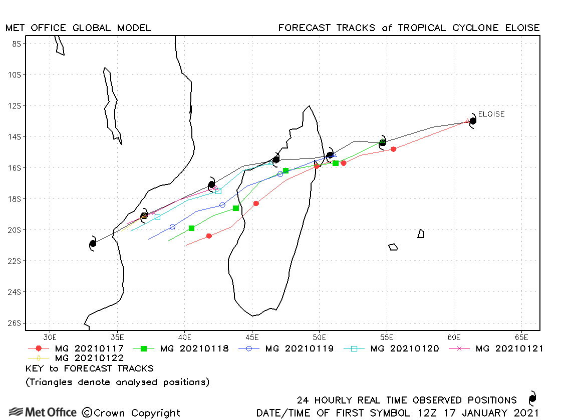
| Eloise (12S) | 17-23 January | 967 mb, 75/80 knots | There was a slow and left-of-track bias in forecasts. Track errors were near to the recent mean at short lead times, but were higher than the mean at longer lead times. |
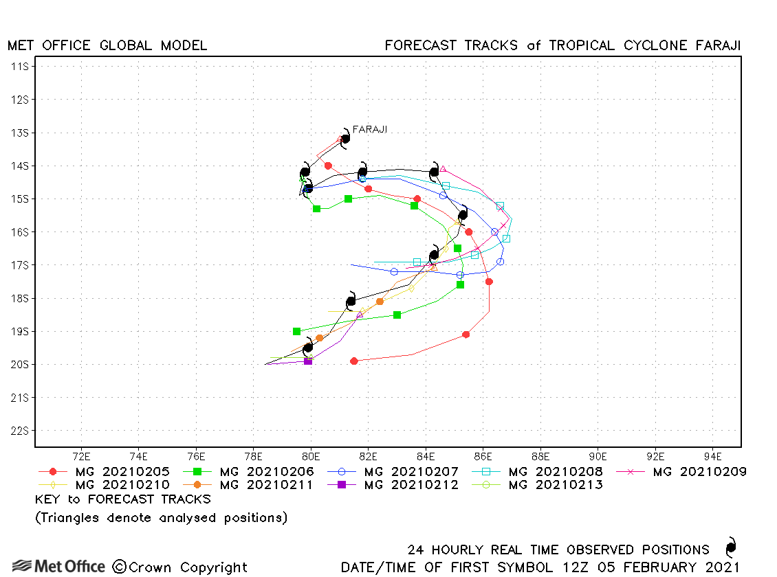
| Faraji (19S) | 05-14 February | 925 mb, 140/125 knots | The turns in the forecast track were forecast reasonably well by the model with track errors near to or below the recent mean value. |
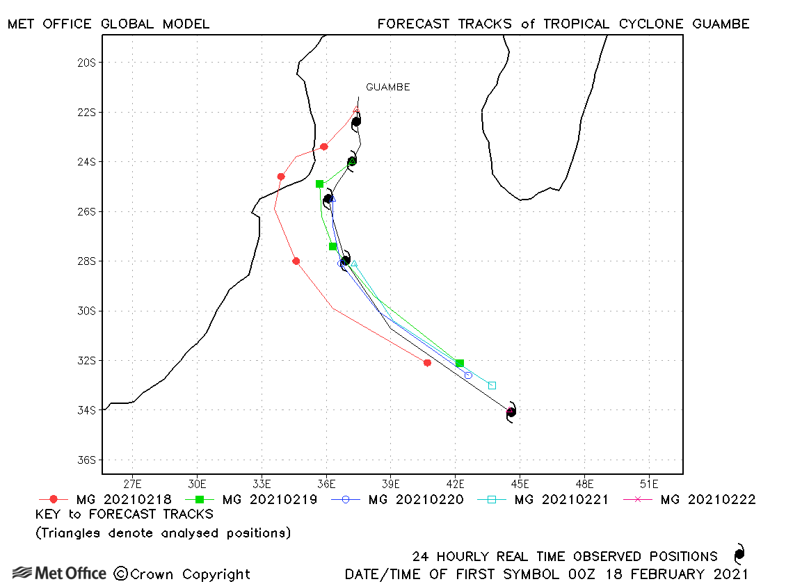
| Guambe (21S) | 17-22 February | 953 mb, 85/85 knots | There was an early right-of-track bias in forecasts and a general slow bias meaning track errors were higher than the recent mean value. |
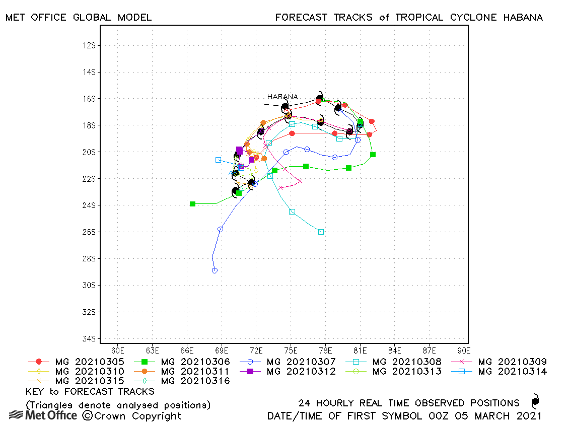
| Habana (24S) | 04-16 March | 940 mb, 130/110 knots | Habana had an unusual track with sharp changes of direction. Although the detail was not always predicted, the model did well in predicting the general changes in direction and track forecasting errors were below the recent mean. |
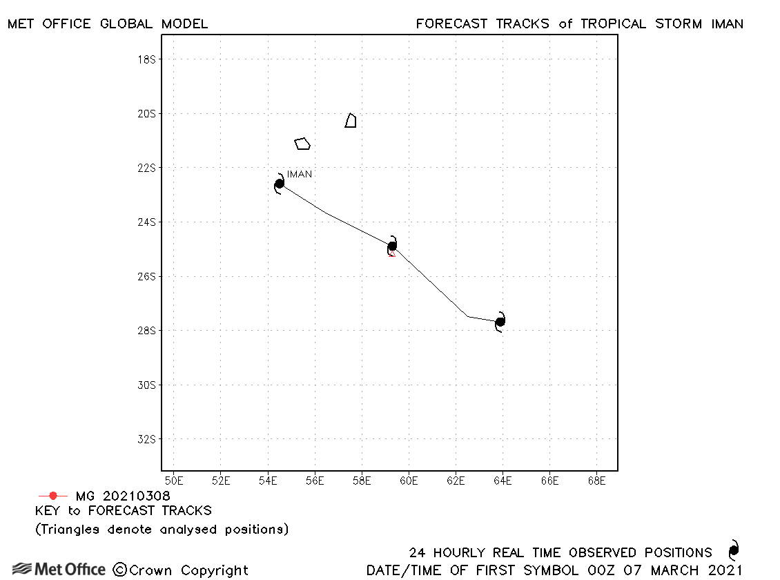
| Iman (25S) | 07-09 March | 996 mb, 45/35 knots | Iman was short-lived as a tropical storm and no forecasts were verified. |
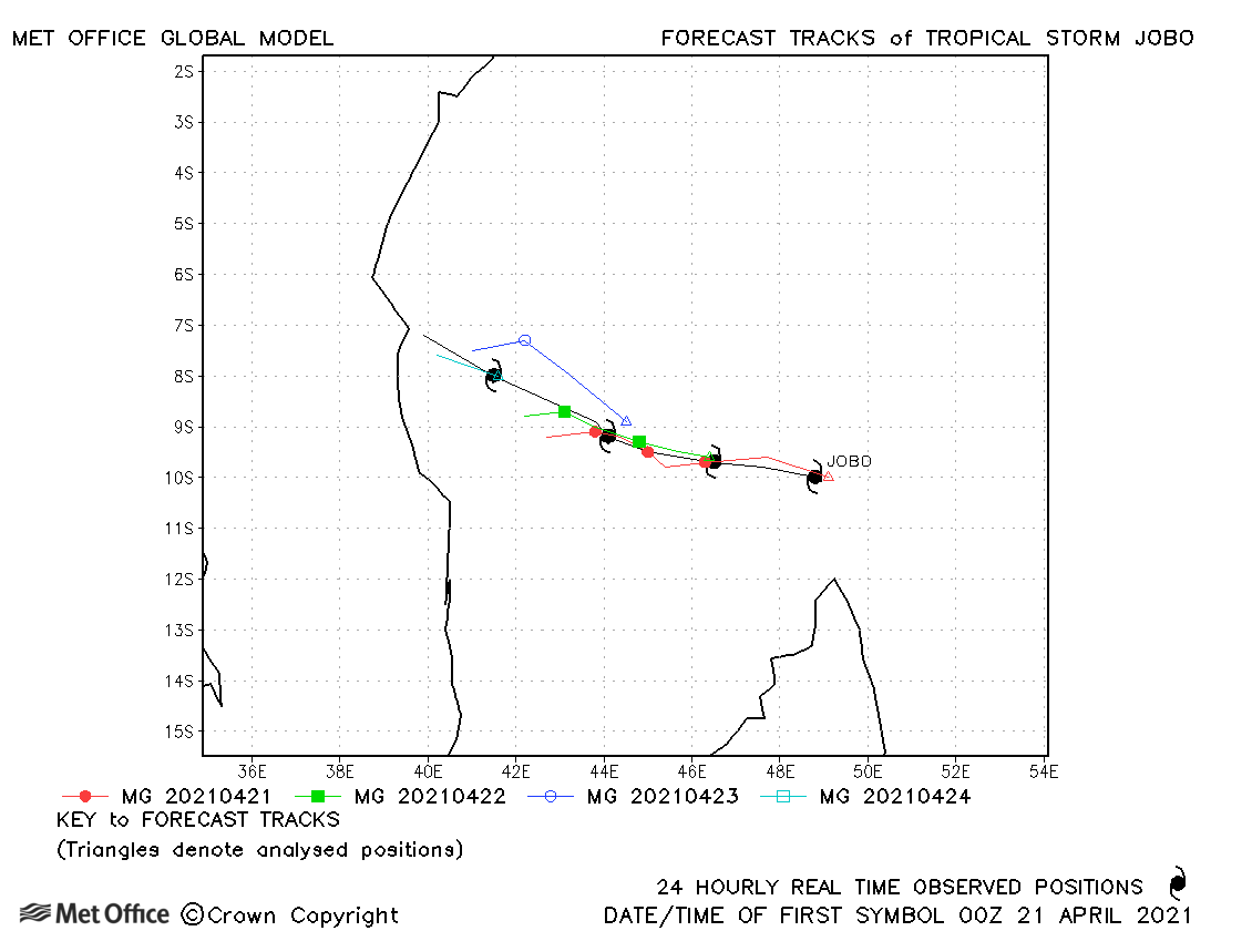
| Jobo (29S) | 20-24 April | 985 mb, 60/65 knots | Forecasts did not predict the acceleration of Jobo as it moved closer to land, resulting in positional errors above the recent mean. |
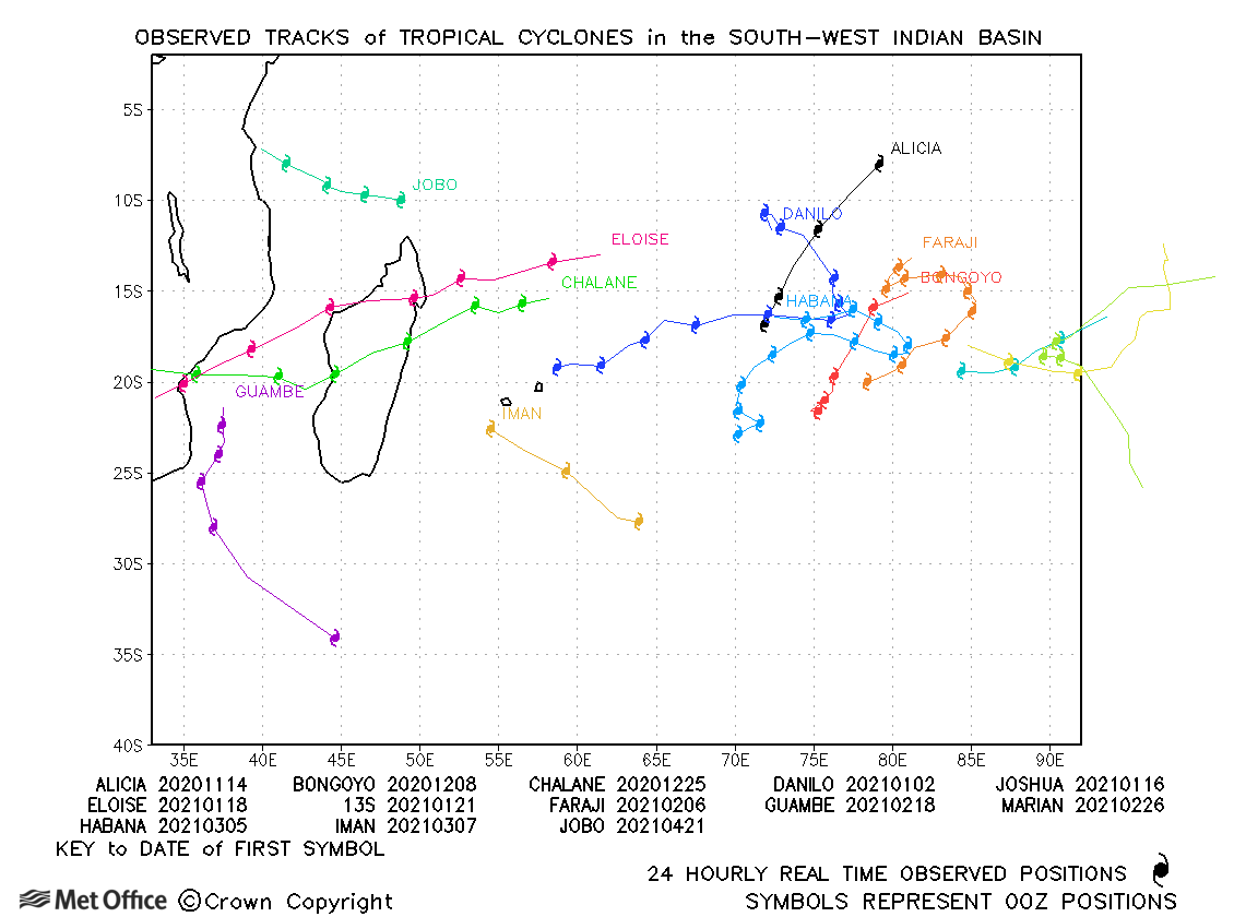
South-west Indian observed tracks in 2020-21
| Name & ID | Start & end dates | Central pressure, 1-/10-minute MSW | Comments on Met Office global model forecasts |
|---|---|---|---|
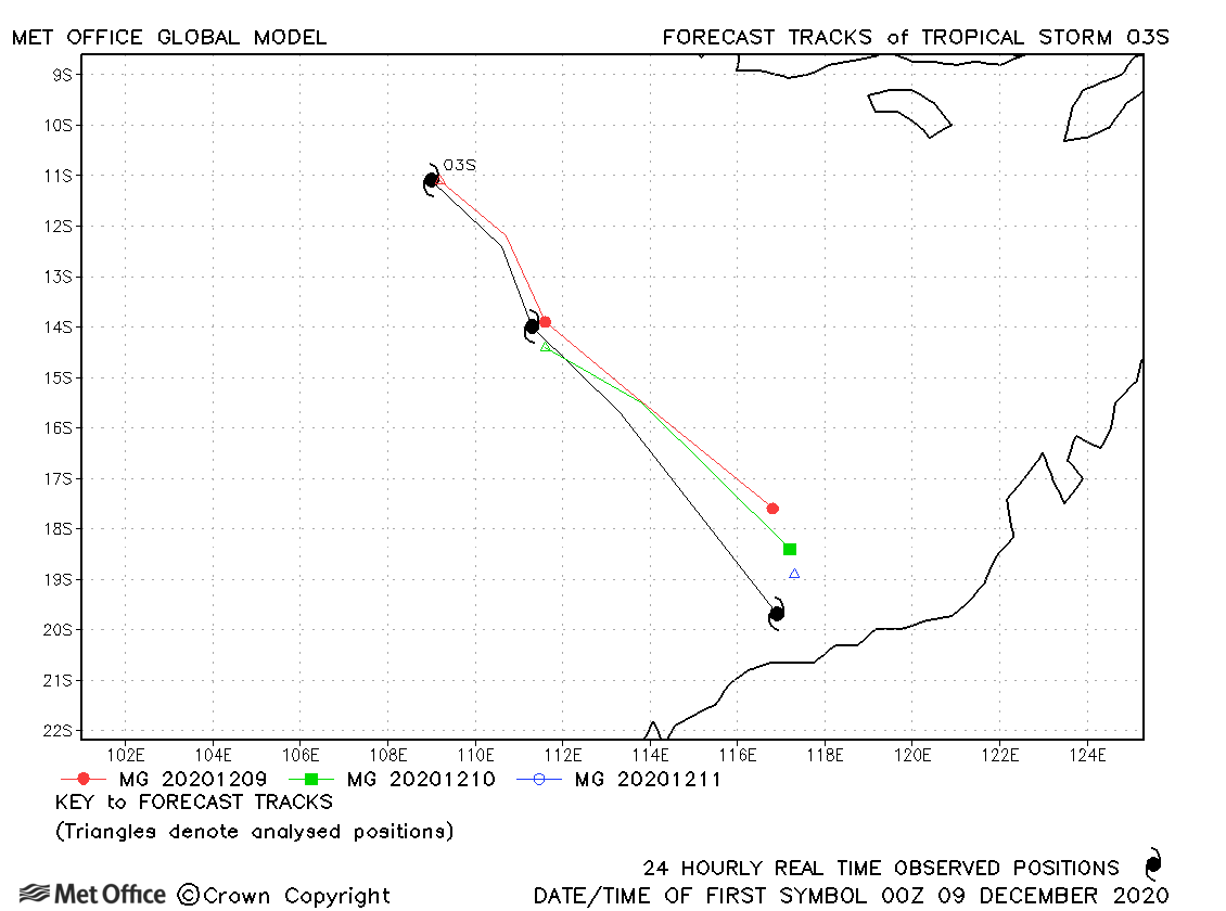
| 08-11 December | 992 mb, 45/30 knots | The track of 03S was well predicted. | |
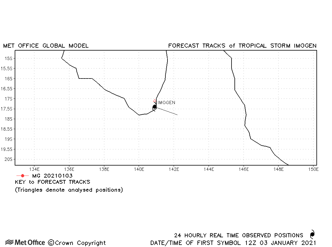
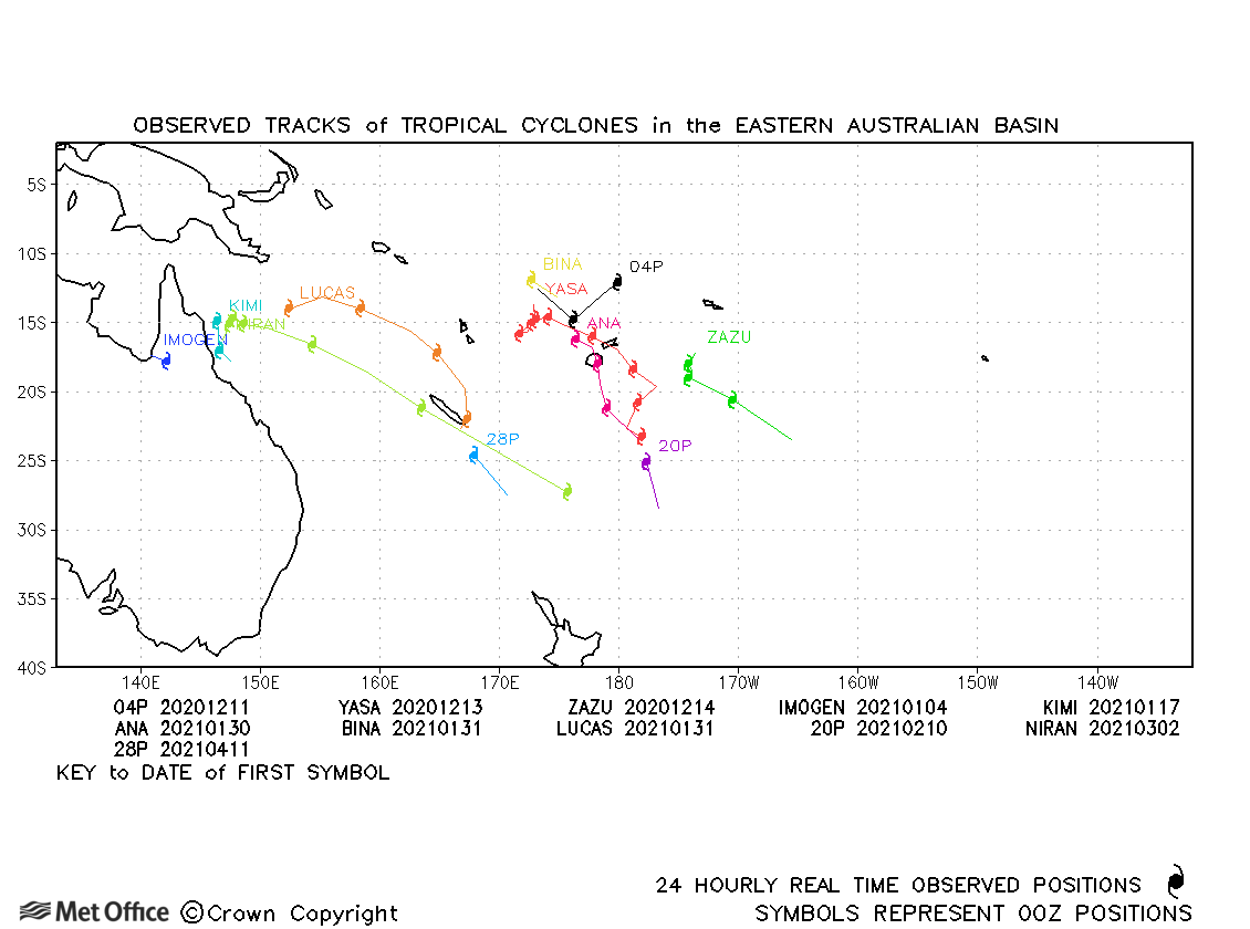
| Imogen (09P) | 03-04 January | 991 mb, 45/40 knots | Imogen was a short-lived storm and no forecasts were verified. |
| Joshua (10S) | 15-19 January | 991 mb, 40/45 knots | Track forecast errors were low for Joshua. |
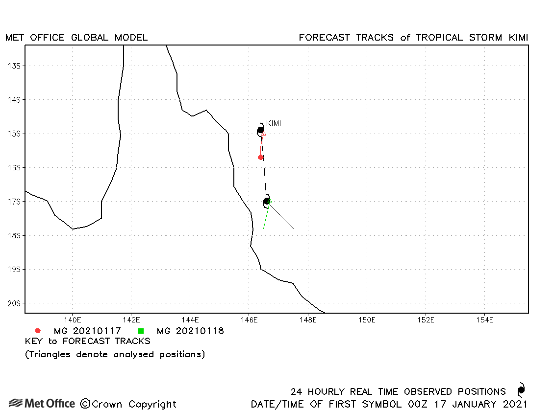
| Kimi (11P) | 17-18 January | 987 mb, 55/55 knots | There was a slow bias for forecasts for Kimi. |
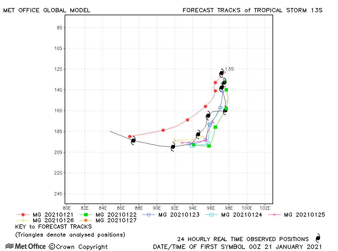
| 13S | 21-28 January | 994 mb, 35/30 knots | 13S was only designated as a tropical storm by JTWC and remained weak throughout its lifetime. Track forecast errors were below the recent mean. |
| 14S | 21-22 January | 994 mb, 40/35 knots | 14S was weak and fairly short-lived. |
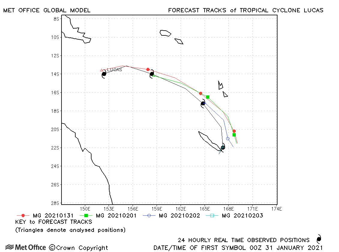
| Lucas (17P) | 31 January-03 February | 975 mb, 65/60 knots | Track forecast errors were a little above the recent mean. |
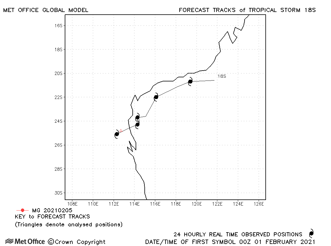
| 18S | 31 January-05 February | 992 mb, 35/30 knots | 18S only briefly attained tropical storm status as measured by 1-minute sustained winds. |
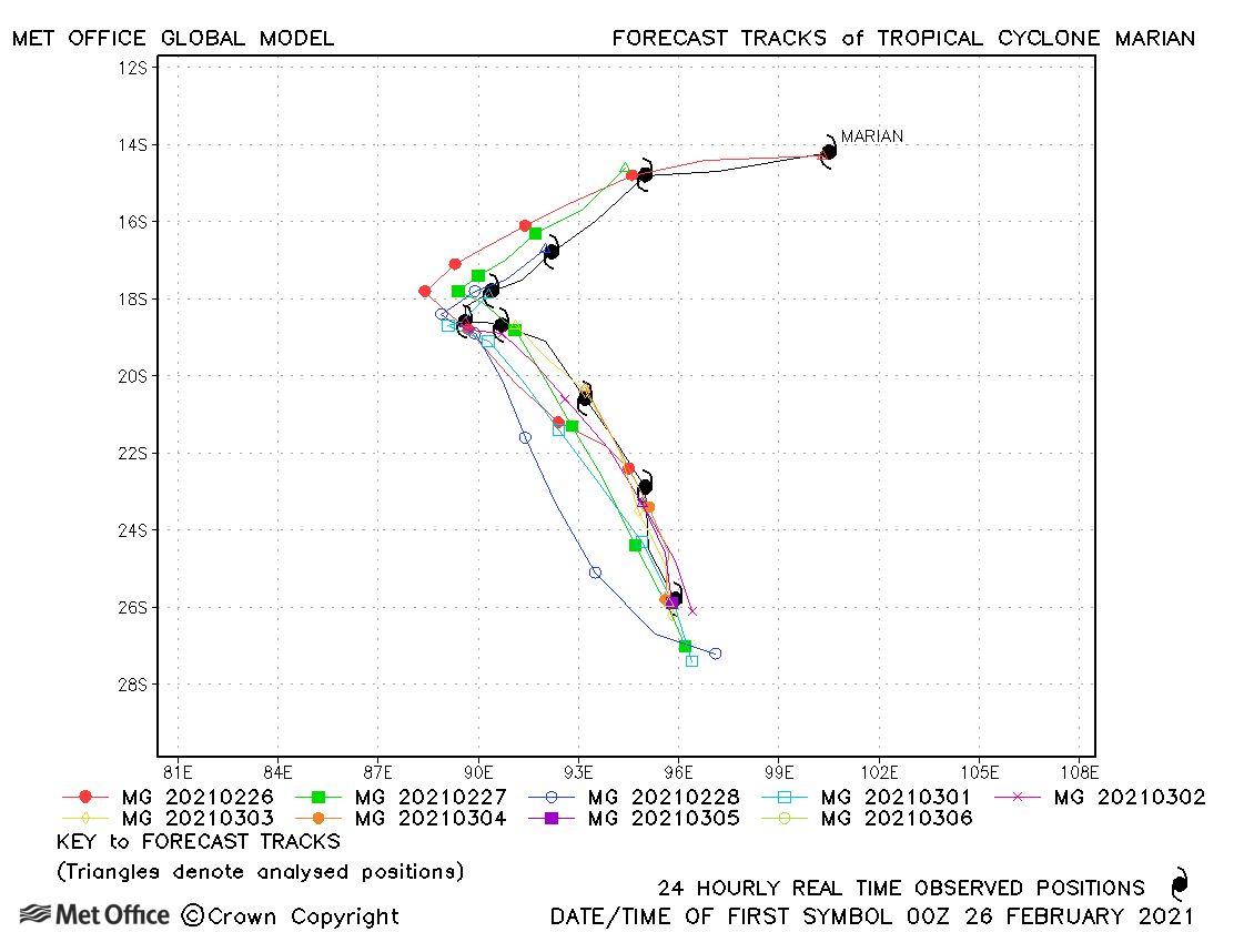
| Marian (22S) | 26 February - 06 March | 950 mb, 100/90 knots | Track forecasts for Marian were very good - notably the sharp turn in direction which occurred. |
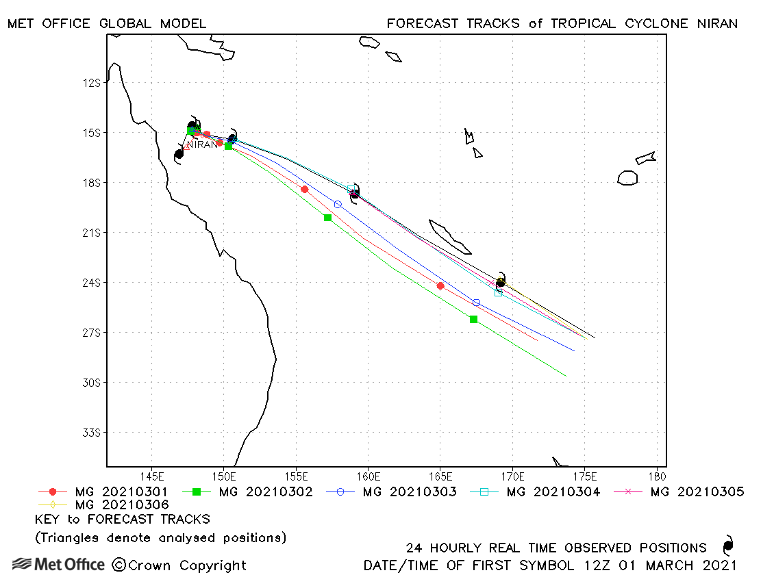
| Niran (23P) | 28 February - 07 March | 931 mb, 140/110 knots | Track forecast errors were close to or below the recent mean. The acceleration southeastwards was well predicted with a slight right-of-track bias. Skill scores against CLIPER were high. |
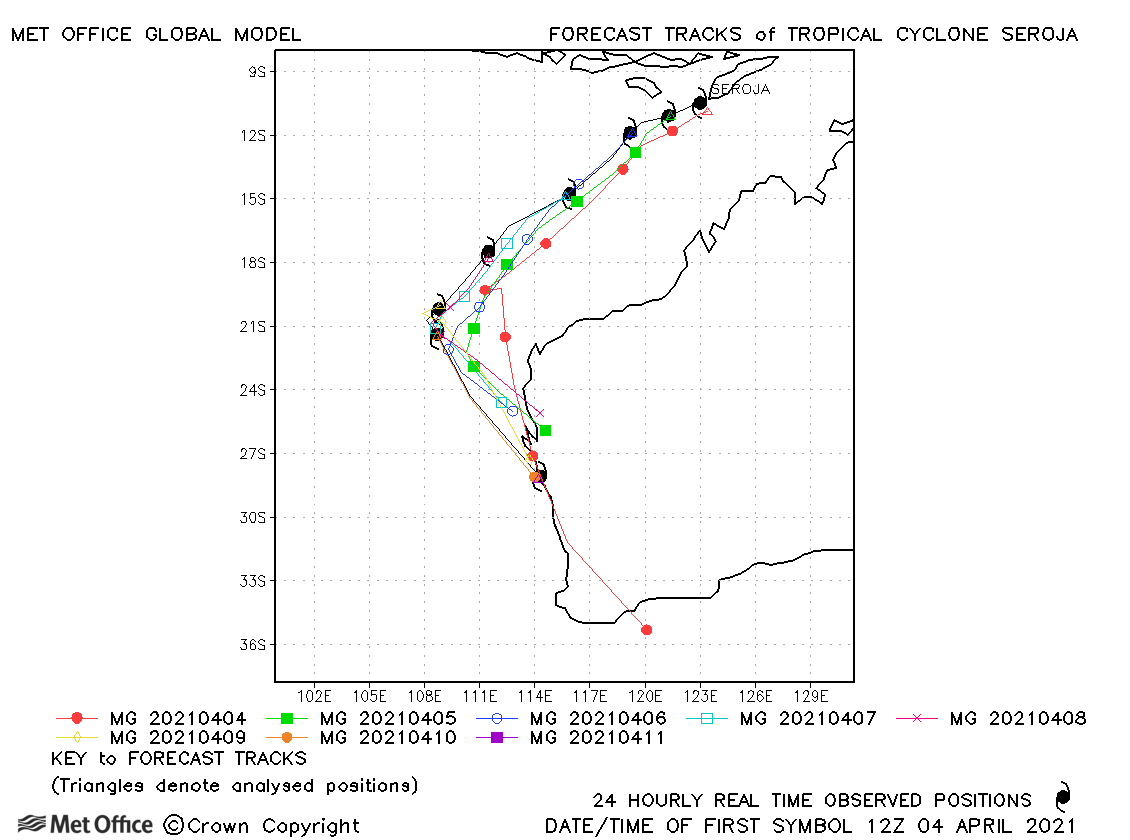
| Seroja (26S) | 04-11 April | 971 mb, 70/65 knots | Track forecast errors were generally near to the recent mean values. The interaction with Odette was well predicted as was the sharp turn south-east, although the acceleration towards land was not. |
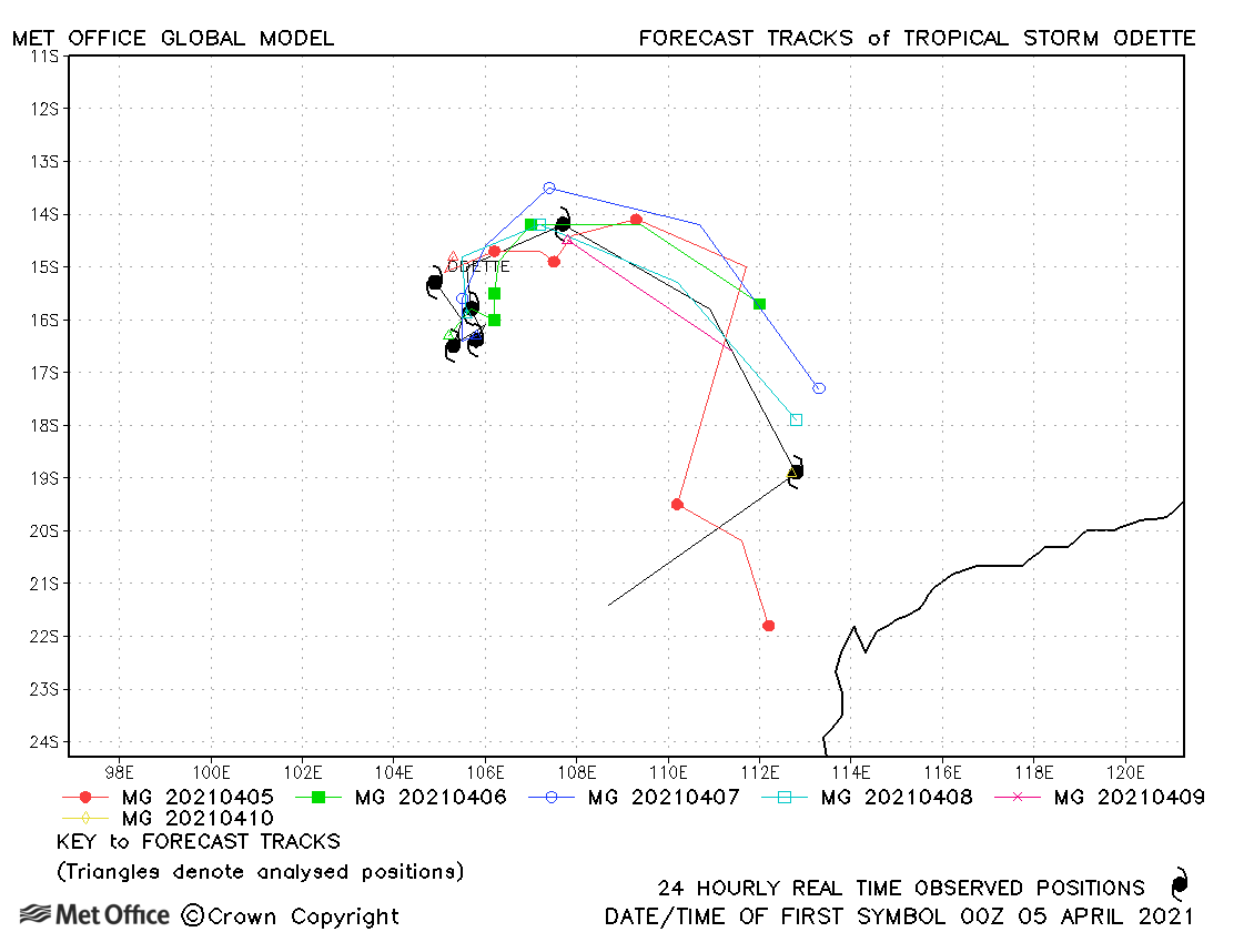
| Odette (27S) | 04-10 April | 982 mb, 50/45 knots | The interaction of Odette with Seroja was mostly well predicted with positional errors near to or below the recent mean. |
| Name & ID | Start & end dates | Central pressure, 1-/10-minute MSW | Comments on Met Office global model forecasts |
|---|---|---|---|
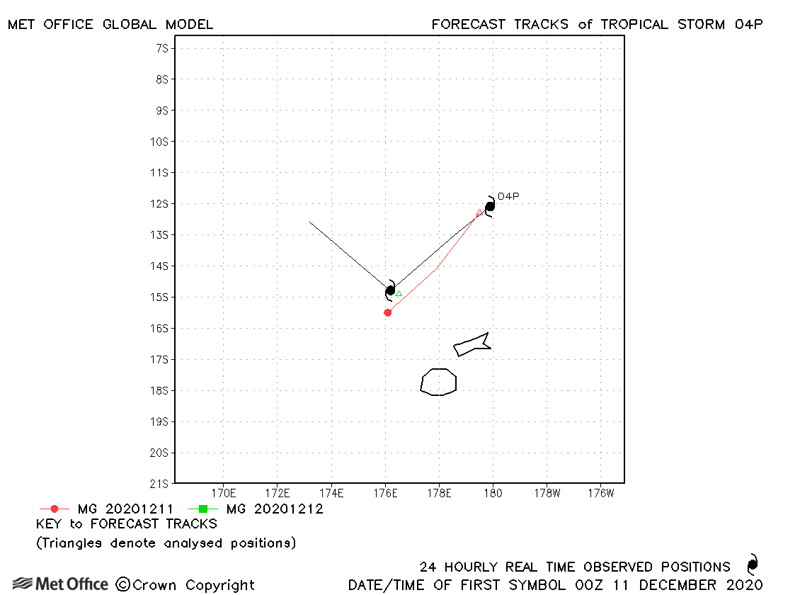
| 04P | 11-12 December | 998 mb, 40/30 knots | 04P was only briefly a tropical storm as measured by 1-minute average winds. |
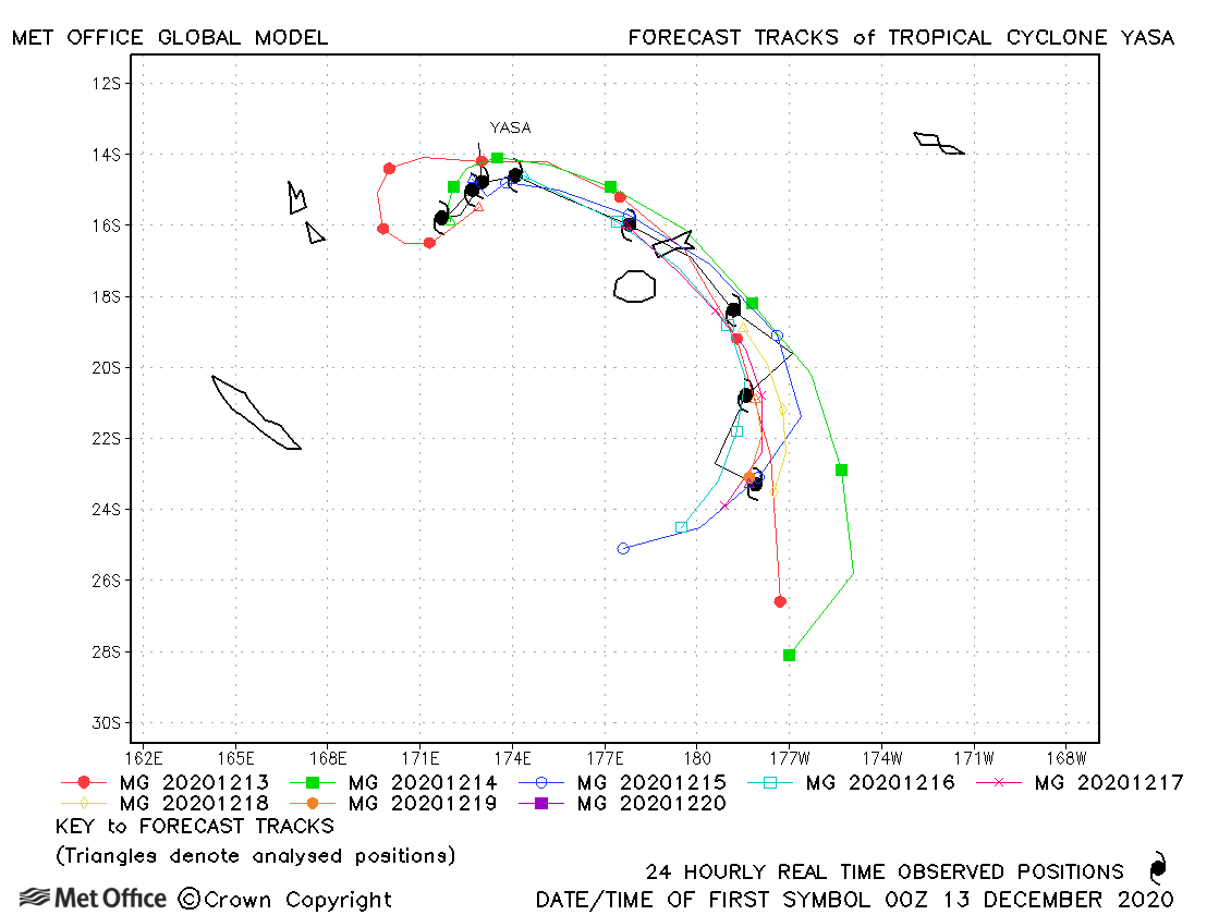
| Yasa (05P) | 12-20 December | 899 mb, 140/135 knots | Track forecast errors were mostly a little below the recent mean values. |
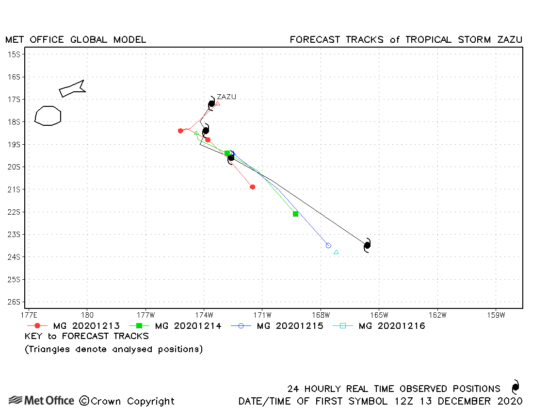
| Zazu (06P) | 13-16 December | 980 mb, 55/50 knots | There was a slow bias resulting in track errors above the recent mean values. |
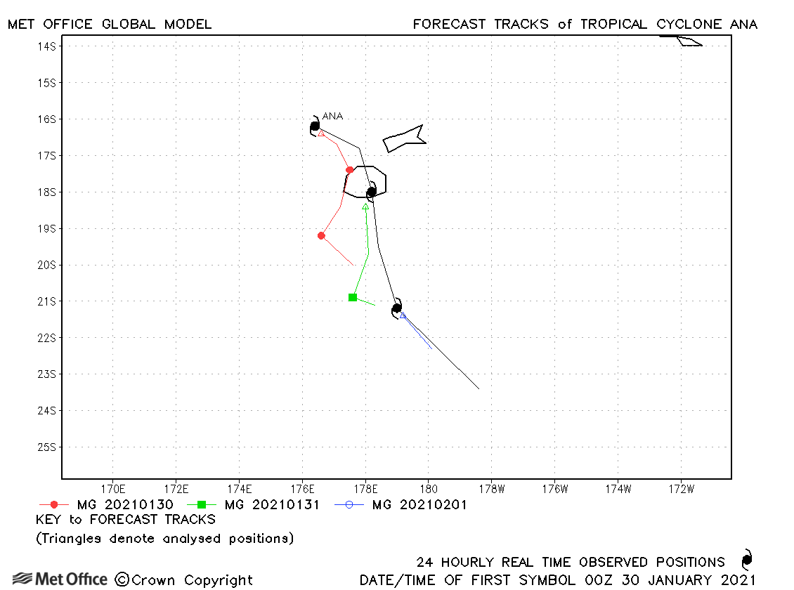
| Ana (15P) | 29 January-01 February | 970 mb, 65/65 knots | Track forecasts were slow resulting in errors above the recent mean. |
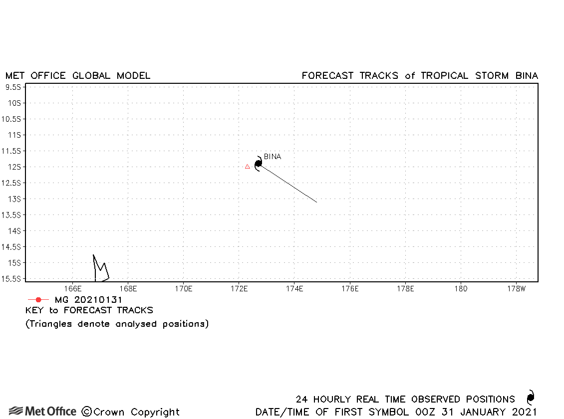
| Bina (16P) | 30 January-01 February | 993 mb, 45/35 knots | Bina was briefly a tropical storm and no forecasts were verified. |
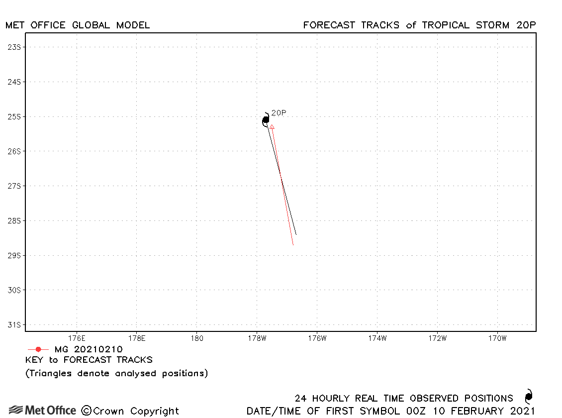
| 20P | 10 February | 991 mb, 45/30 knots | 20P was briefly a tropical storm as defined by 1-minute sustained winds. |
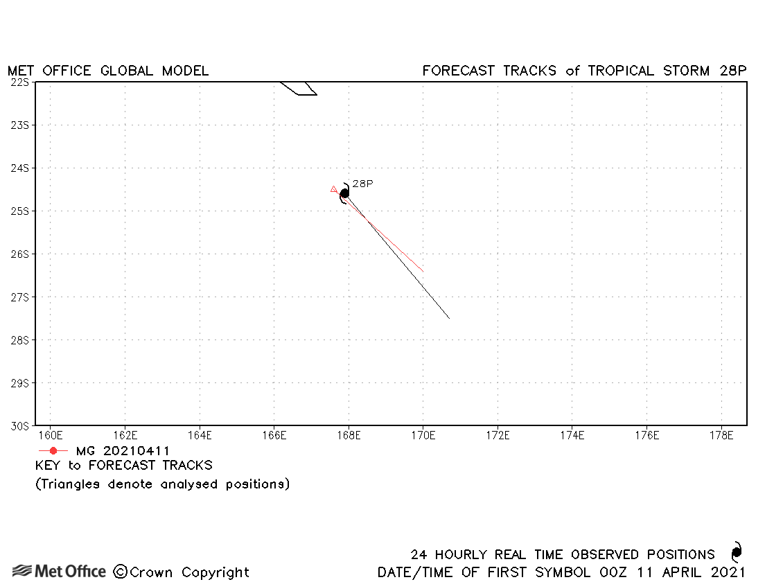
| 28P | 10-11 April | 999 mb, 40/30 knots | 28P was short-lived with just one forecast verified. |
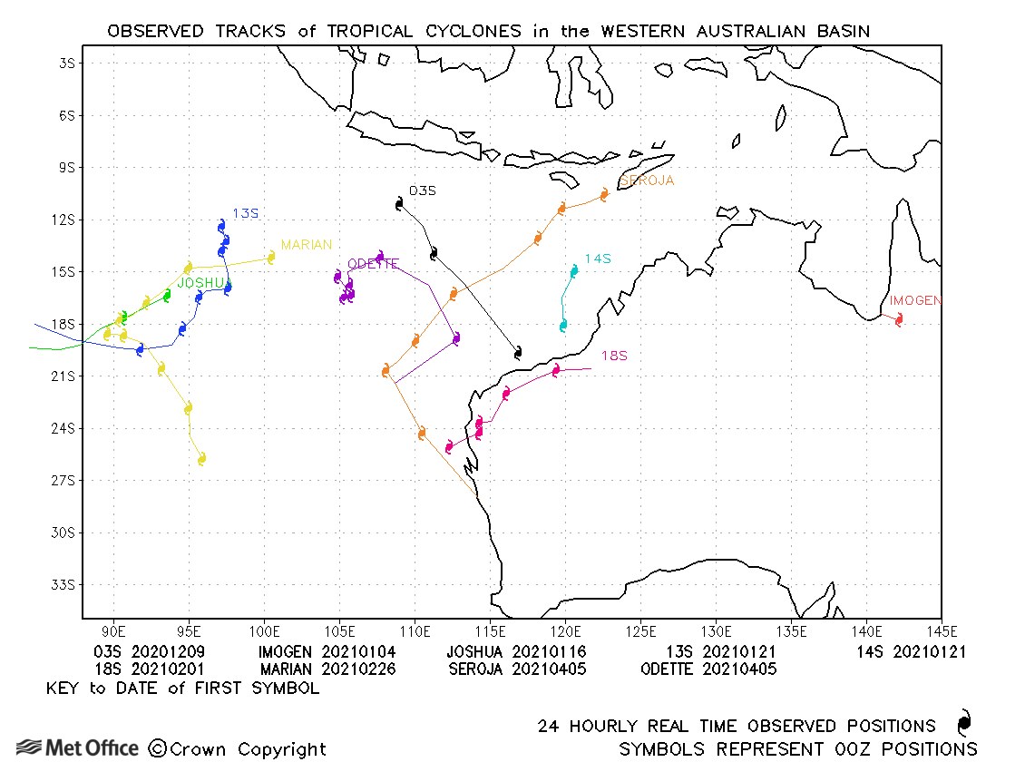
Western Australian observed tracks in 2020-21
Eastern Australian observed tracks in 2020-21
| Name & ID | Start & end dates | Central pressure, 10-minute MSW | Comments on Met Office global model forecasts |
|---|---|---|---|
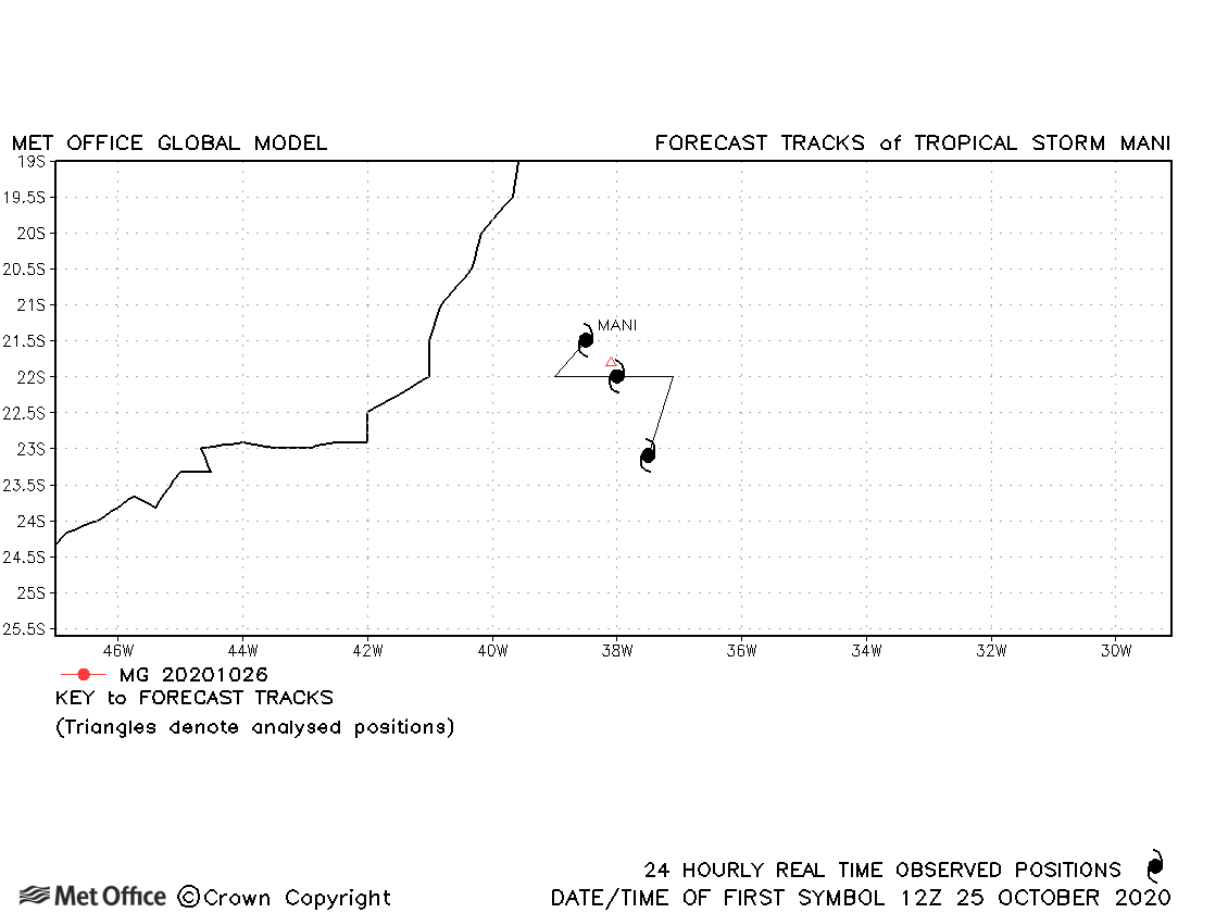
| 25-27 October | 1004 mb, 35 knots | Mani was a short-lived subtropical storm with few forecasts verified. | |
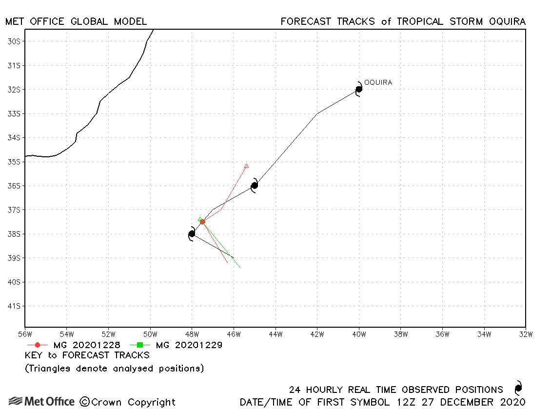
| Oquira (02Q) | 27-30 December | 1004 mb, 35 knots | Track forecast errors were low for this subtropical storm. |
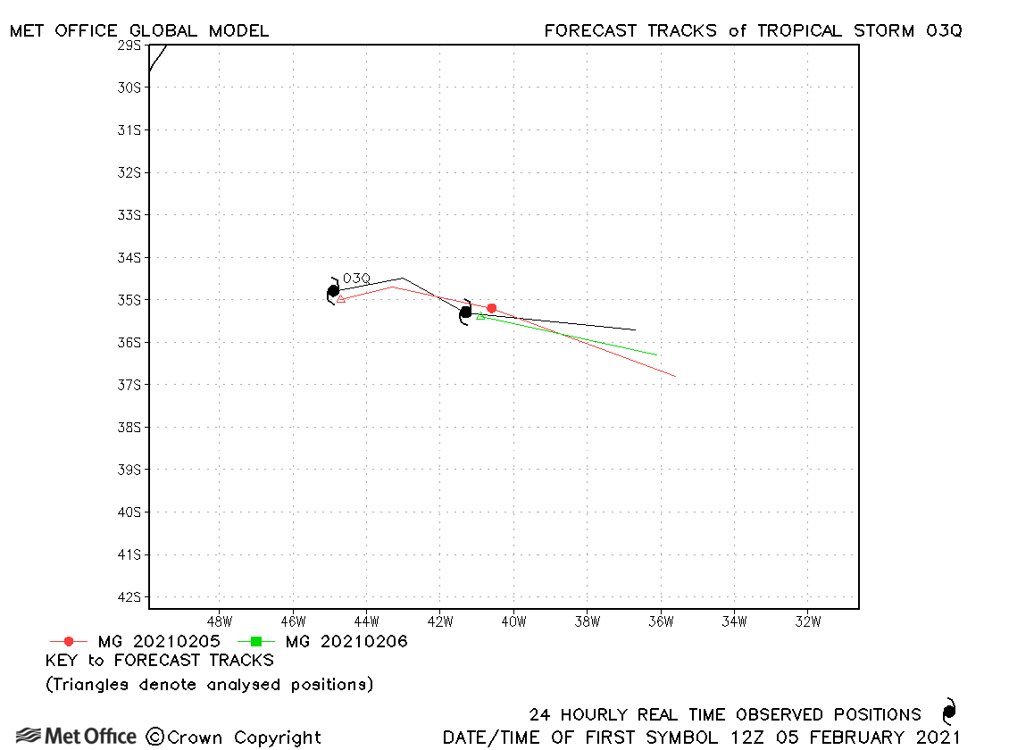
| 03Q | 05-07 February | 980 mb, 50 knots | Forecast tracks were good for this subtropical storm. |
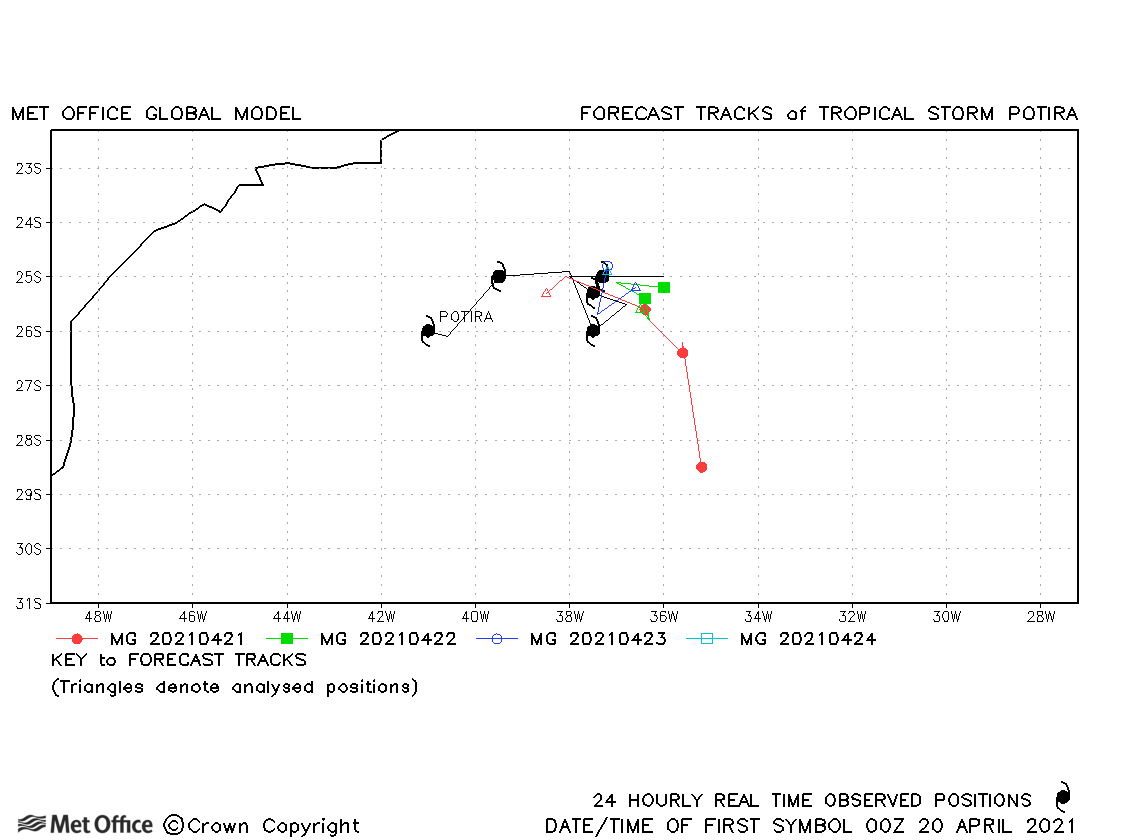
| Potira (04Q) | 20-24 April | 1006 mb, 40 knots | Track forecast errors were large at longer lead times due to a fast bias. |
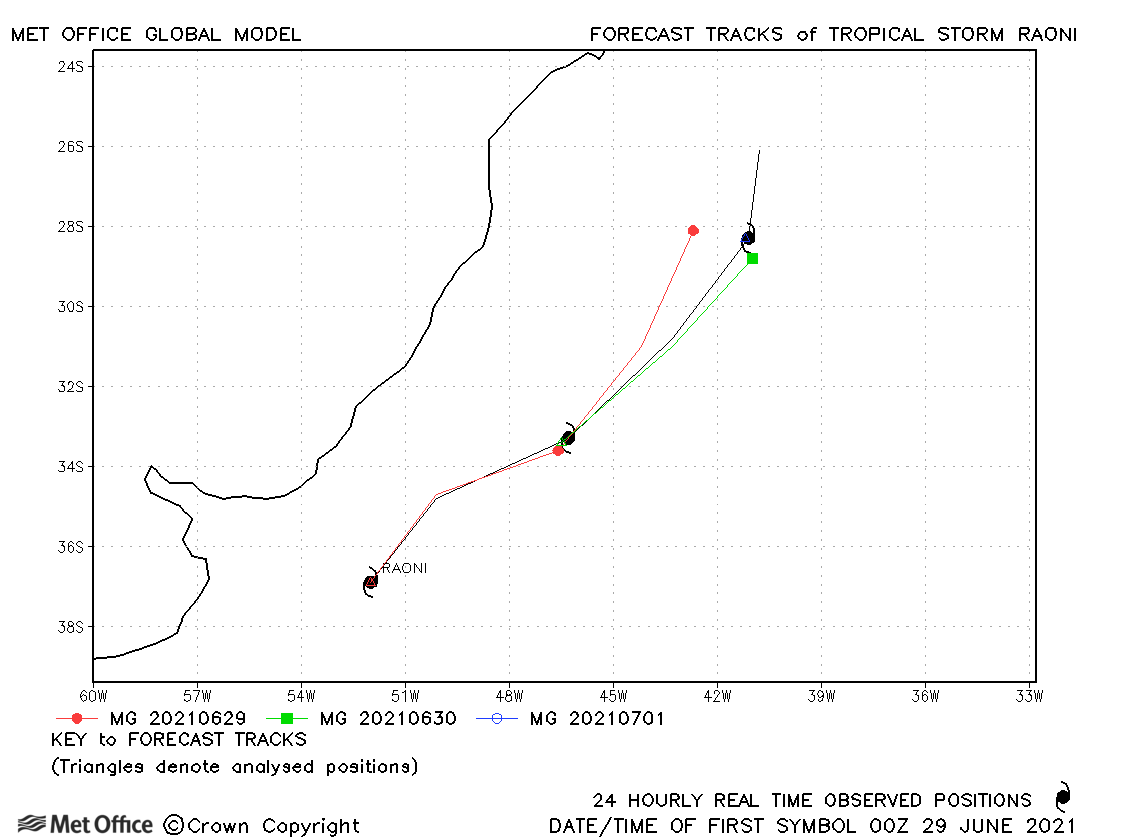
| Raoni (05Q) | 29 June - 01 July | 988 mb, 50 knots | Track forecast errors were very low for this subtropical storm. |
South Atlantic observed tracks in 2020-21
Note on estimated wind speeds
1-minute MSW: Maximum sustained wind (knots) averaged over one minute (JTWC Hawaii)
10-minute MSW: Maximum sustained wind (knots) averaged over 10 minutes (Southern Hemisphere RSMCs and TCWCs)
Note: Although 1-minute average winds should be stronger than 10-minute average, this may not be the case here since estimates are obtained from different warning centres using different analysis techniques.

