
Observed and forecast tracks: southern hemisphere 2022-23
All tropical cyclones in the southern hemisphere season in 2022-23 are listed below including details of their start and end dates, lowest central pressure and maximum sustained wind (MSW).
Click on the name of the tropical cyclone to see a chart of the observed track and forecast tracks from the Met Office global model. Verification statistics on each tropical cyclone are available upon request from tropical_cyclones@metoffice.gov.uk. At the end of the season a verification report on the performance of the Met Office global model will be published.
South-West Indian (west of 90°E)
| Name & ID | Start & end dates | Central pressure, 1-/10-minute MSW | Comments on Met Office global model forecasts |
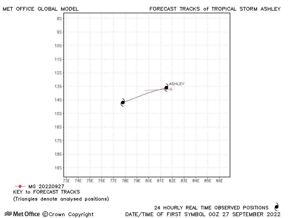
| Ashley (02S) | 26-28 September | 999 mb, 40/35 knots | Ashley was short-lived with only one forecast verified. |
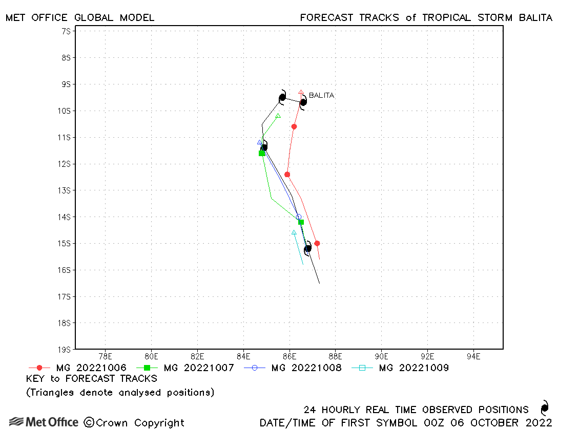
| Balita (03S) | 06-09 October | 996 mb, 40/35 knots | Track forecast errors at longer lead times were below the recent mean values. |
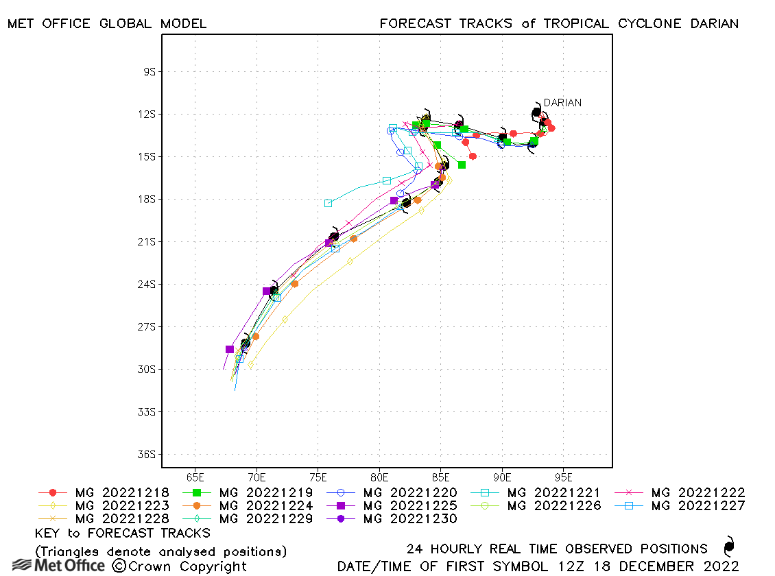
| Darian (05S) * | 18-31 December | 920 mb, 135/120 knots | Track errors were low and skill scores high for this first intense cyclone of the season. |
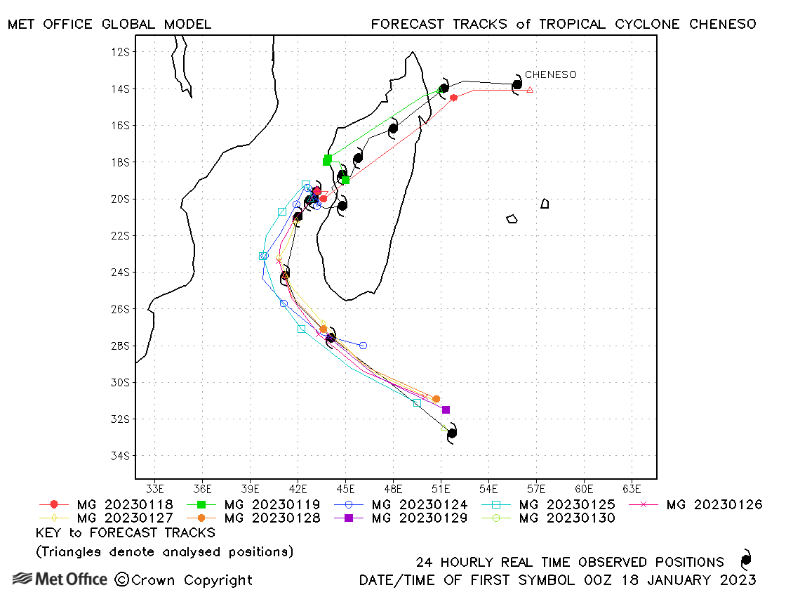
| Cheneso (08S) | 17-30 January | 959 mb, 80/80 knots | Some early forecasts did not predict the track of Cheneso across Madagascar well, but over the whole lifetime of the cyclone track forecast errors were low. |
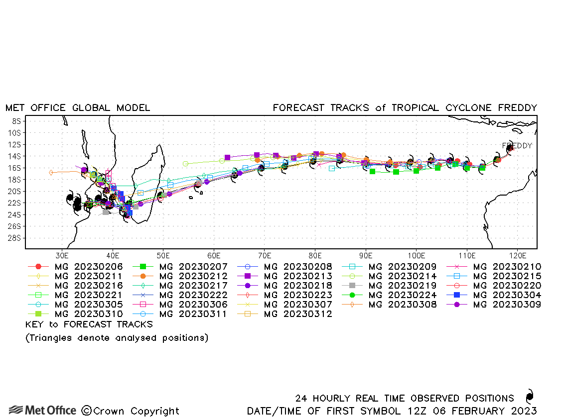
| Freddy (11S) * | 06 February - 13 March | 931 mb, 140/120 knots | Track forecast errors were lower than the recent mean values and skill scores were high for this record breaking cyclone. There was a slight right-of-track bias overall, mainly apparent as Freddy approached landfall over Madagascar. |
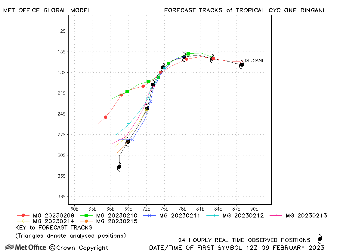
| Dingani (13S) | 09-16 February | 971 mb, 80/75 knots | Track forecast errors were near to the recent average at short lead times, but above average at longer lead times due to a right-of-track bias. |
| Enala (14S) | 22 February-01 March | 982 mb, 75/65 knots | Track forecast errors were below the recent average at short lead times, but above average at longer lead times due to a right-of-track bias. |
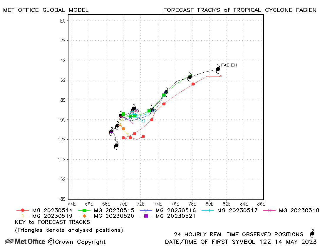
| Fabien (19S) | 14-22 May | 962 mb, 100/90 knots | Track errors were close to the recent mean at short lead times, but lower than the mean at longer lead times. |
* Darian and Freddy originated in the Australian region.
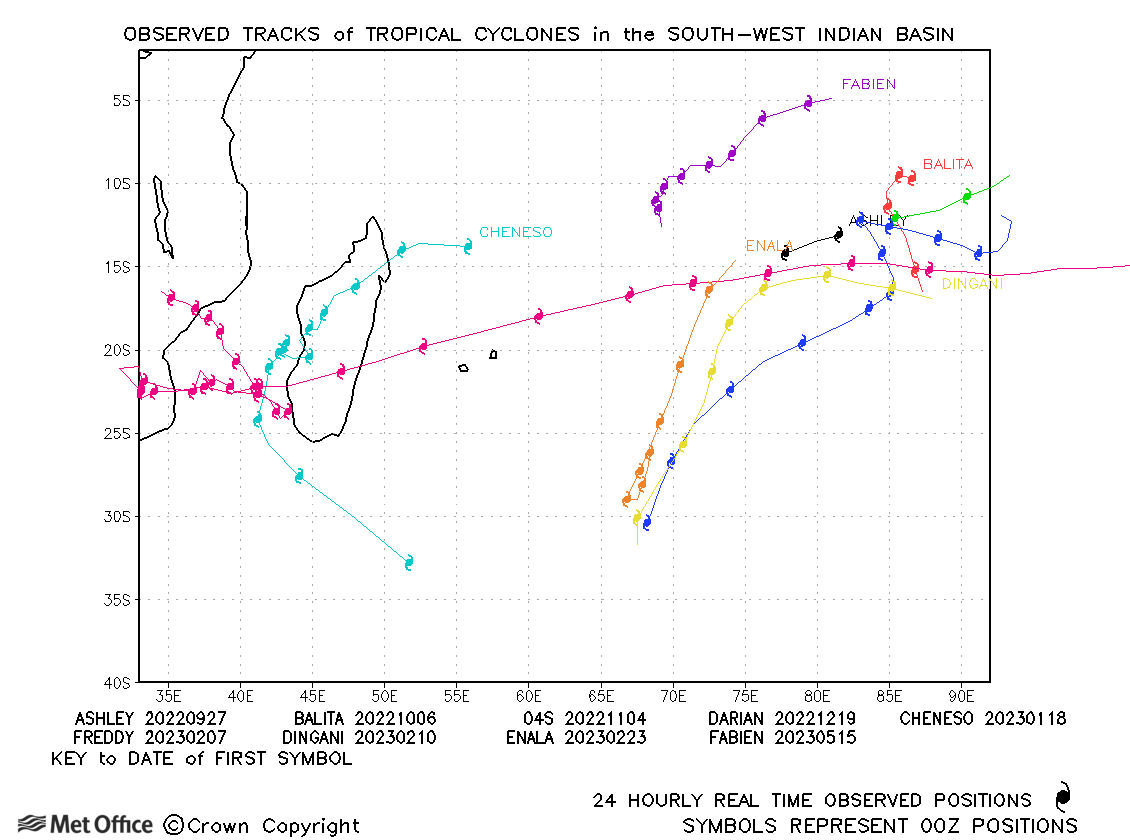
South-west Indian observed tracks in 2022-23
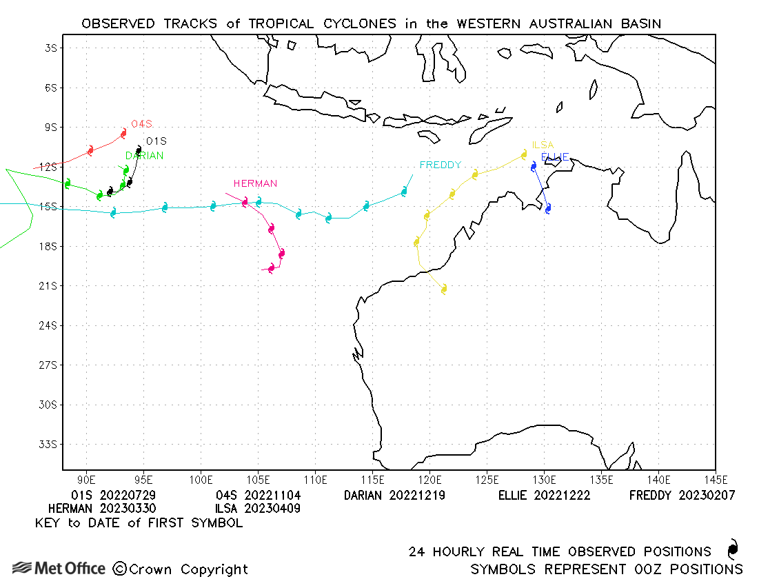
Australian (90-160°E) - including Indonesia and PNG
| Name & ID | Start & end dates | Central pressure, 1-/10-minute MSW | Comments on Met Office global model forecasts |
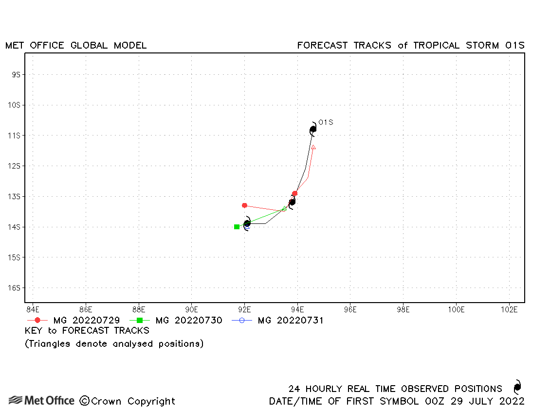
| 28-31 July | 994 mb, 40/40 knots | Track foecast errors were low for this unusual July storm. | |
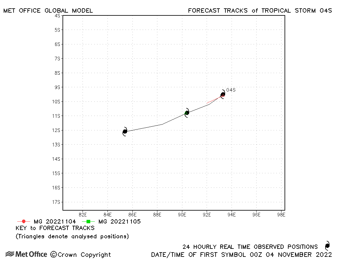
| 04S | 03-06 November | 1004 mb, 35/30 knots | 04S was briefly classified as a storm by JTWC and passed into the South-West Indian region before dissipation. |
| Darian (05S) * | 18-31 December | 920 mb, 135/120 knots | Track errors were low and skill scores high for this first intense cyclone of the season. |
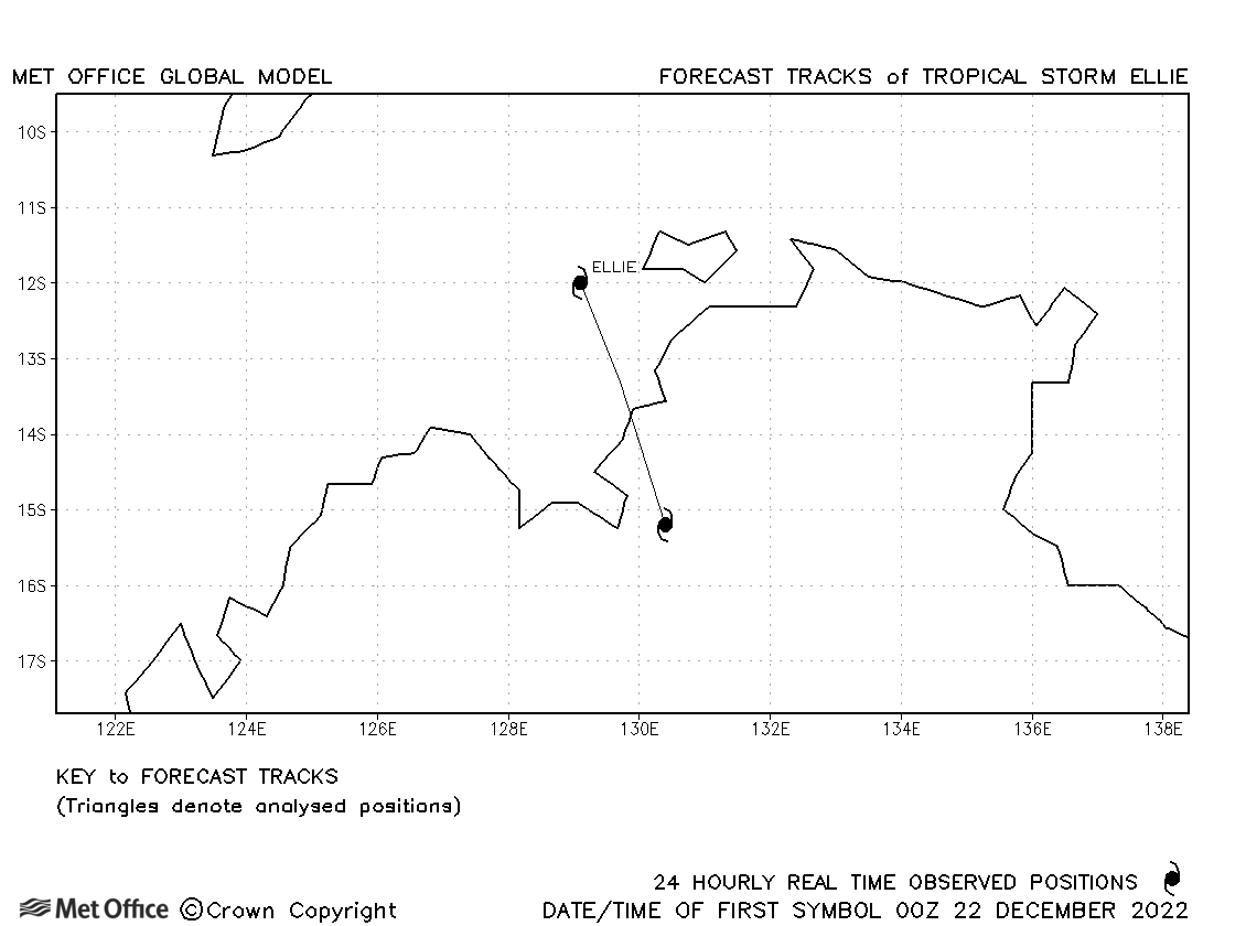
| Ellie (06S) | 22-23 December | 990 mb, 40/40 knots | Ellie was short-lived before landfall, although the circulation persisted overland for many days. |
| Freddy (11S) * | 06 February - 13 March | 931 mb, 140/120 knots | Track forecast errors were lower than the recent mean values and skill scores were high for this record breaking cyclone. There was a slight right-of-track bias overall, mainly apparent as Freddy approached landfall over Madagascar. |
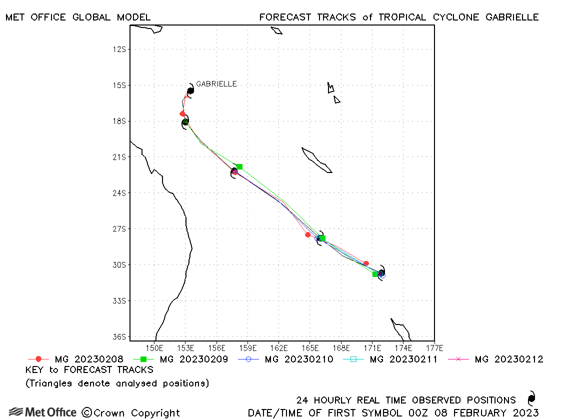
| Gabrielle (12P) | 08-12 February | 959 mb, 90/80 knots | Track forecast errors were very low for this cyclone. |
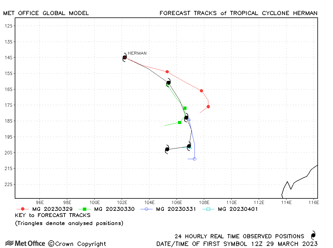
| Herman (17S) | 29 March - 02 April | 935 mb, 110/110 knots | A slow bias resulted in longer range forecast errors being above the recent mean values. |
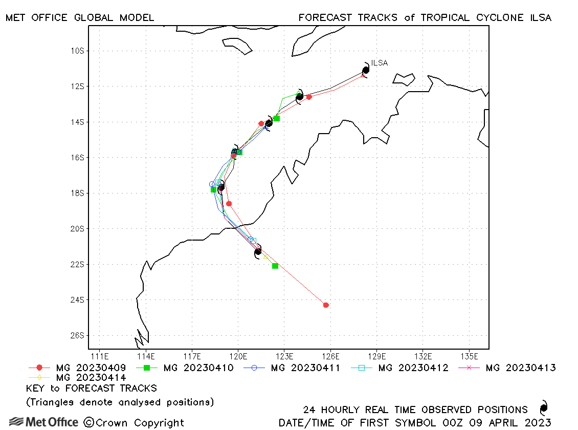
| Ilsa (18S) | 08-14 April | 919 mb, 140/115 knots | Track forecast errors were mostly very low and skill scores high for Ilsa. Only the first couple of forecasts had a fast bias at longer lead times. |
* Darian and Freddy moved into the South-West Indian region.
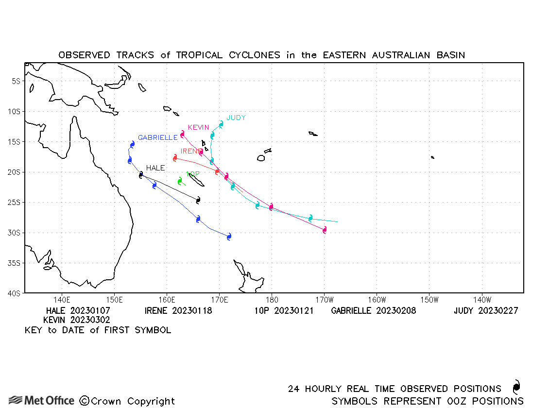
Fiji (east of 160°E)
| Name & ID | Start & end dates | Central pressure, 1-/10-minute MSW | Comments on Met Office global model forecasts |
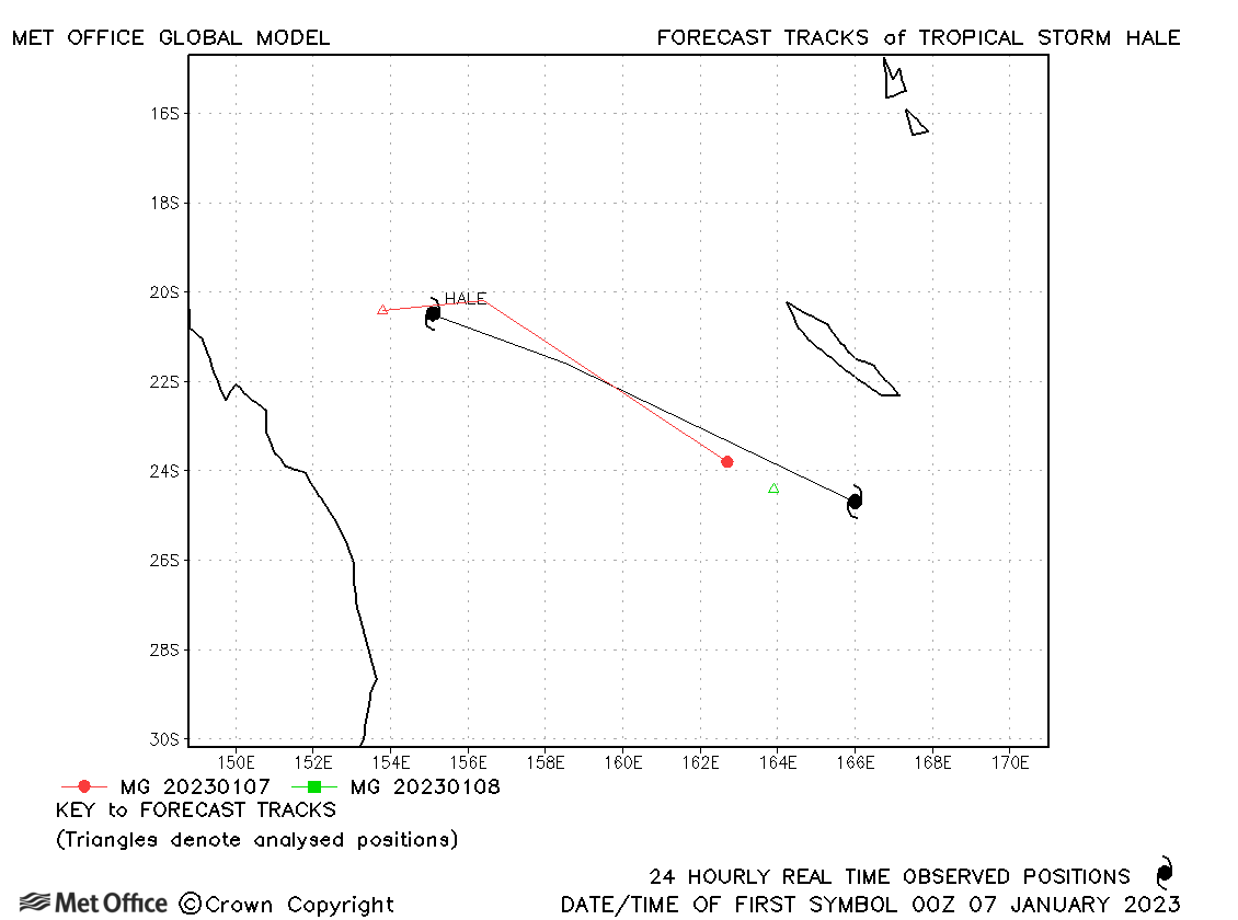
| Hale (07P) | 06-08 January | 992 mb, 45/40 knots | Hale was short-lived, but a slow bias resulted in large track forecast errors for the few forecasts which were verified. |
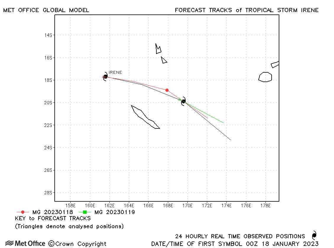
| Irene (09P) | 17-18 January | 985 mb, 50/55 knots | A slow bias resulted in large track forecast errors. |
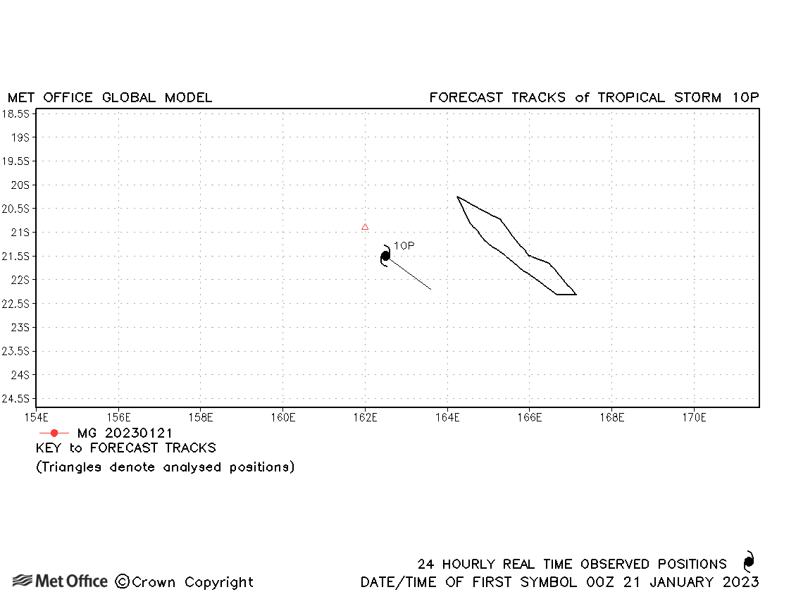
| 10P | 20-21 January | 996 mb, 35/30 knots | No forecasts were verified for this short-lived storm. |
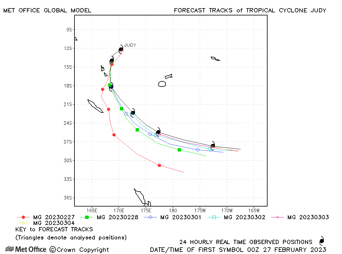
| Judy (15P) | 27 February - 04 March | 945 mb, 110/95 knots | There was a right-of-track and slow bias for this cyclone meaning track errors were higher than the recent mean values. |
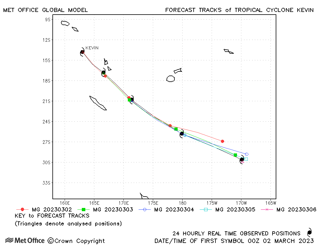
| Kevin (16P) | 01-06 March | 915 mb, 140/115 knots | The direction of motion was well predicted, but a slow bias resulted in larger errors at longer lead times. |
Western Australian observed tracks in 2022-23
Eastern Australian observed tracks in 2022-23
South Atlantic
| Name & ID | Start & end dates | Central pressure, 10-minute MSW | Comments on Met Office global model forecasts |
|
|
South Atlantic observed tracks in 2022-23
Note on estimated wind speeds
1-minute MSW: Maximum sustained wind (knots) averaged over one minute (JTWC Hawaii)
10-minute MSW: Maximum sustained wind (knots) averaged over 10 minutes (Southern Hemisphere RSMCs and TCWCs)
Note: Although 1-minute average winds should be stronger than 10-minute average, this may not be the case here since estimates are obtained from different warning centres using different analysis techniques.