Met Office daily weather: shifting conditions and regional contrasts
The latest Met Office daily weather forecast shows shifting conditions and regional contrasts
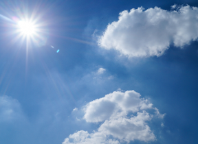
As we head into the first weekend of August, the UK’s weather continues to reflect the season’s shifting patterns, with contrasts between regions and evolving conditions through the day and night
Eastern areas will start the day rather cloudy and breezy, with a scattering of showers developing through the morning and into the afternoon. Some of these may become locally moderate, and very isolated heavy downpours are possible later in the day. Elsewhere across the UK, it will be a dry day with variable cloud and bright or sunny spells.
Read more on Apple News: Met Office 10-day trend: Stormy conditions to end July
Temperatures will be close to the seasonal average overall, though it may feel a touch cooler in the east due to the breeze and cloud cover. In contrast, southern England will feel pleasantly warm in the sunshine. Winds will remain moderate in most areas but could be brisk along exposed eastern coasts.
Showers in the east will gradually become more isolated overnight, eventually confined to windward coastal areas. Elsewhere, it will be a dry night with patchy cloud and clear periods. Under the influence of a ridge of high pressure, temperatures will fall away in western and central parts, particularly in rural locations, where lows of 4-6°C are possible.
Outlook for Friday
Saturday will begin largely dry and fine across much of the UK. A few light showers may linger in the southeast during the morning, but these will quickly clear. Sunny spells will develop widely, making for a pleasant day.
Later in the afternoon and into the evening, cloud will increase across northwestern areas, with rain developing for parts of western Scotland and Northern Ireland. Winds will generally be light to moderate, though it will remain breezy along some North Sea coasts and later in the far northwest.
Temperatures will again be near average for early August, with the best of the warmth felt in the sunshine across southern and central regions.
Read more on Apple News: What is the Gulf Stream and how does it affect UK weather?
Met Office presenter and meteorologist, Alex Deakin, said: “On Friday, again, it is a bit of a messy one, but for many places in the West, it'll be dry and bright. Probably a brighter day compared to Thursday. A better chance of seeing some sunshine. There’s some thickening cloud coming down the eastern side of England, making for a bit of a drab one and a breezy one on some of those North Sea coasts. We could see the rain and drizzle coming in through the afternoon, particularly into Lincolnshire and Norolk, that's not going to feel very pleasant.
“Inland, a better chance of seeing some sunny spells, but there will also be a few showers across northwest England down through the Midlands towards the southeast. As I said, many western areas dry bright. Better chance of seeing some sunshine, especially in western Scotland, west coast of Wales, albeit with a fresher feel. Temperatures mostly only in the high teens, maybe low 20s across the southeast, but again, feeling fresher compared to the humidity of today.
“As we go through Friday evening, not a great deal of change. The thicker cloud and the brisk wind may start to ease away from East Anglia. And the showers in land across England should start to fade as well leading into what will for many of us be a fine day on Saturday under the ridge of high pressure that's moving in."