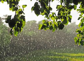
Met Office daily weather: Rain and showers for many
Rain, showers and sunny spells with some blustery conditions at times.
Tuesday will begin with areas of rain and embedded thunderstorms across some southwestern parts of the country. As the morning progresses, these will degenerate into showers, which are expected to persist for much of the day in affected regions. Elsewhere, most areas will experience variable cloud cover and a scattering of mainly light showers, with the chance of an odd moderate shower near southern coasts.
Temperatures on Tuesday will be around normal for the time of year, with values a degree or so either side of average. Central and eastern England can expect highs in the low twenties Celsius, providing a pleasant feel despite the risk of showers.
Is there any sign of the weather settling down this week, or are we in for more spells of rain? 🌧️
— Met Office (@metoffice) September 7, 2025
Find out all the details for the week ahead below 👇 pic.twitter.com/uDvlgzndOY
Outlook for Wednesday
Wednesday will see cloudy conditions with outbreaks of rain and showers in western areas, gradually spreading east and northeast. Some southern-facing hills of Scotland may experience heavy and persistent rainfall. Ahead of the rain band, eastern regions will remain fine for much of the day, though conditions may become increasingly showery as the rain arrives after dark. Fresher, brighter, and sunnier weather will follow into western parts later.
Winds will be light in the far southeast at first, becoming moderate to fresh elsewhere. Strong winds are expected around Irish Sea coasts, with a risk of gales on exposed northwestern coasts and hills in the north. Temperatures will remain near average or rather cool throughout the period.
Met Office Presenter and Meteorologist, Honor Criswick, said: "There will be plenty of clear skies on Monday night which may mean that we'll see some mist and fog particularly in prone spots by the time we reach the early hours of the morning and feeling a little cooler and fresher by the time we start Tuesday too. But the day itself should be fairly similar to what we had on Monday. Still a risk of showers once again across the west. Northern Ireland, northwestern parts of England could catch some showers, but the main bulk of the showers will be across southern parts of Wales and parts of southwest England. Once again, there'll be plenty of sunshine, particularly across eastern areas. But as we see a build of high cloud in the west, that sunshine will turn a little bit hazier. The breeze picking up here, too. Highs reaching around 21-22°C.
“Through into the evening we just need to keep an eye on an area of rain across parts of the southwest. It will slowly skirt its way eastwards. We could see some heavy bursts amongst this area of rain, too, along with quite blustery conditions particularly across exposed coasts. An area of low pressure will eventually start to swing in longer spells of rain through the course of Tuesday evening. Showers will continue before we see more persistent outbreaks of rain later into the day.
“Wednesday is set to be unsettled. It's probably going to be quite a cloudy start for many of us. A risk of showers once again drifting their way eastwards. We'll start to see the breeze pick up before we do see another band of rain push in from the west. Quite blustery with some heavy spells of rain mixed in too, possibly even some hail and thunder. So quite an unsettled and possibly quite wet day by the time we reach the afternoon on Wednesday. But still once again some sunny breaks across eastern areas mixed in with the showers. Temperatures not getting quite as high, highs reaching more like 20-21°C in any sunshine. But for the bulk of us temperatures just pushing into the high teens."
Keep up to date with weather warnings, and you can find the latest forecast on our website, on YouTube, by following us on X and Facebook, as well as on our mobile app which is available for iPhone from the App store and for Android from the Google Play store.