Met Office Deep Dive: Winter arrives early
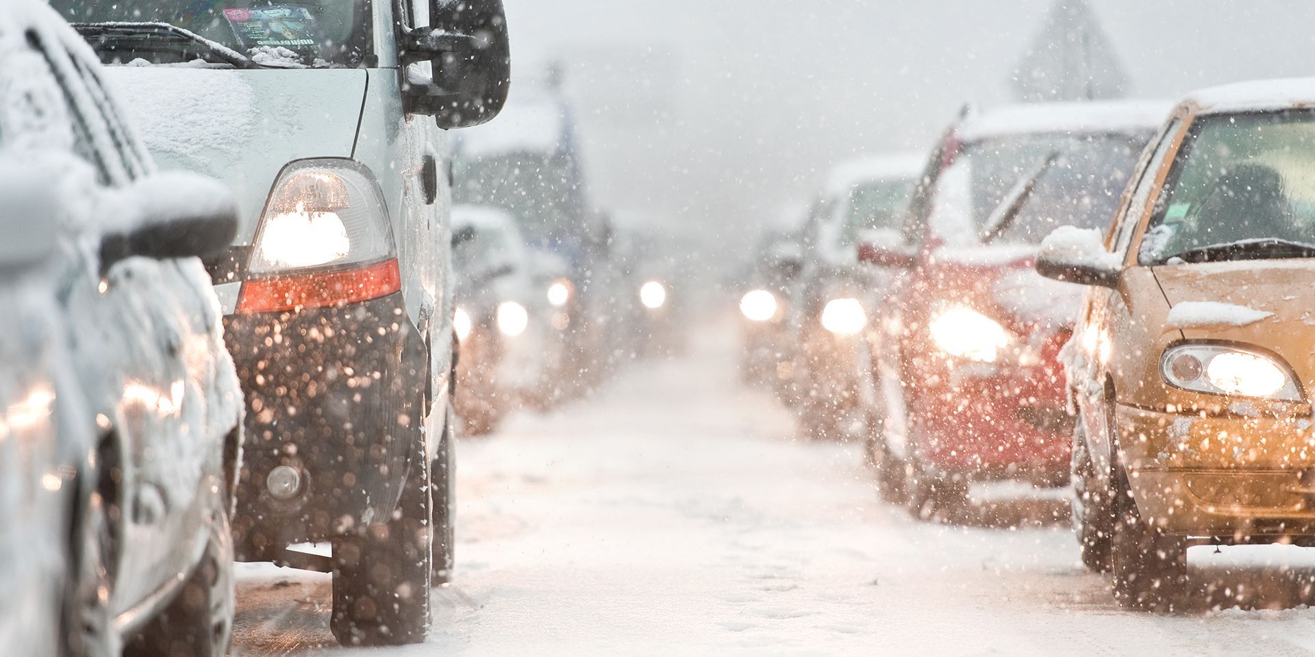
Winter has arrived early across the UK, bringing cold Arctic air and a complex mix of weather hazards.
Winter has arrived early across the UK, bringing cold Arctic air and a complex mix of weather hazards.
This week’s Met Office Deep Dive explores the meteorological setup behind the recent wintry conditions, the impacts seen across the country, and what to expect in the days ahead. With significant snow forecast for some regions and a sudden stratospheric warming event on the horizon, there’s plenty to unpack in this in-depth look at the UK’s weather.
The current situation: Arctic air and snow warnings
Cold Arctic air is sweeping across the UK, with the North York Moors and the Yorkshire Wolds set to see the most significant impacts from snow, particularly on Thursday. Numerous weather warnings are in force for snow and ice, but the effects will be highly localised. While some areas will experience substantial snow, many others will see little or none.
A mixed wintry picture: Rain, sleet, and snow
The week began with an Atlantic system crossing the UK, bringing a messy mix of rain, sleet, and hill snow to northern parts before spreading south. The precipitation radar showed rain highlighted in blue and sleet, snow, or hail in white, illustrating the varied conditions across the country. Northern England, Scotland, and parts of Northern Ireland saw the initial impacts, with the system sinking south overnight into Wednesday.
Regional impacts: Snow, rain, and temperature contrasts
Northern Scotland and the Grampians could see substantial snow accumulations, with 20 to 30 centimetres possible in some areas. The North York Moors and Yorkshire Wolds are of particular concern, with the risk of 20 to 25 centimetres of snow above a few hundred metres.
Coastal areas, by contrast, will see little or no snow, highlighting the sharp regional differences. The Pembrokeshire Dangler, a line of showers funnelled across the Irish Sea, will bring snow to higher parts of Pembrokeshire, while Bodmin Moor and Dartmoor may see a little snow but not much elsewhere.
Yellow warnings for snow and ice are in place over the next couple of days ⚠️
— Met Office (@metoffice) November 19, 2025
Many places won't see much settling snow with icy roads more of a hazard. Heavier falls of snow are likely in northern Scotland and parts of northeast England ❄️
More details👉 https://t.co/QwDLMfRBfs pic.twitter.com/FamQLgq5iU
Recent impacts: Flooding in Monmouth and heavy rain
Last Friday, the focus was on rain, with the town of Monmouth in southeast Wales experiencing devastating flooding due to exceptional rainfall. Bands of heavy rain moved north but stalled across central parts of the UK, intensifying throughout the day.
Wales, the Midlands, and the southwest of England saw particularly heavy and persistent rain, while Scotland and Northern Ireland escaped mostly dry. The meteorological setup behind this event was extraordinary, with contrasting air masses and a stalled weather front leading to prolonged rainfall.
The science behind the weather: Clashing air masses
At the heart of the recent weather was a dramatic clash between air masses. Northern Scotland was under the influence of Arctic air, arriving directly from the North Pole, while the south of England saw air originating from North Africa via Spain and the Mediterranean. This collision created a sharp thermal gradient, with cold air forcing warm, moist air upwards, leading to intense rainfall and cloud formation. The process was further amplified by latent heat release as the warm air condensed, driving rapid ascent and heavy precipitation, particularly over southeast Wales.
Technical insights: Atmospheric cross-sections and jet streams
Meteorologists used cross-sections of the atmosphere to analyse the setup, focusing on potential temperature rather than actual temperature to highlight the gradient between air masses. The cold, dense Arctic air moved south at the surface, while warm, moist air from North Africa rose above it.
READ MORE: Week ahead forecast: Arctic chill brings wintry hazards
The boundary between these air masses was marked by a tight gradient, leading to significant weather impacts. The jet stream played a crucial role, with strong winds at high altitudes and a low-level jet over North Wales and Cumbria contributing to peak wind speeds and further influencing the weather.
Temperature trends: Feeling colder than average
Temperatures across the UK are well below average for the time of year. Maximum temperatures are in the high single figures at best, dropping even lower on Wednesday, Thursday, and Friday. Wind chill will make it feel even colder, with “feels like” temperatures widely at minus one or minus two degrees.
These conditions are several degrees below average, with darker blues on temperature maps indicating the extent of the cold. Minimum temperatures will also be low, especially on Thursday, Friday, and Saturday mornings, before some recovery into Sunday.
The outlook: Transitioning weather and uncertainty
As the week progresses, the northerly winds will be replaced by a subtle return of Atlantic weather. Friday will start with a widespread frost, especially in rural areas with snow cover, but weather fronts moving in for Saturday will bring less cold air and mostly rain. Higher parts of Scotland may see a few more flakes of snow, but the overall trend is towards milder conditions. Temperature graphs for cities like Newcastle, London, and Glasgow show a slight rise into the weekend, with overnight temperatures returning to the low or mid-single figures.
READ MORE: A look back at November's historical weather records
Uncertainty for Sunday and beyond
There is considerable uncertainty about Sunday’s weather, with different computer models offering varying scenarios for the track and depth of low-pressure systems. The most likely outcome is unsettled, showery weather, mainly rain, before conditions clear. After the low moves away, northerly winds may return, bringing colder air but not as cold as earlier in the week.
Next week is expected to be dominated by a mix of high- and low-pressure systems, with frosty nights during ridges of high pressure and milder conditions when weather systems move through. The trend is for occasional spells of rain, temperatures closer to average, and a mixture of dry and wet days.
Looking ahead: Sudden stratospheric warming
A sudden stratospheric warming event is looking likely next week, which could have significant implications for the UK’s weather. This phenomenon involves a rapid increase in temperature in the stratosphere above the North Pole, often leading to a reversal of the stratospheric polar vortex winds.
On roughly 70% of occasions, this increases the likelihood of colder weather in the UK 10 to 14 days later. While not a guarantee, it’s an important factor for meteorologists to watch, as it can lead to a colder than average start to winter.
From the clash of Arctic and North African air masses to the impacts of heavy rain, flooding, and significant snow, the country is experiencing a wide range of conditions. Regional differences are stark, with some areas facing substantial snow while others enjoy sunny skies and frosty nights. The outlook remains uncertain, with the potential for further cold spells and unsettled weather as the season progresses.
Keep up to date with weather warnings, and you can find the latest forecast on our website, on YouTube, by following us on X and Facebook, as well as on our mobile app which is available for iPhone from the App store and for Android from the Google Play store.