Met Office daily weather: Temperatures dropping into midweek
Temperatures set to drop as we head into the new week
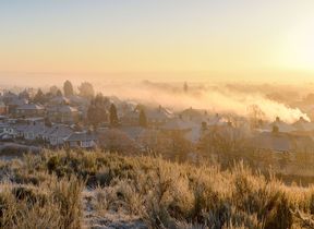
Monday brings a distinctly wintry feel across the UK. Showers, some wintry in nature, will persist in the far north and along North Sea coasts. Elsewhere, most regions can expect fine and dry conditions, with long clear or sunny periods. However, widespread frost is likely, especially early and later in the day, making for a crisp start and finish. A brisk easterly breeze will accentuate the cold, particularly in eastern areas.
Showers will continue across the Northern Isles but will move offshore further south, leaving a dry start to the night for many. However, cloud and wind will increase across northern and north-western areas, bringing more organised rain, sleet, and snow, mainly focused over Scotland. A widespread frost is expected away from Northern Ireland, with icy patches likely on untreated surfaces.
Maximum temperatures will be notably lower than on Sunday, typically by 1–3°C. Most places will remain in single figures, with only the immediate windward coasts in the west seeing slightly milder conditions. The cold will be felt widely, and the breeze will add to the chill.
A cold and frosty start for all 🥶
— Met Office (@metoffice) November 16, 2025
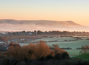
Lots of sunshine but you'll need to wrap up warm to enjoy it 🧣
Feeling cold in brisk northerly winds with a chance of some wintry showers around North Sea coasts ❄️ pic.twitter.com/URu5YJvfVQ
Outlook for Tuesday
Tuesday will be a cold day for all, particularly under persistent precipitation in the north. Showery outbreaks, a mix of rain and sleet at lower levels, and snow over higher ground, will continue across Scotland before gradually moving east-southeast to affect much of England and Wales by afternoon and evening. Most snow will fall over the highest ground, with only a low risk of sleet at lower levels, mainly north of England. Showers across Northern Ireland will turn wintry later, while frequent snow showers will follow to the north of Scotland and the Northern Isles.
Rain and hill snow will clear slowly south-eastwards overnight. Clear spells will follow, but wintry showers will persist in northern exposures, especially northern Scotland, where snow will accumulate. A widespread frost is expected, with a risk of ice developing.
Met Office presenter and meteorologist, Honor Criswick, said: “A cold and crisp start to Monday with a widespread frost overnight and it's certainly going to feel like winter has come early. The good news is it should be mostly dry and bright for many of us. Plenty of sunshine around, even wall to wall blue skies for many areas. Mostly dry though. We can't rule out showers moving in around some North Sea coasts. Mostly isolated, but if we do see any showers, a good chance they could turn wintry, particularly across any high ground in Scotland.
“For most, though, dry, settled, lots of sunshine, but it is going to be feeling cold. We'll see highs between 9°C to 10°C across parts of the south. Elsewhere, the mid to low single figures, but in those brisk northerly winds, it is going to be feeling much chillier. Then through into the evening remaining cold, temperatures soon dipping away as soon as the sun goes down and it's likely we'll see another patchy frost. But a slightly different story across parts of Scotland. We do need to keep an eye on these showers moving through into the northwest. These merging into longer spells of rain and they're falling into some quite cold air. So, it's likely that we'll see some snow by the time we reach Tuesday morning.
READ MORE: Why tackling disinformation matters more than ever at the Met Office
“So, a very cold start to the day once again. Some patchy frost particularly across England and Wales. And it's likely that we'll see some snow start to fall mainly to hills, but also possibly through the day falling to lower levels. And not only this, but we're really going to start to see those winds strengthen particularly across Scotland. So, a chance of gales, some coastal gales as this area of low pressure drifts into the North Sea. And with snow as well, there's a good chance we could see some blizzard conditions. So, a very unsettled day across Scotland.
“Elsewhere, there will be more cloud around, also some showers, and these could bring some winteriness, mainly across hills. Across the far south and southeast though, mostly dry, though it's likely that we'll see more cloud. And there's still fairly brisk winds around even away from Scotland. So, still feeling cold. Highs reaching around 8°C to 9°C, a little higher across the far southwest.”
Keep up to date with weather warnings, and you can find the latest forecast on our website, on YouTube, by following us on X and Facebook, as well as on our mobile app which is available for iPhone from the App store and for Android from the Google Play store.


