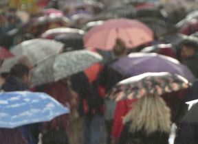
Met Office daily weather: Unsettled weather continues
Thursday will bring a continuation of unsettled conditions across the UK.
Thursday will bring a continuation of unsettled conditions across the UK. The far northwest, particularly northwest Scotland, will see the most active weather, with spells of rain and strong winds, potentially reaching gale or even severe gale force at times. These conditions may lead to some localised disruption, especially in exposed coastal and upland areas.
Elsewhere, the day will be characterised by a mix of sunshine and showers. These showers will be heavy at times, with a risk of hail and thunder, particularly in western regions where they will be most frequent. Eastern and southeastern parts of England will see the best of the brightness, with temperatures reaching 20-21°C. Further west, it will feel cooler, with highs of 15-17°C. Overall, temperatures will be near or slightly below the seasonal average.
Overnight, wet and windy conditions will persist across the far northwest. However, many central and eastern areas will become mainly dry, with clear spells developing. Showers will continue to affect western areas at times, carried in on a brisk westerly breeze.
There's the potential for some notably wet and windy weather later this weekend 🌧️🌬️
— Met Office (@metoffice) September 10, 2025
As models align on the forecast, there are a few scenarios that we're currently assessing
Stay up to date for the latest information pic.twitter.com/ZbSjZQMUb9
Outlook for Friday
Friday will remain breezy, with showers feeding into western coastal areas overnight and becoming more widespread through the day. Some of these showers will be heavy, with isolated thunderstorms possible. In places, showers may merge into more organised bands of rain, particularly across western and northern areas.
Winds will remain strong, with coastal gales possible, especially in the northwest. However, the more persistent rain and strongest winds affecting northwest Scotland should gradually ease through the day.
The driest and brightest conditions are expected in eastern parts of the UK, where sunny spells will develop between showers. Despite this, it will feel rather cool across the country, with temperatures continuing a little below average for the time of year.
Outlook for the weekend
The weather remains changeable heading into the weekend, with further showers and breezy conditions likely.
Met Office meteorologist Alex Burkill said: “Through Saturday, there'll be
some showery rain at times, maybe even something more persistent arriving later on from the west. But it's on Sunday when we're more likely to see the wetter, windier weather. Exactly what this low pressure does, there are still some question marks out there.
"It’s most likely going to deepen but stay towards the northwest of the UK, bringing some wet and windy weather particularly towards northwestern parts. There is the potential though, that it could run across the UK and it depends on how deep a feature it is when it does, as to exactly how unsettled the weather might be.”
Read more: Mist, fog, and haze: What's the difference?
Keep up to date with weather warnings, and you can find the latest forecast on our website, on YouTube, by following us on X and Facebook, as well as on our mobile app which is available for iPhone from the App store and for Android from the Google Play store.


