Visibility is a crucial aspect of weather forecasting, affecting everything from road safety to aviation and shipping.
Among the most common phenomena that reduce visibility are mist, fog and haze. While these terms are often used interchangeably, they refer to distinct atmospheric conditions.
Understanding the differences between them can help you interpret forecasts more accurately and appreciate the science behind our weather.
What is fog?
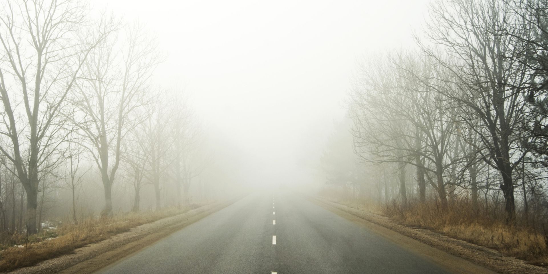
Fog is essentially a cloud at ground level that causes a reduction in visibility to less than 1,000 metres. It forms when tiny water droplets are suspended in the air, creating a thick, obscuring layer. Fog is defined in meteorological terms as ‘obscurity in the surface layers of the atmosphere, which is caused by a suspension of water droplets’. For aviation purposes, fog is the name given when visibility drops below 1 km, but for public forecasts, it generally refers to visibility less than 180 metres.
Fog can be particularly disruptive, especially when it becomes dense. Dense fog is when visibility falls below 100 metres, which can cause severe travel disruption. The thickest fogs tend to occur in industrial areas, where pollution particles in the air allow water droplets to coalesce and grow.
READ MORE: A look back at the 2024/25 storm season
How does fog form?
Fog, like clouds, is caused by tiny water droplets suspended in the air, but not all fog forms in the same way. There are several types of fog, each with its own formation process:
- Radiation fog: This type usually occurs in winter, aided by clear skies and calm conditions. Overnight, the land cools by thermal radiation, which in turn cools the air close to the surface. As the air cools, its ability to hold moisture decreases, leading to condensation and fog. Radiation fog typically dissipates soon after sunrise as the ground warms, except in high elevation areas where the sun has little influence .
- Valley fog: Valley fog forms when cold, dense air settles into the lower parts of a valley, condensing and forming fog. It is often the result of a temperature inversion, with warmer air passing above the valley. Valley fog is confined by local topography and can last for several days in calm winter conditions.
- Advection fog: Advection fog occurs when moist, warm air passes over a colder surface and is cooled. A common example is when a warm front passes over an area with snow cover, or at sea when moist tropical air moves over cooler waters. Sea fog can be transported over coastal land areas if the wind blows in the right direction.
- Upslope fog: Also known as hill fog, this forms when winds blow air up a slope (orographic uplift). As the air rises, it cools, allowing moisture to condense and form fog.
- Evaporation fog: This is caused by cold air passing over warmer water or moist land. It often leads to freezing fog or frost. When relatively warm water evaporates into low air layers, it warms the air, causing it to rise and mix with cooler air. The warm, moist air cools as it mixes, allowing condensation and fog to occur. Evaporation fog can be highly localised, such as when cold air moves over heated outdoor swimming pools or hot tubs, or when cool air masses move over warm seas in autumn.
What is mist?
Mist is similar to fog but less dense. It is defined as ‘when there is obscurity and the associated visibility is equal to or exceeds 1000 m'. Mist typically dissipates more quickly than fog and can disappear rapidly with even slight winds. It’s also what you see when you can see your breath on a cold day.
The key difference between mist and fog is the distance you can see through them. If visibility is less than 1,000 metres, it’s fog; if you can see further than 1,000 metres, it’s mist.
READ MORE: When does Autumn officially start?
What is haze?
Haze is a different phenomenon altogether. It is a suspension of extremely small, dry particles in the air, not water droplets. These particles are invisible to the naked eye but are sufficient to give the air an opalescent appearance. Haze can be caused by dust, smoke, or pollution and is often responsible for the reddish appearance of the sky at sunrise or sunset.
Unlike fog and mist, which are caused by water droplets, haze is made up of dry particles. These particles can travel long distances and affect air quality, visibility, and even the colour of the sky.
Keep up to date with weather warnings, and you can find the latest forecast on our website, on YouTube, by following us on X and Facebook, as well as on our mobile app which is available for iPhone from the App store and for Android from the Google Play store.