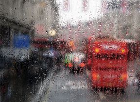
Unsettled May Bank Holiday weekend
As we head into the Bank Holiday weekend there is still some uncertainty around the exact details of the forecast.
The various computer models are disagreeing about the exact track an area of low pressure will take across the southern UK and therefore where will see the worst of any weather.
Currently an area of low pressure over central Europe is pushing a plume of warm air from the east across parts of the UK. This plume will be the focus for heavy showers and thunderstorms today. A yellow National Severe Weather Warning for thunderstorms covering much of central England and parts of Wales is in place until midnight tonight.
⚠️ Yellow weather warning issued ⚠️
— Met Office (@metoffice) May 2, 2024
Thunderstorms across parts of Wales, North West England, the Midlands, East Anglia and South East England
Today 1200 – 2359
Latest info 👉 https://t.co/QwDLMfRBfs
Stay #WeatherAware⚠️ pic.twitter.com/AWf6sZne7Q
It is a quieter picture further north, with Scotland staying largely dry, with plenty of sunshine and the maximum temperature reaching the low 20s Celsius in a few spots in the west whilst onshore winds will peg temperatures back along North Sea coasts. Tomorrow will remain unsettled with rain or showers for some. The risk of thunderstorms continues, but the risk is lower tomorrow with storms fewer in number and more isolated.
Bank Holiday weekend
Deputy Chief Meteorologist Mark Sidaway said: “There continues to be uncertainty around the track of a low-pressure system which is expected to cross the southern UK this weekend, meaning there is some uncertainty about some of the forecast details. While it will remain unsettled with further showers or longer spells of rain, all areas should see some drier conditions at some point and, in any sunshine, it should feel quite warm. But for the exact details for your area stay up to date with forecast over the coming days.”
You can find the latest forecast on our website, on YouTube by following us, on Twitter and Facebook, as well as on our mobile app which is available for iPhone from the App store and for Android from the Google Play store.
As we head through the second half of next week it looks like high pressure will start to build, potentially bringing a more settled, drier, period.


