Is the rain’s reign coming to an end?
Following seemingly incessant rainfall for many locations in the UK, there is a brief respite as colder conditions will temporarily take charge.
An Arctic Maritime air mass will gradually introduce colder conditions from the north of Scotland southwards during the rest of the working week. This shift in conditions will be accompanied by outbreaks of rain on Thursday and early Friday, turning increasingly to sleet and snow initially over higher levels but then to lower elevations too for a time.
Jason Kelly is a Met Office chief forecaster. He said: “Any settling snow will mainly be confined to high ground. Locations of above 200 metres in Scotland and northern England may see 2-5cm of snow, but those locations above 300 metres may see double those amounts, up to 10 cm.
“As the rain and snow clears south, temperatures will fall quickly under the clear skies which could lead to ice forming on untreated surfaces.”
Prospects of sunshine
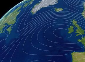
The forecast for Saturday suggests that high pressure will remain largely in charge of the conditions, leading to a rainless day for many with the prospect of sunshine.
From Sunday, there is an anticipated return to more Atlantic-dominated conditions as a weather front sweeps in from the west, bringing rain, strong winds and snow across some northern areas.
You can find the latest forecast on our website, on YouTube, by following us on X and Facebook, as well as on our mobile app which is available for iPhone from the App store and for Android from the Google Play store.


