Fine for many Christmas day, then unsettled – Dec'20
Author: Press Office
12:30 (UTC) on Mon 21 Dec 2020
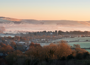
After an unsettled week we are expecting to see a cold frosty start to Christmas day before a return to wet and windy weather on Boxing Day.
National Severe Weather Warning
Heavier rain will affect parts of England and Wales on Wednesday when a Yellow national severe weather warning for rain has been issued covering the UK south of a line from mid Wales to the Wash.
Heavy rainfall
Met Office Chief Meteorologist Dan Suri said: “The heaviest rain is likely to develop during Wednesday afternoon and evening and continue overnight before clearing away south-eastwards by Thursday morning.
“Parts of East Anglia, the Midlands and Wales are likely to see 20-40 mm through this period and some places may see as much as 50-70 mm of rain. There will also be some strong winds during Wednesday evening and overnight.
Colder temperatures
“We expect temperatures to dip from the middle of the week as colder air moves down from the north across the country.”
Environment agency
Carol Holt, Flood Duty Manager at the Environment Agency, said: “Heavy and persistent rainfall could lead to surface water and river flooding in some communities in the south of England and parts of the south Midlands and East Anglia on Wednesday and Thursday.
“Environment Agency teams are out on the ground clearing grills and screens and operating flood defences as required. We urge people to keep away from swollen rivers and not to drive through flood water – it is often deeper than it looks and just 30cm of flowing water is enough to float your car.”
Check with the Enviroment Agency, Natural Resources Wales, Northern Ireland Direct or SEPA for information on the possible impacts of the rain in your area.
Christmas Eve
After early rain in the south Christmas Eve will be a dry day with sunny spells for many. Showers are expected for some coastal areas, more especially for North Sea coasts which could fleetingly turn to sleet or snow with the greatest chance of any accumulations over the North York Moors.
Christmas Day
An area of high pressure is expected to the west of the UK on Christmas Day bringing cold and generally dry conditions for most. After a cold, frosty start it will stay mainly dry with sunny periods. Coastal showers in the east should soon fade. Through the day cloud will increase from the northwest and could be thick enough for light rain or snow over higher ground in the north. Milder, more unsettled conditions will reach north-western parts of the UK before the end of the day.
Boxing Day
Saturday will see a return to unsettled weather with outbreaks of rain and showers in the northwest gradually spreading southwards accompanied by strong winds. Snow is likely over higher ground in Scotland.
The run up to New Year
It is expected to stay unsettled for the rest of the weekend and in the run up to New Year. Outbreaks of rain, heavy showers and strong winds are likely, and there is an increased chance of snow down to lower levels in places.
How often do we see a white Christmas in the UK?
Snow is synonymous with Christmas for many, but just how often do we see a white Christmas in the UK? Find out more here.
Stay connected
In the run up to, and during the Christmas period keep up to date with the latest forecast for your area using our forecast pages and by following us on Twitter and Facebook, as well as using our mobile app which is available for iPhone from the App store and for Android from the Google Play store.
Updated at 16:00 (UTC) on Tue 22 Dec 2020