Weather warnings in place for unsettled weekend
Author: Press Office
12:58 (UTC+1) on Fri 23 Jul 2021
This week’s heatwave conditions will be replaced with unsettled and thundery conditions for southern and central areas through the weekend, as several yellow weather warnings come into force.
Three warnings have been issued from Friday and into the weekend, affecting central and southern parts of England and Wales.
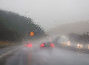
The warnings start with a yellow wind warning for the southern coastal counties of England, lasting from Friday afternoon until midnight on the same day. Strong northeasterly winds could gust up to 55mph, which is most likely on hills and exposed coastal areas in the warning region. This could lead to tricky driving conditions, especially for larger vehicles or those towing caravans.
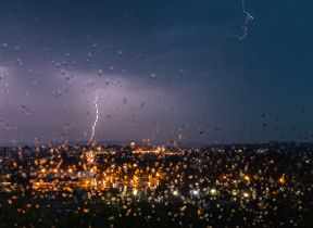
These winds precede the first of two yellow weather warnings for thunderstorms for the weekend, the first one starting at 20:00 on Friday night and lasting through to 22:00 on Saturday night. The focus for this warning is over southern England and Wales, although some central areas are also covered.
This area is likely to see frequent lightning, thundery rain and continued strong, gusty winds. There’s also a risk of large hail falling in a few locations and where heavy downpours occur, up to 35 mm could fall within an hour, bringing a possible risk of flooding.
The second yellow weather warning for thunderstorms shifts the focus away from the far southwest but still covers much of southern England, parts of central England and the far southeast of Wales. This warning runs from 09:00 Sunday morning through to midnight on the same day and carries a risk of heavy, thundery downpours. Some of the heaviest showers are expected in the southeast in the morning, before developing more widely across the warning area as the day goes on.
Rainfall amounts will vary considerably from place to place, but there is the potential for up to 80-100mm to build up in some locations over the course of the day. This brings with it a risk of flooding and some poor driving conditions with surface water likely on roads.
Met Office Principal Operational Meteorologist Frank Saunders said, “The warnings in place over the weekend show a marked shift in the weather pattern for many southern areas as low pressure moves in, with potential impacts for business and the public.
“This more unsettled weather brings a risk of torrential downpours and flooding in some places. However, areas further north will cling onto see some fine weather through the weekend, although not quite as hot as recently.”
The unsettled theme looks set to continue early next week, with the current forecast showing some more persistent rain for much of the UK.
View the latest forecast for the UK.
Find out how to stay safe in a storm.
Find out how to stay safe in thunder and lightning.
Get advice on travelling in adverse weather conditions.