Storm Isha has been named
Author: Press Office
10:00 (UTC) on Fri 19 Jan 2024
Storm Isha has been named by the Met Office, with strong winds for all from Sunday and heavy rain for some.
Cold Arctic air that has been dominating the UK in recent days is subsiding, replaced by an Atlantic influence which will bring a return to milder conditions, but also bring wet and windy weather across the UK on Sunday.
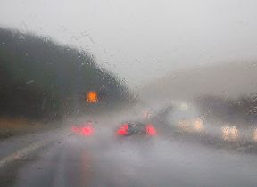
Amber and yellow severe weather warnings have been issued as Storm Isha approaches the UK on Sunday, in what will be a widely windy day for the UK. Many places are likely to see gusts of 50-60mph, even inland. Near coasts there will be widespread gusts of 60-70mph, possibly reaching 80 mph in a few places.
⚠️ Weather warnings for #StormIsha have been updated ⚠️
— Met Office (@metoffice) January 21, 2024
Latest info 👉https://t.co/QwDLMfRBfs
Here are the latest details 👇 pic.twitter.com/bMRIkFZR9r
Chief Meteorologist, Dan Suri, said: “Storm Isha will bring strong winds to the whole of the UK through Sunday and into Monday. The areas of particular concern are reflected by a large Amber severe weather warning which covers Northern Ireland, central and southern Scotland, Wales, much of northern England as well as southwestern parts of England.
“In these regions we could see gusts frequently between 50-60mph and even up to 80mph in exposed coastal locations. As the storm starts to move away on Monday morning very strong winds will also develop in the far southeast of England, bringing the risk of 70-80mph gusts here too in the early hours of Monday morning.
“Storm Isha will bring a disruptive spell of weather to the UK with strong winds across the whole country. Heavy rain will cause additional hazards, particularly in the west. A number of severe weather warnings for rain have also been issued. Keep up to date with the Met Office warnings and pay close attention to guidance from your local authority.”
Warnings highlight the possibility of travel disruption, power cuts and dangerous conditions near the coast with high waves and flying debris. A spokesperson for Energy Networks Association, which represents Britain's energy network operators, said: "An amber warning brings an increased risk of damage to homes and vital infrastructure. Energy network operators are preparing to deal with any damage quickly and safely.
"With severe weather forecast, our advice to customers is to prepare, care and share. Prepare by going online to PowerCut105.com for advice and call 105 for free if you have a power cut. Check in with people who might need extra help, and share this information so friends and family know what to do too.
"If you see damaged power lines or lines brought down over the coming days, stay well clear and call 105 for free to report it, or dial 999 if there’s an immediate danger to life."
Next week
The winds will gradually ease through the day on Monday. Overnight into Tuesday will be a calmer interlude for most, with lighter winds and fewer showers in the north for a time. This does not last for long, however, as low pressure brings further wet and windy weather from the west on Tuesday morning, spreading eastwards across the UK though the day.
Further into next week there are signs that conditions will settle down in the south, with any wet and windy weather becoming more confined to the northwest of the UK. Temperatures are expected to remain mild for the time of year.
You can keep up to date with the latest forecast on our website, by following us on Twitter and Facebook, as well as on our mobile app which is available for iPhone from the App store and for Android from the Google Play store.