
UK Climate Resilience Programme urban climate services
Urban climate services developed by the UK Climate Resilience Programme that ran from 2019 to 2023
As part of the UK Climate Resilience Programme - Climate Services Pilots project, the Met Office worked with stakeholders and end-users to develop and evaluate a number of pilot urban climate services to ensure the research was useful and useable.
City Packs
We developed City Packs using the latest UK Climate Projections (UKCP) data to provide high-level, non technical local summaries of the future climate of UK cities and regions. They use graphics and tables to communicate scientific research in an accessible way, providing robust climate information to help urban decision makers plan for the future, enabling cities to become more resilient to climate change.
Our first City Pack was co-developed with Bristol City Council in 2020. It resulted in the co-delivery of three non-technical factsheets explaining how the climate of Bristol may change over the rest of 21st Century.
The infographic (below) illustrates the lifecycle of the City Pack project, from our initial engagement with Bristol City Council to the ongoing expansion of the City Packs for other UK cities.
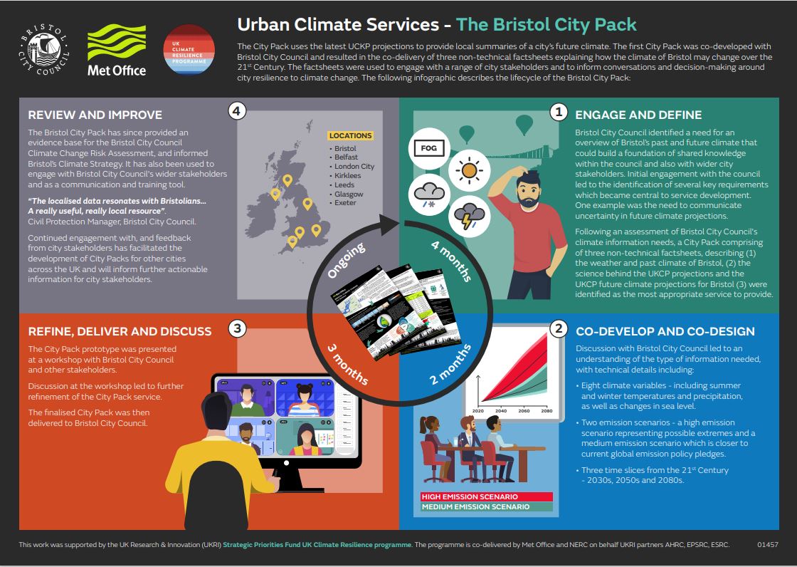
Download the Bristol city pack lifecycle infographic (PDF document)
We published the following City Packs in August 2022:
- Barnsley City Pack, working with Bristol City Council
- Belfast City Pack, working with Belfast City Council and Climate Northern Ireland.
- Bristol City Pack, working with Bristol City Council
- Cardiff City Pack, working with Cardiff University
- Exeter City Pack, working with Exeter City council and Devon County Council
- Glasgow City Pack, working with Glasgow City Council via Climate Ready Clyde
- Hull City Pack, working with Hull University
- Kirklees City Pack, working with Kirklees Climate Commission
- Leeds City Pack, working with Leeds City Council via iCASP
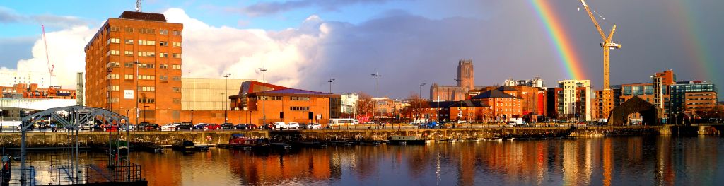
- Liverpool City Pack
- London City Pack, working with City of London Corporation
- Manchester City Pack, working with Manchester Climate Change Agency
- Newcastle City Pack
- Newry City Pack, working with Newry, Mourne and Down District Council
- Reading City Pack, working with Reading Borough Council
- Sheffield City Pack, working with Sheffield City Council
- Torbay City Pack, working with Torbay Council
- Warwick and Southam City Pack, working with Warwick District Council
- West Dunbartonshire City Pack, working with West Dunbartonshire Council
- West Midlands City Pack, working with West Midlands Combined Authority.
We also produced this document to show how our City Packs were being used.
Please note in October 2024 our new Local Authority Climate Service superseded the City Packs.
Urban Heat Service
Cities can be impacted by a range of weather and climate hazards including extreme heat, heavy rainfall and sea level rise. Our Heat Packs (factsheets) provide information on how extreme heat events in selected cities may change this century due to climate change, the impacts, and how to build resilience to extreme heat.
We produced Heat Packs for the following cities:
- Bristol Heat Pack working with Bristol City Council
- Belfast Heat Pack working with Belfast City Council and Climate Northern Ireland
- Hull Heat Pack
- Manchester Heat Pack working with Manchester City Council, Manchester Climate Change Agency and Manchester Metropolitan University.
Additionally, we combined climate information about extreme heat events with socio-economic data to understand future heat risks in UK cities. This work is demonstrated through ArcGIS Storymaps for the following cities:
- Belfast Heat Risk Storymap - working with Belfast City Council and Climate Northern Ireland
- Hull Heat Risk Storymap
- Manchester Heat Risk Storymap working with Manchester City Council, Manchester Climate Change Agency and Manchester Metropolitan University.