Improvements to the UK ensemble
Research news article published in March 2019.
In the latest release of our operational Numerical Weather Prediction (NWP) models, the convection-permitting UK ensemble prediction system (MOGREPS-UK) was updated from a 6-hourly to an hourly-cycling configuration.
Parallel Suite 42 (PS42)
This month saw the latest updates to our suite of NWP models, which were tested during PS42. This Research News article focuses on the changes made to our UK convection-permitting ensemble, MOGREPS-UK. The updated UK ensemble system now issues forecasts every hour, thus delivering the latest predictions in a more timely manner to our forecasters and customers.
Improved ensemble spread through time-lagging
One of the main scientific advantages of this new configuration is an improved indication of the range of possible future states of the atmosphere - an increase in the ‘spread’ between the members. The ensemble now consists of a collection of 18 members which start at 6 different initial forecast times and receive boundary conditions from different cycles of the driving global ensemble, MOGREPS-G. This approach is known as ‘time-lagging’. In this way, spread between members comes from perturbations on small scales (through the different start times and initial conditions derived from our high-resolution deterministic UKV model), as well as on large scales (through the different boundary conditions and initial-condition perturbations from MOGREPS-G).
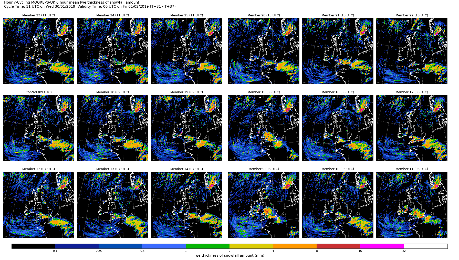
Forecast example
An example of the spread from the new ensemble is illustrated here for the forecast of snow amount in the 6 hours up to midnight on 31st January 2019. Each individual map represents one of the time-lagged ensemble members.
Hourly updates
Producing forecasts every hour also allows us to follow more closely the spatial development of showers and other high-impact weather events such as snow or fog. This estimation of uncertainty in the forecast is particularly useful in the short-range where the initial conditions still have a significant impact on the forecasts and where the model takes time to realistically capture the behaviour of physical processes such as convection and turbulence.
The characteristics of the new configuration were studied in detail through objective verification for a range of parameters and different weather conditions. Overall, the new configuration is better than the old 6-hourly one. However, the change in forecast quality varies with the parameters: precipitation and visibility are improved in the short-range while temperature, in which errors grow rapidly, may show a slight degradation in the first few hours.
Extended forecast lead time
MOGREPS-UK has also been updated to run forecasts out to 120 hours ahead, compared to 54 hours previously. The main benefit is to improve the longer-range weather warnings for high-impact weather. Compared to its global parent MOGREPS-G, the forecasts from MOGREPS-UK should add structure and detail due to the higher resolution.
New diagnostics
Finally, the new configuration gives us the opportunity to develop new diagnostics for our scientists, forecasters and customers. Scientists will continue to work with operational meteorologists to help develop these additional diagnostics, to help us truly exploit the capability offered by the new system.