

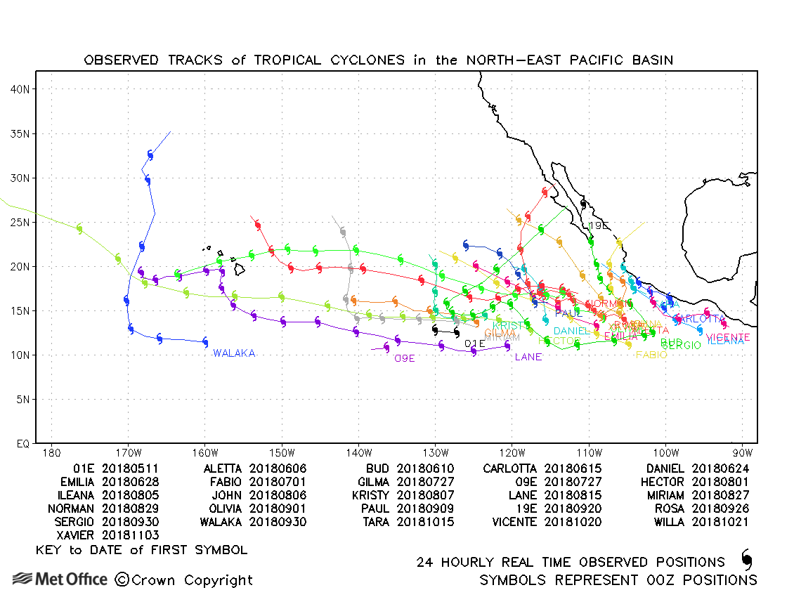
Observed and forecast tracks: northern hemisphere 2018
All tropical cyclones in the northern hemisphere season in 2018 are listed below including details of their start and end dates, lowest central pressure and maximum sustained wind (MSW).
Click on the name of the tropical cyclone to see a chart of the observed track and forecast tracks from the Met Office global model. Verification statistics on each tropical cyclone are available upon request from [email protected]. At the end of the season a verification report on the performance of the Met Office global model will be published.
| Name & ID | Start & end dates | Central pressure, 1-/10-minute MSW | Comments on Met Office global model forecasts |
|---|---|---|---|
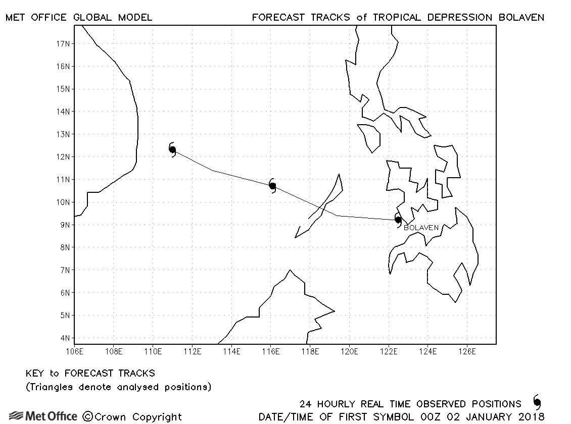
| Bolaven (01W) | 01-04 January | 1000 mb, 30/35 knots | Bolaven briefly attained tropical storm status according to JMA only. No forecasts were verified. |
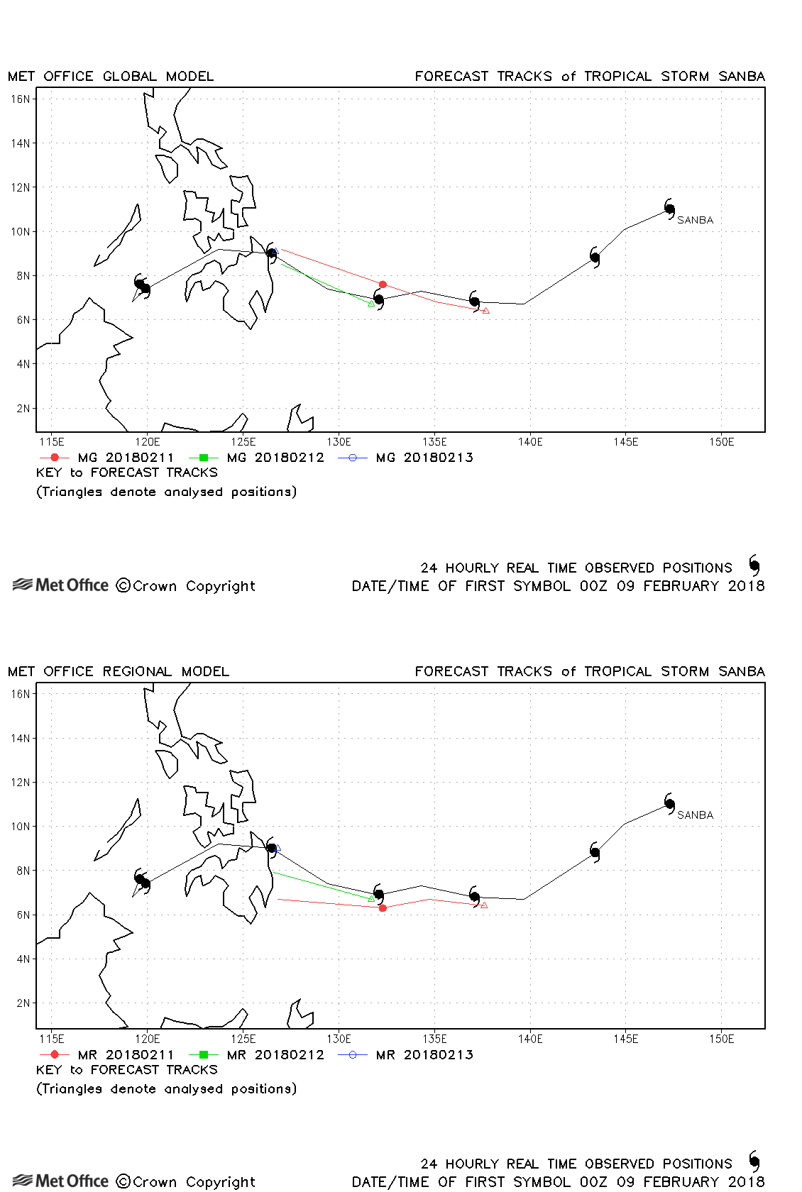
| Sanba (02W) | 08-15 February | 1002 mb, 55/35 knots | Sanba was active for just a couple of days and track forecast errors were low. |
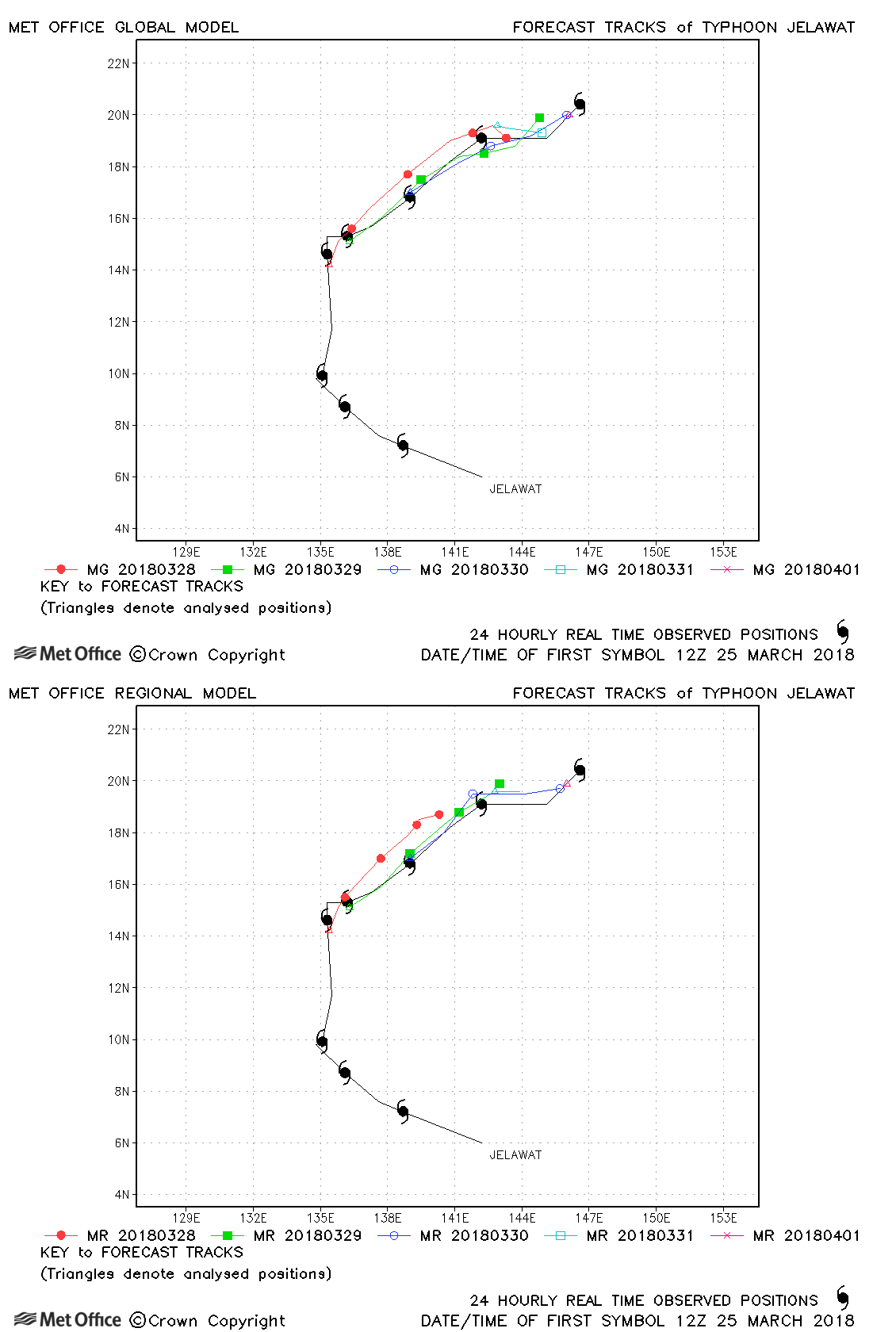
| Jelawat (03W) | 24 March-01 April | 935 mb, 130/90 knots | Track forecast errors were below last season's average for this typhoon. |
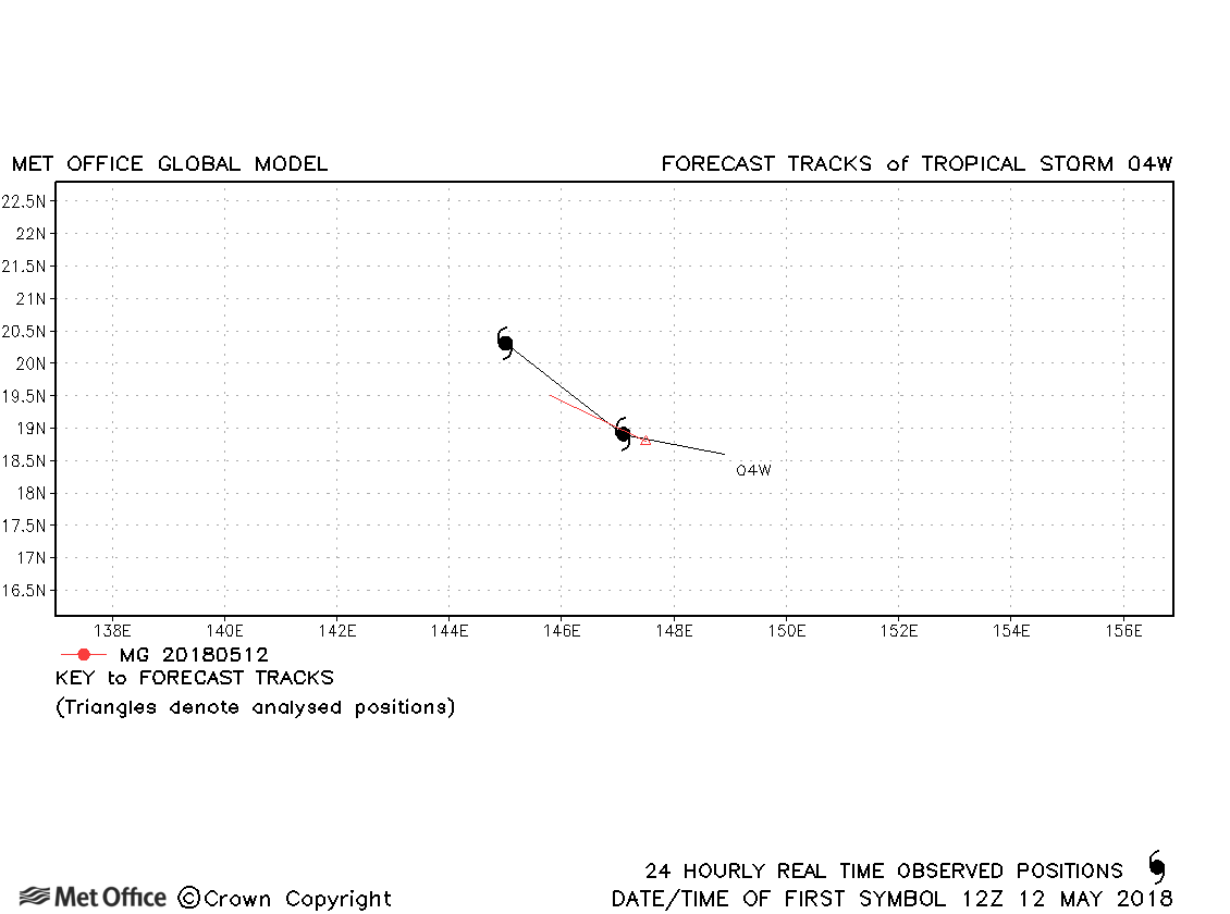
| 04W | 12-13 May | 1004 mb, 35/30 knots | 04W was only briefly a tropical storm according to JTWC and only one forecast was verified. |
| Ewiniar (05W) | 02-08 June | 998 mb, 35/35 knots | Ewiniar was only briefly a tropical storm and few forecasts were verified. |
| Maliksi (06W) | 07-11 June | 970 mb, 60/65 knots | There was a slow bias in forecasts resulting in track forecast errors slightly above last season's average. |
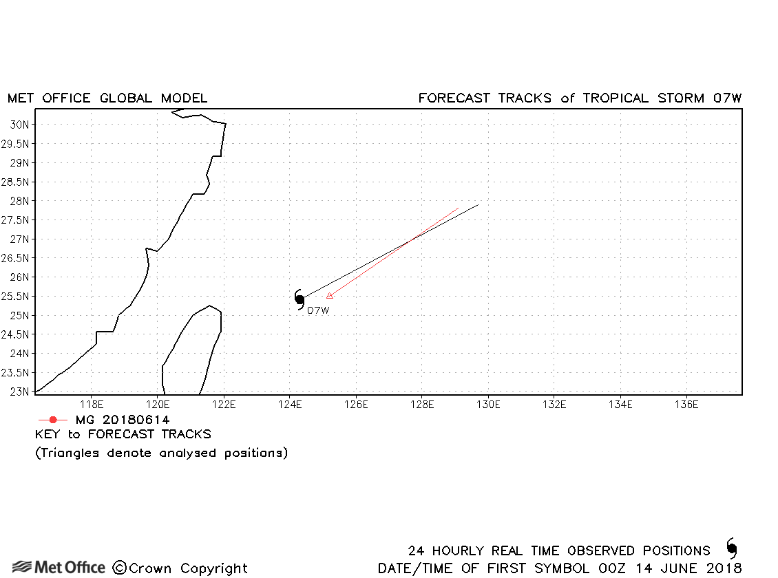
| 07W | 13-14 June | 991 mb, 35/30 knots | 07W was only briefly a tropical storm according to JTWC and few forecasts were verified. |
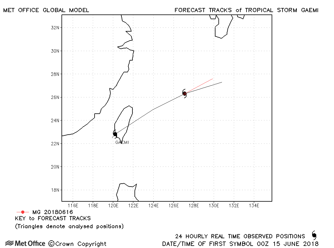
| Gaemi (08W) | 14-16 June | 990 mb, 35/45 knots | Gaemi was only briefly a tropical storm and few forecasts were verified. |
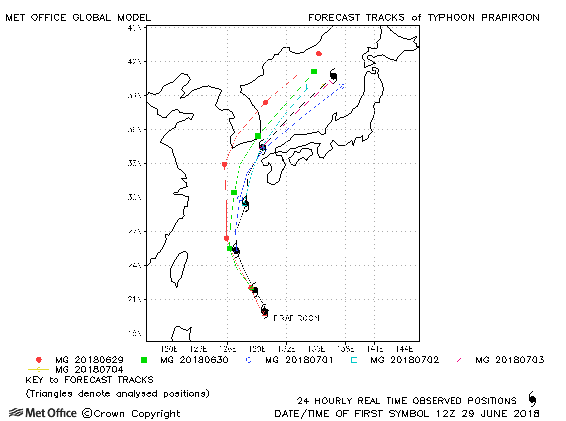
| Prapiroon (09W) | 28 June-04 July | 960 mb, 75/65 knots | Track forecast errors were mostly a little above last season's average due to a left-of-track bias. |
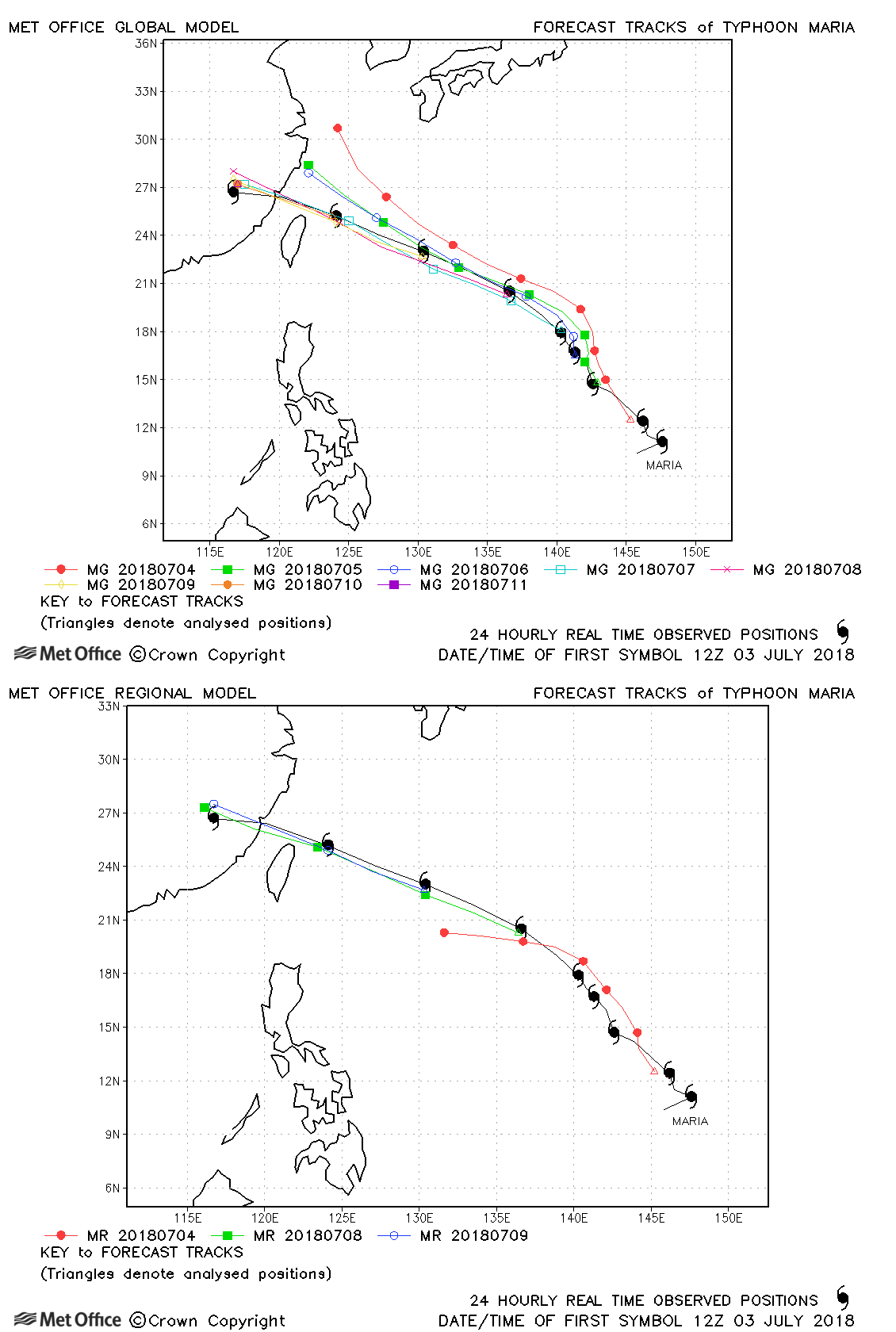
| Maria (10W) | 02-11 July | 915 mb, 140/105 knots | Track forecast errors were mostly near to last season's average, although high at long lead times due to a right-of-track bias. |
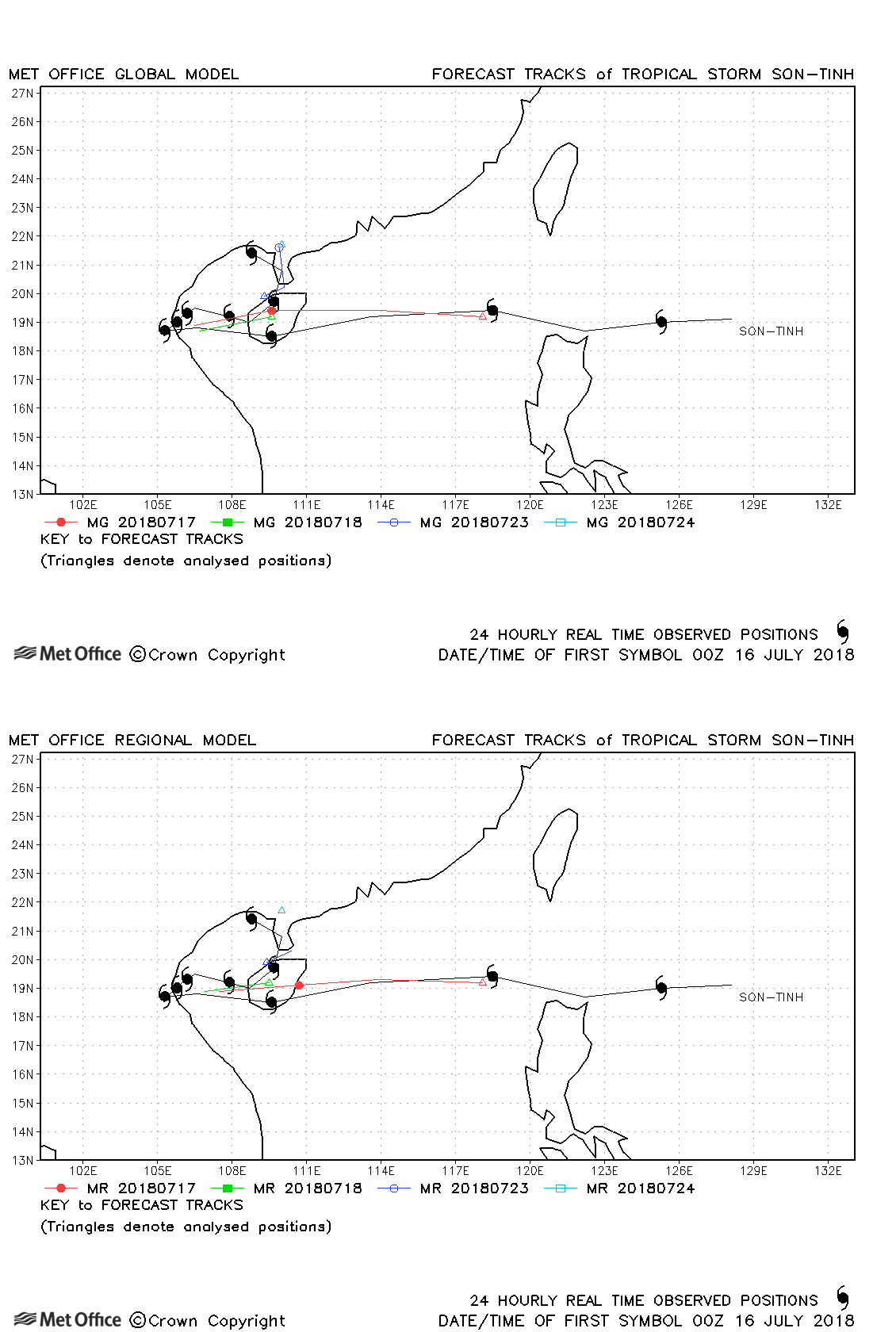
| Son-tinh (11W) | 15-24 July | 994 mb, 40/40 knots | Track forecasts for Ampil had a left-of-track bias resulting in track forecast errors above last season's average |
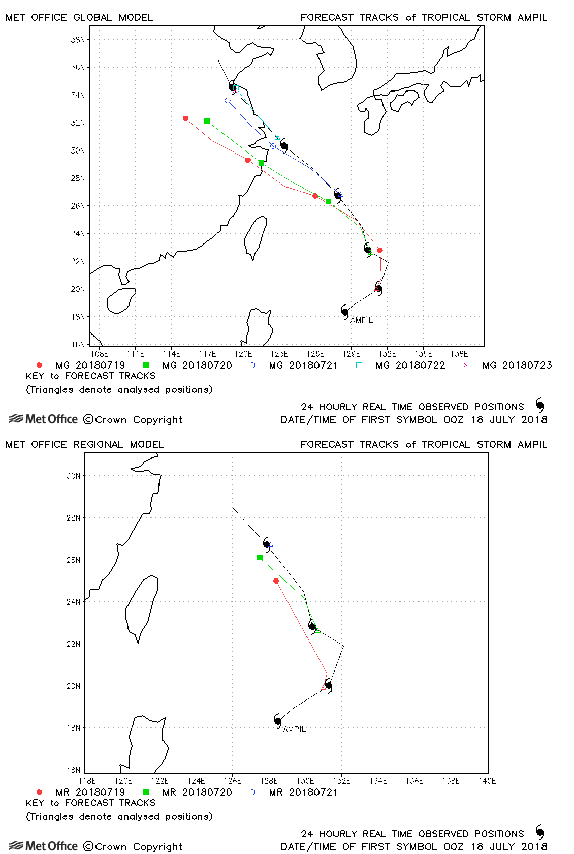
| Ampil (12W) | 17-23 July | 985 mb, 50/50 knots | Track forecasts for Ampil had a left-of-track bias resulting in track forecast errors above last season's average |
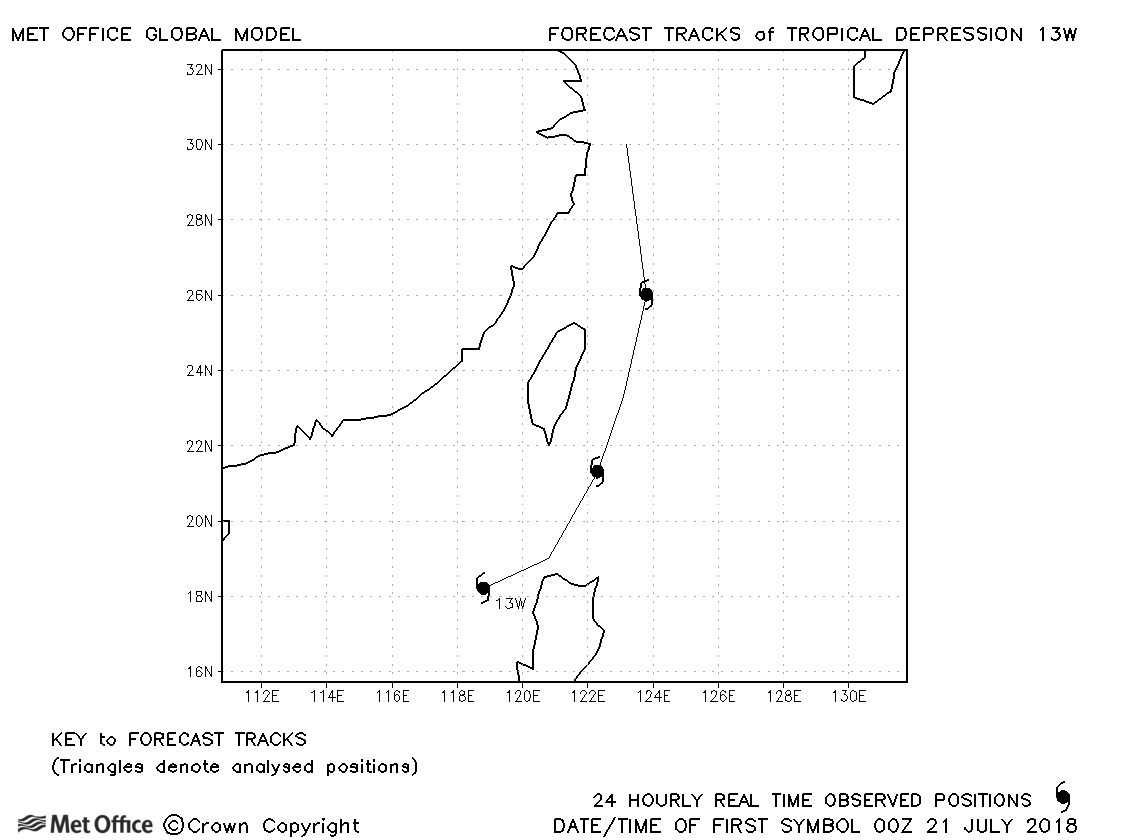
| 13W | 20-23 July | 996 mb, 30/30 knots | No forecasts were verified for this depression. |
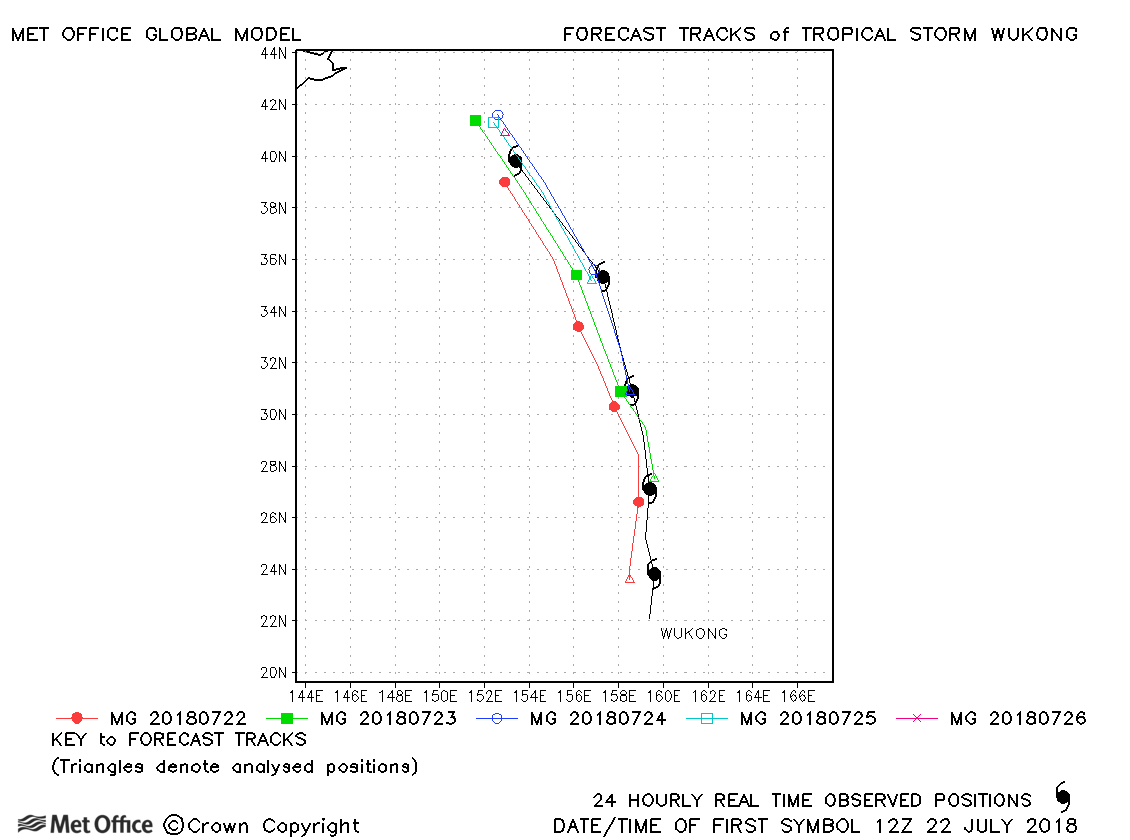
| Wukong (14W) | 21-26 July | 990 mb, 65/50 knots | Track forecast errors were mostly close to last season's average. There were no significant biases. |
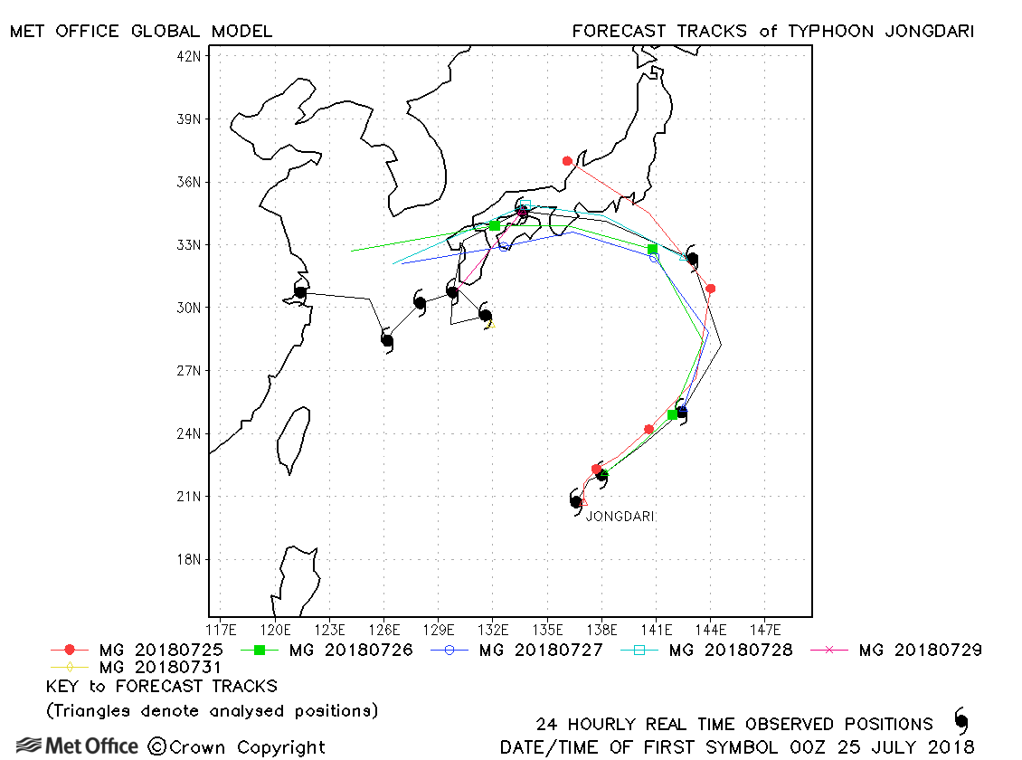
| Jongdari (15W) | 22 July-03 August | 965 mb, 95/75 knots | Track forecast errors were mostly higher than last season's average due to a slow bias. |
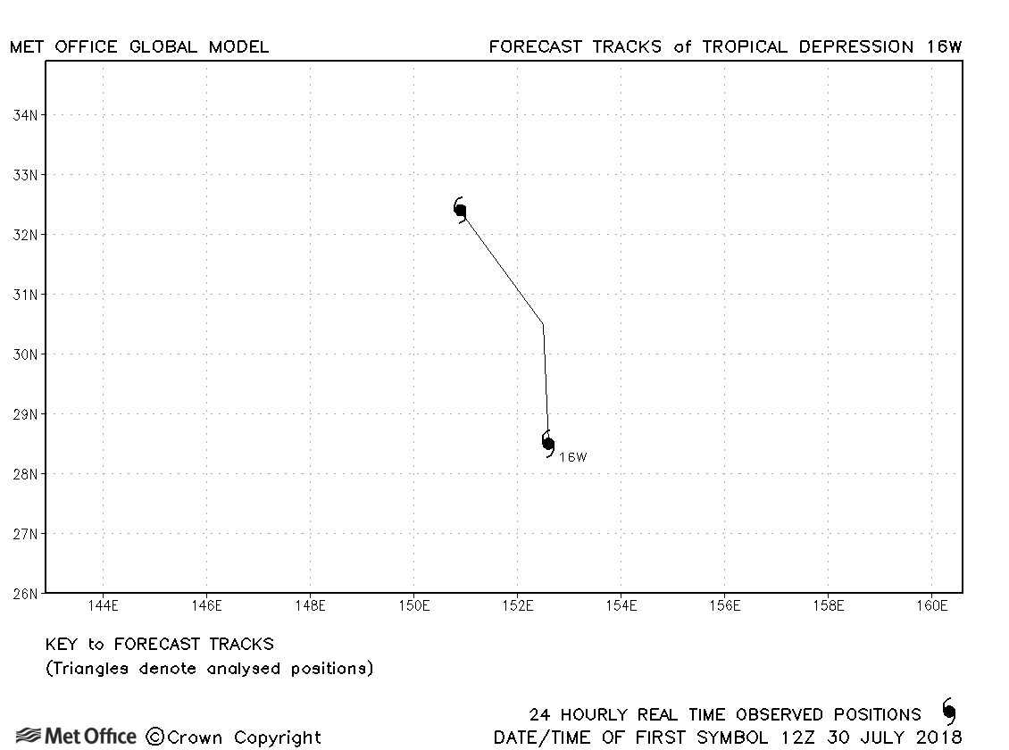
| 16W | 30-31 July | 995 mb, 30/30 knots | No forecasts were verifieid for thsi tropical depression. |
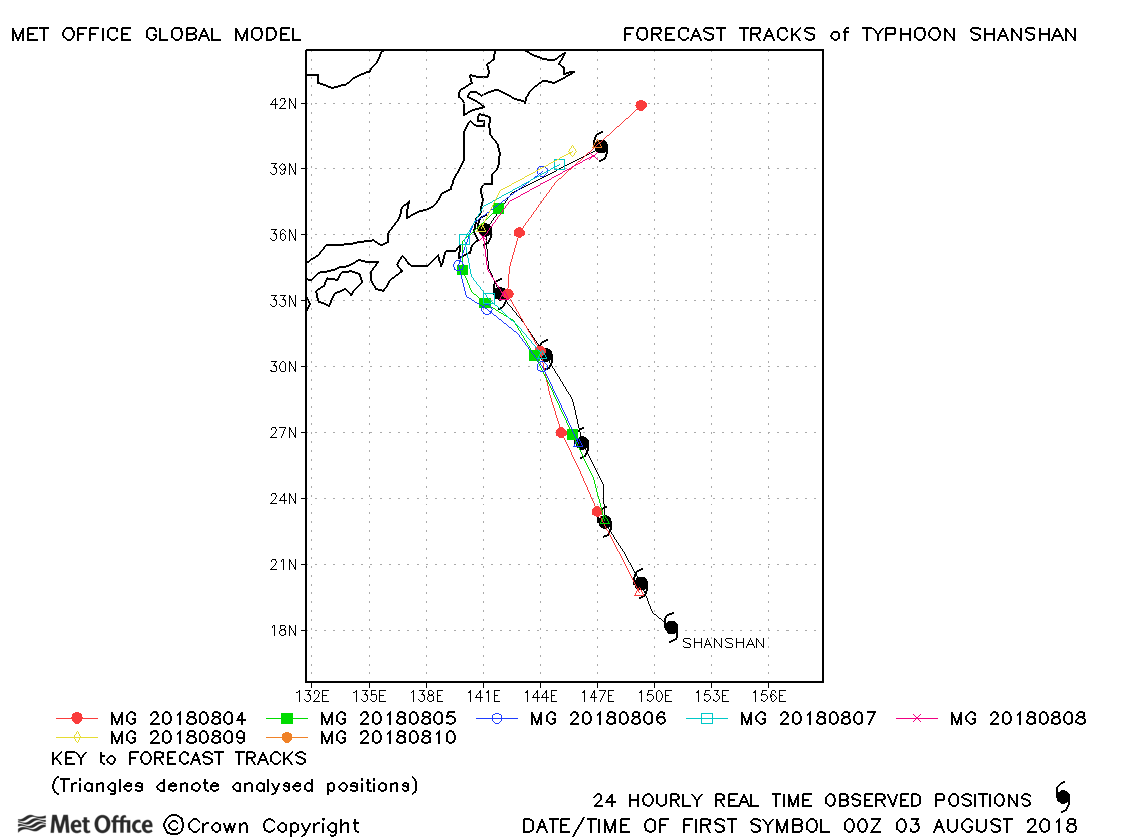
| Shanshan (17W) | 02-10 August | 970 mb, 90/70 knots | Track forecast errors were mostly lower than last season's average for this typhoon. Skill scores were high. |
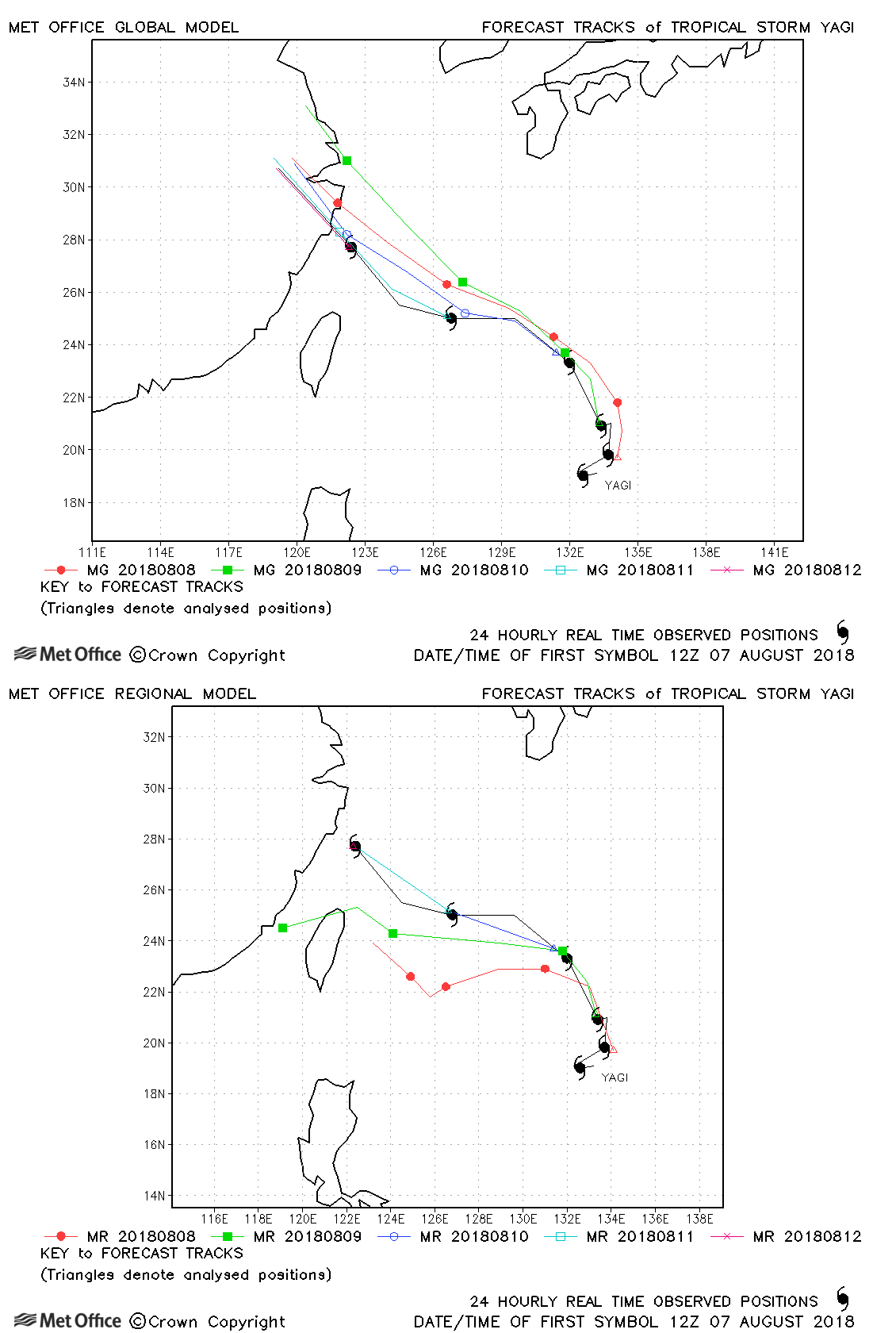
| Yagi (18W) | 06-13 August | 990 mb, 40/40 knots | There was a right-of-track bias in forecasts resulting in errors above last season's average. |
| Leepi (19W) | 11-15 August | 994 mb, 65/50 knots | Forecast tracks were too fast and too far to the left of track. |
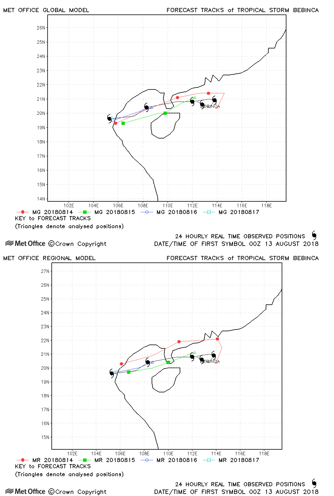
| Bebinca (20W) | 12-17 August | 980 mb, 60/50 knots | Track forecast errors were mostly below last season's average. |
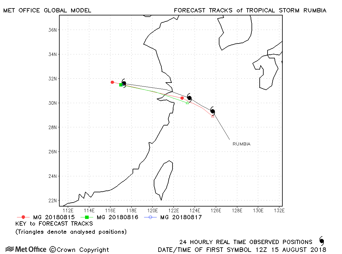
| Rumbia (21W) | 15-17 August | 985 mb, 50/45 knots | Track forecast errors were near last season's average. |
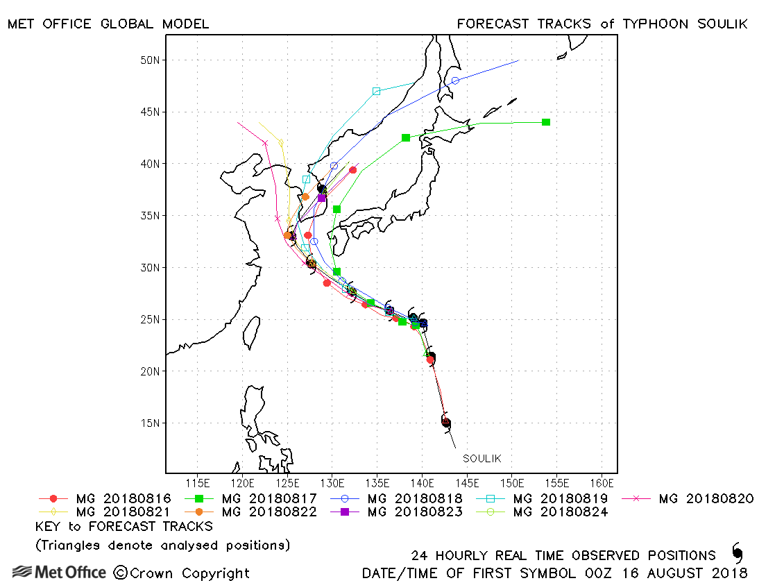
| Soulik (22W) | 15-24 August | 950 mb, 105/85 knots | There was a large disparity in forecast track direction and speed at higher latitude resulting in some large errors. |
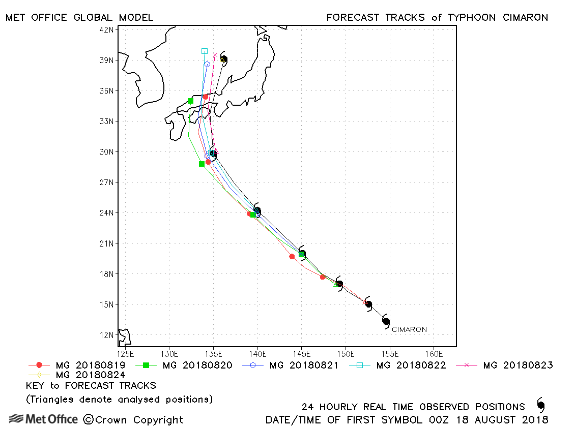
| Cimaron (23W) | 17-24 August | 950 mb, 110/85 knots | Track forecast errors were mostly close to last season's average. |
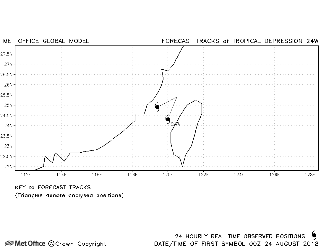
| 24W | 23-25 August | 995 mb, 30/- knots | No forecasts were verified. |
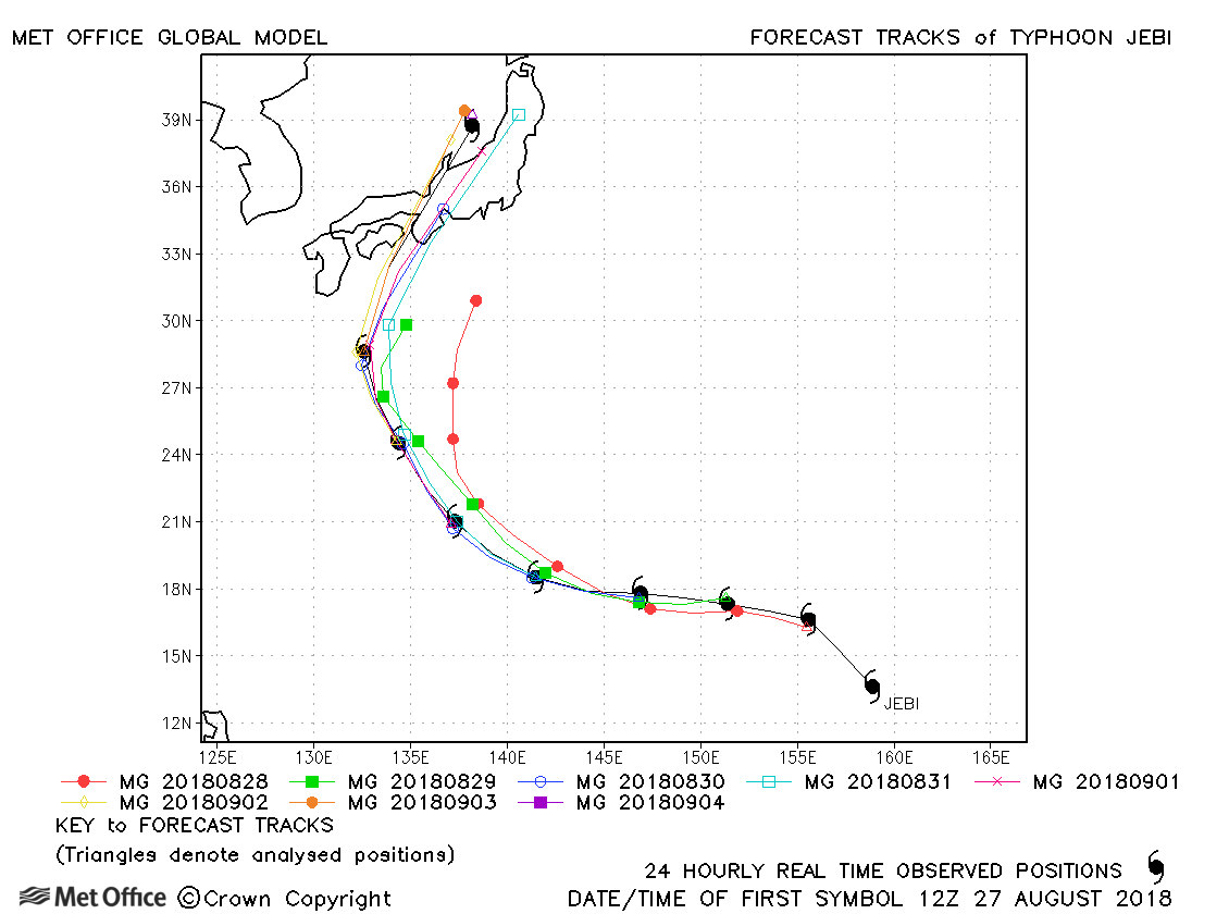
| Jebi (25W) | 27 August - 04 September | 915 mb, 150/105 knots | Track forecast errors were low for this typhoon, except at the longest lead times. |
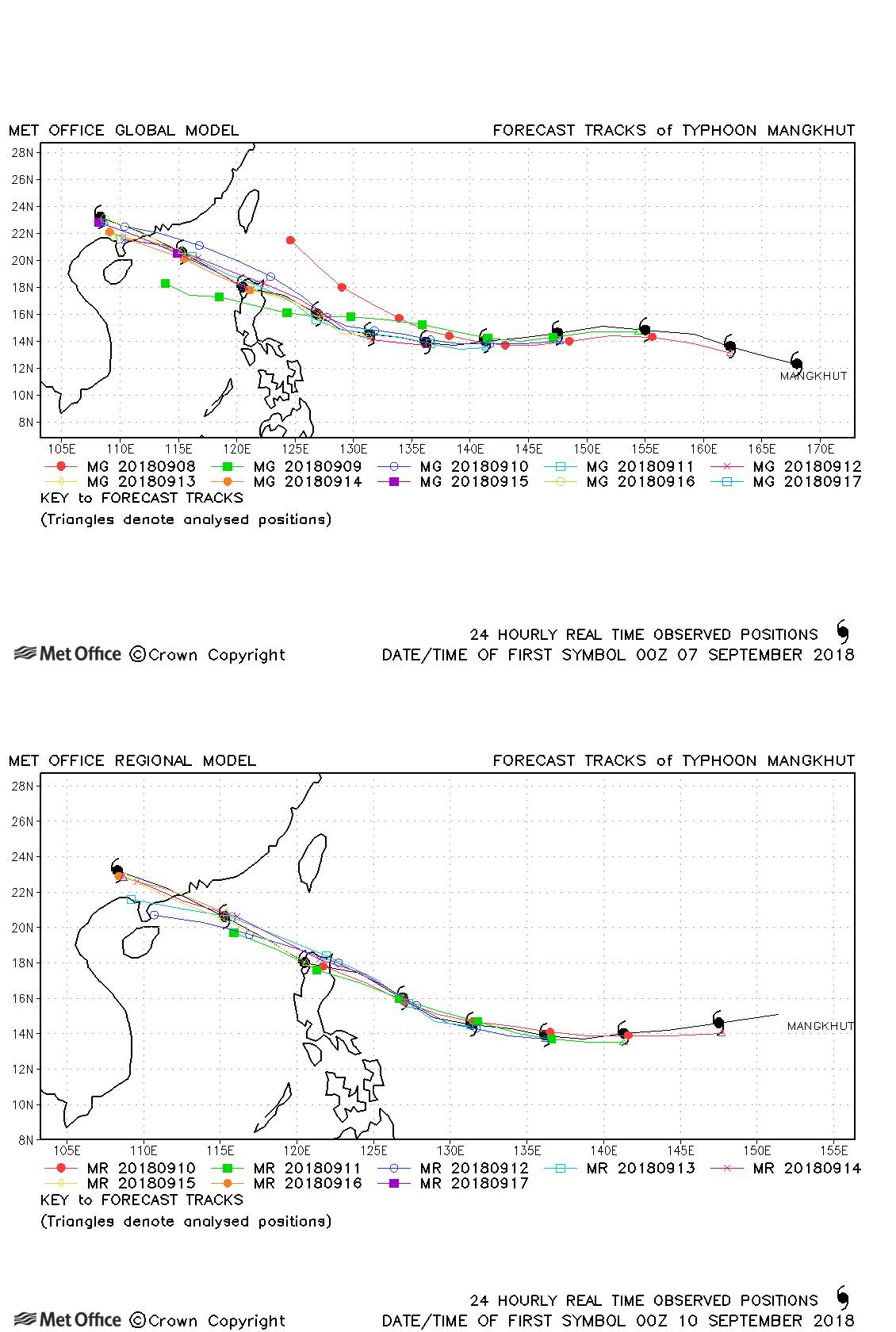
| Mangkhut (26W) | 07-17 September | 905 mb, 155/110 knots | Track forecast errors were well below last season's average for this typhoon. Landfall over the northern Philippines was signalled well in advance. |
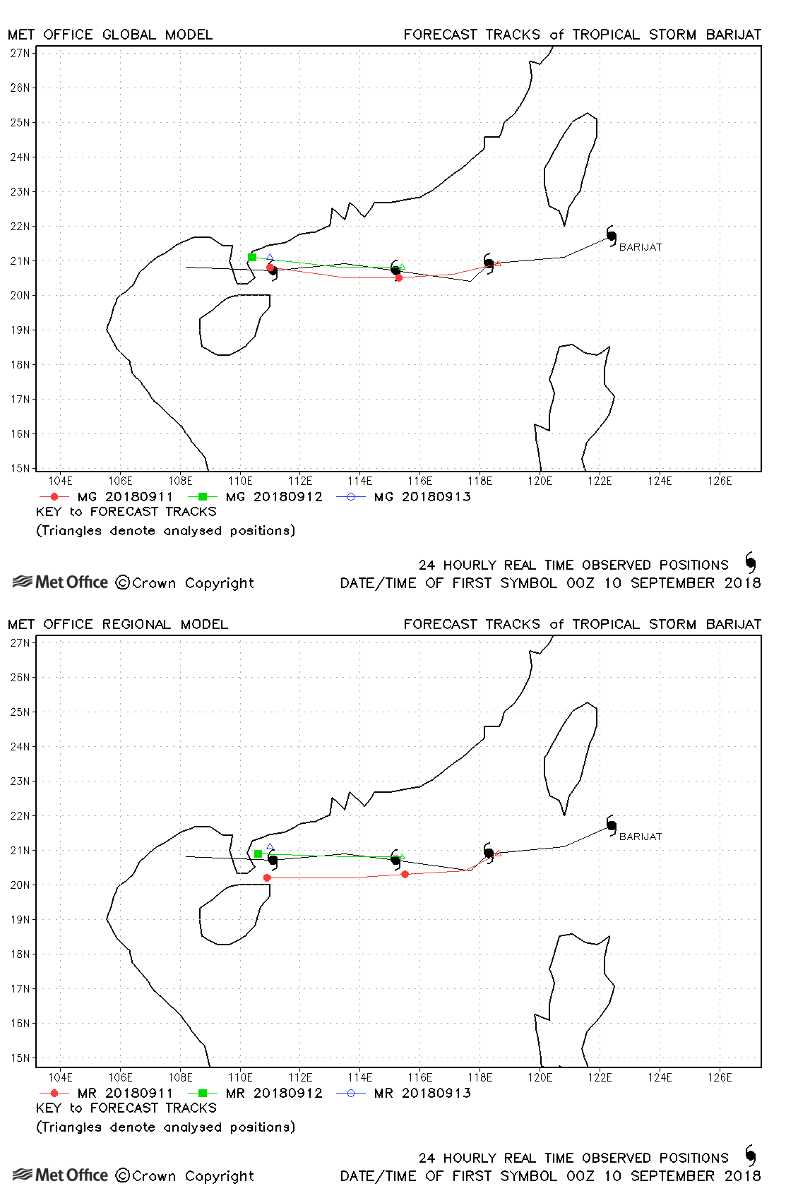
| Barijat (27W) | 09-13 September | 998 mb, 40/40 knots | Track forecast errors were low for Barijat. |
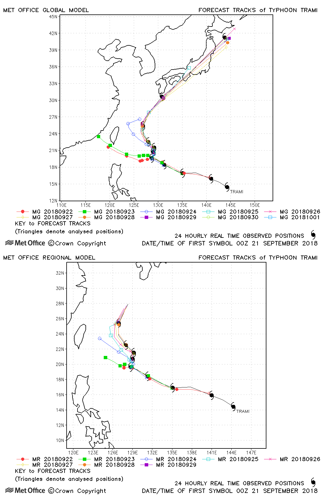
| Trami (28W) | 20 September - 01 October | 915 mb, 140/105 knots | Track forecast errors were low for Barijat. |
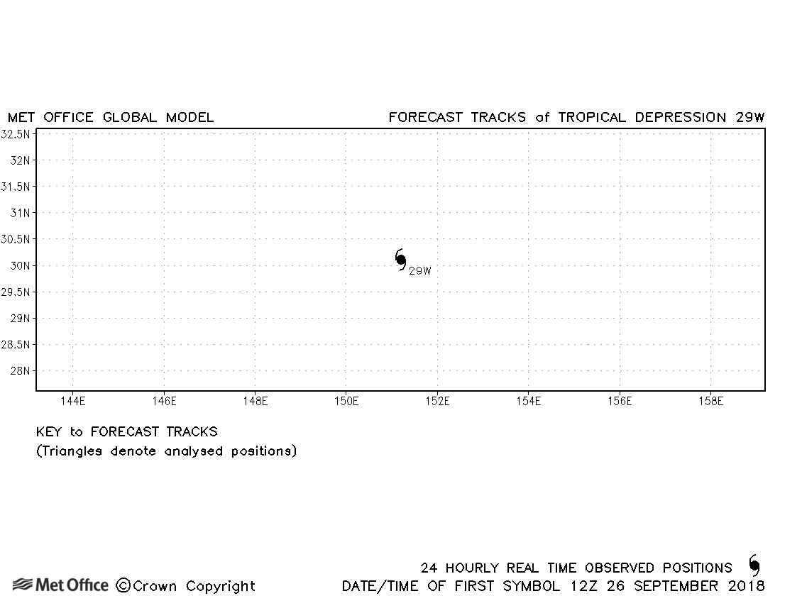
| 29W | 26 September | 1001 mb, 30/- knots | No forecasts were verified for this depression. |
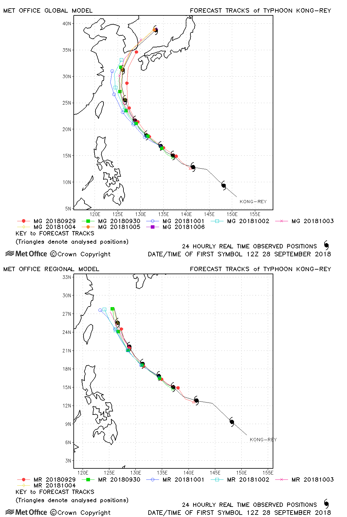
| Kong-rey (30W) | 27 September - 06 October | 915 mb, 140/105 knots | Although the direction of motion was well rpedicted, there was a slow bias in forecasts resulting in track forecast errors above last season's average for forecasts beyond three days. |
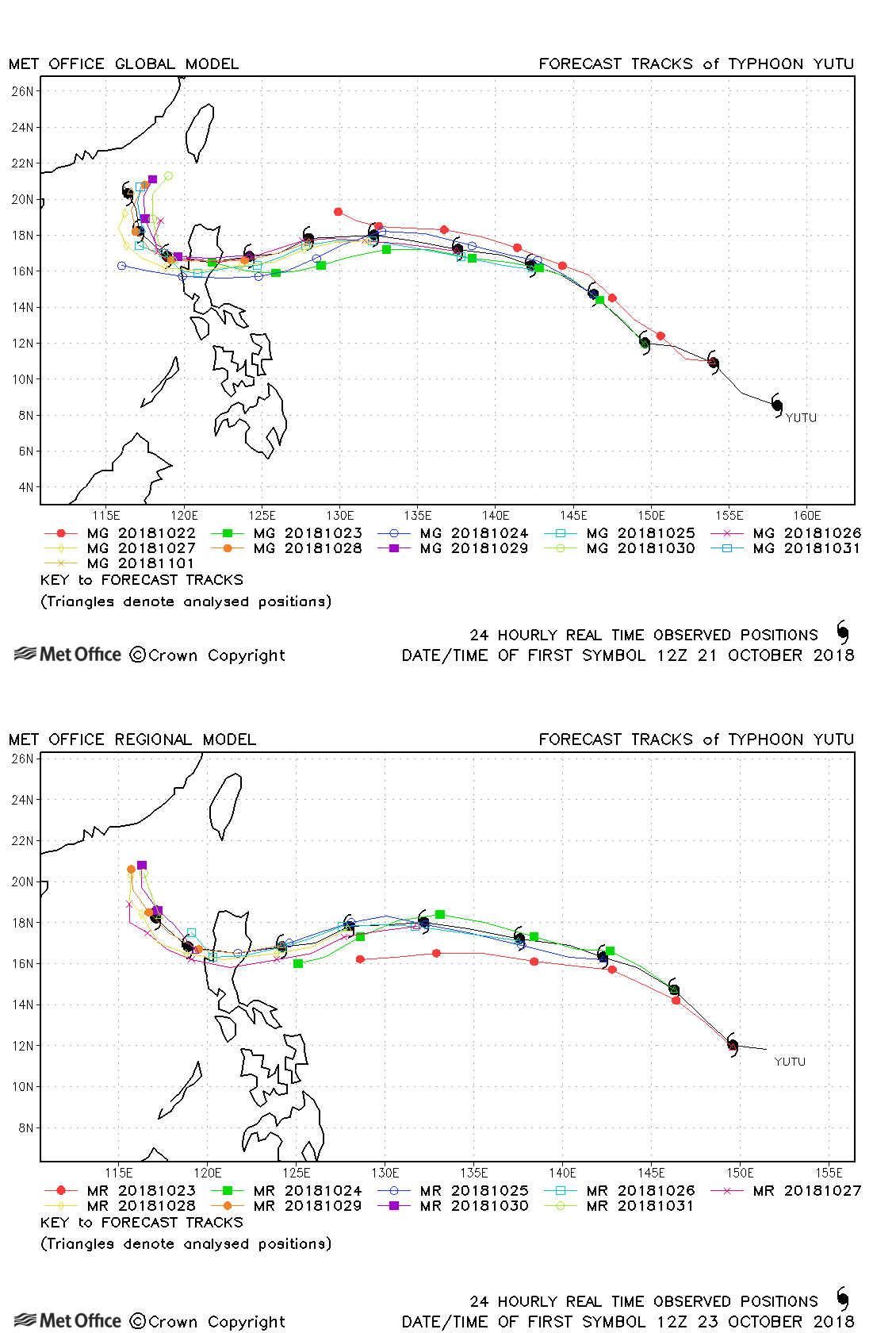
| Yutu (31W) | 21 October-02 November | 915 mb, 140/105 knots | Track forecasts for Yutu were very good and much better than other models early in the typhoon's life when other models incorrectly predicted a northwestwards turn. Skill scores were very high and the landfall over the Philippines was predicted a full seven days before it occurred (as far ahead as the Met Office global model runs). |
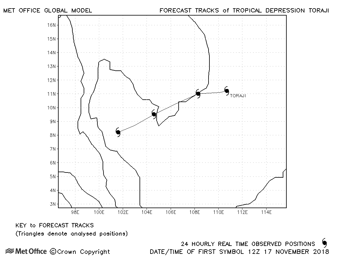
| 17-20 November | 1004 mb, 30/35 knots |
Toraji was only briefly a tropical storm according to JMA and no forecasts were verified. |
|
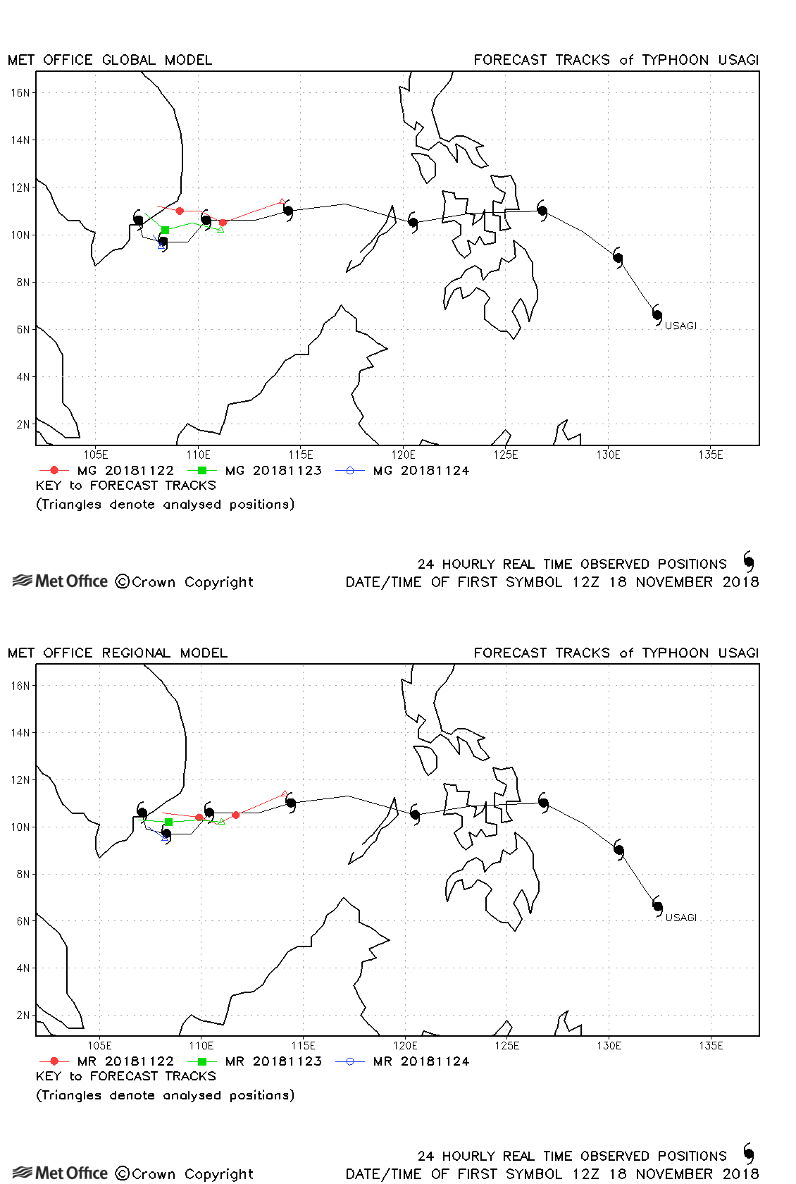
| 18-25 November | 975 mb, 70/65 knots |
Track forecast errors were a little above last season's average. |
|
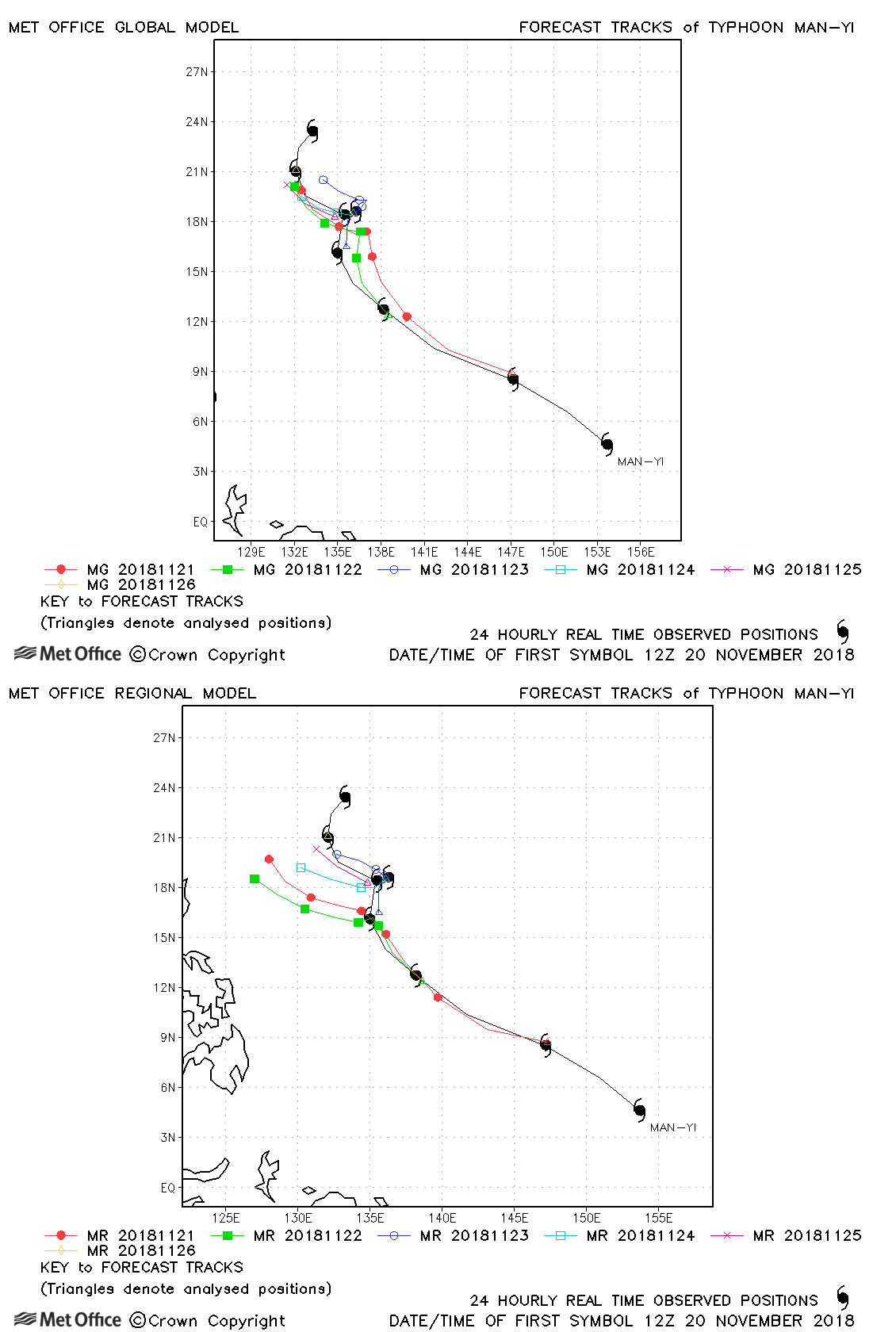
| 19-27 November | 955 mb, 90/80 knots |
Global model track errors were high at short lead times, but lower than average at long lead times. The stalling in motion was well predicted. The SE Asia model had more of a westwards bias. |
|
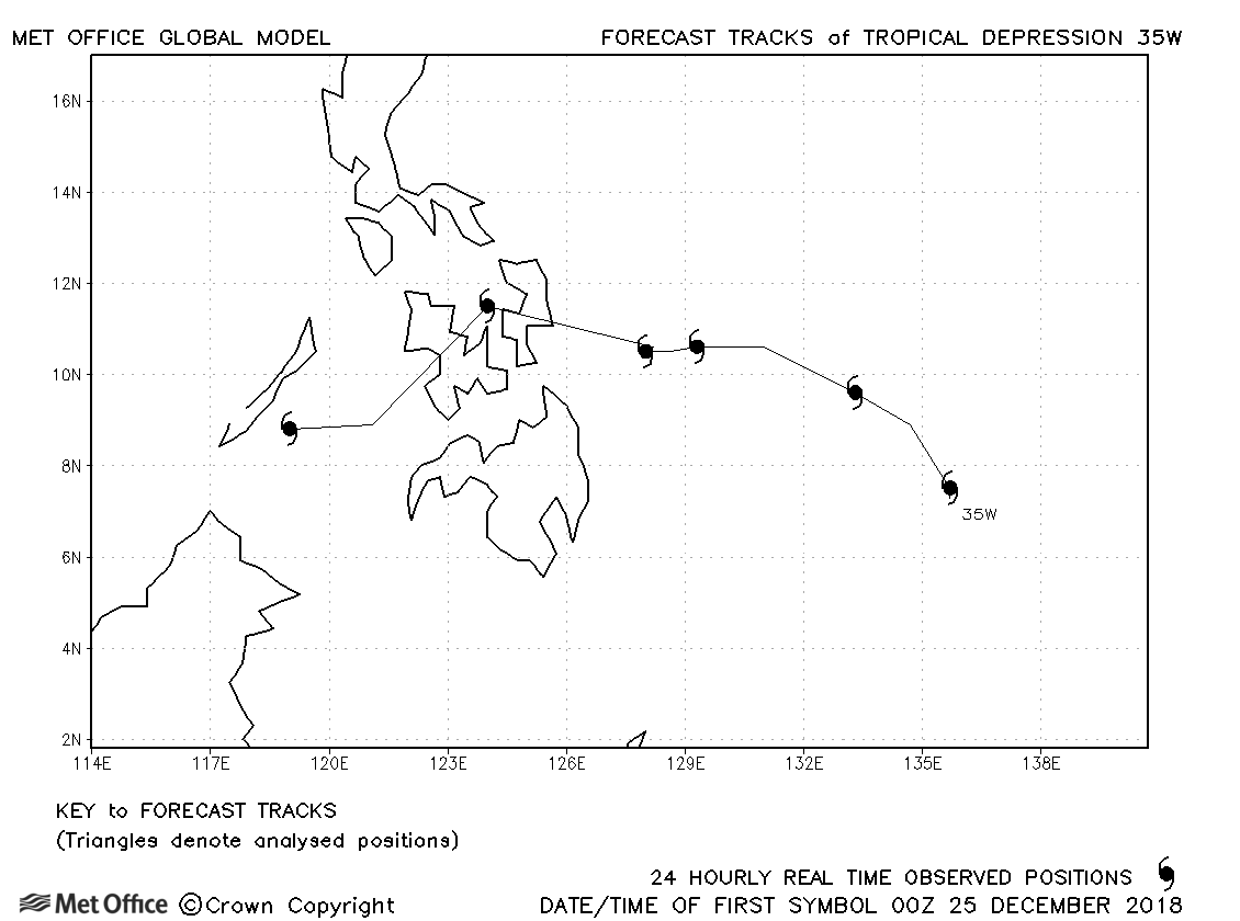
| 24-30 December | 1000 mb, 30/30 knots |
No forecasts were verified as the depression did not achieve tropical storm status. |
North-west observed tracks in 2018
| Name & ID | Start & end dates | Central pressure, 1-minute MSW | Comments on Met Office global model forecasts |
|---|---|---|---|
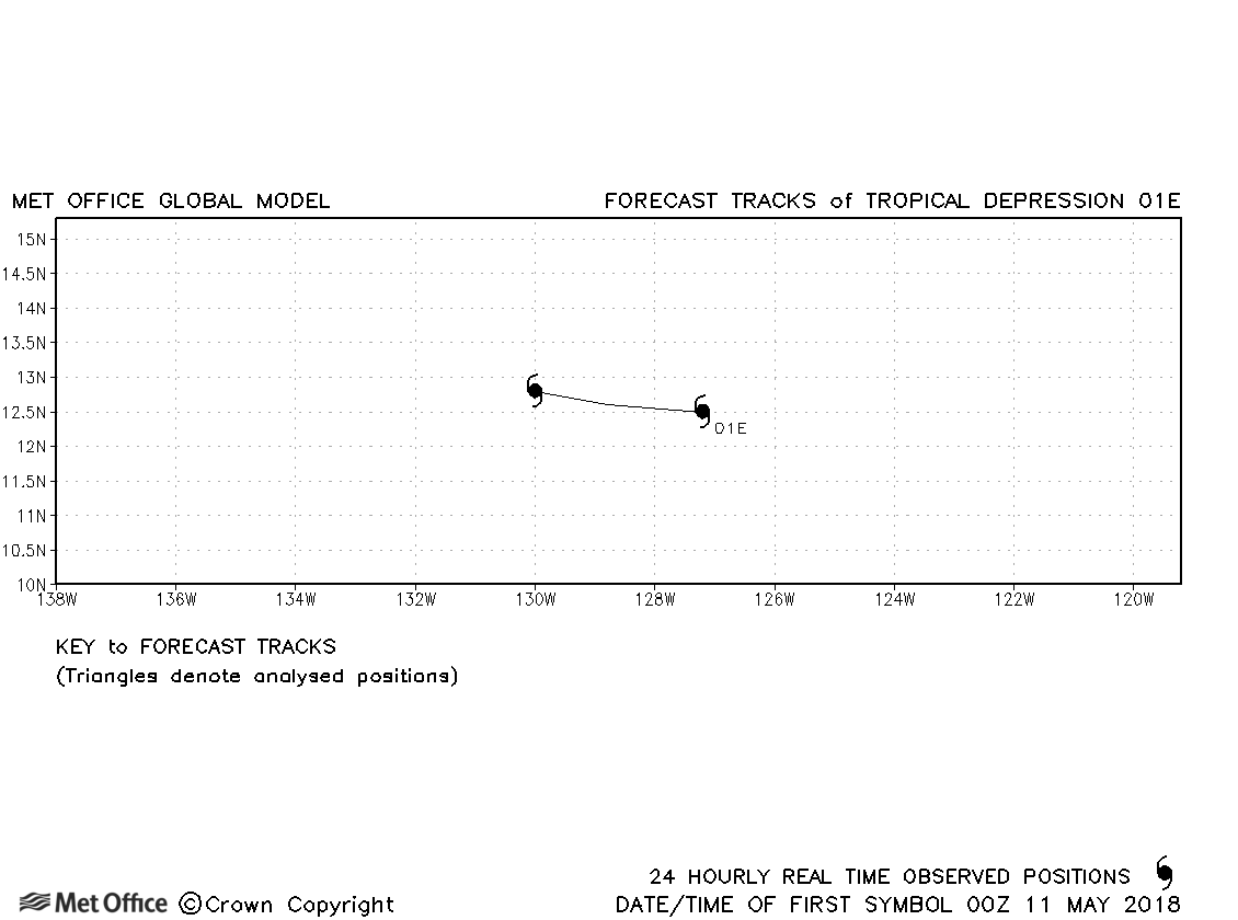
| 01E | 10-12 May | 1006 mb, 30/- knots | 01E did not reach tropical storm status and no forecasts were verified. |
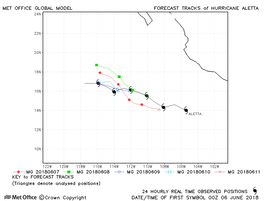
| Aletta (02E) | 06-11 June | 943 mb, 120 knots | Track forecast errors for Aletta were below last season's average. |
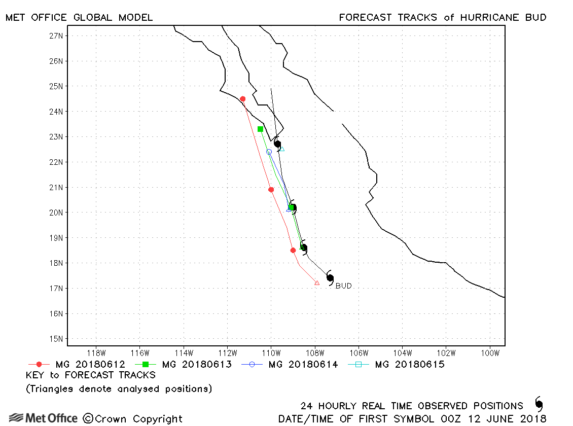
| Bud (03E) | 09-15 June | 948 mb, 115 knots | Track forecast errors were near to last season's average at short lead times, but above average at longer lead times due to a fast bias. |
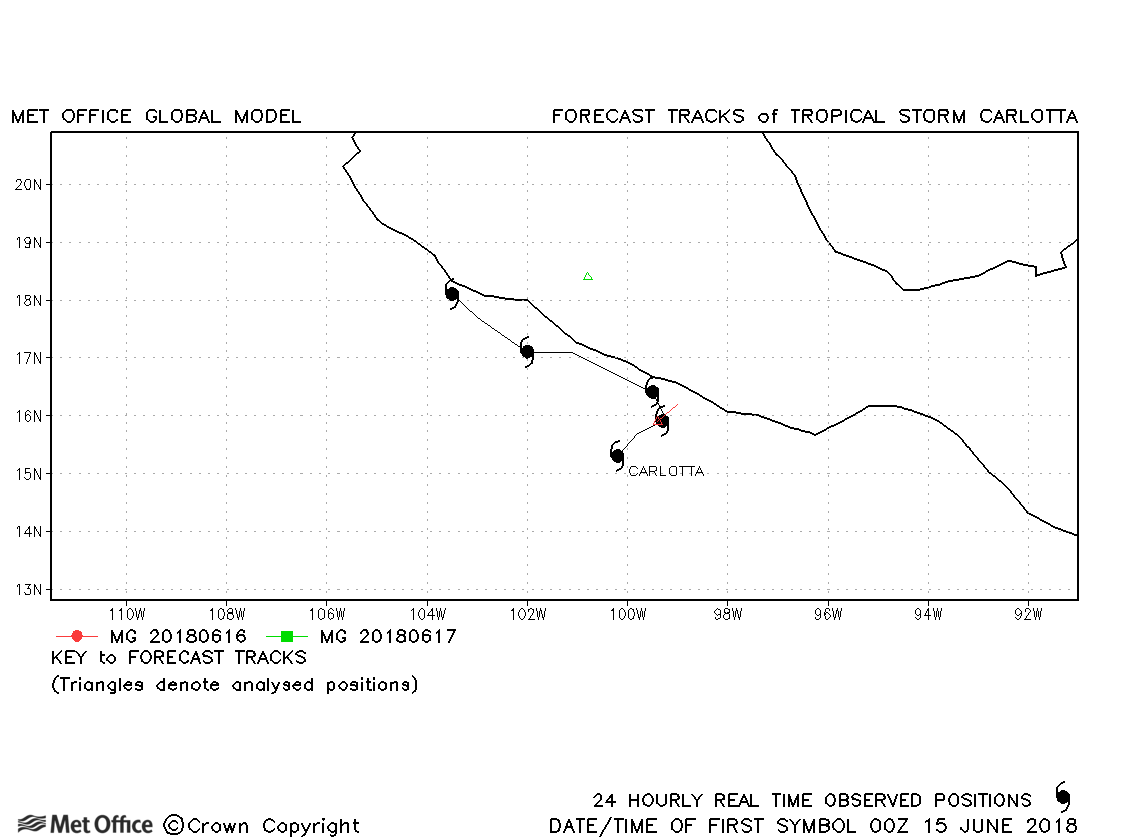
| Carlotta (04E) | 14-18 June | 997 mb, 55 knots | Carlotta was only briefly a tropical storm and few forecasts were verified. |
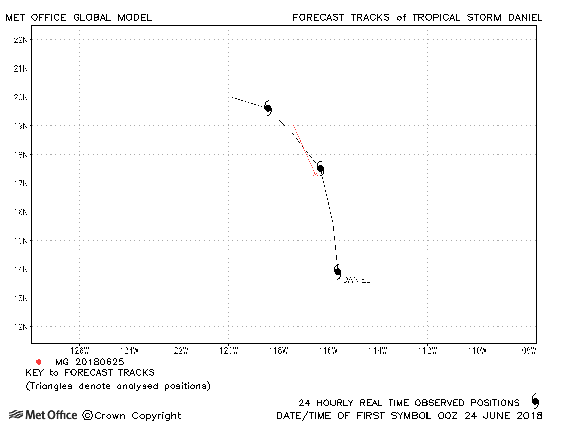
| Daniel (05E) | 24-26 June | 1003 mb, 40 knots | Daniel was only briefly a tropical storm and few forecasts were verified.c |
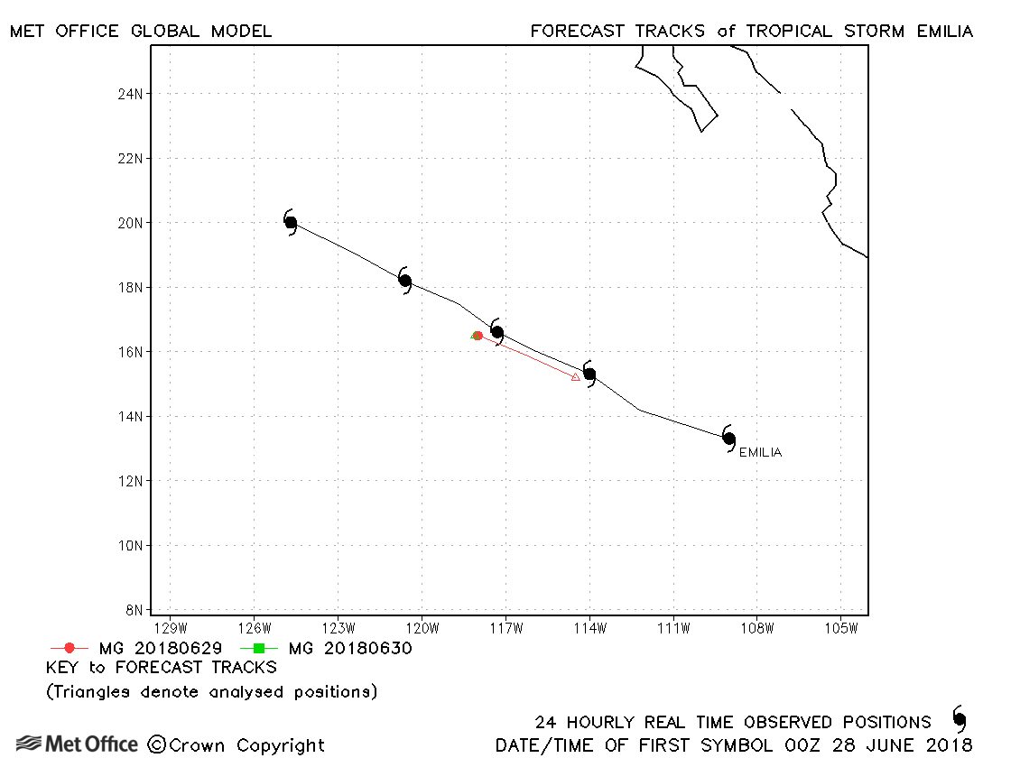
| Emilia (06E) | 27 June-02 July | 997 mb, 50 knots | Track forecast errors were near to or below last season's average. |
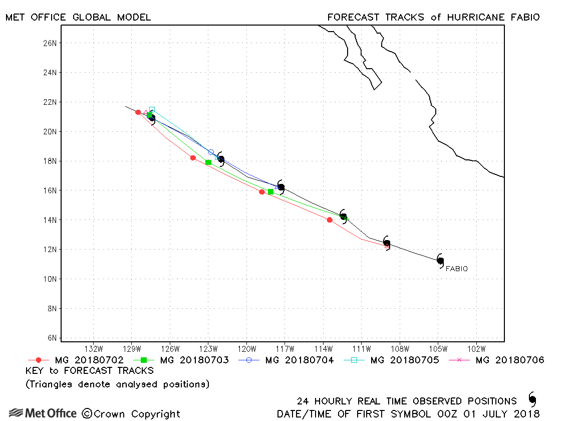
| Fabio (07E) | 30 June-06 July | 964 mb, 95 knots | Track forecast errors were mostly below last season's average. |
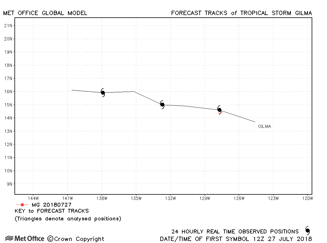
| Gilma (08E) | 26-30 July | 1006 mb, 35 knots | Gilma only briefly reached tropical storm status and no forecasts were verified. |
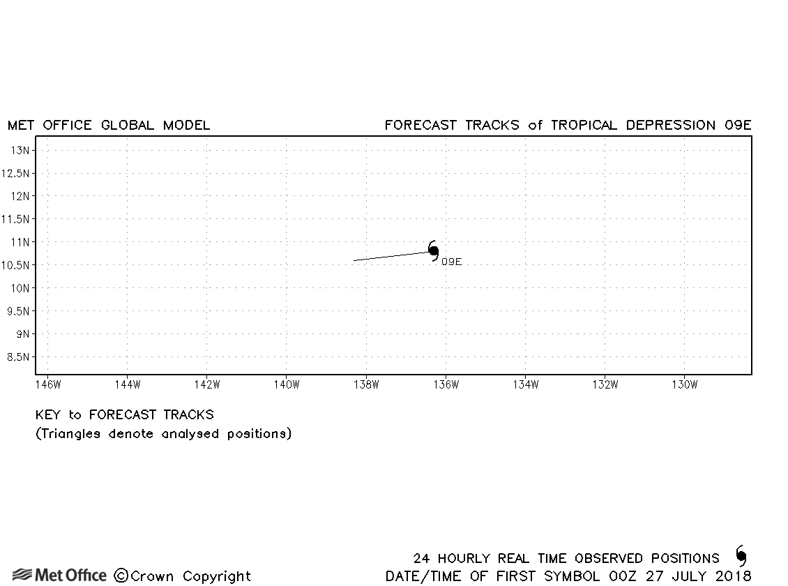
| 09E | 26-27 July | 1008 mb, 30 knots | No forecasts were verified for this depression. |
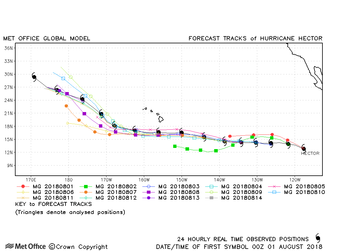
| Hector (10E) | 31 July-15 August | 936 mb, 135 knots | Track forecast errors were consistently below last season's average and skill scores against CLIPER were high. |
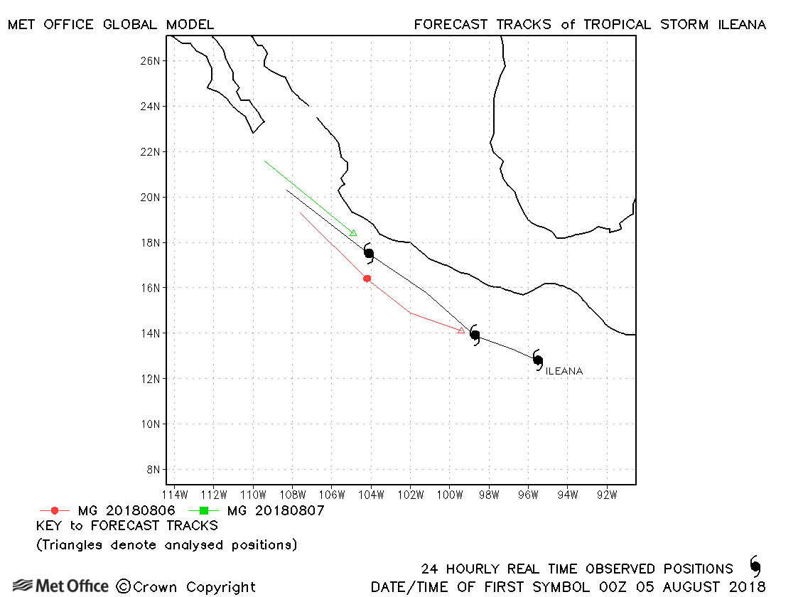
| Ileana (11E) | 04-07 August | 998 mb, 55 knots | Track forecast errors were a little above last season's average. |
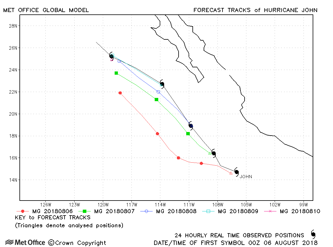
| John (12E) | 05-10 August | 969 mb, 90 knots | Track forecast errors were a little above last season's average due to a left-of-track bias. |
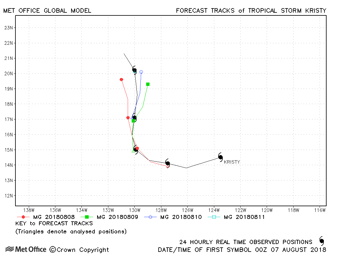
| Kristy (13E) | 07-11 August | 991 mb, 60 knots | Track forecast errors were low. |
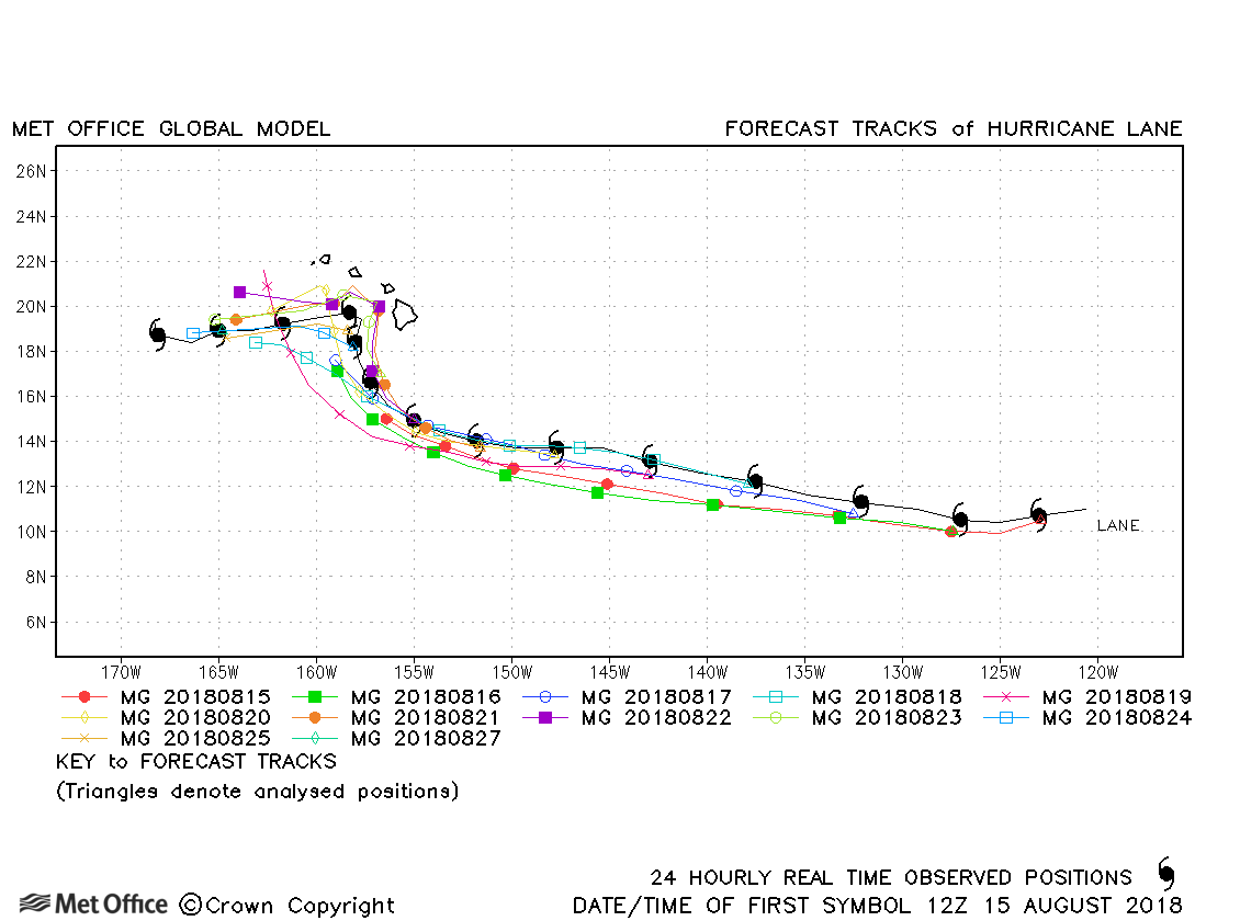
| Lane (14E) | 15-29 August | 926 mb, 140 knots | Track forecast errors were near last season's average at short lead times, but below average at longer lead times. The turn towards Hawaii and the subsequent turn back west were fairly well handled by the model. |
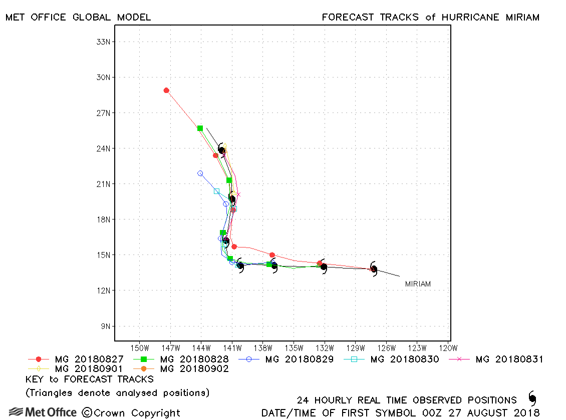
| Miriam (15E) | 26 August - 02 September | 974 mb, 85 knots | Track forecast errors were near to or below last season's average. |
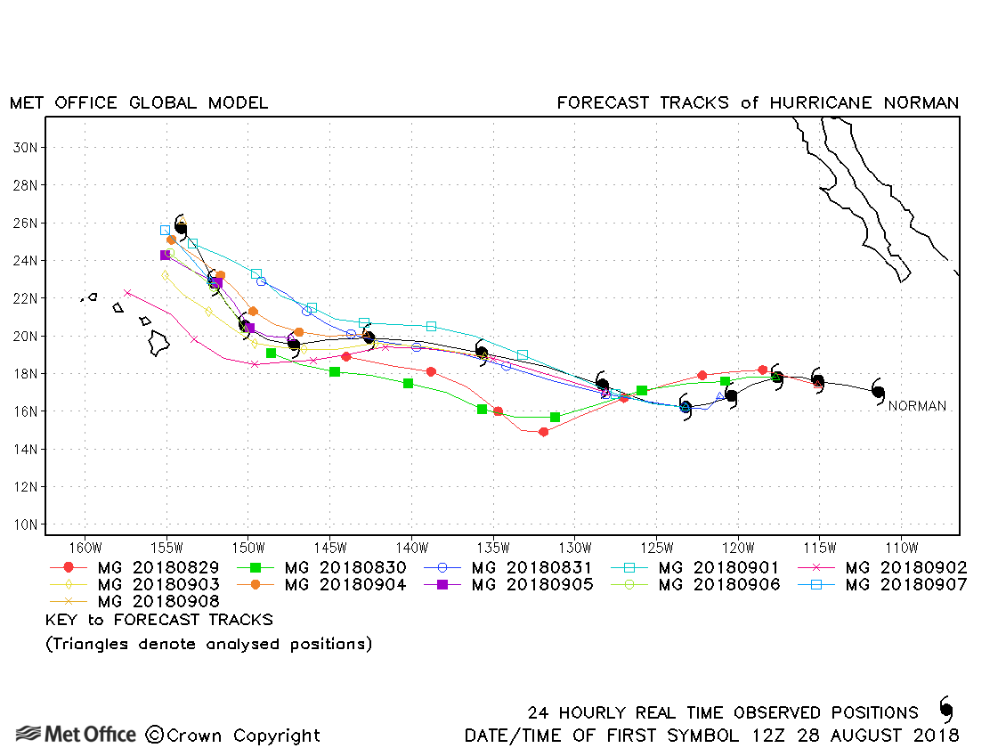
| Norman (16E) | 28 August - 08 September | 937 mb, 130 knots | Track forecast errors were near to last season's average. |
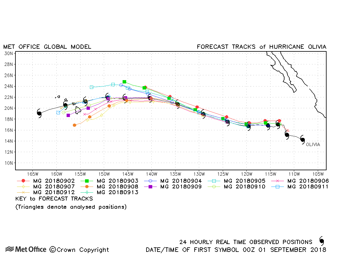
| Olivia (17E) | 01-14 September | 948 mb, 115 knots | Track forecast errors were low and skill scores high for this hurricane. |
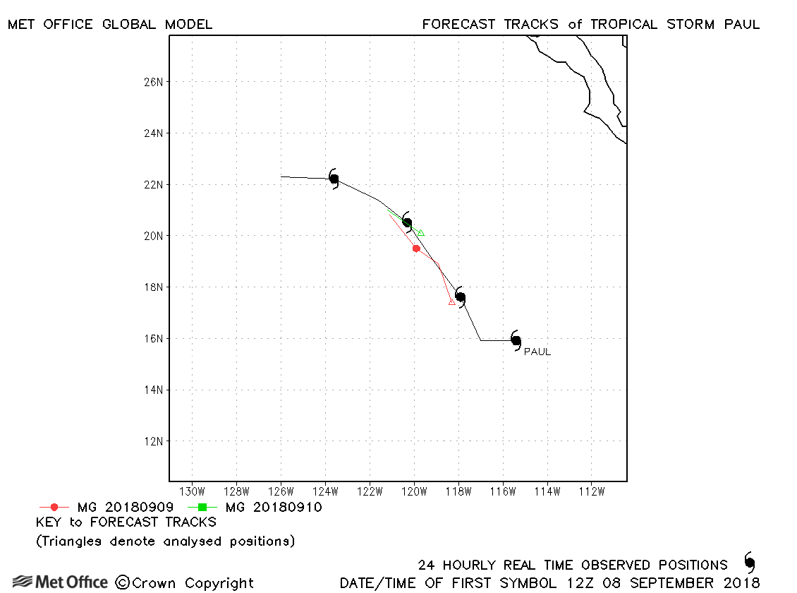
| Paul (18E) | 08-12 September | 1002 mb, 40 knots | Paul was short-lived with track forecast errors close to last season's average. |
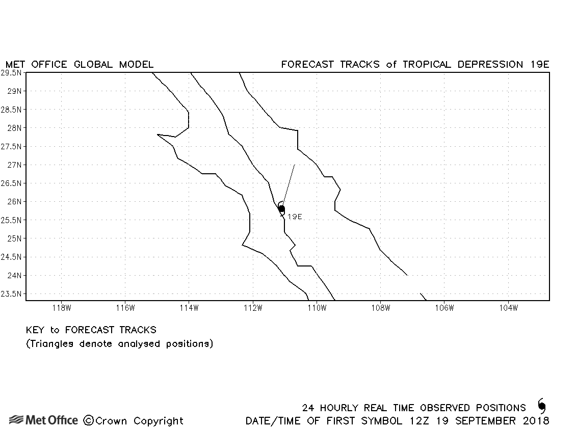
| 19E | 19-20 September | 1002 mb, 30 knots | No forecasts were verified for this depression. |
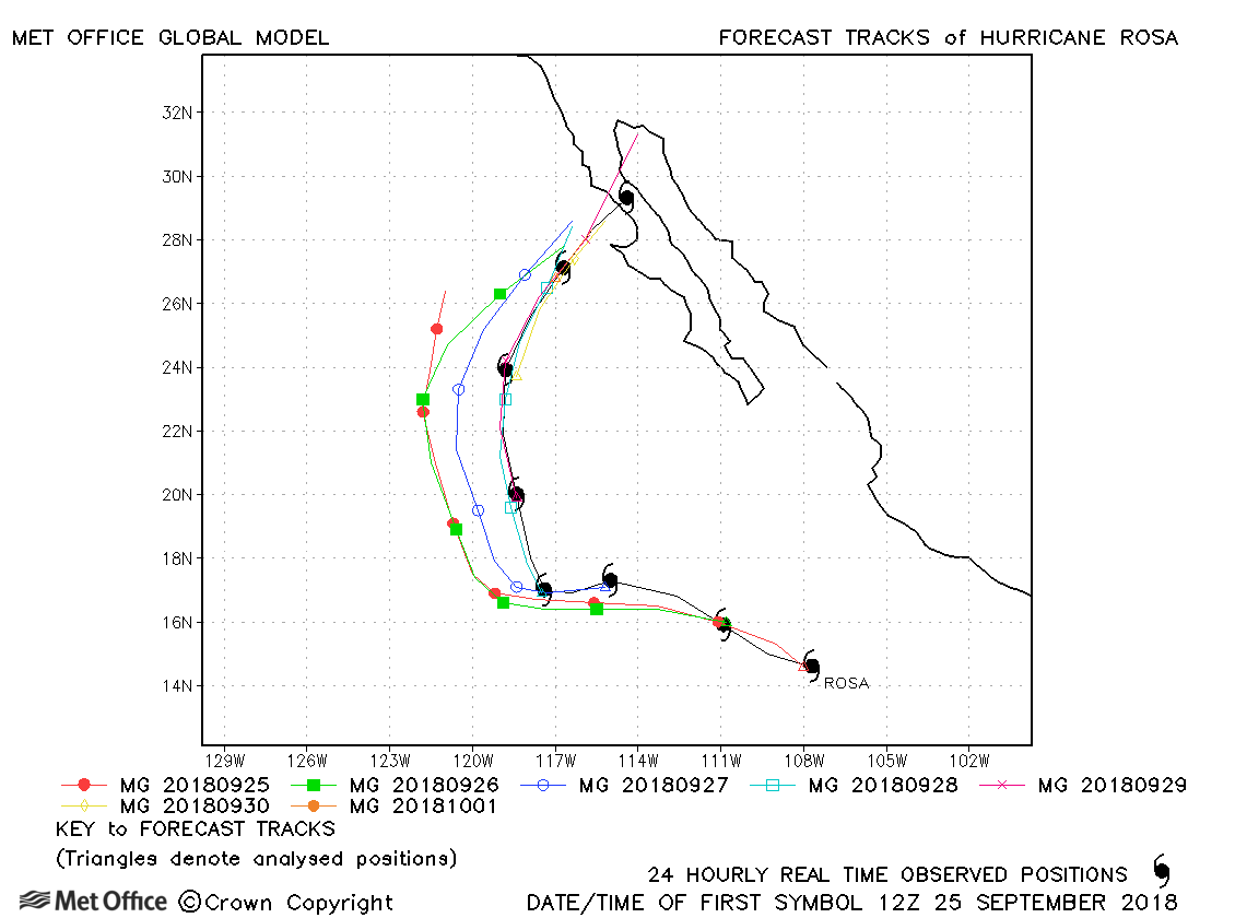
| Rosa (20E) | 25 September - 02 October | 940 mb, 125 knots | There was a slight slow and left-of-track bias in forecasts, but track forecast errors were still near to or below last season's average. |
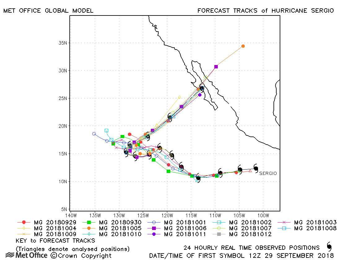
| Sergio (21E) | 25 September - 12 October | 943 mb, 120 knots | A few longer lead time forecasts failed to predict the sharp turn northeastwards by Sergio, but in gerenarl this turn was well predicted resulting in shorter lead time errors near to or below lasts eason's average. |
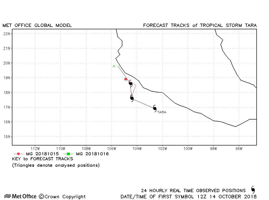
| Tara (22E) | 14-17 October | 995 mb, 55 knots | Tara was short-lived as a tropical storm and few forecasts were verified. |
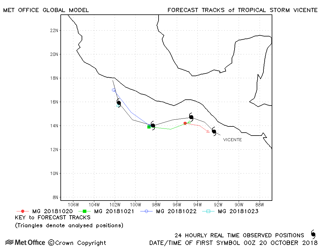
| Vicente (23E) | 19-23 October | 1002 mb, 45 knots | A small number of forecasts were verified for this storm. Track forecast errors were above last season's average. |
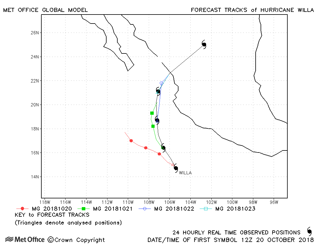
| Willa (24E) | 20-24 October | 925 mb, 140 knots | Early forecasts had a left-of-track bias resulting in large errors and there was also a slow bias in forecasts. |
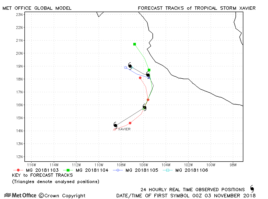
| 02-06 November | 999 mb, 50 knots |
Track forecast errors were mostly a little above last season's average. |
| Name & ID | Start & end dates | Central Pressure, 1-minute MSW | Comments on Met Office global model forecasts |
|---|---|---|---|
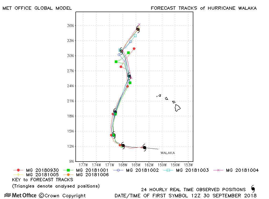
| Walaka (01C) | 29 September - 06 October | 920 mb, 140 knots | Track forecast errors were near to or below last season's average. Skill scores against CLIPER were very high and the turn northwards was very well predicted. |
North-east and Central North Pacific observed tracks in 2018
| Name & ID | Start & end dates | Central pressure, 1-minute MSW | Comments on Met Office global model forecasts |
|---|---|---|---|
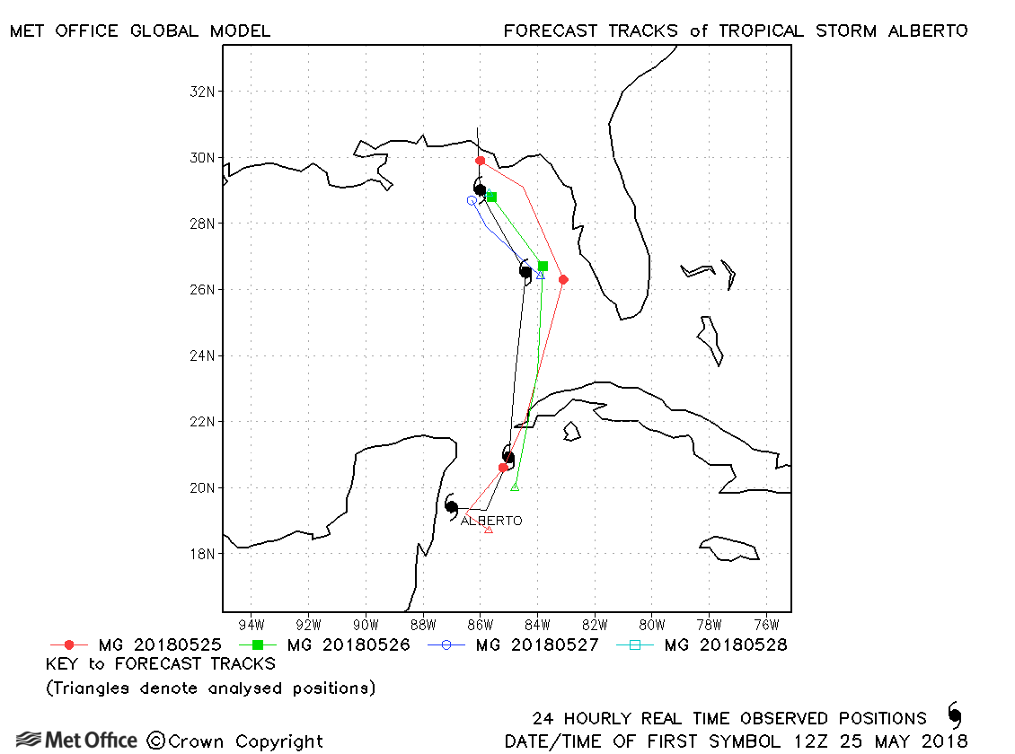
| Alberto (01L) | 25-29 May | 990 mb, 55/- knots | Track forecast errors were near to or below last season's average for Subtropical Storm Alberto. |
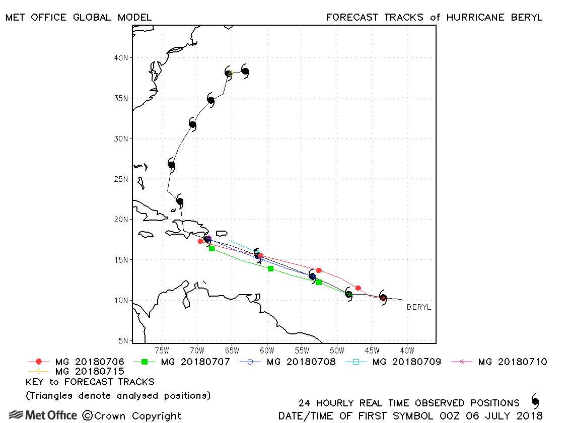
| Beryl (02L) | 05-16 July | 994 mb, 70 knots | There was a slow bias at short lead times, resulting in larger than average track forecast errors, but longer lead time errors were low. |
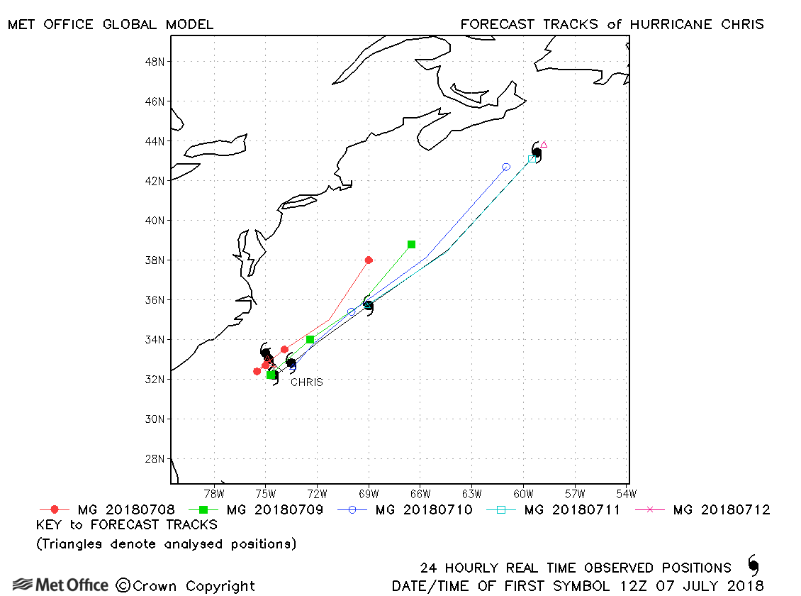
| Chris (03L) | 06-12 July | 970 mb, 90 knots | Track forecast errors for this storm were high due to a slow bias. |
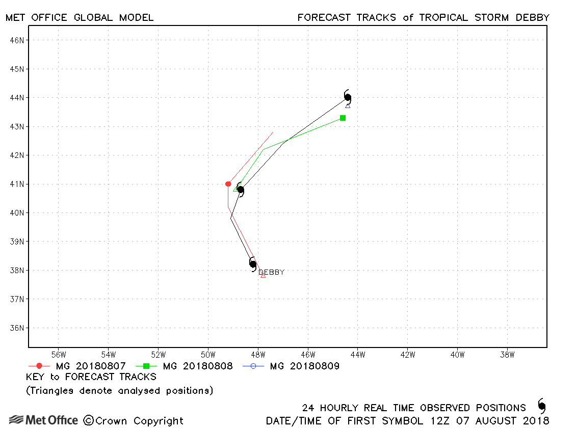
| Debby (04L) | 07-09 August | 1002 mb, 40 knots | Track forecast errors were near last season's average. |
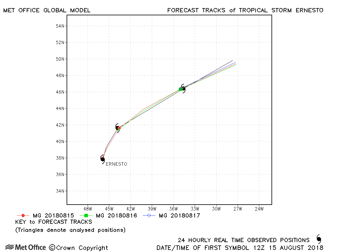
| Ernesto (05L) | 15-18 August | 985 mb, 50 knots | Track forecasts were exceptionally accurate for Ernesto. |
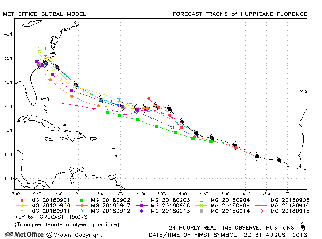
| Florence (06L) | 31 August - 16 September | 945 mb, 120 knots | Track forecast errors were near to or below last season's average for Florence. Landfall over the USA was well signalled including the slow down in forward motion at the time of landfall. |
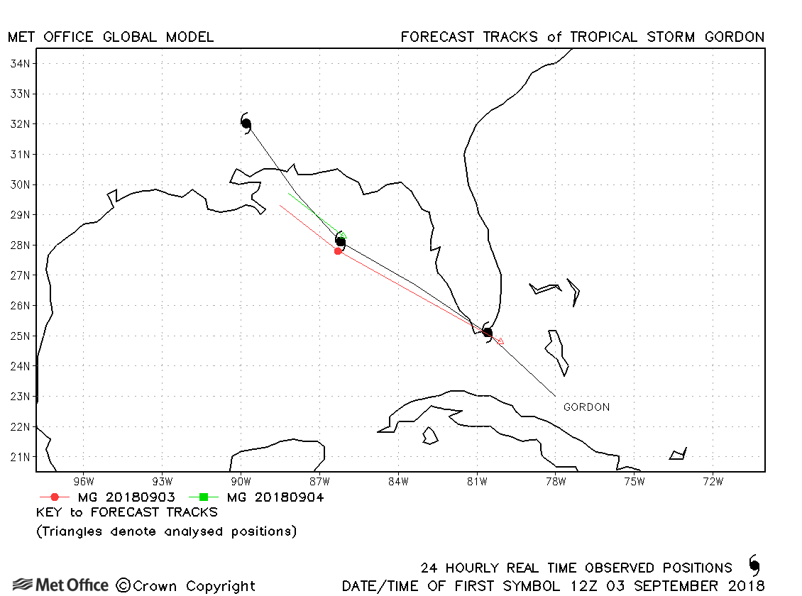
| Gordon (07L) | 03-05 September | 999 mb, 60 knots | Track forecast errors were near to last season's average. |
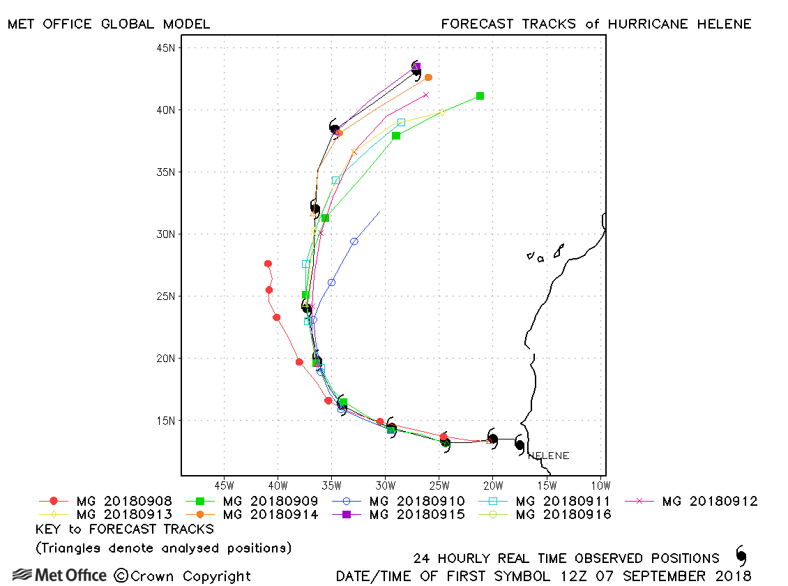
| Helene (08L) | 07-16 September | 966 mb, 95 knots | There was a slow bias in forecasts resulting in track forecast errors above last season's average. |
| Isaac (09L) | 07-15 September | 993 mb, 65 knots | Track forecast errors were large due to the model's erroneaous turn northwards during early forecasts. |
| Joyce (10L) | 12-19 September | 997 mb, 45 knots | Track forecast errors were mixed, but the 180 degree turn was well predicted. |
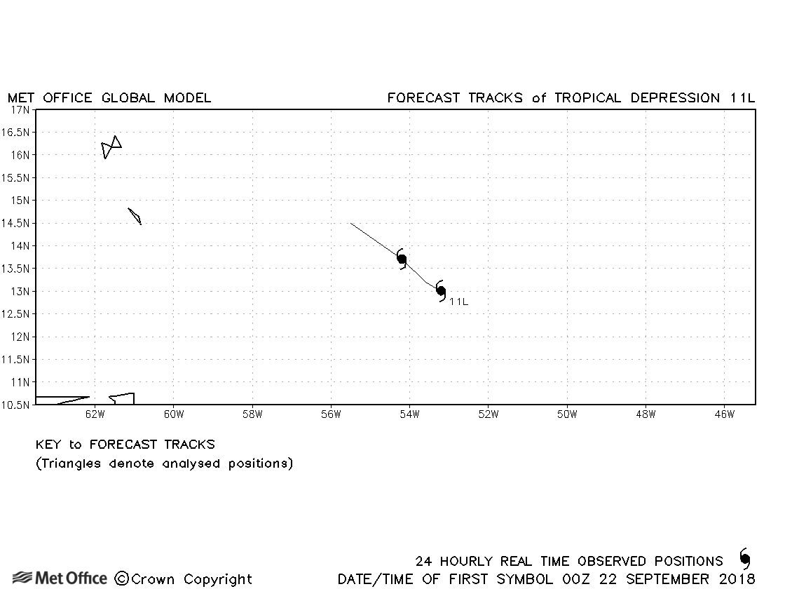
| 11L | 22-23 September | 1007 mb, 30 knots | No forecasts were verified for this depression. |
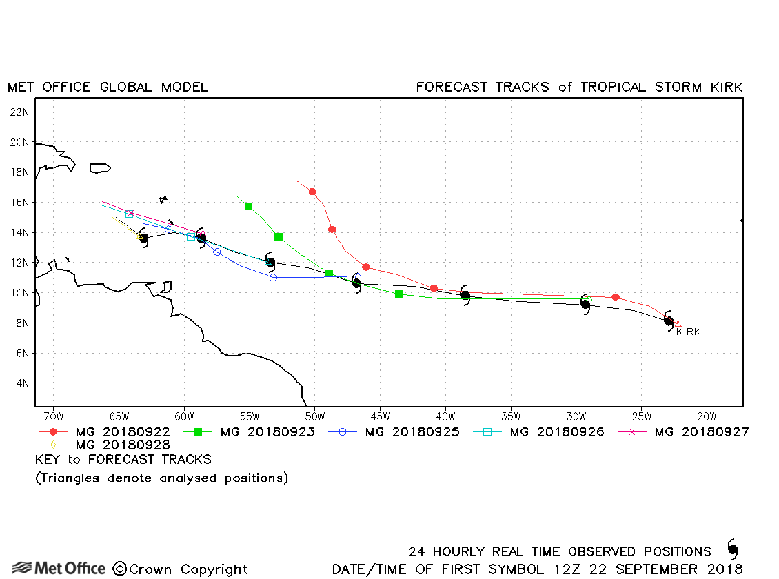
| Kirk (12L) | 22-29 September | 998 mb, 45 knots | Track forecast errors were large due to an erroneous slow down and turn north-westwards. |
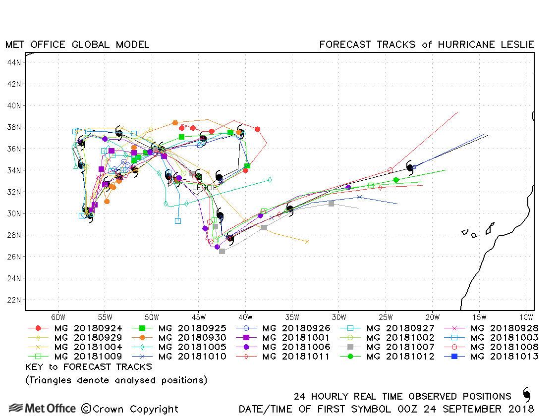
| Leslie (13L) | 23 September - 13 October | 969 mb, 80 knots | Track forecasts for Hurricane Michael were very good. Formation and landfall timing over the USA were well predicted a few days in advance. Track forecast errors were low and skill scores high. |
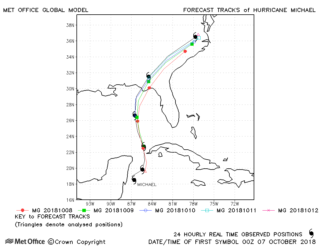
| Michael (14L) | 07-12 October | 919 mb, 140 knots | Track forecasts for Hurricane Michael were very good. Formation and landfall timing over the USA were well predicted a few days in advance. Track forecast errors were low and skill scores high. |
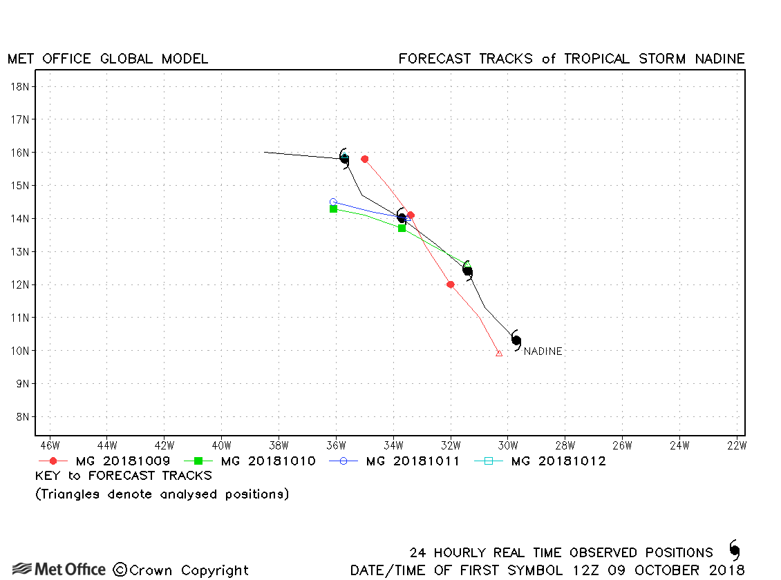
| Nadine (15L) | 09-13 October | 997 mb, 55 knots | Track forecast errors were mostly a little above last season's average. |
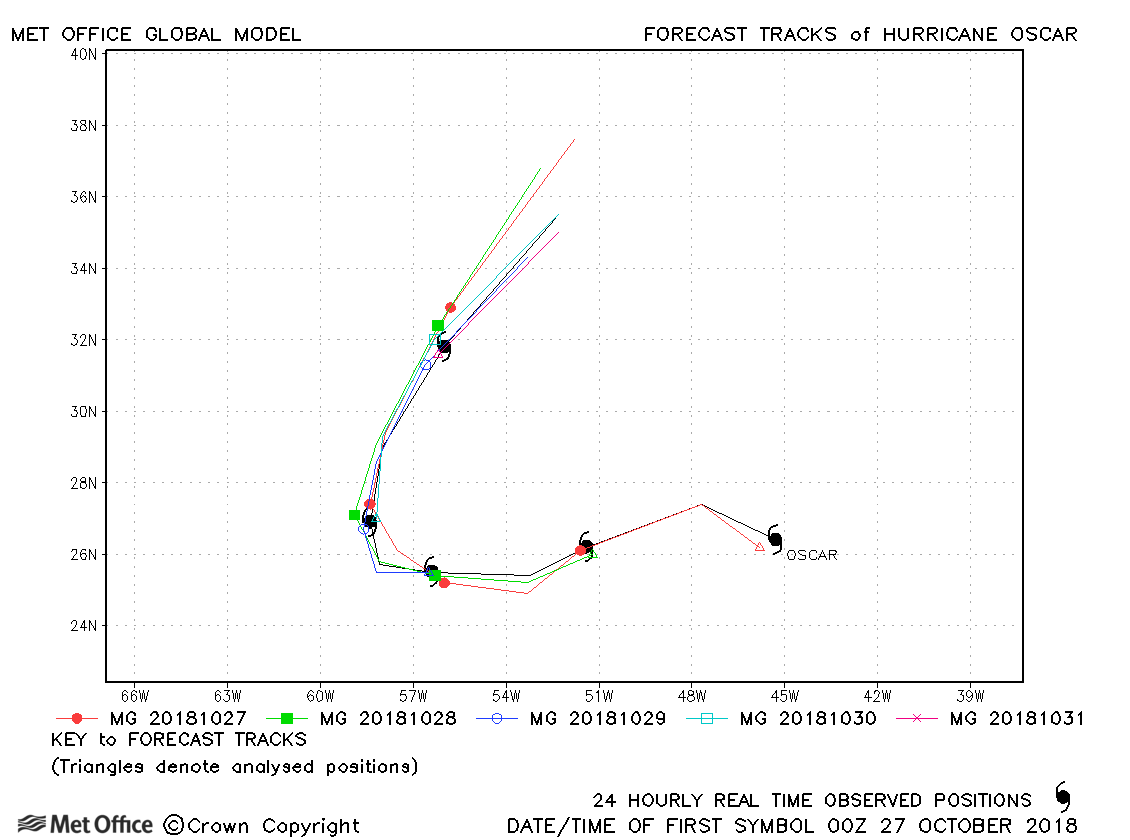
| Oscar (16L) | 27-31 October | 970 mb, 90 knots | Track forecasts for Oscar were very good with errors below last season's average. The turn northwards was well predicted. |
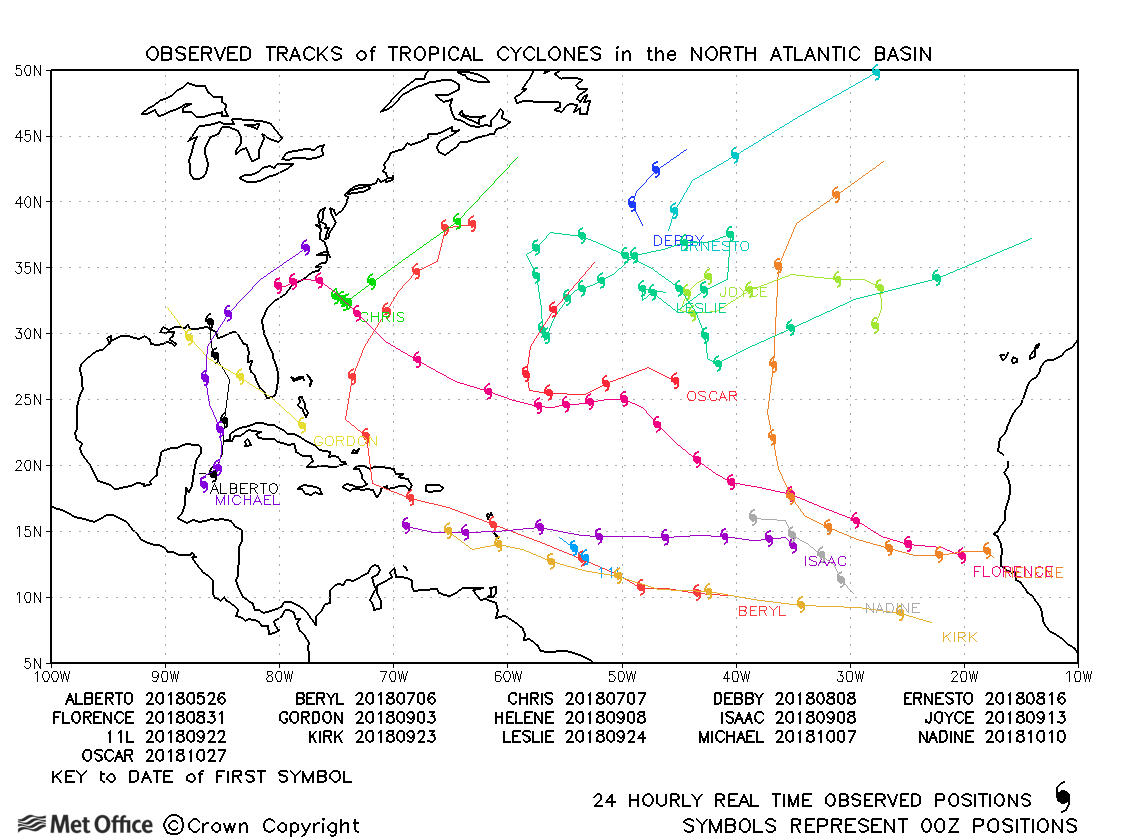
North Atlantic observed tracks in 2018
| Name & ID | Start & end dates | Central pressure, 1-/10-minute MSW | Comments on Met Office global model forecasts |
|---|---|---|---|
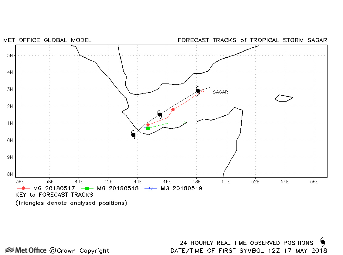
| Sagar (01A) | 16-19 May | 992 mb, 55/45 knots | The Global Model had difficulty initialising Cyclone Sagar and hence analysis and forecast errors were larger than average. |
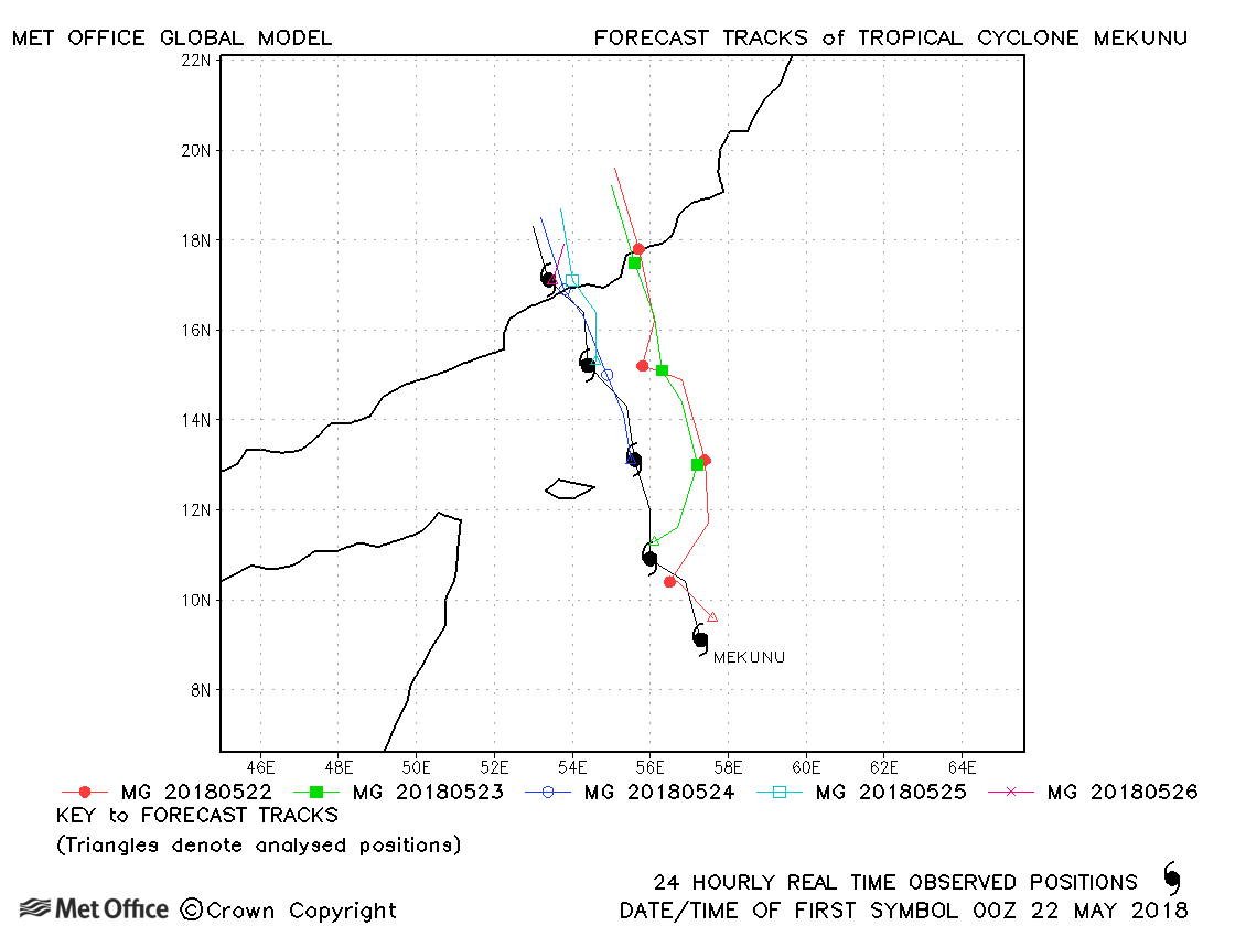
| Mekunu (02A) | 22-26 May | 952 mb, 100/95 knots | Early forecasts had a right-of-track bias with landfall too far east. From 48 hours before landfall track forecasts were much better. Overall, track forecast errors were above last season's average. |
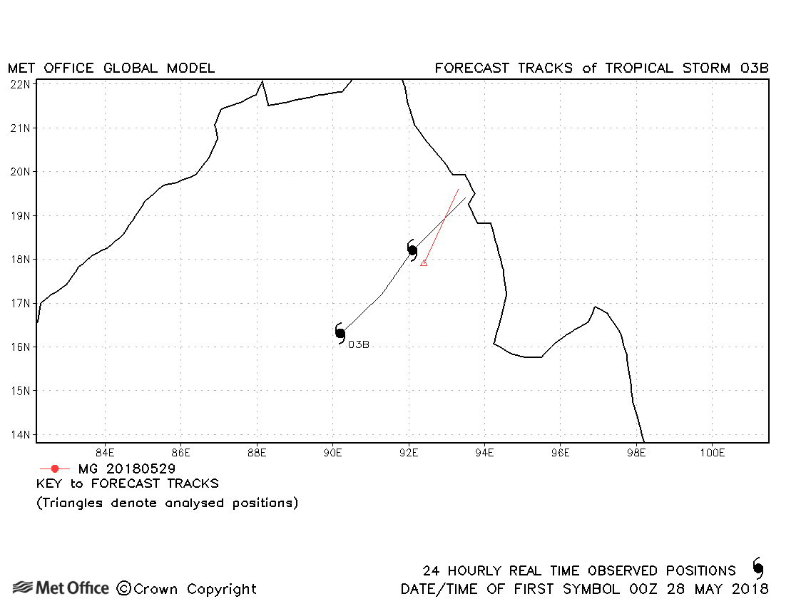
| 03B | 28-29 May | 993 mb, 40/30 knots | 03B was short-lived with only a couple of forecasts verified. |
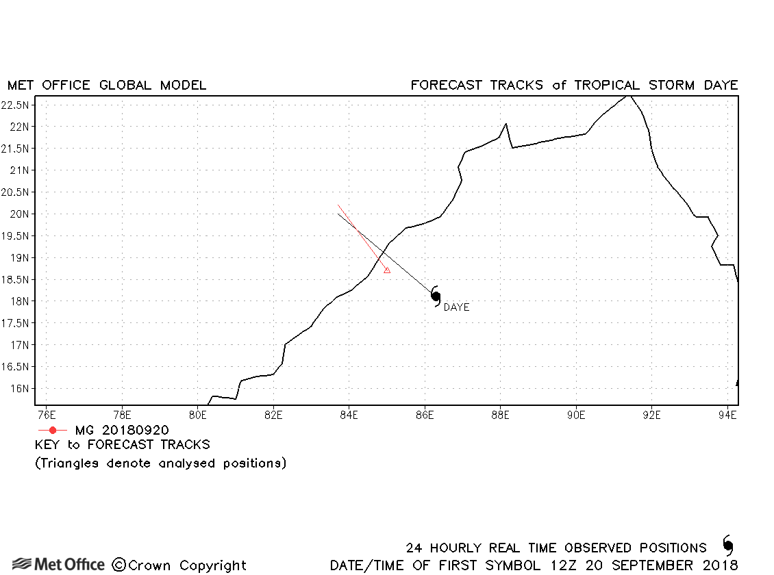
| Daye (04B) | 20-21 September | 992 mb, 35/35 knots | Daye was short-lived with only a couple of forecasts verified. |
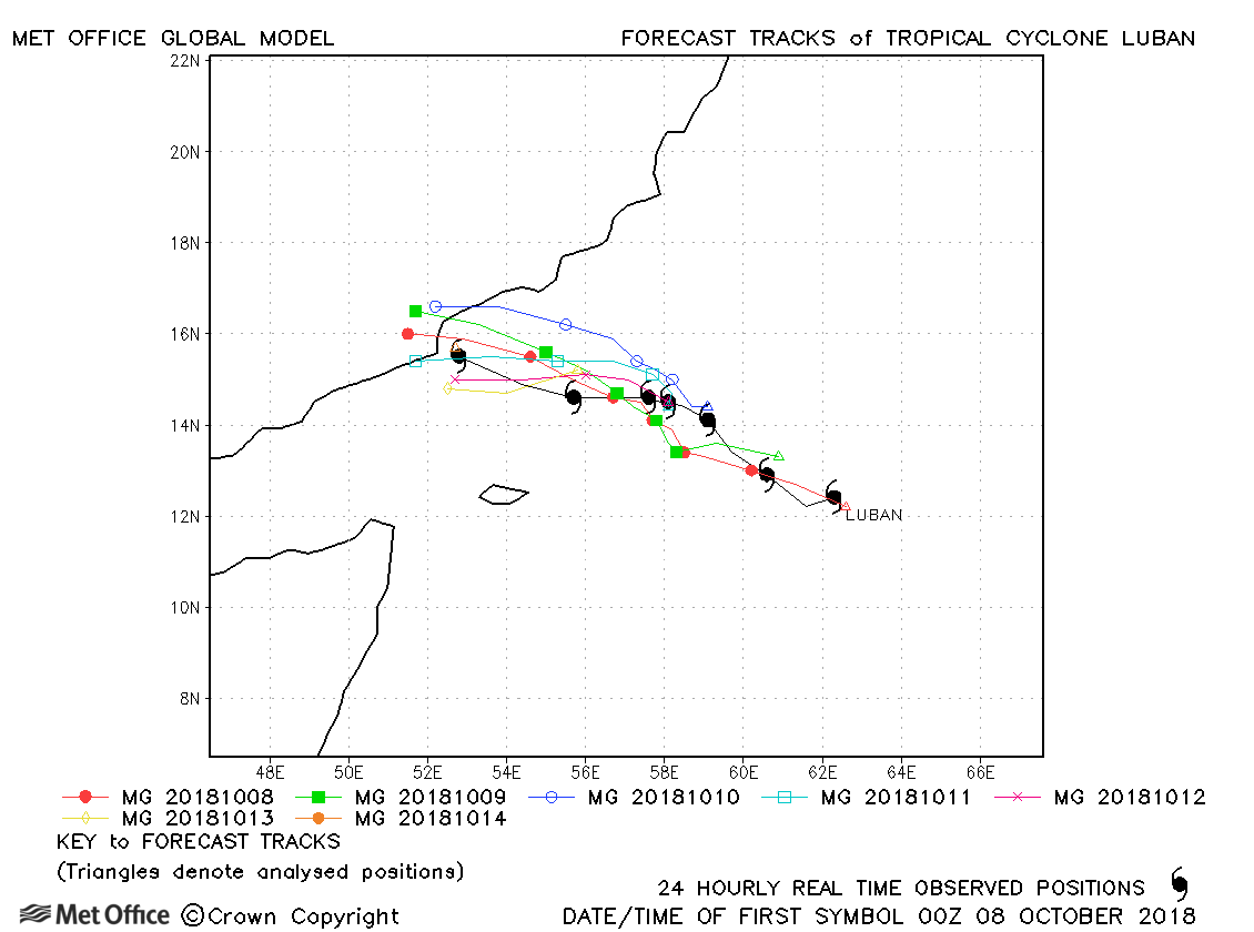
| Luban (05A) | 08-14 October | 975 mb, 75/80 knots | There was a slight right-of-track bias, but mostly track forecast errors were below last season's average for this cyclone. |
| Titli (06B) | 09-12 October | 965 mb, 95/80 knots | Track forecast errors were mostly below last season's average for this cyclone. |
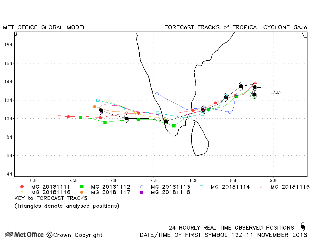
| 10-19 November | 983 mb, 75/60 knots |
Track forecast errors were above last season's average due to a fast bias. |
|
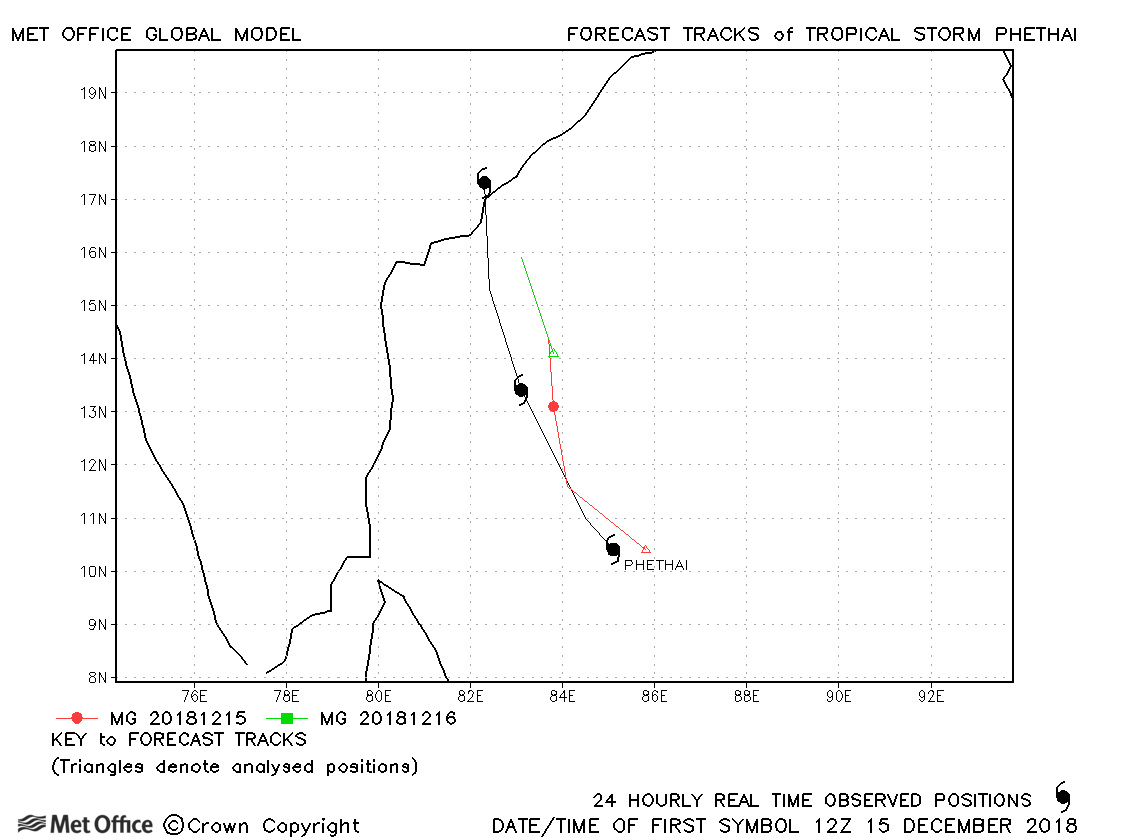
| 15-17 December | 993 mb, 55/55 knots |
Track forecast errors were near last season's average. |
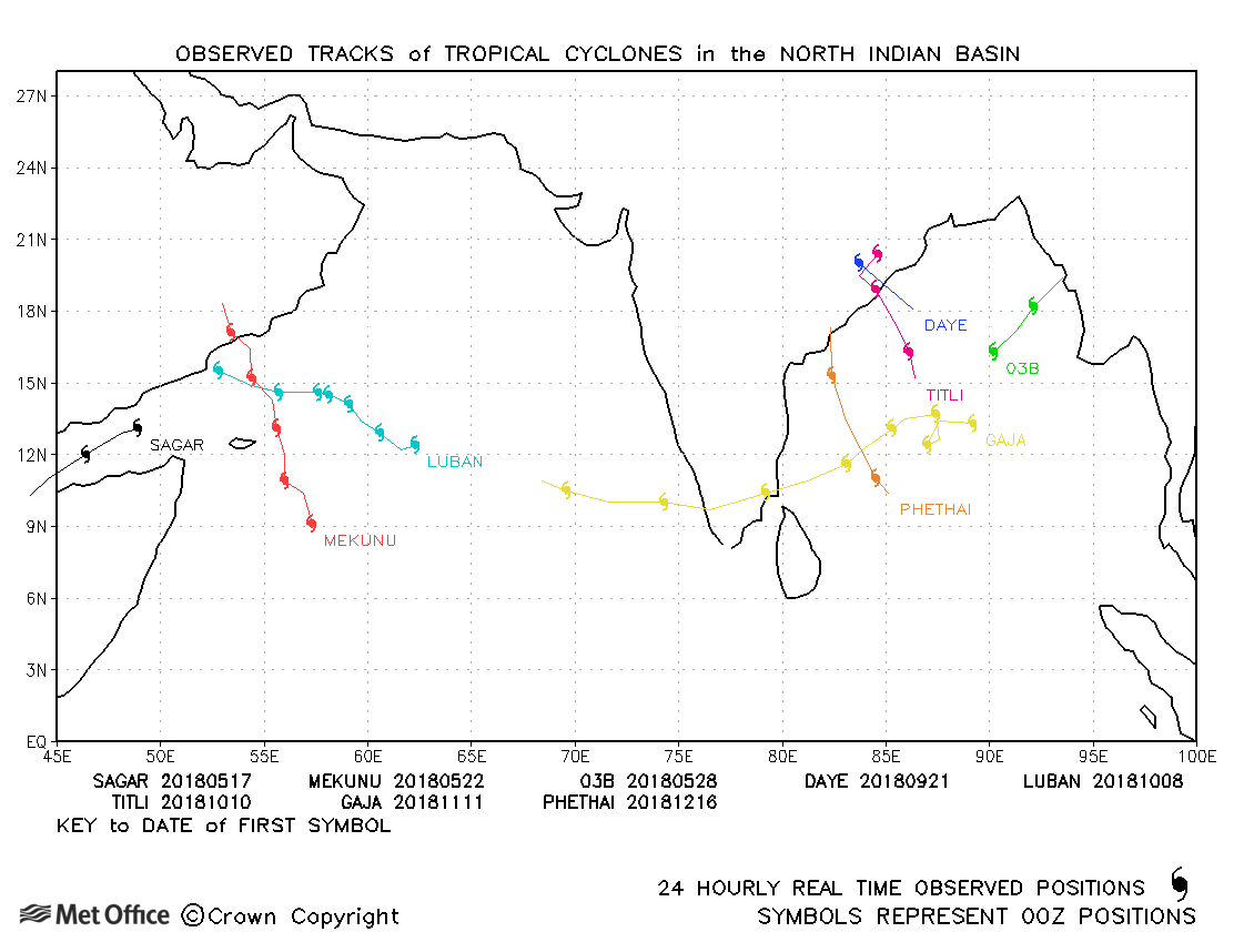
North Indian observed tracks in 2018
Note on estimated wind speeds
1-minute MSW: Maximum sustained wind (knots) averaged over 1 minute (JTWC Hawaii, NHC Miami, CPHC Hawaii)
10-minute MSW: Maximum sustained wind (knots) averaged over 10 minutes (JMA Japan, IMD New Delhi)
Note: Although 1-minute average winds should be stronger than 10-minute average, this may not be the case here since estimates are obtained from different warning centres.

