

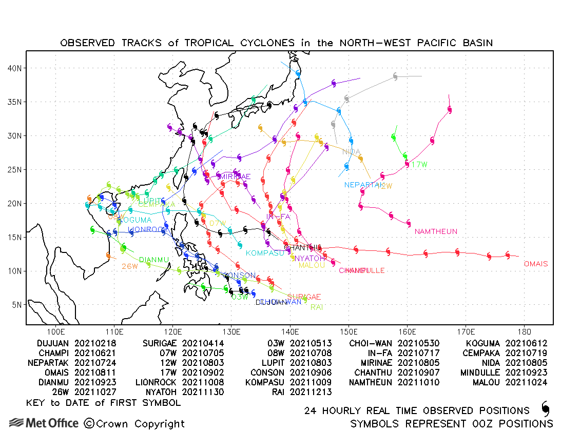
Observed and forecast tracks: northern hemisphere 2021
All tropical cyclones in the northern hemisphere season in 2021 are listed below including details of their start and end dates, lowest central pressure and maximum sustained wind (MSW).
Click on the name of the tropical cyclone to see a chart of the observed track and forecast tracks from the Met Office global model. Verification statistics on each tropical cyclone are available upon request from [email protected]. At the end of the season a verification report on the performance of the Met Office global model will be published.
| Name & ID | Start & end dates | Central pressure, 1-/10-minute MSW | Comments on Met Office global model forecasts |
|---|---|---|---|
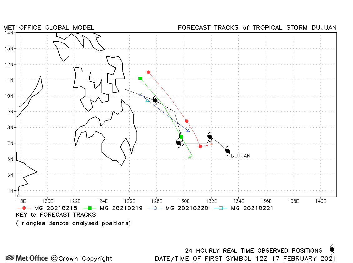
| 17-22 February | 996mb, 40/40 knots | Track forecast errors were mostly slightly above the recent mean values. | |
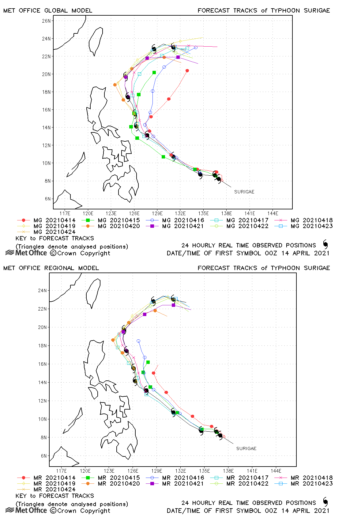
| Surigae (02W) | 13-24 April | 895 mb, 165/120 knots | Early forecasts had a right-of-track bias, but overall track forecast errors were below the recent mean values. An intense typhoon was predicted, although the extent of the rapid intensification was not forecast. |
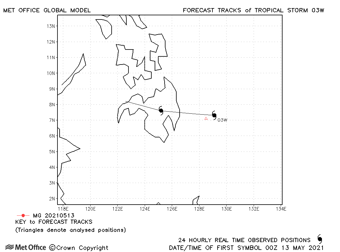
| 03W | 12-14 May | 1001 mb, 35/30 knots | 03W was only briefly a tropical storm according to JTWC only and no forecasts were verified. |
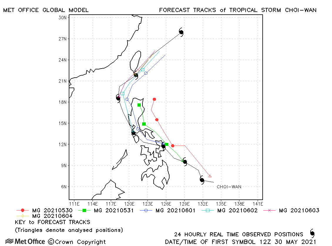
| Choi-wan (04W) | 29 May-05 June | 998 mb, 50/40 knots | A right-of-track bias resulted in track forecast errors above the recent mean values. |
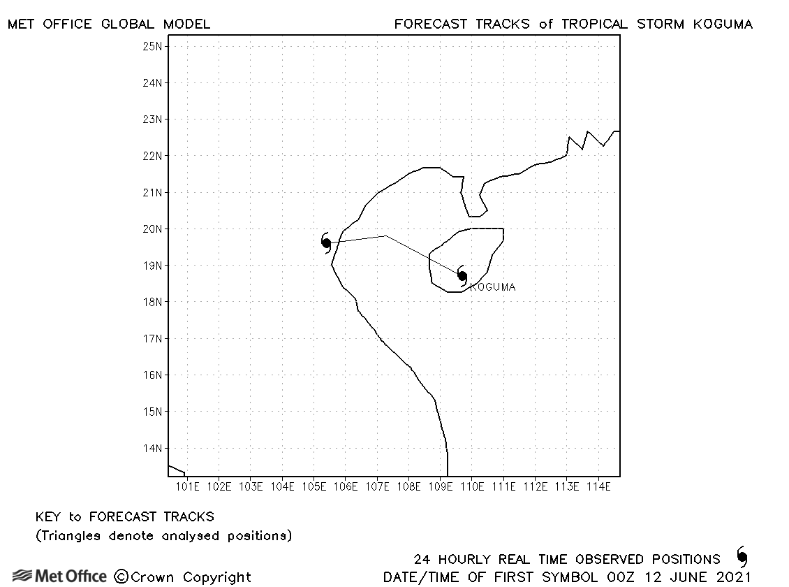
| Koguma (05W) | 12-13 June | 996 mb, 35/35 knots | Koguma was a short-lived storm and no forecasts were verified. |
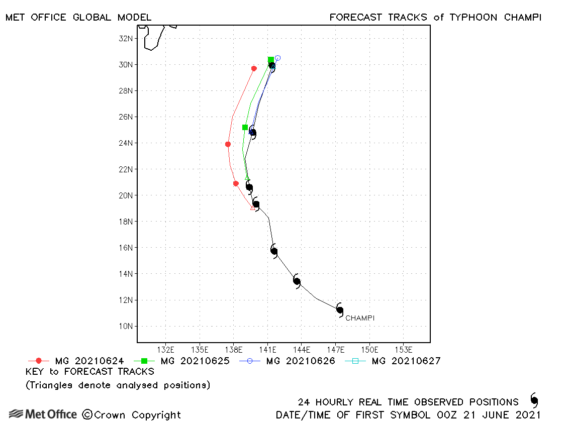
| Champi (06W) | 21-27 June | 980 mb, 65/65 knots | Track forecast errors were a little above the recent mean values. |
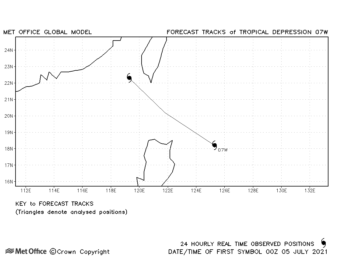
| 07W | 04-06 July | 1003 mb, 30/- knots | 07W did not reached tropical storm status. |
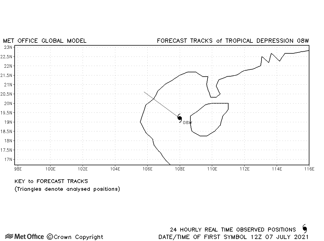
| 08W | 07 July | 1001 mb, 25/- knots | 08W did not reached tropical storm status. |
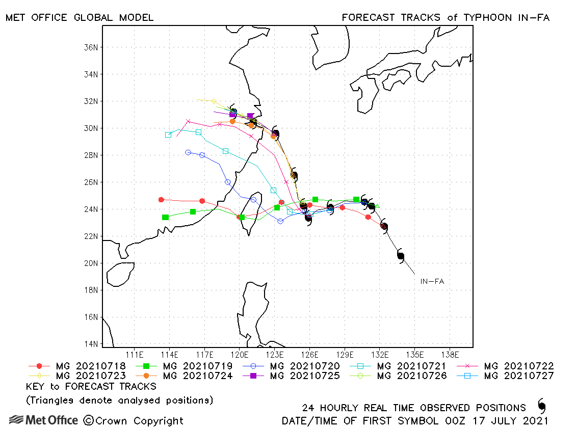
| In-fa (09W) | 16-27 July | 955 mb, 95/80 knots | Forecasts for In-fa were initially too fast and kept the storm on a continued westerly track instead of turning north. This resulted in large longer lead time errors. Short lead time errors were low. |
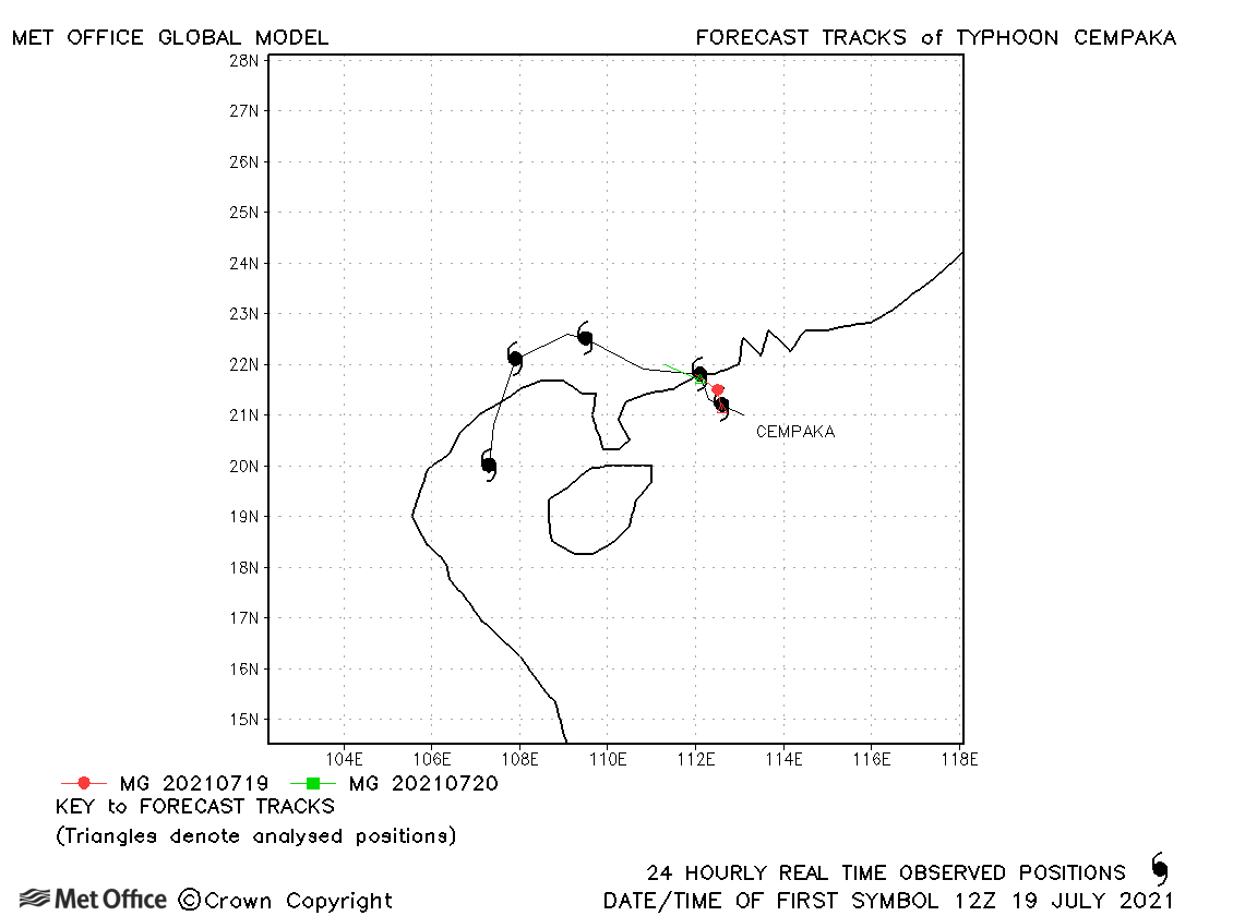
| Cempaka (10W) | 18-23 July | 990 mb, 75/50 knots | Track forecast errors were low for this storm. |
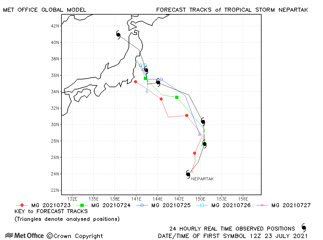
| Nepartak (11W) | 23-28 July | 990 mb, 45/40 knots | Track forecast errors were mostly a little above the recent mean values. |
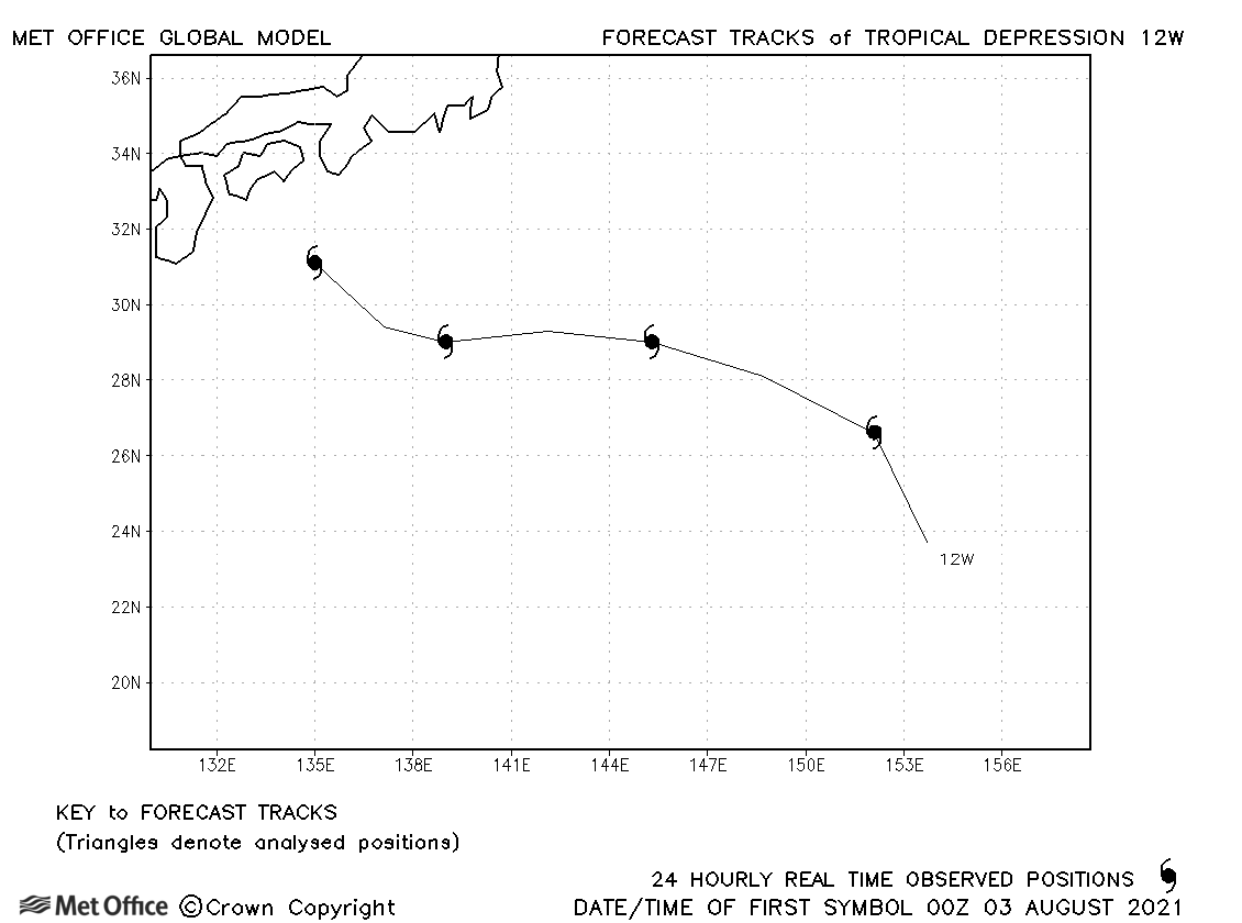
| 12W | 02-06 August | 995 mb, 30/- knots | 12W did not achieve tropical storm status. |
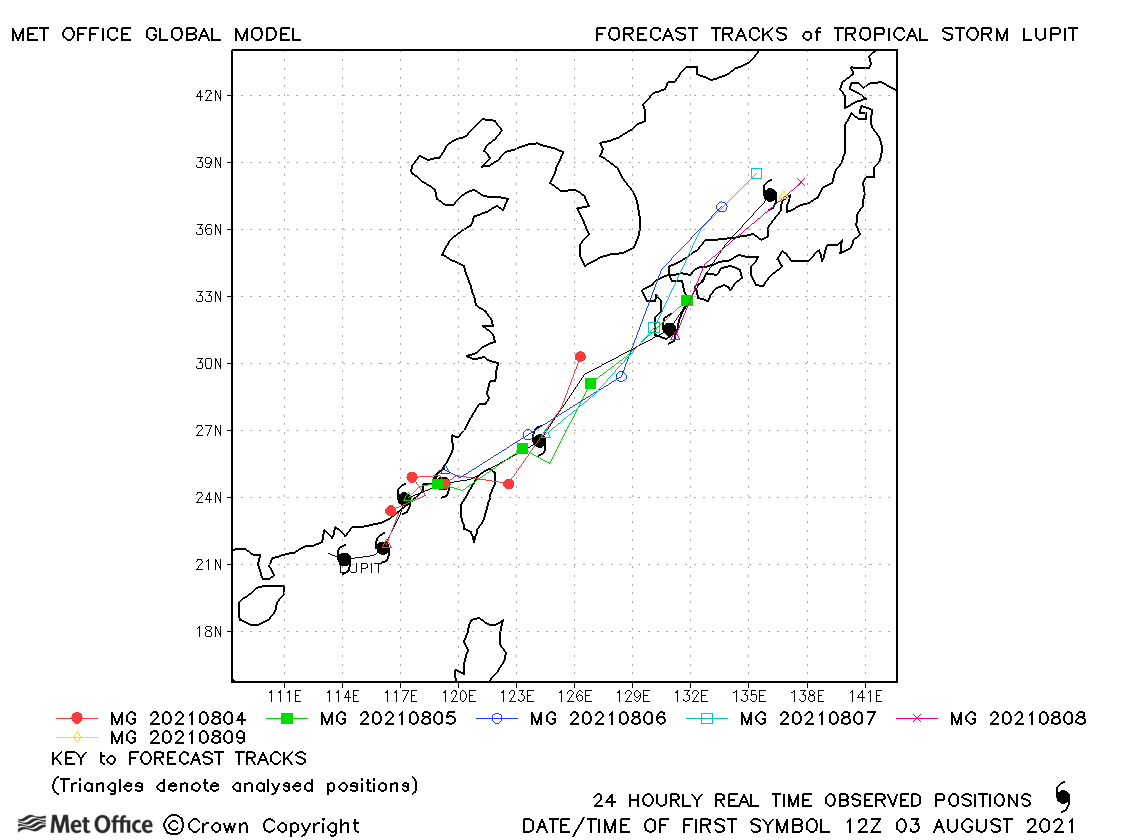
| Lupit (13W) | 02-09 August | 976 mb, 55/45 knots | There was a slow bias and a slight left-of-track bias which resulted in track forecast errors above the recent mean. |
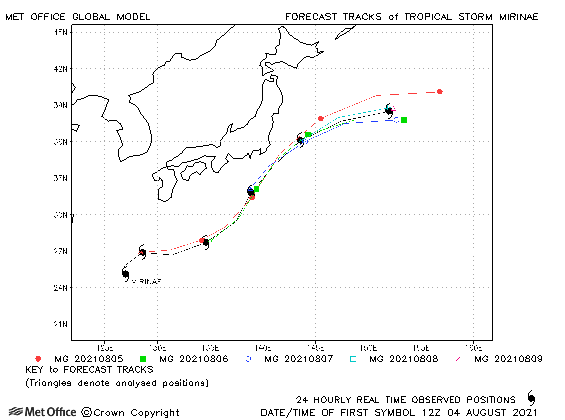
| Mirinae (14W) | 04-09 August | 980 mb, 50/45 knots | Track forecast errors were mostly very low for this storm. |
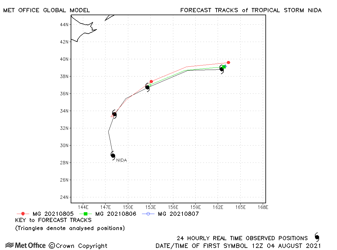
| Nida (15W) | 04-07 August | 992 mb, 55/50 knots | Track forecasts were mostly good for Nida. Skill scores against CLIPER were very high. |
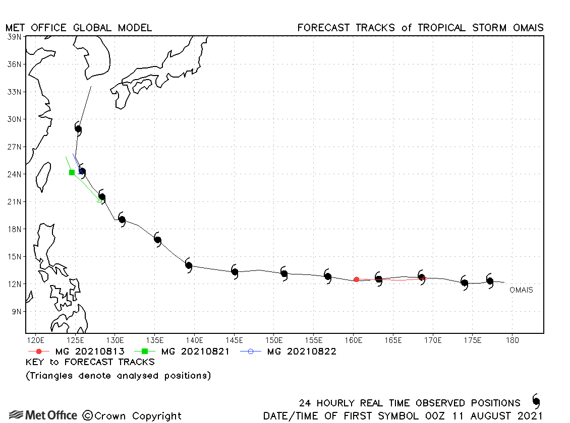
| Omais (16W) | 10-23 August | 994 mb, 50/50 knots | Omais persisted for a long time as a tropical depression, but only had two brief spells as a tropical storm. Track errors were low. |
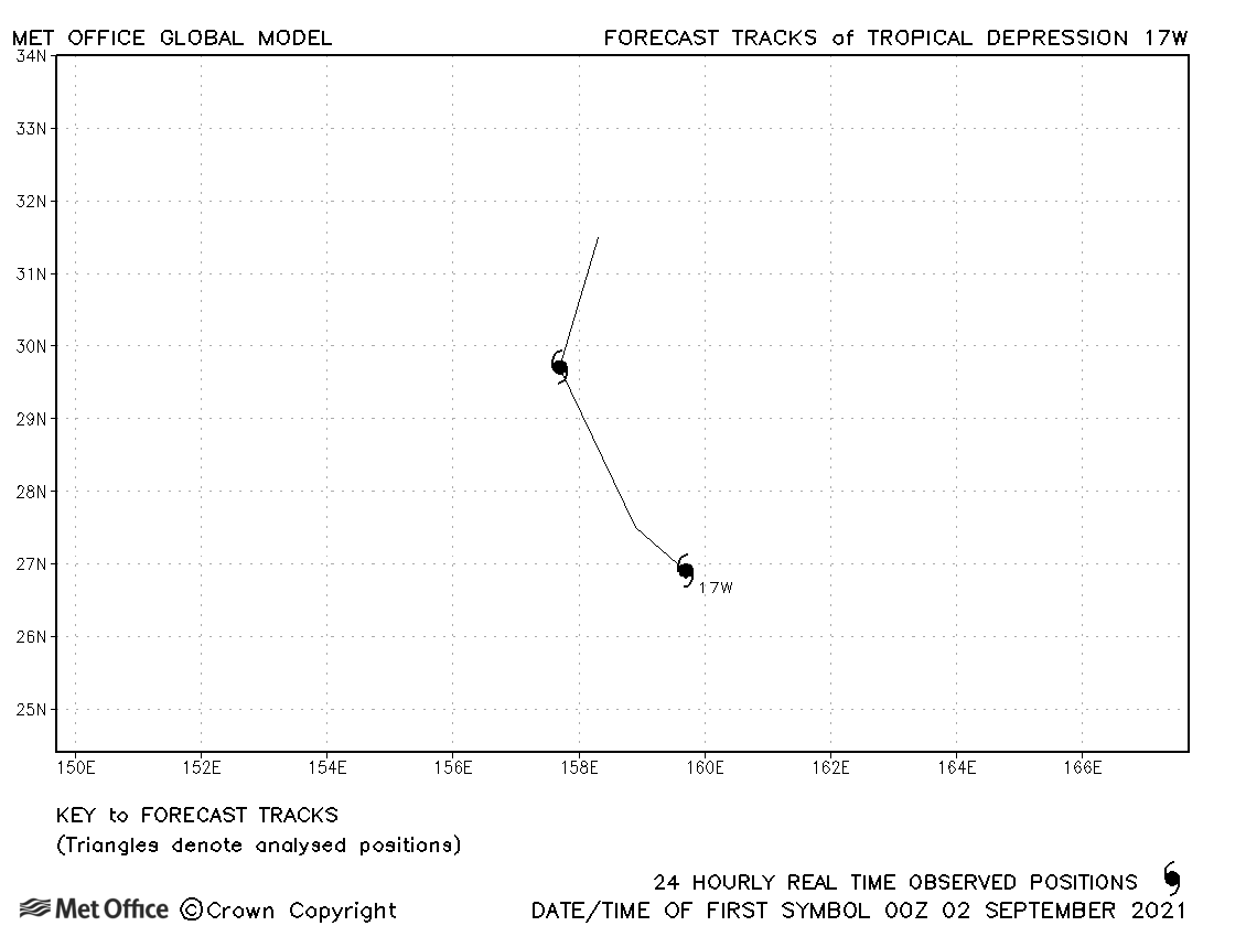
| 17W | 02-03 September | 1001 mb, 30/30 knots | No forecasts are verified for this depression |
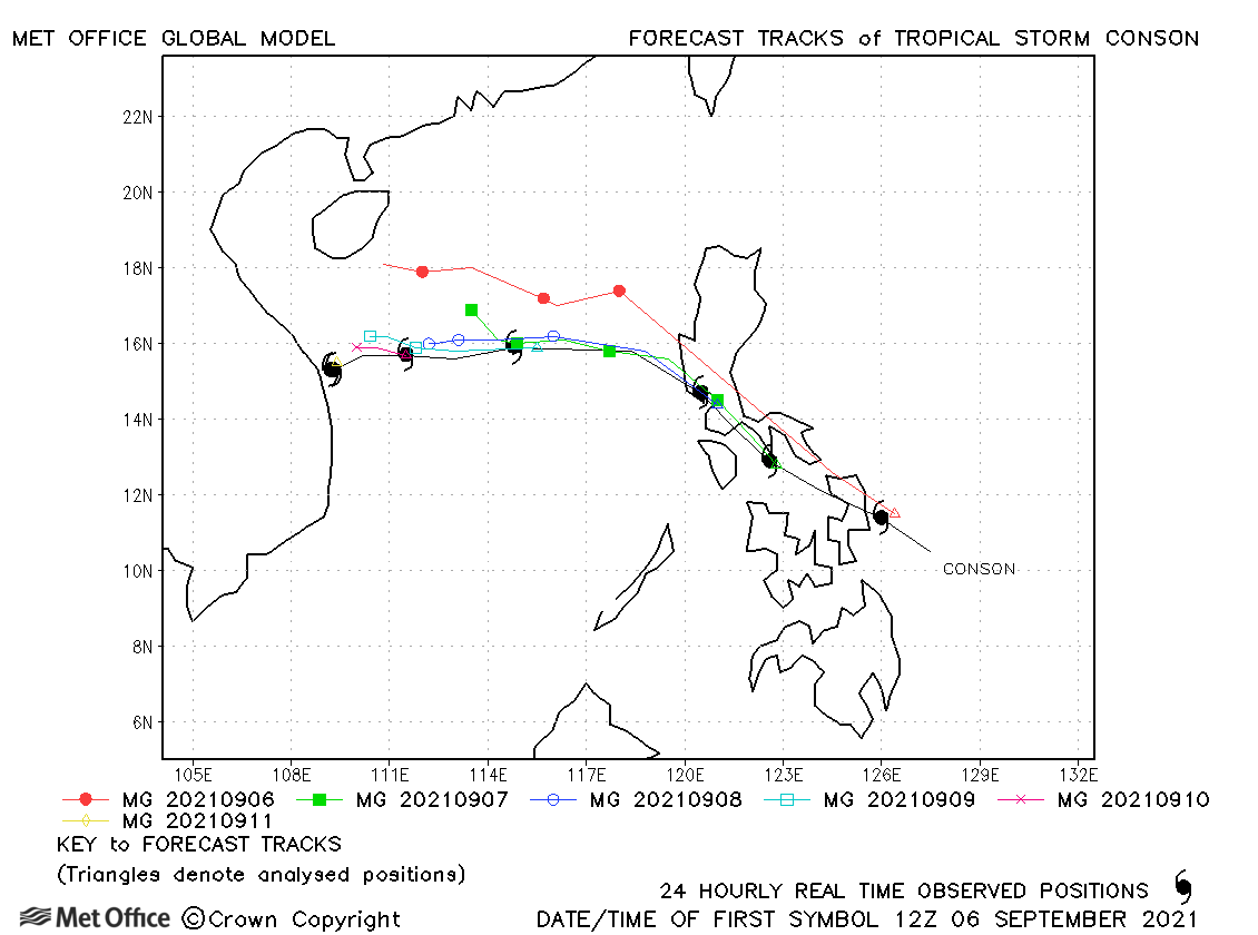
| Conson (18W) | 06-12 September | 985 mb, 60/55 knots | There was a slow bias in forecasts. Track errors were mostly above the recent mean values. |
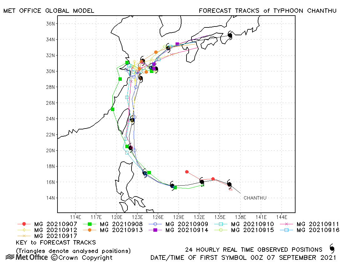
| Chanthu (19W) | 06-18 September | 905 mb, 155/115 knots | Track forecast errors were below the recent mean and skill scores were high. |
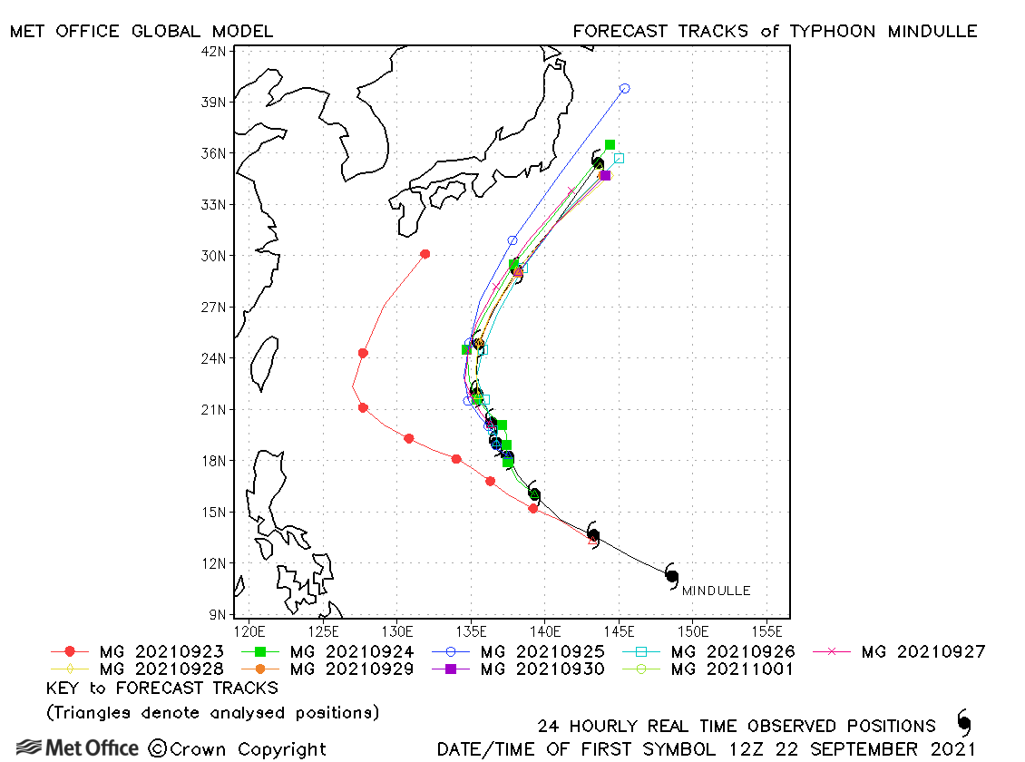
| Mindulle (20W) | 22 September-01 October | 920 mb, 145/105 knots | There was a left-of-track bias, but errors were below the recent mean value. |
| Dianmu (21W) | 22-24 September | 1000 mb, 35/35 knots | Dianmu was only briefly a tropical storm and few forecasts were verified. |
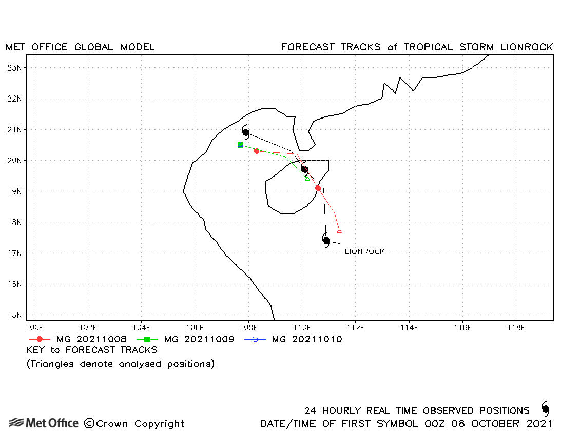
| Lionrock (22W) | 07-10 October | 994 mb, 40/40 knots | Track errors were below the recent mean values. |
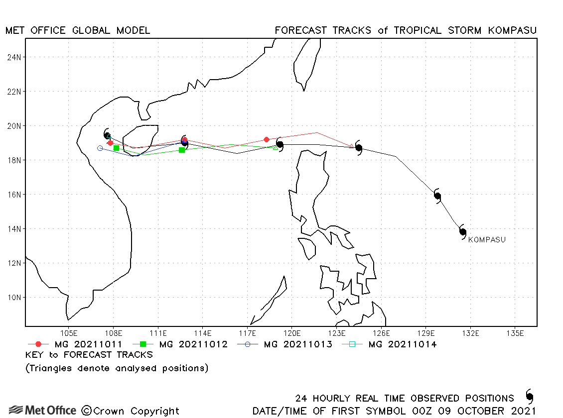
| Kompasu (24W) | 08-14 October | 975 mb, 55/55 knots | Track forecasts were good for this storm. |
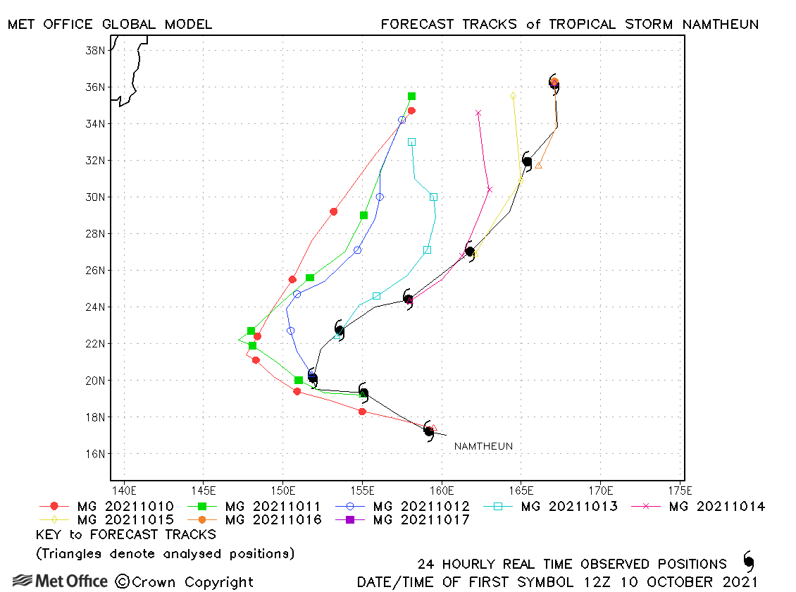
| Namtheun (23W) | 10-17 October | 996 mb, 65/50 knots | There was a marked left-of-track bias resulting in large track forecast errors. |
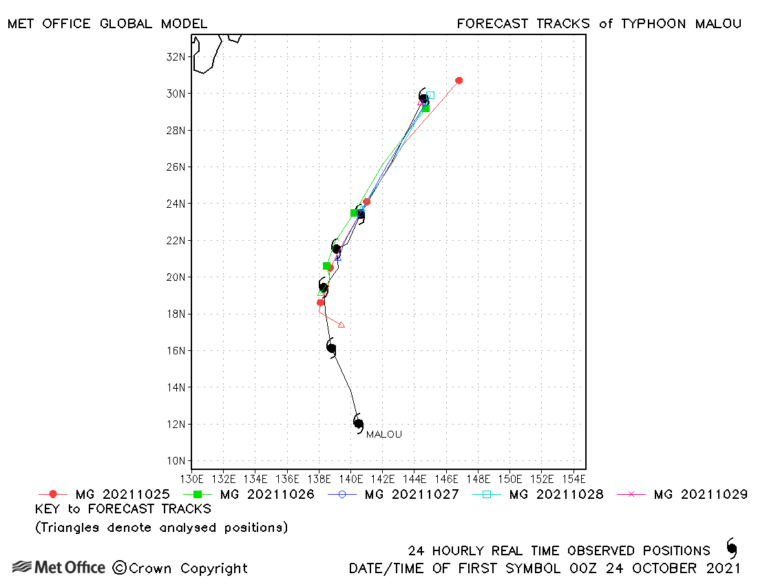
| Malou (25W) | 24-29 October | 965 mb, 85/75 knots | Track forecasts were good for this storm. |
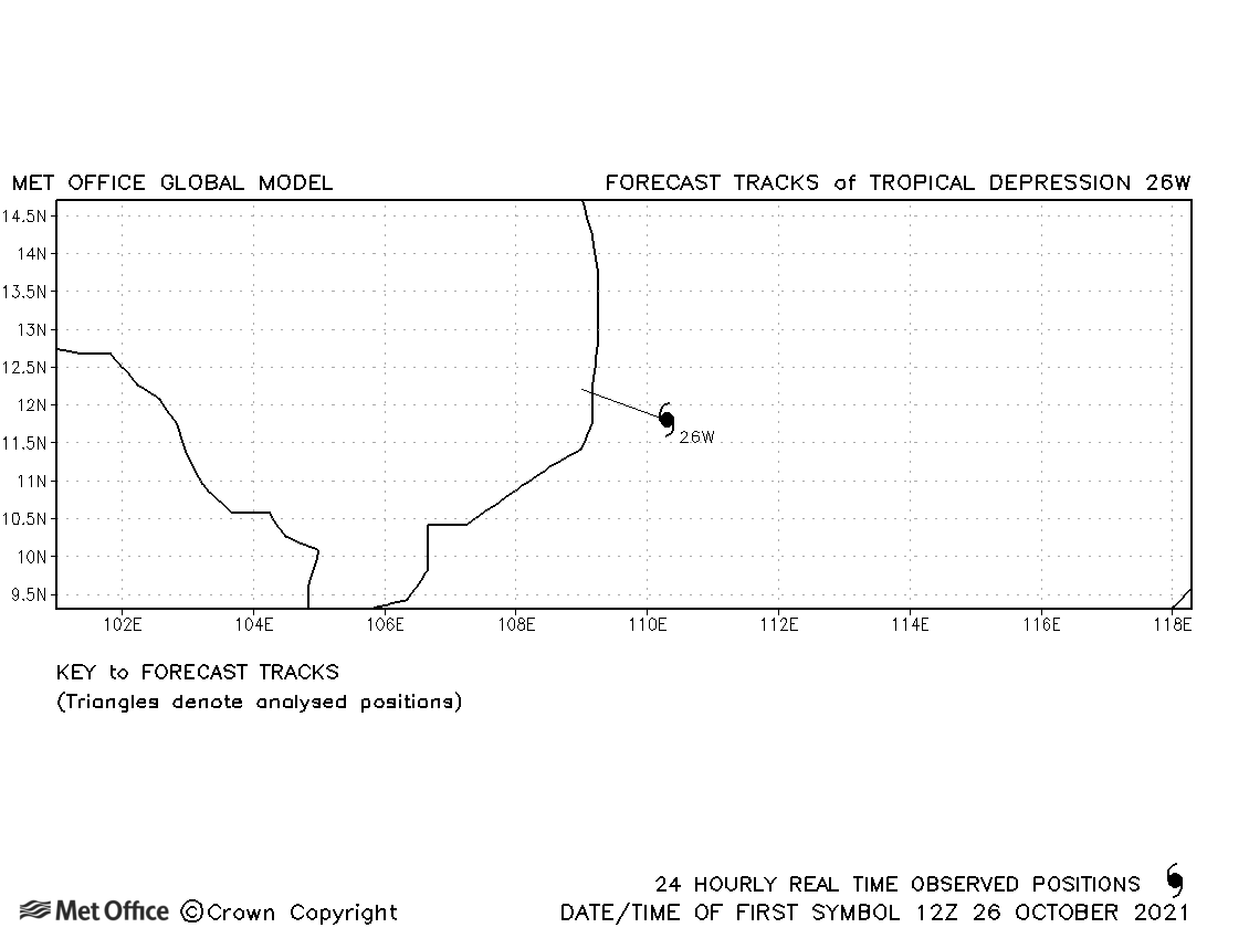
| 26W | 26-27 October | 1000 mb, 30/- knots | No forecasts were verified for this tropical depression. |
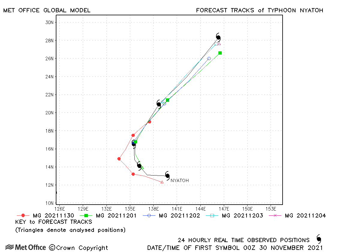
| Nyatoh (27W) | 29 November - 04 December | 925 mb, 125/100 knots | Track forecast errors were mostly above the recent mean values. |
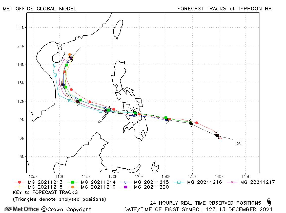
| Rai (28W) | 12-21 December | 915 mb, 145/105 knots | Track forecast errors were low and skill scores high for Typhoon Rai. |
| 29W | 16-17 December | 1004 mb, 25/- knots | No forecasts were verified for this tropical depression. |
North-west observed tracks in 2021
| Name & ID | Start & end dates | Central pressure, 1-minute MSW | Comments on Met Office global model forecasts |
|---|---|---|---|
|
09-11 May |
1005 mb, 35 knots |
Andres was only briefly a tropical storm and just one forecast was verified. |
|
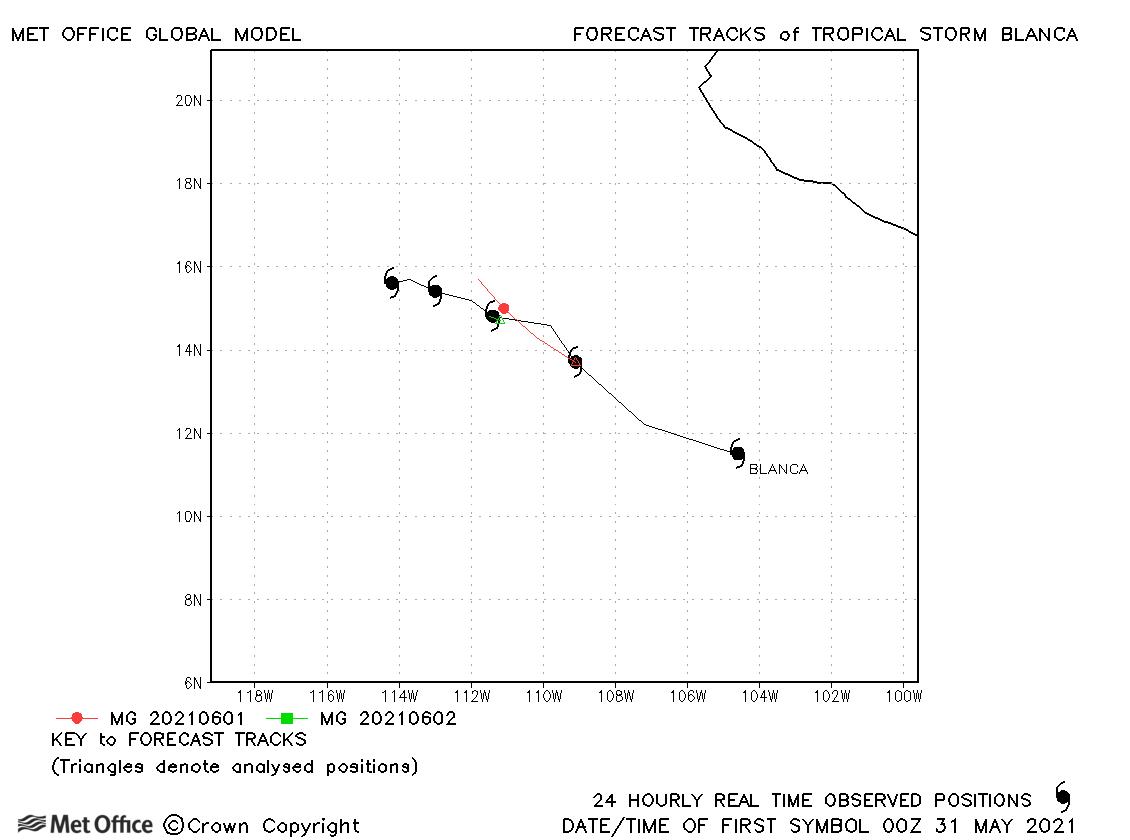
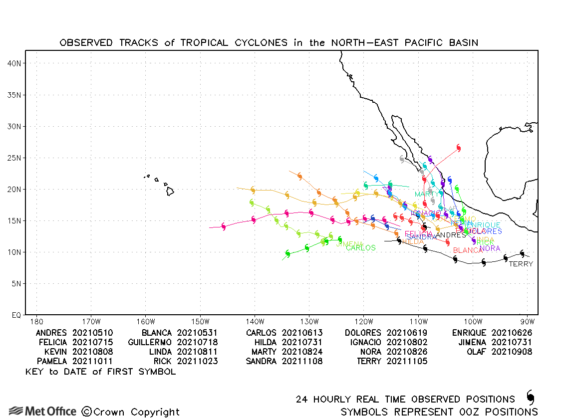
| Blanca (02E) | 30 May-04 June | 998 mb, 50 knots | Track errors were low for this storm. |
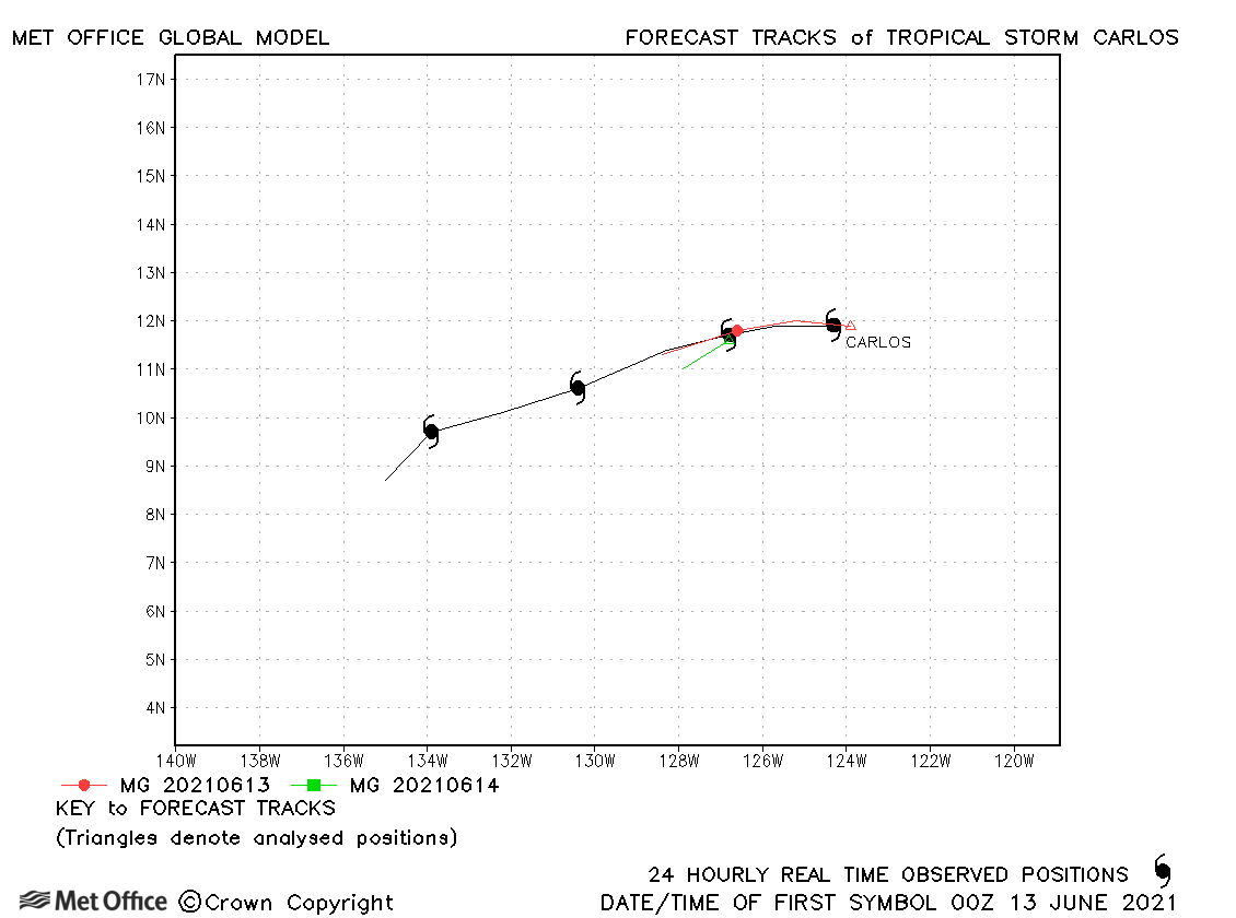
| Carlos (03E) | 12-16 June | 1000 mb, 45 knots | Track errors were low for this storm. |
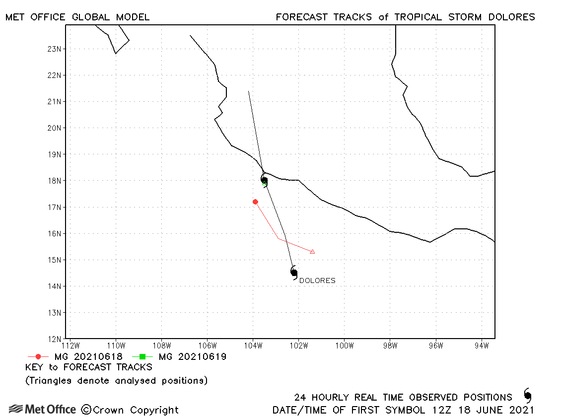
| Dolores (04E) | 18-20 June | 990 mb, 60 knots | Just a small number of forecasts were verified for Dolores. |
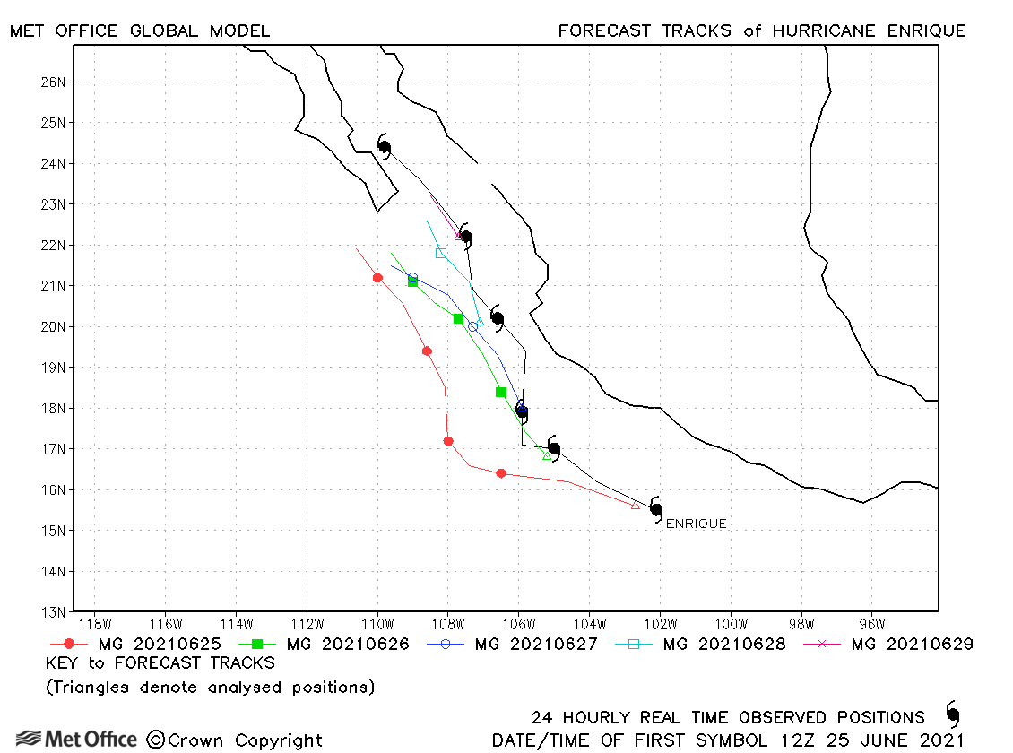
| Enrique (05E) | 24-30 June | 975 mb, 80 knots | There was a left-of-track bias in forecasts for Enrique. |
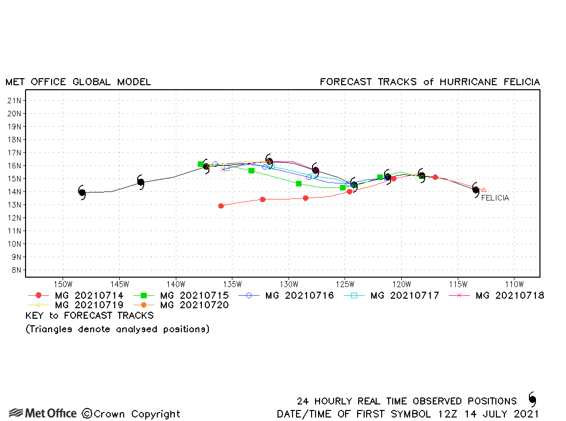
| Felicia (06E) | 14-20 July | 947 mb, 125 knots | Track forecast errors were low for Felicia, although there was a slight left-of-track bias. |
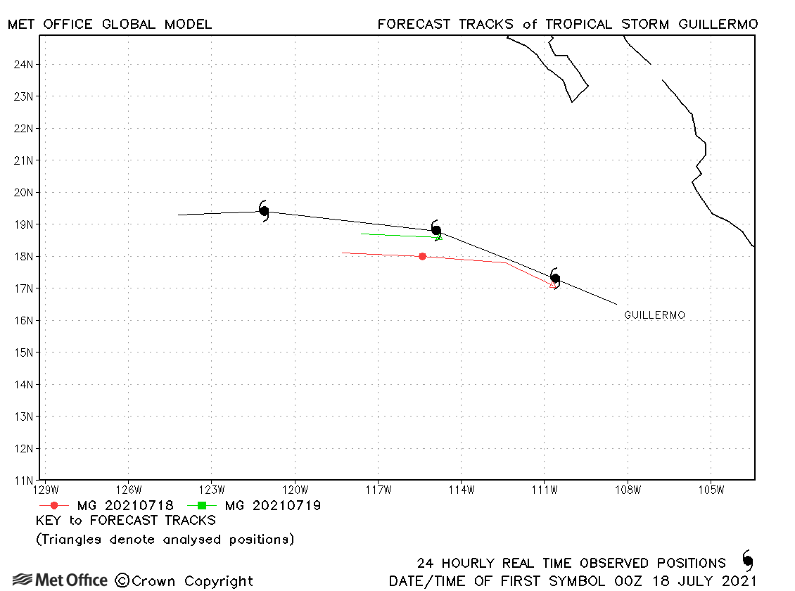
| Guillermo (07E) | 17-20 July | 999 mb, 50 knots | There was a slight left-of-track bias in forecasts for this short-lived storm. |
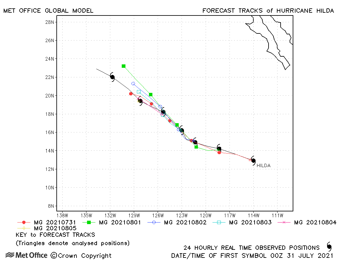
| Hilda (08E) | 30 July-06 August | 985 mb, 75 knots | Track forecast errors were low at short lead times, but high at longer lead times due to a fast bias. |
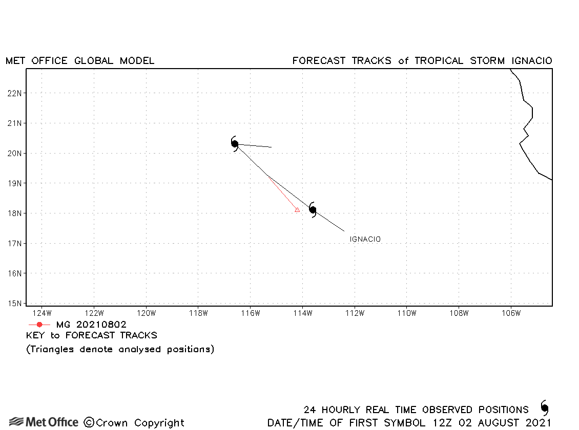
| Ignacio (10E) | 01-04 August | 1004 mb, 35 knots | Ignacio was very short-lived as a tropical storm. |
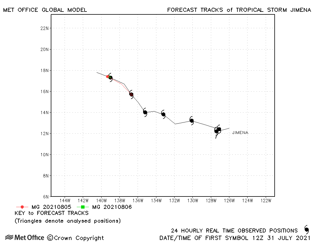
| Jimena (09E) | 30 July-07 August | 1005 mb, 35 knots | Jimena was short-lived as a tropical storm. Track forecast errors were low. |
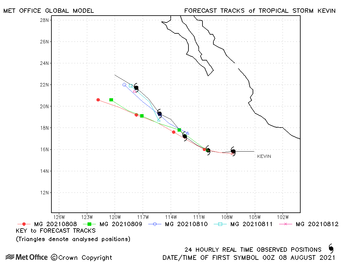
| Kevin (11E) | 07-12 August | 999 mb, 50 knots | There was a fast and left-of-track bias in forecasts resulting in larger than average track forecast errors at longer lead times. |
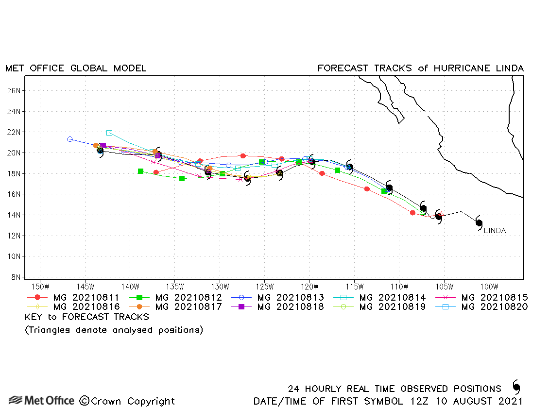
| Linda (12E) | 10-20 August | 950 mb, 115 knots | Track forecast errors for Linda were close to the recent mean values for this basin. |
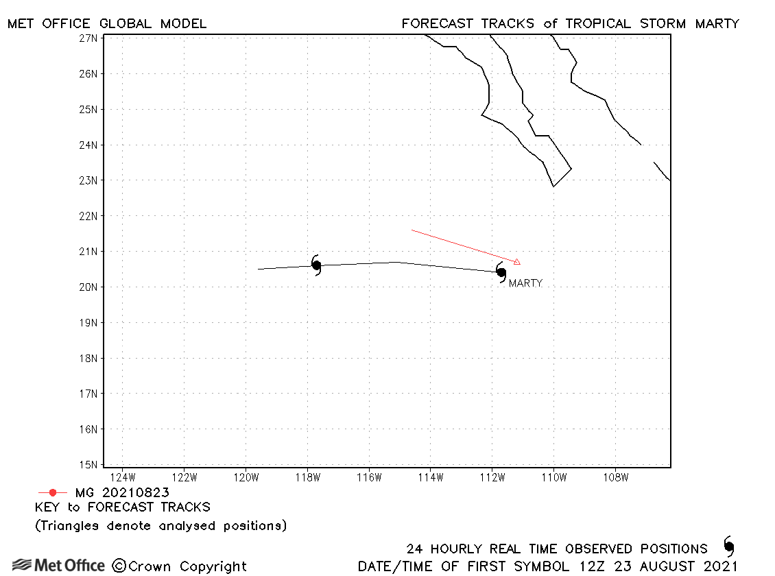
| Marty (13L) | 23-24 August | 1001 mb, 40 knots | Marty only briefly reached tropical storm status. |
| Nora (14E) | 25-30 August | 977 mb, 75 knots | Nora turned right and accelerated towards the coast faster than predicted resulting in track forecast errors above the recent mean. |
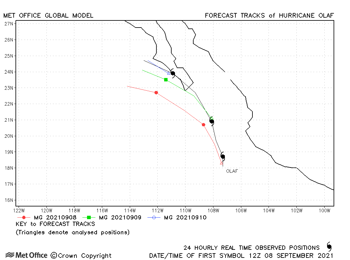
| Olaf (15E) | 07-11 September | 977 mb, 80 knots | There was a left-of-track bias in forecasts for Olaf. |
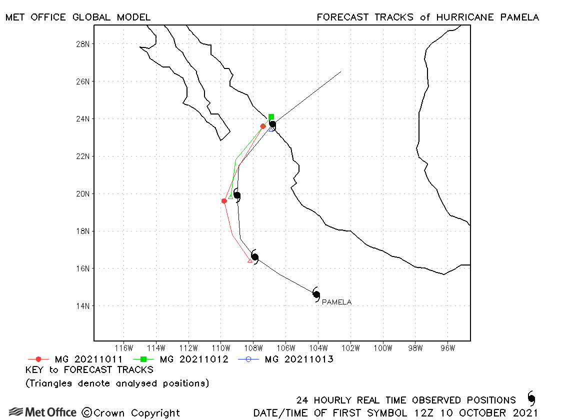
| Pamela (16E) | 10-14 October | 985 mb, 70 knots | Track forecast errors were low and the landfall location well predicted. |
| Rick (17E) | 22-26 October | 977 mb, 90 knots | Track forecast errors were mostly near to the recent mean values. |
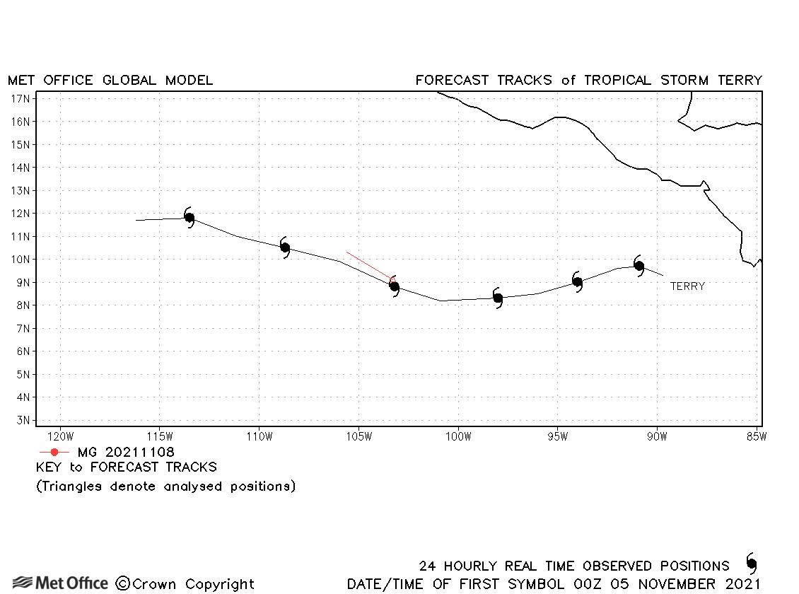
| Terry (18E) | 04-10 November | 1004 mb, 40 knots | Terry was short-lived and only one forecast was verified. |
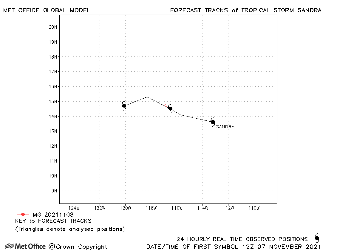
| Sandra (19E) | 07-09 November | 1006 mb, 35 knots | Sandra was short-lived and only one forecast was verified. |
| Name & ID | Start & end dates | Central Pressure, 1-minute MSW | Comments on Met Office global model forecasts |
|---|---|---|---|
|
|
|
North-east and Central North Pacific observed tracks in 2021
Tropical cyclone names (North-east Pacific)
Tropical cyclone names (Central North Pacific)
| Name & ID | Start & end dates | Central pressure, 1-minute MSW | Comments on Met Office global model forecasts |
|---|---|---|---|
| 22-24 May | 1006 mb, 40 knots |
Track forecast errors for Ana were near to the recent mean values. |
|
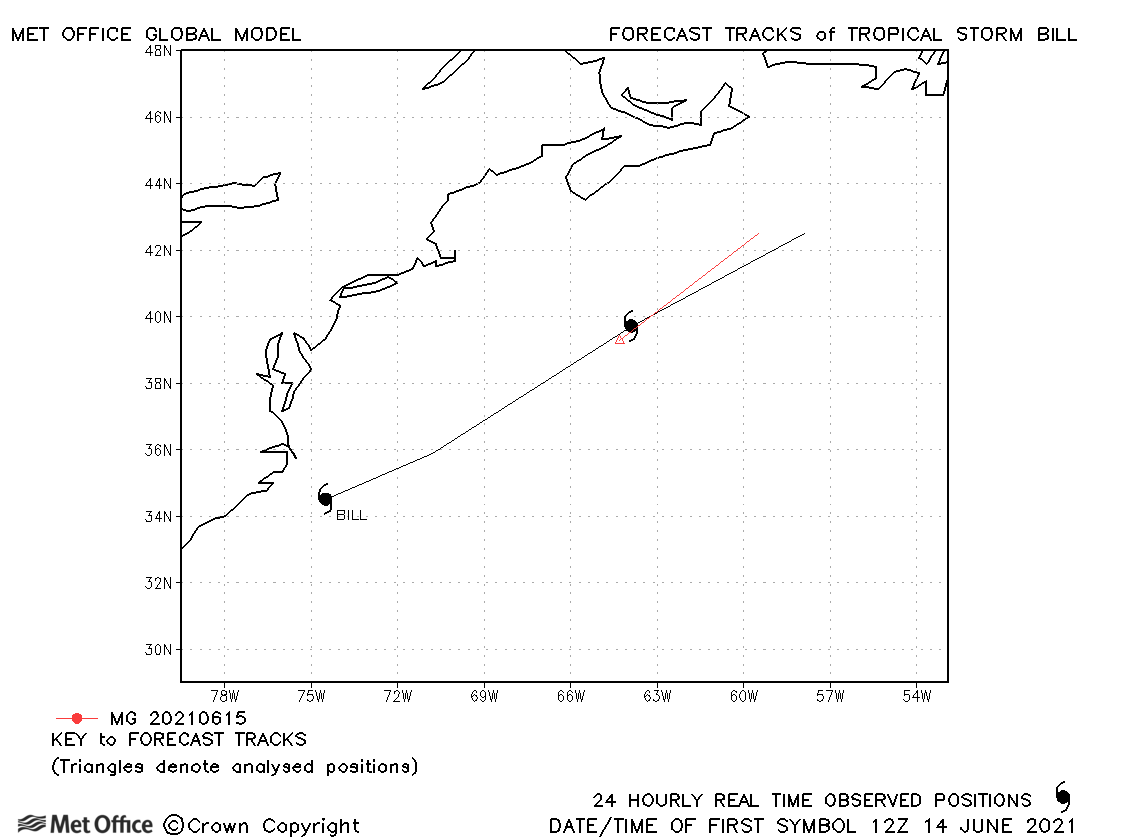
| Bill (02L) | 14-16 June | 998 mb, 50 knots | Bill was a short-lived tropical storm. |
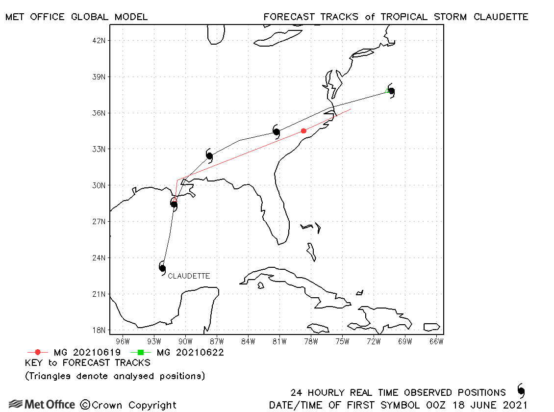
| Claudette (03L) | 17-22 June | 1004 mb, 40 knots | Claudette became a tropical storm at landfall and then again after re-emerging over sea. There was a slow bias in forecasts. |
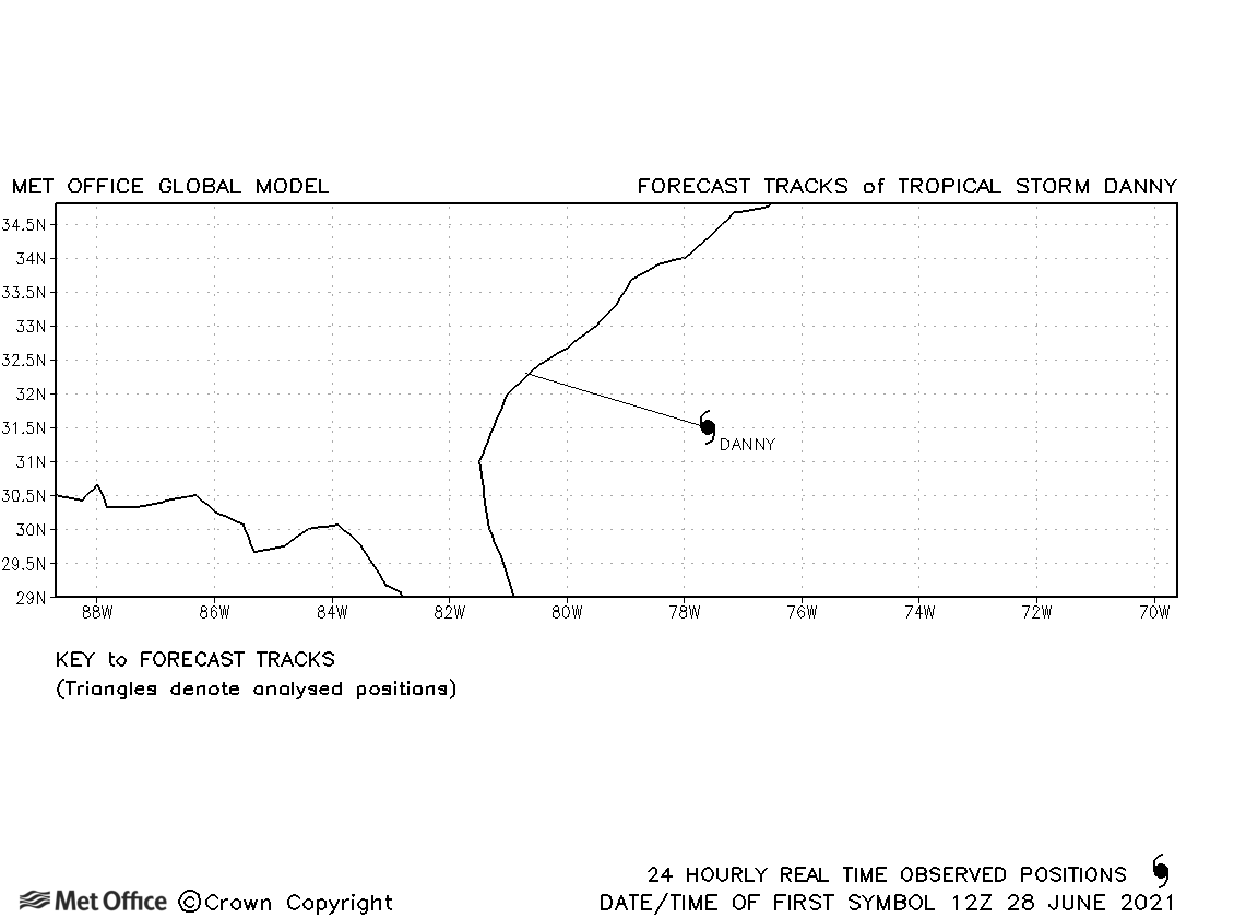
| Danny (04L) | 28-29 June | 1013 mb, 35 knots | Danny was only briefly a tropical storm and no forecasts were verified. |
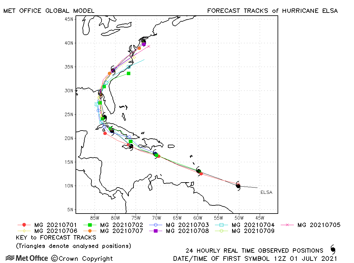
| Elsa (05L) | 30 June - 09 July | 991 mb, 75 knots | Track forecast errors were mostly near to or below the recent mean, although there was a slow bias in forecasts. |
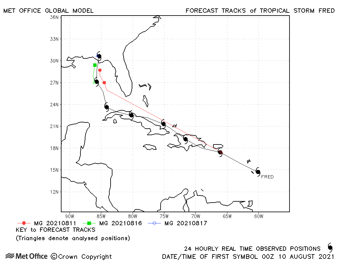
| Fred (06L) | 09-17 August | 994 mb, 55 knots | Fred had two spells as a tropical storm. Short lead time errors were above the recent mean, but long lead time errors were low and the passage into the eastern Gulf of Mexico well predicted. |
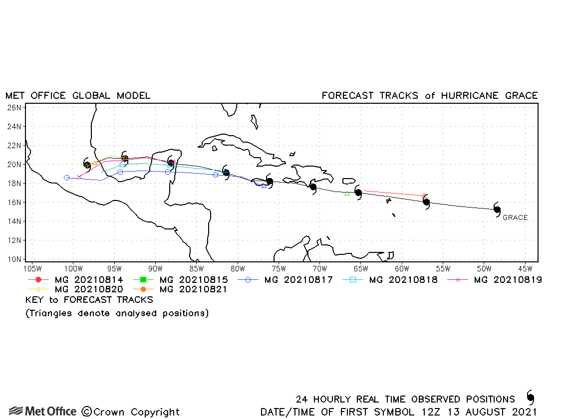
| Grace (07L) | 13-21 August | 962 mb, 110 knots | Track forecast errors were mostly near to the recent mean. There was a slight left-of-track bias in landfall predictions. Also, early forecasts did not develop Grace quickly enough resulting in low detection percentages. |
| Henri (08L) | 16-23 August | 986 mb, 65 knots | Track forecast errors were low for Henri and the turn northwards was well predicted. |
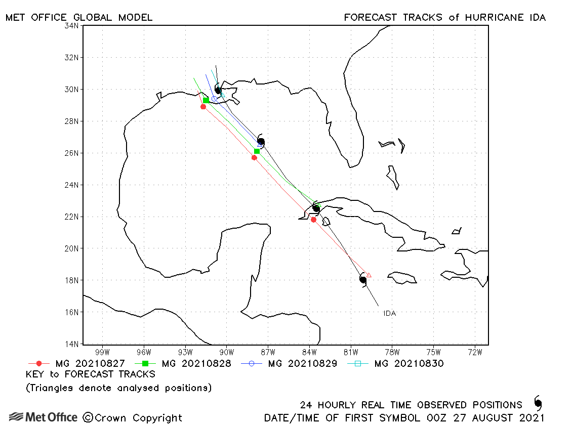
| Ida (09L) | 26-30 August | 929 mb, 130 knots | There was a slight left-of-track and slow bias in forecasts, but track forecast errors were near to the recent mean. |
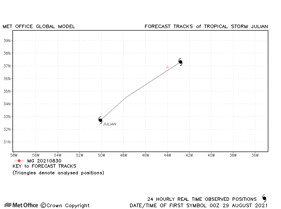
| Julian (11L) | 29-30 August | 998 mb, 50 knots | Julian was a short-lived tropical storm and few forecasts were verified. |
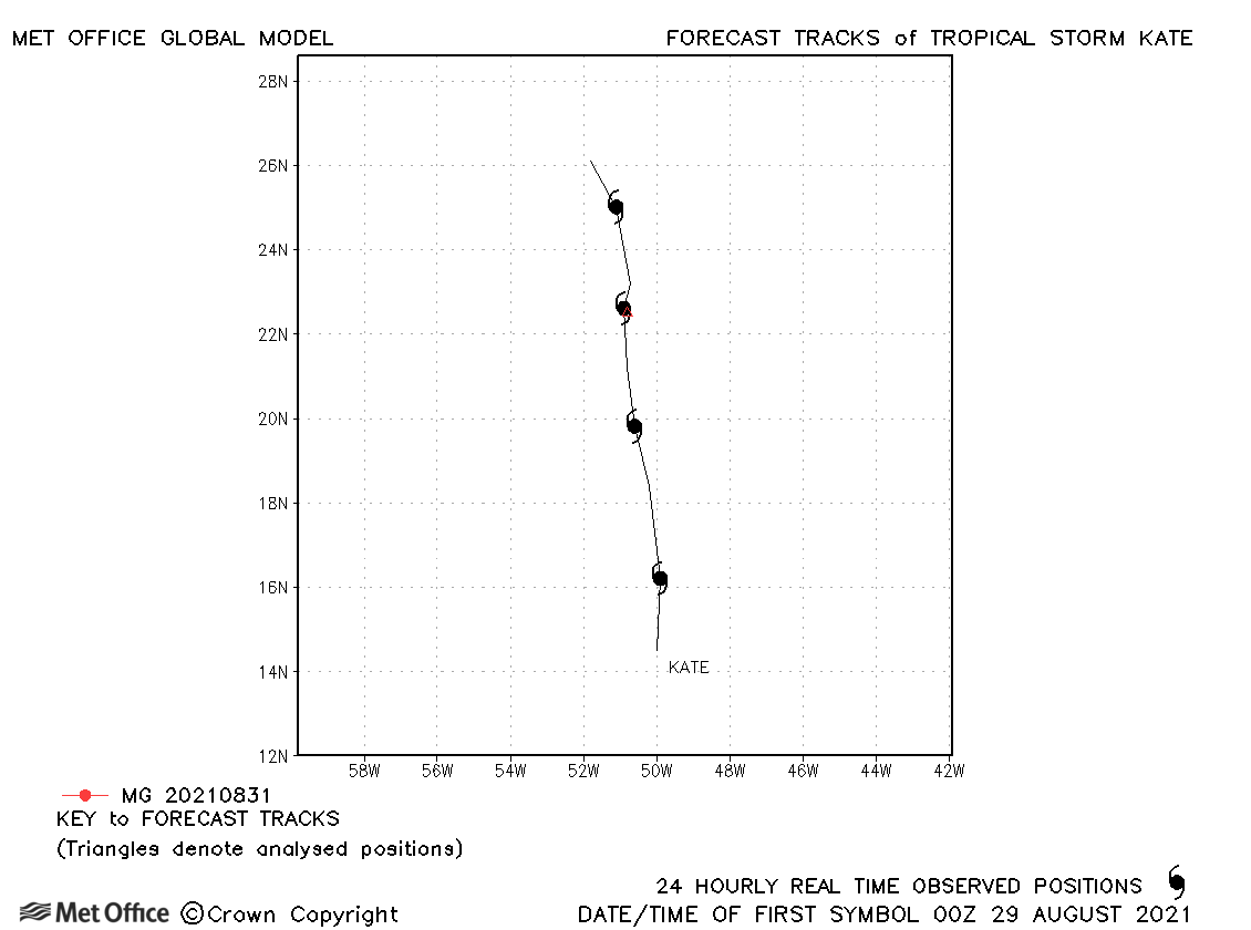
| Kate (10L) | 28 August-01 September | 1006 mb, 35 knots | Kate was a very brief tropical storm. |
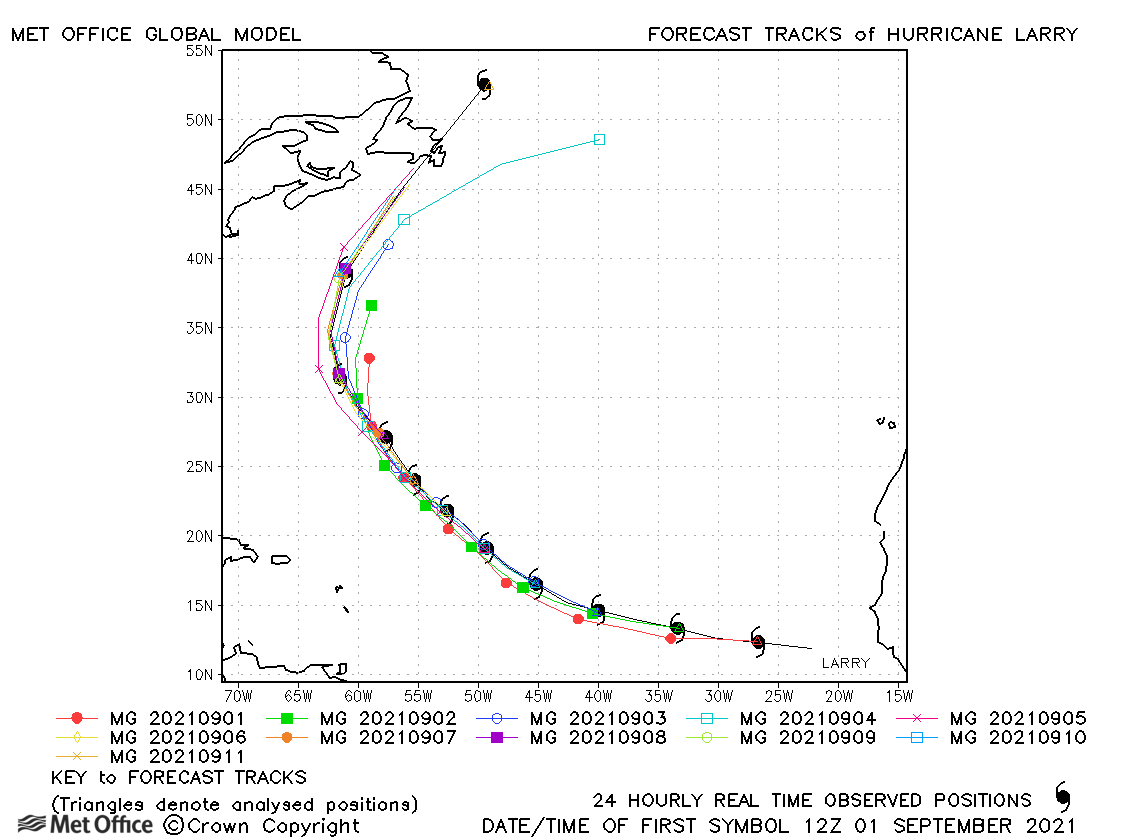
| Larry (12L) | 31 August-11 September | 955 mb, 110 knots | Track forecasts for Larry were mostly very good with errors below the recent mean values. There was a slight fast bias at longer lead times. There was an over-deepening bias in forecasts as larry moved through subtropical latitudes. |
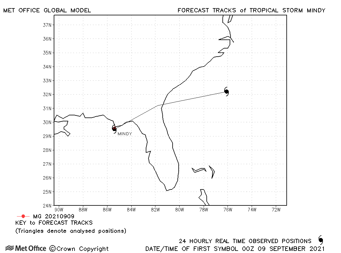
| Mindy (13L) | 08-10 September | 1004 mb, 40 knots | Mindy was a very short-lived tropical storm. |
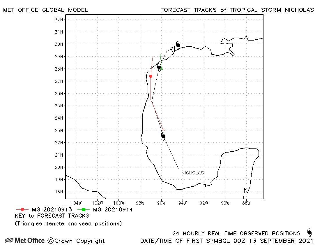
| Nicholas (14L) | 12-15 September | 988 mb, 65 knots | There was a slight slow and left-of-track bias for Nicholas. |
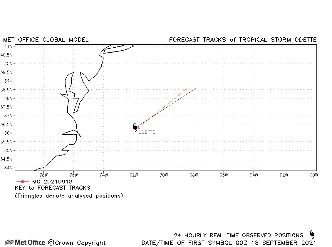
| Odette (15L) | 17-18 September | 1001 mb, 40 knots | Odette was only briefly a tropical storm and few forecasts were verified. |
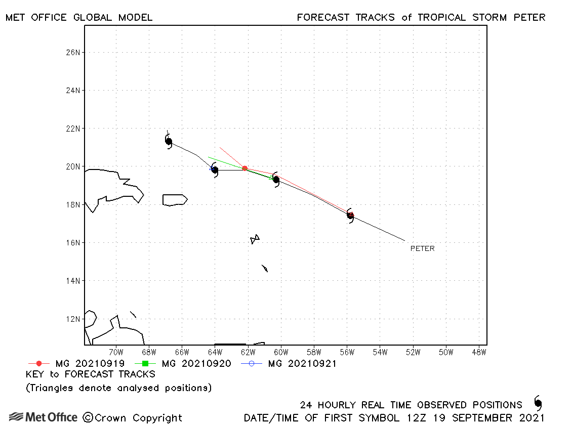
| Peter (16L) | 19-23 September | 1005 mb, 45 knots | Track forecast errors were near to the recent mean values. |
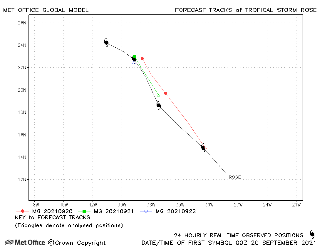
| Rose (17L) | 17-23 September | 1004 mb, 45 knots | Rose was fairly short-lived. Track forecast errors at longer lead times were low. |
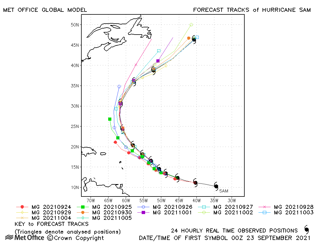
| Sam (18L) | 22 September-05 October | 936 mb, 130 knots | There was a left-of-track bias, but track forecast errors were below the recent mean values. |
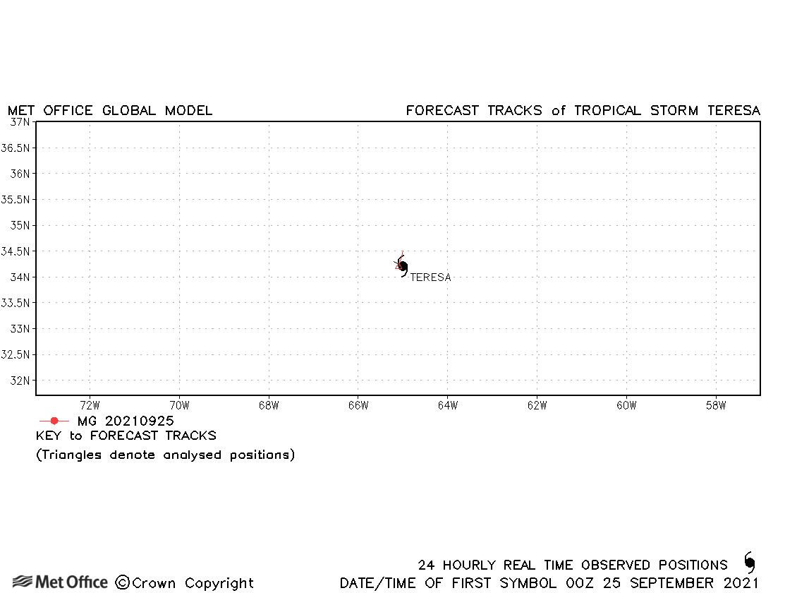
| Teresa (19L) | 24-25 September | 1008 mb, 40 knots | Teresa was a short-lived subtropical storm. |
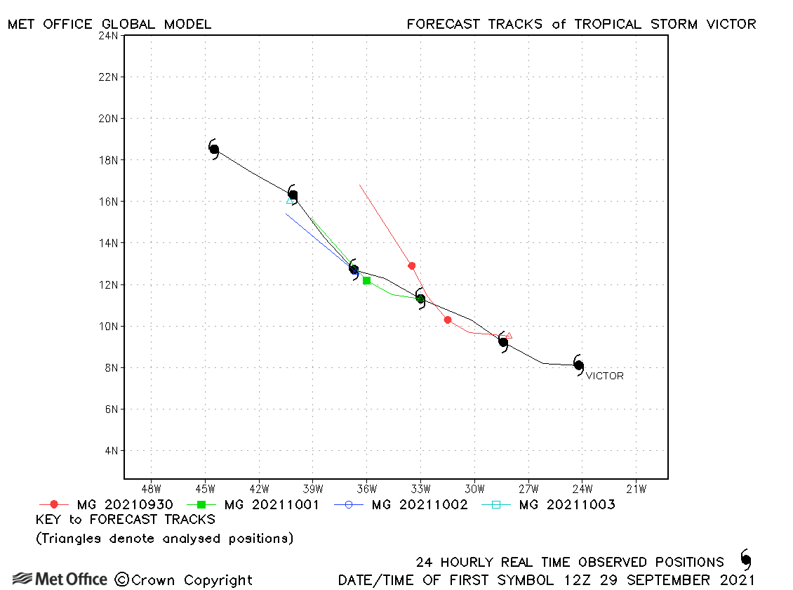
| Victor (20L) | 29 September-04 October | 997 mb, 55 knots | There was a slow bias in forecasts resulting in track forecast errors above the recent mean values. |
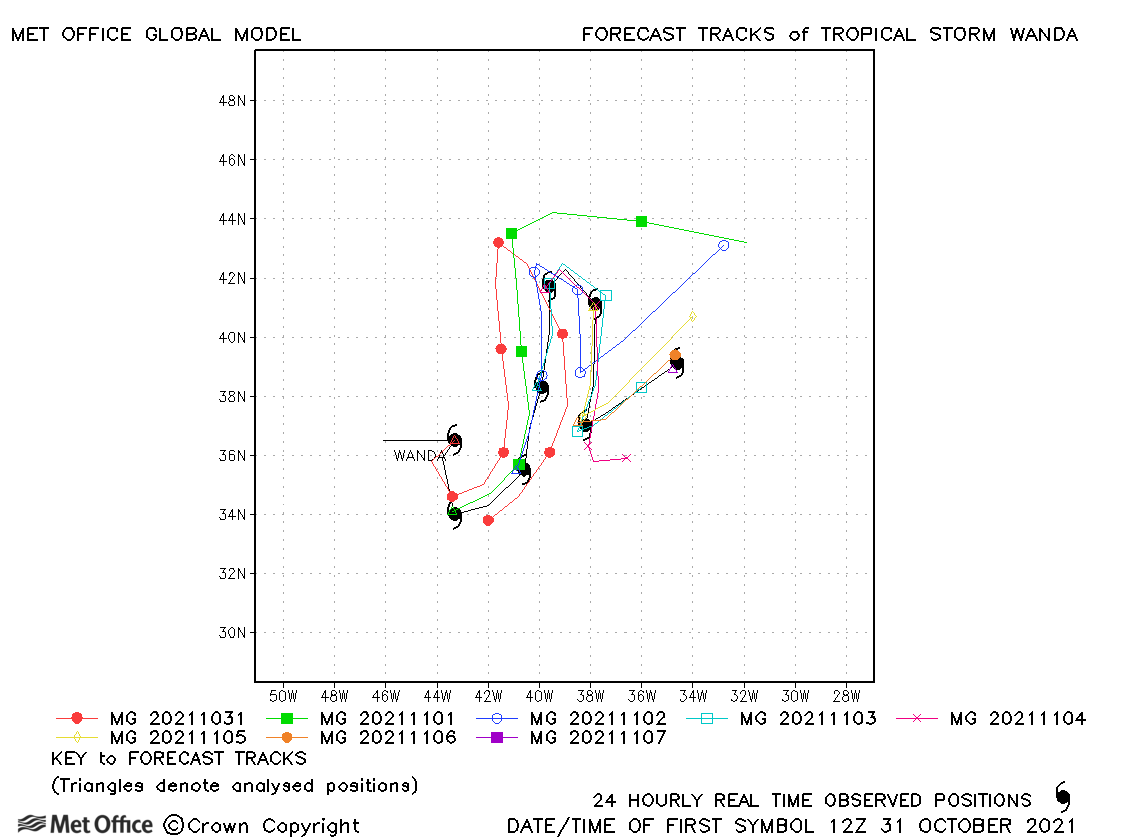
| Wanda (21L) | 31 October - 07 November | 987 mb, 45 knots | Track forecast errors were below the recent mean at short lead times, but mixed at longer lead times. |
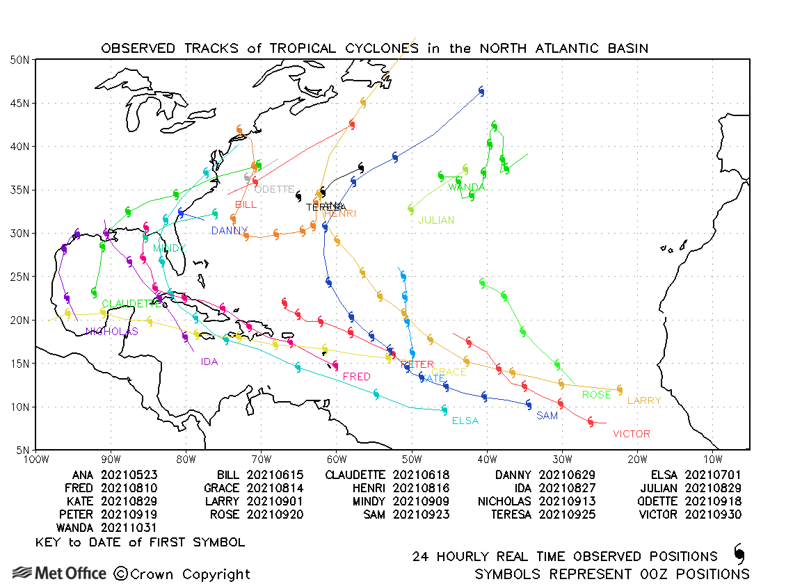
North Atlantic observed tracks in 2021
| Name & ID | Start & end dates | Central pressure, 1-/3-minute MSW | Comments on Met Office global model forecasts |
|---|---|---|---|
| 14-18 May | 935 mb, 120/100 knots |
An early forecast had a left-of-track bias meaning errors at the longest lead times were large, but mostly track forecast errors were low and landfall well predicted over two days in advance. |
|
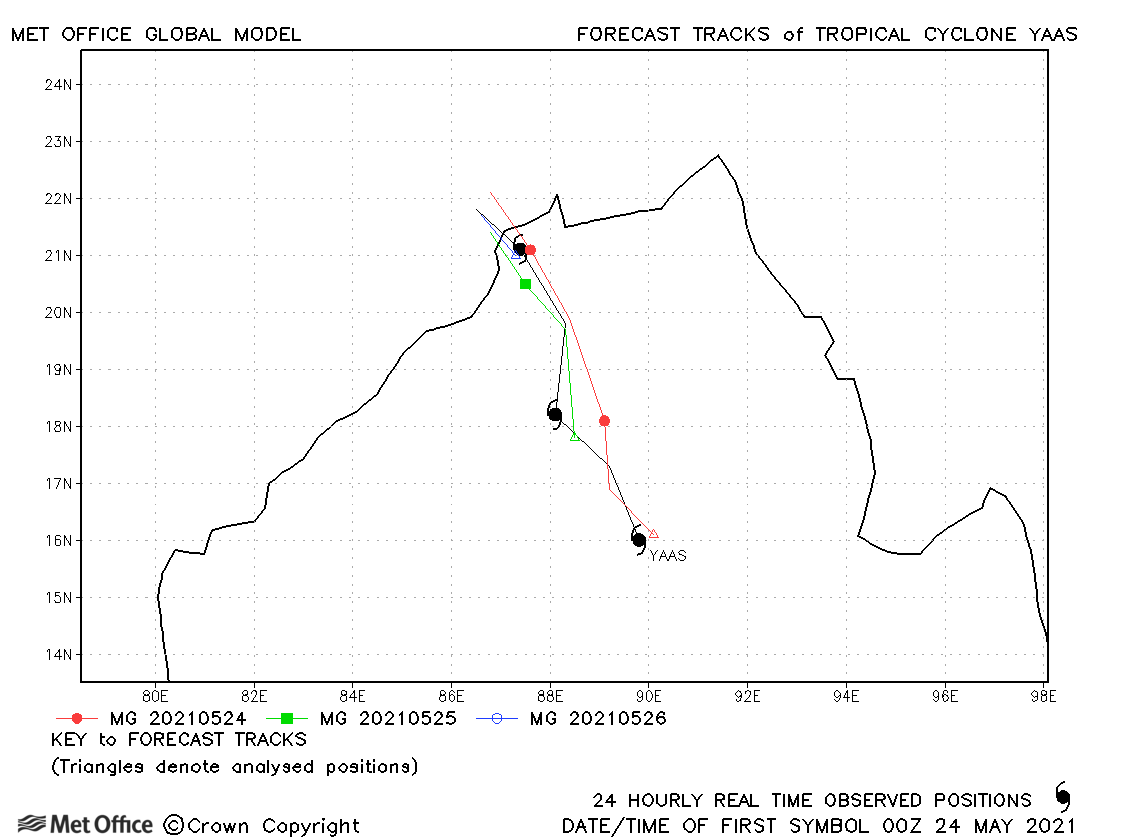
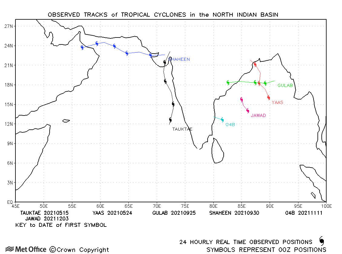
| Yaas (02B) | 24-26 May | 974 mb, 65/70 knots | Track forecast errors were very low and landfall well predicted by the model. |
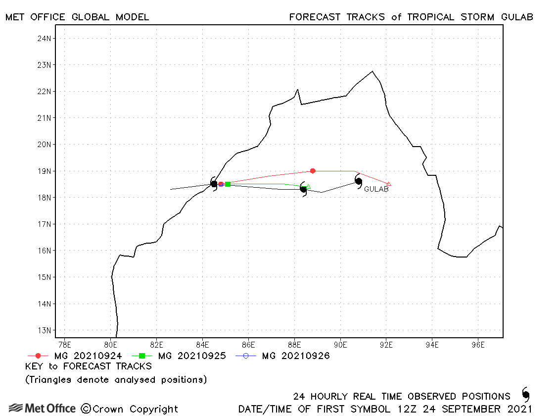
| Gulab (03B) * | 24-27 September | 994 mb, 40/45 knots | The landfall location was well predicted. |
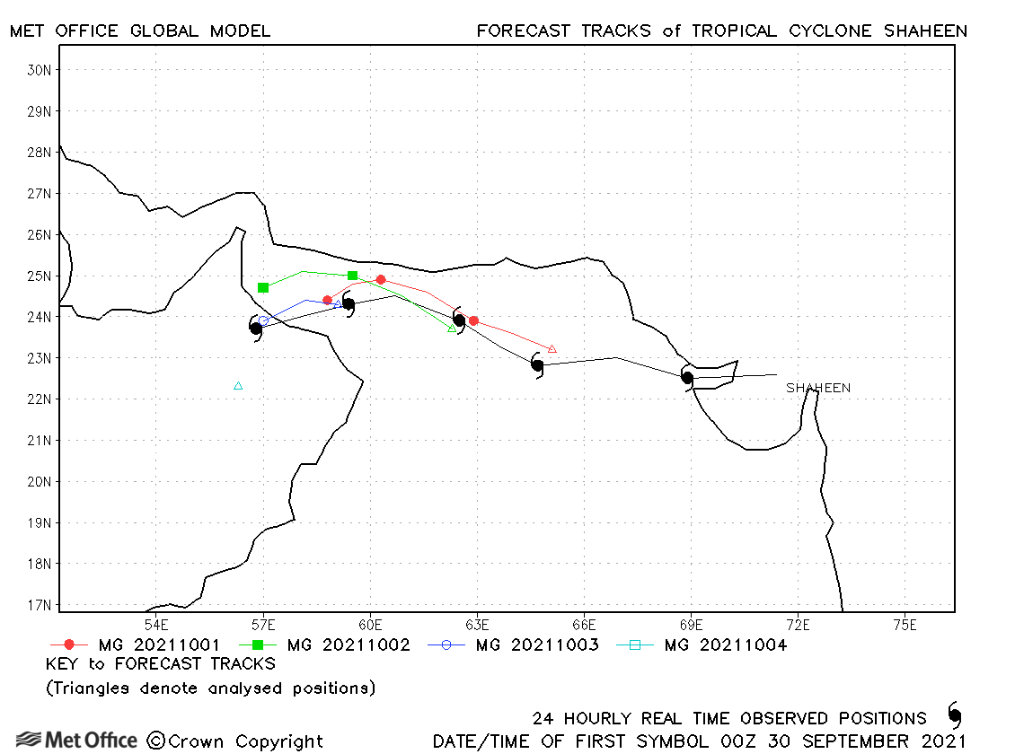
| Shaheen (03B) * | 29 September-04 October | 977 mb, 65/60 knots | Track forecast errors were mostly below the recent mean values. |
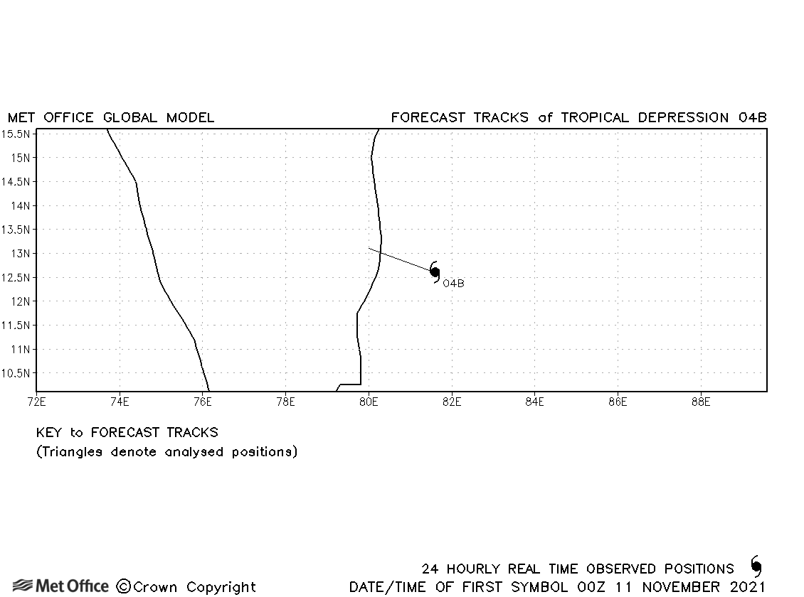
| 04B | 11 November | 997 mb, 35/30 knots | 04B was short-lived and no forecasts were verified. |
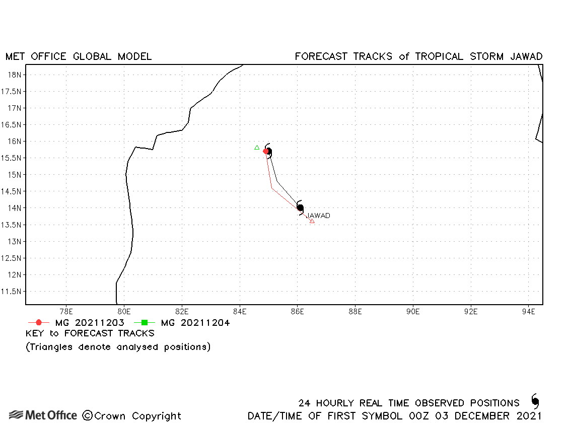
| Jawad (05B) | 03-04 December | 999 mb, 35/40 knots | Jawad was short-lived, but track errors were low. |
| * Shaheen developed from the remnants of Gulab. Treating as two storms as did IMD, but JTWC used the same identifier. | |||
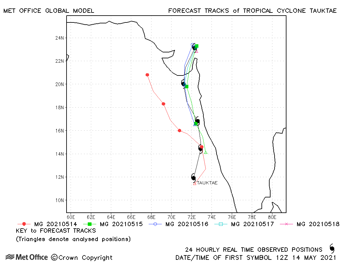
North Indian observed tracks in 2021
| Name & ID | Start & end dates | Central pressure, 1-/10-minute MSW | Comments on Met Office global model forecasts |
|---|---|---|---|
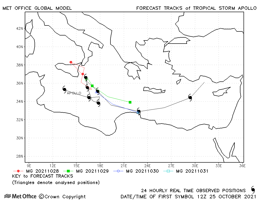
| Apollo (01M) | 25 October - 02 November | 1000 mb, 50/- knots | There was a slow bias due to a failure to predict the turn south-eastwards in some forecasts. |
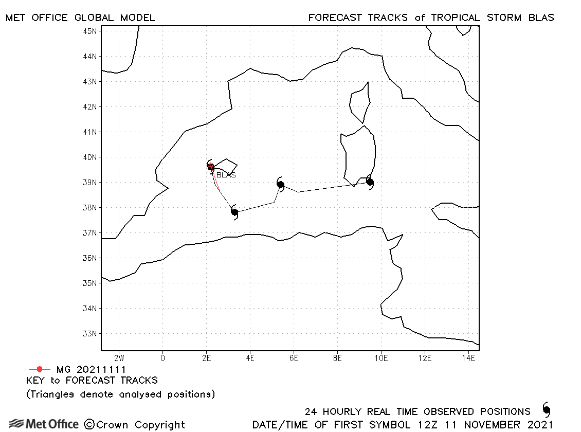
| Blas (02M) | 11-14 November | 1007 mb, 35/- knots | Blas was only considered to have subtropical storm strength winds briefly. Only one forecast was verified. |
Note, there is no official warning agency for Mediterranean tropical or subtropical cyclones, so identifiers are assigned by the Met Office to facilitate tracking and forecast verification.
Mediterranean observed tracks in 2021
Note on estimated wind speeds
1-minute MSW: Maximum sustained wind (knots) averaged over 1 minute (JTWC Hawaii, NHC Miami, CPHC Hawaii)
3-minute MSW: Maximum sustained wind (knots) averaged over 3 minutes (IMD New Delhi)
10-minute MSW: Maximum sustained wind (knots) averaged over 10 minutes (JMA Japan)
Note: Although 1-minute average winds should be stronger than 3-/10-minute averages, this may not be the case here since estimates are obtained from different warning centres using different analysis techniques.

