
Observed and forecast tracks: northern hemisphere 2024
A summary of tropical cyclone activity in the Northern Hemisphere for the 2024 season together with an assessment of the performance of the Met Office global model in predicting the track and intensity of these tropical cyclones.
Click on the name of the tropical cyclone to see a chart of the observed track and forecast tracks from the Met Office global model. Verification statistics on each tropical cyclone are available upon request from tropical_cyclones@metoffice.gov.uk. At the end of the season a verification report on the performance of the Met Office global model will be published.
North-west Pacific
| Name & ID | Start & end dates | Central pressure, 1-/10-minute MSW | Comments on Met Office global model forecasts |
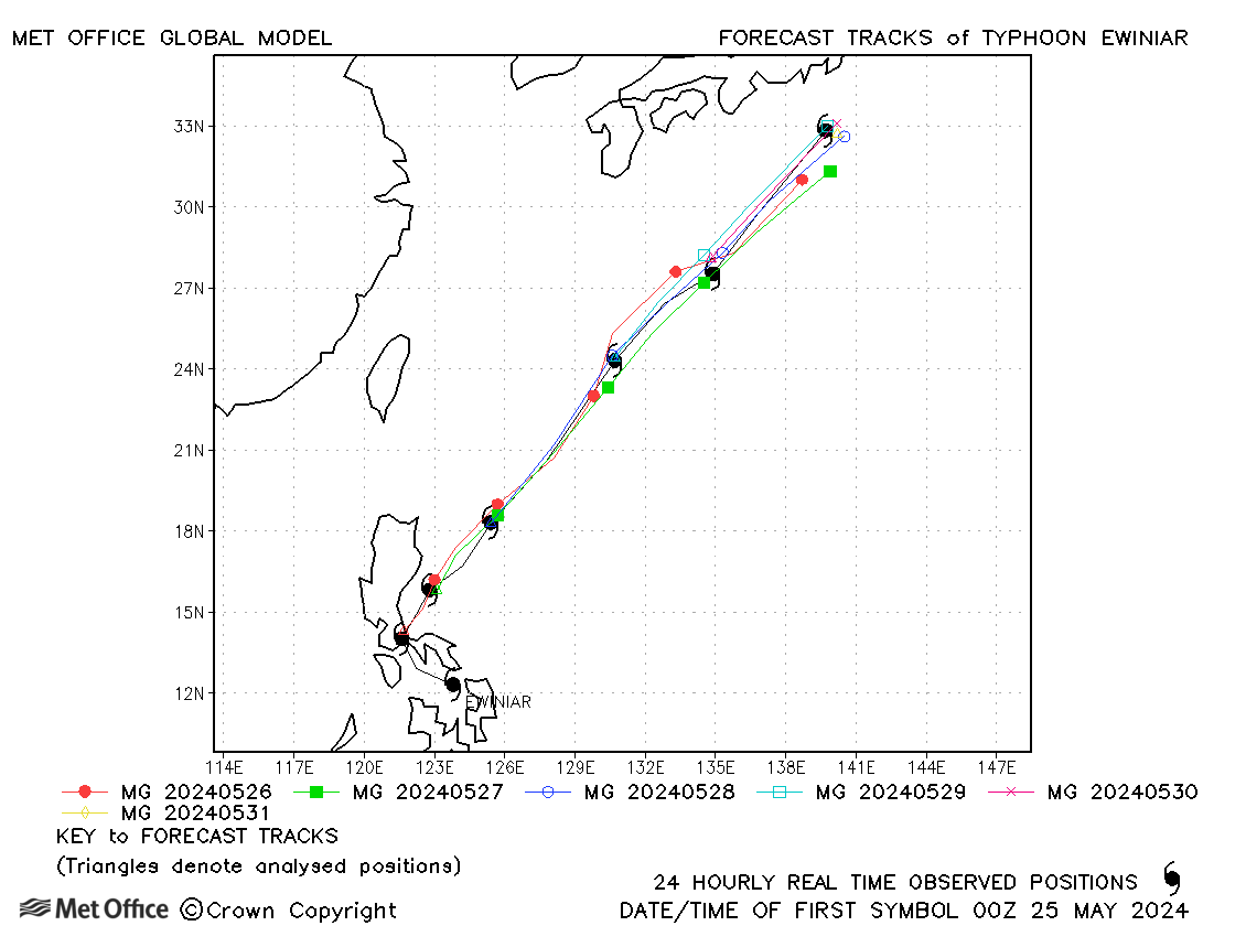
| Ewiniar (01W) | 24-31 May | 980 mb, 95/70 knots | Track forecast errors were low compared to the recent mean values. |
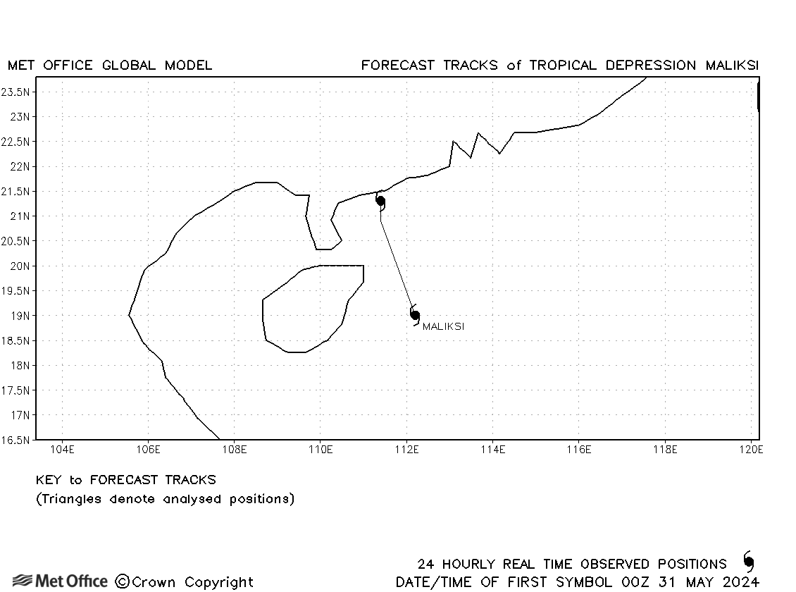
| Maliksi (02W) | 31 May-01 June | 998 mb, 30/35 knots | Although named by JMA, JTWC held 02W at tropical depression status. No forecasts were verified. |
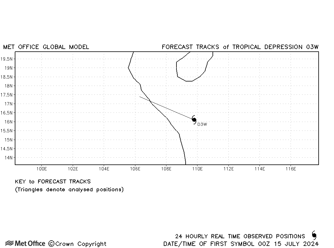
| 03W | 14-15 July | 1000 mb, 30/30 knots | 03W did not attain tropical storm status and no forecasts were verified. |
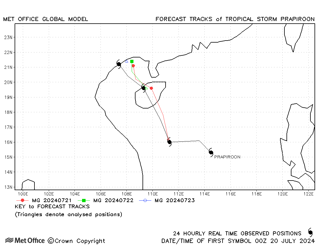
| Prapiroon (04W) | 19-23 July | 980 mb, 60/60 knots | Track forecast errors were close to the recent mean values. |
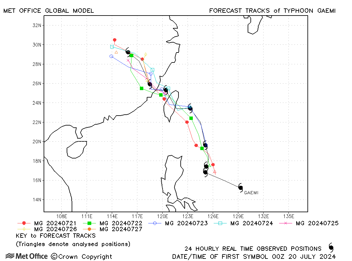
| Gaemi (05W) | 19-27 July | 940 mb, 125/90 knots | Beyond 48 hours, track forecast errors were considerably below the recent mean values. Landfall on Taiwan was well predicted. |
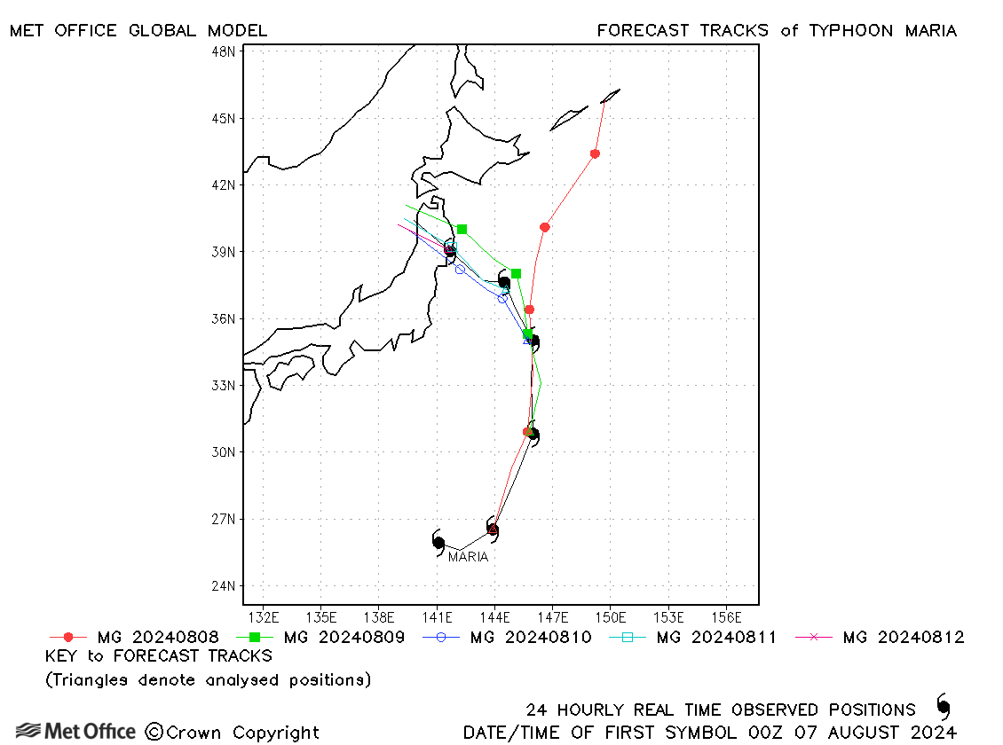
| Maria (06W) | 07-12 August | 980 mb, 70/55 knots | Track forecast errors were below the recent mean values at short lead times, but longer lead time errors were larger. |
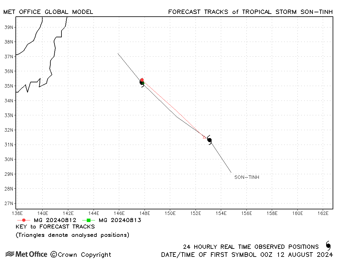
| Son-tinh (07W) | 11-13 August | 994 mb, 40/35 knots | Son-tinh was short-lived and few forecasts were verified. |
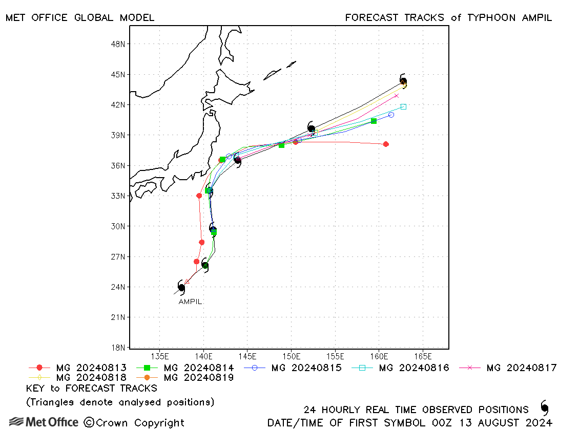
| Ampil (08W) | 12-19 August | 950 mb, 115/85 knots | Track forecast errors were mostly near to or below the recent mean values. |
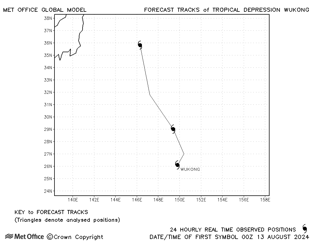
| Wukong (09W) | 13-15 August | 1002 mb, 30/35 knots | Wukong was a short-lived tropical storm according to JMA, but did not even attain tropical storm status according to JTWC. |
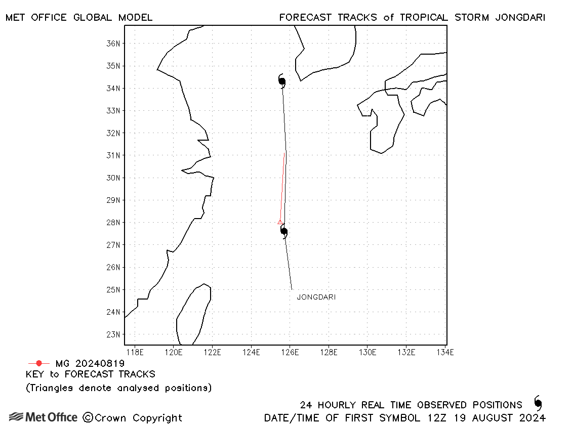
| Jongdari (10W) | 18-20 August | 998 mb, 35/40 knots | Jongdari was only briefly a tropical storm. |
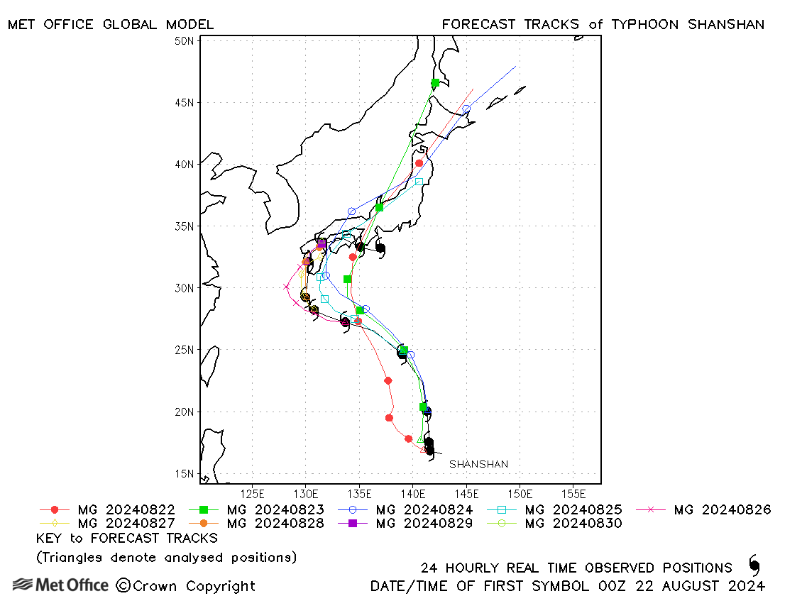
| Shanshan (11W) | 21 August - 01 September | 935 mb, 115/95 knots | Short lead time track forecast errors were near to the recent mean, but longer lead time errors were very large due to a fast bias. At these times the slow down and decay of the storm over Japan were not well predicted. |
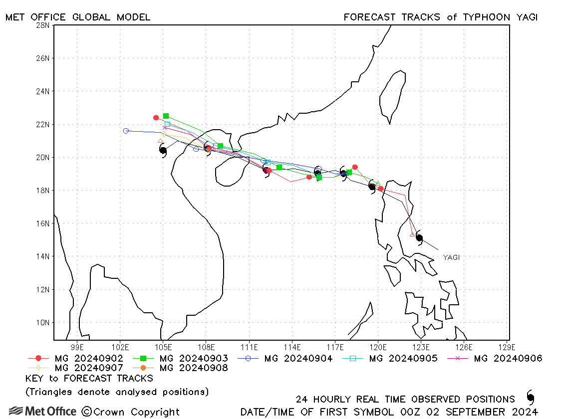
| Yagi (12W) | 01-08 September | 915 mb, 140/105 knots | Track forecast errors were low and skill scores high for this typhoon. |
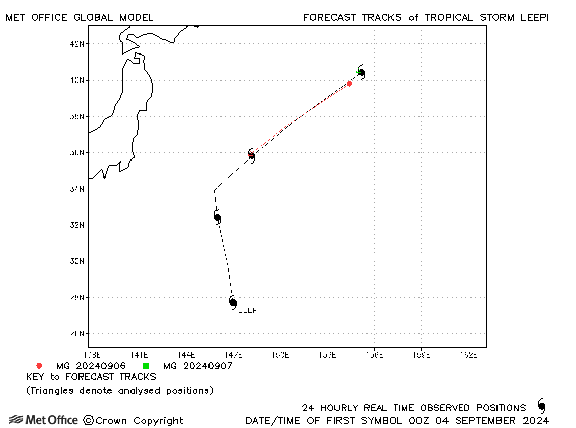
| Leepi (13W) | 03-07 September | 1002 mb, 35/35 knots | Leepi was short-lived as a tropical storm with just a few forecasts verified. Track forecasts were good. |
| Bebinca (14W) | 10-16 September | 965 mb, 75/75 knots | Track forecast errors were mostly lower than the recent mean values and skill scores were very high. |
| Pulasan (15W) | 15-21 September | 992 mb, 65/45 knots | There was a fast bias in many forecasts resulting in errors above the recent mean values. |
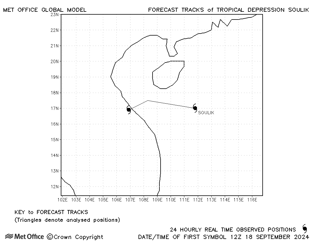
| Soulik (16W) | 18-19 September | 992 mb, 30/35 knots | Soulik was a borderline tropical depression/tropical storm and no forecasts were verified. |
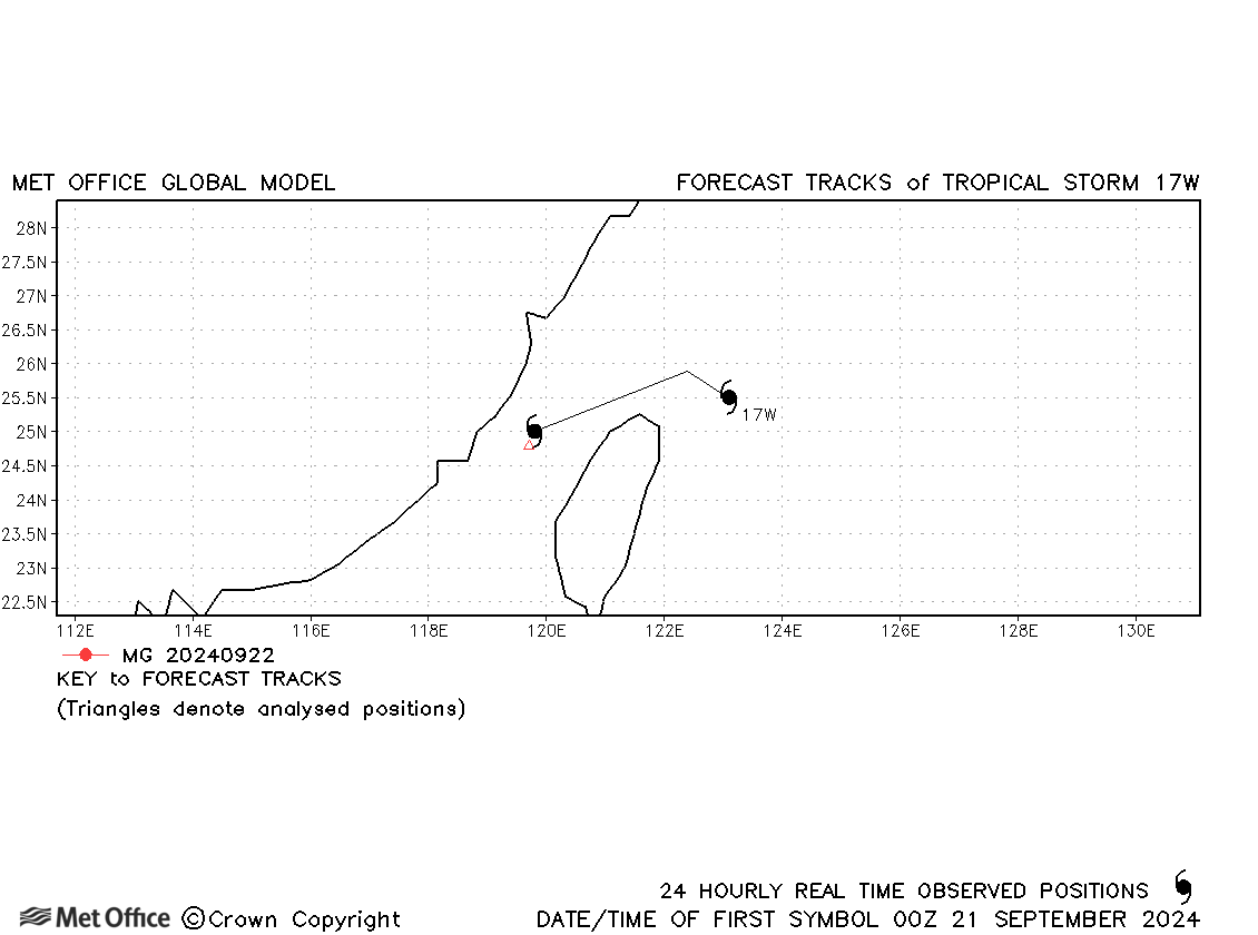
| 17W | 20-22 September | 998 mb, 40/30 knots | 17W was a borderline tropical depression/tropical storm and few forecasts were verified. |
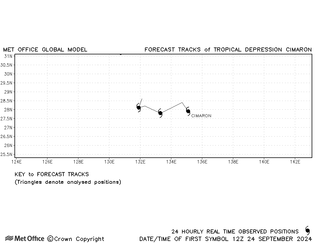
| Cimaron (18W) | 24-27 September | 1002 mb, 35/35 knots | Cimaron was only briefly a tropical storm and no forecasts were verified. |
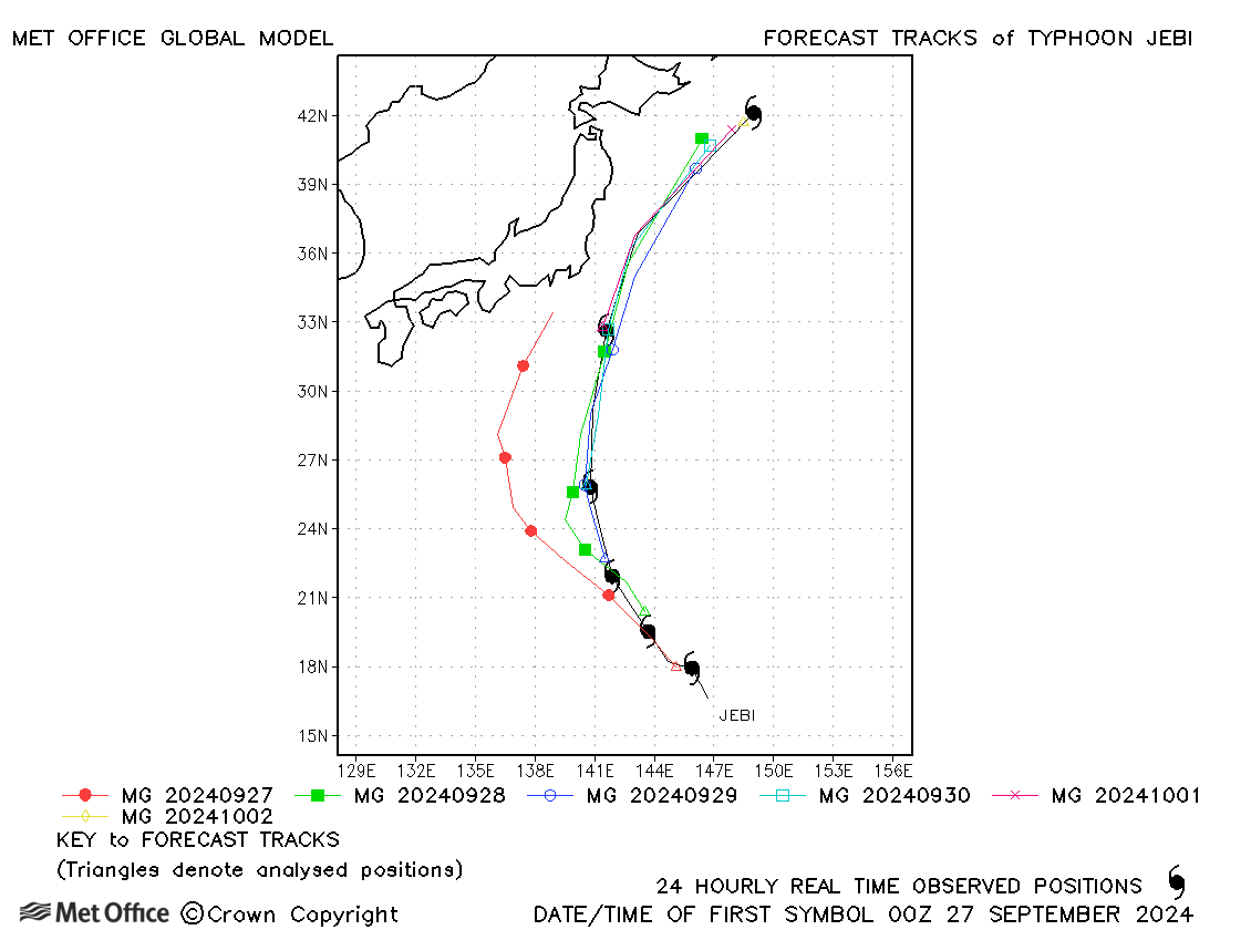
| Jebi (19W) | 26 September - 02 October | 985 mb, 70/60 knots | There was a slow and left of track bias in forecasts resulting in errors above the recent mean values. |
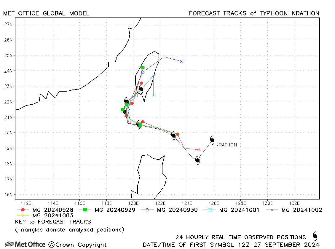
| Krathon (20W) | 27 September - 03 October | 915 mb, 130/105 knots | Track forecast errors were mostly below the recent mean values. |
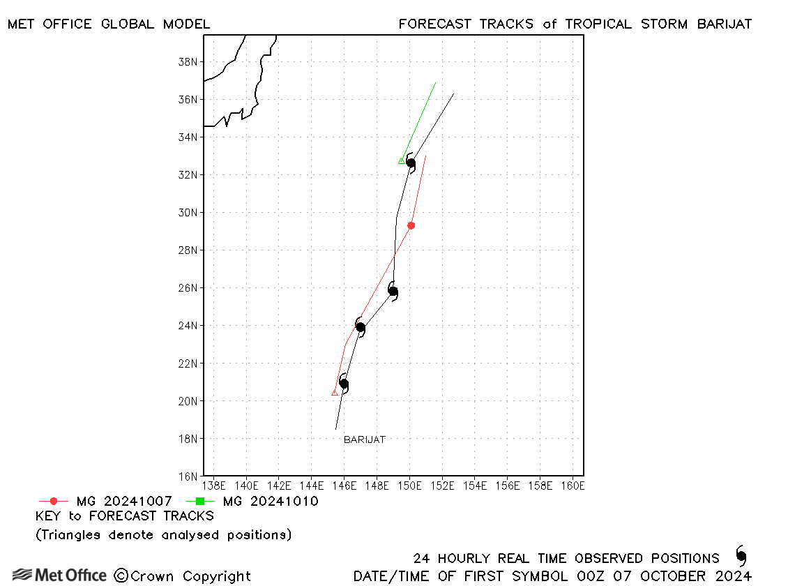
| Barijat (21W) | 06-10 October | 990 mb, 40/45 knots | There was a slow bias in forecast tracks. |
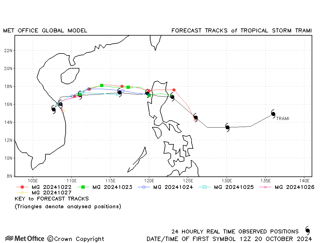
| Trami (22W) | 19-28 October | 970 mb, 60/60 knots | Track forecast errors were near to or below the recent mean values. |
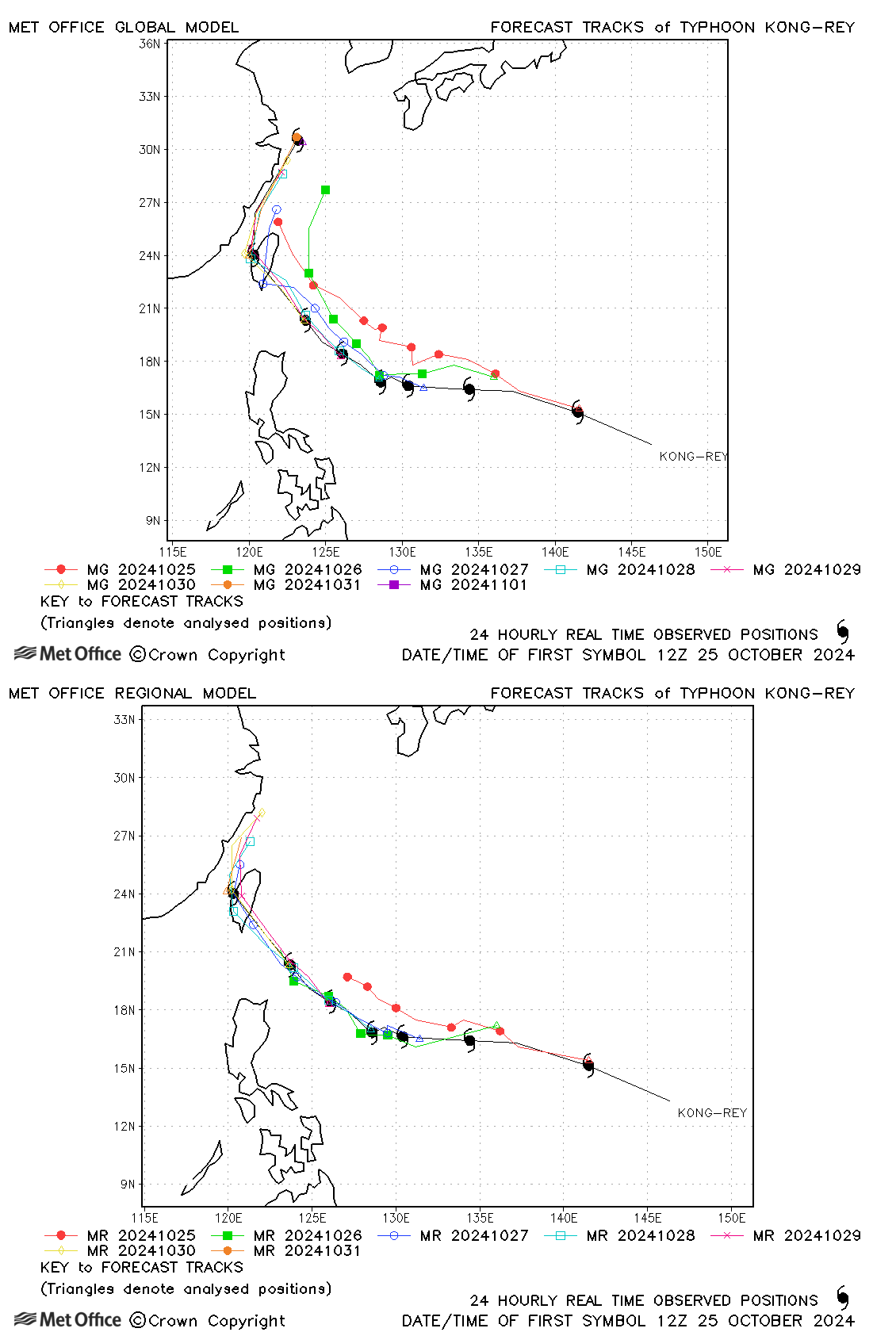
| Kong-rey (23W) | 25 October - 01 November | 925 mb, 130/100 knots | Track forecast errors were below the recent mean values, but there was a right-of-track bias. |
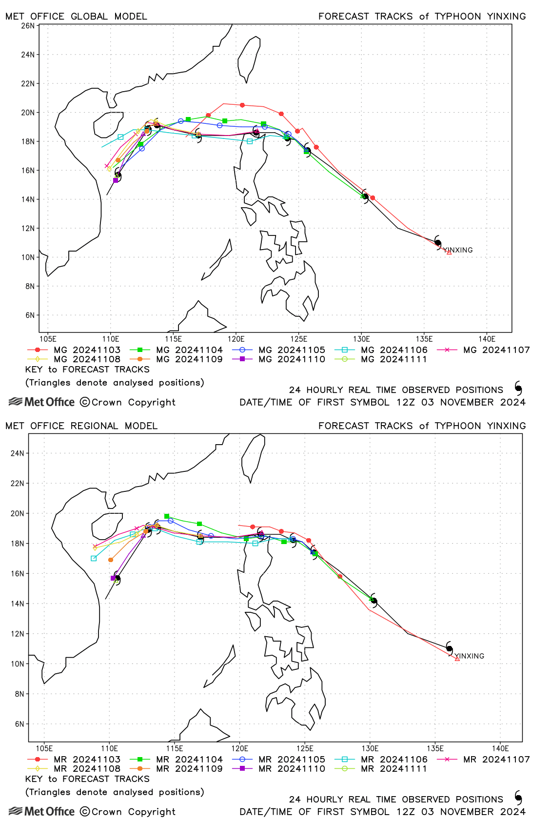
| Yinxing (24W) | 03-12 November | 940 mb, 125/95 knots | Yinxing was well forecast, with track errors well below the recent mean values. |
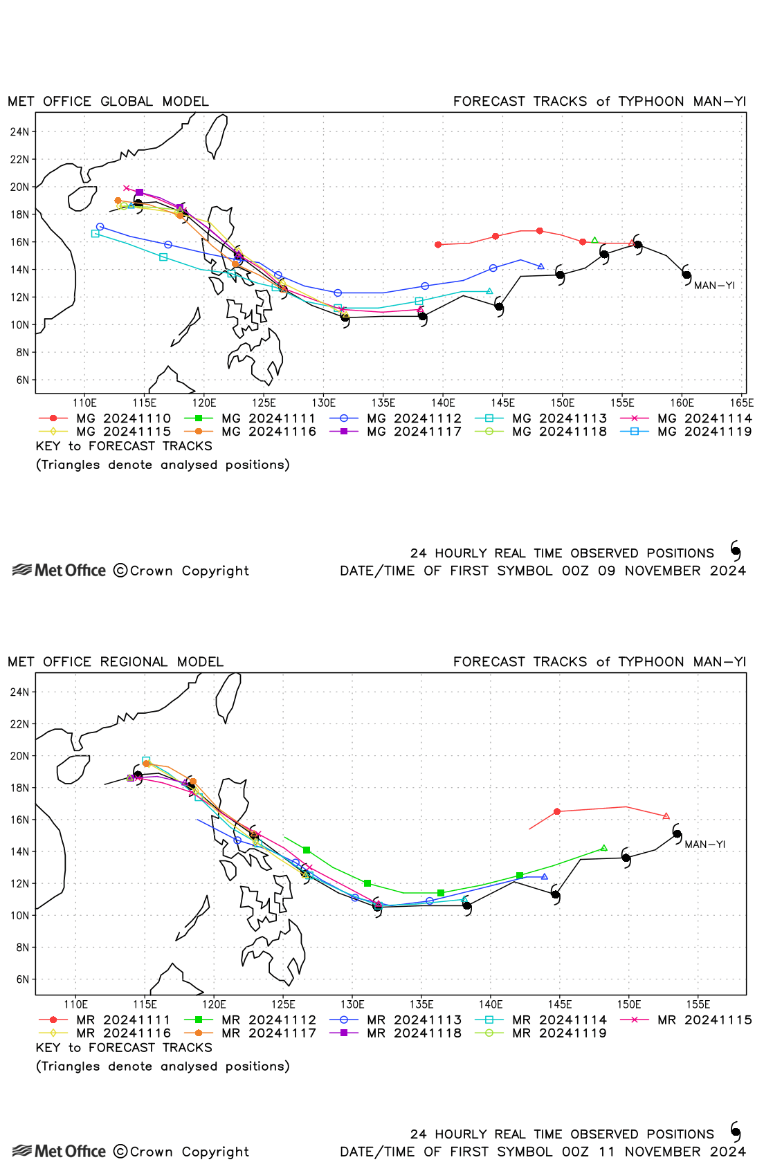
| Man-yi (25W) | 09-19 November | 920 mb, 140/105 knots | Track forecast errors were mostly low except at long lead times, due to a right-of-track bias in early forecasts. |
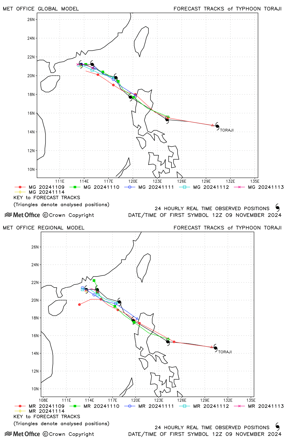
| Toraji (26W) | 09-14 November | 975 mb, 80/70 knots | Track forecast errors were very low and skill scores very high for Toraji. |
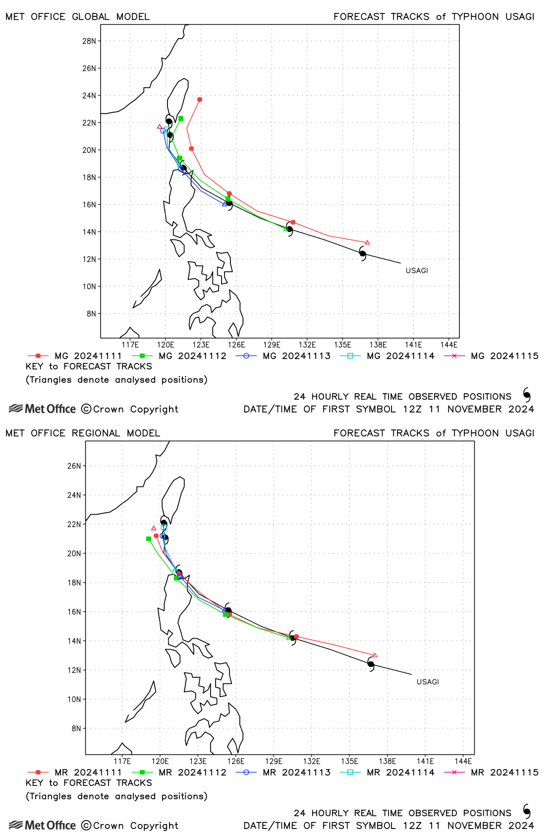
| Usagi (27W) | 11-16 November | 940 mb, 130/95 knots | Track forecast errors were mostly very low for this typhoon. |
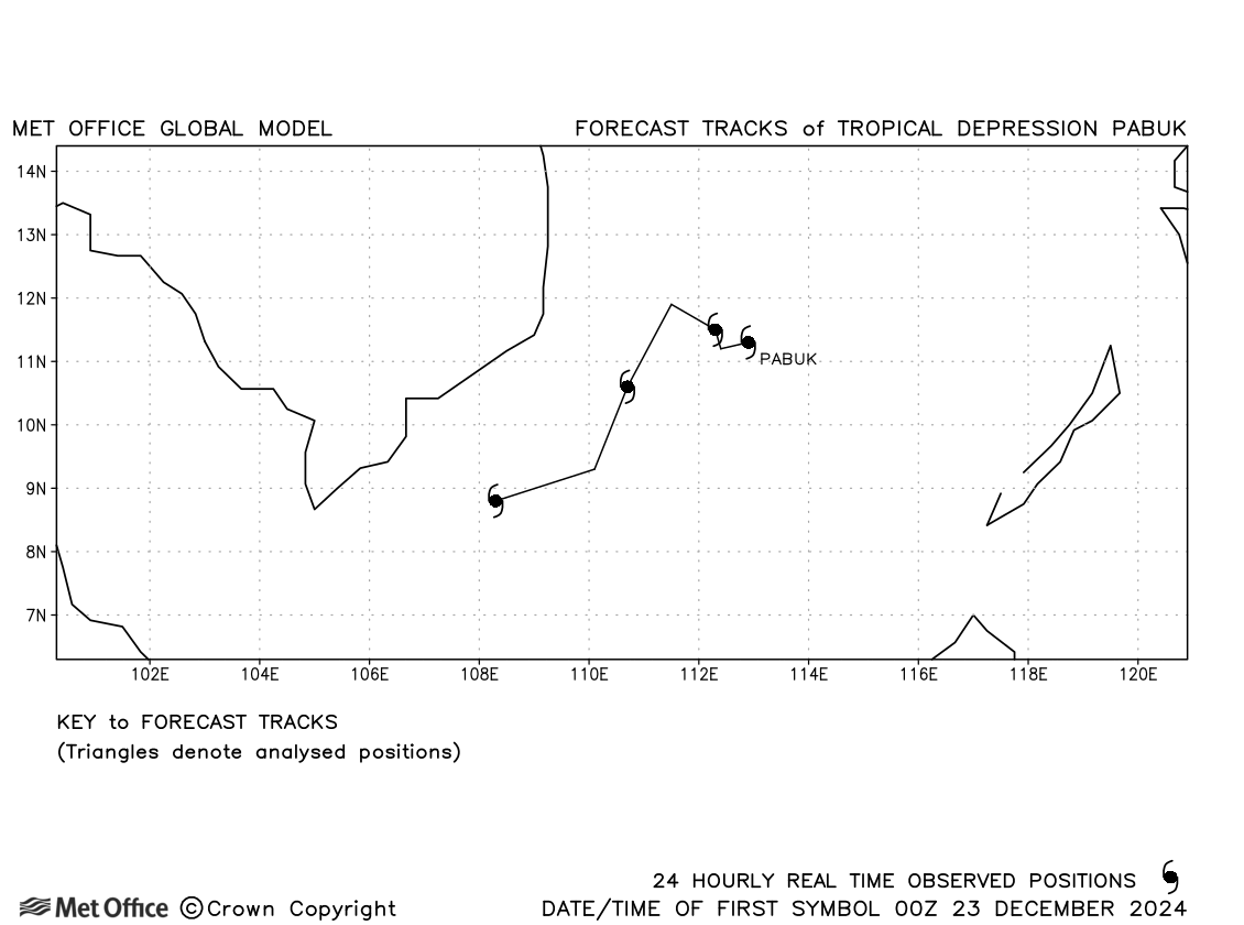
| Pabuk (28W) | 22-26 December | 1000 mb, 30/40 knots | No forecasts were verified as 1-minute average winds from JTWC did not reach 34 knots. |
North-west observed tracks in 2024
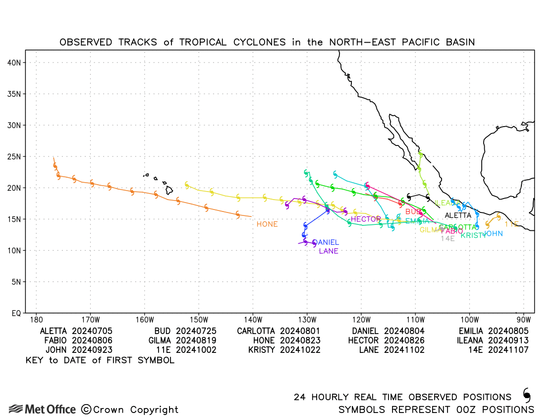
North-east Pacific
| Name & ID | Start & end dates | Central pressure, 1-minute MSW | Comments on Met Office global model forecasts |
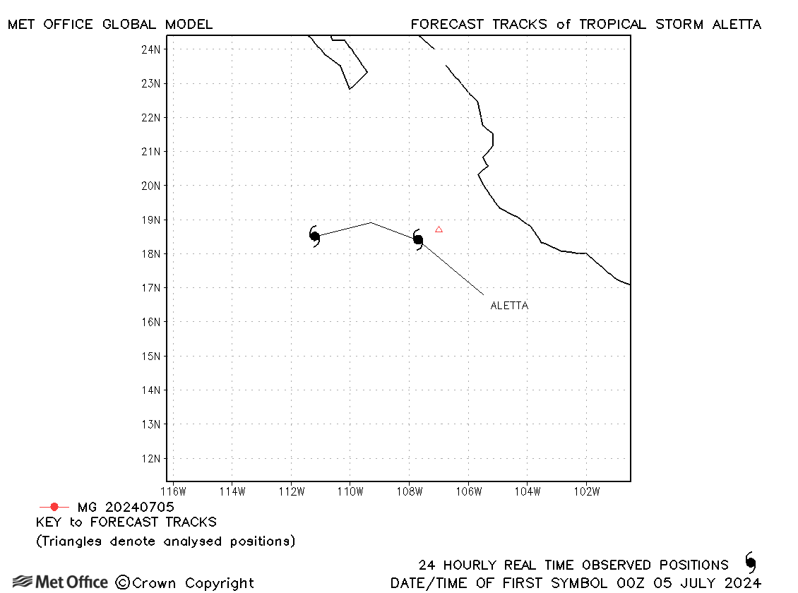
| 04-06 July | 1005 mb, 35 knots | Aletta was a short-lived storm and no forecasts were verified. | |
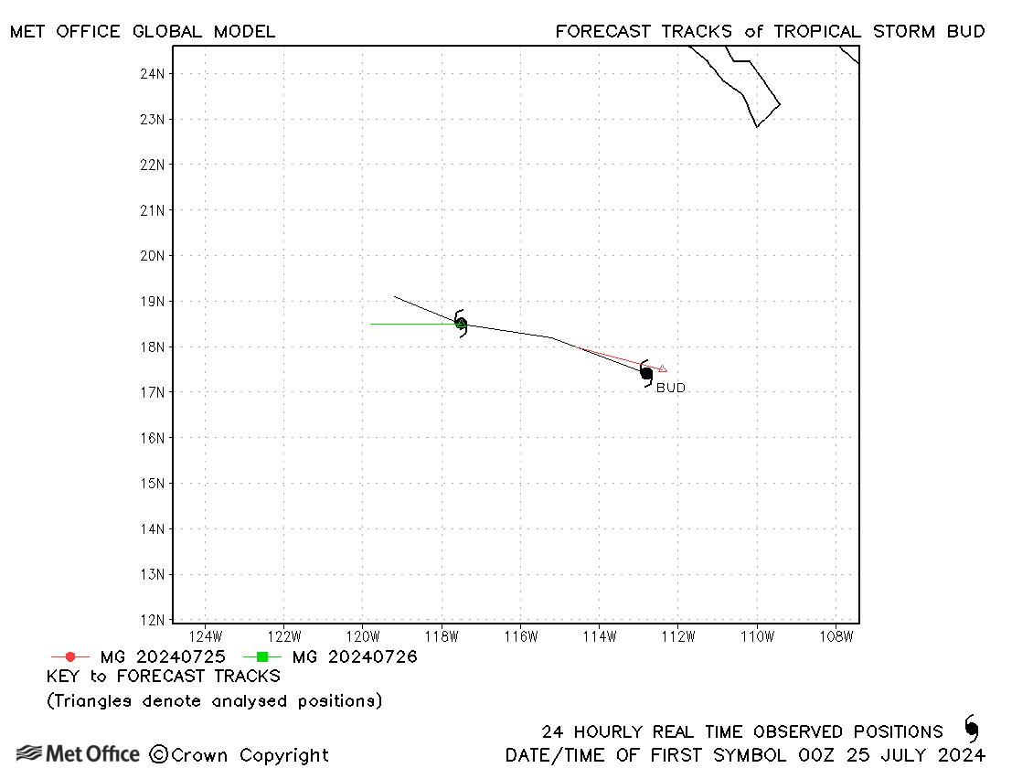
| Bud (02E) | 24-26 July | 1000 mb, 50 knots | Bud was short-lived. Track forecast errors were near to the recent mean values. |
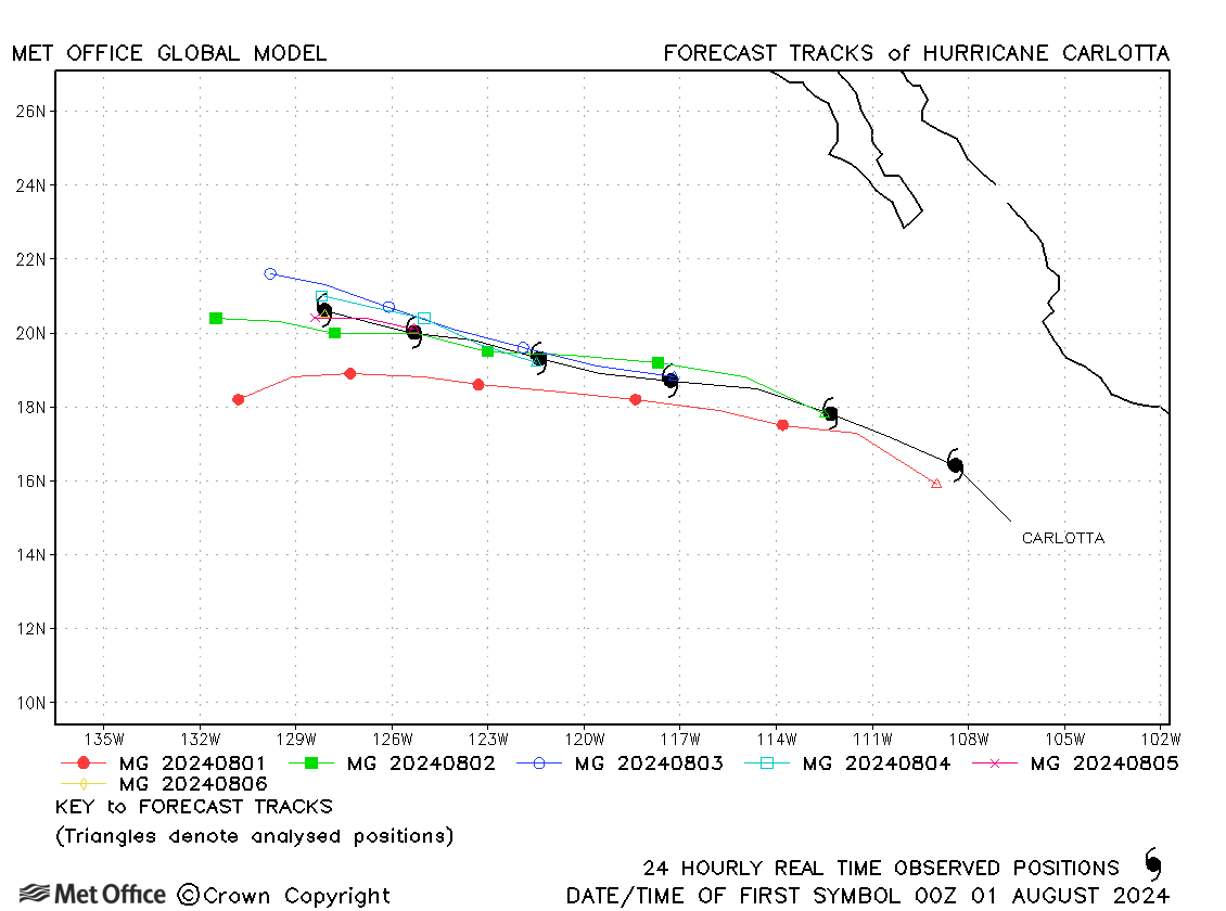
| Carlotta (03E) | 31 July - 06 August | 979 mb, 80 knots | There was a slight fast bias in some forecasts. Track errors were near to or above the recent mean values. |
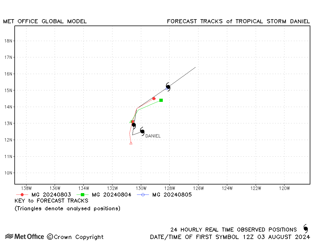
| Daniel (04E) | 03-06 August | 1005 mb, 35 knots | Track forecast errors were near to the recent mean values. |
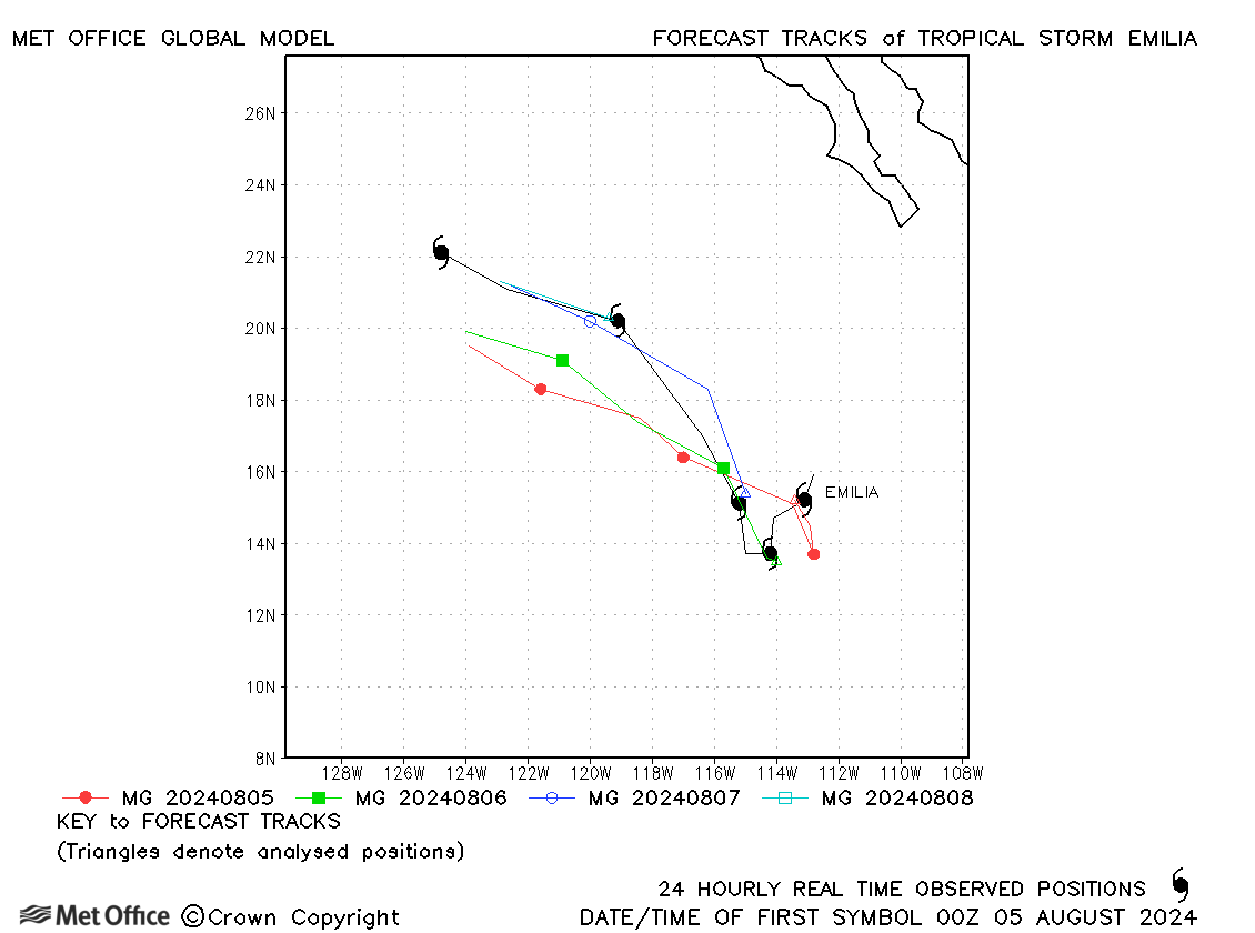
| Emilia (05E) | 04-09 August | 988 mb, 60 knots | Forecasts had a left-of-track bias resulting in errors larger than the recent mean values. |
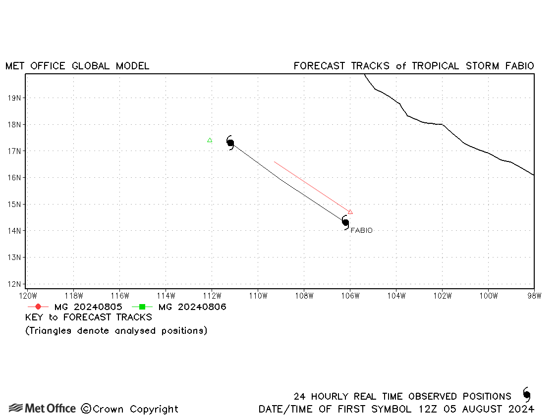
| Fabio (06E) | 05-07 August | 993 mb, 55 knots | Fabio was a short-lived storm. |
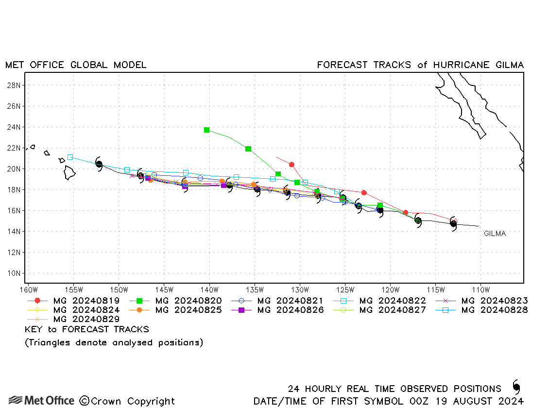
| Gilma (07E) | 18-30 August | 949 mb, 115 knots | Track forecast errors were variable during the lifetime of the storm. There was a fast and right-of-track bias at longer forecast times. |
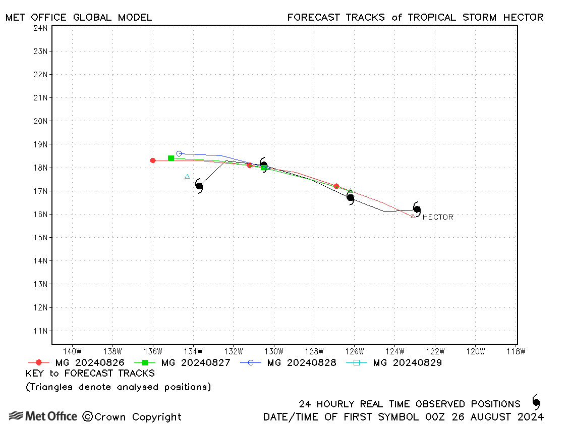
| Hector (08E) | 25-29 August | 1000 mb, 45 knots | Track forecast errors were mostly near to the recent mean values. |
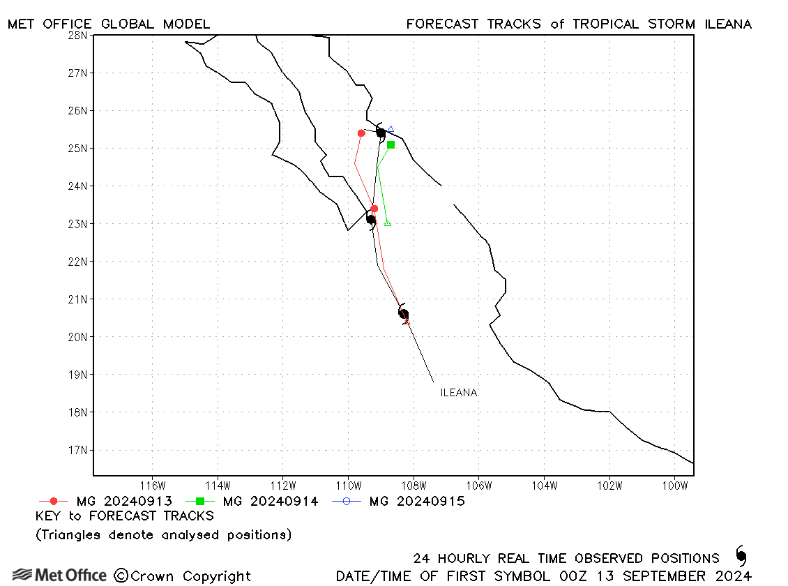
| Ileana (09E) | 12-15 September | 999 mb, 40 knots | Track forecast errors were below the recent mean values. |
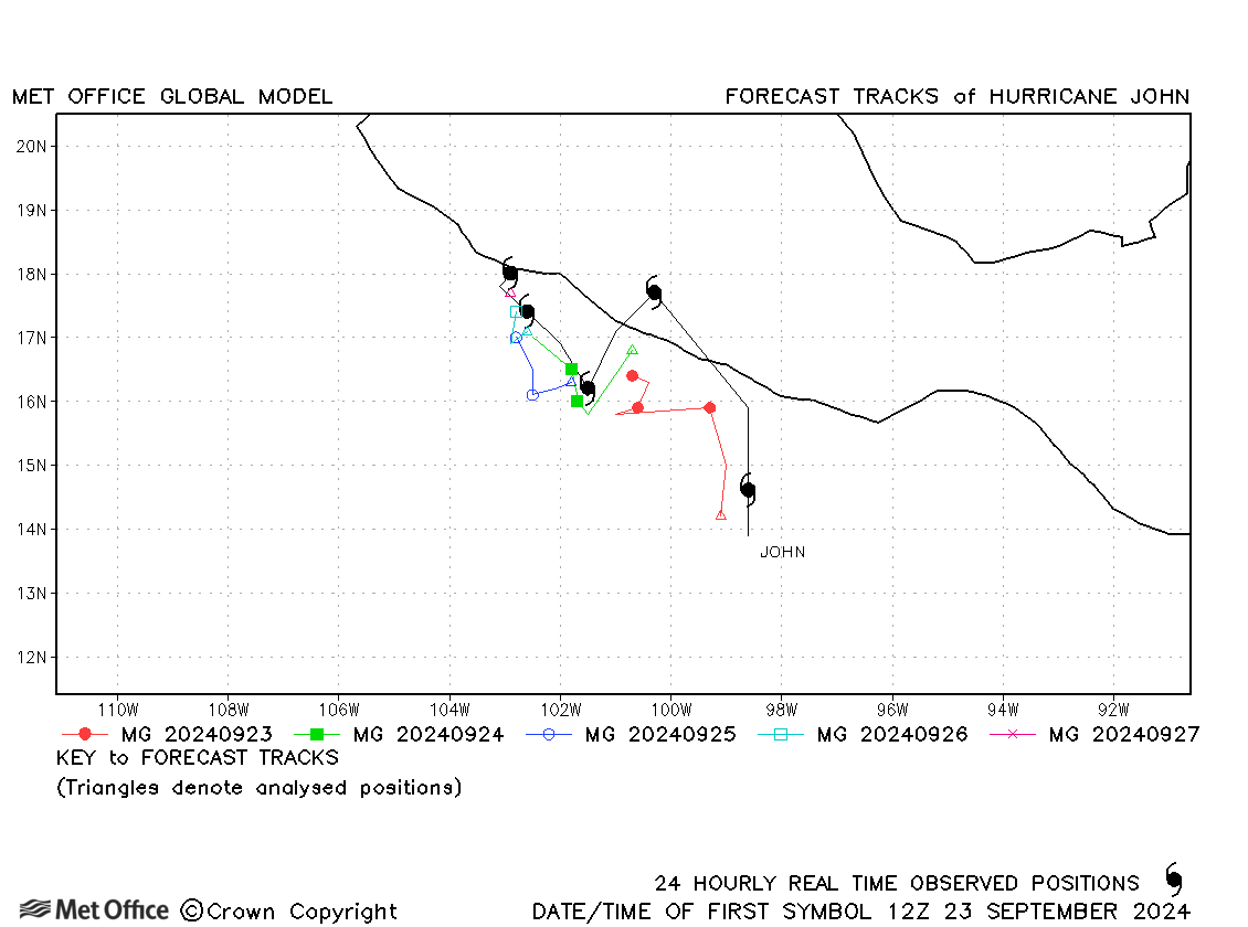
| John (10E) | 22-27 September | 959 mb, 105 knots | Although the initial landfall was not predicted the subsequent erratic movement along the coast was. Track forecast errors were near to or a little above recent mean values. |
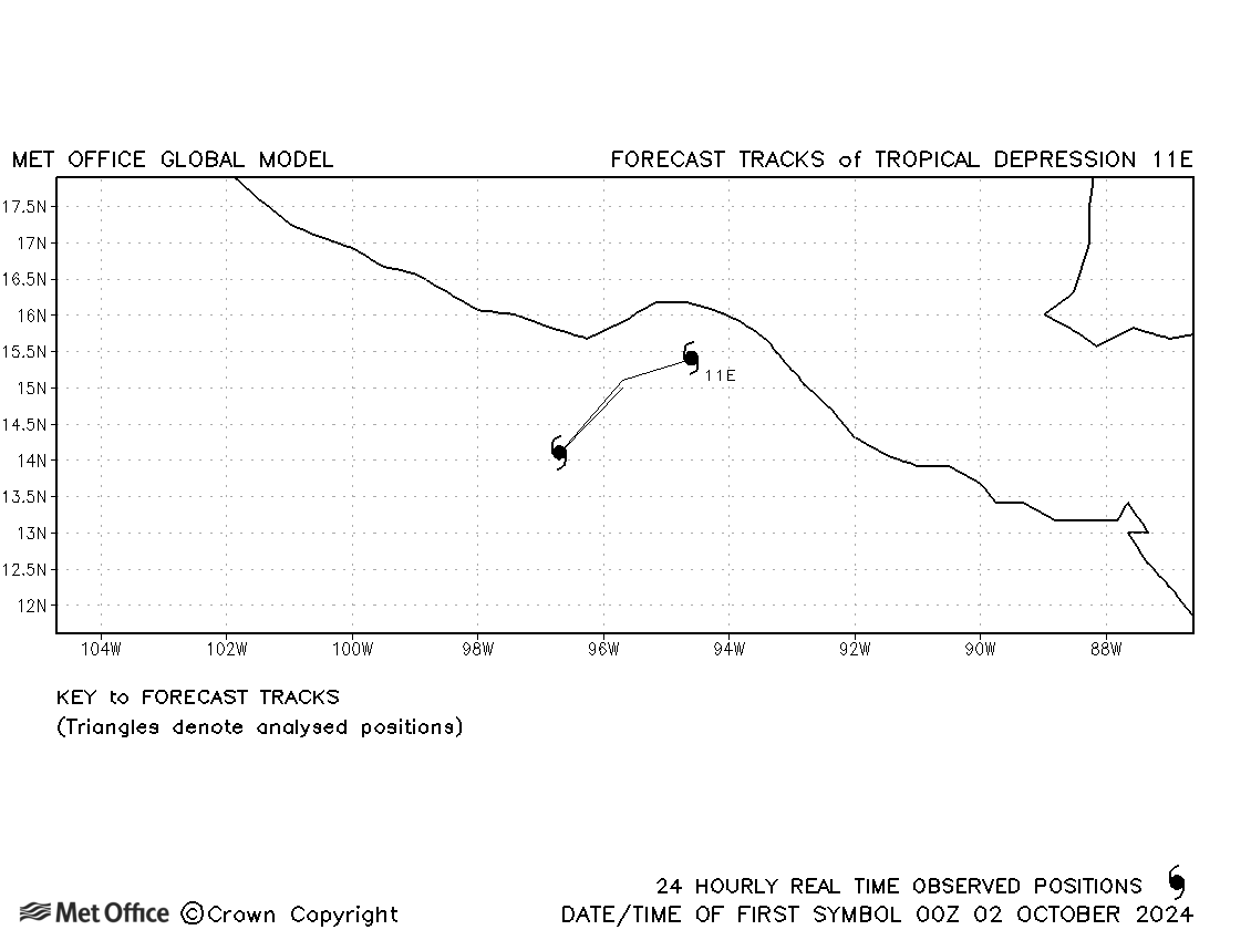
| 11E | 01-03 October | 1004 mb, 30 knots | No forecasts are verified for this depression. |
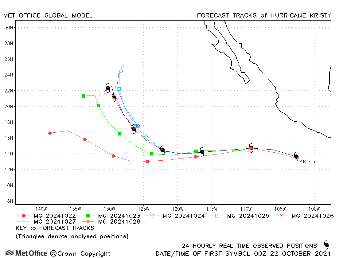
| Kristy (12E) | 21-27 October | 926 mb, 140 knots | There was a left-of-track bias in early forecasts resulting in large track forecast errors at longer lead times. Errors were near average for shorter lead times. |
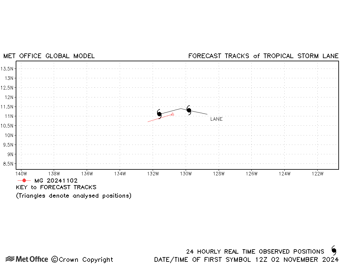
| Lane (13E) | 01-03 November | 1004 mb, 40 knots | Lane was short-lived and few forecasts were verified. |
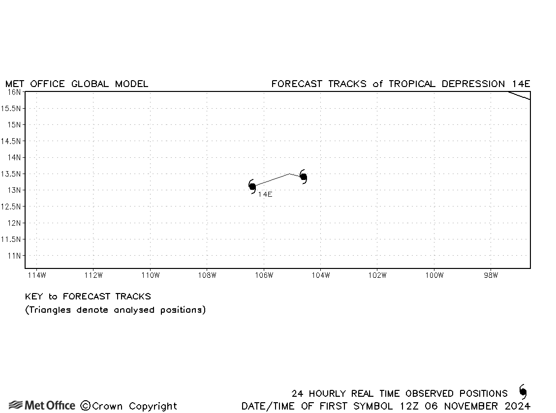
| 14E | 06-07 November | 1006 mb, 30 knots | No forecasts were verified for this tropical depression. |
Central North Pacific
| Name & ID | Start & end dates | Central pressure, 1-minute MSW | Comments on Met Office global model forecasts |
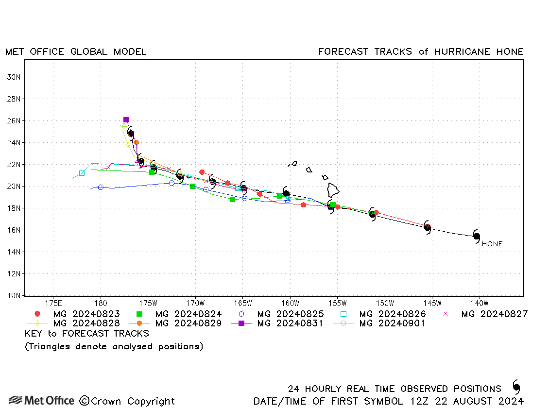
| 22 August - 01 September | 988 mb, 75 knots | Track forecast errors were near to or below the recent mean values. There was a left-of-track bias in some forecasts. |
North-east and Central North Pacific observed tracks in 2024
Tropical cyclone names (Central North Pacific)
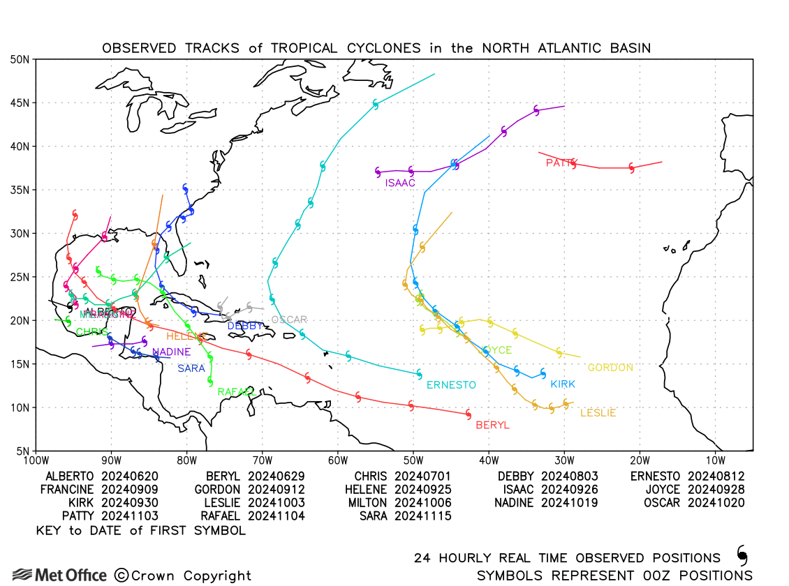
North Atlantic
| Name & ID | Start & end dates | Central pressure, 1-minute MSW | Comments on Met Office global model forecasts |
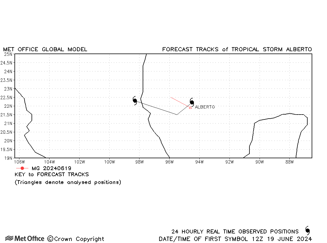
| 19-20 June | 993 mb, 45 knots | Alberto was a short-lived tropical storm. | |
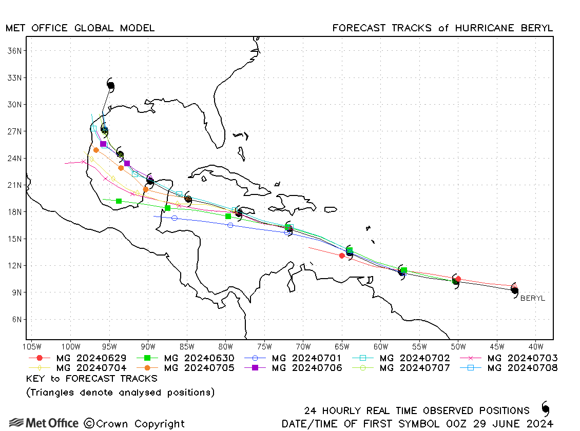
| Beryl (02L) | 28 June - 11 July | 935 mb, 145 knots | Track forecast errors were close to the recent mean values at most lead times, but were low at longer lead times. The track was well forecast through the Caribbean, but there was a left-of-track bias in forecasts as Beryl moved into the Gulf of Mexico. |
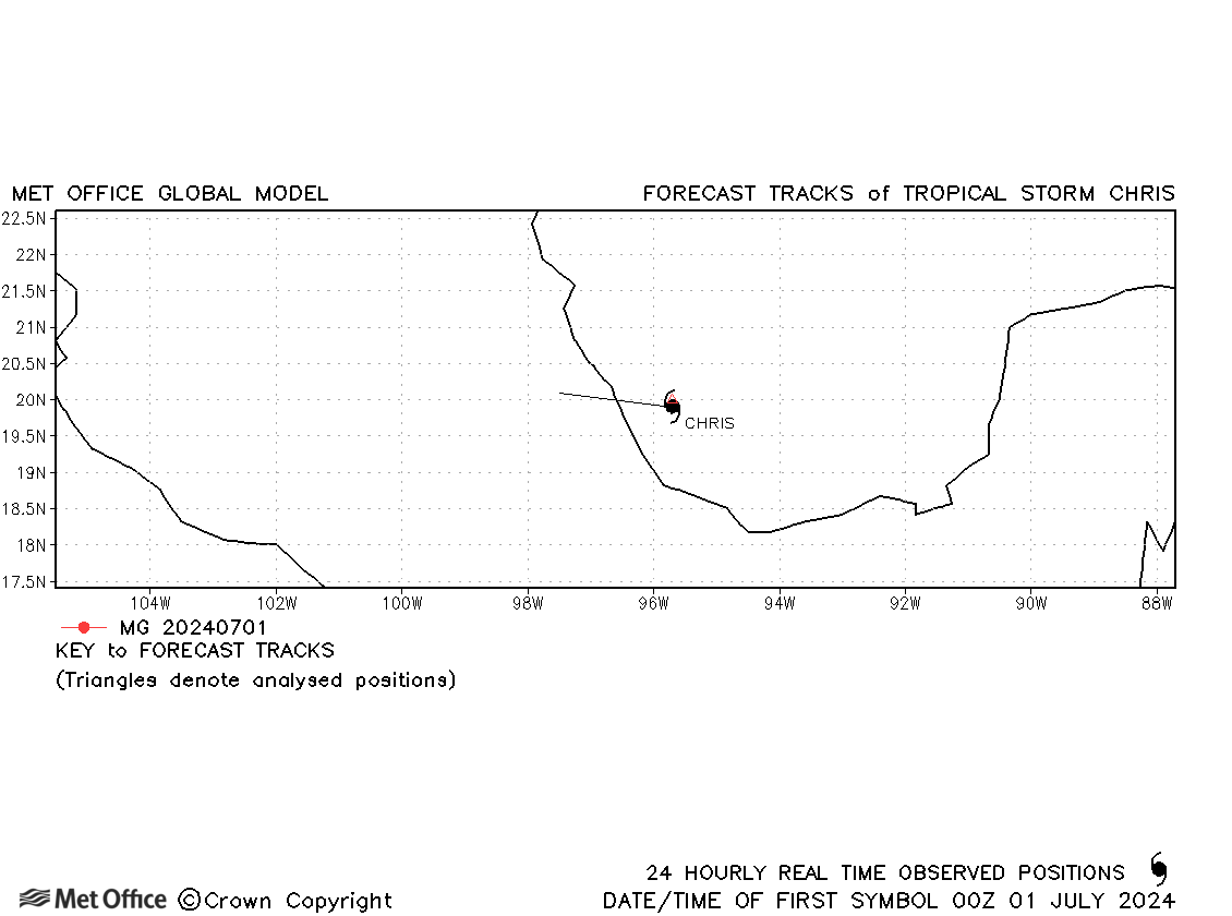
| Chris (03L) | 30 June - 01 July | 1005 mb, 35 knots | Chris was short-lived and no forecasts were verified. |
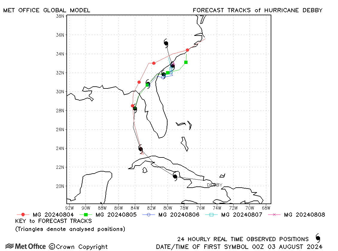
| Debby (04L) | 03-09 August | 979 mb, 70 knots | Track forecast errors were mostly below the recent mean values. |
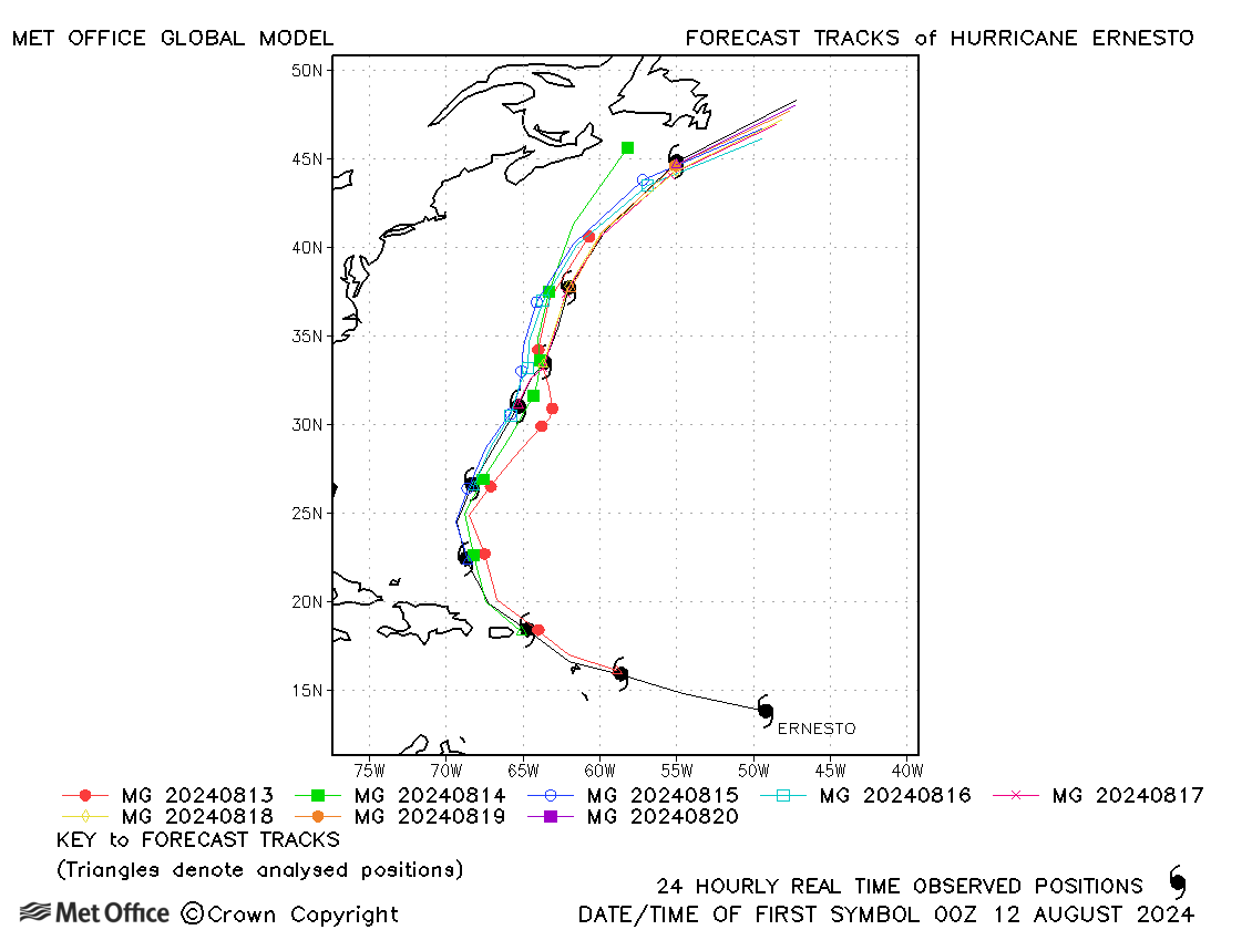
| Ernesto (05L) | 12-20 August | 968 mb, 85 knots | Track forecast errors were mostly low, although at longer lead times there was a slow bias resulting in larger errors. |
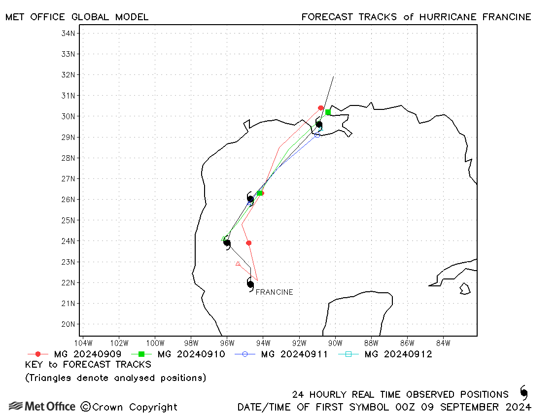
| Francine (06L) | 09-12 September | 972 mb, 85 knots | Track forecast errors were low for Francine. |
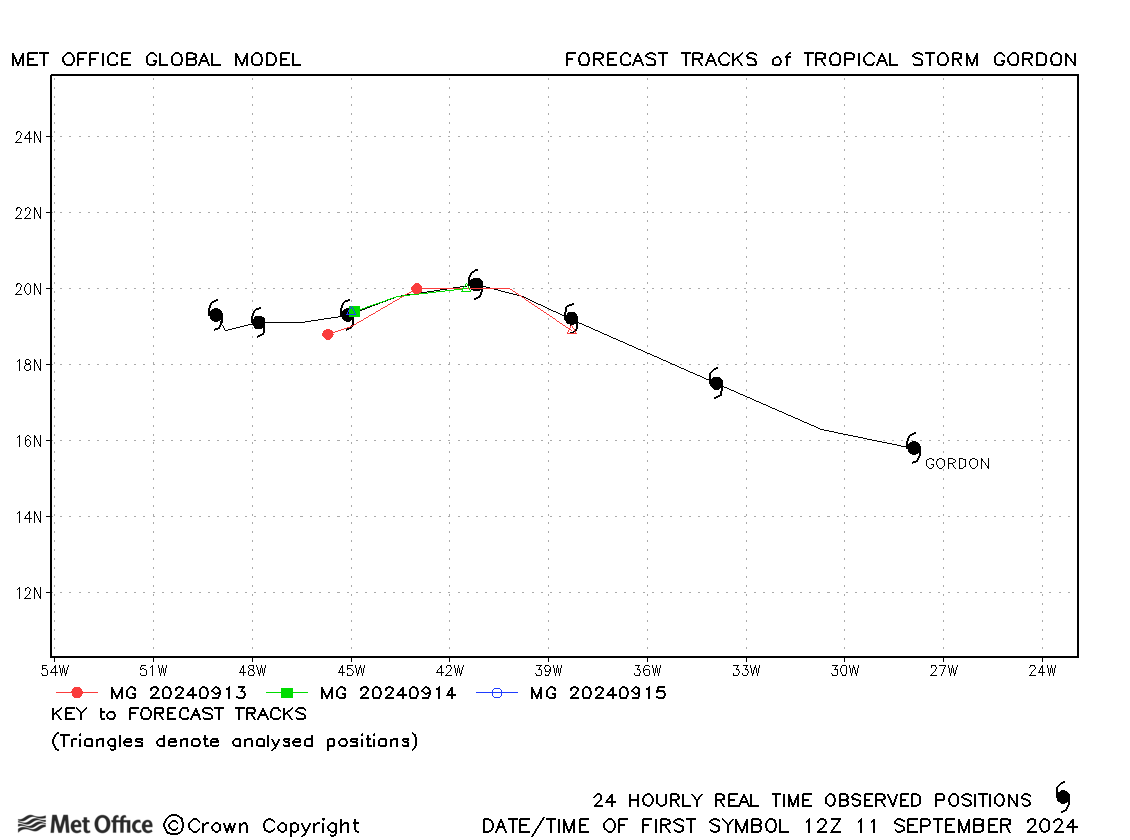
| Gordon (07L) | 11-17 September | 1004 mb, 40 knots | Track forecast errors were mixed for this storm. |
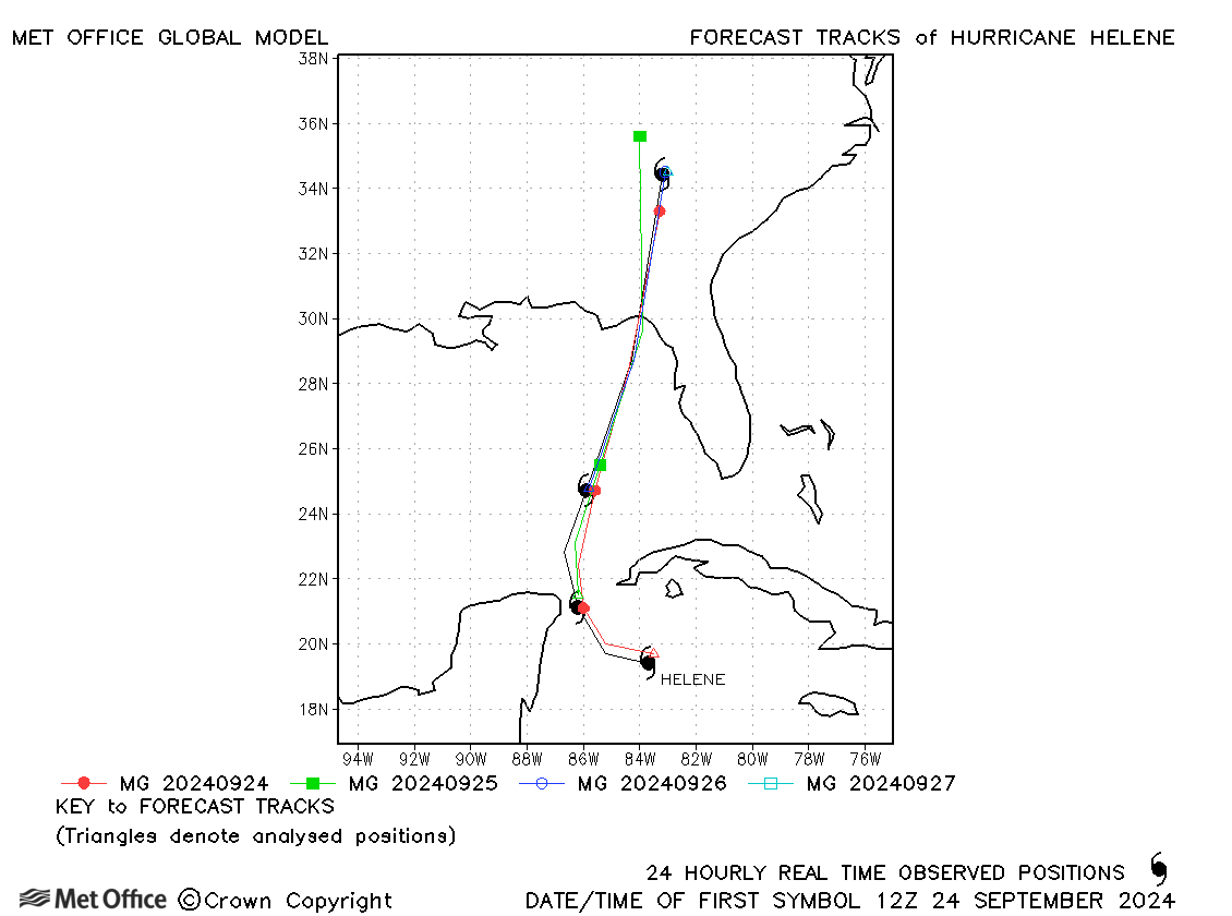
| Helene (09L) | 24-27 September | 938 mb, 120 knots | Track forecast errors were low and skill scores very high for forecasts for Hurricane Helene. The landfall location was very well predicted. |
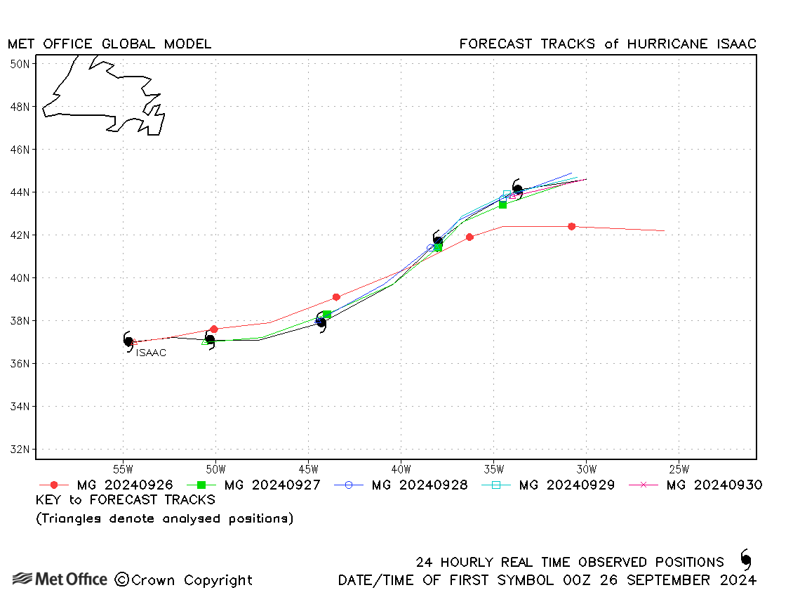
| Isaac (10L) | 26-30 September | 968 mb, 90 knots | The first forecast for Isaac was a little fast, but later forecasts had very low track forecast errors. |
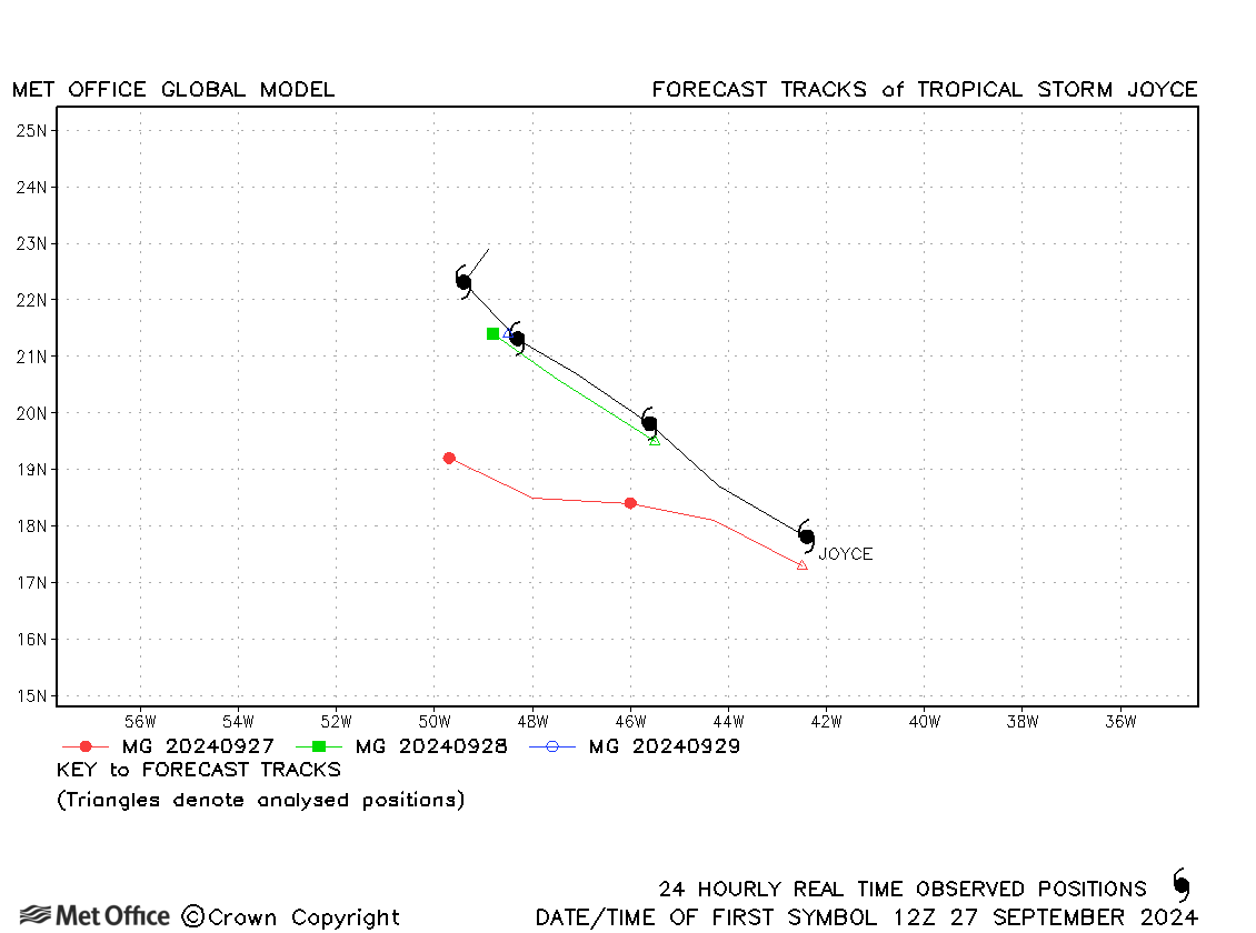
| Joyce (11L) | 27 September - 01 October | 1001 mb, 45 knots | There was a left-of-track bias in forecasts for Joyce. |
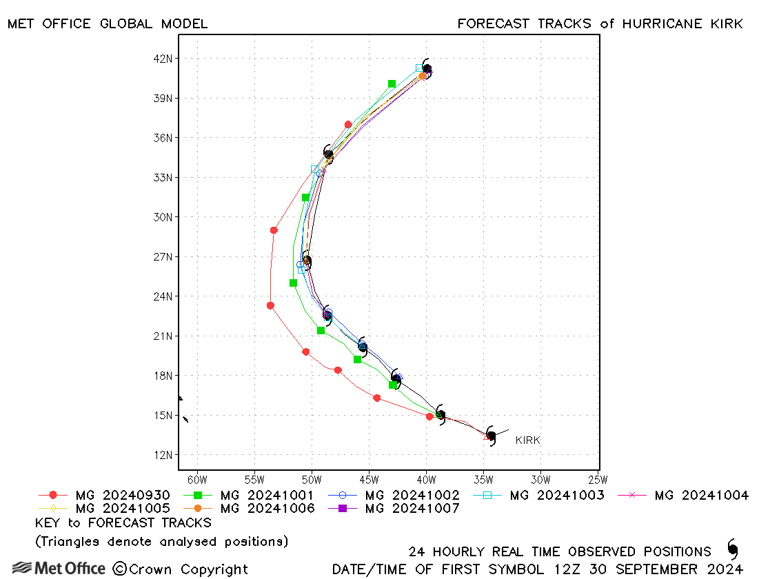
| Kirk (12L) | 29 September - 07 October | 934 mb, 125 knots | Short lead time track forecast errors were low, but longer lead time errors were large due to a slow and left-of-track bias. |
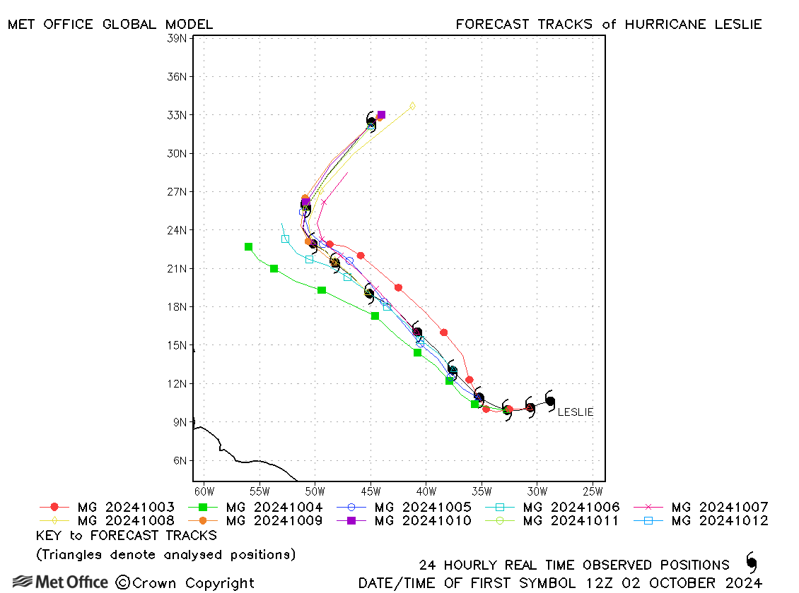
| Leslie (13L) | 02-12 October | 972 mb, 90 knots | Track forecast errors were low. There was a slight slow bias. |
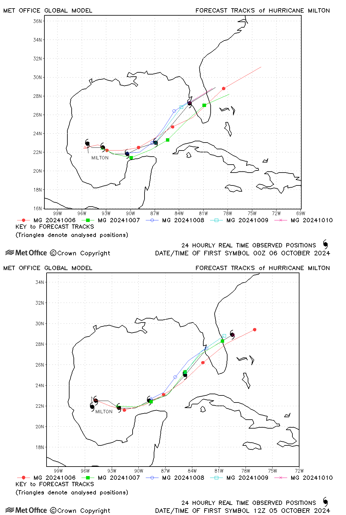
| Milton (14L) | 05-10 October | 897 mb, 155 knots | Early forecasts predicted landfall too far south, but later forecasts predicted the landfall location well, although there were still errors in the timing of landfall resulting in errors above the recent mean values. |
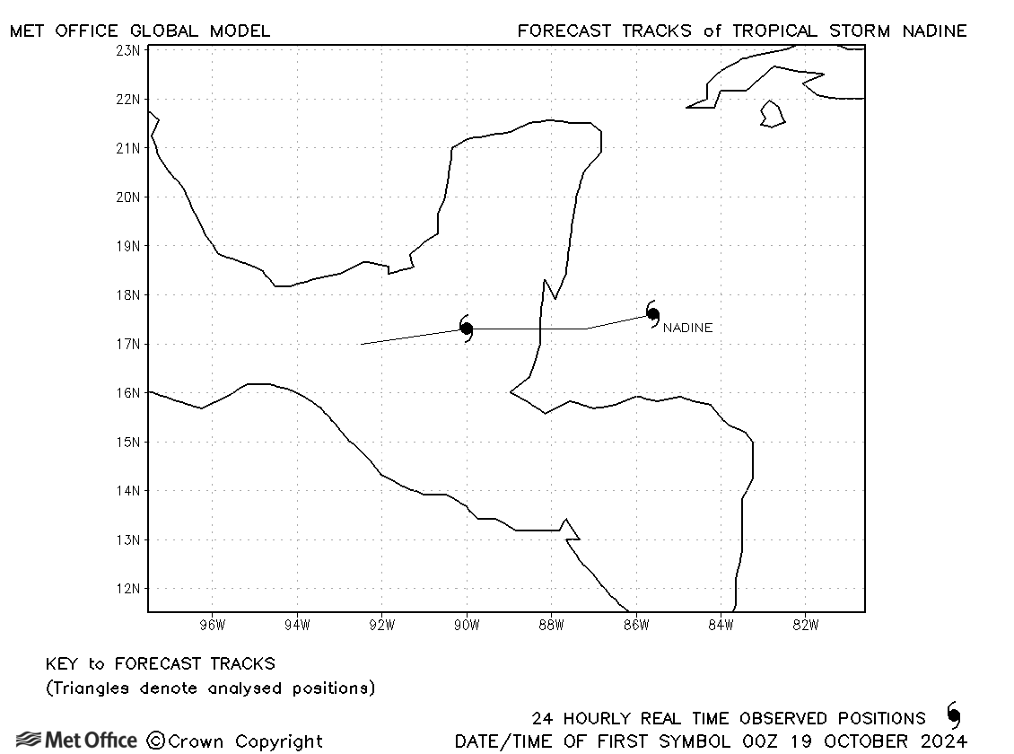
| Nadine (15L) | 19-20 October | 1000 mb, 45 knots | Nadine was only briefly a tropical storm. |
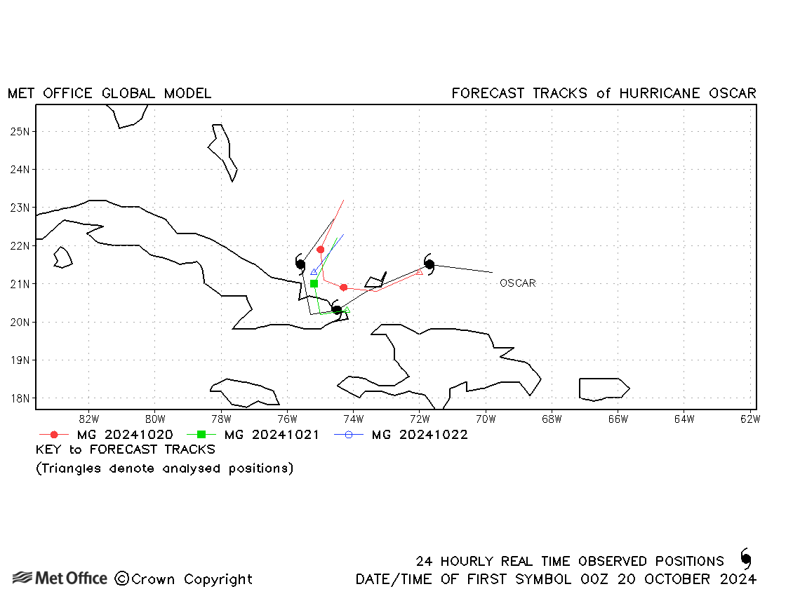
| Oscar (16L) | 19-22 October | 986 mb, 75 knots | The formation of Oscar was not well predicted since it was such a small hurricane. Track forecast errors were mostly above recent mean values. |
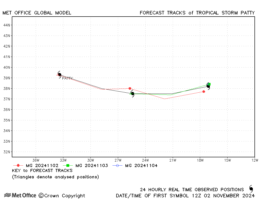
| Patty (17L) | 02-04 November | 982 mb, 55 knots | Track forecast errors were low for Patty. |
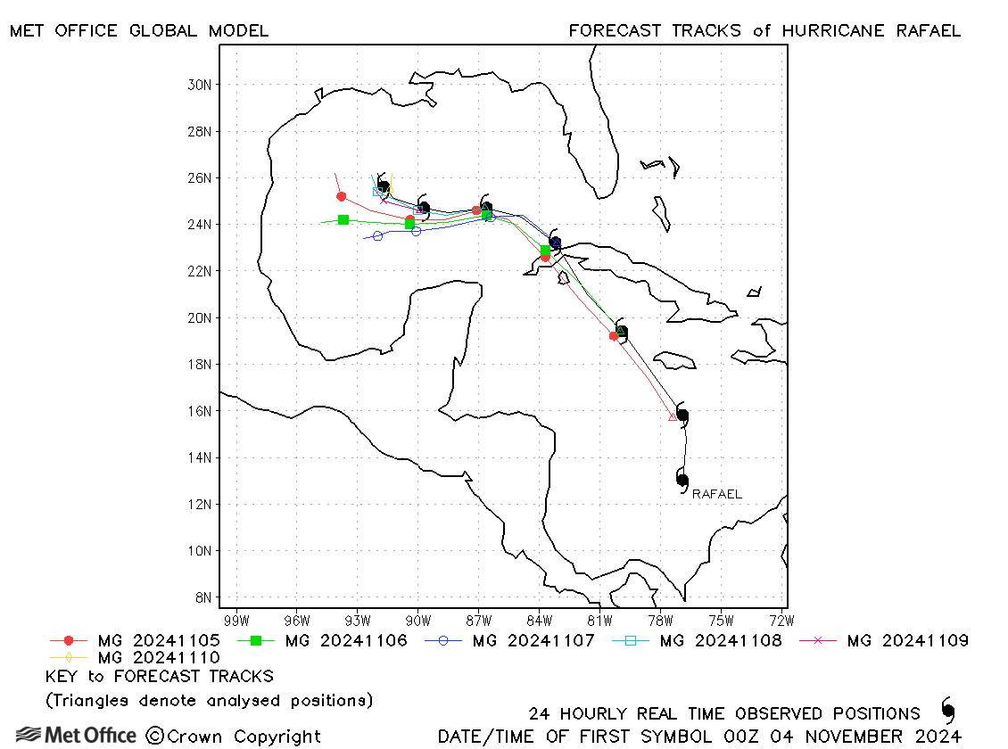
| Rafael (18L) | 03-10 November | 956 mb, 105 knots | The track of Rafael was well forecasts - errors were very low. |
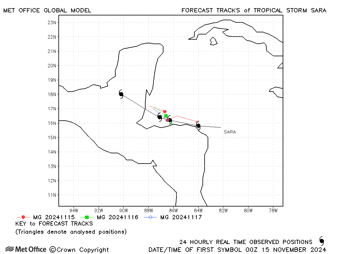
| Sara (19L) | 14-18 November | 997 mb, 45 knots | Track forecast errors were low for Sara. |
North Atlantic observed tracks in 2024
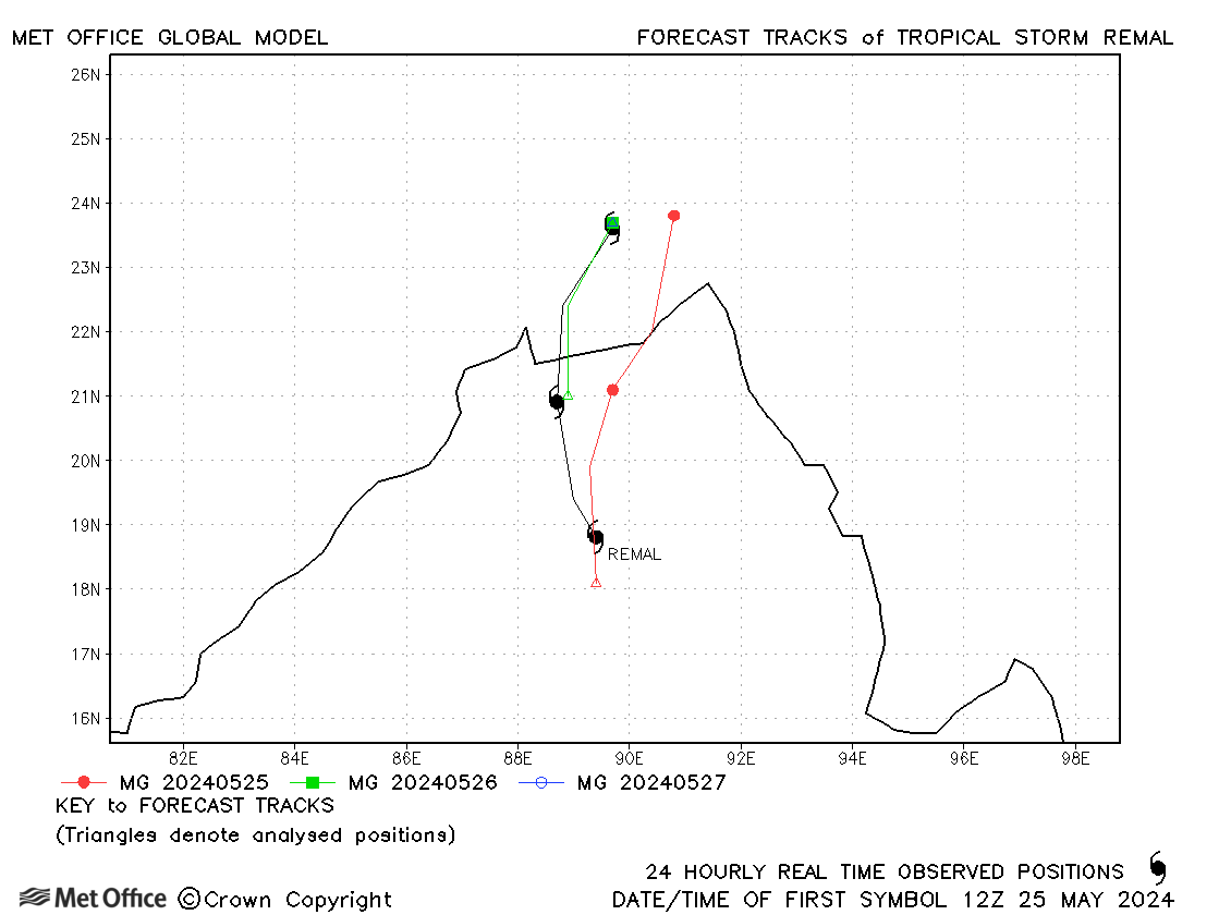
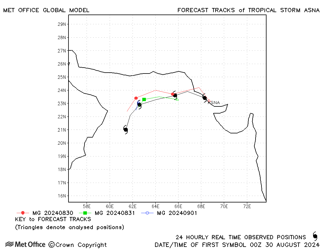
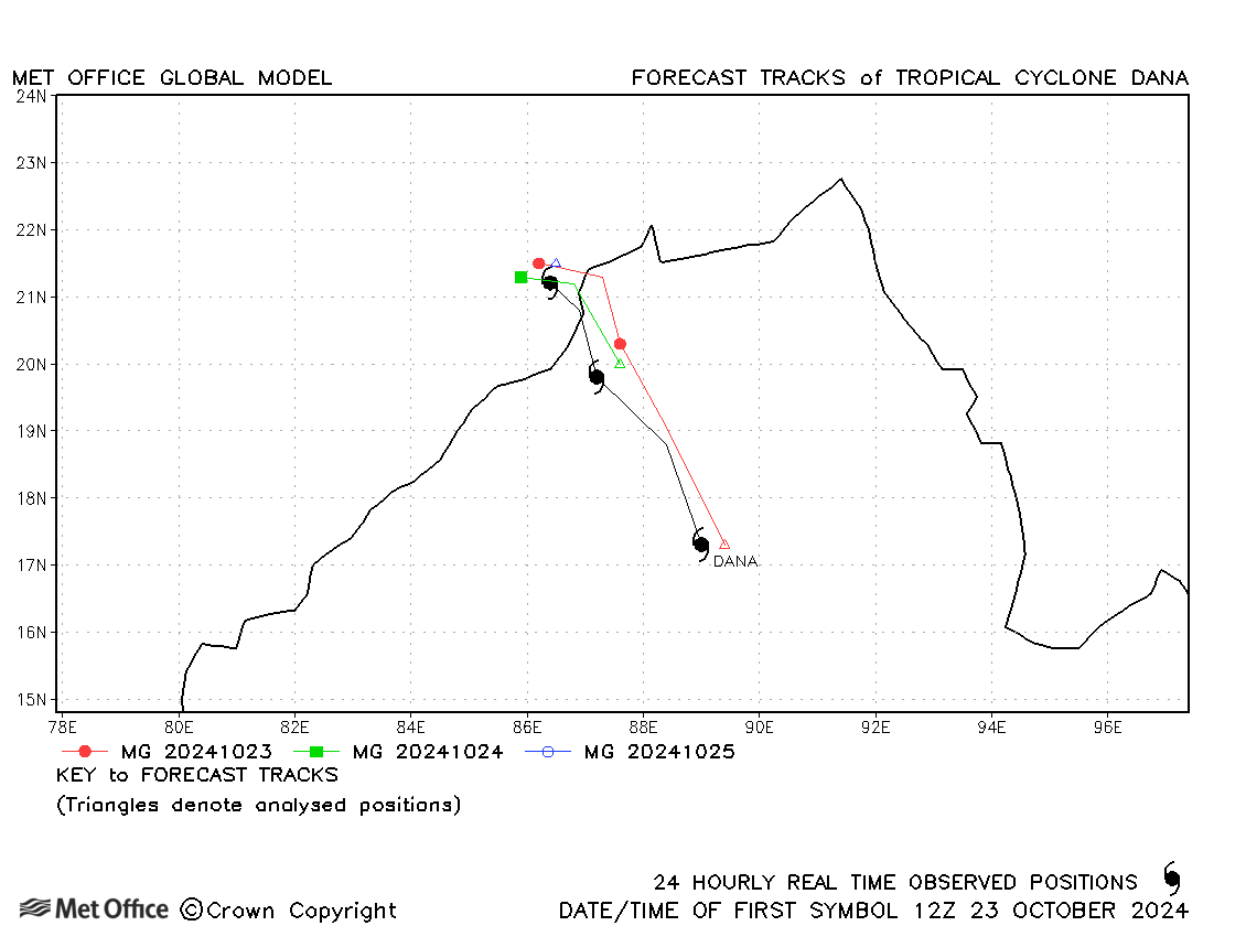
North Indian
| Name & ID | Start & end dates | Central pressure, 1-/3-minute MSW | Comments on Met Office global model forecasts |
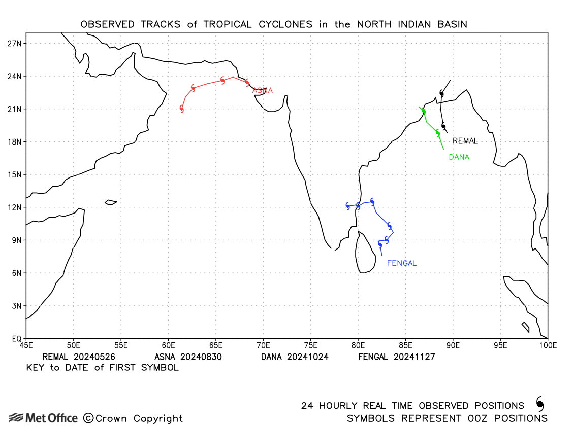
| 25-27 May | 978 mb, 55/60 knots | Track errors were near to the recent mean values. | |
| Asna (02A) | 30 August - 02 September | 989 mb, 45/40 knots | Track forecast errors were low for this unusual August storm. |
| Dana (03B) | 23-25 October | 986 mb, 65/55 knots | Track forecast errors were low for this storm. |
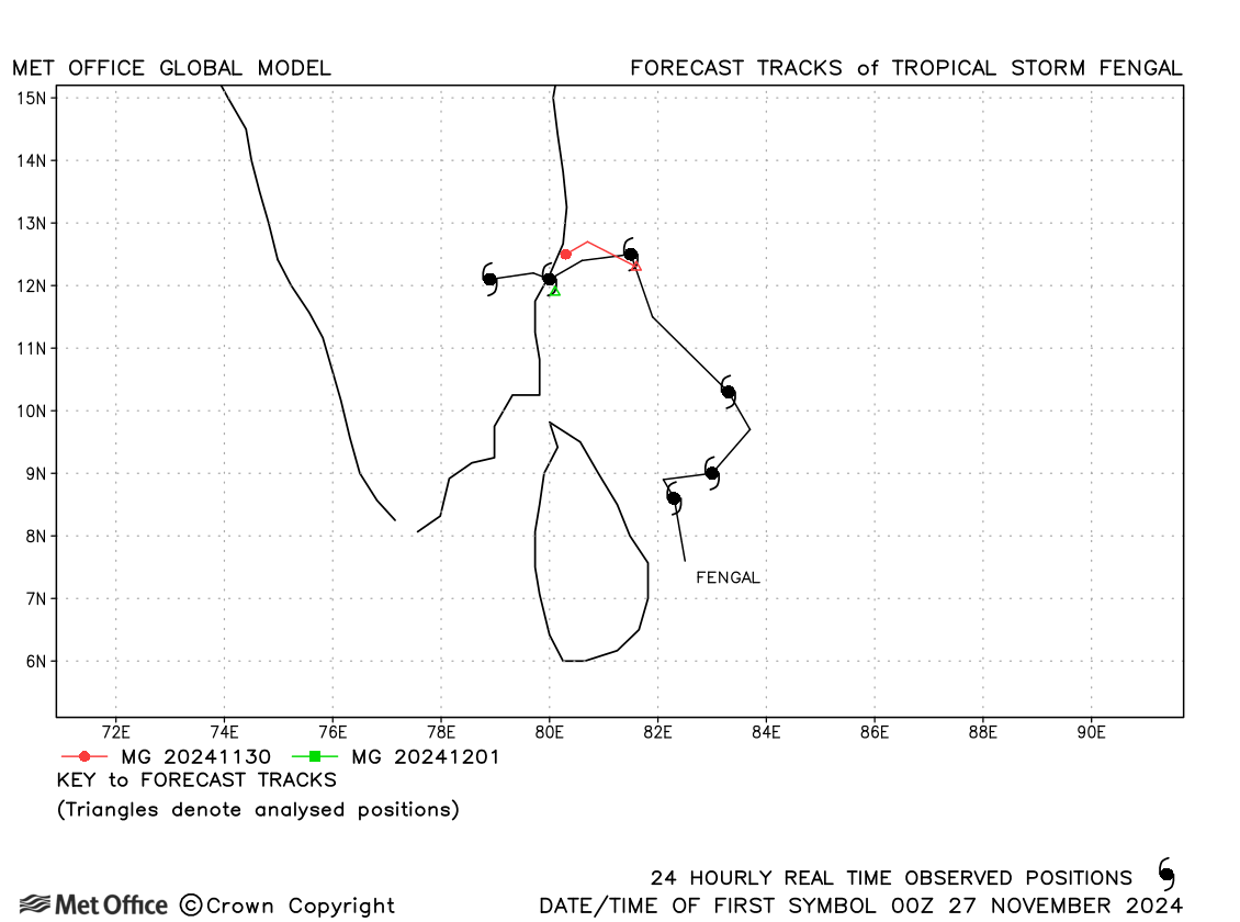
| Fengal (04B) | 26 November - 02 December | 987 mb, 50/45 knots | Track forecast errors were near to the recent mean values. |
North Indian observed tracks in 2024
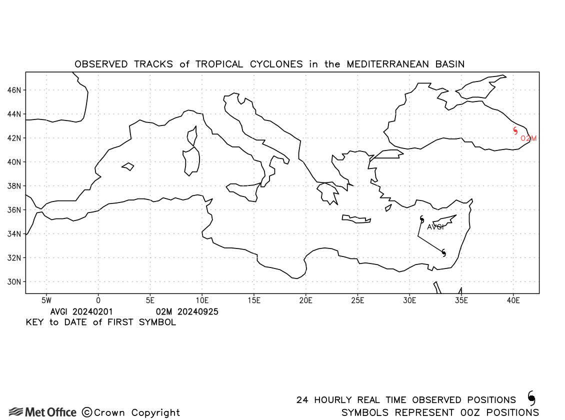
Mediterranean and Black Sea
| Name & ID | Start & end dates | Central pressure, 1-minute MSW | Comments on Met Office global model forecasts |
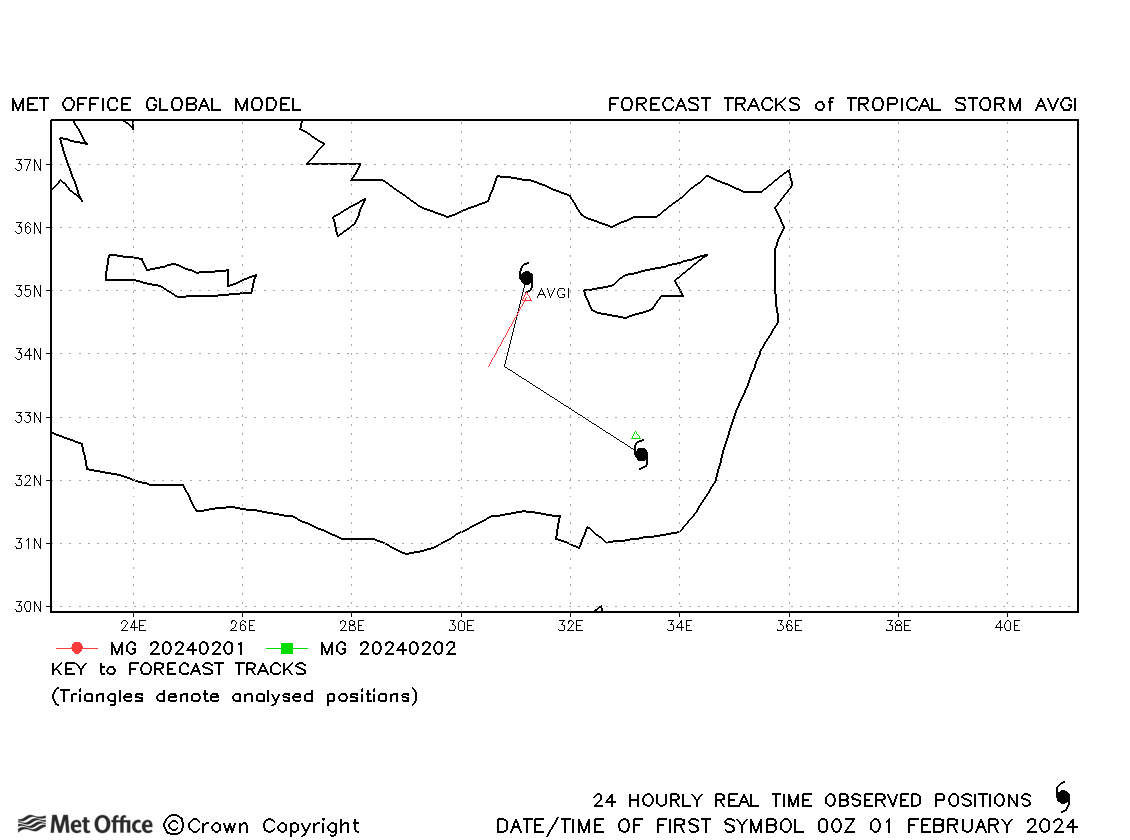
| Avgi (01M) | 01-02 February | 1013 mb, 40 knots | Avgi was short-lived as a tropical storm and few forecasts were verified. |
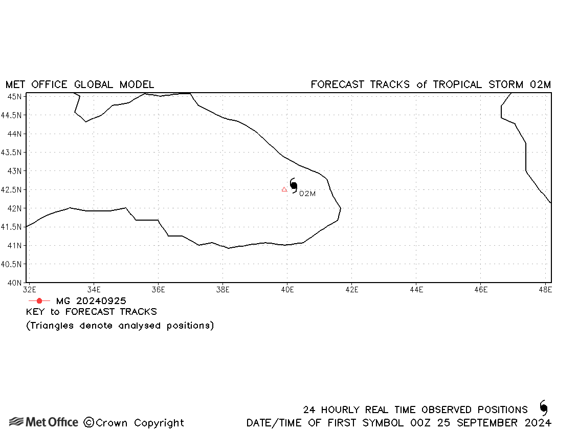
| 02M | 24-25 September | 1010 mb, 35 knots | 02M briefly acquired subtropical characteristics, so is included in the database. |
Note, there is no official warning agency for Mediterranean tropical or subtropical cyclones, so identifiers are assigned by the Met Office to facilitate tracking and forecast verification.
Mediterranean observed tracks in 2024
Note on estimated wind speeds
1-minute MSW: Maximum sustained wind (knots) averaged over 1 minute (JTWC Hawaii, NHC Miami, CPHC Hawaii)
3-minute MSW: Maximum sustained wind (knots) averaged over 3 minutes (IMD New Delhi)
10-minute MSW: Maximum sustained wind (knots) averaged over 10 minutes (JMA Japan)
Note: Although 1-minute average winds should be stronger than 3-/10-minute averages, this may not be the case here since estimates are obtained from different warning centres using different analysis techniques.