

Observed and forecast tracks: southern hemisphere 2011-12
All tropical cyclones in the southern hemisphere season in 2011-12 are listed below including details of their start and end dates and maximum sustained wind (MSW). Qualitative comments are included on the performance of the Met O
Click on the name of the tropical cyclone to see a chart of the observed track and forecast tracks from the Met Office global model. Verification statistics on each tropical cyclone are available upon request from [email protected]. At the end of the season a verification report on the performance of the Met Office global model will be published.
| Name & ID | Start & end dates | 1-/10-minute MSW | Comments on Met Office global model forecasts |
|---|---|---|---|
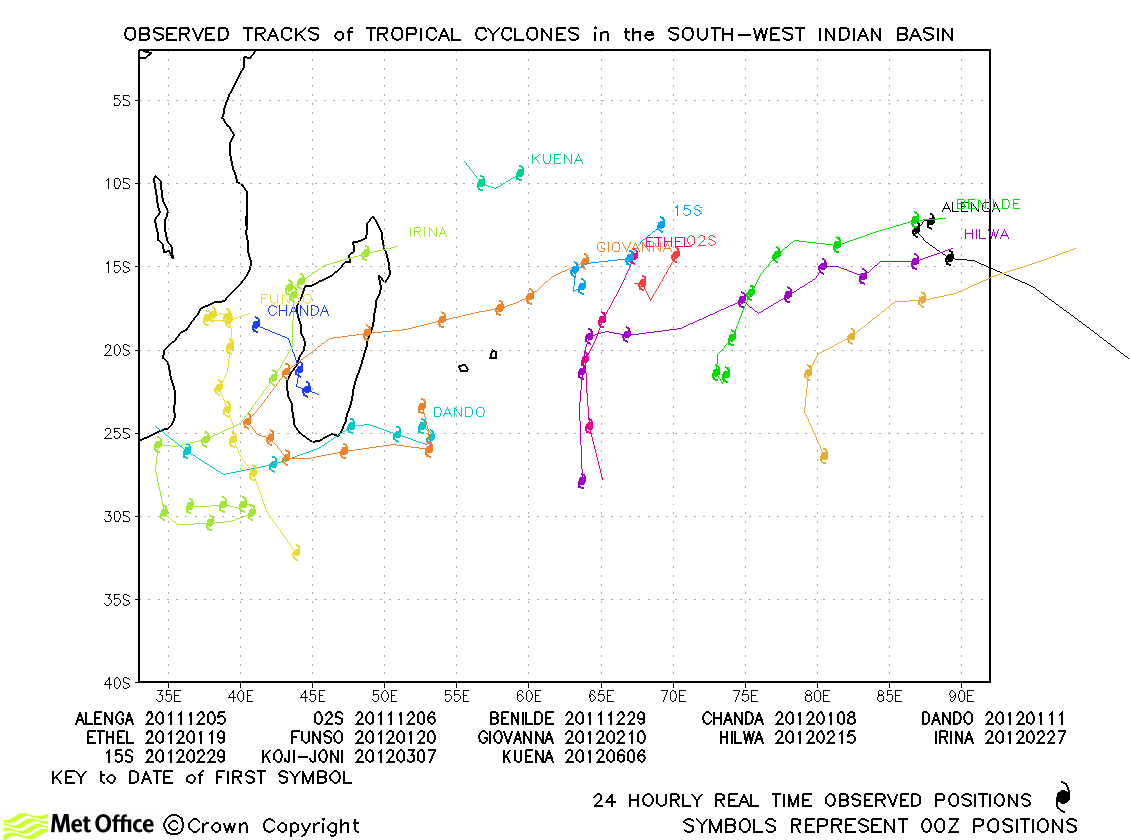
| Alenga (01S) *1 | 05-09 December | 90/80 knots | Track forecast errors were a little above last season's average, but skill scores were very high. |
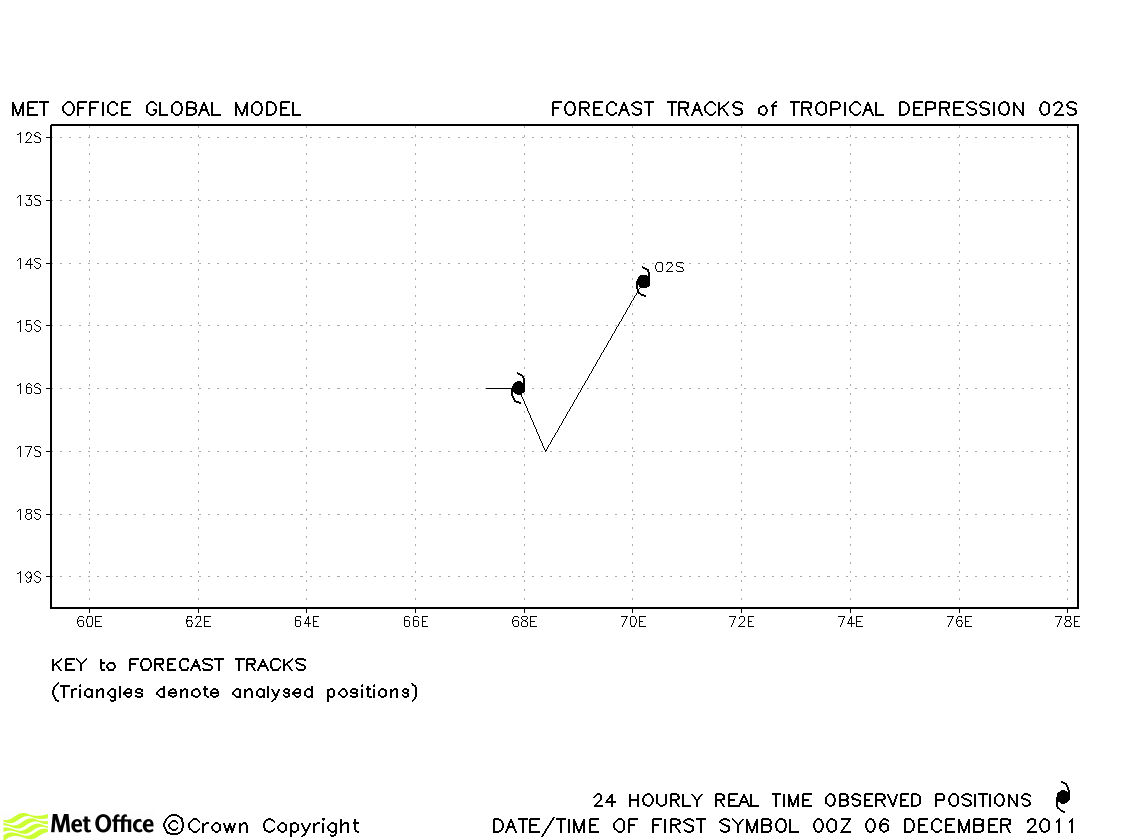
| 02S | 06-07 December | 35/30 knots | 02S only briefly reached tropical storm status (according to JTWC only) and no forecasts were verified. |
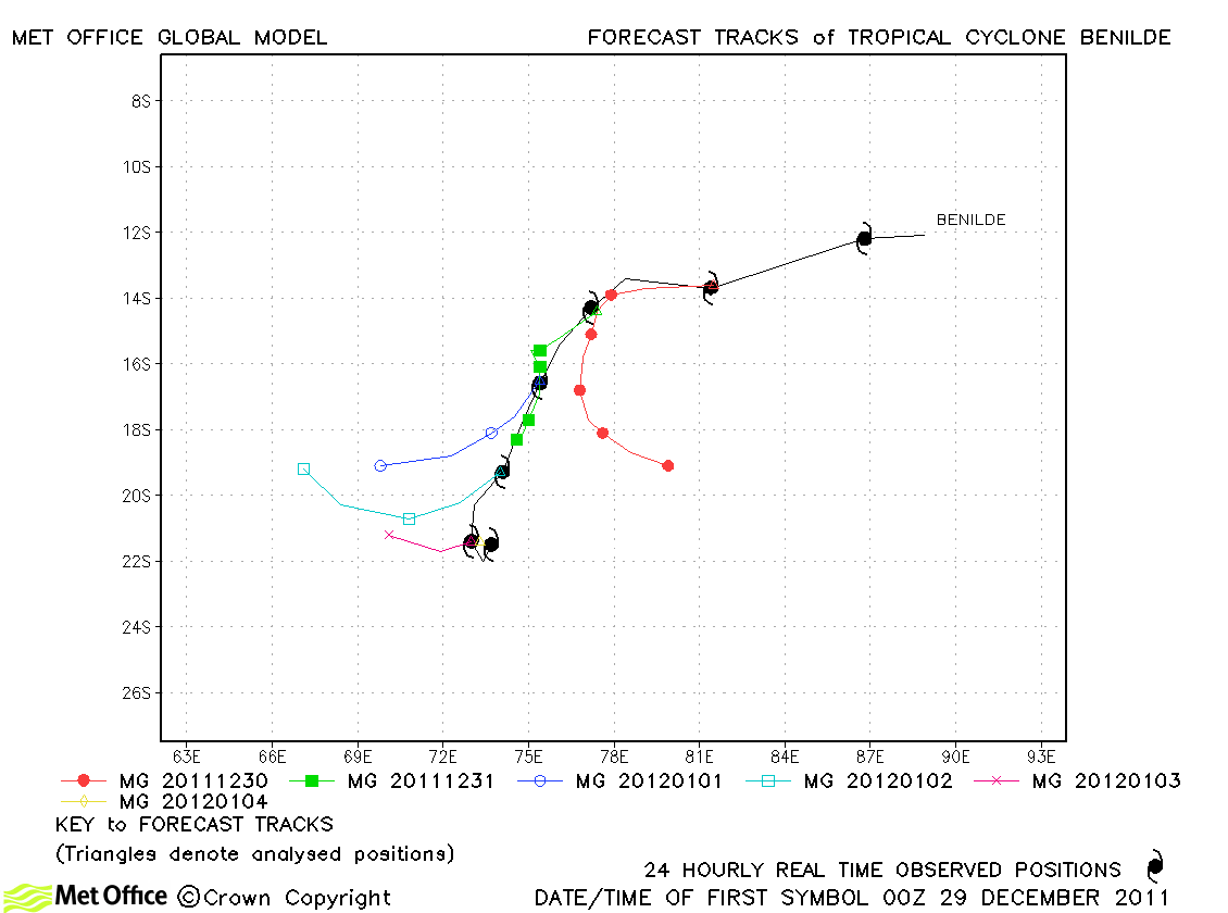
| Benilde (04S) | 28 December-04 January | 90/80 knots | Track forecast errors were above last season's average. Forecasts had left-of-track, right-of-track and slow biases. |
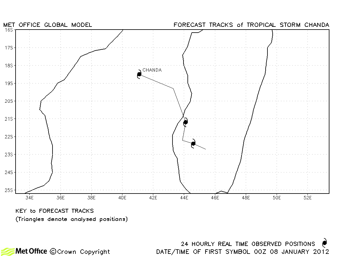
| Chanda (05S) | 07-11 January | 35/35 knots | Chanda was only briefly a tropical storm and no forecasts were verified. |
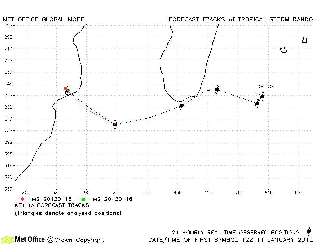
| Dando | 11-16 January | 30/45 knots | JTWC did not consider Dando a tropical storm and RSMC La Réunion advised on it as a subtropical storm. 24-hour prediction of landfall was very good. |
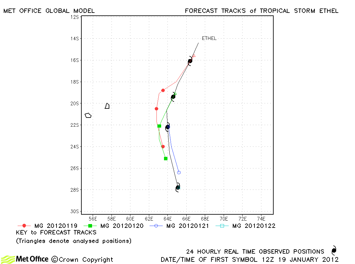
| Ethel (07S) | 18-22 January | 70/55 knots | There was a slow and right-of track bias which resulted in track forecast errors above last season's average. |
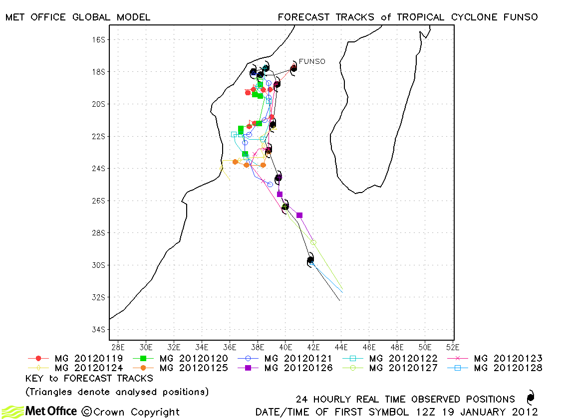
| Funso (08S) | 19-29 January | 120/105 knots | At times the model had a right-of-track bias taking Funso too close to Tanzania. However, overall, forecasts were good with track forecast errors either near to or below last season's average. |
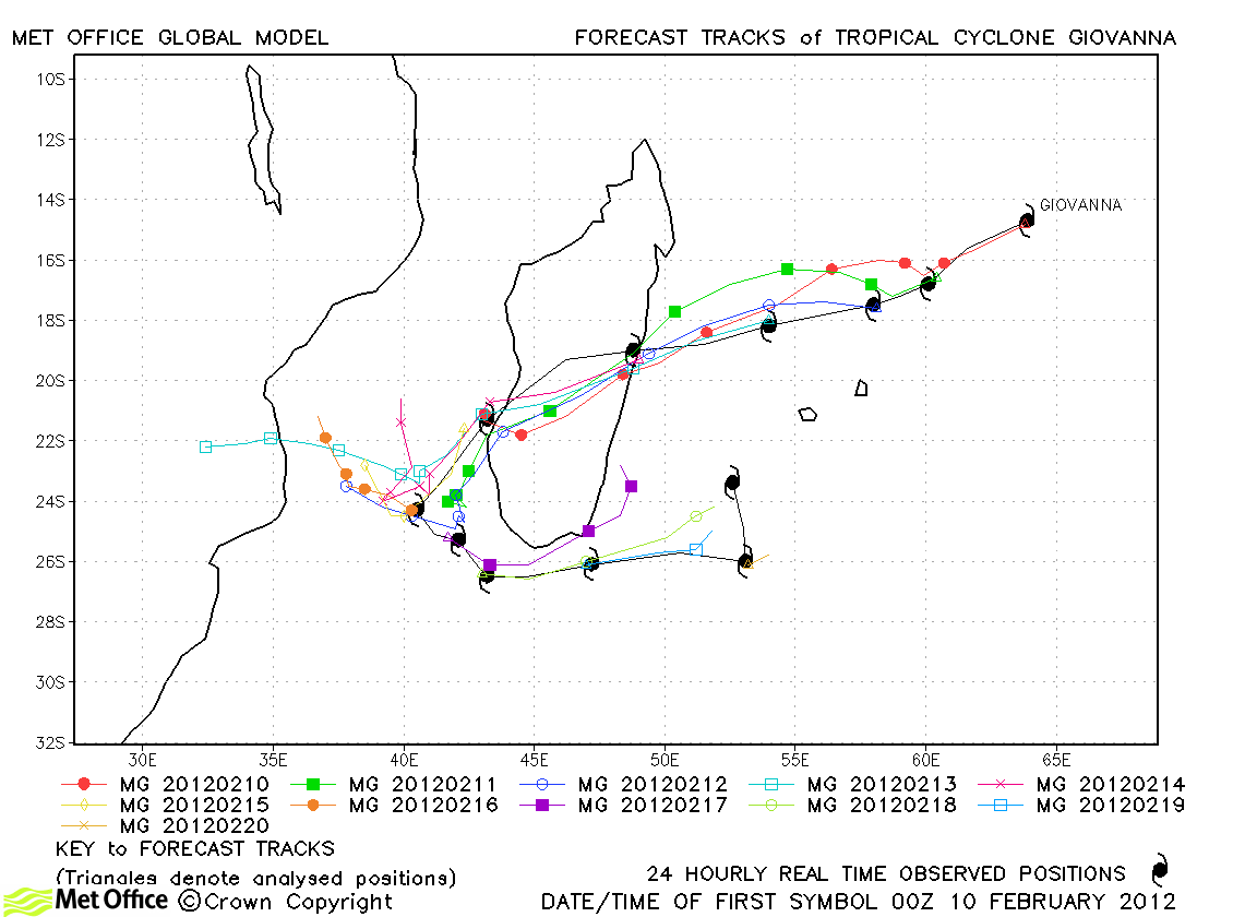
| Giovanna (12S) | 09-21 February | 125/100 knots |
Short period track forecast errors were low and skill scores against CLIPER high. However, longer lead time errors were large due to the failure to predict the leftward turn and eastwards track after Giovanna had crossed Madagascar. |
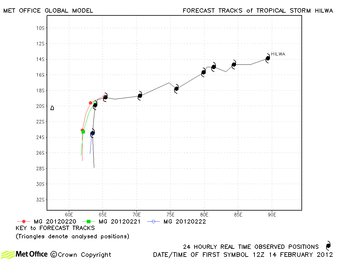
| Hilwa (13S) | 14-23 February | 40/40 knots | Hilwa was a depression for a long time before finally becoming a storm. Track forecast errors were near to or below last season's average. |
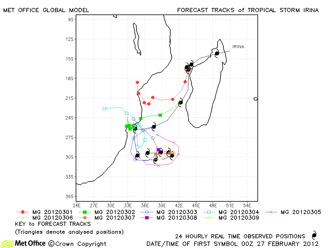
| Irina (14S) | 26 February-10 March | 50/50 knots | Track forecast errors were larger than last year's average and the model tended to incorrectly turn the storm towards Mozambique. However, the model still showed considerable skill over CLIPER. |
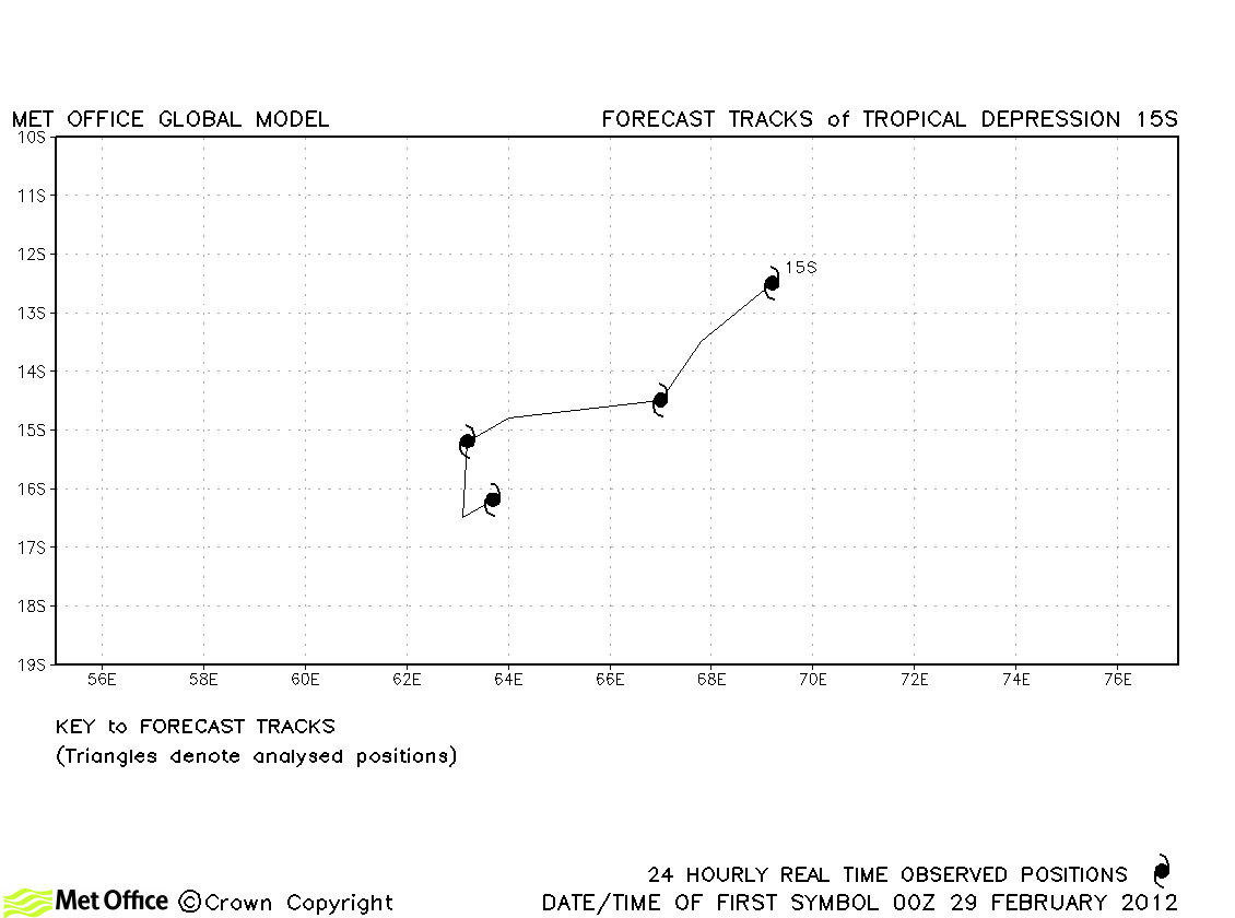
| 29 February-03 March | 35/30 knots | This was short-lived as a storm and no forecasts were verified. | |
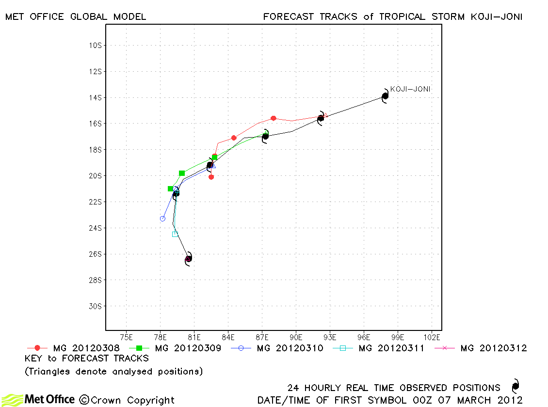
| Koji-Joni (16S) *2 | 07-12 March | 70/55 knots | Track forecast errors were above last season's average due to a slow bias. |
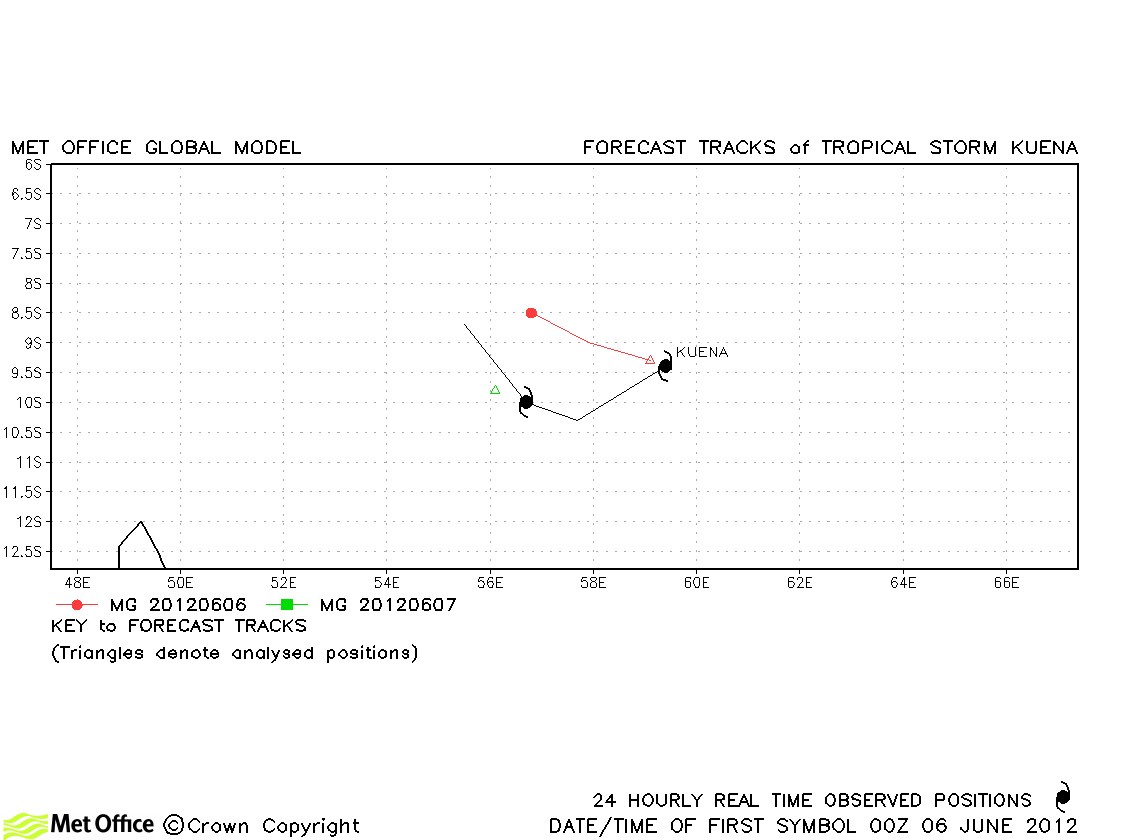
| Kuena (20S) | 06-07 June | 50/50 knots | Kuena was short-lived and only a few forecasts were verified. |
*1: Moved into the Australian region
*2: Moved from the Australian region
South-West Indian observed tracks in 2011-12
| Name & ID | Start & end dates | 1-/10-minute MSW | Comments on Met Office global model forecasts |
|---|---|---|---|
| Alenga (01S) *3 | 05-09 December | 90/80 knots | Track forecast errors were a little above last season's average, but skill scores were very high. |
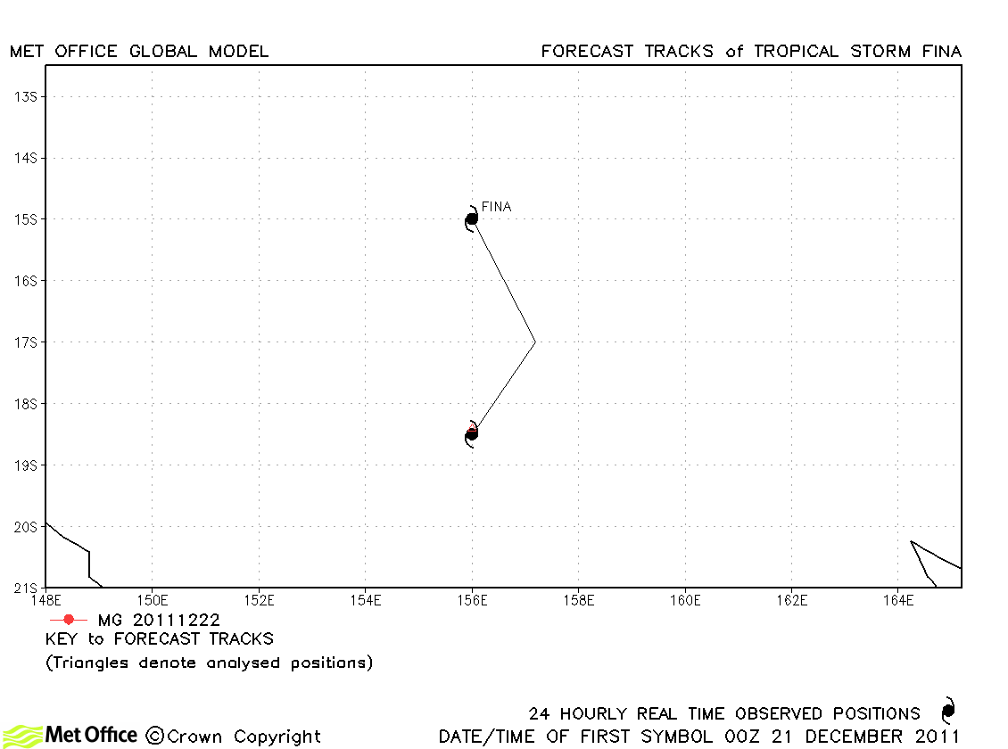
| Fina | 20-22 December | 30/35 knots | Fina was only briefly a tropical storm (according to Australian BoM) and no forecasts were verified. |
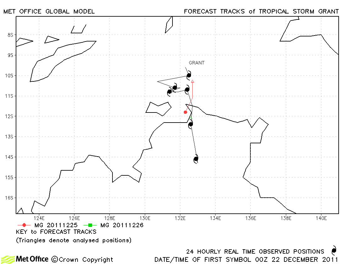
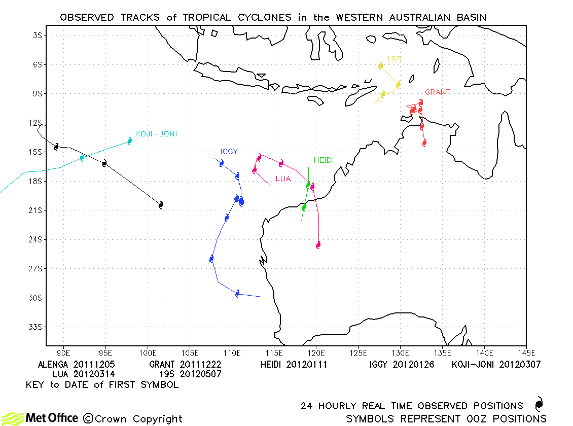
| Grant (03S) | 21-27 December | 40/55 knots | Grant was short-lived as a storm, but track forecast errors were low. |
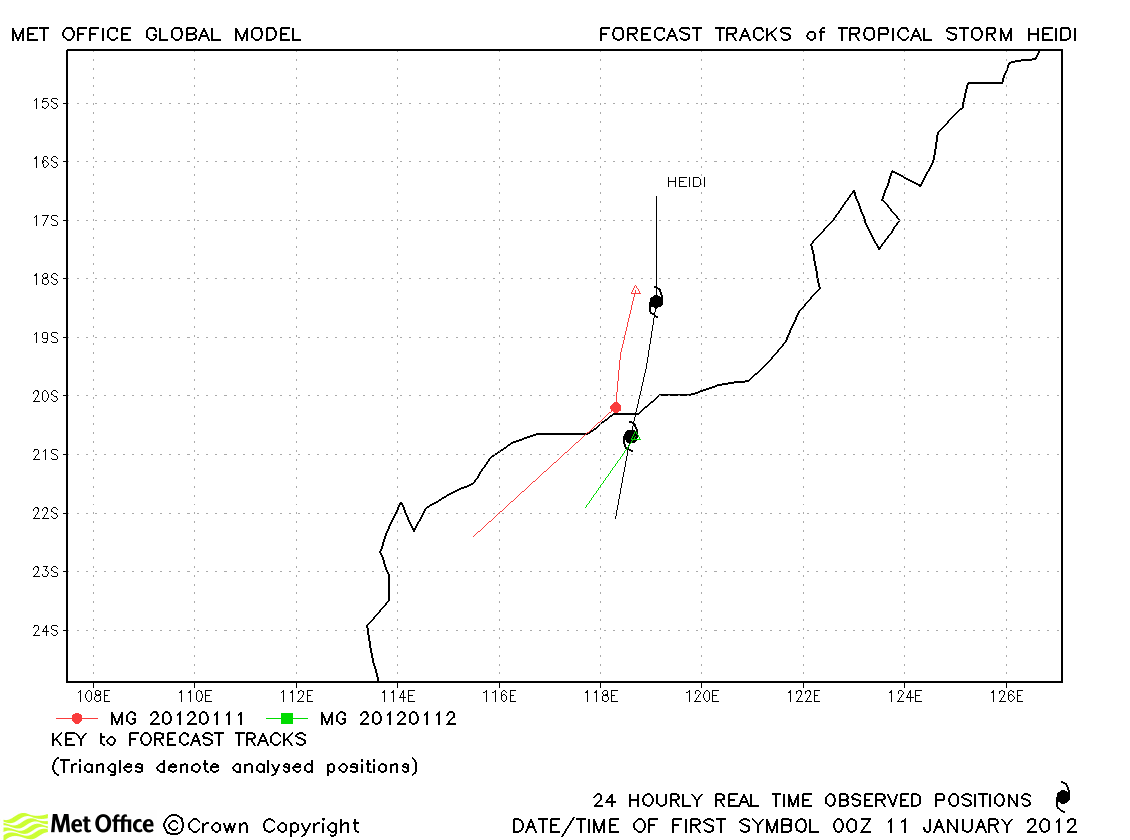
| Heidi (06S) | 10-12 January | 55/60 knots | Heidi became a tropical storm barely more than 24 hours before landfall. Predictions of landfall location were good, although the model turned the storm right too quickly after landfall. |
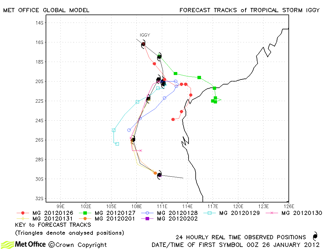
| Iggy (09S) | 25 January-02 February | 65/55 knots | Forecasts for Iggy were mixed. Some early forecasts incorrectly predicted landfall, but later forecasts predicted its track very well. Track forecast errors were low at short lead times, but at longer lead times near to or above last season's average. Skill scores against CLIPER were high. |
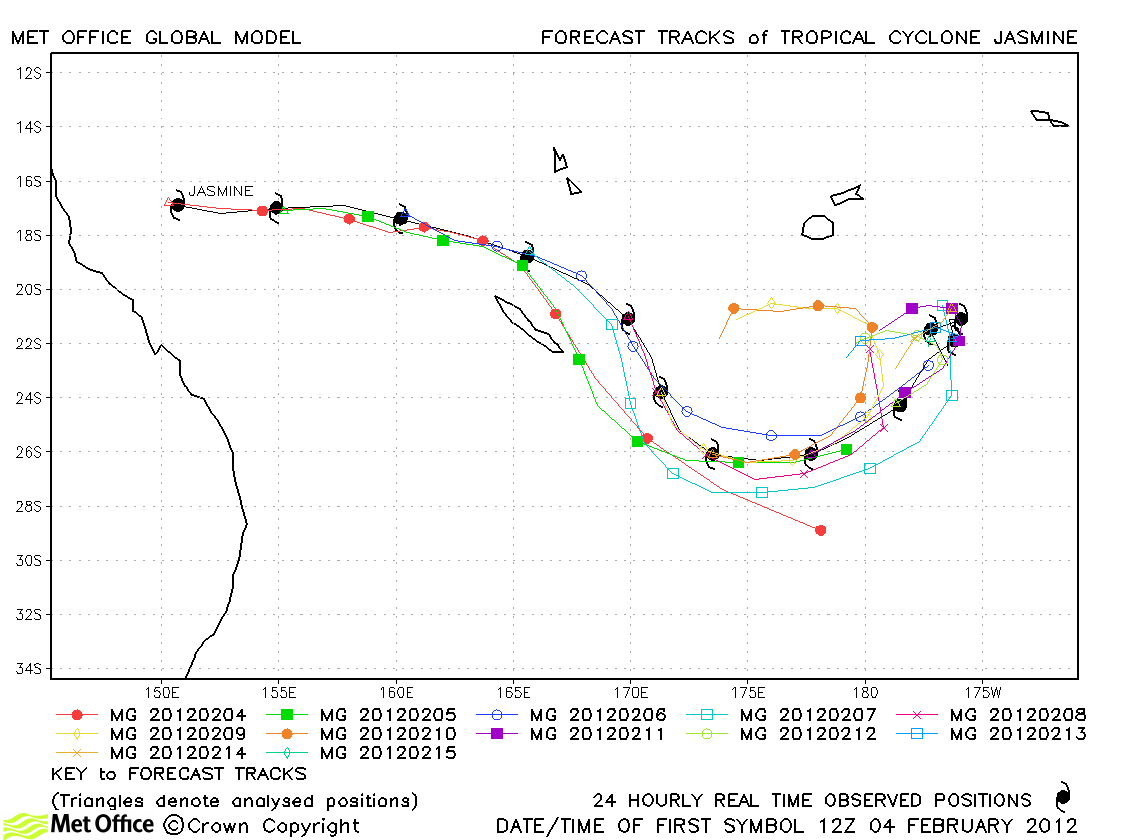
| Jasmine (10P) *4 | 04-16 February | 115/100 knots | Jasmine was well predicted by the model. Track forecast errors were low and skill scores high. The unusual equatorwards turn was well predicted, although the degree to which the storm looped westwards again was over-predicted. |
| Koji-Joni (16S) *5 | 07-12 March | 70/55 knots | Track forecast errors were above last season's average due to a slow bias. |
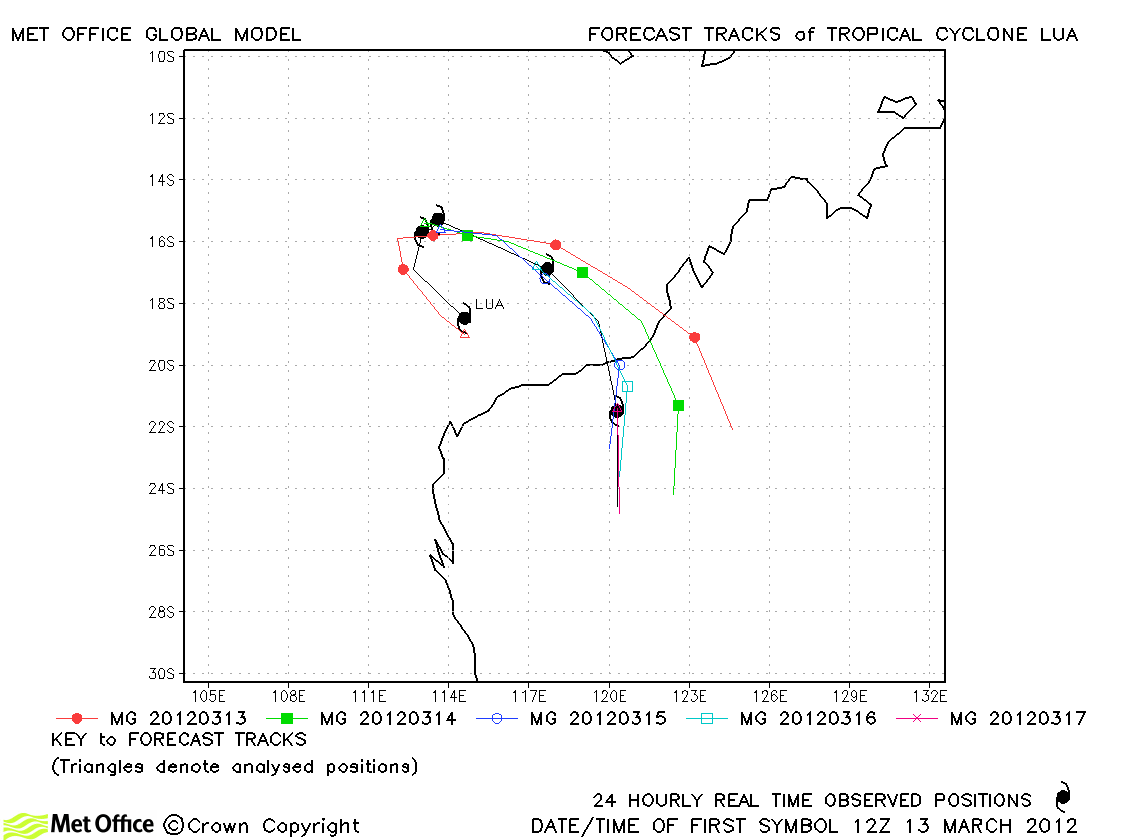
| Lua (17S) | 13-18 March | 95/95 knots | Track forecast errors were low and skill scores high as the model predicted the turn towards land well. There was a slight left-of-track bias in some forecasts. |
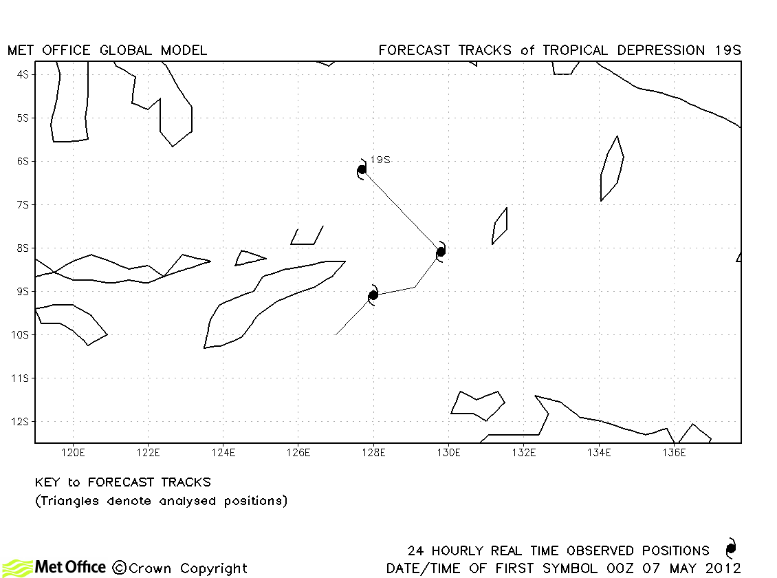
| 19S | 07-09 May | 30/30 knots | 19S did not reach tropical storm strength and no forecasts were verified. |
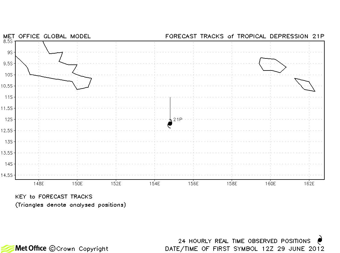
| 21P | 29-30 June | 35/- knots | 21P was only recognised by JTWC and was short-lived. No forecasts were verified. |
*3: Moved from the South-West Indian region
*4: Moved into the Fiji region
*5: Moved into the South-West Indian region
| Name & ID | Start & end dates | 1-/10-minute MSW | Comments on Met Office global model forecasts |
|---|---|---|---|
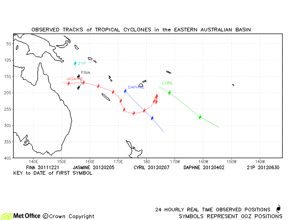
| Jasmine (10P) *6 | 04-16 February | 115/100 knots | Jasmine was well predicted by the model. Track forecast errors were low and skill scores high. The unusual equatorwards turn was well predicted, although the degree to which the storm looped westwards again was over-predicted. |
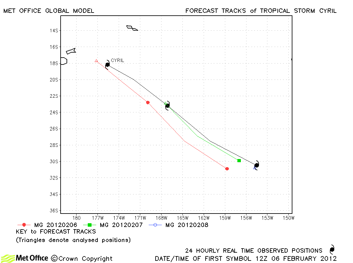
| Cyril (11P) | 06-08 February | 45/50 knots | Cyril only lasted a couple of days an accelerated into the mid-latitudes. Track forecasts were a little slow, but gave reasonable guidance. |
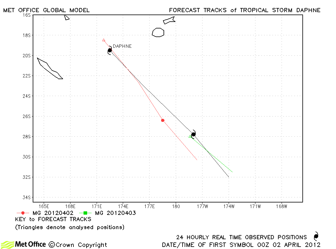
| Daphne (18P) | 02-03 April | 50/50 knots | Only a few forecasts were verified and the model tended to move Daphne too slowly to the south-east. |
*6: Moved from the Australian region
Western Australian observed tracks in 2011-12
Eastern Australian and South Pacific observed tracks in 2011-12
Note on estimated wind speeds
1-minute MSW: Maximum sustained wind (knots) averaged over 1 minute (JTWC Hawaii)
10-minute MSW: Maximum sustained wind (knots) averaged over 10 minutes (Southern Hemisphere RSMCs and TCWCs)
Note: Although 1-minute average winds should be stronger than 10-minute average, this may not be the case here since estimates are obtained from different warning centres.
