
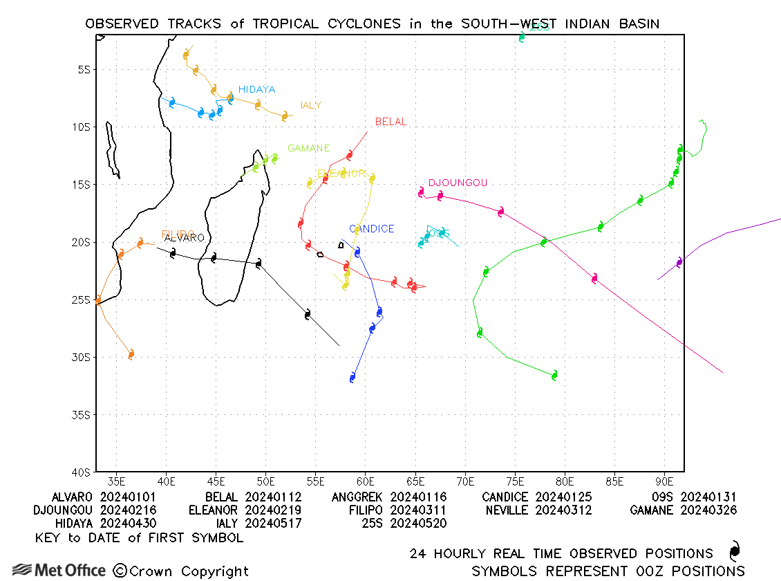
Observed and forecast tracks: southern hemisphere 2023-24
All tropical cyclones in the southern hemisphere season in 2023-24 are listed below including details of their start and end dates, lowest central pressure and maximum sustained wind (MSW).
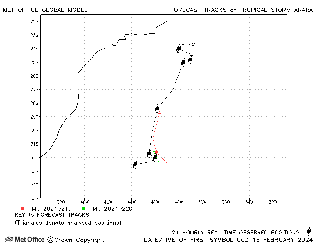
Click on the name of the tropical cyclone to see a chart of the observed track and forecast tracks from the Met Office global model. Verification statistics on each tropical cyclone are available upon request from tropical_cyclones@metoffice.gov.uk. At the end of the season a verification report on the performance of the Met Office global model will be published.
South-West Indian (west of 90°E)
| Name & ID | Start & end dates | Central pressure, 1-/10-minute MSW | Comments on Met Office global model forecasts |
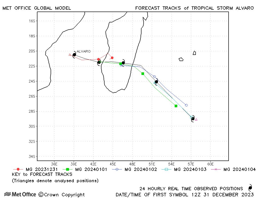
| Alvaro (04S) | 31 December - 04 January | 985 mb, 60/60 knots | Longer lead time errors were large due to a slow bias. |
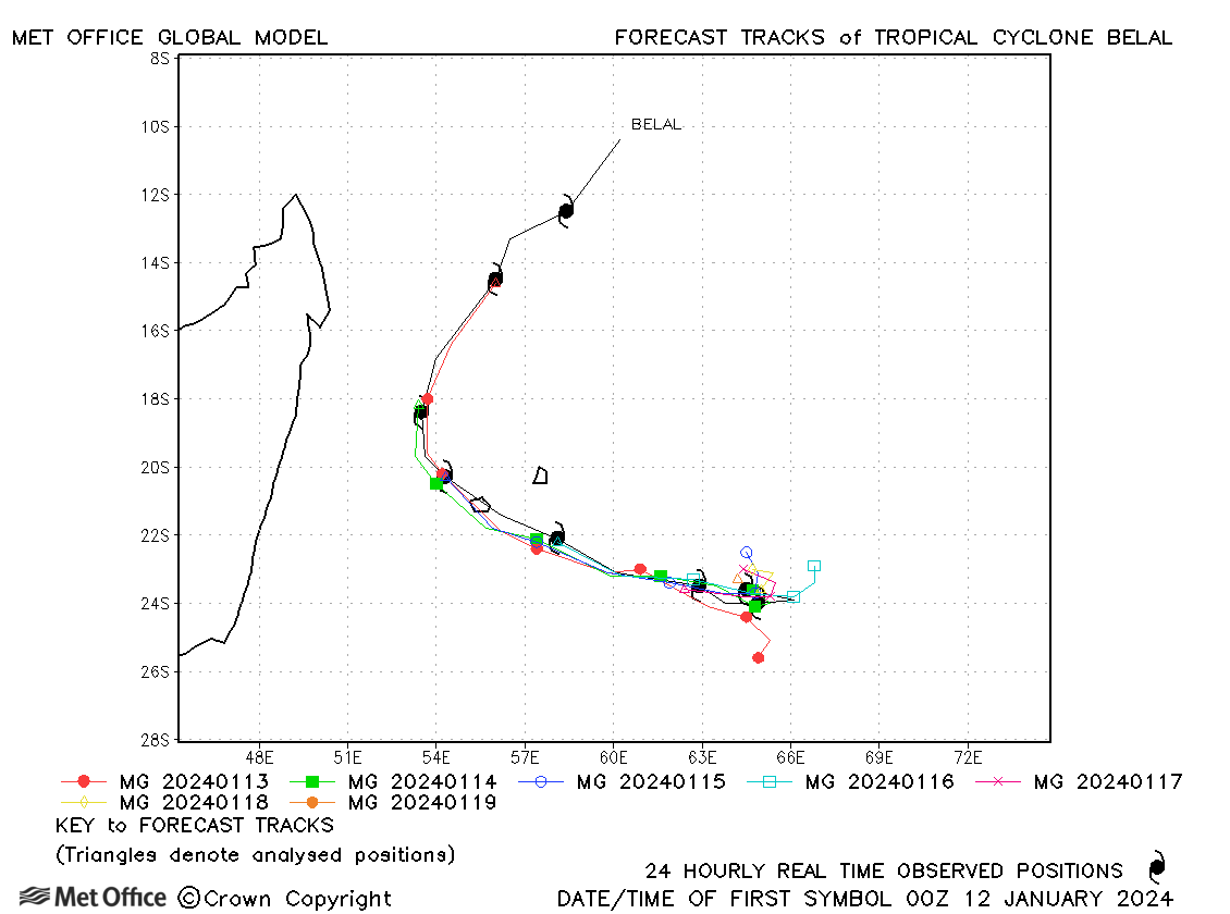
| Belal (05S) | 11-19 January | 964 mb, 90/80 knots | Track forecasts were good with errors below the recent mean values. |
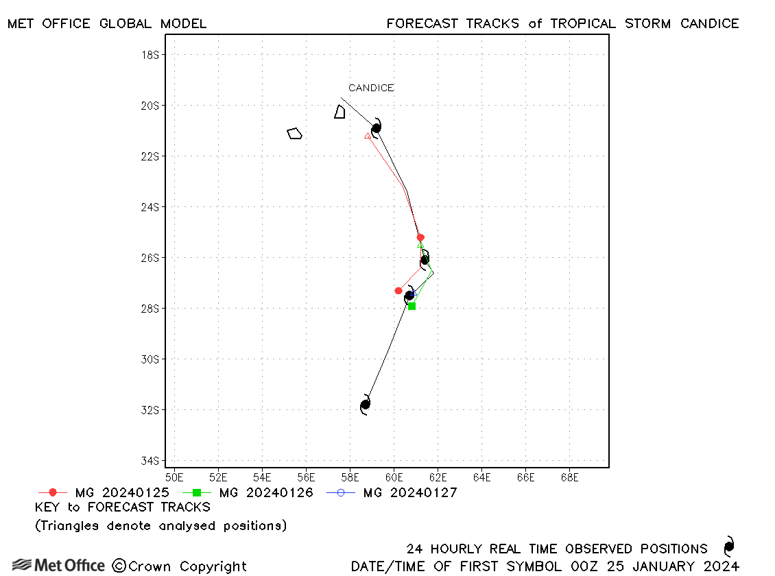
| Candice (08S) | 24-28 January | 985 mb, 50/50 knots | Track forecast errors were low for Candice. |
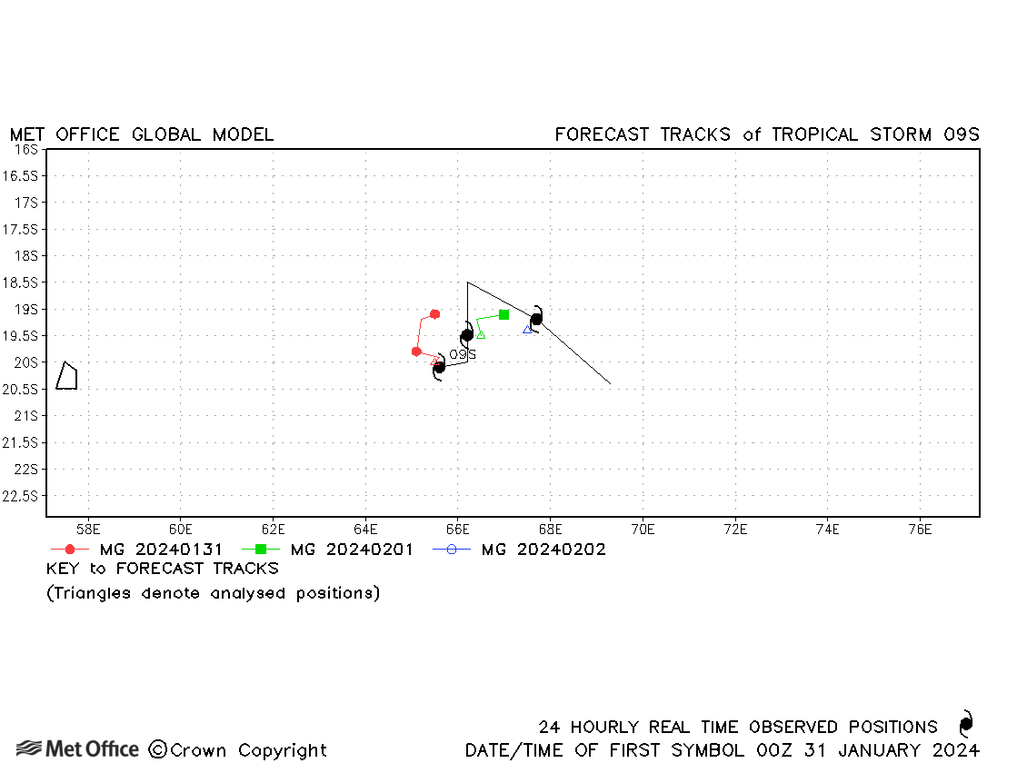
| 09S | 31 January - 02 February | 1001 mb, 35/30 knots | Track forecast errors were close to the recent mean values. Tropical Storm status was only achieved according to JTWC. |
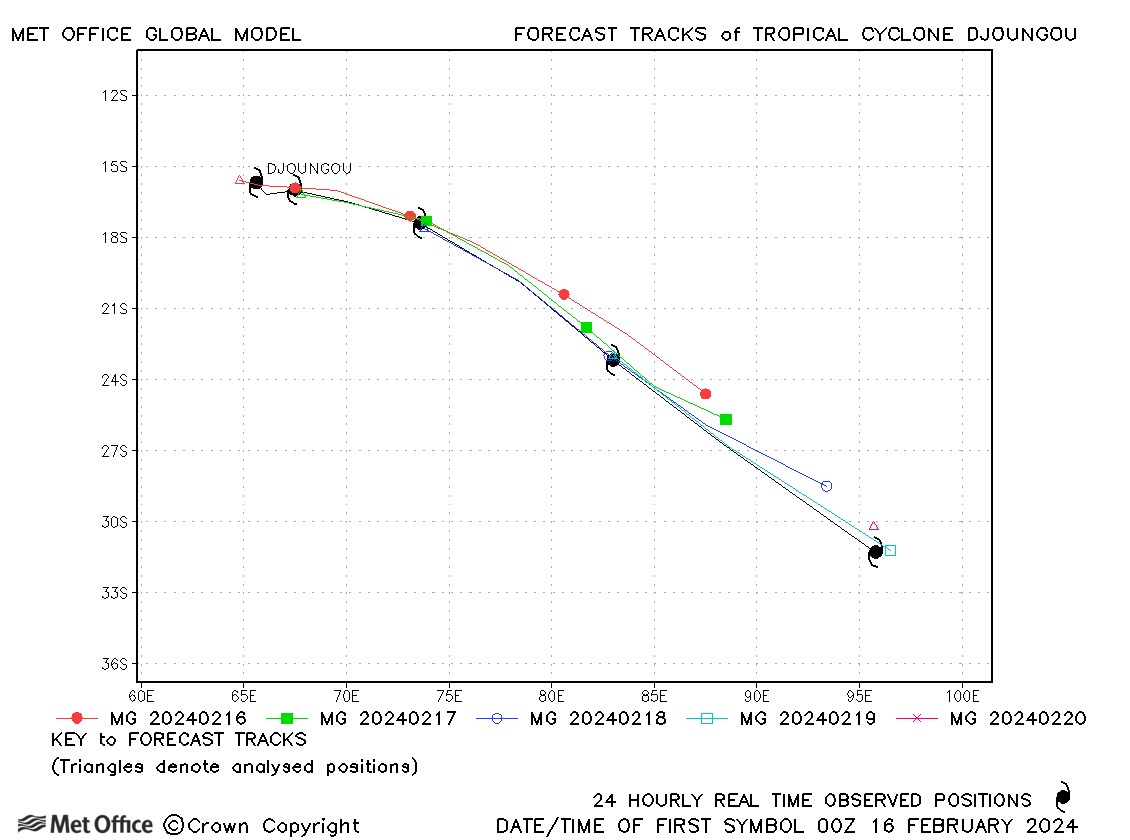
| Djoungou (13S) | 15-20 February | 922 mb, 125/115 knots | Track forecast errors were large due to a slow bias in forecasts. |
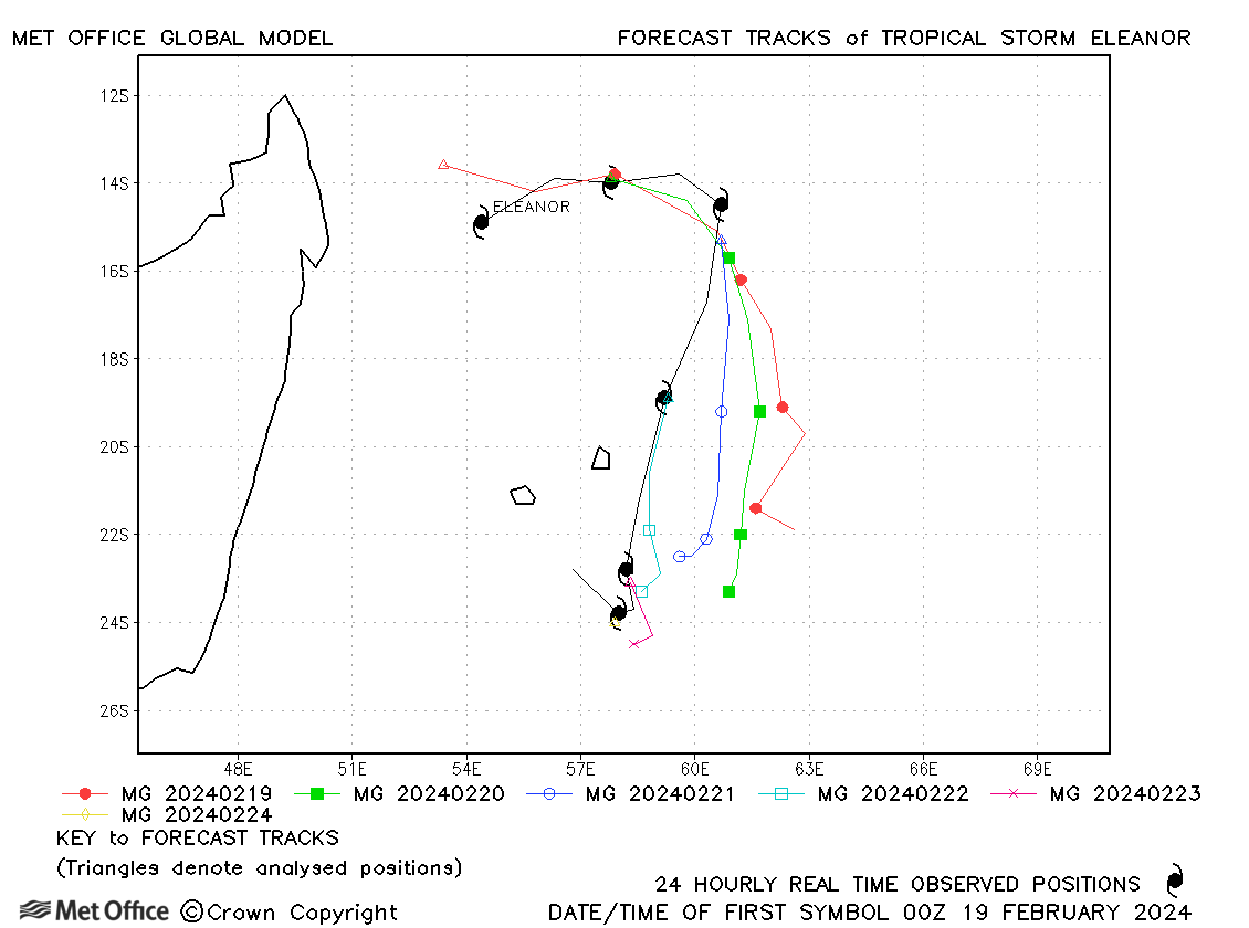
| Eleanor (16S) | 19-24 February | 984 mb, 55/55 knots | Track forecast errors were above the recent mean values due to a left-of-track bias in forecasts. |
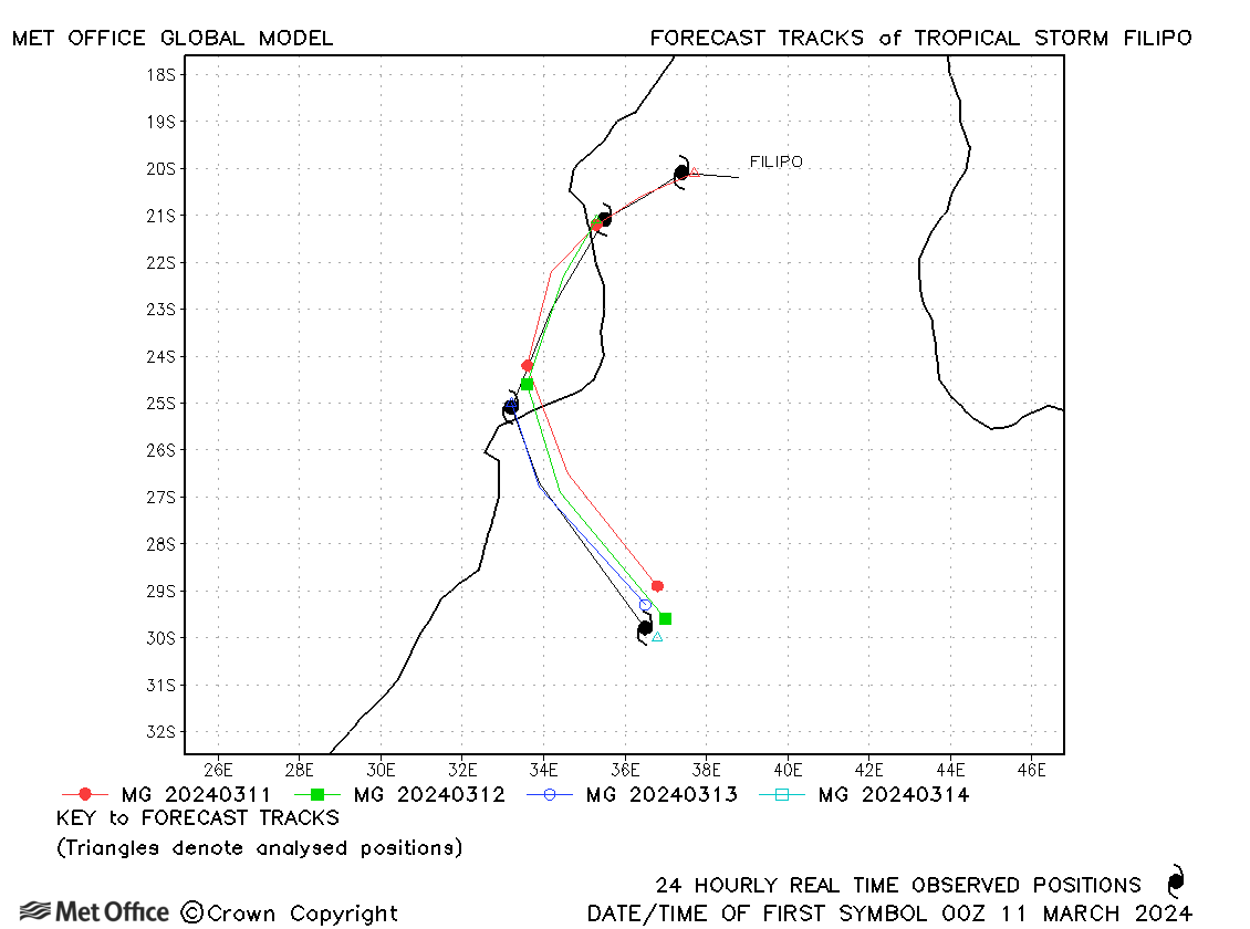
| Filipo (17S) | 10-14 March | 983 mb, 60/60 knots | Track forecast errors were low for this storm. |
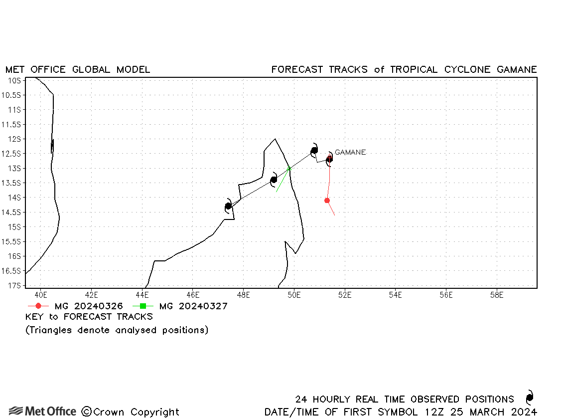
| Gamane (20S) | 25-28 March | 970 mb, 90/80 knots | Forecasts of the landfall and track of Gamane across Madagascar were poor. |
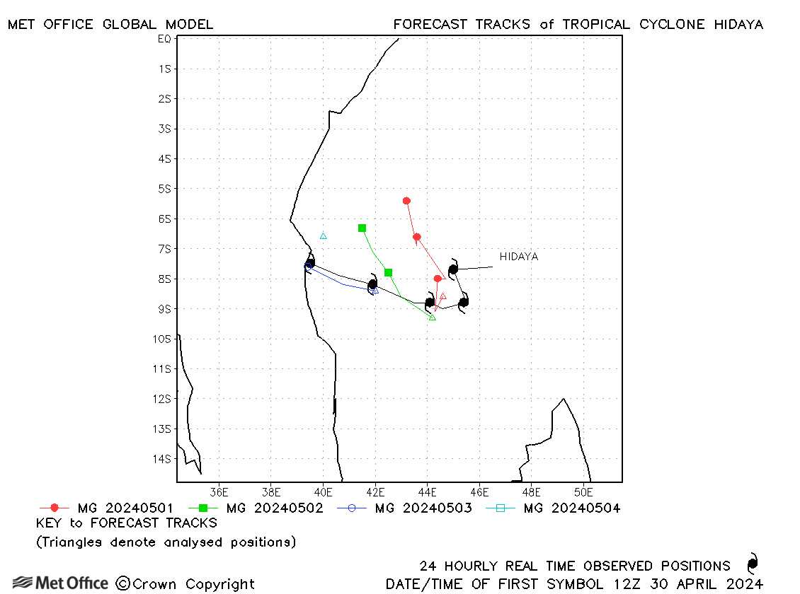
| Hidaya (23S) | 30 April-04 May | 976 mb, 80/70 knots | There was a right-of-track bias in forecasts resulting in larger than average errors. |
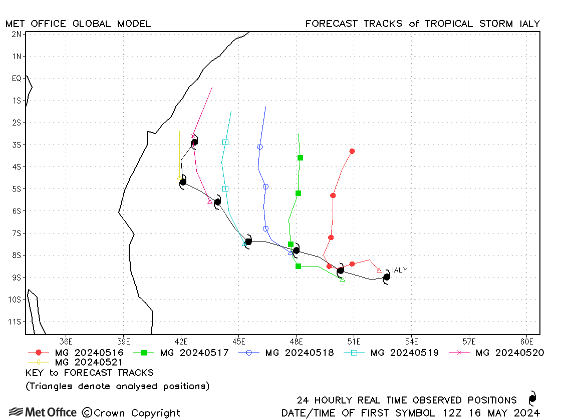
| Ialy (24S) | 16-22 May | 983 mb, 60/65 knots | As for Hidaya a couple of week's earlier a right-of-track bias resulted in larger than average errors. |
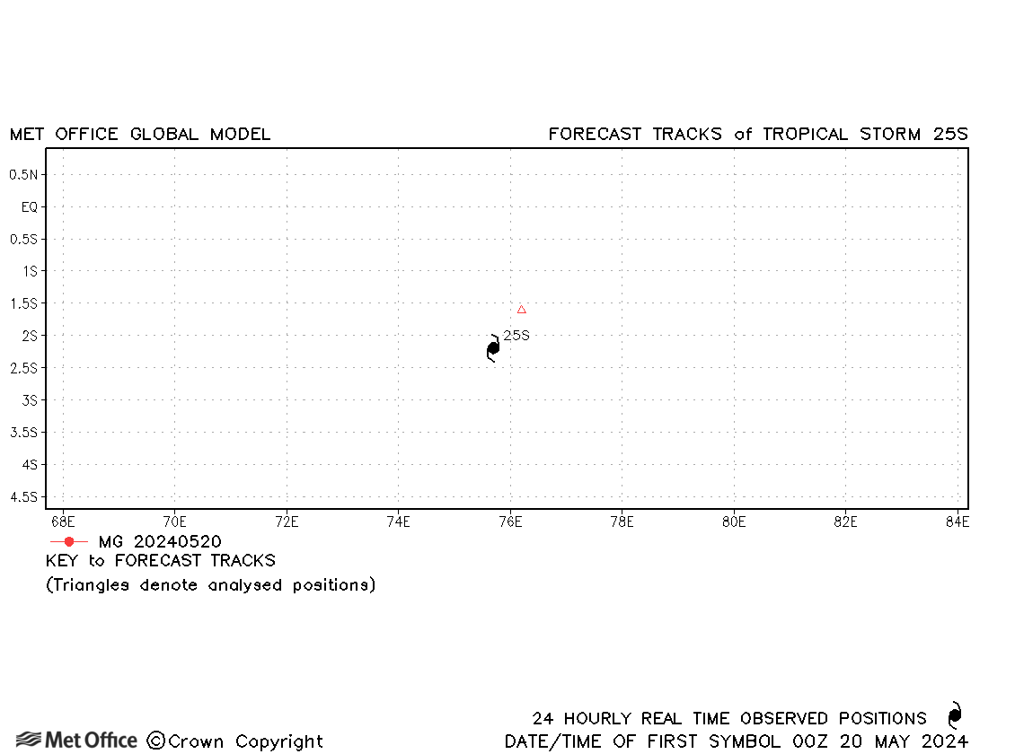
| 25S | 19-20 May | 1002 mb, 35/- knots | 25S was a short-lived storm. |
South-west Indian observed tracks in 2023-24
Australian (90-160°E) - including Indonesia and PNG
| Name & ID | Start & end dates | Central pressure, 1-/10-minute MSW | Comments on Met Office global model forecasts |
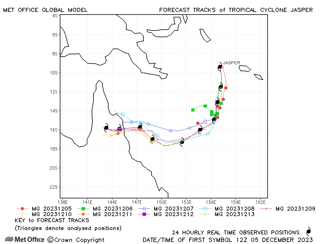
| 05-15 December | 938 mb, 120/105 knots | Track forecasts were low at short lead times, but high at longer lead times due to a slow and right-of-track bias. | |
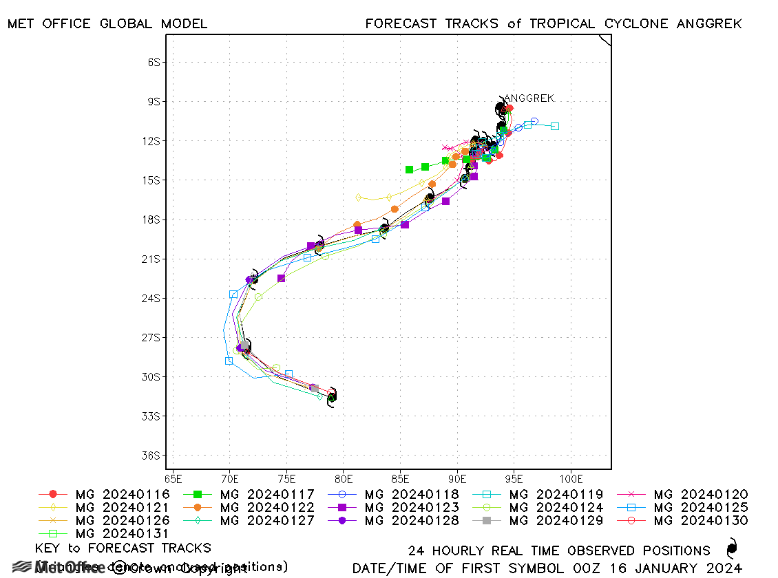
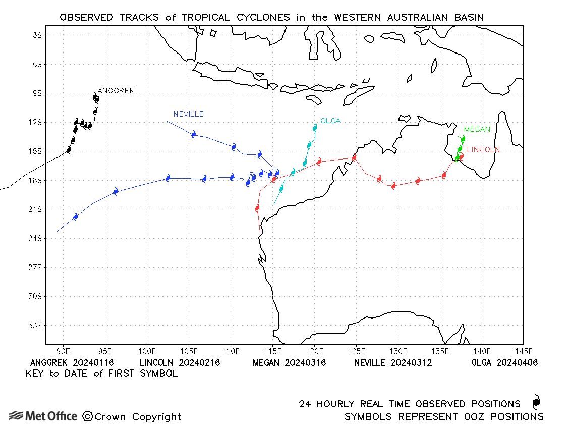
| Anggrek (06S) | 15-31 January | 950 mb, 120/100 knots | Track forecast errors were mostly low for this long-lived storm. The initial slow movement was well predicted, although forecasts were a little late in predicting the subsequent acceleration in forward speed resulting in a slow bias. |
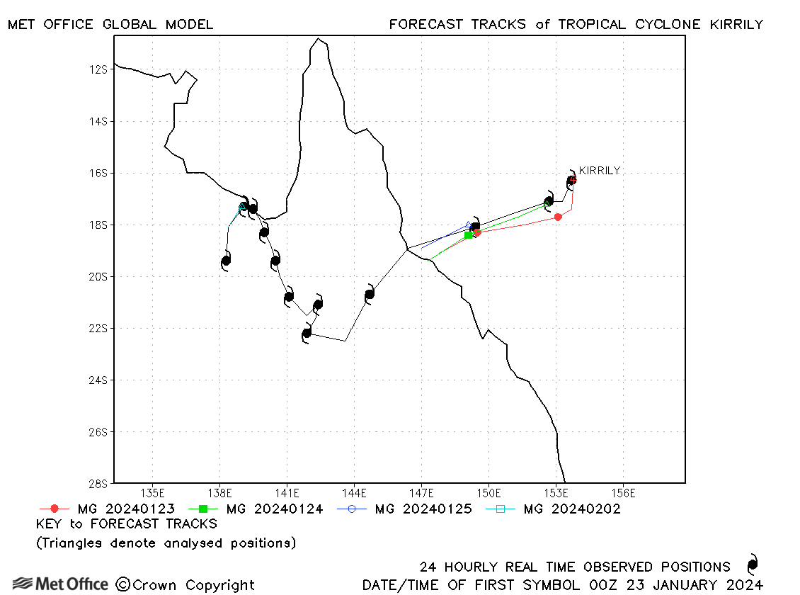
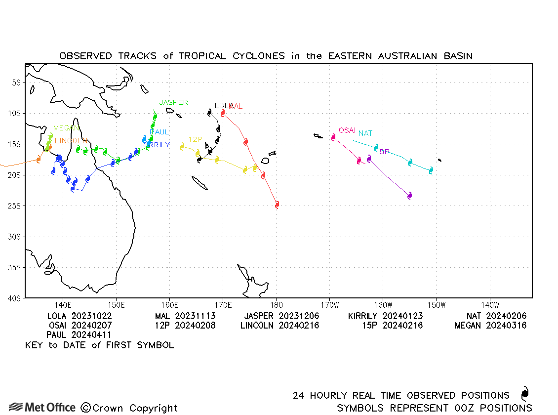
| Kirrily (07P) | 23 January - 02 February | 978 mb, 65/65 knots | Track forecast errors were near to or below the recent mean values. |
| Lincoln (14P) | 15-24 February | 997 mb, 40/35 knots | Track forecast errors were small, but Lincoln was not a tropical storm for long. |
| Neville (18S) | 11-24 March | 952 mb, 115/95 knots | Some early forecasts had a southwards bias, but after that track forecasts were good with errors mostly below the recent mean values. |
| Megan (19P) | 15-18 March | 967 mb, 95/70 knots | Track forecast errors were below recent mean values. |
| Olga (21S) | 05-10 April | 945 mb, 120/100 knots | A right-of-track bias resulted in longer lead time track forecast errors above the recent mean values. |
| Paul (22P) | 10-12 April | 991 mb, 50/50 knots | Paul was a short-lived tropical storm. |
Fiji (east of 160°E)
| Name & ID | Start & end dates | Central pressure, 1-/10-minute MSW | Comments on Met Office global model forecasts |
| Lola (01P) | 21-26 October | 930 mb, 120/115 knots | There was a right-of-track bias resulting in large track forecast errors at some times. |
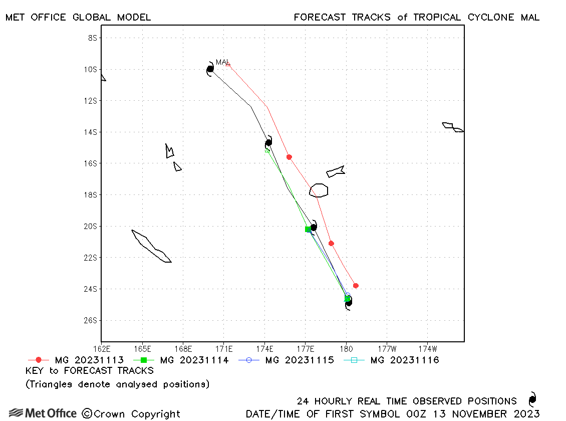
| Mal (02P) | 13-16 November | 965 mb, 75/70 knots | Track forecast errors were low for this storm. |
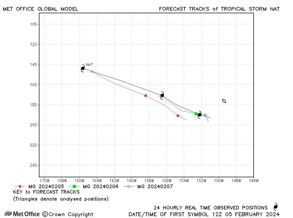
| Nat (10P/06F) | 05-08 February | 985 mb, 50/50 knots | Forecasts were a little slow resulting in larger errors at longer lead times. |
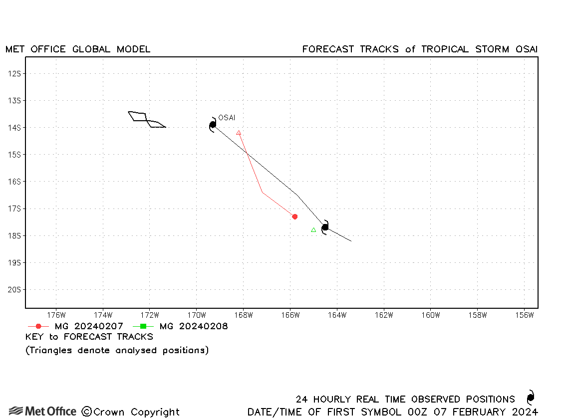
| Osai (11P/08F) | 06-08 February | 991 mb, 50/45 knots | Osai was fairly short-lived and forecasts had a slow bias. |
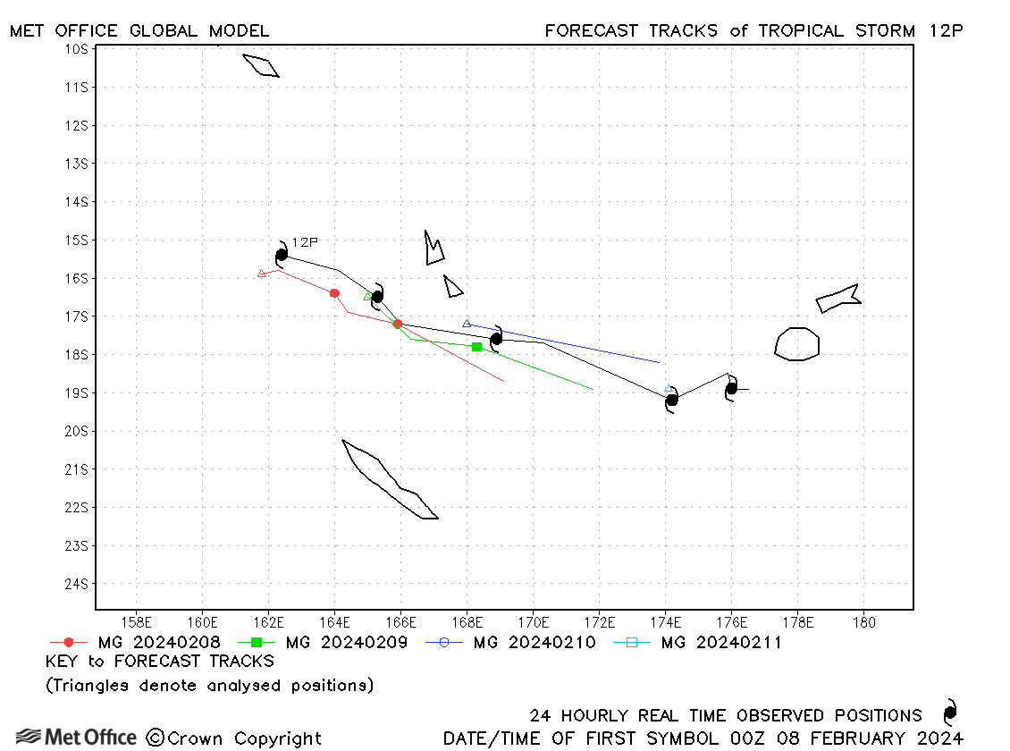
| 12P/05F | 08-12 February | 996 mb, 40/30 knots | 12P was only considered to have reached tropical storm strength by JTWC and forecasts had a slow bias. |
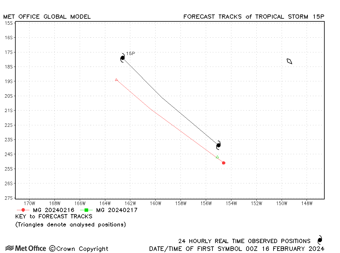
| 15P/10F | 15-17 February | 995 mb, 40/30 knots | 15P was only considered to have reached tropical storm strength by JTWC and only lasted about a day. |
Western Australian observed tracks in 2023-24
Eastern Australian observed tracks in 2023-24
South Atlantic
| Name & ID | Start & end dates | Central pressure, 10-minute MSW | Comments on Met Office global model forecasts |
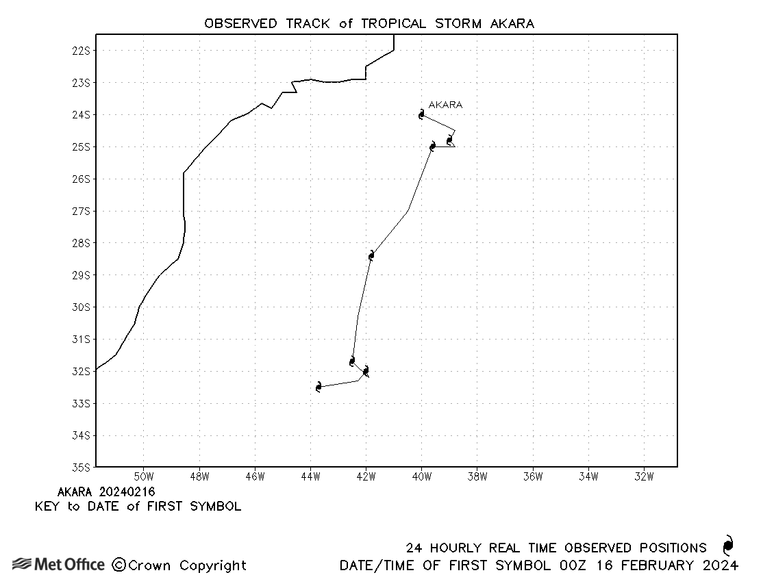
| 16-22 February | 994 mb, 45 knots | Track forecast errors were small for this rare storm. |
South Atlantic observed tracks in 2023-24
Note on estimated wind speeds
1-minute MSW: Maximum sustained wind (knots) averaged over one minute (JTWC Hawaii)
10-minute MSW: Maximum sustained wind (knots) averaged over 10 minutes (Southern Hemisphere RSMCs and TCWCs)
Note: Although 1-minute average winds should be stronger than 10-minute average, this may not be the case here since estimates are obtained from different warning centres using different analysis techniques.