Met Office daily weather: Warnings in force as winter arrives early
Warnings for snow and ice are currently in force across the UK as winter arrives early
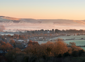
Thursday will bring a distinctly wintry feel across the UK, with inland areas enjoying mostly dry conditions and plenty of sunshine. However, wintry showers are expected to affect northern Scotland and coastal counties both to the east and west.
Some significant snow accumulations are possible away from immediate coasts, especially during the morning, before showers turn more sleety at lower levels later in the day. Winds will be lighter than on Wednesday, but it will remain cold throughout.
As the day progresses into Thursday night, further coastal wintry showers are likely, though these will become less frequent and less intense except perhaps along North Sea coasts. Inland, skies will be mostly clear, leading to widespread frost, which could be locally severe over areas with snow cover.
There is also a risk of isolated patches of freezing fog, particularly in western regions. The night will be another sharp frost, especially in the west as winds ease under a ridge of high pressure, making it colder than the previous night. Severe frost is expected over snow cover, while minima may be slightly higher in eastern and southeastern England due to possible cloud cover.
Outlook for Friday
Friday will begin widely cold and frosty, with temperatures dropping to negative double digits in areas with snow cover. While the southeast will be chilly, many parts here may escape frost. A few showers will affect eastern coasts and the extreme southwest, presenting a wintry mix but mainly rain or sleet by this time. These showers will mostly fade through the morning, with the odd patch of freezing fog possible in the west.
For most, Friday will be dry and fine, with long spells of sunshine that may become increasingly hazy. The southeast will start cloudier but should see steady improvement. Later in the afternoon and evening, cloud and outbreaks of rain, initially falling as hill snow in Scotland, will move into Scotland and Northern Ireland. Winds will remain light to moderate, and it will be widely cold.
Met Office presenter and meteorologist, Alex Burkill, said: “A very cold start to the day on Thursday for sure. It is going to be frosty and icy. It's not just the snow that we need to watch out for. There will be some icy patches through Thursday and it's looking relatively similar to Wednesday. Again, we're seeing showers piling in on that brisk northerly flow.
“Now, the wind will have changed direction ever so slightly and that does mean that we're perhaps going to see a few more showers penetrating a bit further in land across parts of northeast England and with that then snow totals particularly over the North York Moors building up. We could see a substantial amount here. Meanwhile, elsewhere, still some showers down the western parts, but perhaps slightly fewer than on Wednesday. And still showers continue across northern parts of Scotland, many other areas, though again a largely dry day with the best of the sunshine once more towards the west.
“We do currently have lots of snow and ice warnings out at the moment. They are constantly being updated and tweaked, but I wanted to focus on the amber warning. Over the North York Moors through Thursday, in particular, we're going to continue to see that snow building up. 15 to 25 cm possible above 100 meters or so. That's enough to cause some significant disruption, which is why that amber warning is out. There’ll be difficult driving conditions so allow extra time for your journey if you do have to travel. And make sure you've got any necessary equipment with you.
“The winds will be ever so slightly lighter than on Wednesday. So feeling slightly less raw, but nonetheless, temperatures below average for the time of year in the sunshine. That will help counter things a little bit, but for many, a chilly feel. As we go Thursday night into Friday, it's looking even colder perhaps. So, a harsh frost for many of us on Friday morning. But later on, we are set to see some rain arriving from the west. And that takes us into what's going to be a fairly wet weekend.”