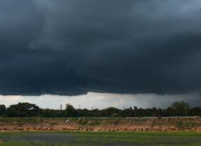
Met Office daily weather: Cloud cover and occasional light showers continue to dominate
The weather on Tuesday and Wednesday is set to be dominated by cloud cover, occasional light showers, and generally mild temperatures.
Tuesday will bring a good deal of cloud across much of the country, with localised drizzle at first and further light showers particularly affecting central, eastern, and south-eastern England. Despite the cloud, temperatures are expected to remain near normal for the time of year, and it will feel rather warm in any sunshine that manages to break through.
As the day progresses into Tuesday night, variable and often large amounts of cloud will persist. Some light showers or drizzle are likely in the east and far north. The best of any clear spells will be found in parts of northern Scotland, where patchy fog may develop once again. There will also be some clearer intervals west of high ground in western Britain.
High pressure remaining firmly in charge this week
— Met Office (@metoffice) October 13, 2025
Keeping the weather cloudy, with patchy drizzle here and there ☁️☁️🌧️ pic.twitter.com/J0KdzbA094
Temperatures overnight will generally be in the range of 8–11°C, though where significant cloud breaks occur in the west, values could fall to low or mid-single figures. Localised frost is possible in north-west Scotland.
Outlook for Wednesday
Wednesday will see anticyclonic conditions bringing another predominantly cloudy day for most areas. However, there will be some breaks in the cloud, especially over and to the lee of high ground. Early mist and fog patches are possible under clear skies but should clear through the morning.
Patchy light rain and drizzle are expected at times in parts of the east and far north, with a few showers possible in coastal areas of the south. Winds will remain light, and temperatures will be close to average for mid-October.
Met Office presenter and meteorologist, Alex Deakin, said: “There's little to shift the weather around at the moment, which means what you're waking up with, you'll probably stick with for most of the day, which means for some it's a little dank over parts of the Midlands, eastern England. The cloud thick enough here for a little bit of drizzle to come and go through the day. Western areas favoured for breaks in the clouds, but there is also some mist and fog around.
“There are a few dense patches here and there clearing through the morning and then sunny spells again for a good part of Scotland. West Wales and southwest England should also see some blue sky at times. Elsewhere, grey is definitely the colour and it makes such a difference to the feel. Temperatures generally 12 to 15°C but if you get the sunshine it feels quite pleasant maybe 16°C across southwest Wales and southwest England with light winds.
"Wednesday is a very similar story. We've still got a lot of clouds. Most places will be dry, but still parts of eastern England susceptible to some drizzle tending to come and go. A bit of a breeze at times around East Anglia and down towards Kensson. Perhaps a bit more of a breeze over the Northern Alles with one or two showers likely here. Again, it'll be western Scotland, West Wales, Southwest England that will be favoured for a little bit of sunshine. Temperatures maybe not quite so high tomorrow. Still generally close to average, 11 to 15 Celsius. And again, it will feel pleasant if you get the sunshine."


