Met Office daily weather: Rain, showers, hill snow and brisk winds.
As we move through the final weekend of January, the UK experiences a mix of rain, showers, hill snow and brisk winds.
As we move through the final weekend of January, the UK experiences a mix of rain, showers, hill snow and brisk winds.
Saturday brings further rain and periods of hill snow across central and northeastern Scotland, with accumulations most likely over higher ground. Elsewhere, showers or longer spells of rain spread across southwest England, Wales and Northern Ireland, turning heavy at times. These showers may extend north-eastward into central England later in the day. Several yellow weather warnings are in place.
Across much of the rest of the UK, conditions remain mostly dry with variable cloud and occasional sunny spells. Despite these brighter intervals, winds strengthen in northeastern Scotland and across parts of southwest Britain, where coastal gales are possible. Temperatures sit near seasonal averages, giving a cool but typical late‑January feel.
tweet
As Saturday night approaches, bands of rain and showers continue to move northeast across many regions. Some of these may be locally heavy, although drier interludes are still expected. A very isolated frost is possible in sheltered locations, but persistent winds across much of the country will prevent any widespread temperature drops.
Sunday: cloudy with rain or showers, hill snow in the northeast
Sunday maintains the unsettled theme, with many areas starting cloudy and experiencing further rain or showers. Higher ground in northern and eastern Scotland is likely to see additional snow, continuing the wintry flavour of the weekend in these regions. There is also a small chance of thunder in showers affecting the southwest during the early part of the day.
Despite the generally grey and damp conditions, a few brighter breaks are possible, and many areas gradually become drier later on, particularly away from eastern Scotland. Winds remain a notable feature, especially along southwest coasts and more widely across northeastern Britain, keeping temperatures near average but making it feel rather cold in the far northeast.
Met Office presenter and meteorologist, Aidan McGivern, said: “We start Saturday with two main areas of continued rain and wind. In the southwest and parts of Wales, persistent heavy rain and showers are expected, accompanied by gusty winds that will gradually ease as the day progresses. Eastern Scotland will also continue to see wet and windy weather.
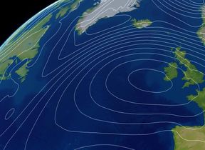
READ MORE: 10‑day trend: A battle between Atlantic systems and colder air to the northeast
“Elsewhere, including the Midlands, East Anglia and the southeast, Saturday brings some decent sunshine, making for a much drier and brighter day. Western Scotland will also see brighter conditions, while Northern Ireland begins dry before rain arrives from the south later. It will feel cold in the northeast, with temperatures a little below average, though closer to or slightly above average elsewhere.
"In short, it will be another unsettled weekend with spells of rain or showers, gusty winds and some drier periods across central parts.”
You can find the latest forecast on our website, on YouTube, by following us on X and Facebook, as well as on our mobile app which is available for iPhone from the App store and for Android from the Google Play store.