Met Office weather: Unsettled midweek with frequent showers and a cool feel
A cool and unsettled pattern will dominate the weather over the next couple of days, with sunshine and showers for many.
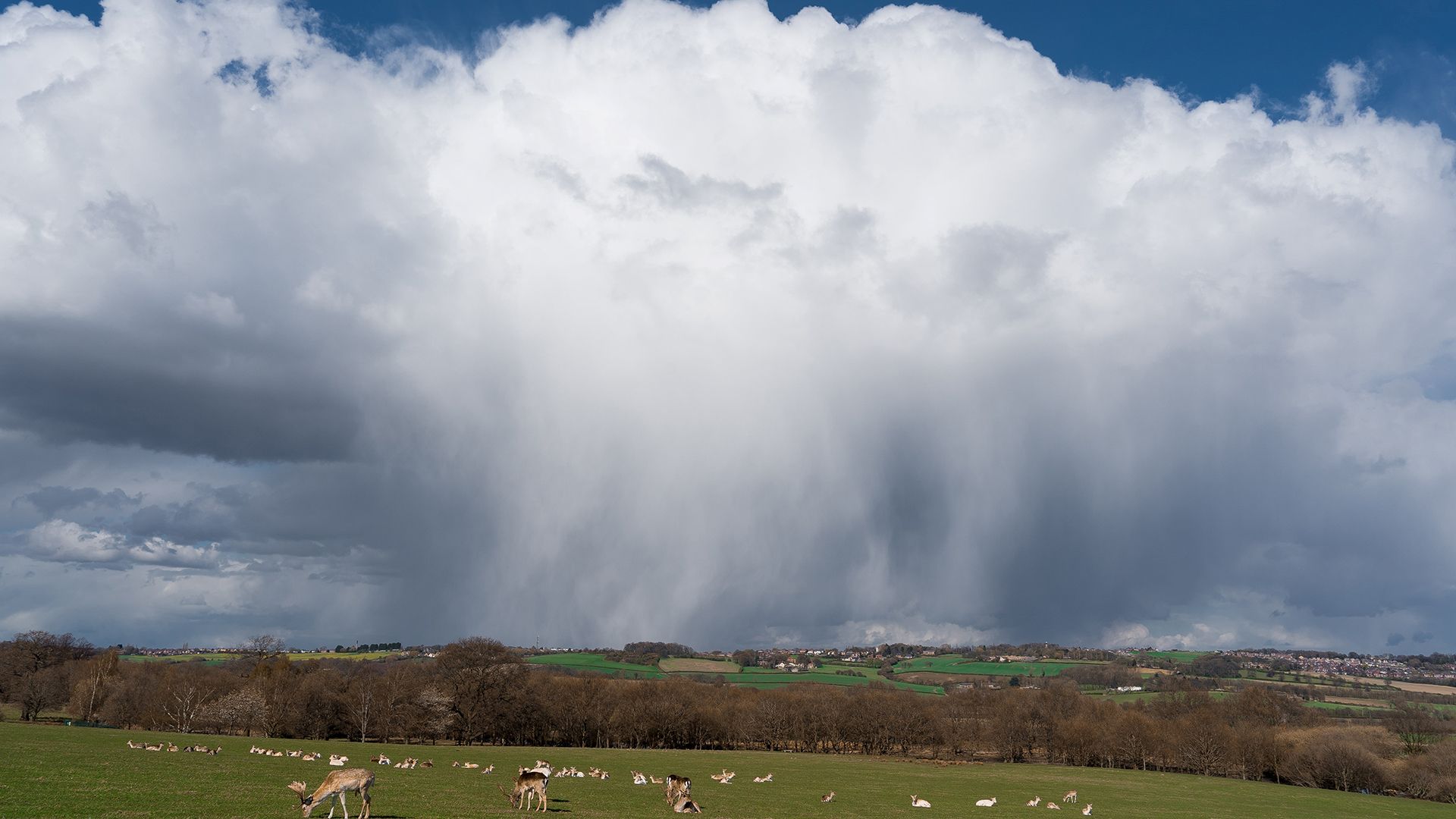
Wednesday: sunshine and showers, feeling cool
Wednesday will bring a mixture of sunny spells and frequent showers across much of the UK. Some of these showers will be heavy, with a local risk of hail and isolated thunder, particularly away from western coasts. In places, showers may merge into longer spells of rain, most notably across parts of northern England.
Winds will be blustery for many, especially outside eastern and north-eastern areas, making it feel rather cold for the time of year. Daytime temperatures will remain below average, with maximum values generally between 8°C and 13°C, though a headline maximum of 14–15°C is possible in the far south and southeast.
Showers will continue into Wednesday night, particularly in areas exposed to a northerly or north-westerly flow. However, many inland areas should become largely dry overnight. It will feel cool, but cloud and a lingering breeze should prevent widespread air frost away from high ground. Minimum temperatures are expected to fall into the low to mid single figures in many places.
Temperatures will be below average for the rest of the week
— Met Office (@metoffice) May 12, 2026
Air temperatures will be in the low double figures, but in the northerly breeze it'll feel more like single figures for most of us pic.twitter.com/eUAPm1CybU
Thursday: widespread showers and a wintry feel
Thursday will remain unsettled, with showers affecting most areas throughout the day. There will again be a risk of hail and thunder at times, and nearly all parts of the country may see these conditions at some point. More organised rain could move south across Northern Ireland during the morning, later reaching parts of southwest Wales and southwest England during the afternoon and evening. Winds will stay breezy, though slightly lighter than on Wednesday, but will continue to enhance the cool feel. Daytime maximum temperatures will remain widely below normal.
Clearer spells later in the week could allow temperatures to dip sharply at night, bringing a renewed risk of late-season rural frost. This is something gardeners and growers should monitor closely, as tender plants may be vulnerable after a relatively mild start to spring.
Met Office Presenter and Meteorologist, Clare Nasir, said: “Through this morning, you may run into a heavy downpour and there is the risk of thunder as we head through the day, some hail mixed in there, and where you catch a heavy shower, the winds will pick up and turn quite gusty. There will be a fresh wind through the morning into the afternoon across western Scotland, Northern Ireland, as well as Wales.
“There'll be fewer showers towards the west country through the afternoon, but they will cluster together towards the east. And here there's a higher likelihood we'll see the risk of thunder and some lightning. Temperatures struggling with highs of around 11 to 14°C.”
Keep up to date with weather warnings, and you can find the latest forecast on our website, on YouTube, by following us on X and Facebook, as well as on our mobile app which is available for iPhone from the App store and for Android from the Google Play store.