

Observed and forecast tracks: northern hemisphere 2013
All tropical cyclones in the northern hemisphere season in 2013 are listed below including details of their start and end dates and maximum sustained wind (MSW). Qualitative comments are included on the performance of the Met Offi
Click on the name of the tropical cyclone to see a chart of the observed track and forecast tracks from the Met Office global model. Verification statistics on each tropical cyclone are available upon request from [email protected]. At the end of the season a verification report on the performance of the Met Office global model will be published.
| Name & ID | Start & end dates | 1-/10-minute MSW | Comments on Met Office global model forecasts |
|---|---|---|---|
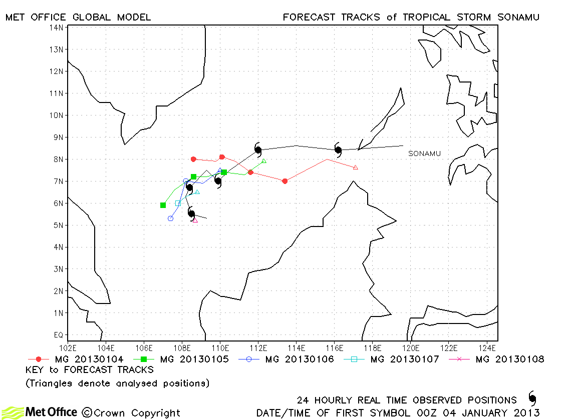
| Sonamu (01W) | 03-08 January | 45/50 knots | Track forecast errors were low and skill scores high for this storm. |
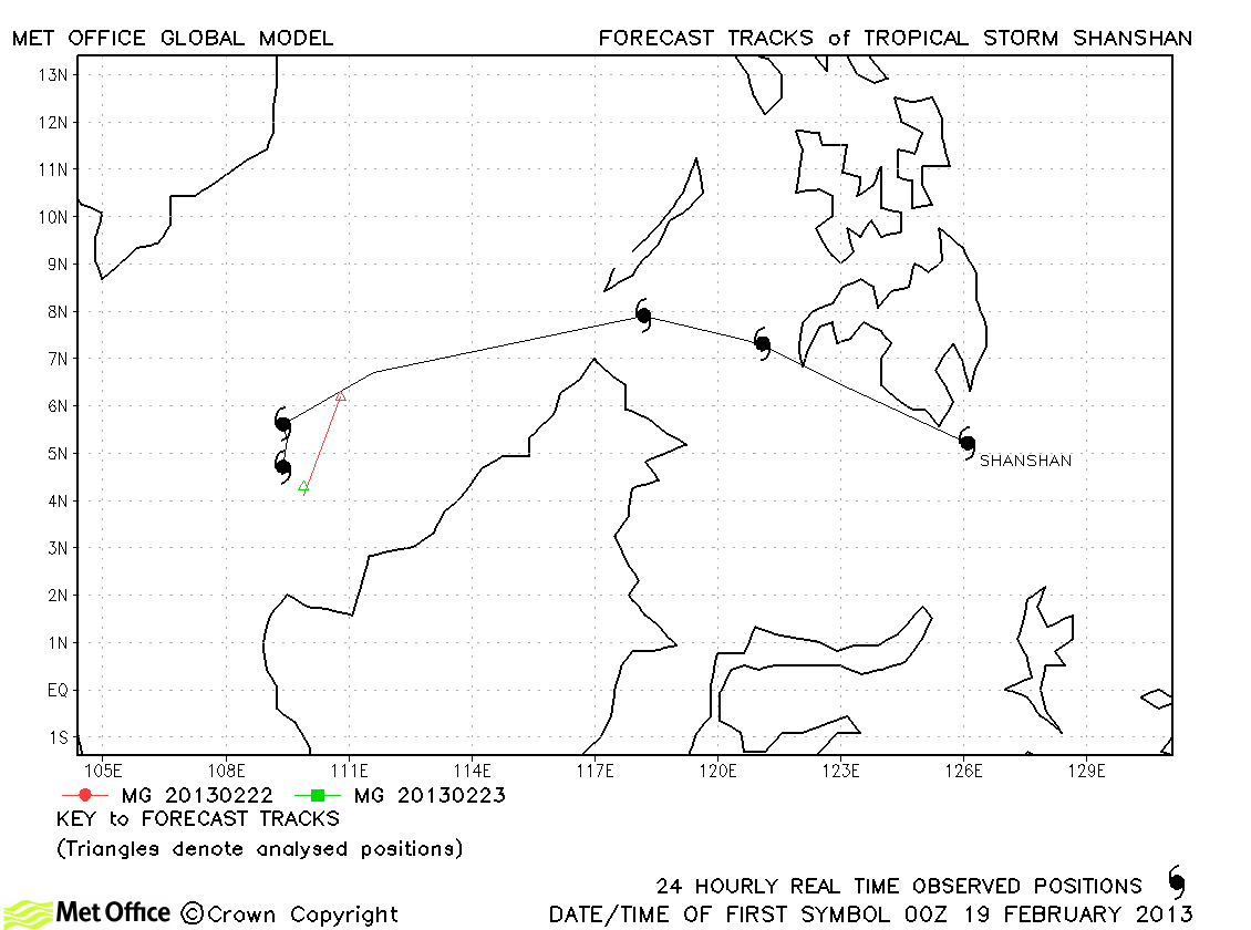
| Shanshan (02W) | 19-23 February | 25/35 knots | Shanshan only briefly reached tropical storm status according to JMA and just one forecast was verified. |
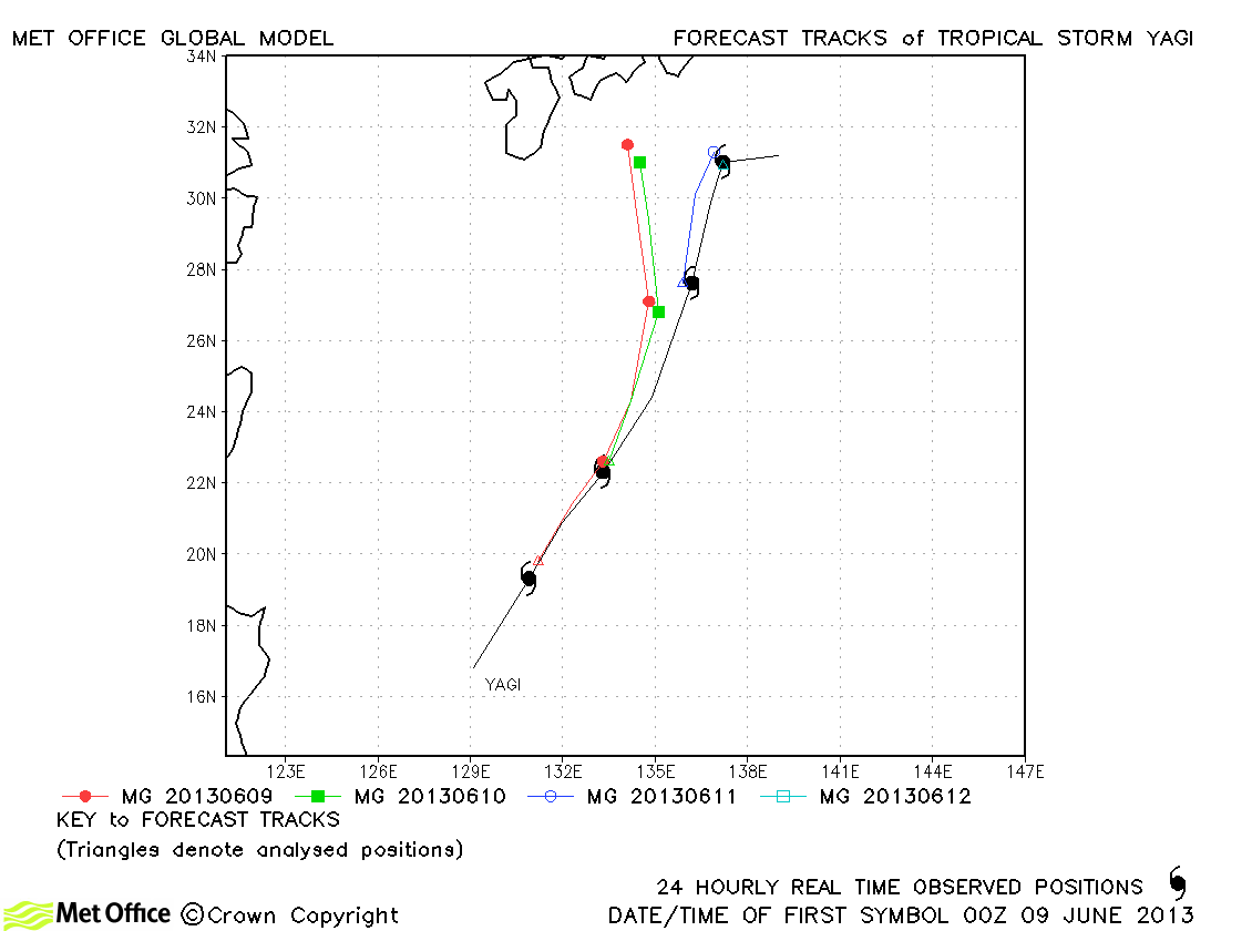
| Yagi (03W) | 08-12 June | 55/45 knots | Track forecast errors were near to or slightly above last season's average. There was a slight left-of-track bias in forecasts. |
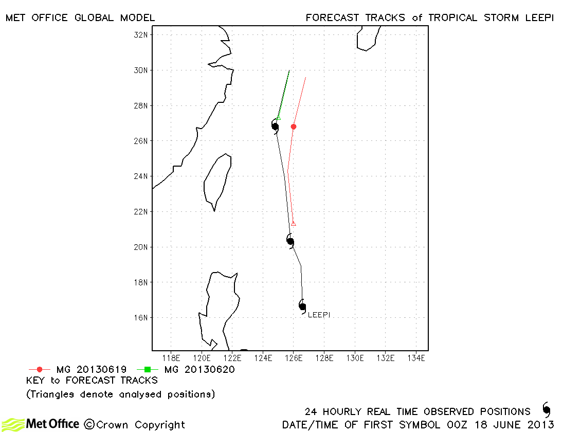
| Leepi (04W) | 17-20 June | 35/40 knots | Track forecast errors were near to or slightly below last season's average. |
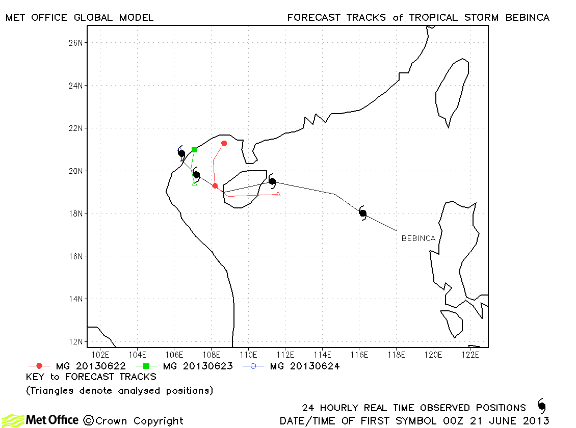
| Bebinca (05W) | 20-24 June | 35/40 knots | Track forecast errors were slightly above last season's average, although skill scores against CLIPER were high. |
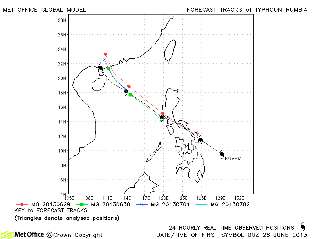
| Rumbia (06W) | 27 June-02 July | 65/50 knots | Track forecasts were very good with low errors and high skill scores. |
| Soulik (07W) | 07-14 July | 125/100 knots | Track forecasts were very good with low errors and high skill scores. |
| Cimaron (08W) | 15-18 July | 40/40 knots | Cimaron was only briefly a tropical storm and had a slight left-of-track bias in its forecast track. |
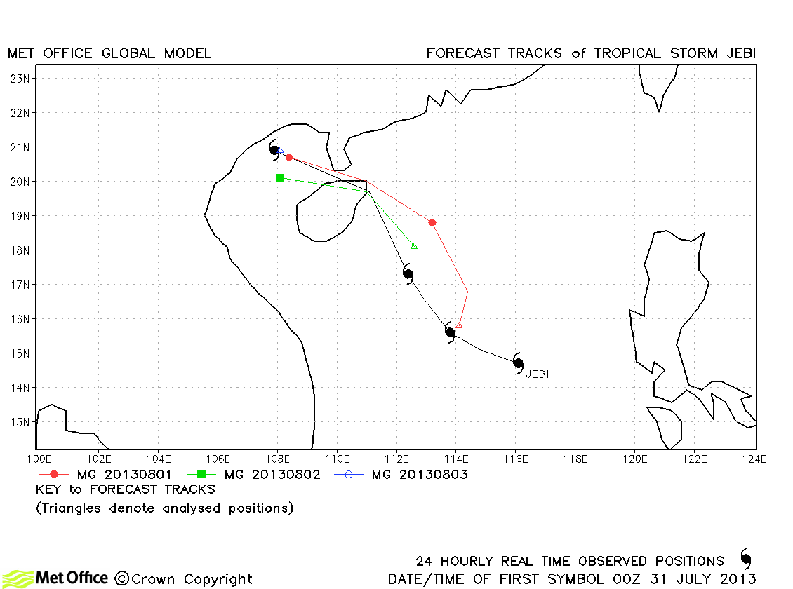
| Jebi (09W) | 31 July-03 August | 60/55 knots | Track forecast errors were low and skill scores high for this storm. |
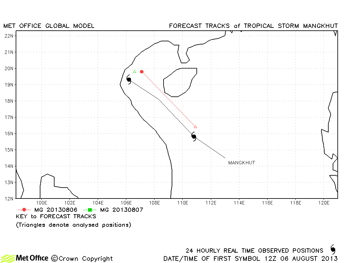
| Mangkhut (10W) | 05-07 August | 40/40 knots | This was a short-lived storm, but track errors were low. |
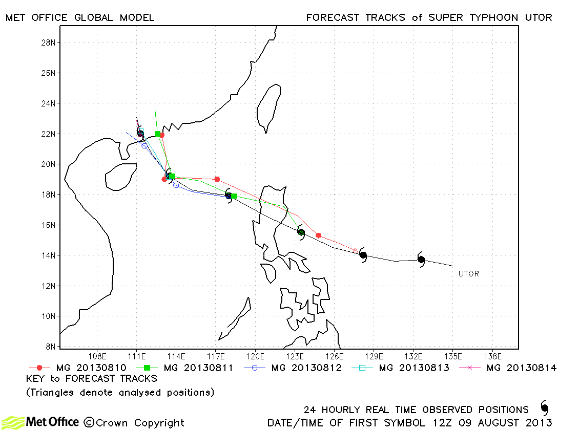
| Utor (11W) | 09-15 August | 130/105 knots | Track forecast errors were very low for this typhoon. |
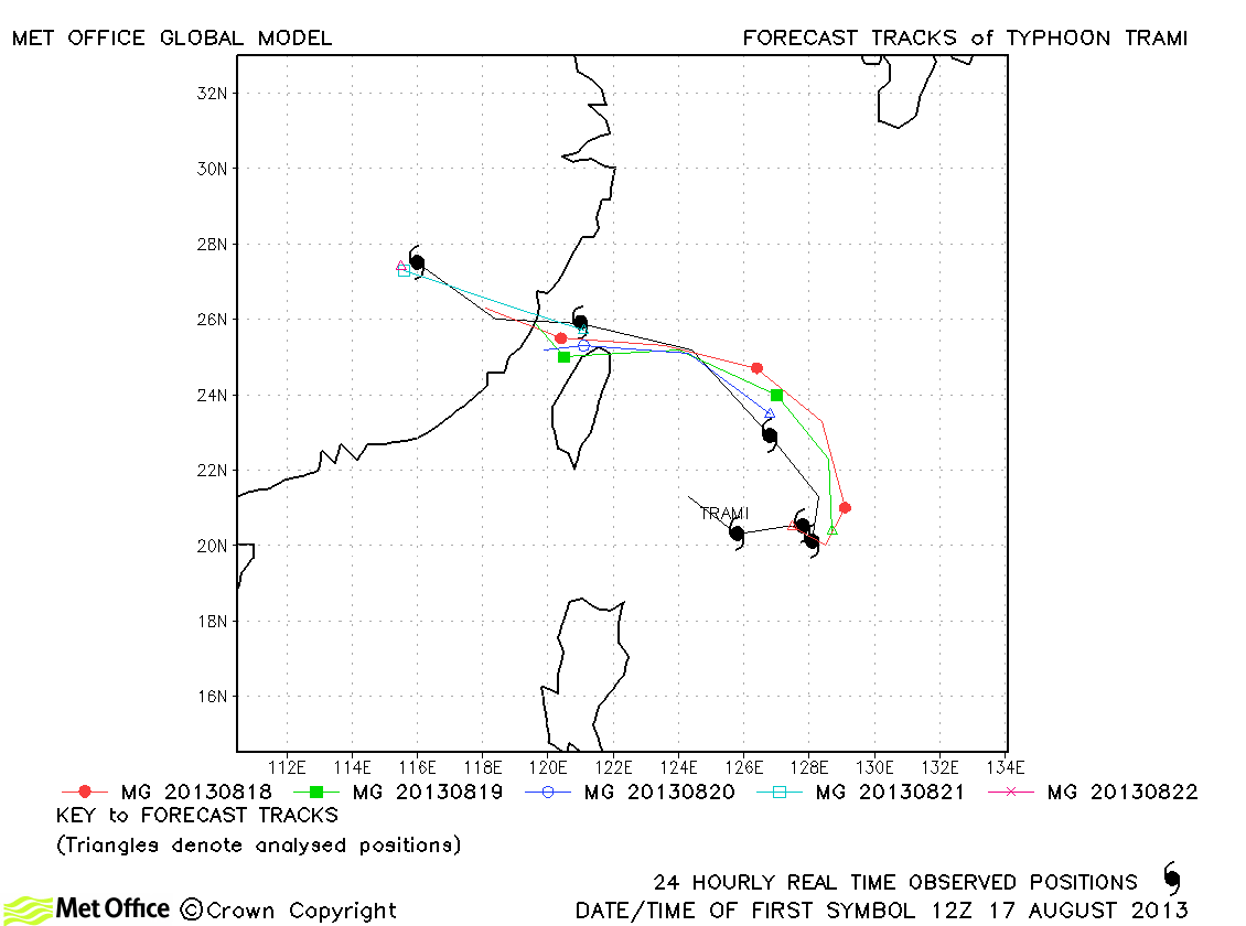
| Trami (12W) | 17-22 August | 75/60 knots | Track errors were very low and skill scores very high for this storm. |
| 13W | 17 August | 25/- knots | No forecasts were verified for this tropical depression. |
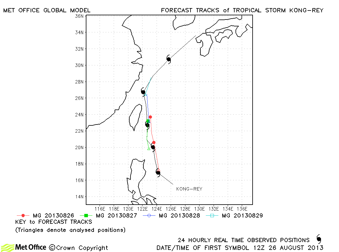
| Kong-rey (14W) | 26-31 August | 55/55 knots | Track forecast errors were low for this storm, but the model weakened it too soon. |
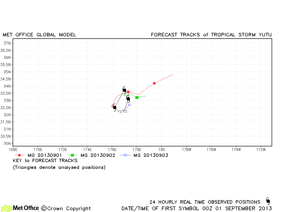
| Yutu (-) | 01-03 September | -/35 knots | Early forecasts had an erroneous north-eastward movement, but short lead time errors were low. |
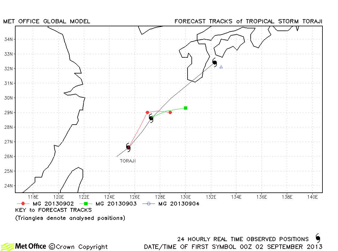
| Toraji (15W) | 01-03 September | 50/50 knots | Track errors were large due to a failure to capture the rapid north-eastward acceleration. |
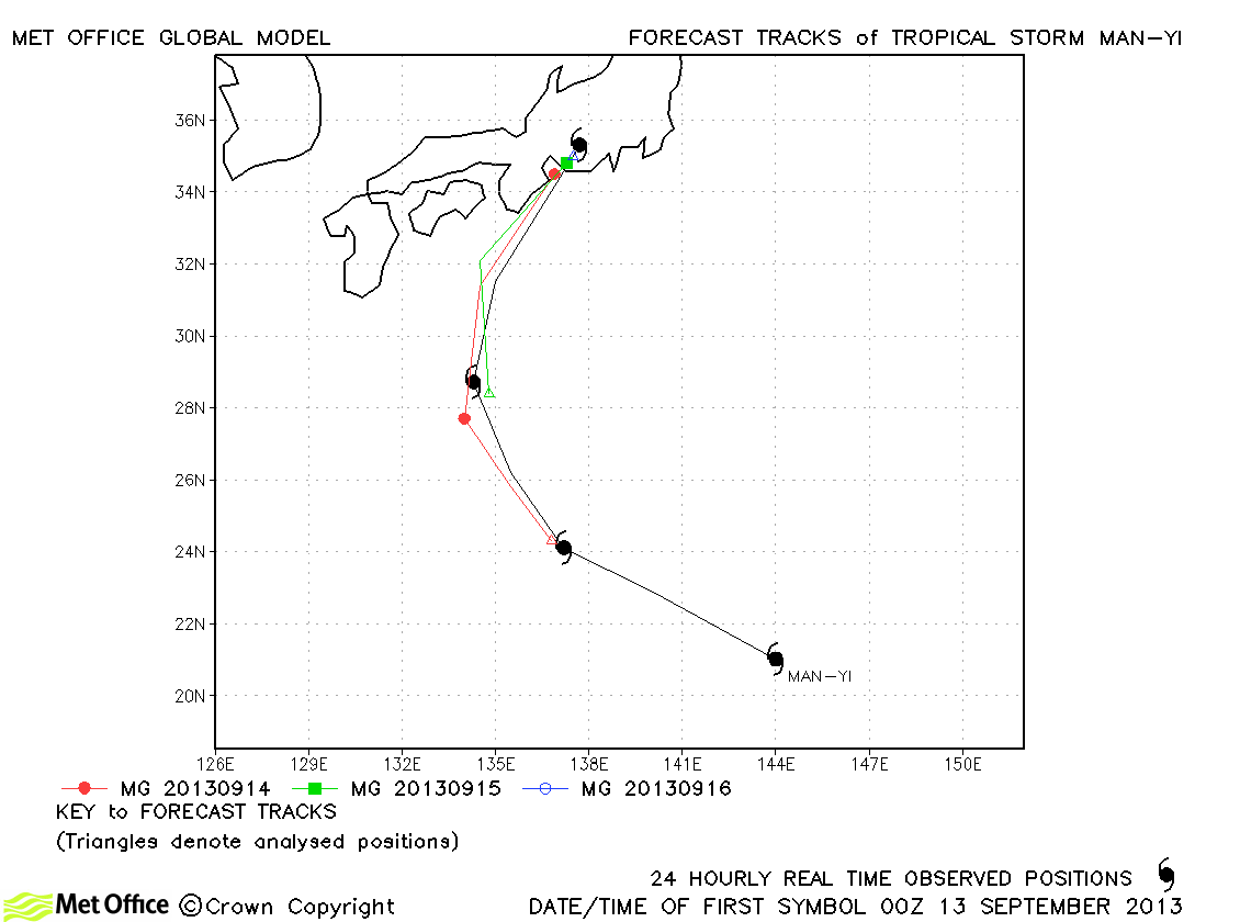
| Man-yi (16W) | 12-16 September | 60/60 knots | Track errors were low. The recurvature and landfall were very well predicted. |
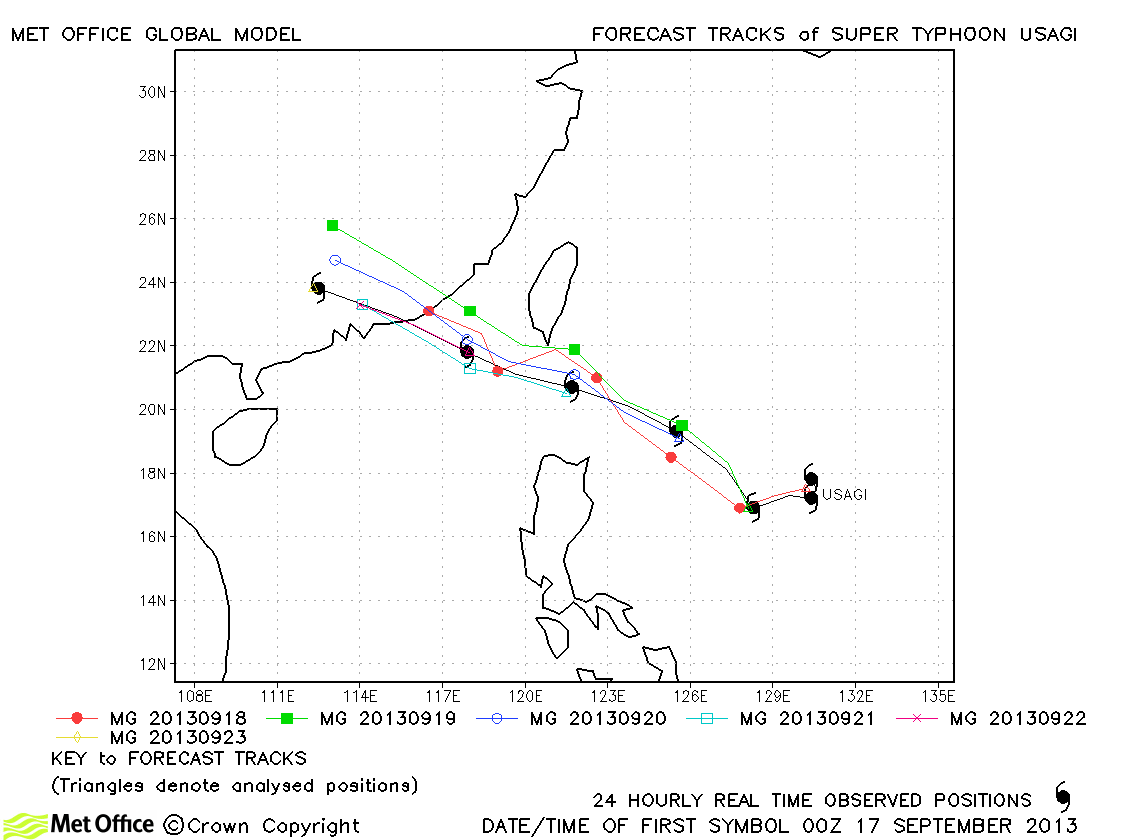
| Usagi (17W) | 16-22 September | 140/110 knots | There was a slight right-of-track bias, but track errors were below last season's average and skill scores against CLIPER high. Unlike some other models, erroneous landfall over Hong Kong was not predicted by the global model. |
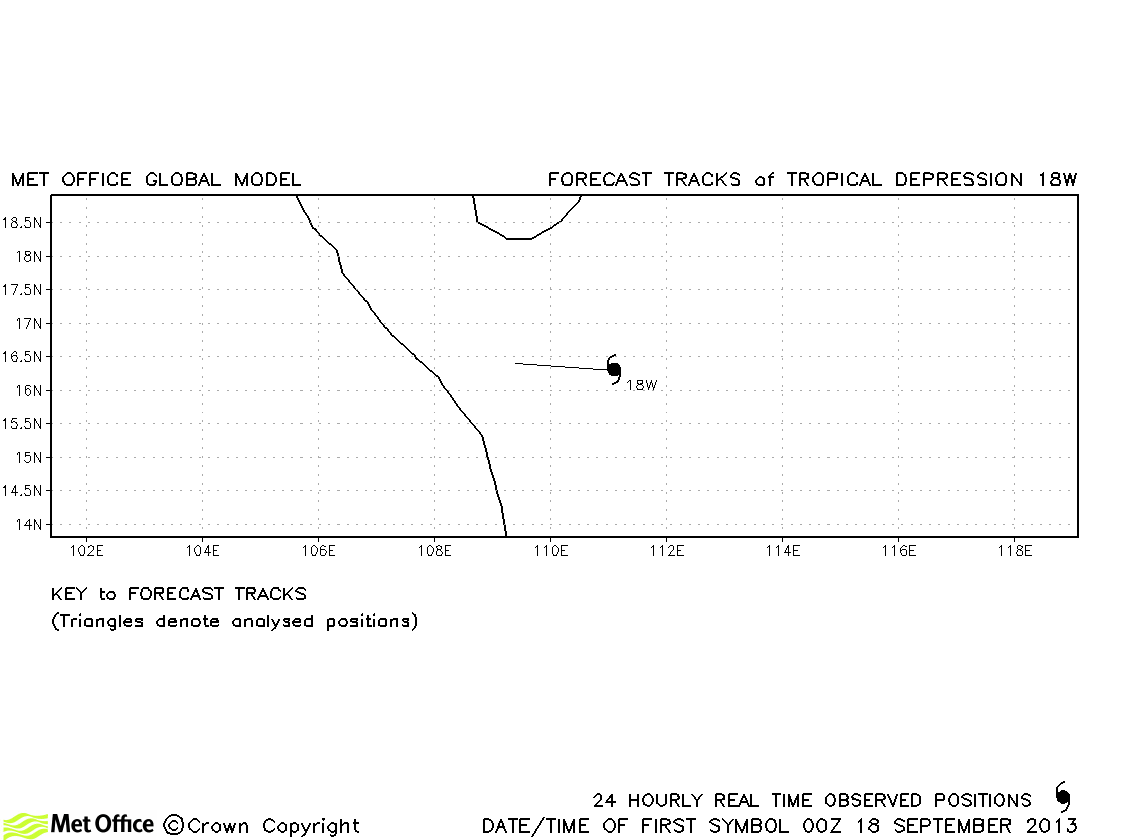
| 18W | 18 September | 25/- knots | 18W did not reach tropical storm strength and no forecasts were verified. |
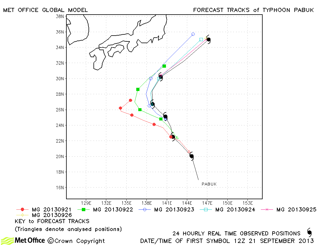
| Pabuk (19W) | 21-26 September | 90/60 knots | Longer lead time errors were large due to the slow and left-of-track bias. However, short period track errors were low. |
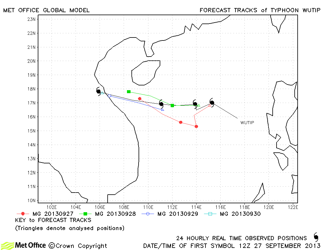
| Wutip (20W) | 26-30 September | 90/70 knots | Track errors were a little above last season's average due to a slow bias. |
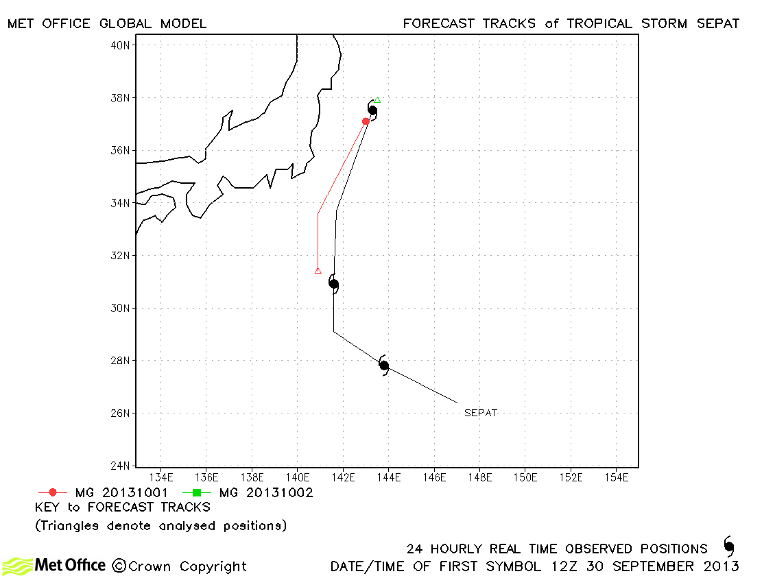
| Sepat (21W) | 30 September-02 October | 35/40 knots | Sepat was only brifly a tropical storm and track errors were low. |
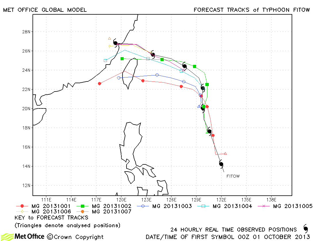
| Fitow (22W) | 30 September-07 October | 90/75 knots | There was a large disparity between models for early forecasts of Fitow. ECMWF had a northerly track whilst the Met Office model turned the storm westwards. Fitow did indeed turn west, but not as sharply as some Met Office model forecasts. However, track forecast errors were below last season's average and skill scores against CLIPER were high. |
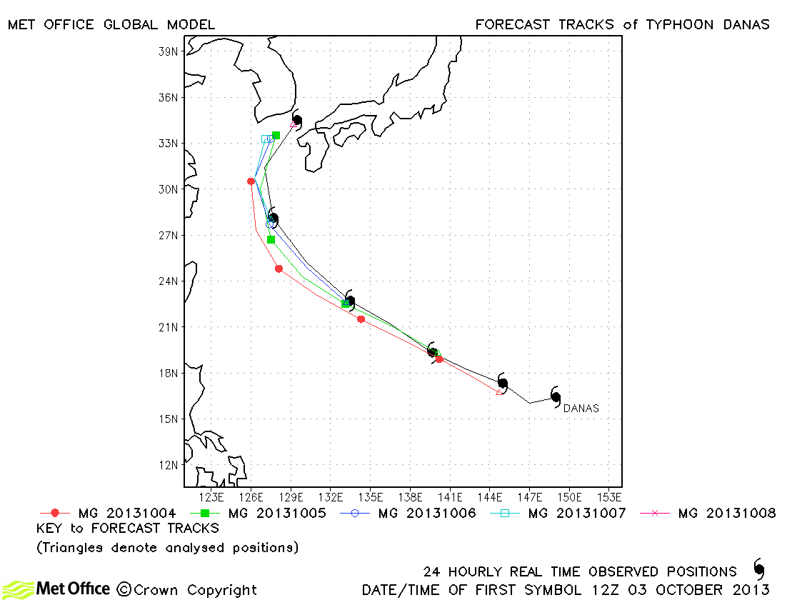
| Danas (23W) | 03-08 October | 125/100 knots | Track forecast errors were near to last season's average and skill scores against CLIPER high. |
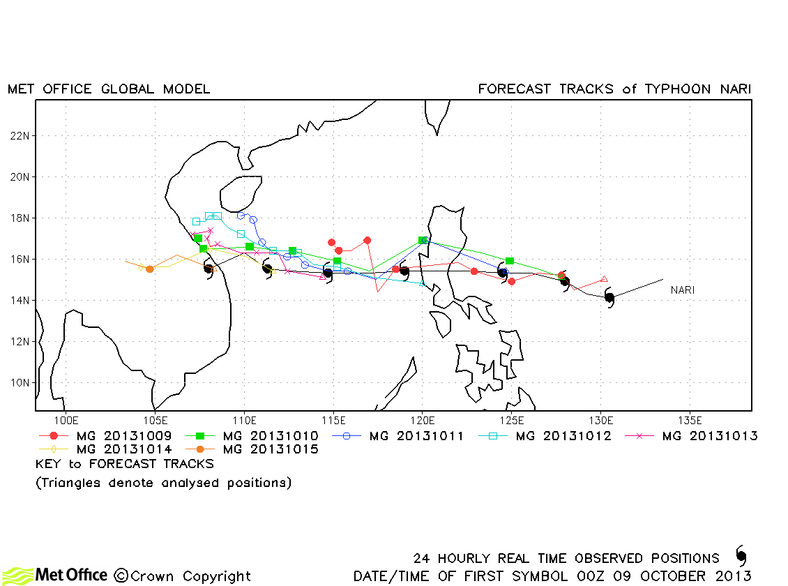
| Nari (24W) | 08-15 October | 105/75 knots | Track forecast errors were near to or below last season's average and skill scores against CLIPER were high. |
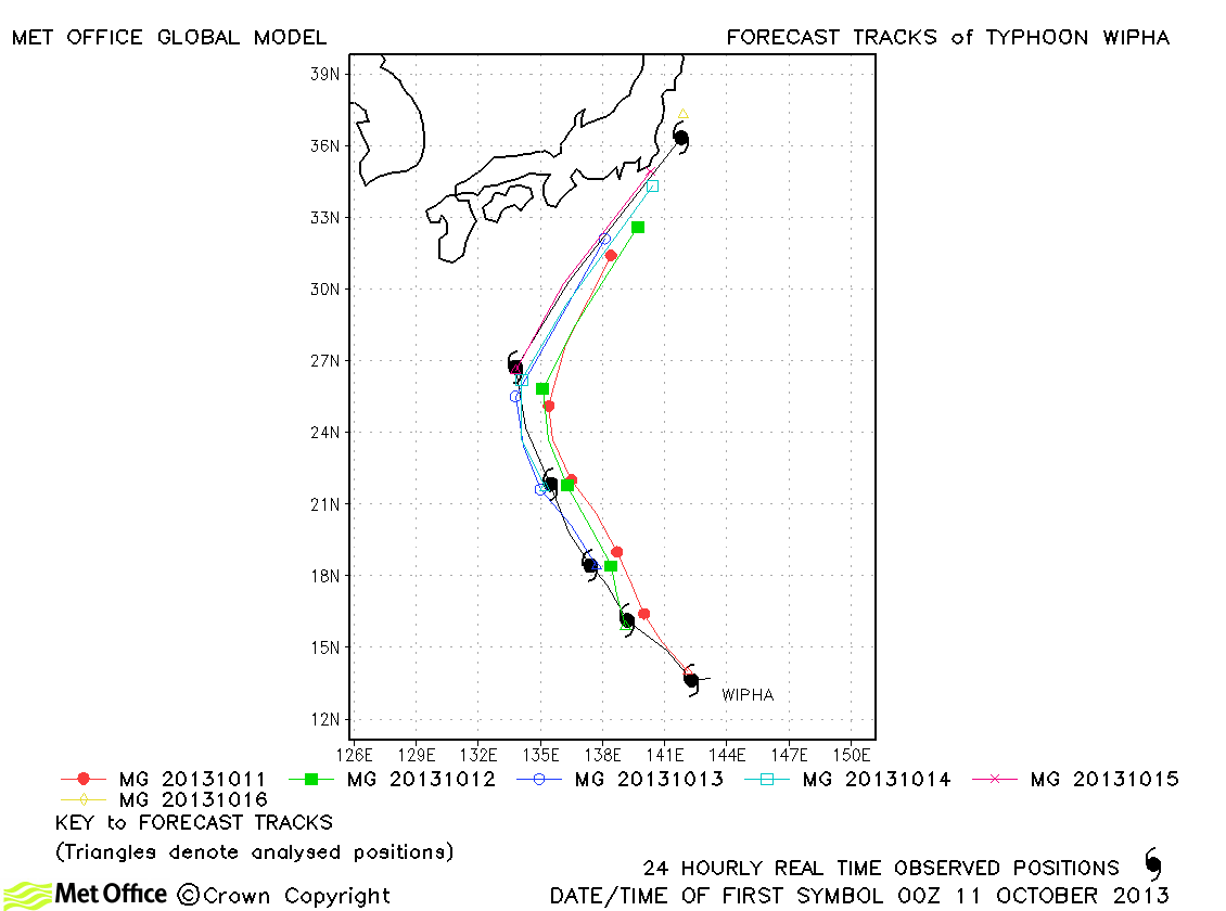
| Wipha (25W) | 10-16 October | 115/90 knots | Track forecast errors were mostly below last season's average and skill scores against CLIPER were high. |
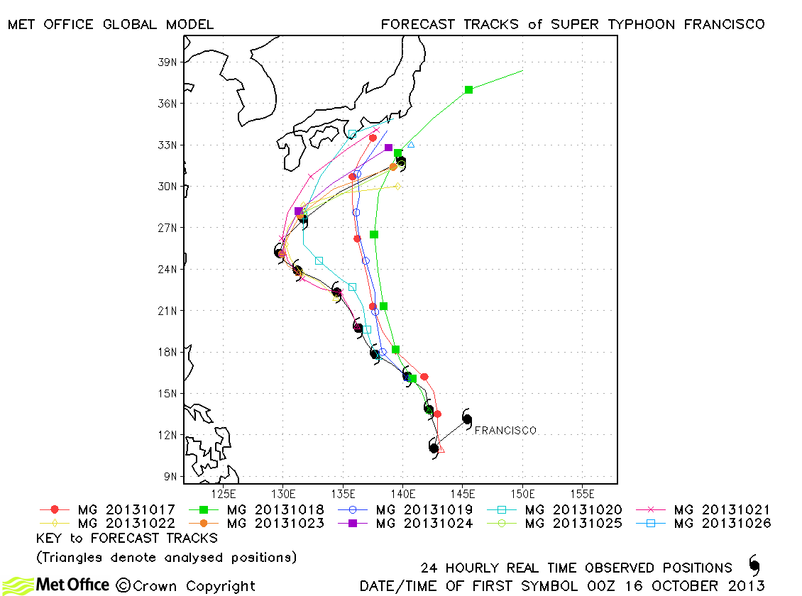
| Francisco (26W) | 16-26 October | 140/105 knots | Longer lead time errors were large due to the failure to interact Francisco with Lekima correctly. However, short lead time errors were very low and skill scores high. |
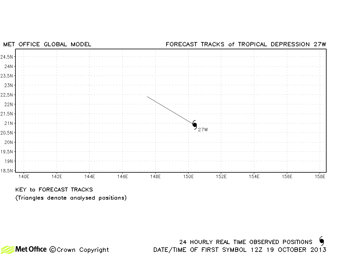
| 27W | 19-20 October | 25/- knots | 27W did not reach tropical storm strength and no forecasts were verified. |
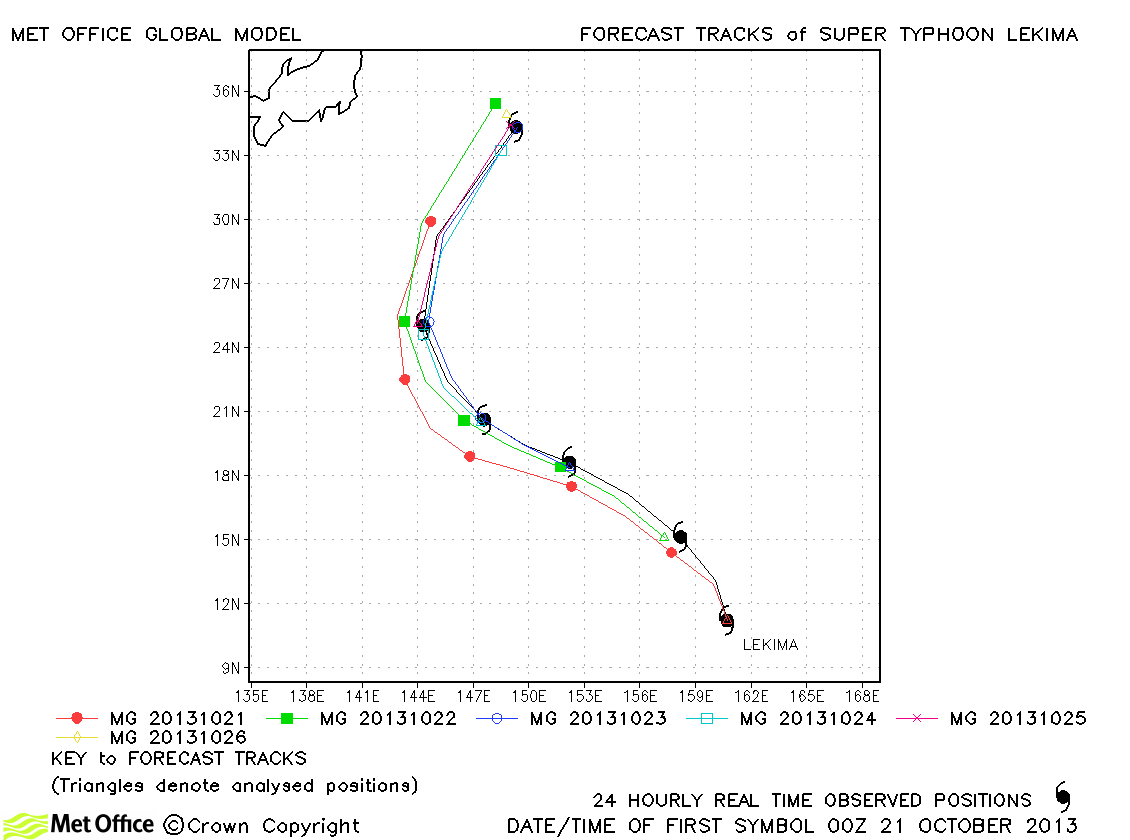
| Lekima (28W) | 20-26 October | 140/115 knots | Forecasts for Lekima were mostly excellent with low track forecast errors and high skill scores. |
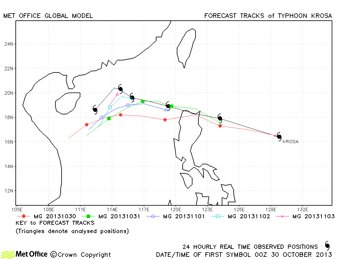
| Krosa (29W) | 29 October-04 November | 100/80 knots | Track forecast errors were a little higher than last season's average due to a left-of-track bias. |
| 30W | 03-16 November | 35/30 knots | 30W only briefly (twice) reached tropical storms strength according to JTWC, but as a tropical depression persisted for a long time across the western Pacific and Bay of Bengal. |
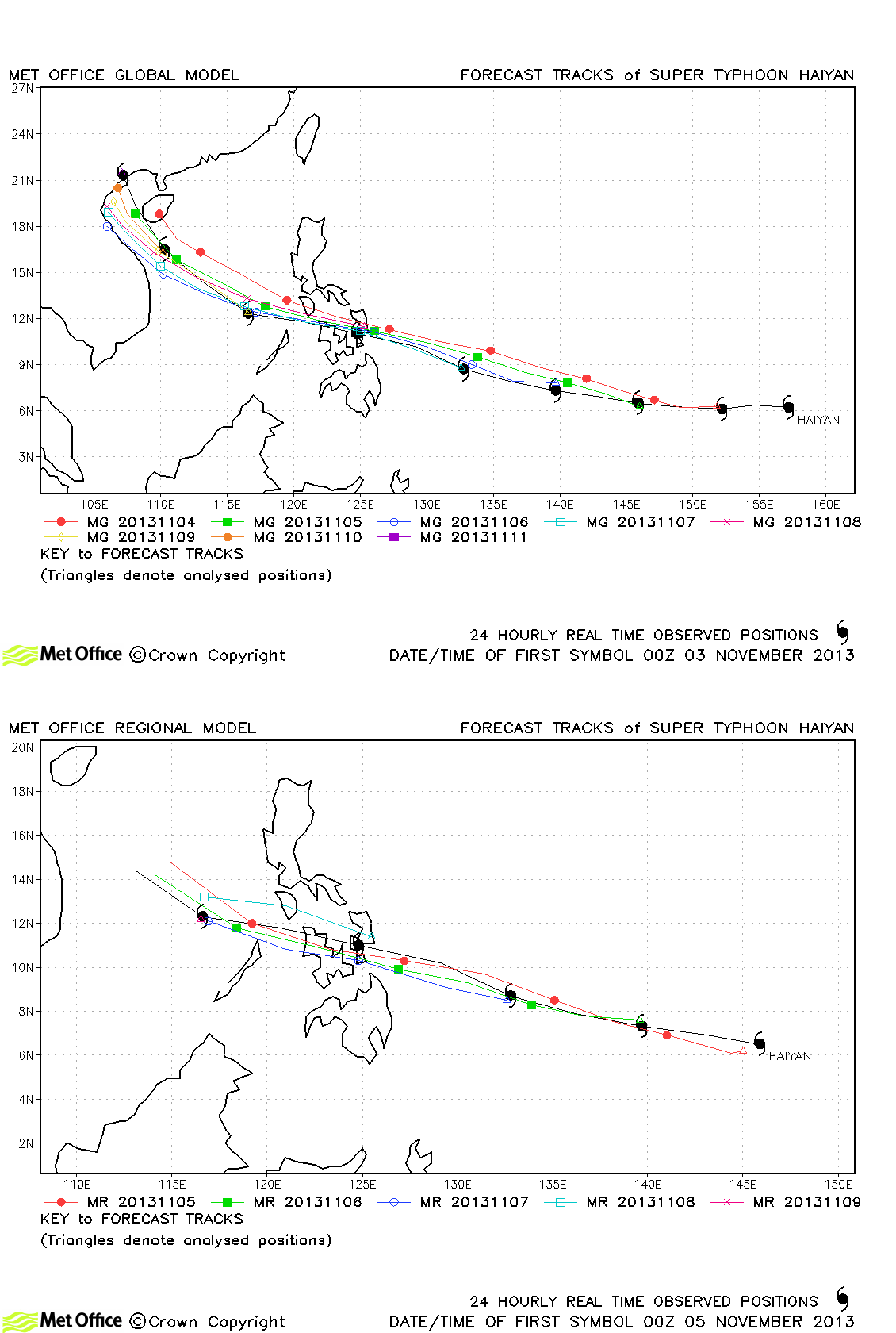
| Haiyan (31W) | 03-11 November | 170/125 knots | The track of Typhoon Haiyan was very well predicted with track errors well below last season's average and skill scores against CLIPER very high. The location of landfall over the Philippines was well predicted days in advance, but with a slight timing error (too slow) at longer lead times. |
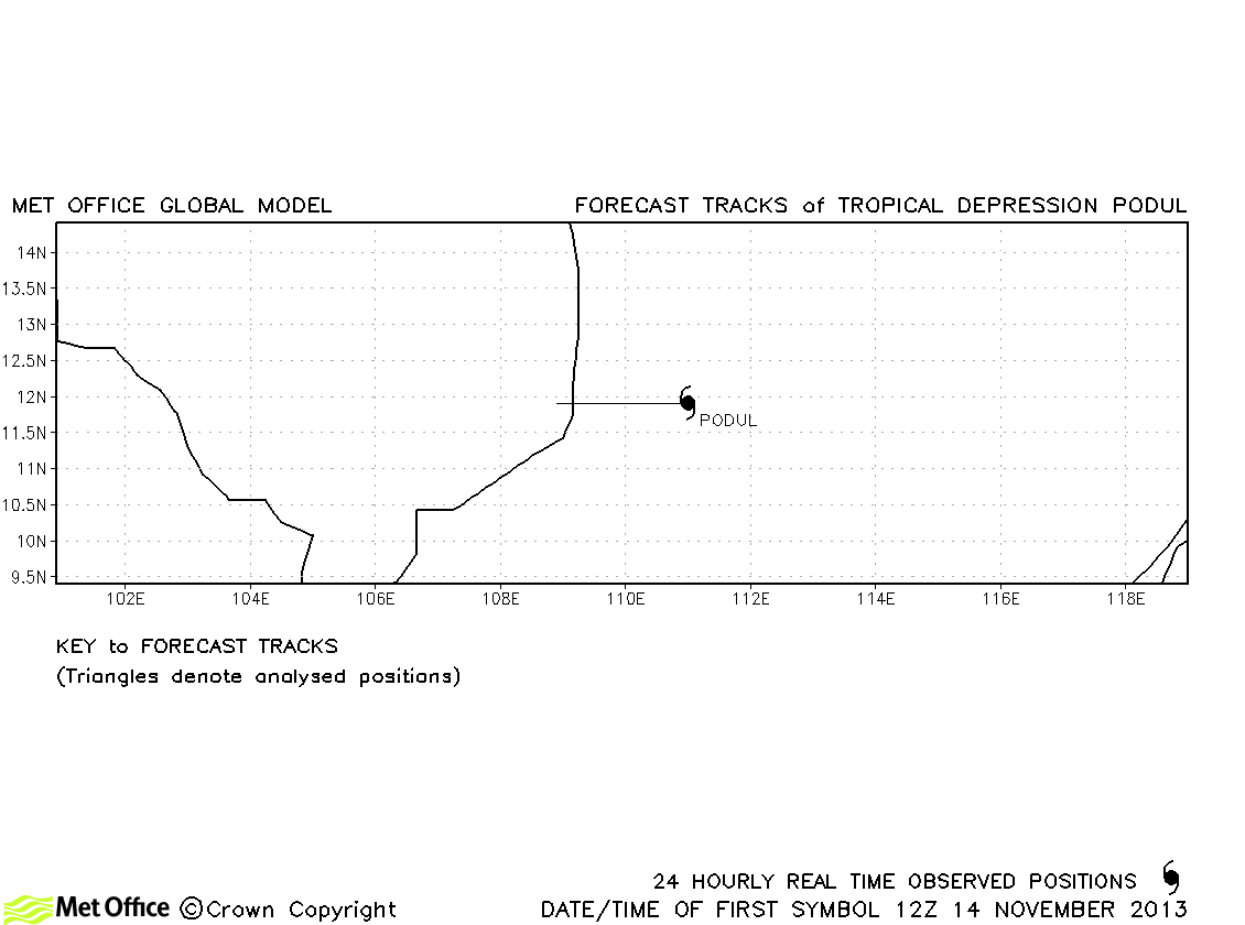
| Podul (32W) | 14-15 November | 25/35 knots | Podul was briefly a named storm according to JMA, but not a tropical storm according to JTWC. No forecasts were verified. |
| 33W | 03-04 December | 30/- knots | 33W did not reach tropical storm status and no forecasts were verified. |
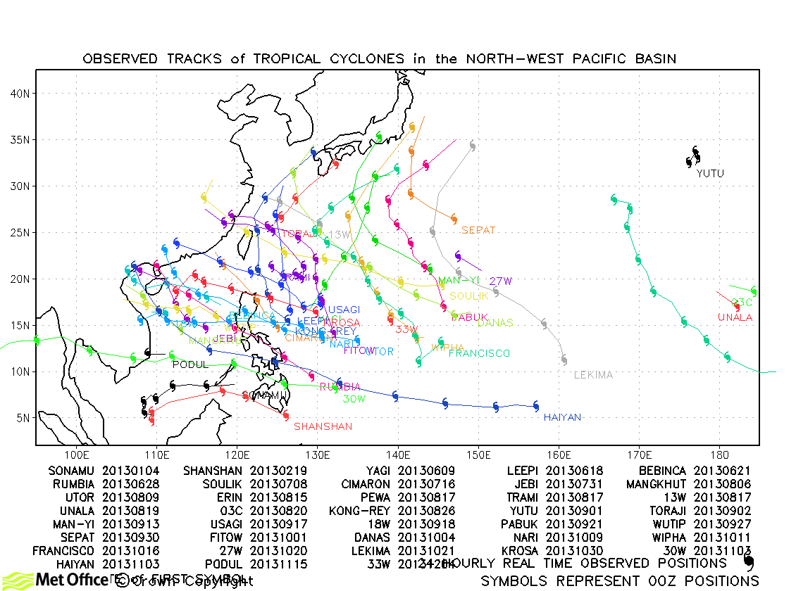
North-west Pacific observed tracks in 2013
North-west Pacific tropical cyclone names
| Name & ID | Start & end dates | 1-minute MSW | Comments on Met Office global model forecasts |
|---|---|---|---|
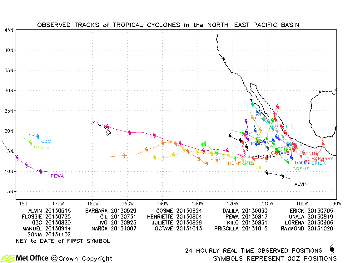
| Alvin (01E) | 15-17 May | 45 knots | Track forecast errors were high for this storm, but the storm was very short-lived. |
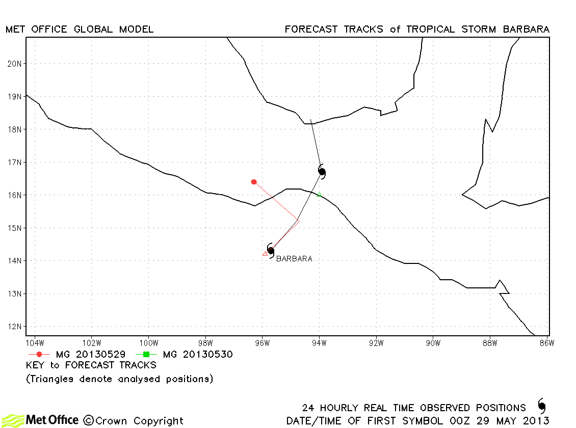
| Barbara (02E) | 29-30 May | 65 knots | Barbara was short-lived and few forecasts were verified. |
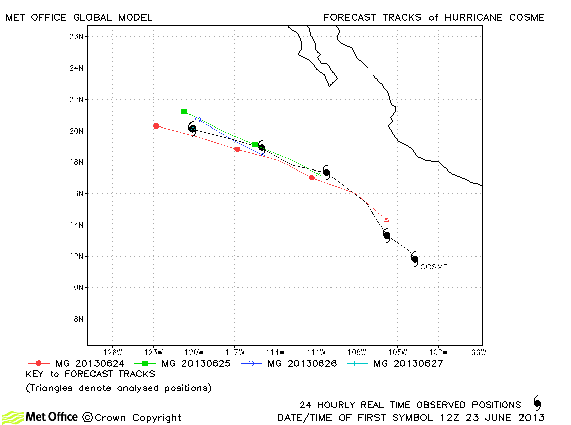
| Cosme (03E) | 23-27 June | 75 knots | Track forecast errors were mostly near to or below last season's average, although there was a fast bias at longer lead times. |
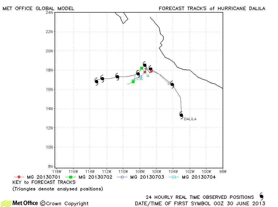
| Dalila (04E) | 30 June-07 July | 65 knots | Track forecasts were very good with low errors and high skill scores. |
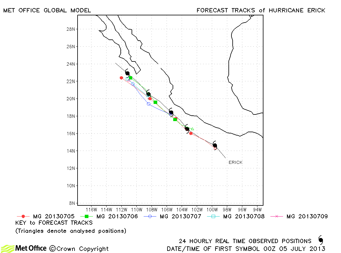
| Erick (05E) | 04-09 July | 70 knots | Track forecast errors were mostly below last season's average and skill scores positive. |
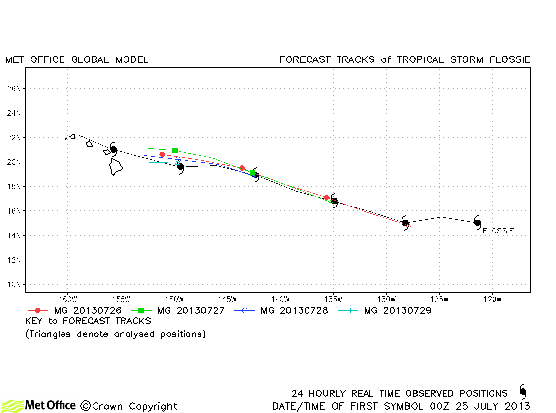
| Flossie (06E) | 25-30 July | 60 knots | Track forecast errors were mostly below last season's average and skill scores were high. |
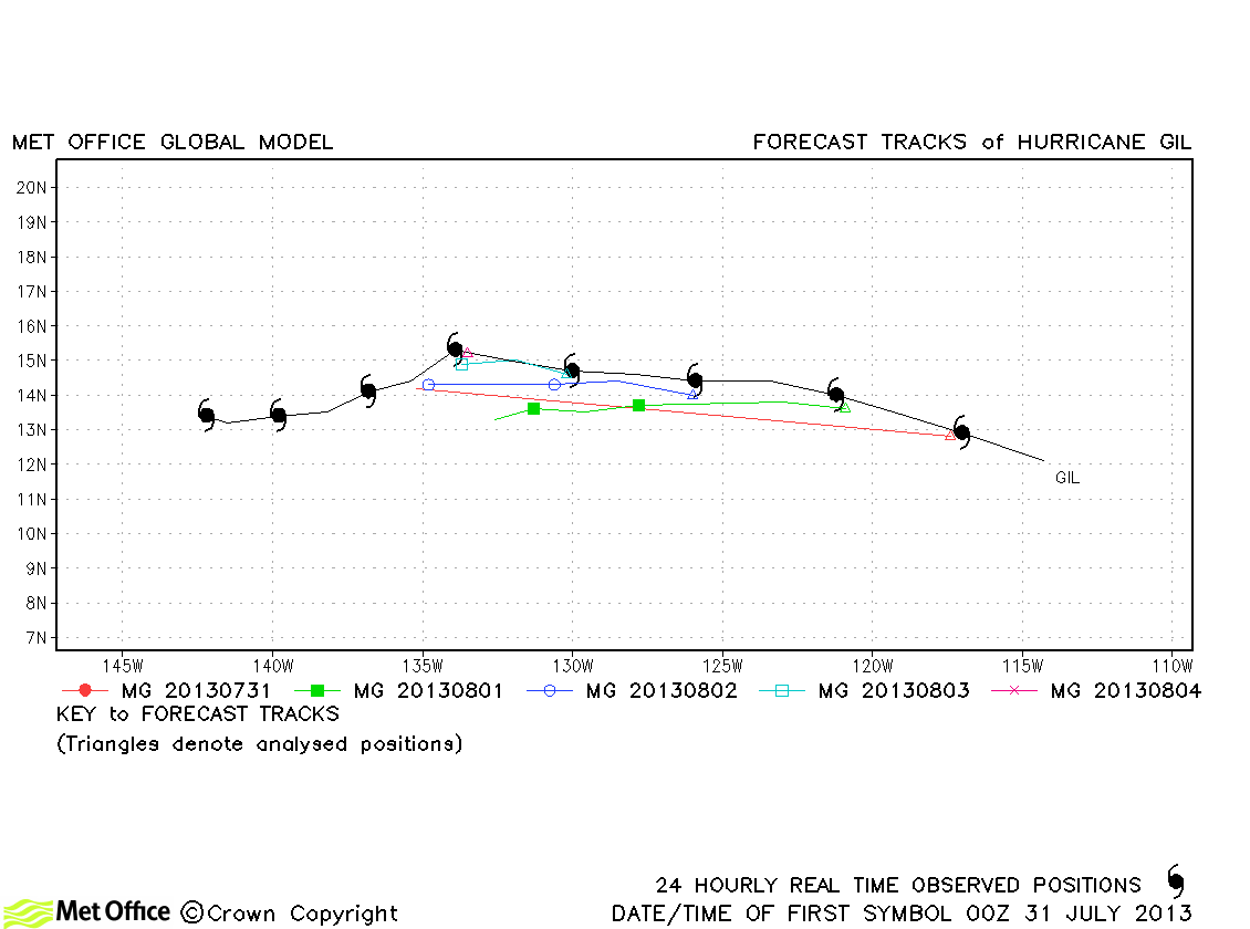
| Gil (07E) | 30 July-07 August | 75 knots | Track forecast errors were near to last season's average for this storm. The model predicted dissipation soon soon. |
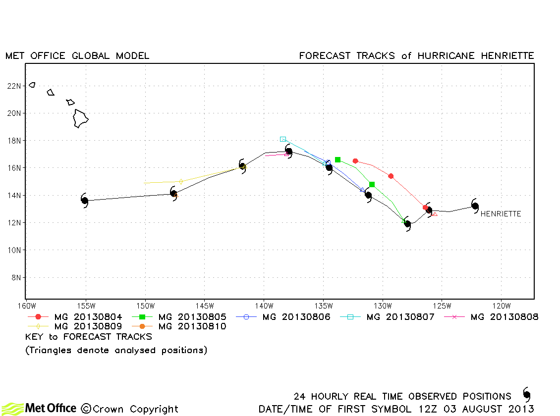
| Henriette (08E) | 03-11 August | 90 knots | Track forecast errors were slightly above last season's average for this storm. The model predicted dissipation soon soon. |
| Ivo (09E) | 22-25 August | 40 knots | Ivo was only briefly a tropical storm. |
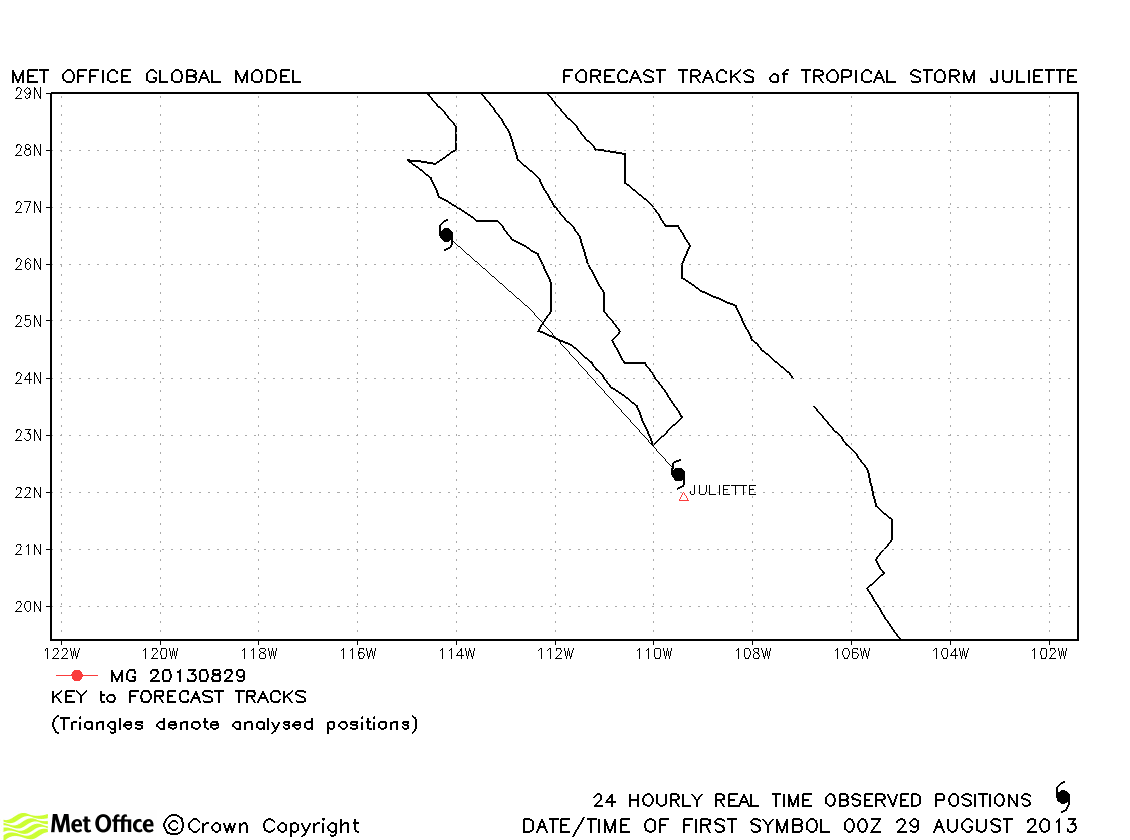
| Juliette (10E) | 28-29 August | 45 knots | Juliette was only briefly a tropical storm. |
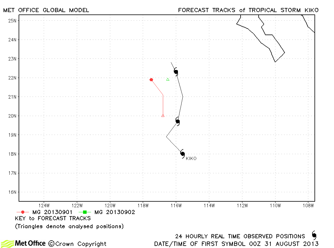
| Kiko (11E) | 31 August-02 September | 60 knots | Kiko was fairly short-lived and just a few forecasts were verified. |
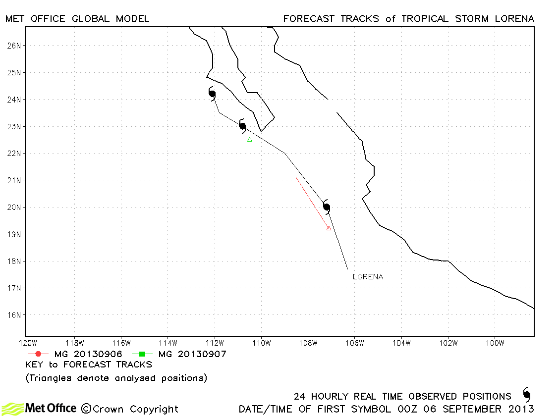
| Lorena (12E) | 05-08 September | 40 knots | Lorena only briefly reached tropical storm status. |
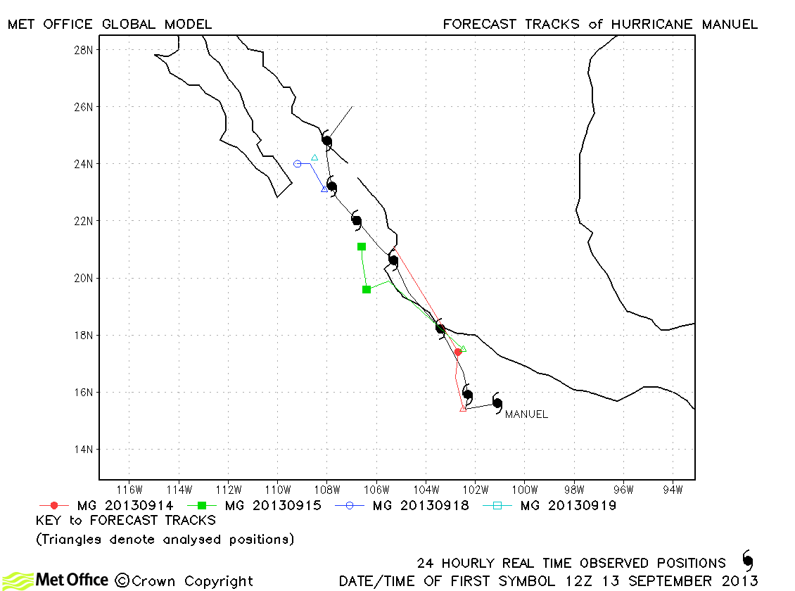
| Manuel (13E) | 13-20 September | 65 knots | Track errors were above last season's average due to a slow bias. However, the model predicted the regeneration of Manuel into a hurricane after its first landfall well. |
| Narda (14E) | 06-10 October | 55 knots | Narda was relatively short-lived and only a few forecasts were verified. |
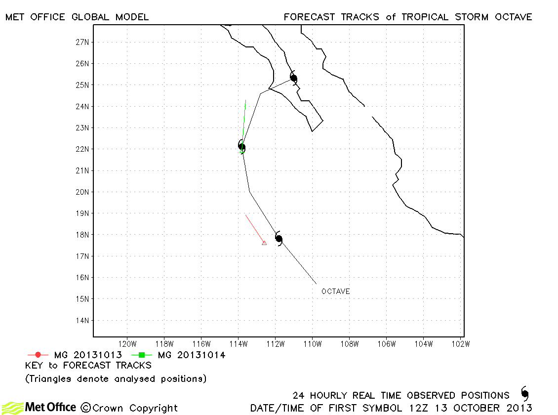
| Octave (15E) | 13-15 October | 55 knots | Octave was a fairly brief storm. The model tended to weaken the storm too rapidly. |
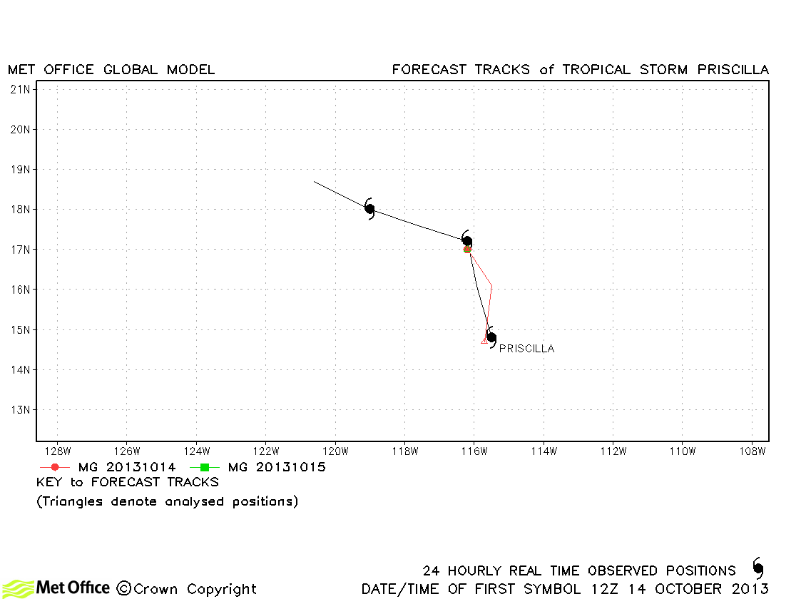
| Priscilla (16E) | 14-17 October | 40 knots | Priscilla was only briefly a tropical storm, but forecasts were good. |
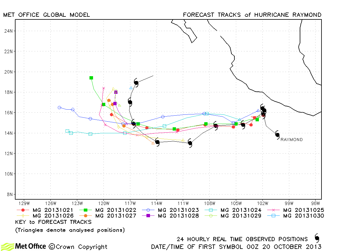
| Raymond (17E) | 20-30 October | 110 knots | Track forecast errors were a little above last season's average, but the model predicted the turn away from the Mexican coast early in the storm's lifetime well. |
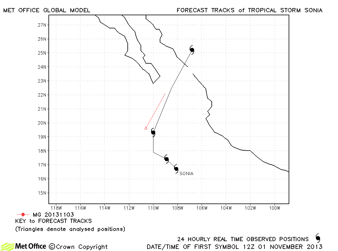
| Sonia (18E) | 01-04 November | 40 knots | Sonia was only briefly a tropical storm and just one forecast was verified. |
| Name & ID | Start & end dates | 1-/10-minute MSW | Comments on Met Office global model forecasts |
|---|---|---|---|
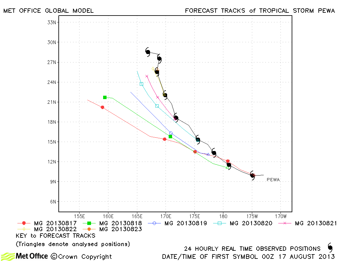
| Pewa (01C) | 16-25 August | 65/55 knots | Track forecast errors were high for this storm due to a left-of-track bias. The storm was also very weak in the model. |
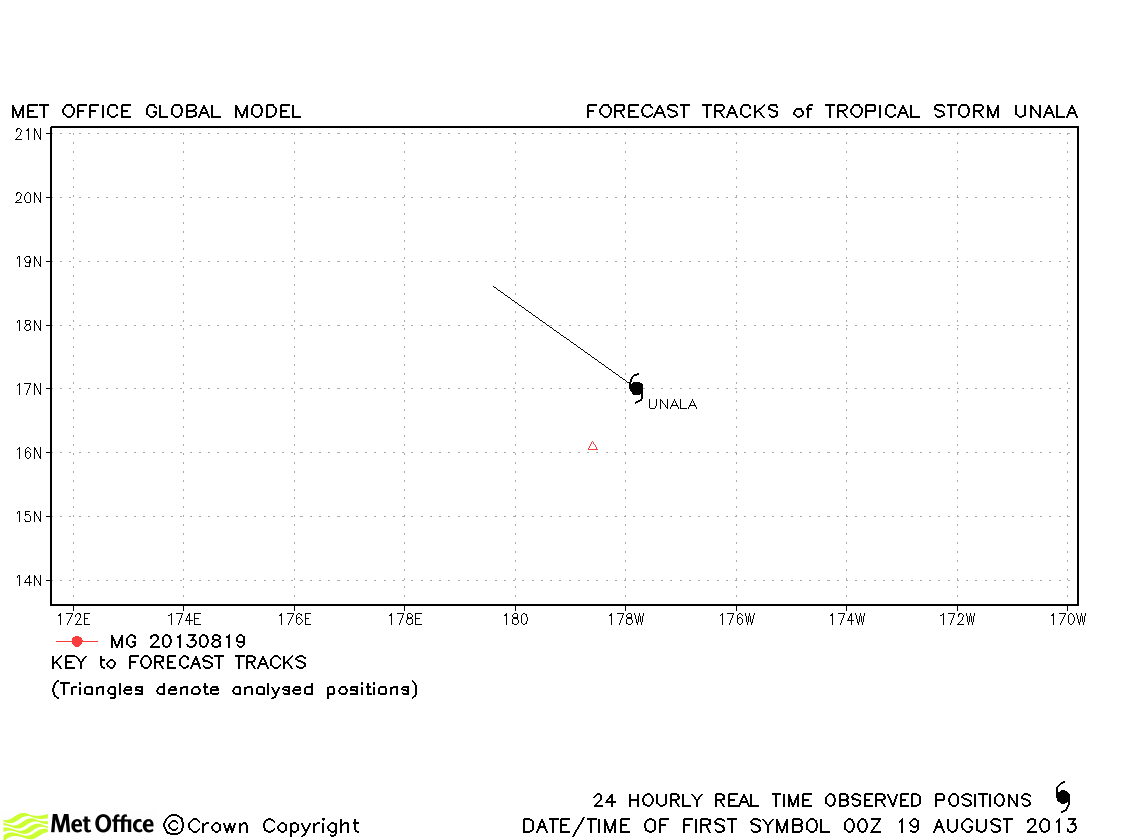
| Unala (02C) | 19 August | 35/35 knots | Unala was only briefly a tropical storm and no forecasts were verified. |
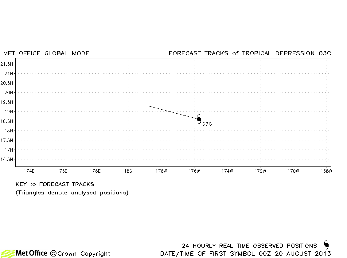
| 03C | 19-20 August | 30/- knots | 03C did not attain tropical storm status. |
* Pewa, Unala and 03C all moved into the North-West Pacific region
North-east and Central North Pacific observed tracks in 2013
North-east Pacific tropical cyclone names
Central North Pacific tropical cyclone names
| Name & ID | Start & end dates | 1-minute MSW | Comments on Met Office global model forecasts |
|---|---|---|---|
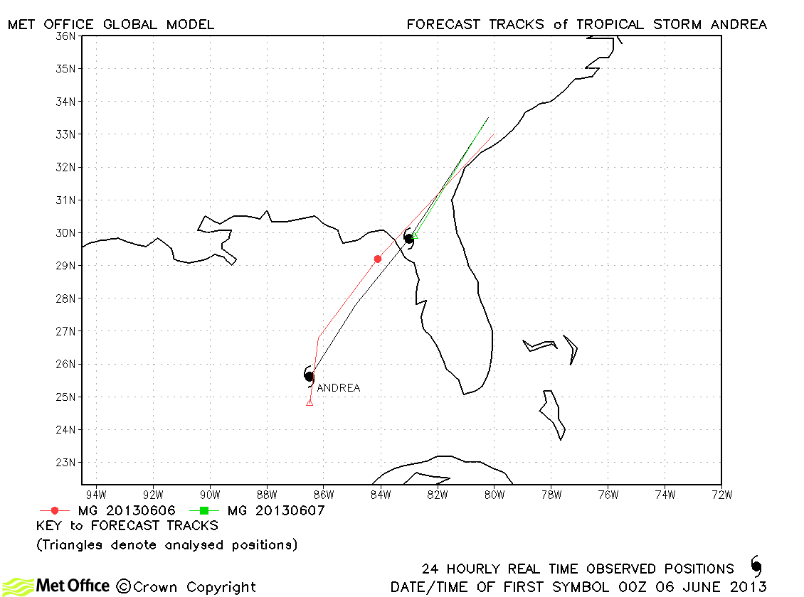
| Andrea (01L) | 05-07 June | 55 knots | Track forecast errors were below last season's average for Andrea. |
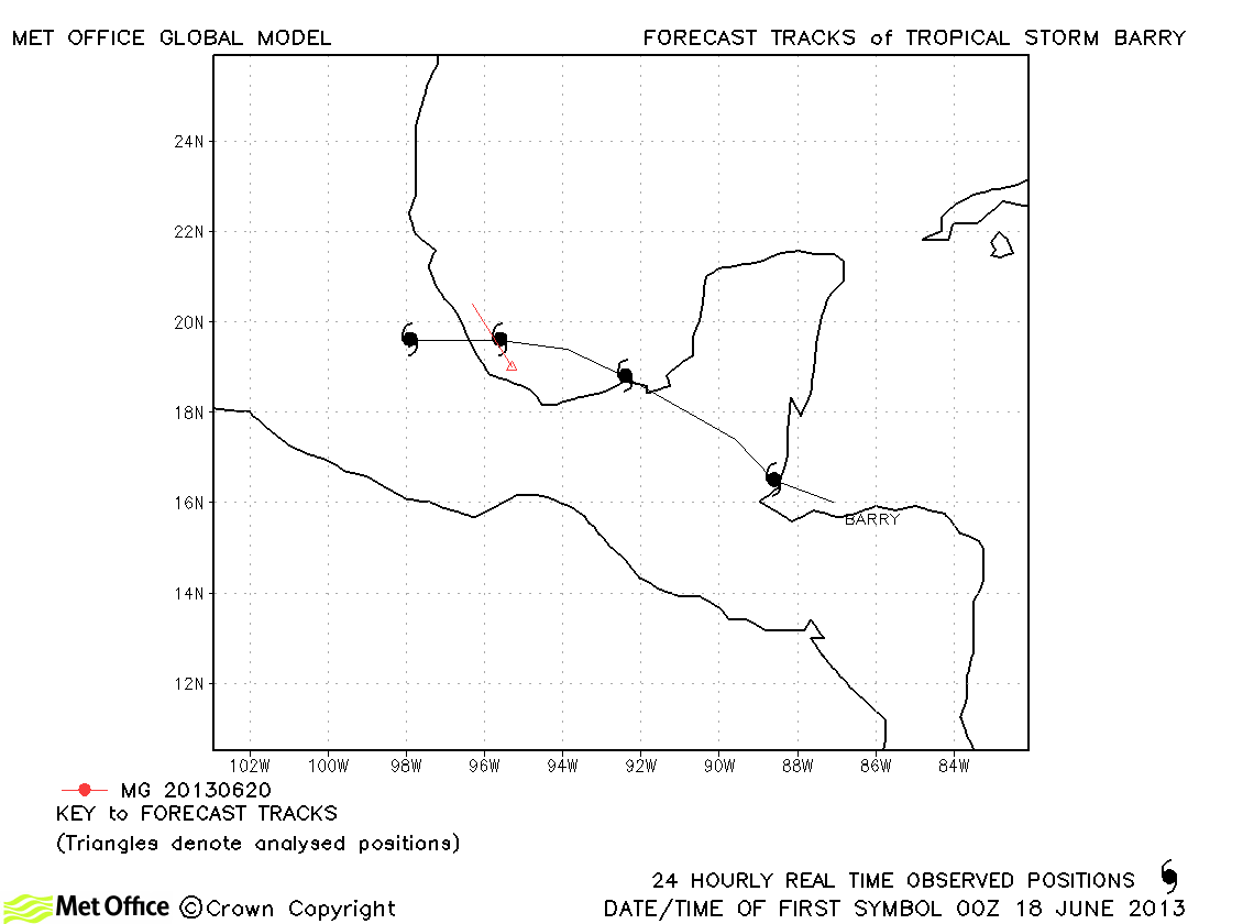
| Barry (02L) | 17-21 June | 40 knots | Barry was short-lived as a tropical storm and only one forecast was verified. |
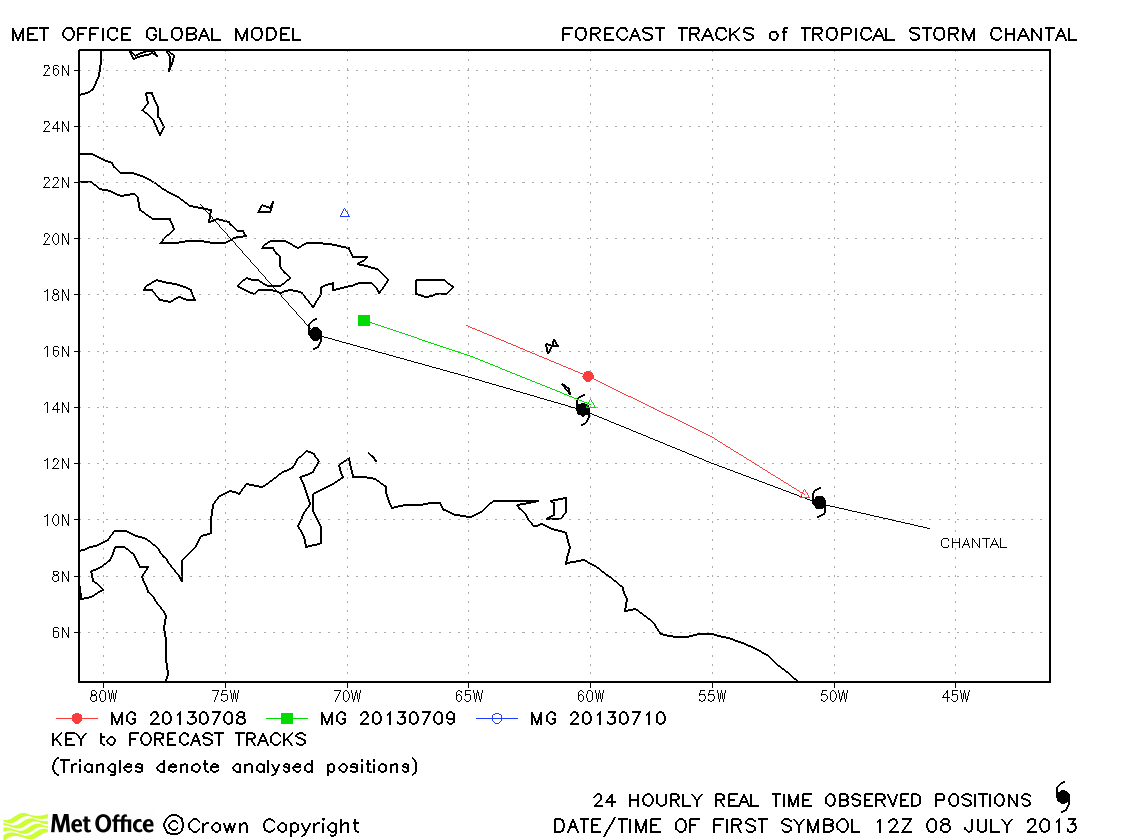
| Chantal (03L) | 08-11 July | 55 knots | There was a slight right-of-track bias in forecasts and a tendency to dissipate the storm too soon. |
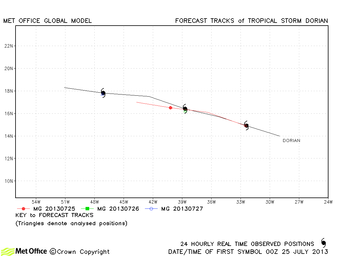
| Dorian (04L) | 24-27 July | 50 knots | There was a slight fast bias in forecasts and a tendency to dissipate the storm too soon. |
| Erin (05L) | 15-18 August | 35 knots | Track forecast errors were very low and skill scores high for this storm. |
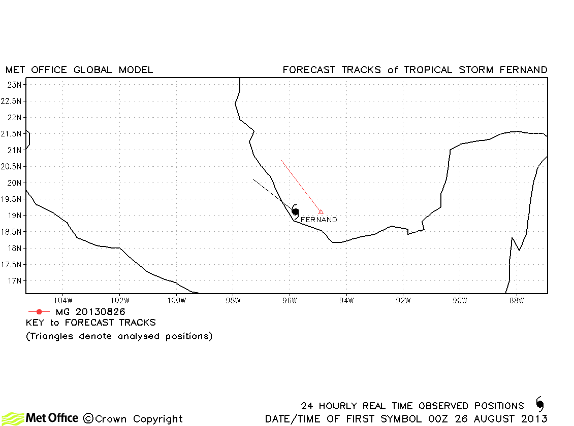
| Fernand (06L) | 25-26 August | 45 knots | Fernand was only briefly a tropical storm and just one forecast was verified. |
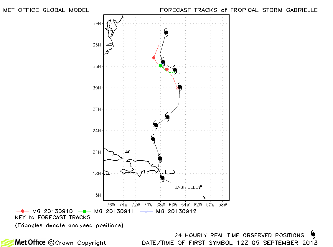
| Gabrielle (07L) | 04-13 September | 50 knots | Track errors were below last season's average for this storm. |
| 08L | 06-07 September | 30 knots | 08L did not reach tropical storm status and no forecasts were verified. |
| Humberto (09L) | 08-19 September | 75 knots | Track forecast errors were below last season's average and skill scores against CLIPER high for this storm. The various turns by the storm were well predicted by the model. |
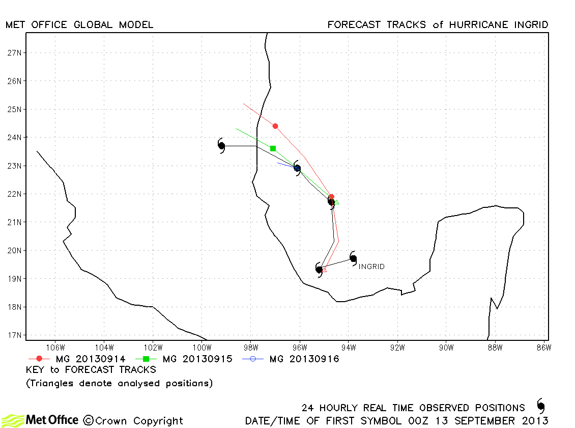
| Ingrid (10L) | 12-17 September | 75 knots | Track errors were near to last season's average for this storm. The turn towards land was well signalled, although landfall location was a little too far north. |
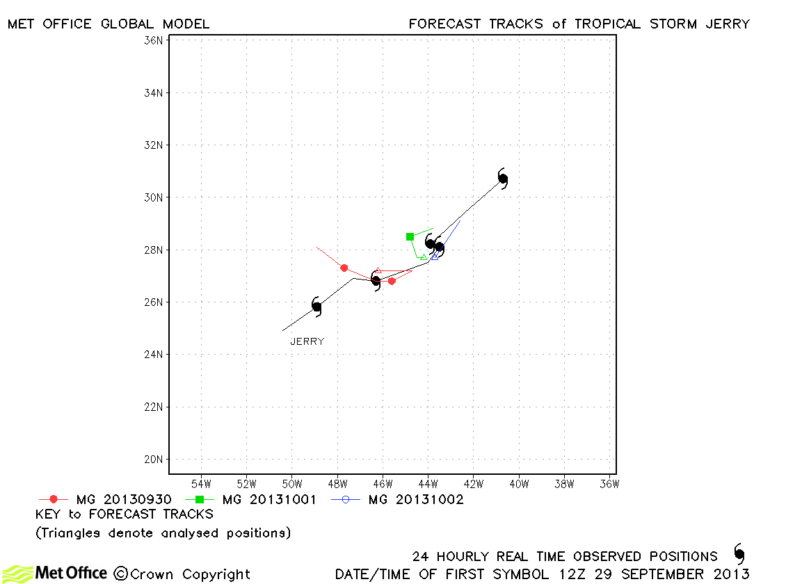
| Jerry (11L) | 29 September-03 October | 45 knots | Track forecasts for Jerry were mostly higher than last season's average. |
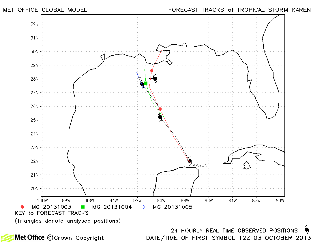
| Karen (12L) | 03-06 October | 55 knots | Track forecast errors were mostly lower than last season's average. |
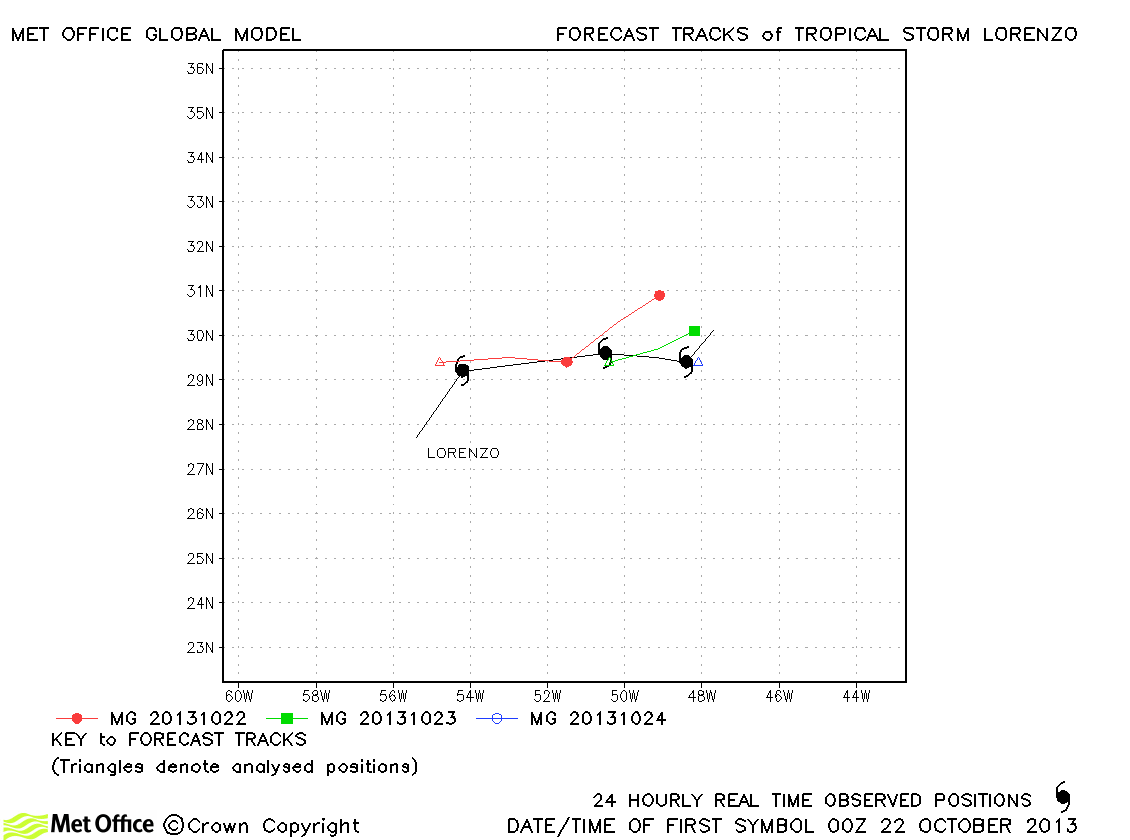
| Lorenzo (13L) | 21-24 October | 45 knots | Track forecast errors were near to last season's average. |
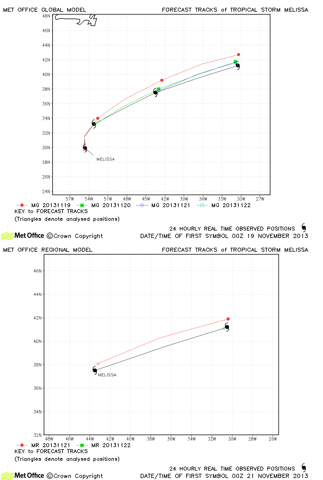
| Melissa (14L) | 18-22 November | 55 knots | Track errors were low for this storm as its north-eastward turn and acceleration were well predicted. |
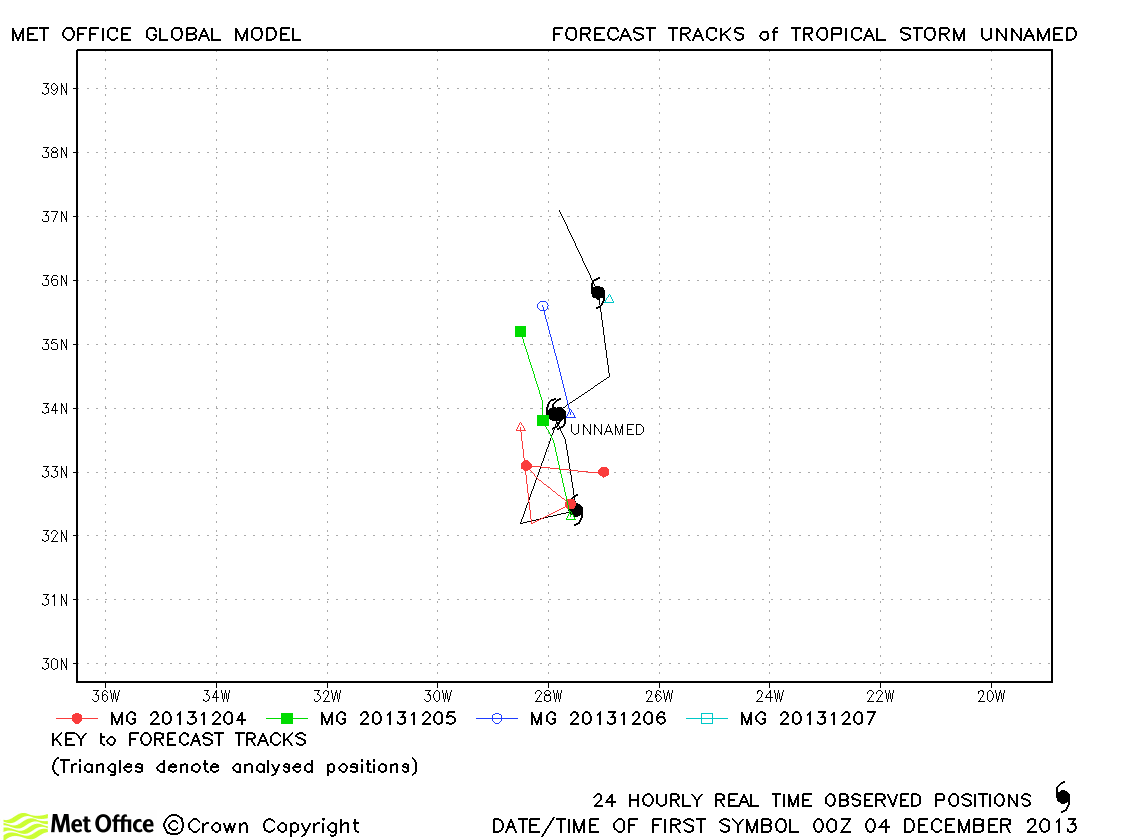
| Unnamed (15L) | 03-07 December | 55 knots | Track errors were below last season's average for this subtropical storm added to the database in post season reanalysis. |
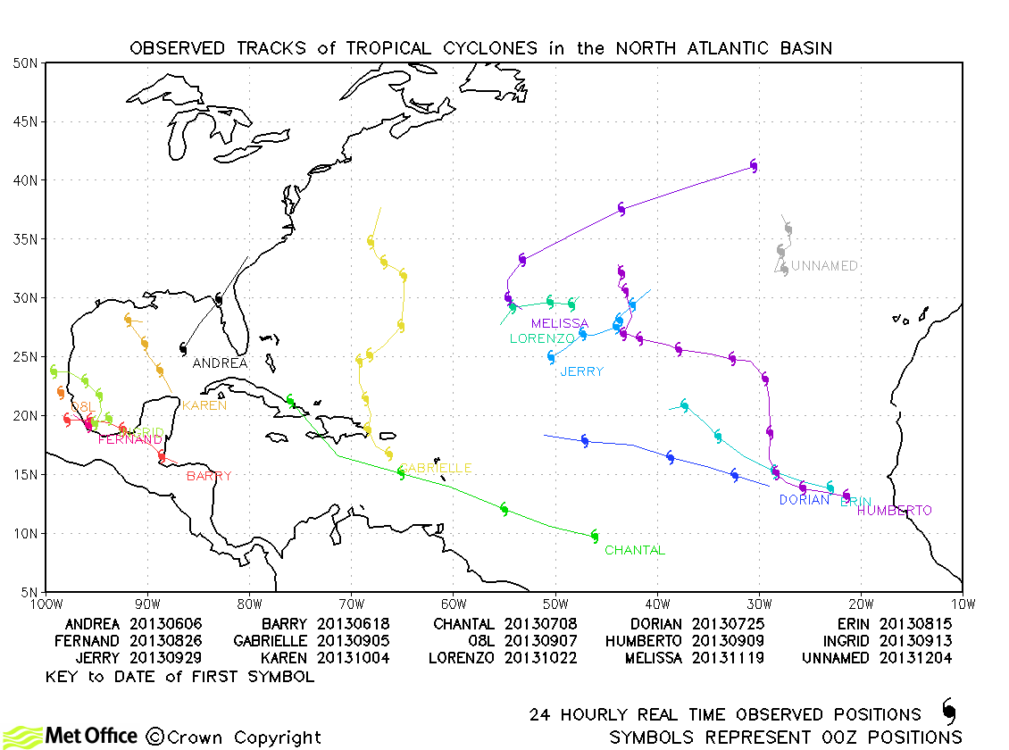
North Atlantic observed tracks in 2013
North Atlantic tropical cyclone names
| Name & ID | Start & end dates | 1-/10-minute MSW | Comments on Met Office global model forecasts |
|---|---|---|---|
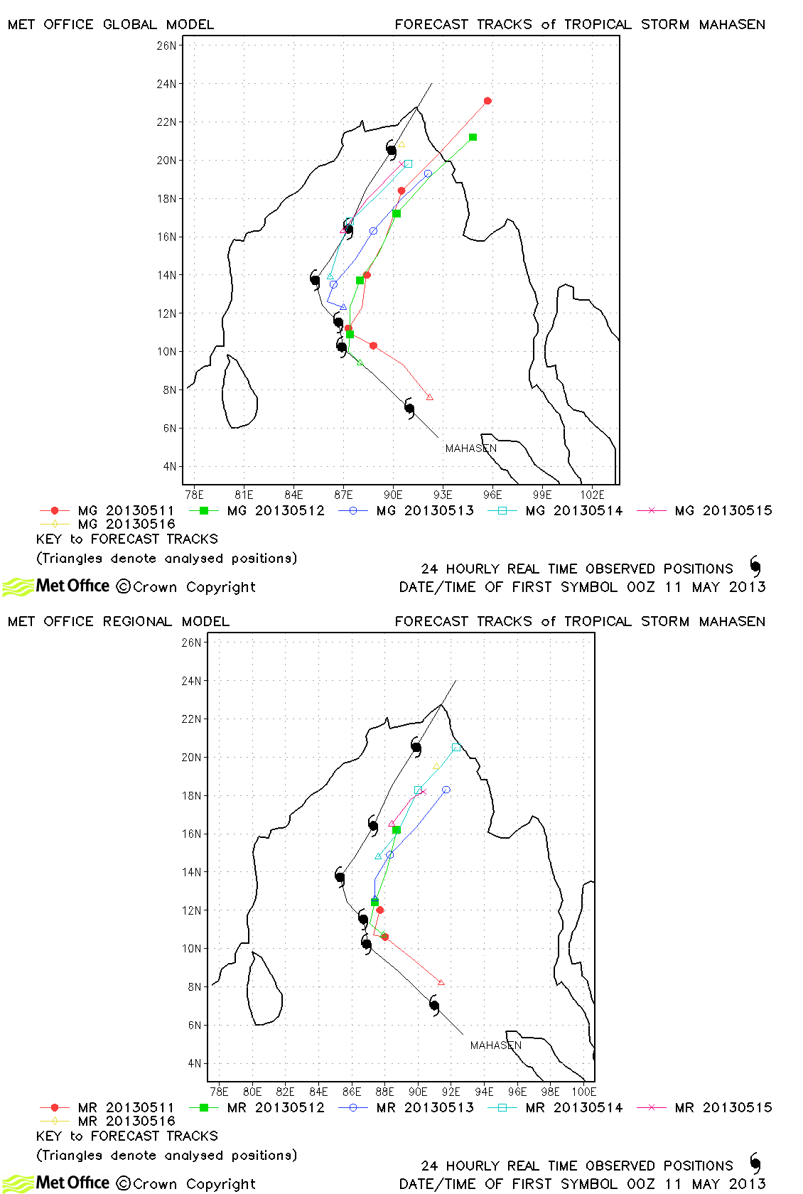
| Mahasen (01B) | 10-16 May | 50/45 knots | Track forecast errors were low at short lead times and high at long lead times for the global model. There was a right-of-track bias in forecasts. South Asia Model track forecast errors were larger than the global model. |
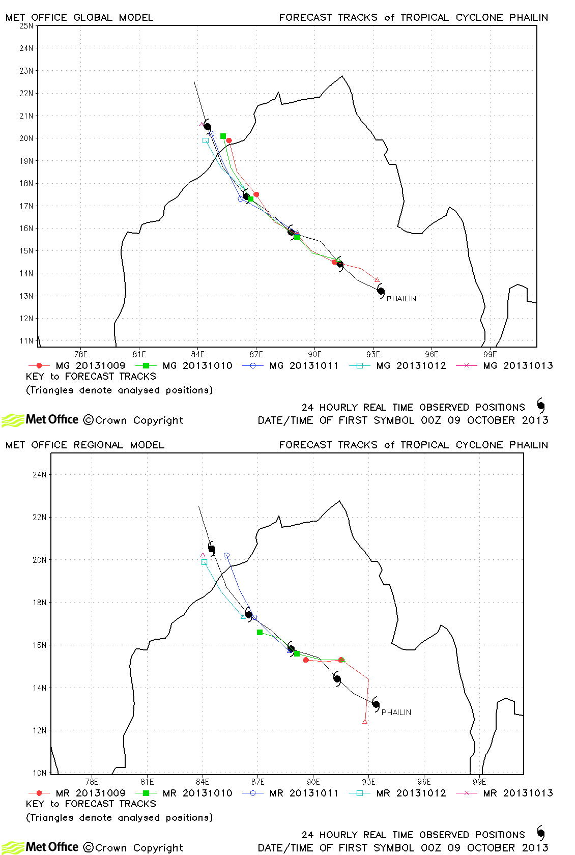
| Phailin (02B) | 09-12 October | 140/110 knots | The formation of Cyclone Phailin was well predicted days in advance and track forecast errors once the storm had formed were very low. |
| 30W | 03-16 November | 35/30 knots | 30W only briefly (twice) reached tropical storms strength according to JTWC, but as a tropical depression persisted for a long time across the western Pacific and Bay of Bengal. |
| 03A | 08-11 November | 40/30 knots | Track forecast errors were near to last season's average for this region, but forecasts did not predict landfall. |
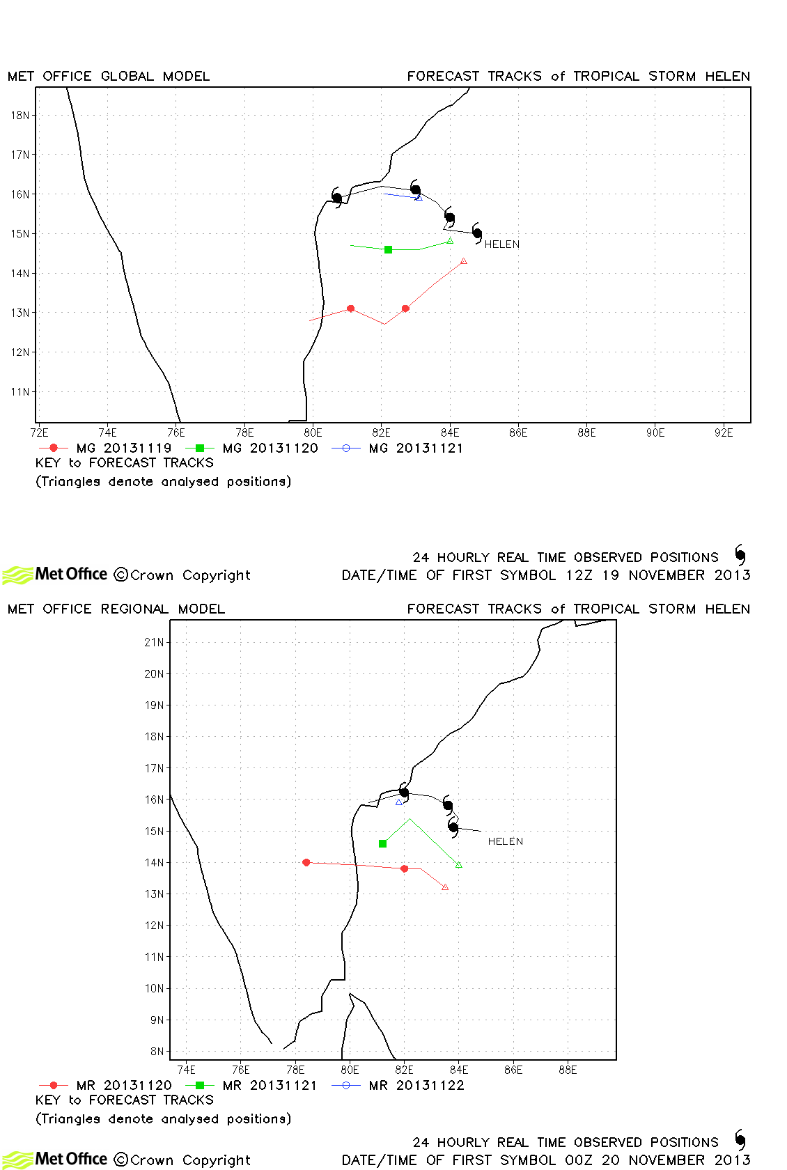
| Helen (04B) | 18-22 November | 60/55 knots | Some early runs analysed Helen poorly resulting in large forecast errors. |
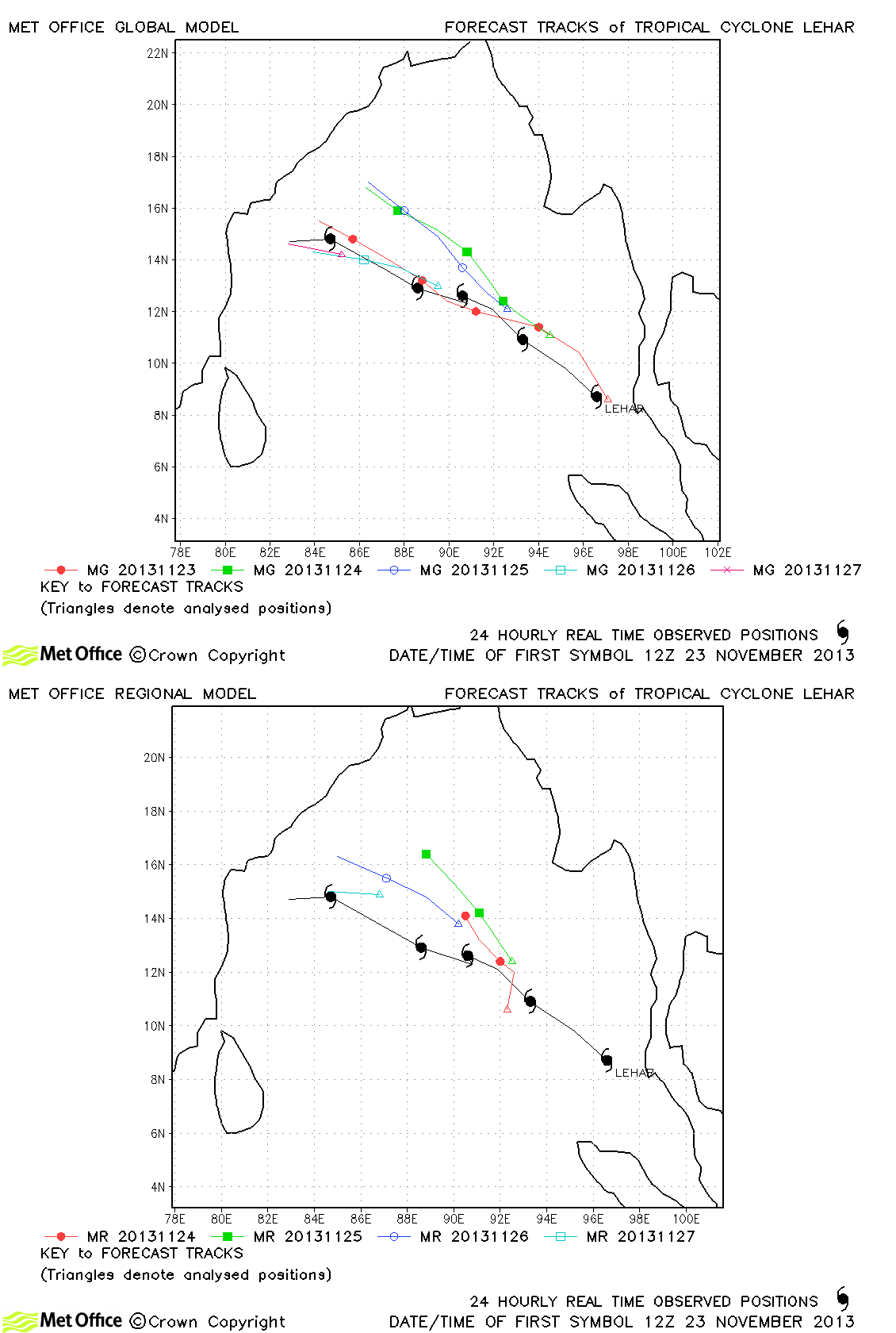
| Lehar (05B) | 23-28 November | 75/75 knots | Early poor analyses resulted in forecasts with a northward bias. However, later forecasts were better with small track forecast errors. |
| Madi (06B) | 06-12 December | 70/65 knots | Track forecast errors were mostly larger than last year's average due to a premature sharp turn southwestwards. However, this turn did eventually occur. |
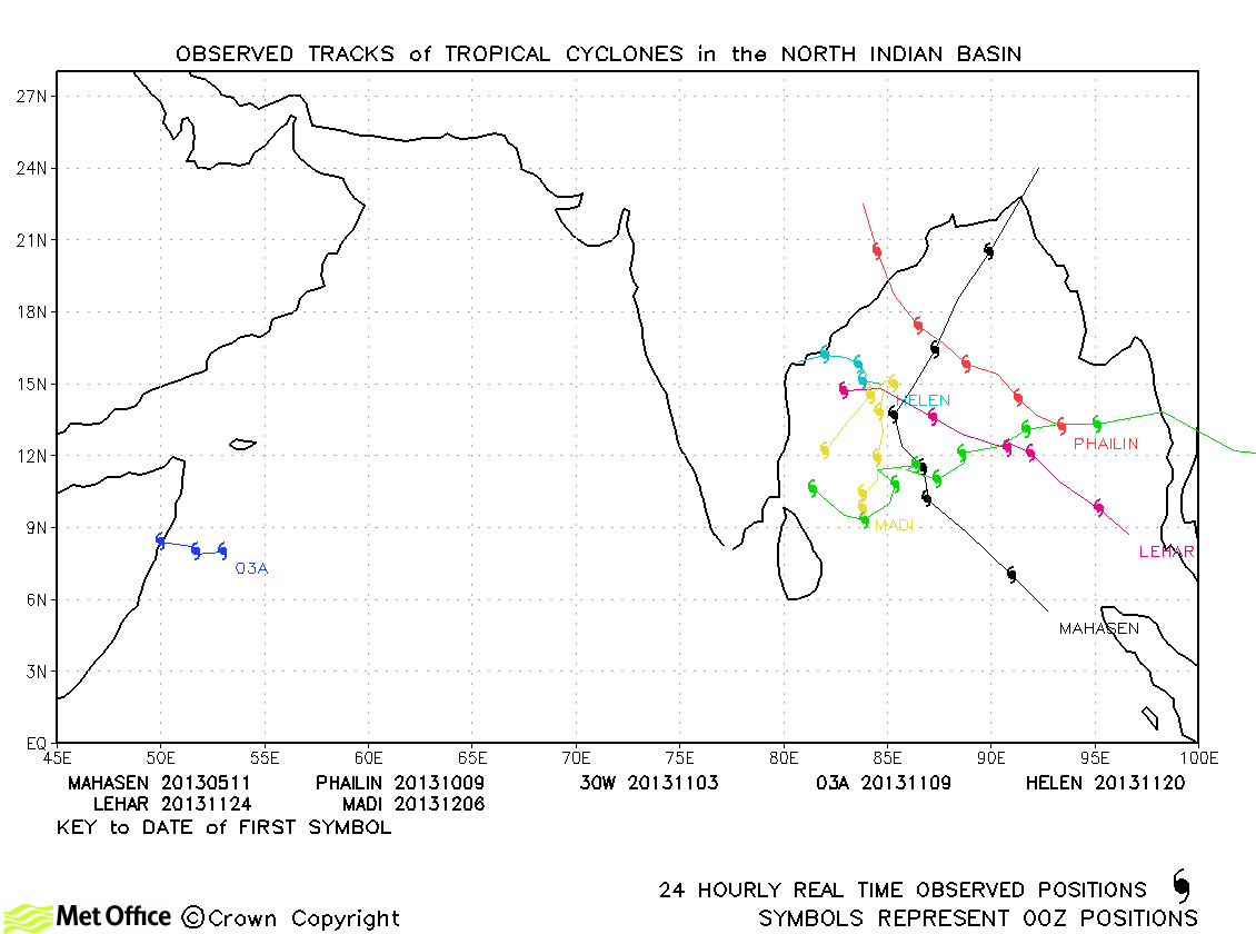
North Indian observed tracks in 2013
North Indian tropical cyclone names
Note on estimated wind speeds
1-minute MSW: Maximum sustained wind (knots) averaged over 1 minute (JTWC Hawaii, NHC Miami, CPHC Hawaii)
10-minute MSW: Maximum sustained wind (knots) averaged over 10 minutes (JMA Japan, IMD New Delhi)
Note: Although 1-minute average winds should be stronger than 10-minute average, this may not be the case here since estimates are obtained from different warning centres.

