Met Office weather: Largely dry but fairly cloud with some outbreaks of rain
Friday will begin on a largely dry but fairly cloudy note across many eastern and southeastern parts of the UK
Friday will begin on a largely dry but fairly cloudy note across many eastern and southeastern parts of the UK. Some isolated frost is possible away from southern areas during the early morning. Further west, however, a band of cloud and rain already affecting Northern Ireland and western Scotland will continue to move eastwards. This rain may bring some transient snow over high ground before pushing across the rest of the UK by early afternoon, with some locally heavy bursts expected.
As the rain clears, skies will brighten from the west, although this improvement will be accompanied by heavy and blustery showers for many. A few of these showers may contain isolated thunder. Winds will freshen through the day, especially in western areas, but the air mass moving in from the west will bring a milder feel compared with recent days.
Overnight, scattered showers will continue in the north, while many central and western areas turn mostly cloudy as further spells of rain move in from the southwest. The northeast will see the longest clear intervals, where a slight frost is possible. Elsewhere it will be mild or even very mild for the time of year, with a continued breeze.
Milder air on the way! 🌡️
— Met Office (@metoffice) February 19, 2026
A change in wind direction will bring southwesterlies across the UK, lifting temperatures through the weekend pic.twitter.com/dK9XpFCrlF
Outlook for Saturday
Saturday will be rather cloudy for most, with outbreaks of rain or drizzle pushing northeast across the UK. This rain may be heavy at times and fairly persistent over west‑facing hills. In contrast, eastern parts, particularly areas in the lee of higher ground, will often be drier, brighter and clearer. The best of the dry and bright weather is likely to be found in Shetland.
It will be windy for many, with strong lee‑side gusts developing across parts of England and Wales, though winds will be lighter across the far northeast. Temperatures will be mild or very mild by both day and night, especially in the south where any sunnier breaks will feel springlike.
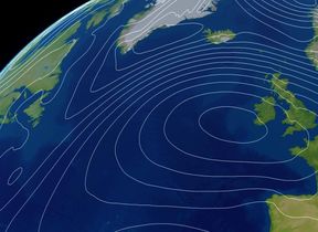
Met Office presenter and meteorologist, Alex Deakin, said: “Most places are much drier than they were yesterday, though it remains fairly cloudy and chilly. The satellite picture shows a blanket of cloud smothering the UK, along with a beautiful swirl far out in the Atlantic, a deep and intense area of low pressure. It will weaken slightly, but its weather fronts will move in, bringing rain and milder air as we head through Friday.
“In the meantime, a ridge of high pressure is trying to build, giving some drier weather for many. Although yesterday brought widespread rain and today started on a wet note for some, that rain is now fizzling out, leaving damp and drizzly conditions across parts of southern Scotland and northeast England. Another weather front is bringing more rain to Northern Ireland and western Scotland, with a little drizzle at times across Pembrokeshire, Devon and Cornwall.
READ MORE: 10-Day trend: Unsettled conditions continuing
“A good portion of the country, especially areas that saw the heaviest rain yesterday, will be much drier today across the Midlands and southern England. A brisk, cold wind continues to blow in from the North Sea along eastern coasts, and it’s breezy in the southwest too. Here, temperatures may reach 9 or 10°C, but elsewhere under thick cloud they will struggle at around 4 or 5°C, feeling particularly cold around the coasts of Scotland.
“Through the evening, outbreaks of rain will continue across Scotland with a little hill snow over the highest peaks. Northern Ireland may turn drier for a time before the next system moves in, making things wetter again. Most of England and Wales will have a dry night with plenty of cloud, helping keep temperatures above freezing in towns and cities.
“Friday will start cold and quite grey, but largely dry across eastern England. Further west, a band of rain will move through, clearing Northern Ireland before becoming heavy over northern England, Wales and southern Scotland, then easing as it reaches East Anglia and the southeast. Most places will see a spell of rain followed by lively showers, some heavy and fast-moving, with strengthening winds.
“As winds turn more westerly or south-westerly, milder air will arrive. By Friday afternoon, temperatures will be several degrees higher than today, with many places reaching double figures and perhaps 11 or 12°C where brighter spells develop. It will feel milder, though gusty winds and frequent showers may take the edge off.”
You can find the latest forecast on our website, on YouTube, by following us on X and Facebook, as well as on our mobile app which is available for iPhone from the App store and for Android from the Google Play store.