Unsettled weather continues this weekend – December '20
Author: Press Office
12:19 (UTC) on Fri 4 Dec 2020
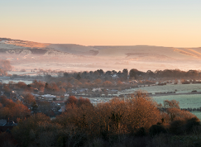
Scotland and other parts of the UK have seen their first significant snowfall of the winter.
Snowfall in Scotland and northern England
Rain, sleet and snow fell across a broad swathe of Scotland and northern England last night. Upland areas of South Lanarkshire in Scotland saw as much as 13 cm of snowfall overnight with temperatures falling below -9C in places. Some areas saw thunderstorms and ‘thunder snow’.
Light snow in areas of southern England
Further south parts of Kent and south east England woke to snowfall this morning. This snow spread northwards giving a dusting of snow over the Wealds and Downs of southeast England.
Current conditions
Friday will continue unsettled and cold with rain, sleet and some strong winds affecting most areas at times.
Met Office Chief Meteorologist Neil Armstrong said; “Rain, which was heavy at times and wintry in places through the morning, will ease this afternoon, with some areas in the south turning brighter. It will stay cold everywhere today (Friday) and, windy for most, with gales in coastal areas.
“There will be further rain at times tonight with sleet or wet snow still possible over hills.”
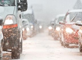
National Severe Weather Warning
There are a number of yellow national severe weather warnings in place across the UK. There is one for snow covering parts of central and northern England valid until 9pm this evening. There is a rain warning in place until 6am tomorrow morning covering parts of eastern Scotland where there could be some heavy rain at times with 20 - 40 mm of rain falling quite widely.
There is also a yellow warning for ice in place covering south east England valid from 9pm this evening until 10am tomorrow (Saturday) where freezing temperatures overnight could lead to icy patches on untreated surfaces. A few showers are also expected across Kent and the far east of Essex, Suffolk and Norfolk which may lead to more widespread ice in these areas.
Upcoming forecast
Tomorrow (Saturday) will be cold and cloudy with rain in most areas at times and there is still a chance some might see a little snow on hill tops.
The rain will become confined to mainly eastern areas as we go through the rest of the weekend and into the start of next week. Elsewhere it will be mostly dry with sunny spells but staying cold with overnight frost and fog.
Road safety
Traffic Scotland operator manager Douglas Cairns said: “The first severe weather warning of the winter for snow and ice led to some very challenging driving conditions this morning. It’s yet another timely reminder for people to check they are winter ready and to make appropriate preparations or consider if they even need to travel when the weather is so severe.
“The safest and best advice is to check Traffic Scotland twitter, radio and the website before you travel and to always drive to the conditions, if your journey is essential.”
Stay connected
You can check the latest weather warnings on our severe weather warnings pages and you can get the most accurate and up to date forecast for your area using our forecast pages and by following us on Twitter and Facebook, as well as using our mobile app which is available for iPhone from the App store and for Android from the Google Play store. Whatever the weather we are all being urged to remember the Government Coronavirus guidelines.