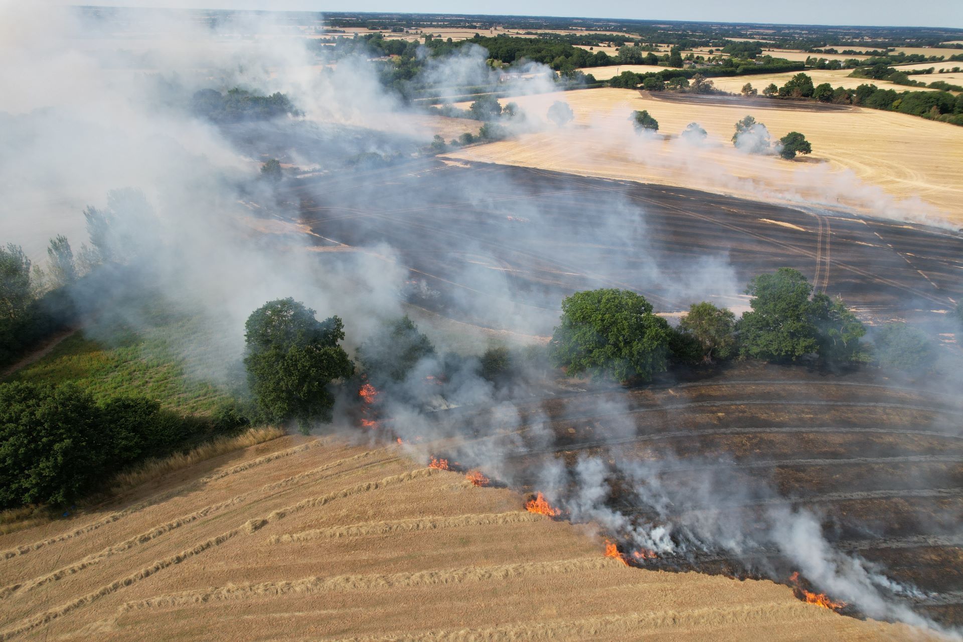
Recent hot and dry weather has not only affected parts of the UK but has also contributed to significant wildfire activity across Europe.
While some parts of the UK continue to face an elevated wildfire risk, conditions across Spain and France have become particularly concerning, with large fires forcing hundreds of thousands of people to evacuate.
This week’s weather pattern highlights the stark contrast between wetter conditions in the north of the UK and ongoing heat and dryness further south.
Major wildfires across Europe
Satellite imagery has revealed extensive smoke plumes across western and eastern Spain, associated with several major wildfire outbreaks. Fires west of Madrid have become the country's largest on record, while significant fires have also been burning near Bordeaux in France.
With hot and dry weather expected to continue across parts of southern Europe, there is concern that fire conditions could worsen further in the coming days.
When fires create their own thunderstorms
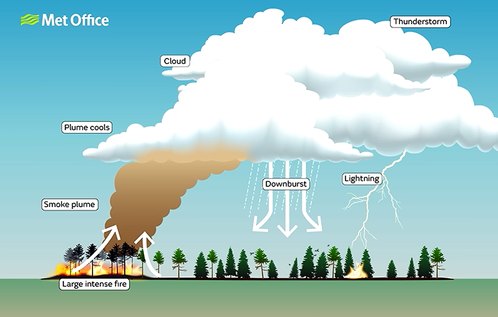
One of the more unusual features associated with large wildfires is the development of pyrocumulonimbus clouds – towering thunderstorm clouds generated by the intense heat from fires rather than traditional atmospheric processes.
As fire-heated air rises rapidly, smoke particles provide ideal surfaces for water vapour to condense onto. This allows cloud development, with some storms growing to heights of 10–15 kilometres and extending into the stratosphere.
These clouds can create additional hazards. Strong downdrafts may help spread fires, while dry lightning can ignite new blazes several kilometres away from the original wildfire. NASA has described these clouds as the “fire-breathing dragon of clouds” because of their ability to worsen wildfire situations.
Recent examples have been observed in France, where they have contributed to worsening wildfire conditions.
A tale of two weather patterns across the UK
Back in the UK, dry weather remains a key theme, particularly across England and Wales. Many observing stations have recorded long runs without measurable rainfall, and several locations are continuing to add to those totals.
However, rainfall prospects differ sharply depending on location.
Northern Ireland, Scotland and parts of northern England are expected to see repeated bands of rain through the remainder of the week. Some areas of Scotland could receive 30–40 mm of rainfall, with locally higher totals possible.
Further south, conditions remain markedly different. While occasional weak fronts may bring a few spots of rain, most southern areas are likely to remain largely dry through the rest of the week and into the weekend. Recent forecast updates have also reduced the likelihood of a weather system reaching southern areas during the weekend, increasing confidence in continued dry conditions.
Heavy rain and thunderstorms for northern Scotland
Although much of the south remains dry, parts of northern Scotland could see significant rainfall over the coming days.
Forecast models indicate that some areas of northeastern Scotland may receive between 40 and 50 mm of rain within a six- to twelve-hour period. The greatest risk appears to come during Thursday afternoon and evening.
The atmosphere is also expected to become unstable enough to support thunderstorms, bringing the potential for locally heavy downpours and lightning across eastern and northeastern Scotland.
READ MORE: Week ahead: Heat builds again, but not everywhere
Another surge of heat
Alongside the dry weather, heat remains a major talking point.
The UK has experienced several notable heatwaves since May, including record-breaking warmth during both May and June. July has also seen prolonged periods of heat, although with some variation in where the highest temperatures have occurred.
Wednesday is expected to bring the peak of the current spell of heat, particularly across southeastern England, as very warm air is drawn northwards from the continent. Temperatures could reach 34–35°C, making it one of the hottest days of the year.
A fresher feel later in the week
Although temperatures will ease later this week as fresher air moves southwards through the UK, conditions are still expected to remain warmer than average for many areas. Meanwhile, southern parts of the country are likely to continue their run of predominantly dry and sunny weather well into the weekend and the start of next week.
For many, the heat may ease somewhat after Wednesday, but significant rainfall remains in short supply across southern Britain, meaning dry conditions and elevated wildfire concerns are likely to remain a feature of the weather in the days ahead.
https://www.youtube.com/watch/209R40OPcfE?start=0Keep up to date with weather warnings, and you can find the latest forecast on our website, on YouTube, by following us on X and Facebook, as well as on our mobile app which is available for iPhone from the App store and for Android from the Google Play store.