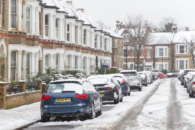
As we step into the first full week of January, the UK finds itself under the influence of crisp winter sunshine and a persistent Arctic air mass as well as continued snow and ice hazards.
For many, this has meant bright, cold days and frosty mornings, a classic start to the year. But as is often the case with British weather, the story is far from simple. This week, the more typical Atlantic-driven conditions will attempt to make not one, but three comebacks, clashing with the entrenched cold and bringing a variety of weather hazards and uncertainties to the forecast.
Arctic air dominates the early week
This week began with Arctic air firmly in place across the UK. This means slippery surfaces are likely, especially in northern, eastern, and western regions, following showers on Monday and into Monday night. As Tuesday dawns, expect a widespread frost and icy patches, take extra care if you’re out and about early. A number of yellow weather warnings are in place until Tuesday.
First Atlantic front: Snow and rain on Tuesday
The first attempt by Atlantic weather to break through arrives on Tuesday morning, as an occluded weather front moves in from the northwest. Ahead of this, much of the country will see bright but cold conditions. However, as the front meets the cold air, cloud and rain will spread into Scotland, turning to snow in many areas and then into northern England. Expect patchy accumulations of 1–5cm of snow in northern England and Scotland, with significantly more, up to 10–15cm, in central and eastern Scotland and some lower parts where the cold air is slow to clear. northeast England may also see notable snowfall.
READ MORE: Keeping your home warm during cold weather
As the front continues southeast during Tuesday night, most areas will see rain and hill snow, but there’s a risk of lower-level snow across eastern England, particularly overnight into Wednesday. East Anglia and northeast England could see a couple of centimetres, potentially causing minor disruption on Wednesday morning.
Midweek: Cold returns and coastal showers
Behind the front, colder air sweeps south again, bringing more icy patches and a widespread frost to start Wednesday. Sleet and snow showers are likely, especially along North Sea coastal areas and northern Scotland, while the west enjoys brighter and drier conditions for now. The Arctic air remains dominant, but changes are brewing in the Atlantic.
Thursday: Uncertainty as Atlantic low approaches
Thursday begins with another widespread frost and icy surfaces, but also plenty of dry, bright weather, especially in the east. Temperatures will remain below average, typically 2 to 4°C. Through the day, cloud increases from the west and winds pick up as a deepening Atlantic low approaches, bringing rain from the southwest. However, there’s considerable uncertainty about the track of this low, which will have a major impact on the weather.
Meteorologists use multiple computer simulations to account for chaos theory, the idea that small changes at the start of a forecast can lead to big differences by the end. At first, the Met Office and European models agree on the low’s position, but as Thursday progresses, their tracks diverge. The Met Office model suggests a path through north Wales and the north Midlands, while the European model favours a more southerly route across northern France.
READ MORE: Weather records for New Year’s Day and New Year’s Eve across the UK
Three scenarios for Thursday’s low
The difference in tracks may seem minor, but it’s crucial for local impacts. If the low takes the more northerly track (considered less likely, with a 20% chance), widespread disruptive wind and rain could affect much of England, Wales, southern Scotland, and Northern Ireland, with disruptive snow possible in higher parts of Wales, the Pennines, and the north Midlands.
A more southerly track (northern France, 30% chance) would shift the worst wind and rain into France, but southern counties of England could see disruption from snow, especially on higher ground. The most likely scenario (50% chance) is something in between: wind and rain for southern UK, with central areas facing the risk of snow disruption.
Friday and the weekend: Clearing, then another Atlantic push
By Friday, whichever scenario plays out, the low will move away, and the weather will improve through the day. Arctic air returns for the start of Saturday, bringing dry, bright, and frosty conditions with icy patches. But the Atlantic isn’t finished yet, a third, larger area of low-pressure will move in over the weekend, taking a more northerly track and replacing the Arctic air with wind, rain, and much milder weather by Sunday.
Keep up to date with weather warnings, and you can find the latest forecast on our website, on YouTube, by following us on X and Facebook, as well as on our mobile app which is available for iPhone from the App store and for Android from the Google Play store.

