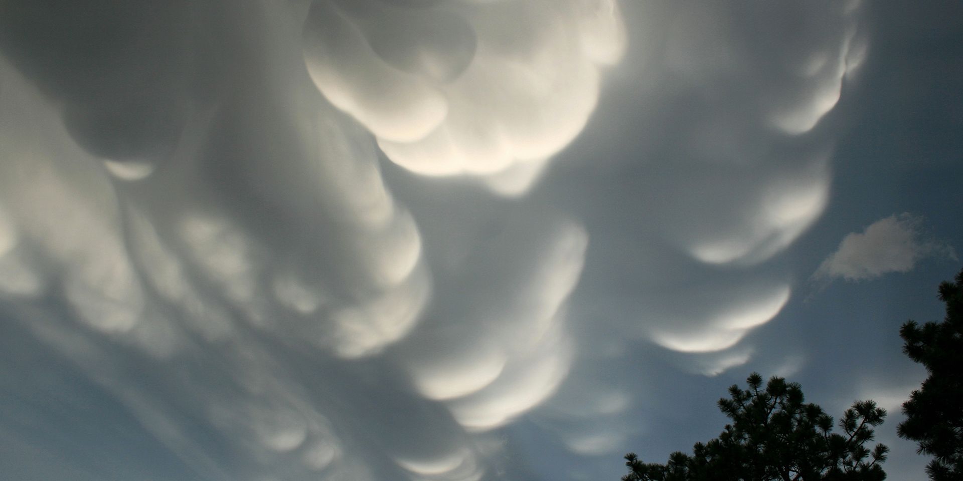
The atmosphere is capable of creating some truly strange and spectacular sights.
Clouds that glow after sunset, frost flowers and mysterious red flashes above thunderstorms can all occur when the conditions are just right.
Some of these phenomena are so rare that witnessing one can feel almost otherworldly, but there is real science behind them. Temperature, moisture, wind, ice and electricity can combine in unusual ways to create remarkable effects in our skies and landscapes.
Here are nine of the world’s weirdest weather phenomena, how they form and where you might have a chance of seeing them. How many have you heard of?
What is blood rain?
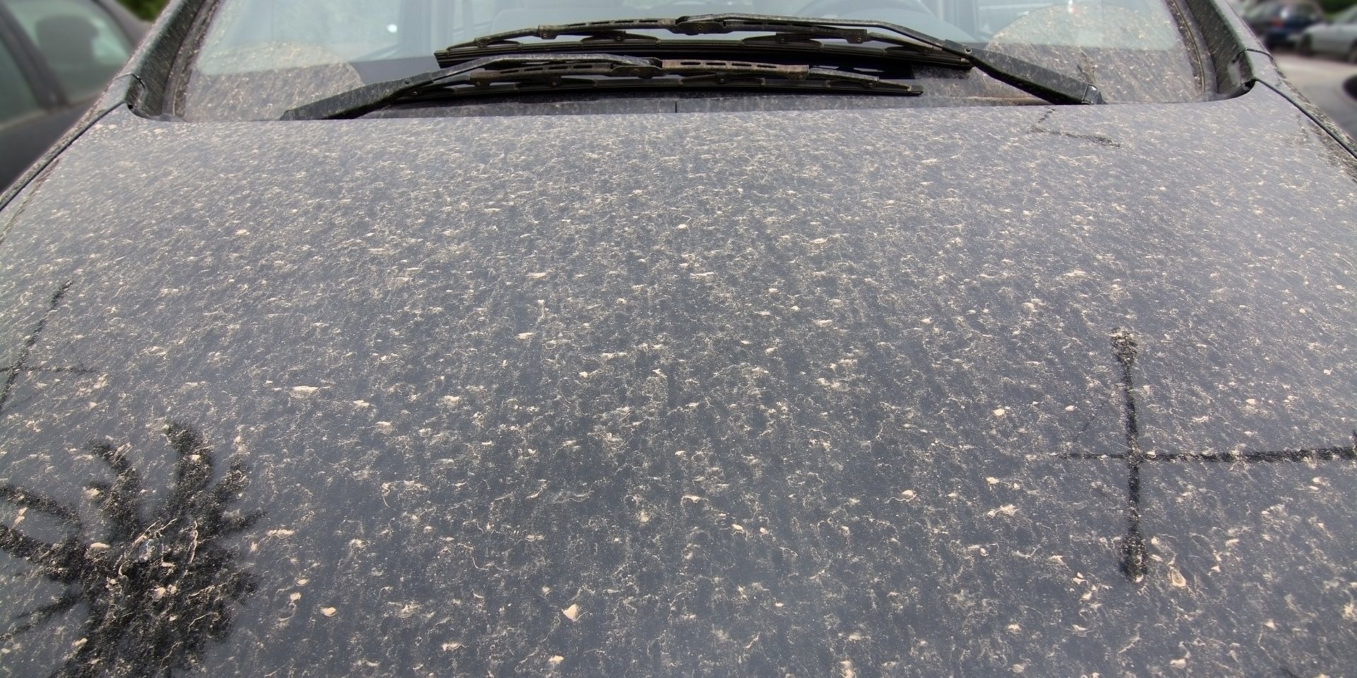
“Blood rain” describes rain that appears red because it contains relatively high concentrations of coloured dust or particles. It is a colloquial expression rather than an official meteorological term.
Strong winds and storms can lift dust and sand into the atmosphere, where circulation may transport them for thousands of miles. The particles can then mix with water droplets in clouds before falling with the rain.
The UK occasionally receives dust transported from the Sahara. However, it is generally yellow or brown and present in concentrations too low to turn rain visibly red. Instead, a thin layer of dust may remain on cars and windows after the rainwater evaporates.
How do snow rollers form?
Snow rollers are naturally formed cylindrical snowballs. Wind or gravity moves a piece of snow across the ground, causing it to collect additional layers in much the same way as a snowball made by hand.
Their formation requires a thin layer of wet, loose snow over a surface to which it will not stick, such as ice or powder snow. The wind must be strong enough to move the snow but not strong enough to break it apart.
Snow rollers are often hollow because their weak inner layers can blow away. Although most are only a few centimetres wide, some can grow larger than a car.
What are mammatus clouds?
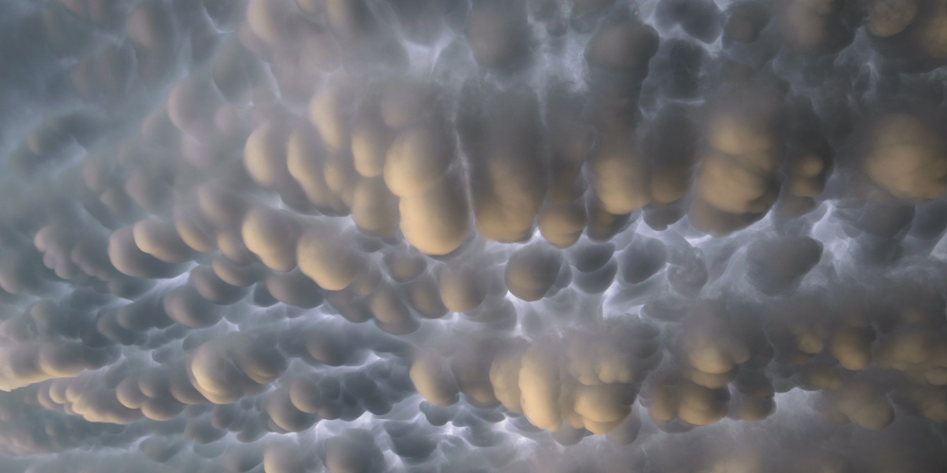
Mammatus are distinctive pouches or bulges that hang from the base of a cloud. They usually develop beneath the anvil of a cumulonimbus, where descending air creates an uneven cloud base.
Their presence near a cumulonimbus can coincide with thunderstorms, hail, heavy rain or lightning. However, mammatus can also form beneath other cloud types and have even been observed below volcanic ash clouds.
The name comes from the Latin mamma, meaning “udder” or “breast”. The pouches can look particularly dramatic when illuminated by a low sun.
What are frost flowers?
Frost flowers are delicate ice crystals that grow on young sea ice or thin lake ice in cold, calm conditions. They commonly form in patches measuring around 3–4 cm across.
Formation requires relatively warm new ice to be exposed to still air that is at least 15°C colder. Moisture above the ice enters the colder air and creates a supersaturated layer in which crystals grow around small surface irregularities.
Frost flowers are more common on sea ice in polar regions. Freshwater frost flowers are rarer because they require a sudden and substantial fall in temperature.
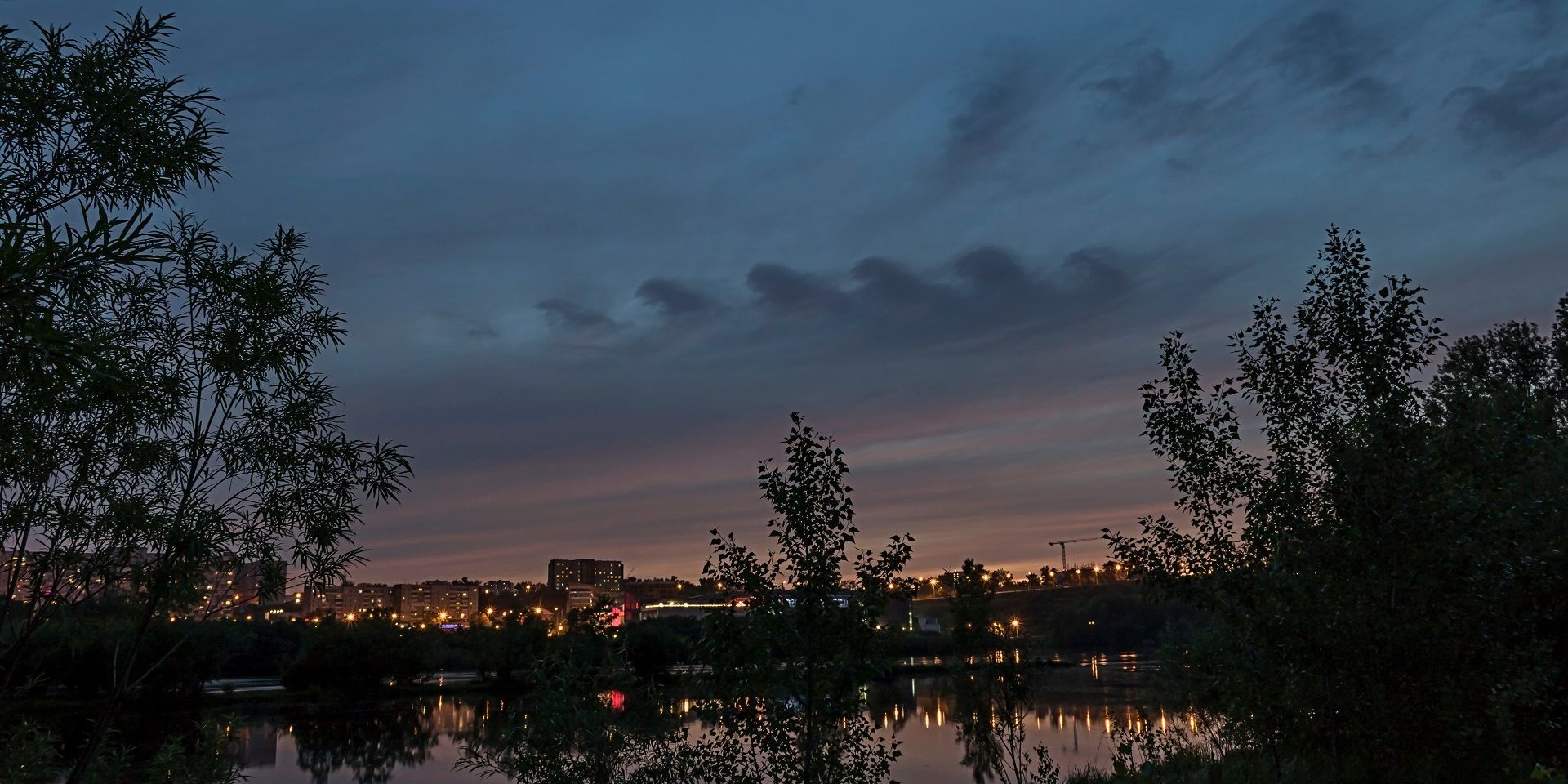
Why do noctilucent clouds glow after sunset?
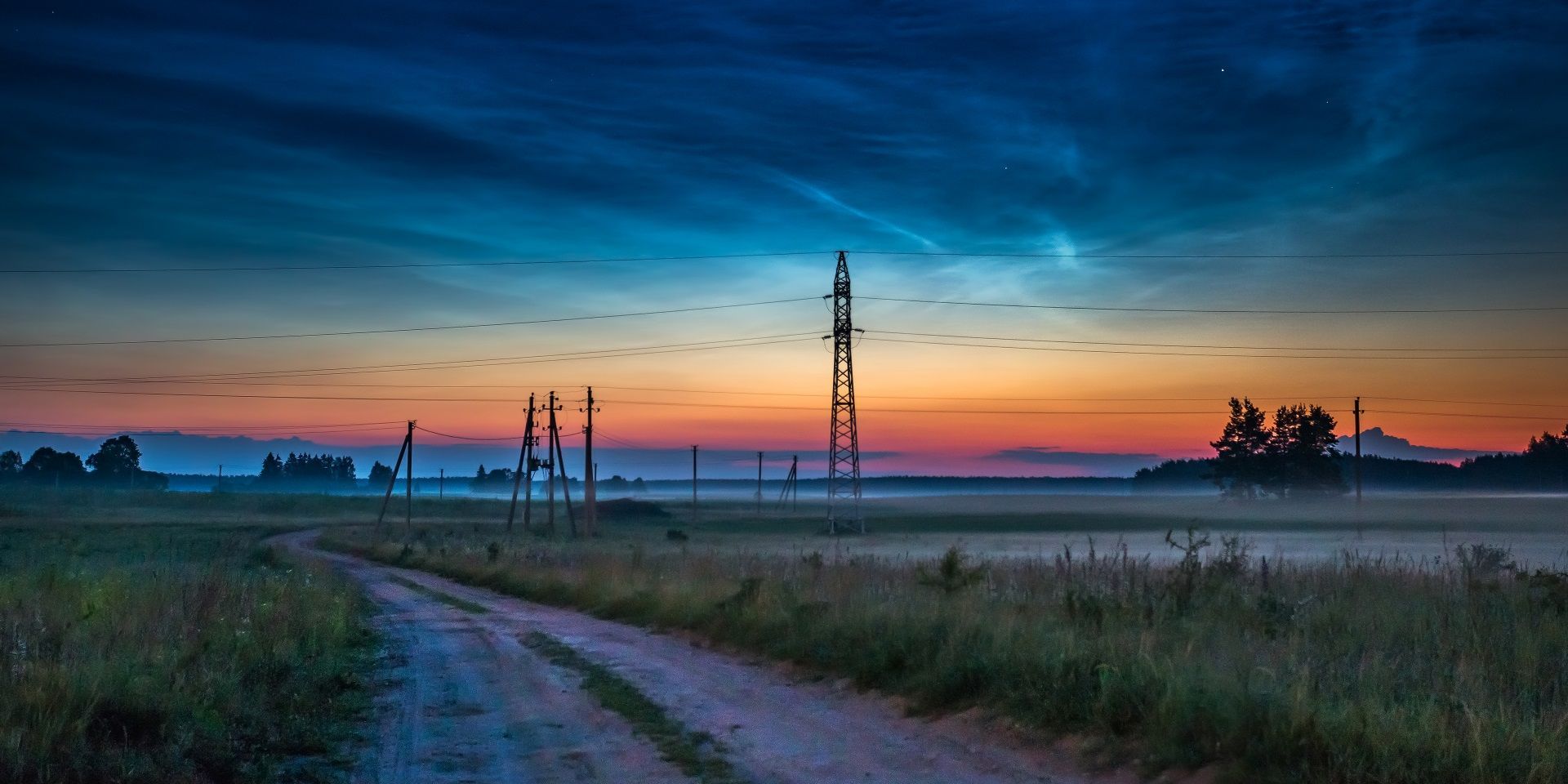
Noctilucent clouds are rare collections of ice crystals in the mesosphere, higher than ordinary weather-producing clouds. Their name means “night-shining”.
They become visible on clear summer evenings because their great altitude allows them to remain illuminated by sunlight after the Sun has set at ground level. They are seen between approximately 45° and 80° latitude in both hemispheres, although observations are less common in the Southern Hemisphere.
Noctilucent clouds are too high to affect weather at the Earth’s surface.
What is frazil ice?
Frazil ice is a collection of tiny ice crystals that forms in turbulent, supercooled water. The particles are generally thin discs around 1 mm or less in diameter, giving the water a slushy appearance.
It develops when moving water loses heat to colder air and cools just below its freezing point. In rough conditions at sea, frazil ice can gather into larger circular formations known as pancake ice.
What creates a fallstreak hole?
A fallstreak hole, sometimes called a hole-punch cloud, is a large opening that appears within a layer of cloud.
It forms when supercooled water droplets freeze into ice crystals and become heavy enough to fall, leaving a clear space behind. Aircraft can sometimes initiate this process. Air passing over wings or propellers expands and cools, encouraging droplets to freeze and fall in a distinctive streak.
Why do some clouds resemble breaking waves?
Kelvin-Helmholtz clouds form a repeating pattern resembling breaking ocean waves. They develop when adjacent layers of air move at different speeds, creating vertical wind shear.
If the upper layer moves faster than the air below, it can scoop the top of an existing cloud layer into rolling shapes. These rare clouds are more likely on windy days and can indicate the presence of aircraft turbulence.
What are sprites?
Sprites are brief, red-orange flashes that occur above thunderstorms, generally at altitudes of 50–90 km. They are triggered by electrical fields generated by lightning below and are different from ordinary lightning because they are cold-plasma phenomena.
Sprites were first photographed on 4 July 1989. Their characteristic red colour is produced by excited nitrogen in the low-pressure environment of the upper mesosphere.
Taken together, these phenomena show that the atmosphere is rarely as straightforward as it first appears. From Saharan dust carried across continents and naturally forming snow rollers to wave-shaped clouds, night-shining ice crystals and red flashes above thunderstorms, each spectacle is created by a particular combination of moisture, temperature, wind, ice or electrical activity.
Some occur close to the ground, while others form tens of kilometres above it, but all offer clues about the physical processes taking place around us.
READ MORE:
'Super El Niño'? '551-mile wall of rain and snow? Weather headline review
World Space Week: exploring weather on other planets
Are the UK’s seasons changing?
October weather extremes: from late warmth to early winter
Keep up to date with weather warnings, and you can find the latest forecast on our website, on YouTube, by following us on X and Facebook, as well as on our mobile app which is available for iPhone from the App store and for Android from the Google Play store.