

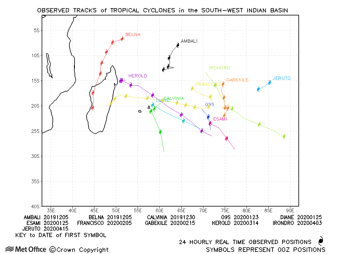
Observed and forecast tracks: southern hemisphere 2019-20
All tropical cyclones in the southern hemisphere season in 2019-20 are listed below including details of their start and end dates, lowest central pressure and maximum sustained wind (MSW).
Click on the name of the tropical cyclone to see a chart of the observed track and forecast tracks from the Met Office global model. Verification statistics on each tropical cyclone are available upon request from [email protected]. At the end of the season a verification report on the performance of the Met Office global model will be published.
| Name & ID | Start & end dates | Central pressure, 1-/10-minute MSW | Comments on Met Office global model forecasts |
|---|---|---|---|
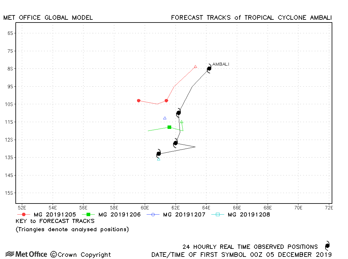
| 04-08 December | 930 mb, 135/120 knots |
Track forecast errors were mostly above the recent running mean. |
|
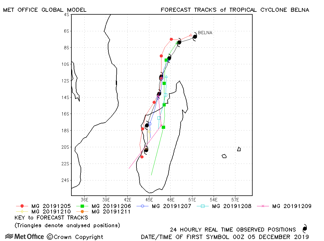
| 04-11 December | 964 mb, 100/85 knots |
Track forecast errors were mostly below the recent running mean, particularly at longer lead times. |
|
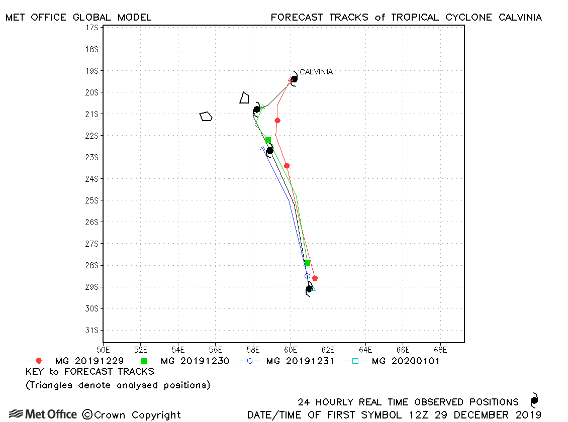
| 29 December-01 January | 973 mb, 70/65 knots |
Track forecast errors were low and skill scores high for this storm. |
|
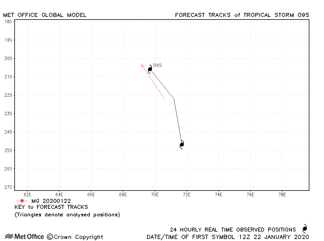
| 22-23 January | 999 mb, 35/30 knots |
09S was short lived and few forecasts were verified. |
|
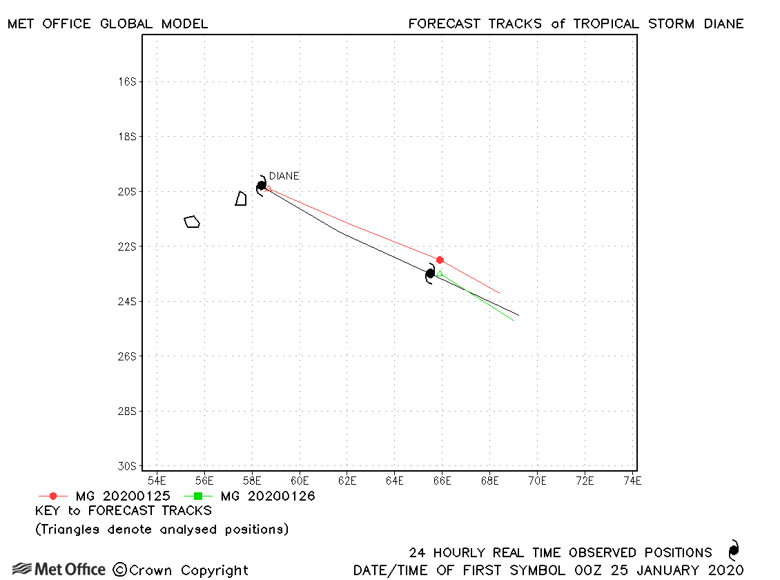
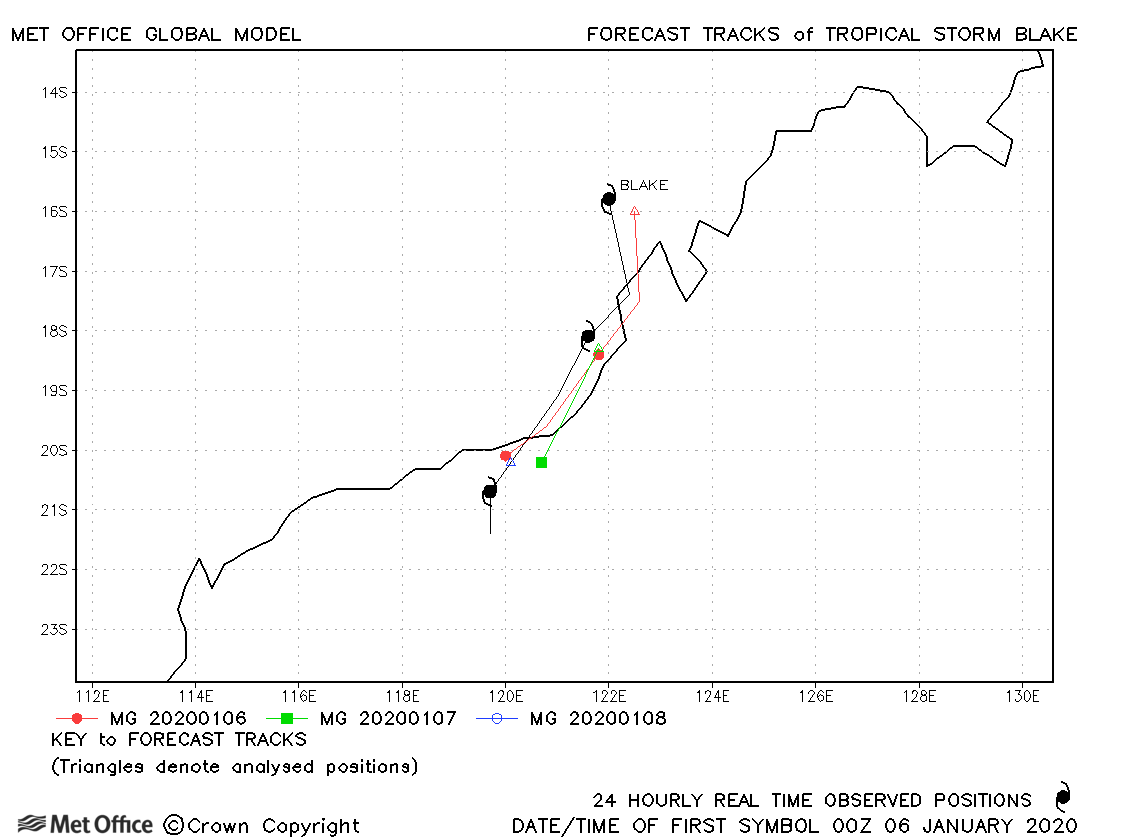
| 24-26 January | 980 mb, 45/50 knots |
Track forecast errors were near the recent mean error for this basin. |
|
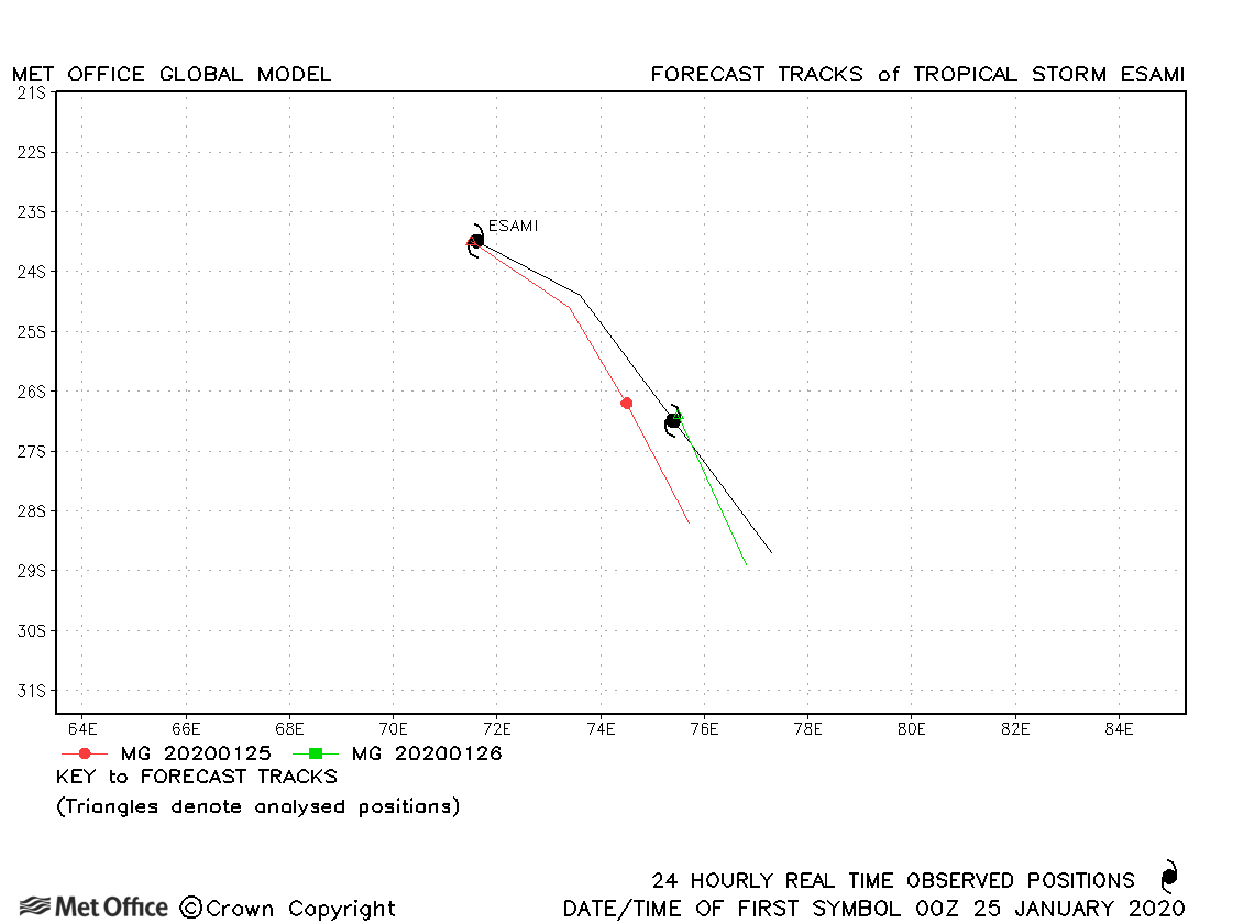
| 24-26 January | 993 mb, 45/45 knots |
There was a slight slow bias in forecasts. |
|
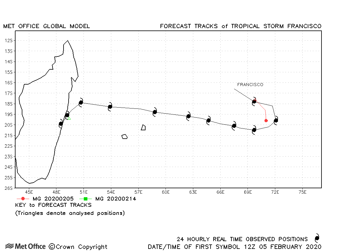
| 04-15 February | 994 mb, 45/40 knots |
Francisco was short-lived as a tropical storm, although persisted a long time as a depression before reforming close to the coast of Madagascar. Track forecast errors were below the recent mean value. |
|
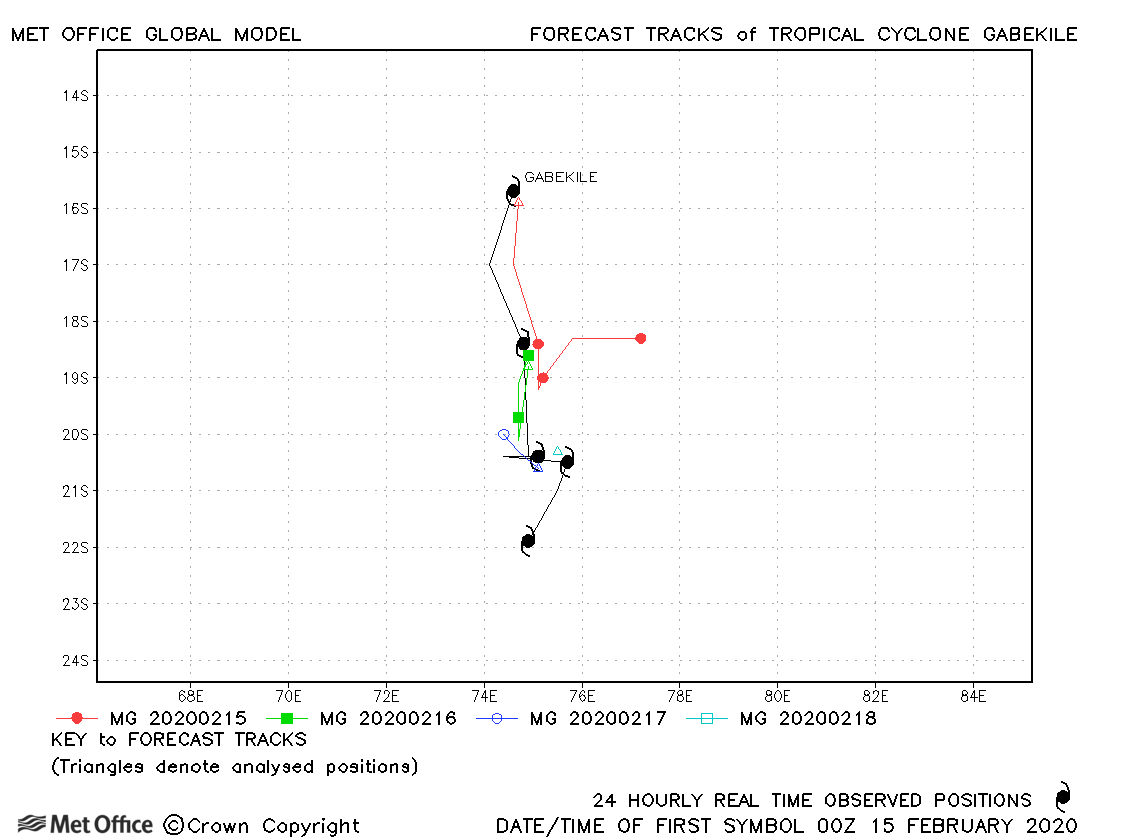
| 15-19 February | 980 mb, 75/70 knots |
Track forecast errors for this storm were above the recent mean value. |
|
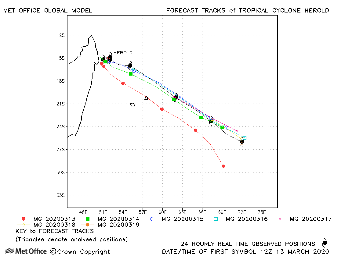
| 13-19 March | 957 mb, 100/95 knots |
Apart from the first forecast which had a southwards bias, track forecast errors were low and skill scores high for this storm. |
|
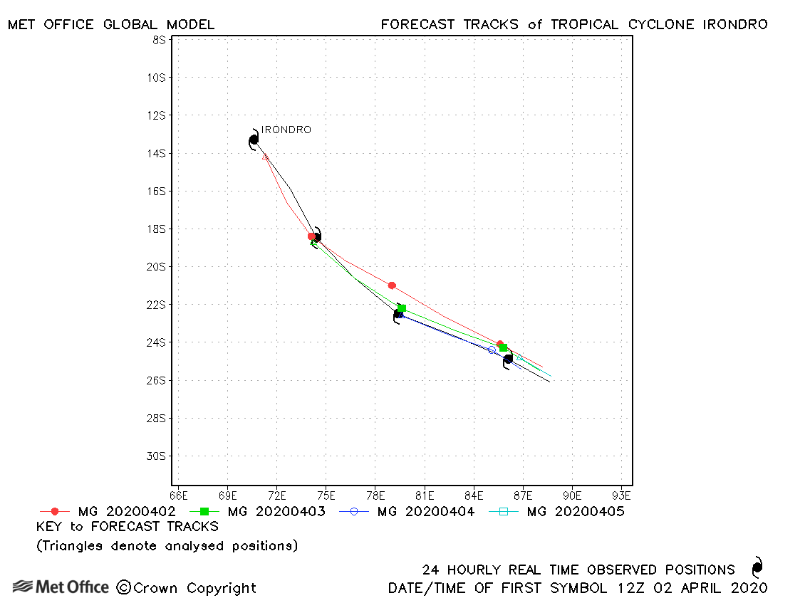
| 02-06 April | 945 mb, 95/95 knots |
Track forecast errors were near to or below the recent mean value. |
|
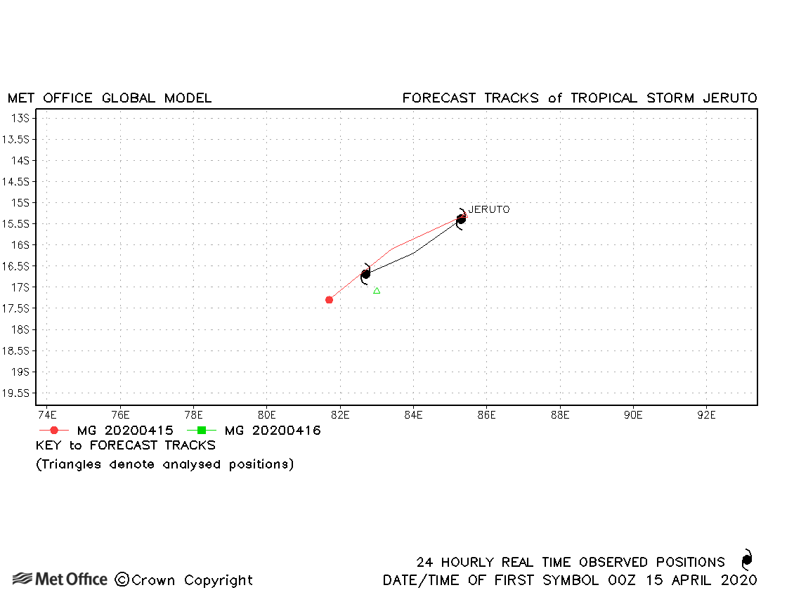
| 14-16 April | 999 mb, 40/35 knots |
Track forecasts were a little fast. |
South-west Indian observed tracks in 2019-20
| Name & ID | Start & end dates | Central pressure, 1-/10-minute MSW | Comments on Met Office global model forecasts |
|---|---|---|---|
| 05-08 January | 989 mb, 50/40 knots |
Track forecast errors were low and the landfall well predicted. |
|
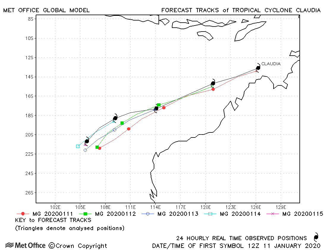
| 11-15 January | 969 mb, 85/75 knots |
Track forecast errors were mostly below the recent mean for this basin. |
|
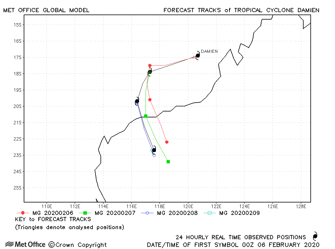
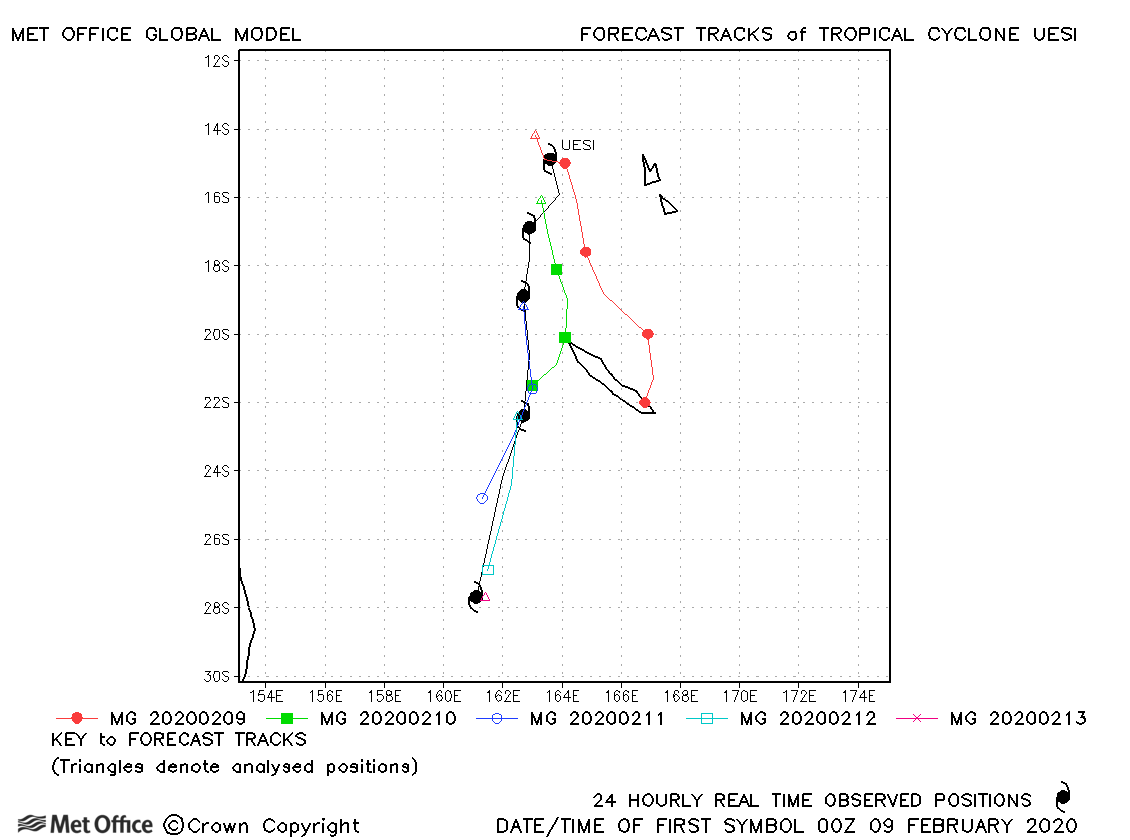
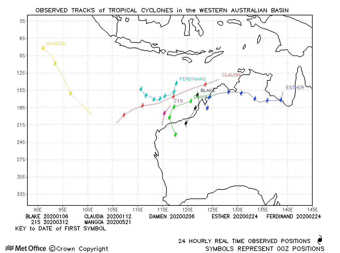
| 06-09 February | 955 mb, 95/80 knots |
Track forecast errors were below the recent mean value and the turn towards land was predicted well in most forecasts. |
|
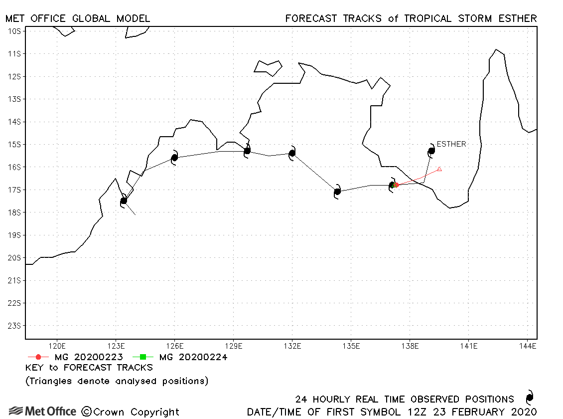
| 23 February-01 March | 990 mb, 50/40 knots |
Since Esther was only a tropical storm for a short while, few forecasts were verified. However, the model did well in predicting the remnant would remain intact and circulate around the interior of Australia for some considerable time after landfall. |
|
| 23 February-01 March | 960 mb, 95/85 knots |
Track forecast errors were low for Ferdinand. |
|
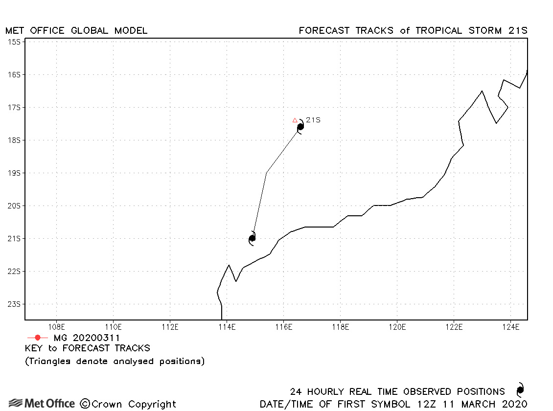
| 11-12 March | 1003 mb, 35/30 knots |
21S was very briefly designated as a storm by JTWC. No forecasts were verified. |
|
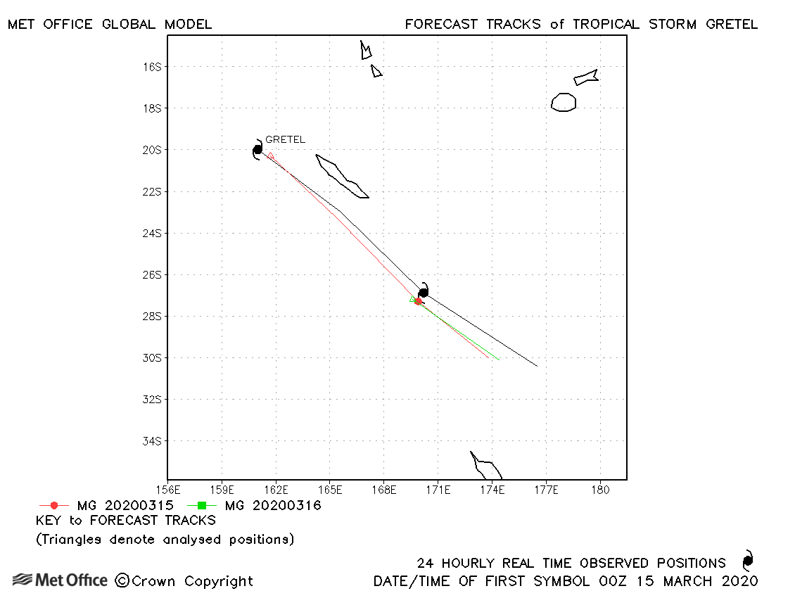
| 14-16 March | 980 mb, 55/55 knots |
There was a slow bias in some forecasts resulting in errors above the recent mean values. |
|
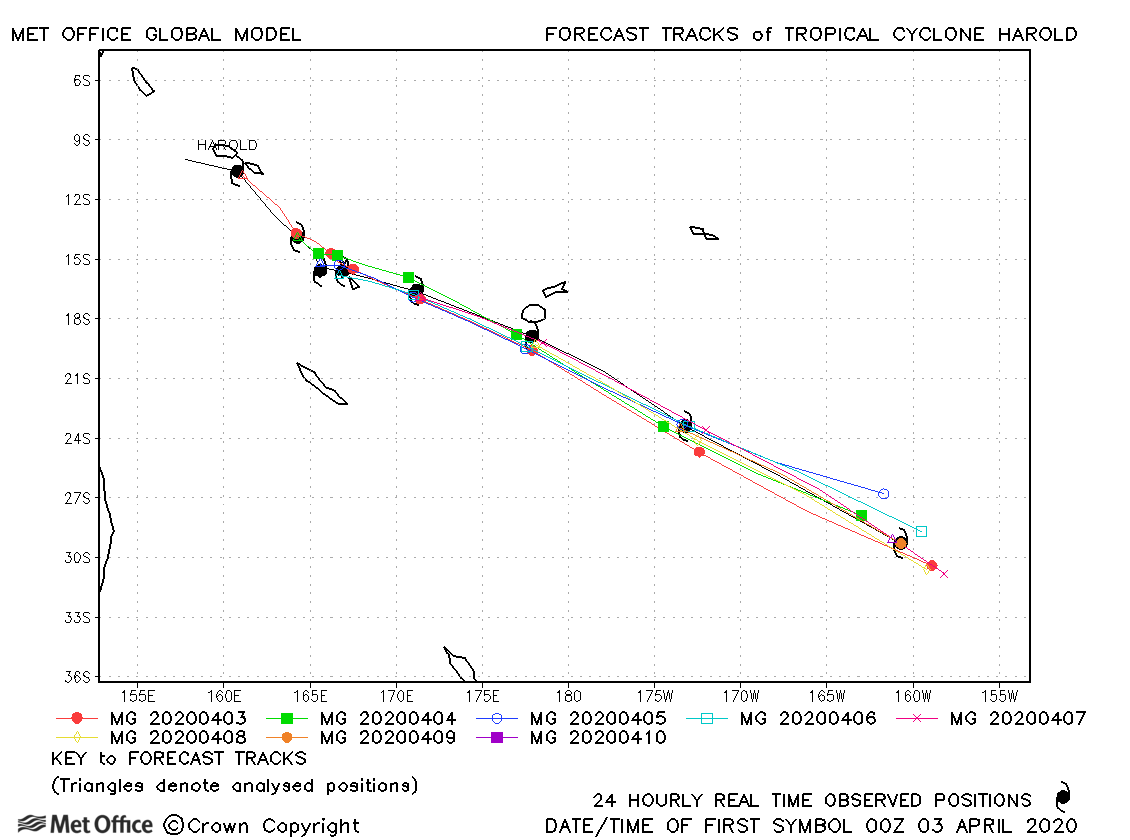
| 02-10 April | 924 mb, 145/120 knots |
Track forecasts were exceptionally good with very low errors and high skill scores. |
|
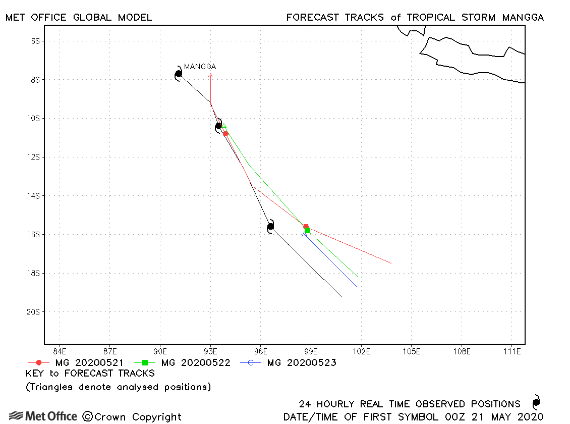
| 21-23 May | 995 mb, 40/35 knots |
Track forecasts were a little above the recent running mean for this storm. |
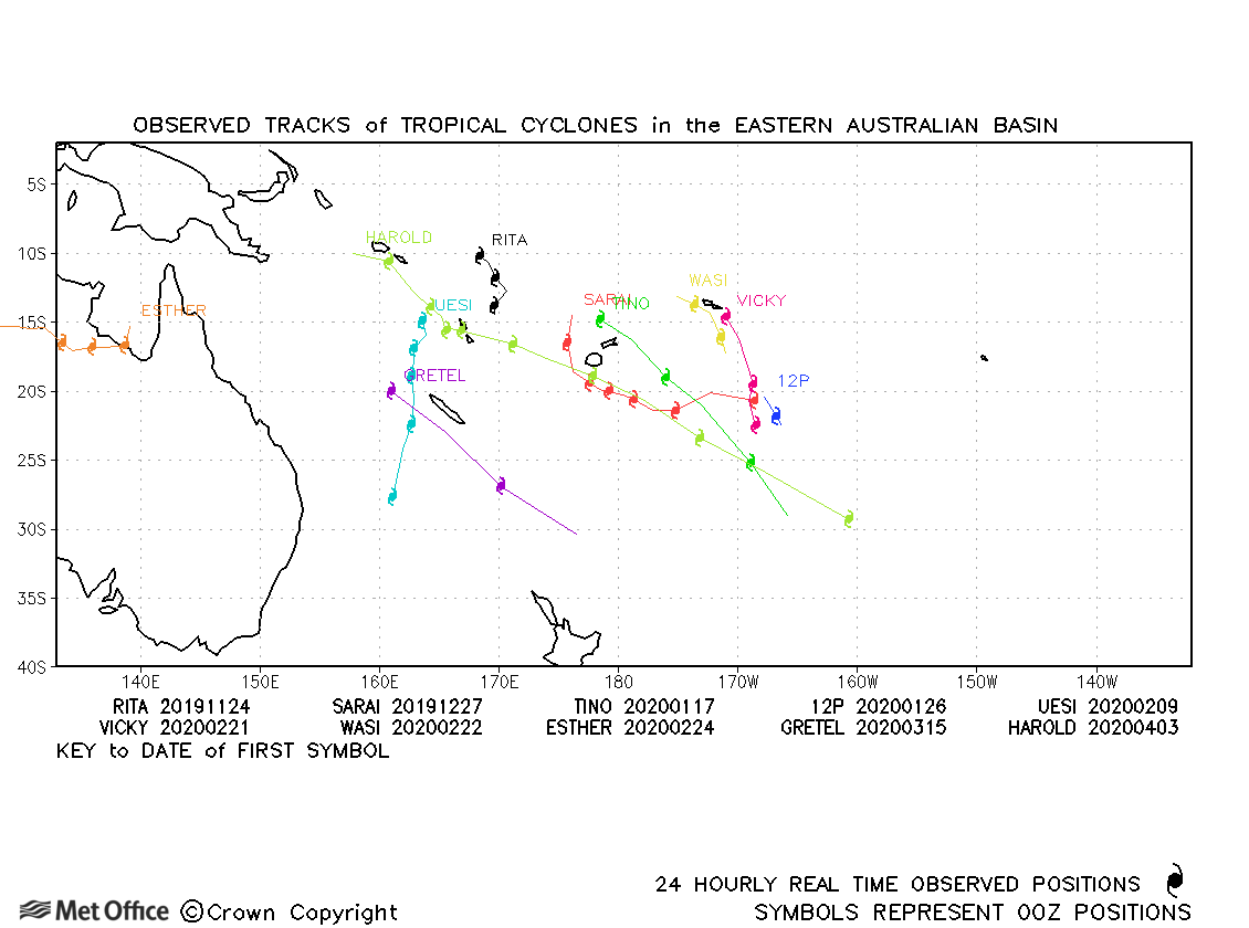
| Name & ID | Start & end dates | Central pressure, 1-/10-minute MSW | Comments on Met Office global model forecasts |
|---|---|---|---|
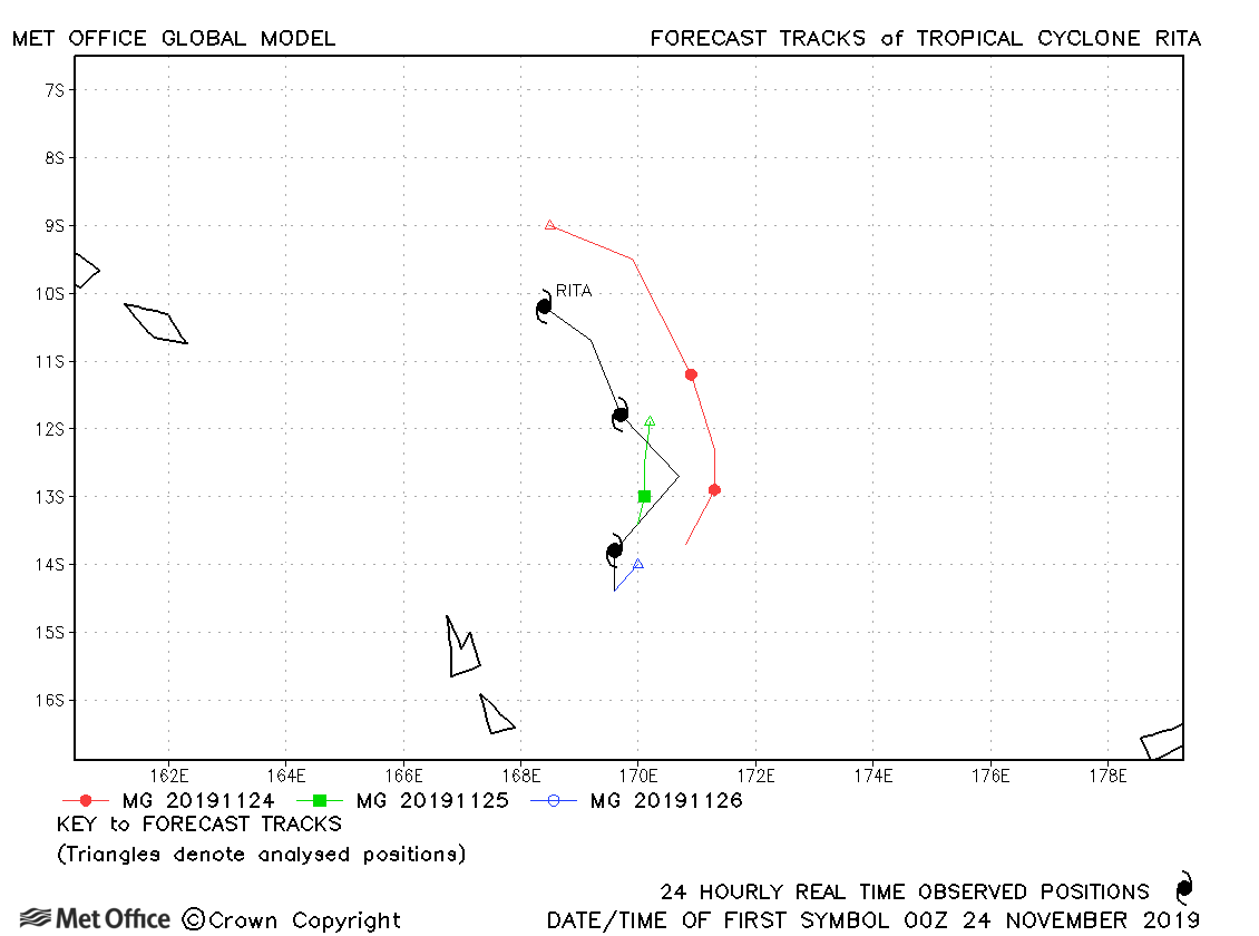
| Rita (01P) | 24-26 November | 977 mb, 65/65 knots |
Track forecast errors were slightly above last season's average. |
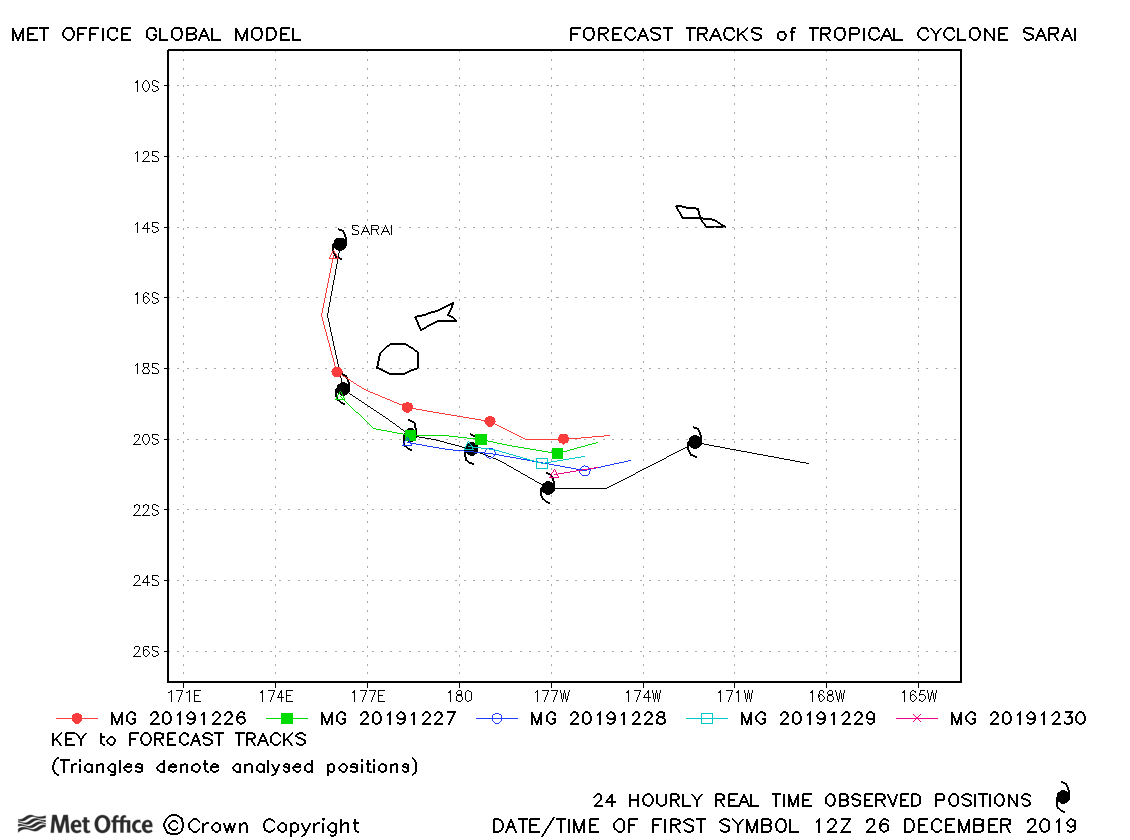
| 26 December-01 January | 972 mb, 70/60 knots |
Track forecast errors were low for this storm. |
|
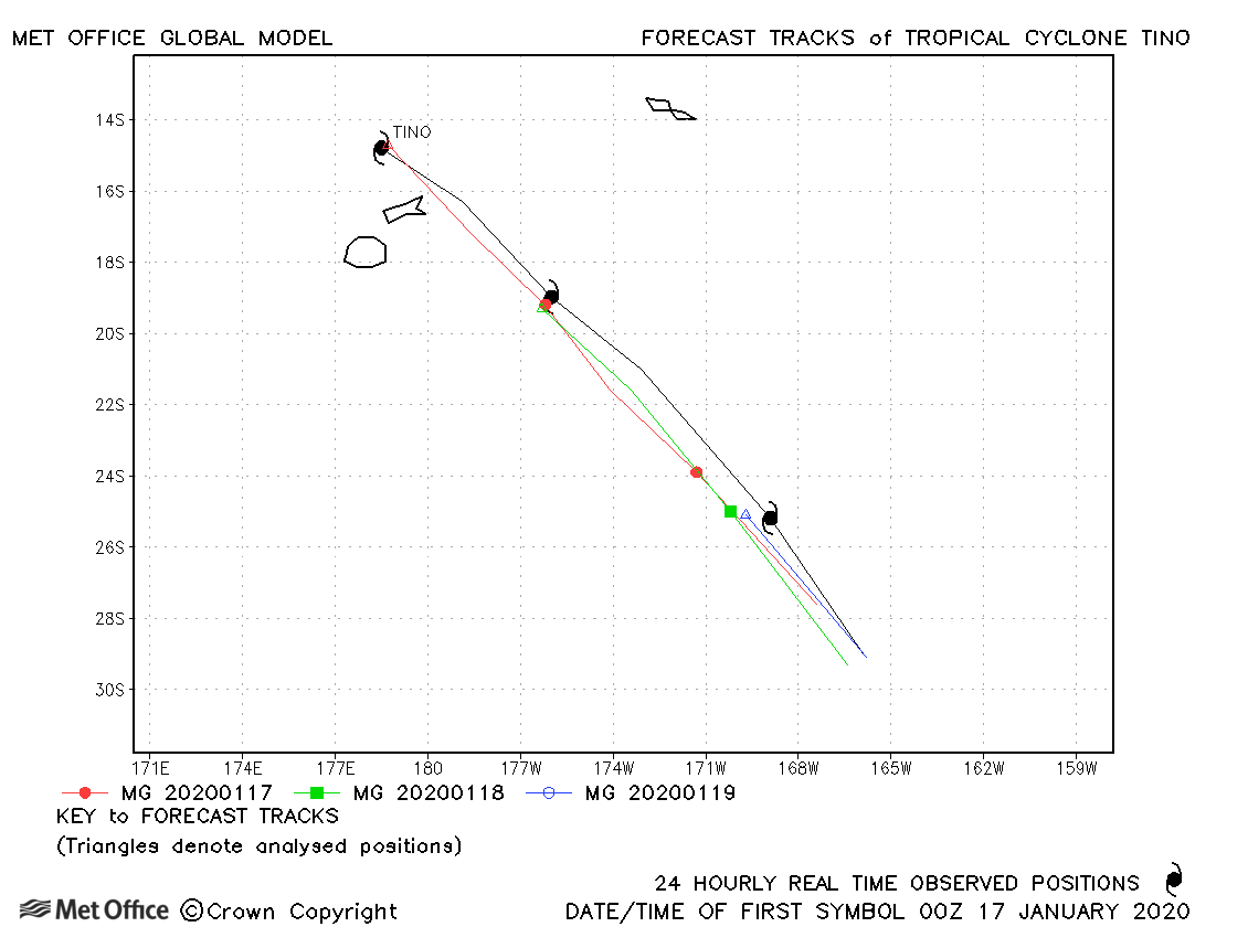
| 16-19 January | 970 mb, 70/65 knots |
Track forecast errors were low at short lead times, but there was a slow bias at longer lead times. |
|
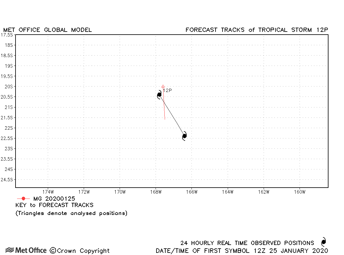
| 25-26 January | 1000 mb, 35/30 knots |
This was a short-lived storm. |
|
| 09-13 February | 970 mb, 75/70 knots |
Due to a slow and left-of-track bias, forecasts had larger track forecast errors than the recent mean values. |
|
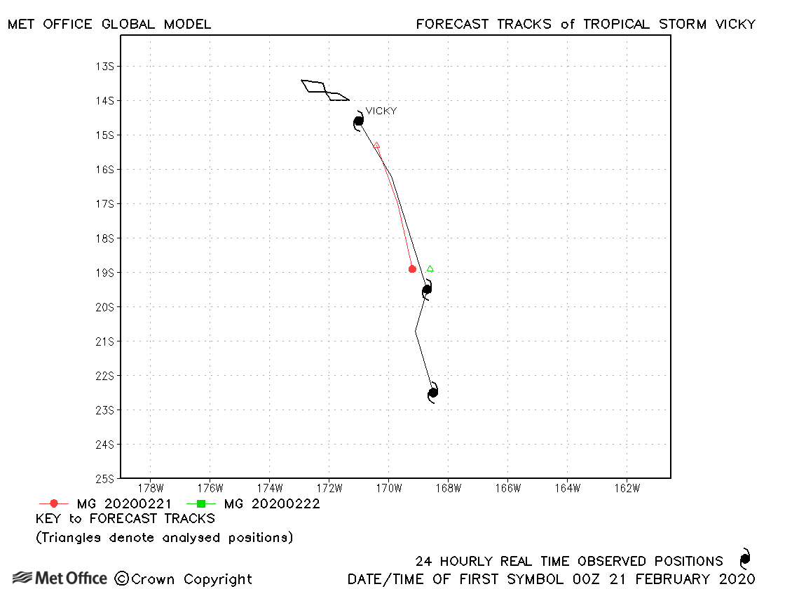
| 20-23 February | 988 mb, 45/45 knots |
Vicky was short-lived and just a few forecasts were verified. |
|
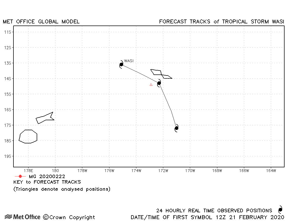
| 21-23 February | 990 mb, 55/45 knots |
Wasi was only briefly a tropical storm. |
Western Australian observed tracks in 2019-20
Eastern Australian observed tracks in 2019-20
| Name & ID | Start & end dates | Central pressure, 1-/10-minute MSW | Comments on Met Office global model forecasts |
|---|---|---|---|
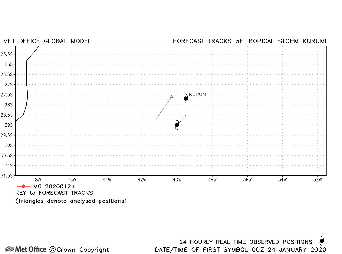
| 24-25 January | 999 mb, -/35 knots |
Kurumi was a short-lived subtropical storm with few forecasts verified. |
Note on estimated wind speeds
1-minute MSW: Maximum sustained wind (knots) averaged over one minute (JTWC Hawaii)
10-minute MSW: Maximum sustained wind (knots) averaged over 10 minutes (Southern Hemisphere RSMCs and TCWCs)
Note: Although 1-minute average winds should be stronger than 10-minute average, this may not be the case here since estimates are obtained from different warning centres.
