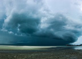
Met Office daily weather: Unsettled for many, with a mix of rain, showers, and brighter spells
Today’s forecast looks distinctly unsettled for many, with a mix of rain, showers, and brighter spells.
An area of rain and showers, some of which may be heavy, squally, or even thundery at times, will affect parts of Wales, southern England, and the Midlands during the morning. This band of wet weather will move east-northeastwards, clearing eastern England by late afternoon. A yellow weather warning for thunderstorms has been issued for parts of Wales plus central and northern England from 2am to 5pm.
Elsewhere, there will be sunny spells interspersed with showers, some of which could again be heavy and carry a risk of thunder. It will be windy in the far south and also in the far north at first, adding to the autumnal feel for some.
Thursday’s temperatures will show a north-south split. In the north, values will be higher than Wednesday and close to the seasonal average. In the south, temperatures will be near or just below average, with the highest values expected in the far south and east of England, where 20-21°C is likely. Isolated spots in Northern Ireland may reach 20°C, and 19°C is possible in the far north and east of Scotland.
⚠️ Yellow weather warning issued ⚠️
— Met Office (@metoffice) September 3, 2025
Thunderstorms across parts of Wales plus central and northern England
Thursday 0200 – 1700
Latest info 👉 https://t.co/QwDLMfRBfs
Stay #WeatherAware⚠️ pic.twitter.com/OG1cvzYg6E
As we move into Thursday night, conditions will gradually improve for most. Showers will become largely confined to north-western areas, with clear spells developing elsewhere. Winds will ease, and it will feel cooler than recent nights, particularly where skies clear.
Outlook for Friday
Friday will bring a drier and brighter day for many, especially across eastern and south-eastern areas, where sunshine is expected. A few showers are possible in western and north-western parts, with the odd isolated shower elsewhere. Later in the day, cloud and some patchy rain will spread into the far northwest, where it will also become windy. Elsewhere, winds will be mainly light to moderate, and temperatures will be around average for the time of year.
Met Office presenter and meteorologist, Honor Criswick, said: “As we head into Thursday morning, it’ll be all eyes towards the southwest. Devon, Cornwall, southern parts of Wales will once again we'll see a secondary band of heavy showers, possible thunderstorms. We need to keep an eye on this band as it moves its way north-eastwards.
READ MORE: Met Office Deep Dive: Storm season past and present
“Once again, another thunderstorm warning issued here across parts of England and Wales. Pushing its way north-eastwards and some heavy bursts of rain along with it. Hail, possible frequent lightning. So, an unsettled day once again, but we should see more sunny spells in between these showers. But, nevertheless, pretty much anywhere could catch some heavy downpours as we head into tomorrow. Still some strong gusty winds, particularly if you do catch any heavy showers, but mostly across the south.
“That strong breeze will start to ease away through Thursday afternoon. Fairly similar temperatures, highs reaching around 20 to 21° C. If you're not a fan of the unsettled wet weather, we do have high pressure starting to build across the south through Friday bringing mostly settled conditions. It will turn wet and windy for a time towards the end of the week. But low pressure is never too far away.”
Keep up to date with weather warnings, and you can find the latest forecast on our website, on YouTube, by following us on X and Facebook, as well as on our mobile app which is available for iPhone from the App store and for Android from the Google Play store.


