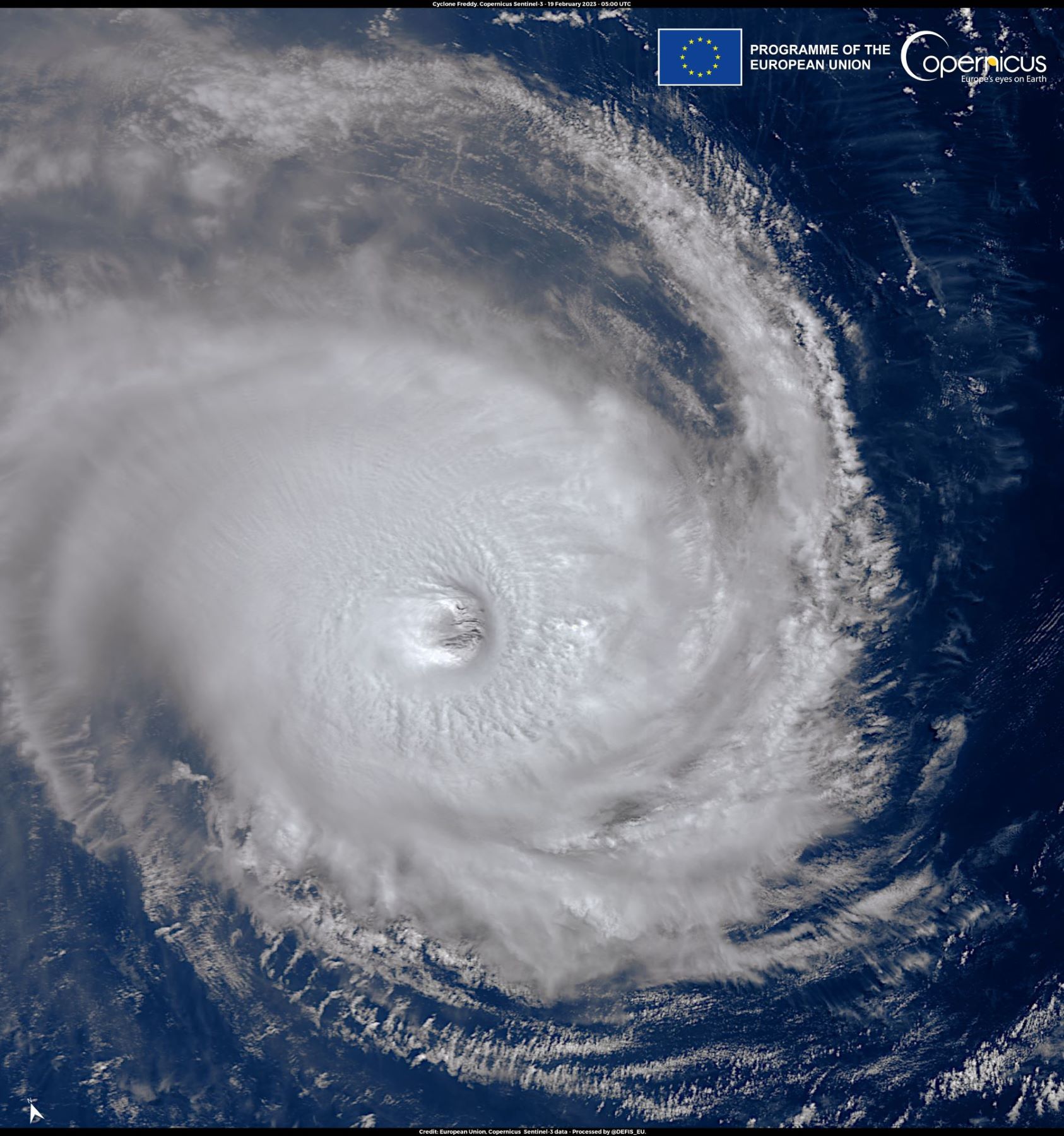
Tropical Cyclone Freddy, which has just rocked Madagascar, has been barreling through the tropical Indian Ocean for 16 days – making it one of the longest-lived systems in the southern hemisphere. It developed on 6 February off the coast of north-west of Australia and has affected island nations, including Mauritius, during its passage.
Julian Heming is a tropical cyclone expert with the Met Office. He said: “Once making landfall over Madagascar, Freddy has begun to fall apart, but the forecast models are expecting it to reform again over the Mozambique Channel – the strait separating Madagascar from continental Africa – before making a second landfall in Mozambique itself.”
Freddy made landfall just south of Mananjary, in Madagascar on Tuesday evening, with estimated 10-minute sustained speeds of 100 mph, gusts to 150 mph and a storm surge of up to one metre at and just south of the landfall location, with waves of up to 13 metres on top of the surge.
Freddy reaches the west coast of Madagascar early Wednesday evening (local).

Image: European Union, Copernicus Sentinel-3 imagery
Michael Silverstone is an Expert Operational Meteorologist with the Met Office global guidance unit. He said: “Heavy rain will affect the usually drier west of Madagascar, with 50-100 mm expected here, which is about half the February average. Later, Freddy is likely to begin strengthening again as it moves into the Mozambique Channel, becoming a severe tropical storm and maybe even regaining tropical cyclone status prior to an expected second landfall on the coast of Mozambique between Inhambane and Beira on Friday morning.
“It is likely to bring a smaller storm surge here than occurred over eastern Madagascar. Rainfall is likely to be the main hazard, with widely over 200-300 mm and locally over 500 mm of rain expected late this week and into the weekend over a large area across central and southern Mozambique and into eastern Zimbabwe, northeast South Africa and Eswatini (the average February rainfall for the affected area is roughly 100-200 mm).
“Coastal flooding and damaging, possibly destructive, winds are expected close to the landfall location in south-eastern Mozambique Friday morning, although this likely be less impactful than was seen in Madagascar. For mainland south-eastern Africa, the very heavy rainfall coming on top of a very wet recent spell will pose a significant threat of widespread flash and riverine flooding late this week and through this weekend, with an enhanced landslide threat too.”
Tropical cyclones acquire their energy from the ocean. Freddy may not have the capacity to rebuild into such an intensive system while crossing the Mozambique Channel but the main concern is the amount of moisture the system has wrapped up within it.
Julian Heming added: “Some of the forecast models are suggesting that Freddy could become quite a slow-moving system effectively hanging over Mozambique for several days unleashing extremely high rainfall totals over the country and neighbouring coastal regions. This might cause real flooding problems.”
The record for the longest-lived tropical cyclone for the southern hemisphere is Cyclone Leon-Eline, which happened in 2000, and that was a tropical storm for 18 and a half days that took a very similar track starting to the north west of Australia. It then struck Madagascar and then reformed and restrengthened in the Mozambique Channel and then went on to make landfall over Mozambique.
There is an association between the development of these long-lived tropical cyclones in the South Indian Ocean and the La Niña (cool) phase of the El Niño Southern Oscillation cycle in the tropical Pacific. There is currently a La Niña in the tropical Pacific: the third in three successive years.
Julian Heming added: “Leon-Eline and its associated flooding happened at the end of a very long, prolonged La Niña period which also produced flooding over Mozambique. It looks like we could get a similar flooding situation over the next few days in Mozambique.”


