
Higher resolution climate data is now part of the Met Office Local Authority Climate Service (LACS) following a notable update in response to user feedback.
What is the Local Authority Climate Service?
The Met Office Local Authority Climate Service (LACS) was launched in 2024 and is designed to support decision-making and adaptation planning in Local Authorities, providing them with crucial information on climate change in their area. Over 21,000 Climate Reports have been generated since the initial launch.
LACS, supported by Defra, is built using geospatial technology from Esri UK and is part of the Met Office Climate Data Portal. The LACS is a commitment made by Defra in The Third National Adaptation Programme (NAP3) and the Fourth Strategy for Climate Adaptation Reporting.
To reduce emissions and to coordinate climate action at a local level, Local Authorities need access to area specific information for their local communities and the services that they provide. The reports generated by the LACS include detailed information on climate change in the selected Local Authority at different warming levels and consider potential impacts as well as future climate risks. The tool visualises climate challenges, explores climate projections and communicates a climate story specific to local areas.
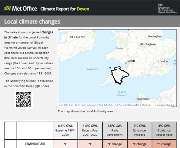
Snapshot of part of the LACS Climate Report for Devon
Whilst the LACS is particularly relevant to Local Authorities, other organisations can also access this free, open access service.
What’s new?
Professor Jason Lowe OBE, Met Office Principal Fellow Climate Science and Applications, said, “This major step will help local authorities better understand the risks from extreme weather as the climate continues to change. By making this new information more available and easier to use we aim to support building resilience in local communities.
“We have seen extreme weather becoming much more frequent as the climate changes. Our new dataset helps to better represent these extremes and how they could change in the future. It will equip local authorities to raise awareness of relevant climate risks for their area, including better information on sea-level rise for those that rely on infrastructure at the coast.”
There have been four key updates to the LACS:
1. Higher resolution climate data - UKCP Local (5 km) data is further downscaled to a 1 km resolution dataset. This enables better representation of the influence of mountains, coastlines and cities on local weather. (Information for Shetland uses the 12km UKCP Regional projections as there is no coverage of UKCP Local over Shetland).
2. Sub-local authority level information - the update to UKCP Local means we can provide sub-local authority level information at different census geographies appropriate to each region, providing more granular information within each Local Authority.
3. Sea-level rise information – in the Climate Report, a sea level rise page for non-coastal Local Authorities now includes sea level rise information for key coastal locations around the UK, providing information to those which depend on vital infrastructure at the coast.
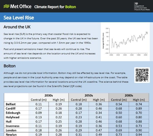
Snapshot of part of the LACS Climate Report for Bolton showing Sea Level Rise for key locations around the UK.
4. New case studies - the Case Studies section of the LACS Take Action page has been updated with new case studies demonstrating how a number of Local Authorities have been using the LACS in adaptation planning.
What difference will the higher resolution data make?
Rachel Toresen-Owuor from Local Partnerships said, "LACS has already been a catalyst for a step change in how many local authorities understand how climate change at the local level will impact on delivery of services. The updates to LACS will support more in-depth, localised exploration for risk assessments and crucially how to adapt and redesign service delivery in a changing climate, to better serve and support communities and businesses."
The data provided in the previous version of the LACS was the best available information that was able to be released at the time. The information remains valid and can continue to be used. The data now available in the LACS, however, offers a more granular view of future projections of metrics within Local Authorities.
The underlying data in the LACS has gone from using our UKCP Regional product to UKCP Local since its launch and now, a 1 km dataset has been derived from this UKCP Local data. Additionally, this latest update to the LACS also reflects a recent update to the UKCP Local data which added four new model members from the 5th coupled model intercomparison project - CMIP5. This updated version of UKCP Local has a wider spread of plausible future climate conditions and therefore provides an enhanced representation of uncertainty.
Miles Gabriel, Head of Business Development (Government), Climate & Disaster Response at Esri UK, said, “Through the Met Office Local Authority Climate Service, it’s been great to see how Esri’s geospatial software is supporting adaptation planning. This latest update, featuring higher‑resolution data, further strengthens local decision‑making and highlights the value of the partnership between the Met Office and Esri - combining cutting‑edge climate insight with the world’s leading GIS platform.”