Typhoon Ragasa has now cleared the Luzon Strait and is currently tracking northwest, with gradual weakening expected.
Ragasa remains a very strong typhoon at present, and is forecast to ease to sustained winds of 80–90 mph by Wednesday as it nears the Chinese coast. Landfall is anticipated on Wednesday between northern Hainan and Macau. After landfall, Ragasa is expected to gradually decay as its circulation drifts west, with only a small chance of any redevelopment as it briefly passes across the northern Gulf of Tonkin early on Thursday.
Heavy rainfall of 150–250 mm is expected around the landfall location, with a broader swathe of 75–100 mm across the coast. The heavy rainfall caused by Ragasa’s broad circulation, which is likely distinct from the wind and surge hazard, will continue to be monitored as the situation evolves.
In this blog we’ll look at what typhoons are, how and where they form, and the potential impacts they bring.
What is a typhoon?
A typhoon is a type of tropical cyclone, a rapidly rotating storm system characterised by a low-pressure centre, strong winds, and heavy rain. The term “typhoon” is used for storms that form in the north-west Pacific Ocean, but similar systems are known as hurricanes in the Atlantic and north-east Pacific, and cyclones in the Indian Ocean and south-west Pacific. Despite the different names, these storms all result from the same meteorological processes.
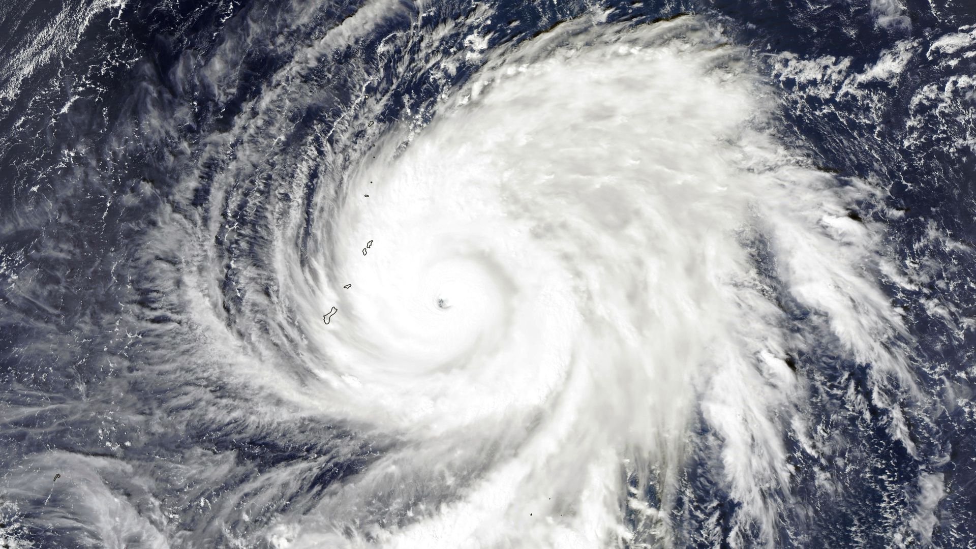
The eye of Typhoon #Ragasa is currently located directly over Calayan Island just north of Luzon, the largest island of the Philippines. Ragasa is the strongest western Pacific typhoon for almost two years with a central pressure near 905 millibars. pic.twitter.com/cjKlaJUEY4
— Met Office Storms (@metofficestorms) September 22, 2025
How do typhoons form?
Typhoons begin as clusters of clouds over warm tropical oceans. These clusters amalgamate and start to rotate, forming a tropical depression. When sustained wind speeds around the depression reach 39 mph, the system is classified as a tropical storm and is assigned a name. If the winds intensify further and reach 74 mph, the storm is then classified as a typhoon, hurricane, or cyclone depending on its location.
The formation of typhoons is closely linked to sea surface temperatures. Warm ocean waters provide the energy needed for these storms to develop and intensify. This is why typhoons are most commonly found in tropical regions between 5° and 30° latitude. The process is also influenced by the coriolis effect, which causes the storm’s surface winds to rotate counter-clockwise in the northern hemisphere and clockwise in the southern hemisphere.
The lifecycle and movement of typhoons
Once formed, typhoons typically move westward due to prevailing easterly winds and gradually drift towards the poles. As they move into areas dominated by westerly winds in the middle latitudes, their direction can reverse, sending them eastward. Typhoons can travel at speeds of up to 30 mph and cover distances of around 3,000 miles before dissipating. If a tropical cyclone moves far enough polewards, it can transition into an extratropical or post-tropical storm, which may still bring severe weather to regions outside the tropics.
READ MORE: Hurricanes, typhoons and tornadoes: What’s the difference?
Where and when do typhoons occur?
Typhoons are most common in the north-west Pacific Ocean, where they can occur all year round, with the main season running from July to November. In the northern hemisphere, the broader tropical cyclone season lasts from June to November, peaking in September. In the southern hemisphere, the season runs from November to April, although storms are less frequent there.
Globally, tropical cyclones occur in seven main basins, each with its own season:
- Atlantic basin: June to November
- North-east Pacific basin: late May/early June to late October/early November
- North-west Pacific basin: all year, mainly July to November
- North Indian basin: April to December
- South-west Indian basin: late October/early November to May
- South-east Indian/Australian basin: late October/early November to May
- Australian/south-west Pacific basin: late October/early November to May
Potential impacts of typhoons
Typhoons can have devastating impacts on the regions they affect. The most immediate threats are damaging winds, heavy rainfall, and storm surges, which can lead to flooding, landslides, and widespread destruction of infrastructure. Coastal areas are particularly vulnerable, as landfalling typhoons can bring sustained winds well above hurricane strength and torrential rain over large areas.
The impacts of typhoons are not limited to the tropics. As these storms move polewards and transition into extratropical systems, they can still bring severe weather to higher latitudes. For example, the UK is occasionally affected by the remnants of tropical cyclones, such as ex-Hurricane Ophelia in 2017. Intense mid-latitude depressions, like the Great Storm of 1987, can also produce near hurricane-strength winds.
READ MORE: A look back at the 2024/25 storm season
Typhoons are among the most powerful and destructive weather systems on Earth. The recent example of Ragasa highlights the need for accurate forecasting and preparedness in regions at risk. By understanding how typhoons form, move, and impact the environment, meteorologists and emergency planners can better protect lives and property.
Keep up to date with weather warnings, and you can find the latest forecast on our website, on YouTube, by following us on X and Facebook, as well as on our mobile app which is available for iPhone from the App store and for Android from the Google Play store.