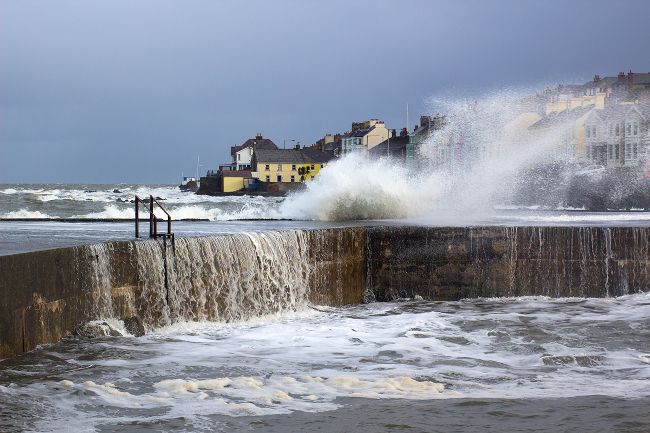
Storm Boelo will bring a wet and windy weekend to much of the UK, with the strongest winds expected across Scotland, Northern Ireland and northern England.
Gusts of 60 to 70 mph are possible, with potentially higher speeds in exposed locations.
Heavy rain will spread eastwards during Saturday, followed by further rain and strong winds in northern areas on Sunday. Although southern England and Wales should become drier, it will remain blustery and feel chilly across the country.
What is the UK weather forecast for this weekend?
The UK weekend forecast is dominated by Storm Boelo, which will arrive from the Atlantic during Saturday.
Storm Austen will move eastwards during Friday, leaving a brief ridge of high pressure in its wake. However, this short period of quieter weather will quickly end as Storm Boelo approaches north-western parts of the UK.
A powerful jet stream is driving this unsettled pattern. The jet stream is picking up areas of low pressure over the Atlantic and helping to steer them towards the UK, resulting in successive spells of wet and windy weather.
Where and when will Storm Boelo arrive?
Storm Boelo will approach the northwest of the UK during Saturday, bringing strengthening winds and outbreaks of heavy rain.
The early hours of Saturday will be relatively calm, with many places starting dry but chilly beneath largely cloudy skies. Conditions will then deteriorate from the west as rain and strong winds move into Northern Ireland, Scotland, Wales and western England.
Rain will spread eastwards through the morning and afternoon. Western coastal areas and higher ground exposed to the wind are likely to see some of the most persistent rain. By Saturday afternoon, most parts of the UK will have experienced rain and increasingly strong winds.
How strong will the winds be on Saturday?
Saturday will be windy across the UK, but the strongest gusts are expected in Scotland, Northern Ireland and northern England.
Wind gusts of 60 to 70 mph are possible in these areas, with potentially higher speeds in some exposed locations. Coastal districts and routes over higher ground will be particularly susceptible to gusty conditions.
The winds will continue to strengthen later on Saturday and into Sunday. Rain should gradually ease across parts of southern England and Wales, but it will remain very blustery.
Met Office warnings have been issued for strong winds from Friday, Saturday and into Sunday, covering Northern Ireland, Scotland and parts of northern England. Strong winds could generate large waves around exposed coastlines and cause travel disruption. People planning journeys should check the latest forecast and warnings before travelling and allow additional time where necessary.
Will it rain on Sunday?
Sunday will remain wet and windy across Scotland and northern England. Heavy rain is expected to continue across northern and north-eastern Scotland for much of the day.
Behind the main area of rain, showers will affect Northern Ireland and northwest England. Some could be heavy, with a chance of thunder, and a few may travel farther east across England.
Wales, southern England and south-eastern England should have a considerably drier day than Saturday. Nevertheless, strong and gusty winds will continue, making it feel chilly even during brighter spells.
Temperatures will generally reach between 11°C and 14°C. However, the strength of the wind, especially in northern areas, will make it feel colder than the temperature suggests.
How long will the unsettled weather last?
The unsettled conditions are expected to continue into the beginning of next week because the jet stream will remain strong.
Another area of low pressure could bring further wet and windy weather on Monday, with north-western parts of the UK again likely to experience the most unsettled conditions.
READ MORE:
How to find wind and gust information in the Met Office app
What does it take for a storm to be named?
Week ahead: First named storm of the season set to arrive on Friday
Weather bombs: What causes explosive cyclogenesis?
Keep up to date with weather warnings, and you can find the latest forecast on our website, on YouTube, by following us on X and Facebook, as well as on our mobile app which is available for iPhone from the App store and for Android from the Google Play store.