Storm Floris has been officially named by the Met Office, with disruptive winds and heavy rainfall expected to affect the northern half of the UK from Monday 4 August into Tuesday 5 August 2025.
A Yellow wind warning has been issued, covering Northern Ireland, north Wales, northern England, and all of Scotland. The warning is in place from 6am on Monday until 6am on Tuesday.
While the timing may seem surprising, storms in August are not as unusual as many might think.
Summer storms: not as rare as they seem
Although named storms are more commonly associated with the colder months of autumn and winter, summer storms do occur and can be just as impactful. Historical records show several named storms in August over recent years:
- Lilian – 22 August 2024
- Antoni – 4 August 2023
- Betty – 18 August 2023
- Ellen – 18 August 2020
- Francis – 24 August 2020
Even late July has seen named storms, such as Evert on 29 July 2021. These examples highlight that while less frequent, summer storms are not out of the ordinary.
READ MORE: 40 degree heat? 492-mile ‘rain bomb’? Met Office headline weather review
Storm Floris is the sixth named storm of the 2024/2025 season, following Storm Éowyn in January. The occurrence of a named storm in August is a reminder that severe weather can happen at any time of year.
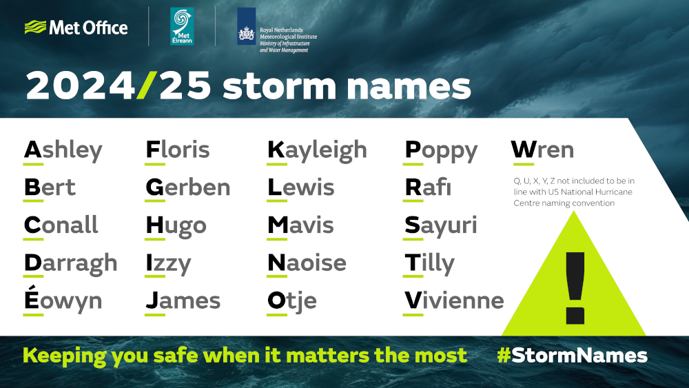
Why do we name storms?
Storm naming is a collaborative initiative between the Met Office, Met Éireann in Ireland, and KNMI in the Netherlands. Now in its eleventh year, the scheme aims to improve communication and public awareness around severe weather events.
Each organisation contributes names to the annual list, selecting from the alphabet while excluding Q, U, X, Y, and Z in line with international conventions. However, there are times in which the public is asked to submit their own ideas for storm names, as was the case this year.
Names are chosen with care, considering pronunciation, cultural relevance, and potential sensitivities across the three countries.
While the UK, Ireland and the Netherlands collaborate as the western storm naming group, they are not the only countries in Europe to name storms. Spain, Portugal, France, Belgium and Luxembourg form the south-western storm naming group, while Norway, Sweden and Denmark make up the northern group. Each of these regional partnerships works together to name storms that are expected to have significant impacts in their respective areas, helping to ensure consistent communication and public awareness across borders.
Beyond Europe, tropical and subtropical cyclones in the North Atlantic are named by the US-based National Hurricane Center once they reach wind speeds of at least 40 mph. These names are drawn from six rotating alphabetical lists maintained by the World Meteorological Organization (WMO), alternating between masculine and feminine names. If a storm is particularly deadly or costly, its name is retired from the list and replaced at the next WMO meeting to avoid confusion in future seasons.
The naming process is not just about tradition, it’s about safety. A storm is named when it is expected to have medium or high impacts, typically when amber or red warnings are anticipated. This helps the public and media to quickly understand the severity of the weather and take appropriate action.
Does naming storms make a difference?
Evidence shows that naming storms significantly improves public awareness. Post-storm surveys following Storm Babet revealed that 97% of people in amber and red warning areas were aware of the warnings, and 89% took action as a result. This demonstrates the effectiveness of storm naming in helping people prepare and stay safe.
READ MORE: Met Office 10-day trend: Stormy conditions to end July
Climate change
In the current climate, there is no clear trend in the number or intensity of windstorms. These events naturally vary from year to year and decade to decade, making long-term patterns difficult to detect.
However, climate projections suggest that winter windstorms may become slightly more frequent and intense over the UK in the future. This includes a potential increase in disproportionately severe storms. While confidence in these projections is medium due to differing model outcomes, the possibility underscores the importance of continued research.
Windstorms can lead to coastal impacts such as storm surges and high waves, which are expected to worsen with rising sea levels. Understanding how climate change may influence storm behaviour is vital for future preparedness.
As we continue to experience varied and sometimes extreme weather, the importance of storm naming and public awareness remains clear. The Met Office is currently inviting suggestions for storm names for the 2025/26 season. While summer may be dominated by heatwaves, it’s also a time to think ahead and prepare for the storms that may come.
Keep up to date with weather warnings, and you can find the latest forecast on our website, on YouTube, by following us on X and Facebook, as well as on our mobile app which is available for iPhone from the App store and for Android from the Google Play store.