Since the end of February, high pressure has been the dominant force in our weather, bringing mostly dry and sunny conditions. But why is this happening?
To understand this, we need to delve into the concepts of high pressure, blocking patterns, and the amplified jet stream.
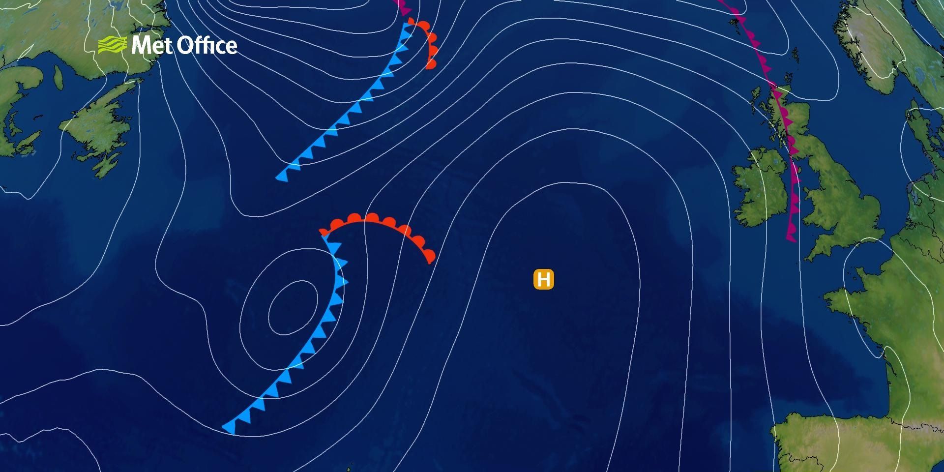
What is high pressure?
High pressure systems are areas where the atmospheric pressure is higher than the surrounding areas. These systems are characterized by descending air, which reduces cloud formation and leads to settled weather conditions. In the northern hemisphere, winds in a high-pressure system blow in a clockwise direction. High pressure systems can remain stationary for extended periods, creating what is known as a "blocking high."
READ MORE: Learn about high and low pressure
Blocking patterns and the jet stream
Blocking patterns occur when an area of high pressure remains nearly stationary and distorts the usual eastward progression of pressure systems. This can lead to prolonged periods of dry and settled weather in the area under the high pressure, while areas on the periphery may experience wet and windy conditions. Blocking patterns are often associated with an amplified jet stream.
The jet stream is a fast-flowing ribbon of air high in the atmosphere that helps to steer weather systems around the globe. An amplified jet stream is one that has large waves, or "meanders," which can create areas of high and low pressure. When the jet stream dips down and then rises back up, it can create areas of high-pressure underneath, leading to blocking patterns.
For the past few months, we have been experiencing an amplified jet stream, which has created a blocking high over our region. This has resulted in mostly dry and sunny weather, with high pressure dominating our weather for the last few months. Occasionally, the high pressure has drifted towards Europe, allowing some weather systems to come through, but it has quickly rebuilt, maintaining the dry and settled conditions.
READ MORE: Learn about blocking patterns
How are these conditions affecting us now?
This pattern is not uncommon, but what is unusual is the duration of the blocking high. It has been with us since the end of February, and there are indications that it will continue for the next few weeks. This prolonged period of high pressure has led to one of the warmest starts to May on record and one of the sunniest Aprils.
The impact of this blocking high on our weather is significant. It has brought mostly dry and sunny conditions, with temperatures increasing day by day. However, the high pressure has also brought cooler temperatures to some areas, particularly in the northeast, where a breeze has knocked down the temperatures slightly.
Temperatures are on the rise again, but will it get as warm as last week? Honor Criswick has the answers in this week's Deep Dive and takes a look at some of the spring 2025 stats so far 👇https://t.co/qkMId5ANVC
— Met Office (@metoffice) May 6, 2025
Keep up to date with weather warnings, and you can find the latest forecast on our website, on YouTube, by following us on X and Facebook, as well as on our mobile app which is available for iPhone from the App store and for Android from the Google Play store.