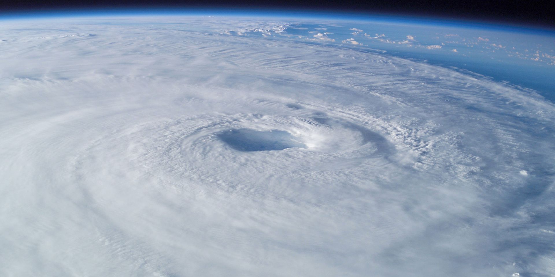
Hurricanes, or tropical cyclones, are among the most powerful and destructive weather systems on Earth. But not every swirling storm over the ocean qualifies as a hurricane.
So, when is a hurricane not a hurricane? The answer lies in how we classify these systems based on their wind speeds, structure, and energy sources.
Understanding the terminology
The term “hurricane” is used specifically for tropical cyclones that form in the Atlantic and northeast Pacific. In the northwest Pacific, they are called “typhoons”, and in other regions such as the Indian Ocean and South Pacific, they are referred to simply as “cyclones” or “tropical cyclones”.
All of these systems fall under the umbrella of tropical cyclones — low-pressure systems that form over warm tropical or subtropical waters, with organised thunderstorm activity and rotating winds near the surface.
READ MORE: Met Office weekend weather forecast: Largely dry and bright Bank Holiday weekend
The stages of a tropical cyclone
Tropical cyclones are classified by their wind speeds:
- Tropical depression: Wind speeds up to 38 mph.
- Tropical storm: Wind speeds between 39 and 73 mph.
- Hurricane: Wind speeds of 74 mph or more.
These classifications are part of the Saffir-Simpson Hurricane Wind Scale, which categorises hurricanes from Category 1 (minimal damage) to Category 5 (catastrophic damage), based on sustained wind speeds.
What fuels a hurricane?
Hurricanes are powered by warm, moist air rising from tropical oceans. Several conditions must align for a hurricane to form:
- Sea surface temperatures of at least 27°C.
- Converging winds at the surface to lift air.
- Low wind shear to allow vertical cloud development.
- Sufficient distance from the equator to enable the Coriolis effect, which imparts spin.
As the system intensifies, it becomes a self-sustaining heat engine, drawing more energy from the ocean and releasing it through condensation in towering cumulonimbus clouds.
READ MORE: 600-mile rainstorm? Hotter than Ibiza? Met Office weather headline review
When a hurricane is no longer a hurricane
Hurricanes cannot form in the UK due to our cooler sea temperatures. However, we can still feel their effects when they transition into what are known as “ex-hurricanes” or “extra-tropical cyclones”.
This transformation, called extratropical transition, occurs when a hurricane moves into higher latitudes and its energy source shifts from warm ocean waters to the interaction between warm and cold air masses. While no longer classified as hurricanes, these systems can still produce hurricane-force winds and significant impacts - as seen with ex-Hurricane Ophelia in 2017.
A recent example: Erin
A recent Atlantic system, formerly Hurricane Erin, illustrates this transition. As Erin moves northwards across the mid-Atlantic, it will lose its tropical characteristics but remain a powerful area of low pressure. While no longer a hurricane, it looks likely to generate large waves and swells, particularly affecting western UK coasts. This highlights how ex-hurricanes can still pose hazards, even after losing their official hurricane status.
Understanding the distinctions between tropical depressions, storms, hurricanes, and ex-hurricanes is vital for accurate forecasting and public safety. While the name may change, the potential for severe weather remains, and being prepared is key.
Keep up to date with weather warnings, and you can find the latest forecast on our website, on YouTube, by following us on X and Facebook, as well as on our mobile app which is available for iPhone from the App store and for Android from the Google Play store.