The upcoming weekend brings a mixed picture across the UK, with a combination of cloudy skies, mist and fog, some showery rain, and the occasional brighter spell.
While neither day looks especially wet or stormy, there will be subtle regional variations to keep in mind. Here’s the full forecast for Saturday and Sunday, based on the latest information.
A weakening area of low pressure, previously centred to the west of Ireland, continues to lose its influence as we move into the weekend. As this system fills and drifts away, the pressure pattern across the UK becomes increasingly slack. This lack of strong steering winds is a key feature of the forecast, allowing mist, fog, and low cloud to develop and linger in places. At the same time, subtle shifts in moisture and weak frontal features will cause showery rain to develop intermittently.
With such slack patterns, small changes in cloud cover can make a big difference to how the weather feels. Areas stuck under persistent low cloud or fog will feel decidedly chilly, while any sunshine that does break through could lift temperatures to around or just above average for mid‑January.
A bright afternoon for many, with plenty of sunny spells ⛅
— Met Office (@metoffice) January 16, 2026
A scattering of blustery showers, most frequent in the west 🌦️ pic.twitter.com/sIOn61A64H
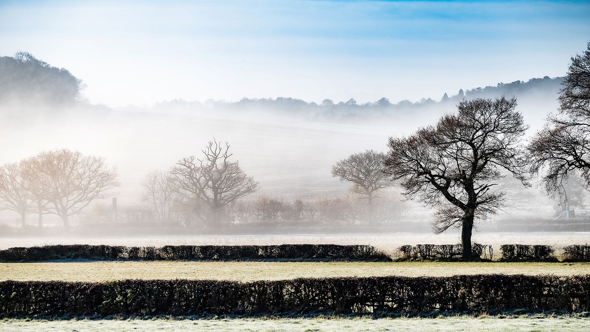
Saturday: grey for many, with mist, fog and scattered showers
Saturday begins on a quiet but rather murky note for large parts of the country. The calm conditions overnight will have allowed widespread mist and fog to form, especially across eastern England and parts of western Northern Ireland. Radiation fog is also possible in areas where skies cleared sufficiently overnight. This type of fog forms through radiative cooling at the surface and, although common in winter, can be slow to lift.
Some low cloud and general murkiness may persist well into the morning across eastern England, covering areas such as Lincolnshire, Yorkshire and the east Midlands. Western Northern Ireland may also start the day in similarly grey and foggy conditions.
Elsewhere, areas that begin with clearer skies are still likely to see patches of fog, but these may lift more readily through the morning. Visibility could be quite poor at times, so travellers should allow extra time for journeys.
As the day progresses, many places remain largely dry but quite cloudy. The weak, slack flow means cloud will be slow to break, and some spots may stay grey all day. However, where sunshine does appear, temperatures will respond, rising into the high single digits or even edging into double figures across parts of Cornwall.
Showery bursts of rain are possible almost anywhere, though forecasting their exact location is difficult due to the lack of organised systems. Scotland looks likely to see a more persistent band of showery rain moving northwards. Around the Irish Sea, affecting eastern Northern Ireland, parts of Wales, and southwest England, a few showers may drift through too. Even away from these areas, isolated spots of light rain cannot be ruled out.
Where the fog or low cloud hangs on, it will feel quite cold, and temperatures may struggle despite the relatively mild air mass.
READ MORE: January weather extremes: a look back records from past events
As we move into Saturday night, the influence of the earlier low pressure continues to fade, leaving an even slacker pattern of air flow across the UK. This increases the chance of further mist and fog developing, particularly in areas where skies clear even partially.
Some model guidance suggests the possibility of a weak system edging in from the southeast during the early hours of Sunday. Confidence in this feature remains low, with recent runs shifting its track and timing, but it may bring a spell of light rain to parts of central or eastern England. Regardless of this, most places begin the night dry, though widespread murk and fog could again become an issue.
Where temperatures drop below freezing under clearer skies, pockets of freezing fog are possible. These areas may see particularly difficult travel conditions by dawn on Sunday.
Sunday: mostly dry with variable cloud and a weak band of rain
Sunday morning brings another risk of low cloud, fog and generally murky conditions across much of the country. As on Saturday, any fog could be stubborn and slow to lift, especially where the air is moist and winds remain light.
If the weak frontal feature from the southeast materialises, some areas of central and northeastern England may see a spell of light rain early in the day. This rain does not look heavy but could make for a damp start.
For many parts of the UK, Sunday looks drier overall than Saturday, with fewer showers expected. The weak band of rain, if it develops, should gradually move northwards through the day, affecting parts of central England and the northeast before slowly fading away.
READ MORE: Understanding the Met Office’s WeatherReady preparedness work
Elsewhere, some regions are likely to see breaks in the cloud, especially across East Anglia, Kent, western Wales, northwest England and parts of Cornwall. These sunnier intervals could lift temperatures into the high single digits or low double digits, similar to Saturday. However, in areas where the cloud lingers it will continue to feel cold.
Looking ahead to early next week
Looking beyond the weekend, the UK remains in a complex pattern. Atlantic systems will continue approaching from the west, bringing periods of rain and potentially breezier spells. Meanwhile, high pressure is building to the east over Scandinavia. The exact positioning of this high will determine how far and how quickly Atlantic fronts are able to progress into the UK. As the week goes on, and particularly toward next weekend, there is an increasing chance that colder air could spread westwards, lowering temperatures and potentially altering the character of the weather.
Keep up to date with weather warnings, and you can find the latest forecast on our website, on YouTube, by following us on X and Facebook, as well as on our mobile app which is available for iPhone from the App store and for Android from the Google Play store.