After weeks of dry, sunny weather across much of the UK, this week’s Met Office Deep Dive confirms a significant shift is on the horizon, just in time for the late May Bank Holiday and half-term break.
While the news may disappoint those with outdoor plans, it brings a welcome change for gardeners and farmers who have been hoping for rain.
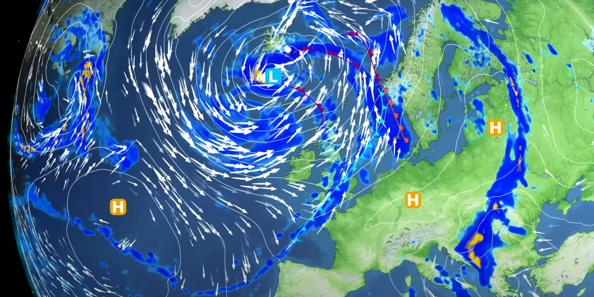
So what does the immediate weather picture look like? Showers are expected across Northern Ireland and the Republic of Ireland, with some potentially heavy and thundery. As we move into midweek, a band of rain is set to sweep across southwest England and South Wales during the early hours, before pushing eastwards. Simultaneously, another system will descend from the north, bringing intense showers to Wales and southern and central England. Some of these could include thunder and hail, with rainfall totals reaching 10–15mm in just a few hours.
The bank holiday weekend sees a marked change in weather type, with many areas seeing rain or showers and more unsettled conditions, which remain into next week.
— Met Office (@metoffice) May 21, 2025
Read more in our latest Press Release ⤵
READ MORE: Why has spring been so warm and dry so far this year?
Despite the wet spells, large parts of the UK will still enjoy warm temperatures, with highs in the low to mid-20s. Coastal areas, however, will feel cooler due to persistent northerly winds. Thursday looks drier overall, though scattered showers remain possible.
A notable feature of this week’s forecast is the potential for a late-season frost on Friday morning, particularly in rural areas. This is unusually late given the proximity to meteorological summer and could pose a risk to gardeners. However, temperatures are expected to rise again over the weekend.
A deeper look at the meteorological drivers behind the change shows a strengthening jet stream, influenced by a sharp temperature gradient across North America, is helping to steer low pressure systems toward the UK. This will bring more unsettled weather through the Bank Holiday weekend, especially from Saturday into Sunday, with widespread rain and blustery winds. Eastern and southeastern areas may stay dry longer, with rain arriving later and likely being lighter.
The bank holiday weekend sees a marked change in weather type, with many areas seeing rain or showers and more unsettled conditions, which remain into next week.
— Met Office (@metoffice) May 21, 2025
Read more in our latest Press Release ⤵
READ MORE: How close are we to breaking spring records?
Looking further ahead, the models suggest a return to more settled conditions during the first and second weeks of June. High pressure is expected to rebuild, particularly from the south, bringing drier and sunnier weather back to much of the UK. While it may not match the prolonged dry spell of recent weeks, it offers hope for more stable conditions as summer approaches.
The coming days will bring a mix of wet and dry spells, with a notable shift toward more changeable weather. For those with outdoor plans, it’s a good time to stay updated with the latest forecasts, and if you’re attending BBC Radio 1’s Big Weekend, from May 23 to May 25, check out our forecast for the weekend. Despite the much needed rain, there’s light at the end of the tunnel for sunworshippers as June promises a return to brighter skies.
Keep up to date with weather warnings, and you can find the latest forecast on our website, on YouTube, by following us on X and Facebook, as well as on our mobile app which is available for iPhone from the App store and for Android from the Google Play store.