After weeks of seemingly relentless rain, this weekend finally brings something a little different for the UK’s weather story.
While it won’t mark the end of unsettled conditions, many of us will notice longer gaps between weather systems and a brief but welcome spell of drier, brighter weather to start the weekend.
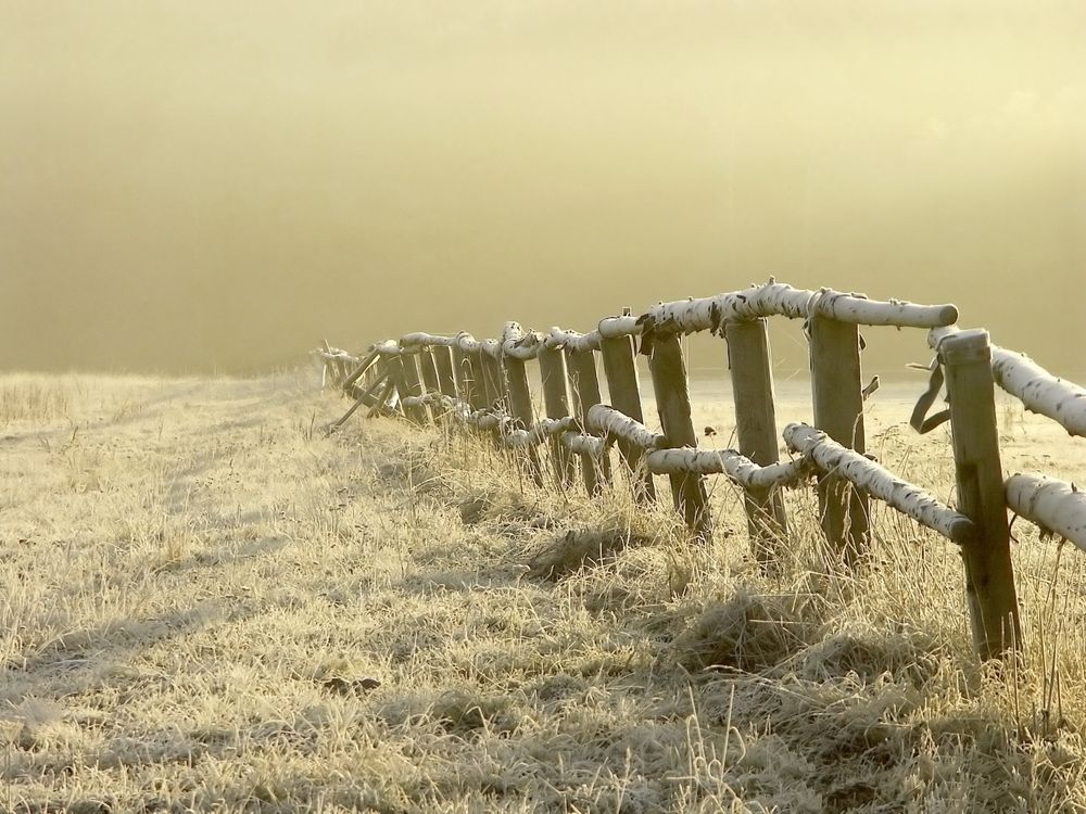
A crisp and frosty start to Saturday
A ridge of high pressure arrives as we move into Saturday, allowing skies to clear widely on Friday night. With light winds and those clear conditions in place, temperatures will fall sharply. Many parts of the UK are set to experience their first widespread frost in some time, with sub‑zero values expected for large areas as Saturday begins.
It will be a crisp but bright start for most, with widespread sunshine greeting the morning. A few exceptions stand out: some wintry, “sleepy” showers may drift onto the east coast of England early on, and a few showers could also affect Pembrokeshire and North Wales. These are expected to fade quite quickly. A number of yellow weather warnings for snow and ice are in place across the weekend.
Further north, a separate showery feature will push across the far north of mainland Scotland, reaching Orkney and Shetland by around lunchtime. Outside of these areas, the majority of the UK will be dry, bright, and settled.
READ MORE: 10-Day Trend: Mixed conditions across the UK
Sunshine for many, but temperatures on the cooler side
As we move into Saturday afternoon, the best of the sunshine will linger across central and eastern parts of the UK. Further west, cloud will gradually thicken and the sunshine turn hazier as the next weather system approaches. Winds will also begin to pick up, particularly in the west and southwest later in the day.
Despite the sunshine, temperatures will feel noticeably cooler than of late, with highs of around 4–6°C for many. That said, the combination of bright skies and lighter winds in the east will still make conditions feel much more pleasant than the wet and unsettled weather of recent weeks.
Rain and hill snow move in on Saturday night
The colder air in place sets the stage for a more complex picture as the next weather system arrives from the Atlantic. As this system meets the cold air, there is an increased chance of snow, mostly over northern hills but not exclusively.
By Saturday afternoon and evening, rain will reach Northern Ireland, pushing into western Scotland by around 8 pm. Rain will also begin to affect parts of Wales and southwest England later in the evening, arriving around 10 pm.
Those heading out on Saturday evening should be prepared for wet and increasingly windy weather, especially in western areas. Gales are likely around coastal regions, making it feel particularly raw in exposed locations.
The leading edge of the rain may bring a mix of rain and snow, especially across higher ground in Wales, northern England and much of Scotland. These areas could see accumulations of snow overnight, with the potential for some disruption. At lower levels, some temporary and patchy snowfall cannot be ruled out, but any accumulations here are likely to be small and short‑lived.
As the system moves east, temperatures will rise from the west, gradually turning snow back to rain at lower elevations. For southern counties, the precipitation will fall almost entirely as rain from the outset, with Cornwall seeing temperatures as high as 8°C early on Sunday.
A brighter but showery picture for Sunday
Once the overnight system clears, any remaining snow over northern hills and lower‑level patches will melt quickly. Skies will brighten again for many during Sunday morning, offering another window of drier weather.
However, this improvement will be temporary. Frequent showers will push in from the west through the day, some of them heavy with the potential for hail and even the odd rumble of thunder. Winds will strengthen, making it feel colder than the actual temperatures, which will be a degree or two higher than Saturday.
For those caught in heavier downpours, it will feel decidedly unpleasant at times. Western areas in particular are likely to see repeated showers throughout the afternoon.
READ MORE: Deep Dive: Understanding this winter’s remarkably persistent weather pattern
Looking ahead: a more typical winter pattern returns
Sunday’s showers are part of a broader shift in the weather pattern. The stubborn atmospheric block to the east, which has helped funnel a succession of slow‑moving, rain‑bearing systems across the UK, has finally begun to move further into Scandinavia and western Russia. With that block easing, weather systems are now able to move through more freely.
This change means the UK is heading into a more typical pattern for winter: alternating periods of wet and windy weather followed by clearer, drier interludes. Several more low‑pressure systems are expected next week, some of which may be fairly deep, bringing further spells of wind and rain. However, unlike recent weeks, these systems are likely to be more progressive, allowing brighter and calmer intervals in between.
You can find the latest forecast on our website, on YouTube, by following us on X and Facebook, as well as on our mobile app which is available for iPhone from the App store and for Android from the Google Play store.