
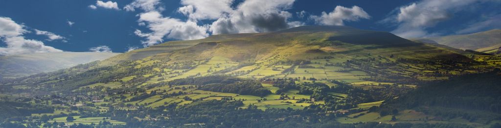
Mountain weather
Bannau Brycheiniog / Brecon Beacons Mountain weather forecast table
Confidence
Low confidence in the details of rain this weekend. High confidence in a drier and warmer spell of weather early next week.
Mountain weather hazards
Hazards apply at or above 300m, reflecting the more severe conditions which can occur at altitude.
 Severe Chill Effect
Wind significantly lowers the ‘feels-like’ temperature relative to the actual temperature, with even moderate winds significantly adding to the chilling effect. Strong winds can result in a severe and debilitating wind chill many degrees below the actual temperature. This effect will be enhanced in rain or wet snow. Without protection, prolonged exposure could result in frost nip or frostbite on exposed parts of the body and/or hypothermia.
Poor Visibility
Poor visibility presents challenging route finding conditions. Visibility could be significantly less than 50 metres in all directions with few or no visual references, especially on featureless moors or plateaux. Distances become hard to judge and cliff or cornice edges can be difficult to recognise. These conditions require good navigational skills. There is a risk of white-out conditions when mist or fog is combined with extensive snow cover.
Mountain weather forecast
Overcast with hill fog developing, and outbreaks of rain or summit sleet.
| 06:00 | 09:00 | 12:00 | 15:00 | 18:00 | 21:00 | |
|---|---|---|---|---|---|---|
Weather (at 600m) |
|
|
|
|
|
|
Chance of precipitation (at 600m) |
70% | 70% | 80% | 60% | 40% | 60% |
Wind direction and speed (mph)
Altitude above mean sea level
| 06:00 | 09:00 | 12:00 | 15:00 | 18:00 | 21:00 | |
|---|---|---|---|---|---|---|
| 600m |
E
20
|
E
20
|
NE
18
|
NE
18
|
NE
18
|
NE
19
|
| 300m |
E
10
|
E
12
|
NE
12
|
NE
12
|
NE
11
|
NE
11
|
| Valley |
E
7
|
E
11
|
E
10
|
NE
11
|
NE
10
|
NE
10
|
Wind gust (mph)
Altitude above mean sea level
| 06:00 | 09:00 | 12:00 | 15:00 | 18:00 | 21:00 | |
|---|---|---|---|---|---|---|
| 600m | 24 | 25 | 24 | 24 | 24 | 25 |
| 300m | 19 | 21 | 23 | 23 | 22 | 22 |
| Valley | 16 | 20 | 21 | 22 | 20 | 22 |
Altitude above mean sea level
| 06:00 | 09:00 | 12:00 | 15:00 | 18:00 | 21:00 | |
|---|---|---|---|---|---|---|
| 600m |
2°
|
2°
|
3°
|
4°
|
4°
|
4°
|
| 300m |
4°
|
4°
|
5°
|
6°
|
6°
|
6°
|
| Valley |
5°
|
5°
|
6°
|
7°
|
7°
|
6°
|
| Freezing Level |
900m
|
700m
|
900m
|
1,100m
|
1,200m
|
1,100m
|
Altitude above mean sea level
| 06:00 | 09:00 | 12:00 | 15:00 | 18:00 | 21:00 | |
|---|---|---|---|---|---|---|
| 600m |
-4°
|
-5°
|
-3°
|
-2°
|
-1°
|
-2°
|
| 300m |
0°
|
0°
|
1°
|
2°
|
3°
|
2°
|
| Valley |
2°
|
1°
|
3°
|
4°
|
4°
|
3°
|
Additional weather information
Meteorologist's view
Feeling very cold for late April on the summits with the risk of severe wind chill. Prepare for winter conditions if venturing to the summits and take extra layers including a waterproof outer layer. Lengthy periods of hill fog will result in poor visibilities and make for challenging navigation, especially over featureless terrain.
Weather
Outbreaks of rain will spread north this morning, with some heavier bursts of rain in places. This afternoon outbreaks of light rain or drizzle will continue, as hill fog becomes more widespread. More persistent rain, heavy at times, arrives this evening.
Chance of cloud-free hill tops
80% decreasing 20% this afternoon.
Low cloud and visibility
Periods of cloud above 500-600m until mid-morning and then persistent cloud above 500m for the remainder of the day with periods of cloud above 400m during any prolonged periods of rain. Poor or very poor visibility for most of the day on the summits and varying between good and moderate at valley level as the periods of rain and drizzle come and go.
Recent rainfall
Location: Neuadd (Near Pontsticill)
Altitude: 353m
| Last 24 hours | Last 48 hours | Last 72 hours |
|---|---|---|
| 0.2mm | 0.4mm | 0.4mm |
Measurement date:
Rainfall data provided by Natural Resources Wales. The Met Office is not responsible for content provided by third parties and may remove this data without warning.
Mountain weather information
Weather
Heavy and persistent rain overnight, falling as sleet over the summits, becoming more intermittent through the morning and then clearing eastwards early afternoon. Dry and brighter conditions follow with sunny spells developing. Dry and clear through the evening.
Chance of cloud-free hill tops
20% overnight, becoming 90% by mid-afternoon.
Maximum wind speed expected
Northerly 20-25mph gusting 40-45mph, easing later.
Temperature
- At 600m Plus 1 Celsius rising to plus 7 Celsius.
- Valley Plus 3 Celsius rising to plus 12 Celsius.
- Freezing level Just above the summits.
Low cloud and visibility
Extensive cloud above 400-500m at first, becoming more broken above 700m during the morning and lifting clear of the summits through the afternoon. Poor or very poor visibility first thing at higher levels but becoming very good with excellent air clarity across the whole of the National Park by mid-afternoon.
Mountain weather information
Mon 29 Apr
Sunrise:
Sunset:
Mostly dry with sunny spells, especially early and late with cloudier skies at times. The outside chance of a shower. Feeling warmer but with a moderate to strong southerly wind developing. Freezing levels well above the summits.
Tue 30 Apr
Sunrise:
Sunset:
Noticeably milder and probably staying generally dry with bright or sunny intervals but also a lot of cloud. Moderate to strong southeasterly winds. Freezing levels well above the summits.
Wed 1 May
Sunrise:
Sunset:
Some uncertainty regarding the details with an increasing chance of showers or longer spells of rain at times but staying relatively warm with bright or sunny spells. Light to moderate winds from the east or south. Freezing levels well above the summits.
Updated at:
Summit specific forecast
Mountain summit forecast map
Loading map…
Key
The Bannau Brycheiniog / Brecon Beacons is a mountain range in South Wales comprising six main peaks, with the highest peak, Pen y Fan, standing at 886 metres.