
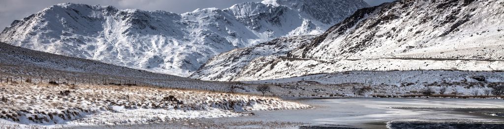
Mountain weather
Eryri / Snowdonia Mountain weather forecast table
Confidence
High for unsettled themes, moderate for rain and low cloud detail this weekend.
Mountain weather hazards
Hazards apply at or above 300m, reflecting the more severe conditions which can occur at altitude.
 Severe Chill Effect
Wind significantly lowers the ‘feels-like’ temperature relative to the actual temperature, with even moderate winds significantly adding to the chilling effect. Strong winds can result in a severe and debilitating wind chill many degrees below the actual temperature. This effect will be enhanced in rain or wet snow. Without protection, prolonged exposure could result in frost nip or frostbite on exposed parts of the body and/or hypothermia.
Poor Visibility
Poor visibility presents challenging route finding conditions. Visibility could be significantly less than 50 metres in all directions with few or no visual references, especially on featureless moors or plateaux. Distances become hard to judge and cliff or cornice edges can be difficult to recognise. These conditions require good navigational skills. There is a risk of white-out conditions when mist or fog is combined with extensive snow cover.
Mountain weather forecast
Cloudy with outbreaks of rain spreading north. Significant windchill.
| 06:00 | 09:00 | 12:00 | 15:00 | 18:00 | 21:00 | |
|---|---|---|---|---|---|---|
Weather (at 800m) |
|
|
|
|
|
|
Chance of precipitation (at 800m) |
20% | <05% | 30% | 40% | 20% | <05% |
Wind direction and speed (mph)
Altitude above mean sea level
| 06:00 | 09:00 | 12:00 | 15:00 | 18:00 | 21:00 | |
|---|---|---|---|---|---|---|
| 900m |
E
25
|
E
22
|
E
18
|
E
20
|
NE
23
|
NE
25
|
| 600m |
E
18
|
E
17
|
E
16
|
E
16
|
NE
14
|
NE
14
|
| 300m |
E
14
|
E
14
|
E
13
|
E
11
|
NE
10
|
NE
8
|
| Valley |
E
14
|
E
13
|
E
13
|
E
11
|
NE
9
|
NE
9
|
Wind gust (mph)
Altitude above mean sea level
| 06:00 | 09:00 | 12:00 | 15:00 | 18:00 | 21:00 | |
|---|---|---|---|---|---|---|
| 900m | 31 | 28 | 24 | 25 | 29 | 31 |
| 600m | 25 | 23 | 22 | 22 | 19 | 20 |
| 300m | 24 | 23 | 21 | 20 | 17 | 17 |
| Valley | 24 | 22 | 21 | 20 | 16 | 17 |
Altitude above mean sea level
| 06:00 | 09:00 | 12:00 | 15:00 | 18:00 | 21:00 | |
|---|---|---|---|---|---|---|
| 900m |
-1°
|
0°
|
1°
|
1°
|
1°
|
1°
|
| 600m |
2°
|
3°
|
4°
|
4°
|
4°
|
4°
|
| 300m |
4°
|
6°
|
7°
|
7°
|
6°
|
6°
|
| Valley |
6°
|
8°
|
9°
|
9°
|
8°
|
7°
|
| Freezing Level |
800m
|
800m
|
900m
|
1,000m
|
1,000m
|
1,000m
|
Altitude above mean sea level
| 06:00 | 09:00 | 12:00 | 15:00 | 18:00 | 21:00 | |
|---|---|---|---|---|---|---|
| 900m |
-8°
|
-6°
|
-5°
|
-5°
|
-6°
|
-6°
|
| 600m |
-4°
|
-2°
|
-1°
|
-1°
|
-1°
|
-1°
|
| 300m |
0°
|
2°
|
4°
|
4°
|
3°
|
3°
|
| Valley |
2°
|
4°
|
6°
|
6°
|
5°
|
5°
|
Additional weather information
Meteorologist's view
Suitable winter layers should be worn due to the significant windchill today, even at lower levels.
Weather
A mostly dry and cloudy start to the day. By midday outbreaks of light rain will reach the south of the Park, then spreading north this afternoon and falling as sleet above 800m. This evening becoming dry, while remaining cloudy.
Chance of cloud-free hill tops
70%, becoming 30% for a time this afternoon.
Low cloud and visibility
Very good visibility this morning, becoming moderate in rain or very poor in sleet and hill fog. Scattered to broken cloud above 500-600m this morning and evening, becoming widespread for a time this afternoon with perhaps some isolated scraps down to 400m.
Ground conditions
Please see - https://yrwyddfa.live/
Mountain weather information
Weather
Currently a generally dry day is expected, with perhaps some clear then bright or sunny spells across the far west of the Park through the morning. However, outbreaks of rain or sleet are likely at times across eastern areas overnight and through the morning. Dry conditions with increasing amounts of sunshine then spread east across all of Snowdonia through the afternoon. Through the evening broken cloud and isolated showers arrive from the west.
Chance of cloud-free hill tops
20% in the east, 60% in the far west becoming 80% for all areas by the afternoon.
Maximum wind speed expected
North-northwesterly 10-15mph gusting 25-30mph becoming southwesterly 15mph gusting 25mph.
Temperature
- At 800m Zero Celsius becoming plus 4 Celsius.
- Valley Plus 5 Celsius becoming plus 10 Celsius.
- Freezing level 800m rising above summits by the evening.
Low cloud and visibility
Generally very good visibility, becoming moderate in rain and sleet across the east of the Park during the morning. Broken to widespread cloud bases in the east, scattered across the far west, around 600-700m lifting and clearing to see cloud bases mostly above summits by the afternoon.
Mountain weather information
Mon 29 Apr
Sunrise:
Sunset:
Scattered showers or longer spells of rain. Fresh to Strong southerly winds. Freezing level rising above the summits.
Tue 30 Apr
Sunrise:
Sunset:
Mist and fog around in the morning, slowly burning away to a largely fine day. Fresh to Strong southeasterly winds. Freezing level above summits.
Wed 1 May
Sunrise:
Sunset:
Risk of heavy showers and thunder. Moderate easterly winds. Freezing level above summits.
Updated at:
Summit specific forecast
Mountain summit forecast map
Loading map…
Key
The Eryri (Snowdonia) mountains are made up of 90 mountain peaks including the tallest mountain in Wales, Yr Wyddfa (Snowdon), standing at 1,085 metres.