Local weather forecast
Local seven-day weather forecasts are available for around 7000 locations around the UK, covering population centres, sporting venues and tourist attractions.
This page provides links to Met Office local weather forecasts along with details on how they are created.
Local weather seven-day forecasts
Use the Met Office weather forecast page to find your local seven-day weather forecast. Simply enter your town, city, region, first half of a UK postcode or mountain area into the search box. You will then be given the option to choose from a range of locations near you.
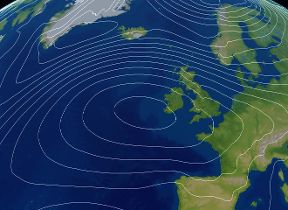
UK forecast
How local weather forecasts are created
Local forecasts (or site-specific forecasts) are regularly updated and make use of a range of weather models run on the Met Office supercomputer. They use a "best data" approach, whereby the most recent highest resolution model is used at any given forecast lead time.
Forecasts are updated hourly to include the most recent nowcast and any recently updated forecast models. This means that at any time, the most recent model data is available.
The site-specific forecasts themselves have to be extracted from horizontal gridded fields for a range of forecast parameters, including rainfall, temperature and wind speed. The extracted model data for each location goes through a series of post-processing procedures to make the forecast more specific to a particular location, hence the name "site-specific" forecasts. Two of the methods are briefly outlined below.
Coastal adjustment of local weather forecasts
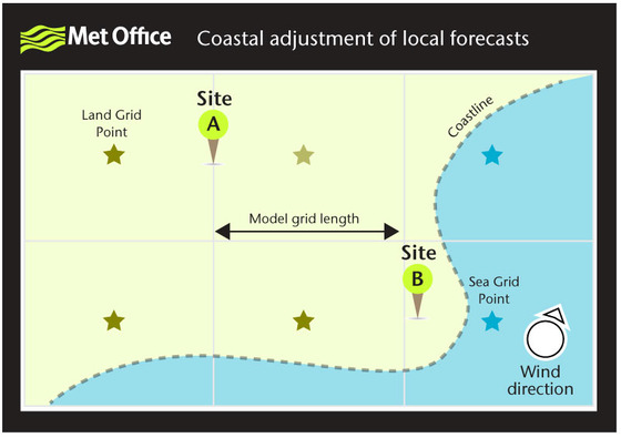
Figure 1 illustrates how a local (site-specific) forecast can be computed from a range of surrounding model grid points.
Site A is likely to be computed from the nearest two land points as it is exactly half way between the two.
Local forecasts for coastal sites can be more difficult to define than inland sites. For coastal sites, the weighting between the 'land' and 'sea' values varies with the direction of the wind. This means that forecast temperature and wind speed at Site B would be quite different depending on whether the wind is on- or off-shore.
This method is often referred to as "intelligent grid point selection", whereby grid points with most similar characteristics to a specific location are given greater weighting in the final forecast.
Orographic adjustment of local weather forecasts
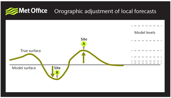
Figure 2 illustrates taking account of differences between model orography and reality.
Model orography is usually defined as the average elevation for each grid square. This has implications for a range of forecast parameters (including rainfall, temperature, wind speed and visibility), meaning that orographic adjustments need making depending on a specific site elevation.
If a site is higher in reality than the model orography (Site A), then the wind speed may be under-estimated by the model. In these situations winds may be intensified slightly. Alternatively, a site lower than model orography (Site B) may have forecast wind speeds slightly over-estimated and hence these are reduced slightly in the post-processing.