
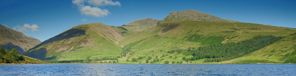
Mountain weather
Lake District Mountain weather forecast table
Confidence
High for mainly dry weather for the next couple of days but medium for cloud details. Then good confidence for more changeable conditions but low for details and timing.
Mountain weather hazards
Hazards apply at or above 300m, reflecting the more severe conditions which can occur at altitude.
 Poor Visibility
Poor visibility presents challenging route finding conditions. Visibility could be significantly less than 50 metres in all directions with few or no visual references, especially on featureless moors or plateaux. Distances become hard to judge and cliff or cornice edges can be difficult to recognise. These conditions require good navigational skills. There is a risk of white-out conditions when mist or fog is combined with extensive snow cover.
Mountain weather forecast
A cloudy damp start with hill fog and patchy drizzle, then becoming dry, cloud lifting and breaking to an extent. Freshening south to southwesterly breeze.
| 06:00 | 09:00 | 12:00 | 15:00 | 18:00 | 21:00 | |
|---|---|---|---|---|---|---|
Weather (at 800m) |
|
|
|
|
|
|
Chance of precipitation (at 800m) |
20% | 10% | 10% | <05% | <05% | <05% |
Wind direction and speed (mph)
Altitude above mean sea level
| 06:00 | 09:00 | 12:00 | 15:00 | 18:00 | 21:00 | |
|---|---|---|---|---|---|---|
| 900m |
SW
26
|
SW
25
|
SW
27
|
SW
30
|
S
34
|
S
38
|
| 600m |
SW
24
|
SW
22
|
SW
25
|
SW
26
|
S
29
|
S
34
|
| 300m |
SW
8
|
S
10
|
S
11
|
S
12
|
S
10
|
S
13
|
| Valley |
SW
7
|
S
9
|
SW
11
|
S
10
|
S
9
|
S
12
|
Wind gust (mph)
Altitude above mean sea level
| 06:00 | 09:00 | 12:00 | 15:00 | 18:00 | 21:00 | |
|---|---|---|---|---|---|---|
| 900m | 31 | 30 | 34 | 38 | 42 | 48 |
| 600m | 30 | 28 | 32 | 33 | 40 | 47 |
| 300m | 21 | 23 | 26 | 28 | 31 | 35 |
| Valley | 19 | 20 | 22 | 22 | 27 | 30 |
Altitude above mean sea level
| 06:00 | 09:00 | 12:00 | 15:00 | 18:00 | 21:00 | |
|---|---|---|---|---|---|---|
| 900m |
7°
|
6°
|
6°
|
5°
|
6°
|
6°
|
| 600m |
8°
|
8°
|
8°
|
8°
|
7°
|
8°
|
| 300m |
10°
|
10°
|
11°
|
10°
|
9°
|
10°
|
| Valley |
11°
|
12°
|
13°
|
13°
|
12°
|
12°
|
| Freezing Level |
1,800m
|
1,900m
|
1,600m
|
1,800m
|
1,500m
|
1,700m
|
Altitude above mean sea level
| 06:00 | 09:00 | 12:00 | 15:00 | 18:00 | 21:00 | |
|---|---|---|---|---|---|---|
| 900m |
1°
|
1°
|
0°
|
-1°
|
0°
|
0°
|
| 600m |
4°
|
4°
|
4°
|
3°
|
2°
|
2°
|
| 300m |
8°
|
8°
|
8°
|
8°
|
7°
|
7°
|
| Valley |
10°
|
10°
|
11°
|
11°
|
10°
|
10°
|
Additional weather information
Meteorologist's view
Nothing additional
Weather
A cloudy morning with some patchy drizzle mainly over southern and western fells though it will be mainly dry. A few sunny intervals in good shelter. In the afternoon cloud lifting and also breaking to an extent with more chance of a few sunny intervals especially later. Some clear spells in the evening but some low cloud again forming over the hills.
Chance of cloud-free hill tops
10% in morning rising 70-80% by mid-afternoon dropping 50% during the evening
Low cloud and visibility
Fairly extensive cloud of cloud above 500m in morning and hazy below the cloud but this lifting and breaking in the afternoon with mostly good visibility, just a few patches of cloud lingering on higher fell tops. Some cloud again lowering onto higher hills during the evening.
Ground conditions
No recent ground conditions report available.
Mountain weather information
Weather
Another mainly dry day. Any low cloud lifting off the tops in the morning, with a mixture of sunny intervals and cloudier spells in the afternoon. Best breaks in the north, while southern fell tops likely to stay mainly cloudy and shrouded. Cloud becoming overcast in the evening with perhaps some rain towards midnight.
Chance of cloud-free hill tops
40% at first rising 80% from mid-morning, but 60% in south, gradually falling 20% or less as the evening goes on.
Maximum wind speed expected
South to southeast 25 gusts 35mph.
Temperature
- At 800m Plus 6 rising to Plus 9 Celsius.
- Valley Plus 10 rising to Plus 15 Celsius.
- Freezing level Above the summits.
Low cloud and visibility
Areas of cloud above 500-600m at first tending to break and lift off most hills during the afternoon though some patches persisting over southern summits. Good visibility away from the cloud. Then by mid to late evening extensive cloud above 500-600m, visibility also dropping at lower levels in any rain that arrives later.
Mountain weather information
Fri 25 Oct
Sunrise:
Sunset:
Low confidence in detail. Any rain clearing in early hours then sunny intervals and some showers. More general cloud and rain may then return in the evening. Fresh southwesterly winds, potentially becoming strong with summit gales in the evening.
Sat 26 Oct
Sunrise:
Sunset:
Likely to be cloudy at first with outbreaks of heavy rain, hill fog and southwesterly gales, brightening up for the afternoon to sunny intervals and showers, with winds veering west to northwesterly.
Sun 27 Oct
Sunrise:
Sunset:
Cloudy with occasional rain, and some hill fog. Strong west to southwest winds.
Updated at:
Summit specific forecast
Mountain summit forecast map
Loading map…
Key
The Lake District covers an area of 885 square miles with its highest point, Scafell Pike, standing at 978 metres.