
Mountain weather
Mourne Mountains Mountain weather forecast table
Confidence
High confidence at first, decreasing by Thursday with uncertainty on movement of the low and associated rain and wind.
Mountain weather hazards
Hazards apply at or above 300m, reflecting the more severe conditions which can occur at altitude.
 Gales
Gales
Gale force winds (gusts over 50mph) make walking difficult and strenuous with a potential to be blown over by gusts. There is often a marked increase in winds through cols or on exposed ridges and summits. Distances can take longer to cover and compass bearings become harder to follow accurately.
Mountain weather forecast
Dry and mainly sunny on Wednesday. Winds increasing through the day.
| 06:00 | 09:00 | 12:00 | 15:00 | 18:00 | 21:00 | |
|---|---|---|---|---|---|---|
Weather (at 700m) |
|
|
|
|
|
|
Chance of precipitation (at 700m) |
<05% | <05% | <05% | <05% | 10% | 10% |
Wind direction and speed (mph)
Altitude above mean sea level
| 06:00 | 09:00 | 12:00 | 15:00 | 18:00 | 21:00 | |
|---|---|---|---|---|---|---|
| 600m |
SW
21
|
S
20
|
S
19
|
S
25
|
S
34
|
S
38
|
| 300m |
SW
5
|
S
6
|
S
11
|
S
15
|
S
18
|
S
21
|
| Valley |
SW
1
|
S
3
|
S
9
|
S
13
|
S
16
|
S
18
|
Wind gust (mph)
Altitude above mean sea level
| 06:00 | 09:00 | 12:00 | 15:00 | 18:00 | 21:00 | |
|---|---|---|---|---|---|---|
| 600m | 28 | 26 | 26 | 35 | 47 | 54 |
| 300m | 13 | 12 | 17 | 25 | 32 | 37 |
| Valley | 9 | 10 | 17 | 24 | 32 | 36 |
Altitude above mean sea level
| 06:00 | 09:00 | 12:00 | 15:00 | 18:00 | 21:00 | |
|---|---|---|---|---|---|---|
| 600m |
8°
|
6°
|
7°
|
8°
|
8°
|
8°
|
| 300m |
8°
|
8°
|
10°
|
11°
|
10°
|
10°
|
| Valley |
6°
|
8°
|
11°
|
12°
|
11°
|
12°
|
| Freezing Level |
2,200m
|
2,300m
|
2,300m
|
2,000m
|
1,600m
|
2,100m
|
Altitude above mean sea level
| 06:00 | 09:00 | 12:00 | 15:00 | 18:00 | 21:00 | |
|---|---|---|---|---|---|---|
| 600m |
3°
|
0°
|
2°
|
4°
|
2°
|
3°
|
| 300m |
6°
|
6°
|
8°
|
8°
|
7°
|
7°
|
| Valley |
6°
|
8°
|
10°
|
10°
|
8°
|
8°
|
Additional weather information
Meteorologist's view
Feeling cold at height.
Weather
Sunny during the morning with patchy cloud developing during the afternoon. Cloud increasing from the west during the evening with increasing winds.
Chance of cloud-free hill tops
90%
Low cloud and visibility
Visibility good or very good.
Mountain weather information
Weather
Patchy cloud and some bright or sunny spells through Thursday. Turning increasingly cloudy later in the afternoon with rain arriving from the west into the evening, heavy at times.
Chance of cloud-free hill tops
80% falling 20% by late afternoon
Maximum wind speed expected
South or southeasterly 20-25mph, gusting 35-45mph, easing into the evening
Temperature
- At 700m Plus 7 to 9 Celsius
- Valley Plus 12 to 14 Celsius
- Freezing level Above summits
Low cloud and visibility
Few cloud base 700-900m at first, becoming broken 400-600m during the evening. Visibility mainly good, falling moderate in rain later.
Mountain weather information
Fri 25 Oct
Sunrise:
Sunset:
Outbreaks of rain, heavy at times, throughout the day. Strong northwesterly winds.
Sat 26 Oct
Sunrise:
Sunset:
Early rain clearing to a mainly dry afternoon. Strong westerly winds.
Sun 27 Oct
Sunrise:
Sunset:
Further rain arriving from the west. Strong southwesterly winds.
Updated at:
Summit specific forecast
Mountain summit forecast map
Loading map…
Key
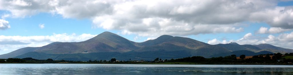
The Mourne Mountains are a granite mountain range in County Down in the southeast of Northern Ireland, is an area of outstanding natural beauty, and has been proposed as the first National Park in Northern Ireland.