
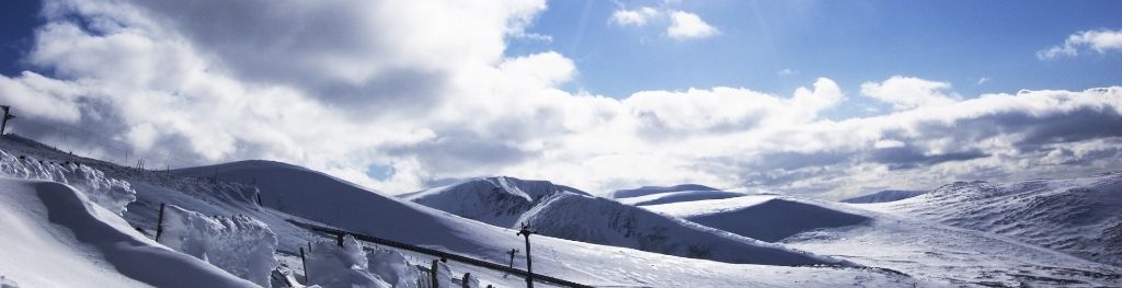
Mountain weather
South Grampian and Southeast Highlands Mountain weather forecast table
Confidence
High confidence for showery conditions on Saturday and for a dry, bright and occasionally breezy day on Sunday. Lower confidence into next week, particularly around the extent and timing of any rain.
This evening forecast
Showers spreading eastwards this evening, but generally becoming few and far between by midnight. Blustery on highest ground with gusts up to 35mph at first, perhaps a little higher across the Cairngorm Plateau.
Mountain weather hazards
Hazards apply at or above 300m, reflecting the more severe conditions which can occur at altitude.
 Strong Sunlight
Harmful UV levels from sunlight increase with altitude giving a greater risk of sunburn and eye damage, even on some overcast days. On breezy days, the cooling effect of wind on exposed skin may disguise any feeling of sunburn until it is too late. If there is snow cover, glare increases the effect of UV rays especially on the eyes. It is advisable to wear sun block, protective clothing such as a long-sleeved top and hat and have good quality eye protection.
Thunderstorms
Lightning is a significant mountain hazard which can result in serious injury or death. Mountain terrain often leaves one highly exposed to lightning strikes. Hail may give unpleasant conditions with torrential rain and localised flash flooding also possible, mainly in Summer months.
Mountain weather forecast
Bright or sunny and largely dry, but cloud amounts are a little uncertain.
| 00:00 | 03:00 | 06:00 | 09:00 | 12:00 | 15:00 | 18:00 | 21:00 | |
|---|---|---|---|---|---|---|---|---|
Weather (at 800m) |
|
|
|
|
|
|
|
|
Chance of precipitation (at 800m) |
10% | 10% | 00% | 00% | 30% | 60% | 40% | 10% |
Wind direction and speed (mph)
Altitude above mean sea level
| 00:00 | 03:00 | 06:00 | 09:00 | 12:00 | 15:00 | 18:00 | 21:00 | |
|---|---|---|---|---|---|---|---|---|
| 1100m |
SW
18
|
SW
15
|
SW
11
|
W
8
|
NW
8
|
NW
8
|
W
11
|
W
7
|
| 900m |
SW
13
|
SW
11
|
SW
9
|
W
7
|
NW
7
|
NW
7
|
W
7
|
W
5
|
| 600m |
SW
8
|
SW
8
|
W
5
|
W
5
|
NW
5
|
NW
6
|
W
5
|
W
4
|
| 300m |
W
4
|
W
3
|
W
3
|
SW
5
|
SW
4
|
W
5
|
NE
3
|
NW
2
|
| Glen |
W
3
|
W
3
|
W
3
|
W
4
|
SW
4
|
W
4
|
NE
3
|
NW
2
|
Wind gust (mph)
Altitude above mean sea level
| 00:00 | 03:00 | 06:00 | 09:00 | 12:00 | 15:00 | 18:00 | 21:00 | |
|---|---|---|---|---|---|---|---|---|
| 1100m | 23 | 19 | 15 | 12 | 12 | 13 | 15 | 9 |
| 900m | 17 | 15 | 13 | 11 | 12 | 12 | 12 | 8 |
| 600m | 16 | 15 | 9 | 10 | 9 | 11 | 9 | 6 |
| 300m | 10 | 8 | 8 | 9 | 9 | 9 | 7 | 4 |
| Glen | 8 | 7 | 6 | 8 | 8 | 10 | 7 | 3 |
Altitude above mean sea level
| 00:00 | 03:00 | 06:00 | 09:00 | 12:00 | 15:00 | 18:00 | 21:00 | |
|---|---|---|---|---|---|---|---|---|
| 1100m |
5°
|
5°
|
5°
|
7°
|
9°
|
10°
|
9°
|
7°
|
| 900m |
6°
|
6°
|
6°
|
9°
|
11°
|
12°
|
11°
|
9°
|
| 600m |
8°
|
8°
|
9°
|
12°
|
14°
|
15°
|
13°
|
11°
|
| 300m |
9°
|
8°
|
10°
|
14°
|
17°
|
17°
|
16°
|
13°
|
| Glen |
10°
|
9°
|
11°
|
16°
|
18°
|
18°
|
16°
|
13°
|
| Freezing Level |
1,900m
|
1,900m
|
1,800m
|
1,900m
|
2,100m
|
2,200m
|
2,200m
|
2,200m
|
Altitude above mean sea level
| 00:00 | 03:00 | 06:00 | 09:00 | 12:00 | 15:00 | 18:00 | 21:00 | |
|---|---|---|---|---|---|---|---|---|
| 1100m |
0°
|
0°
|
1°
|
4°
|
7°
|
8°
|
7°
|
5°
|
| 900m |
3°
|
3°
|
4°
|
7°
|
10°
|
10°
|
9°
|
8°
|
| 600m |
6°
|
6°
|
8°
|
11°
|
13°
|
14°
|
13°
|
11°
|
| 300m |
8°
|
7°
|
10°
|
14°
|
16°
|
16°
|
15°
|
13°
|
| Glen |
9°
|
9°
|
10°
|
15°
|
17°
|
17°
|
16°
|
14°
|
Additional weather information
Met Office Aberdeen meteorologist's view
Nothing to add.
Weather
Isolated showers west of the A9 and some clear spells in the east through the early hours. Then a dry, bright or sunny morning Ben Alder and Creag Meagaidh may see thicker cloud for a time though. Showers will develop through afternoon, these heaviest across the Cairngorms where the odd rumble of thunder may occur. Showers fading through evening.
Chance of cloud-free hill tops
60% in the west at first, otherwise 80%.
Low cloud and visibility
Generally excellent visibility, although periods of cloud may linger above 800m through morning, mostly in the west. Showers may briefly obscure nearby slopes.
Mountain weather information
Weather
Dry throughout with morning cloud gradually lifting to leave most summits cloud free by afternoon. Strong sunshine, although increasingly hazy through late afternoon and evening. Feeling warm away from the wind.
Chance of cloud-free hill tops
70% until mid morning, then 90%.
Maximum wind speed expected
Southwest 15-25mph.
Temperature
- At 800m 5 Celsius rising to 12-14 Celsius.
- Glen 12 Celsius rising to 19-21 Celsius.
- Freezing level Well above summits.
Low cloud and visibility
Areas of cloud possible above 700-900m through morning in the west, otherwise most, if not all, slopes cloud free. Excellent visibility.
Mountain weather information
Mon 29 Jul
Sunrise:
Sunset:
A bright day on Monday with some sunshine. Cloud will build to bring some patchy rain through evening and southerly winds will increase to near gale force on highest ground. Cloud descending onto higher slopes in the west too.
Tue 30 Jul
Sunrise:
Sunset:
The forecast is quite uncertain, but most likely bright or sunny although patchy rain is possible at times.
Wed 31 Jul
Sunrise:
Sunset:
Lighter winds and a mix of bright or sunny spells and a few spells of rain, but low confidence in details.
Updated at:
Summit specific forecast
Mountain summit forecast map
Loading map…
Key
Including South and East Cairngorms National Park, Aberdeenshire and Angus Hills, Ben Vrackie, Ben Lawers, Loch Tay and Ochils
For snow and avalanche hazard forecasts please visit Scottish Avalanche Information Service